A Trip Back East

Some photos from a trip back to New Jersey and New York for the Thanksgiving Holidays.

I didn’t want to go, but Mike talked me into it. Then we made flight reservations before I could change my mind. It would be a short trip. I’d fly out on Wednesday and return on Saturday. Only three nights, and those would be made comfortable with a room at the Glenpointe Marriott in Teaneck, NJ. Dinner with my family at my brother’s house in New Jersey on Thursday, dinner with Mike’s family at a restaurant in Queens on Friday, Dim Sum with family and friends in Ft. Lee, NJ on Saturday morning.

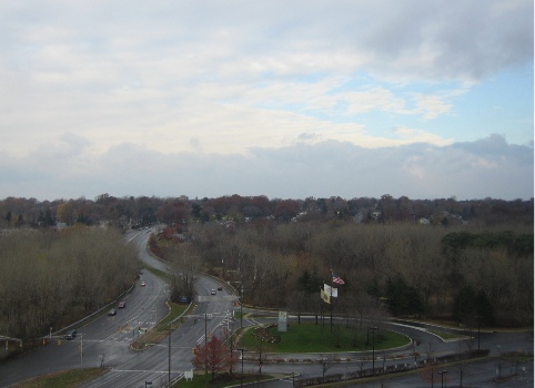
The New York/New Jersey metro area where I grew up and lived most of my life is very different from Wickenburg, AZ, where I live now. So different that I decided to take some photos to try to document some of the differences. I could have done better, but this is what I’ve got to share. This is the view from our hotel room in Teaneck, NJ, on Thursday morning. It had snowed and rained during the night and it was bitter cold that day.

This looks out to the southwest. As you can see, there are lots of tall trees, but they’re pretty much bare in late November. The overall effect is gray. A gray day with gray skies, gray trees, and gray pavement. I hated the gray of the New York metro area in the winter months. But it was the cold that finally chased me out of the area.
Photo

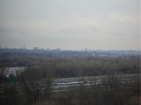
Here’s another look from our hotel room window. This view looks toward the southeast. The highway in the foreground is I-95, which stretches from Maine to Florida. The body of water is some marshland that might just be close enough to the Meadowlands to be considered part of it. The gray buildings poking into the gray sky are the skyscrapers of New York City off in the distance. The pointy one on the left is the Empire State Building, which is now the tallest building in New York again. It formerly held that title from 1934 to 1977, when the World Trade Center was completed. With the WTC gone, this depression-era building is once again the tallest in the city.
Photo

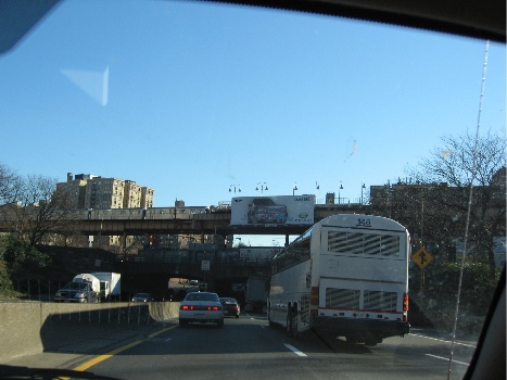
On Friday, we drove to Queens. Here’s a snapshot taken on the Cross Bronx Expressway, which goes from the George Washington Bridge (on the Hudson River), across the top of Manhattan and the middle of the Bronx, to two of the bridges to Long Island: the Whitestone and the Throgs Neck. When I was growing up, this area of the Bronx was filled with burned-out building shells, and we’d often see broken-down or abandoned cars being stripped on the side of the road as we drove through. But the buildings have they’ve since been renovated and people live there once again. Don’t get the idea that this is an up-and-coming area of New York, though. It’s still a poor, crime-ridden area. Ever read Bright Lights, Big City?
Photo

I forgot to take photos the day before, on the way to my brother’s house. We took the New Jersey Turnpike (I-95 down) and there are lots of weird scenic things along that, like the big gas tanks that appeared in a scene of Stephen King’s The Stand and Newark Liberty International Airport. Next time.

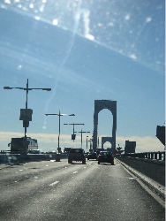
Here’s a pretty poor photo of the roadway on the Whitestone Bridge.
Photo

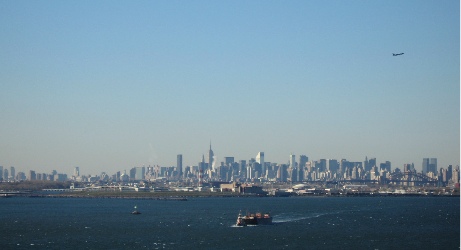
There are three bridges that’ll get you from the Bronx to Queens and Long Island and they’re all pretty similar in appearance: single-span suspension bridges. The Triboro Bridge has some nice art deco touches that make it my favorite of the three bridges, but that one’s much closer to Manhattan, which was out of our way. The Throgs Neck bridge has great views of the Long Island Sound which, in the summer, is full of sailboats and very picturesque. Of course, the Whitestone Bridge does offer the best long-distance views of Manhattan. I took a bunch of photos and this one was the best. It really gives you the flavor of new York from a distance. The tugboat with barge in the foreground, the plane departing La Guardia Airport (out of this shot on the left), and the huge cluster of buildings in midtown Manhattan. You can clearly see the Empire State Building almost dead center and CitiCorp Center (look for the slanted roof to the right). Astoria, Queens is in the foreground, on the other side of the water. And you can just about see the heavy black bridge of the train trestle that parallels the Triboro Bridge. If the World Trade Center were still standing, its towers would appear to the far left in this photo.
Photo

If you’ve never been to New York and you have the opportunity to visit, don’t pass it up. New York is like no other place on earth. As I was telling a Phoenix cab driver just the other day, it’s one of the few U.S. cities that blend old and new in a way that leaves you breathless. Go downtown, to the Wall Street area, and see exactly what they mean by the “Canyons of Wall Street.” The streets are so narrow and the buildings are so tall that light rarely gets down to the street. Although midtown has more tall buildings, the streets are a bit wider. You won’t believe the crowds walking the streets during a weekday lunch hour, the sea of yellow cabs, the bicycle messengers, the street vendors. This time of year, they’re roasting chestnuts near Rockefeller Center and steam is rising from manhole covers and vents on the street.

I do love New York, but I don’t have enough money to live there the way I want to. And New York is one of the grayest places I know.

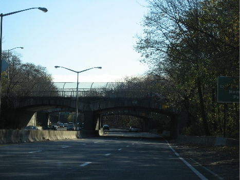
We didn’t get into the city during this trip. Next time I go back, I’ll take some photos. But you might have to wait a few years. Once in Queens, we hopped on the Cross Island Parkway to go to Mike’s Mom’s apartment. I took this shot out the front window of the car. It’s an interesting example of one of Robert Moses’s parkways. He built them all over Long Island — Queens is on the eastern end of Long Island — and this was probably one of his first. One of the trademarks of his roadways was his stone overpasses. They all look pretty much the same, but they’re really nicely executed. When you look at this photo, it’s hard to imagine that tens of thousands of people live within a mile of where it was taken.
Photo

This stretch of roadway is sunken in and surrounded by trees. Mike and I had our first apartment together about 5 miles further down this road, in Bayside. We had a wonderful view of Littleneck Bay (you’ve heard, perhaps, of Littleneck clams?), but had to listen to a never-ending stream of cars going by far beneath our terrace.

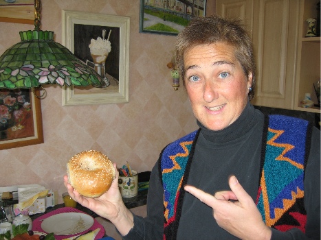
At Mike’s mom’s place, we had bagels for breakfast. This is a photo of me holding a real New York bagel. Notice that it is large and plump. The outside is crusty and the inside is moist and almost doughy. It doesn’t have blueberries or cranberries or any other type of berry in it. This one has sesame seeds (my personal favorite), but they also come plain, egg, poppy seed, salt, pumpernickel, onion, cinnamon raisin, or everything. Everything means seeds, onion, and salt and is a real assault to the taste buds. A common way for a New Yorker to eat a bagel is to slice it open and toast it, then cover each half with cream cheese and slices of lox (smoked salmon). Some people add red onions, capers, and/or tomatoes. (I don’t like tomatoes on my bagels.) A quick spread of cream cheese is referred to as a “schmear” in New York; I prefer a more generous helping. You can’t get a good bagel anywhere outside of the New York metro area, although you can get decent ones here and there. Einstein Brothers makes a decent bagel. Bagels do not come in the grocery freezer section; anything you find there that is labeled a bagel is a mere imitation.
Photo

The next time you go to New York, have a bagel as described above. It’s part of the New York experience and should be required for all serious visitors. And, while you’re at it, take a ride down to the Lower East Side and have a corned beef, pastrami, and tongue on rye sandwich at Katz’s Deli. Get that with mustard. Do not ask for it with mayonnaise; you will be forcibly removed from the premises and publicly laughed at out on the street. A Dr. Brown’s Creme soda is a nice accompaniment — and don’t forget the kosher pickle. Leave the Carnegie Deli for the tourists. What you’ll learn — among other things — is how to properly make a sandwich. There should be more meat than bread. That’s something they just don’t get outside the New York metro area.

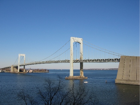
But I digress, again. This is a photo of the Throgs Neck Bridge, taken from Mike’s mom’s patio. She’s on the 7th floor and has a nice view out this way. Beyond the bridge is the Long Island Sound. Imagine it with lots of sailboats and you’re imagining the view on a summer Sunday afternoon. Put some green leaves in the tree in the foreground to complete the picture.
Photo

As you can see, it isn’t always grey in New York in the winter. Friday was a very nice day, although it was still bitter cold, with temperatures in the 30s and enough wind to make it feel a lot colder. Of course, it did get gray again on the next day.

Here’s a look at the George Washington Bridge from the foot of the Palisades. The Palisades, in case you’re wondering, are a line of cliffs along the Hudson River in New Jersey. This photo was taken from a boat basin/park area almost directly across the river from the northernmost end of Manhattan. The view is to the southeast.
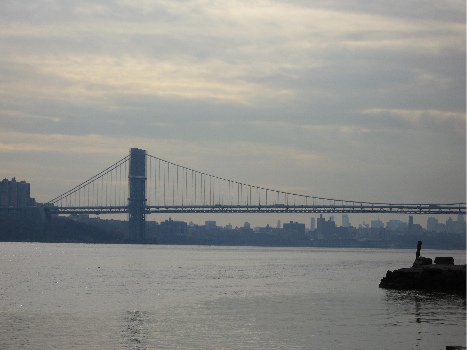
Photo

The GW Bridge has two decks — upper and lower — and is a major route between New Jersey and eastern New York. It’s actually the first bridge you get to if you sail up the river from New York Harbor. The next bridge is the Tappan Zee, which is at least 20 miles further upriver. To cross the river closer to downtown Manhattan, you can use one of two tunnels: the Lincoln (midtown at around 30th Street) and the Holland (downtown at around Houston).

When I was growing up in New Jersey, my family had a small boat that we used to take out in the river. I’ve been around Manhattan by boat more times than I can count. It’s a neat trip that you can do on the Circle Line tour boats. We also took a few perilous trips into New York Harbor and around the Statue of Liberty. I say perilous because our boat was really small and the water can get rough out in the harbor. I also remember going past Ellis Island long before it was fixed up and opened to the public. I’ve never been on the island, though.

Anyway, all those boat trips started at the base of the George Washington Bridge, on the New Jersey side. I can still remember the smell of the water at low tide, and the look of all those exposed barnacles. And the way the boat floated up and down as it was loosely tied at the boarding area. We didn’t swim in the river back in those days — it was too polluted south of the Tappan Zee — but we did fish in it, although we never ate any of the fish we caught.

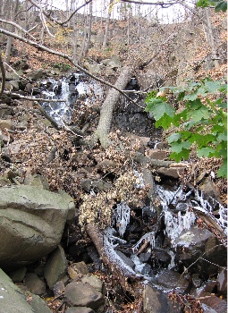
Here’s a shot of one of the “waterfalls” coming down the Palisades to the Hudson River. It’s really probably just runoff from a storm drain, but when we were kids, it was a waterfall and it was one of the most beautiful things we’d ever seen. My family often drove along the river’s shore road on Sunday outings. That’s back in the days when taking a drive in the family car was a cheap and fun day out. There were no malls, no computer games, no cell phones. We’d get in the car and go for a drive and drink up everything we saw out the window. If it was autumn, we’d go to a place called Tices Farms, which had apples and doughnuts (note the spelling) and cider and pumpkins for sale. When I got out of the car to take this photo, the smell of wet leaves brought me back to a time when we would rake them into huge piles and take turns jumping in them. Leave stems would stick in our sweaters and hair and we’d be breathless in the cool autumn sun. I don’t know if you can see it clearly, but there’s ice in the water in this photo. We’re talking cold enough to make a waterfall freeze. Cold.
Photo

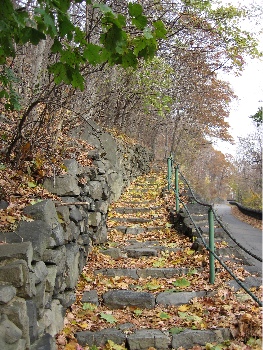
The Palisades area of Bergen County in New Jersey is one of its more historic areas. Originally settled by the Dutch in the 1600s, it was a hotbed of activity during the Revolutionary War. Posted alongside roads all over the area are “Washington’s Retreat Route” signs. Yes. This is the area George Washington retreated from when we weren’t doing very well in the first war with the Brits. Why we need that on signs is beyond me. But the area is also full of walking trails that were probably built during the depression. In more than a few places, you can find stairways and paths that climb the Palisades. This is one example, that follows the road for a short distance before cutting right up the cliff. We did a lot of hiking in the area when we lived there. The views from the top of the Palisades are magnificent.
Photo

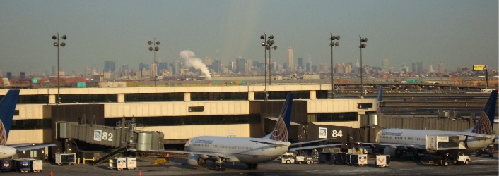
I took the shot that appears below from the AirTrain that travels around Newark Airport. That’s New York in the background.
Photo

This photo reminds me of a visit by one of my editors when we still lived in New Jersey. I picked him up at the airport and was driving north along the New Jersey turnpike toward our house. He looked off to the right as we climbed a bit of highway that passed over the marshes at the Meadowlands and said, “What city is that?” He was looking at New York. That’s when I realized that the skyline I’d grown up with wasn’t nearly as familiar to everyone else.

Am I homesick? Maybe a bit. Would I go back to live there again? Nope.

Been there, done that.
An Excellent Weekend

And it ain’t over yet.

Flying M Air’s second big weekend of the season started on Friday morning, with a call from a man who wanted to charter the helicopter. The weather was cloudy and it had rained earlier in the morning. Although he wanted to go to Sedona with his daughter, he’d settle for Tucson. He decided to wait and see what the weather was like closer to noon.

When I hung up, I started doing some research on the weather. There’s no weather forecast specifically for Sedona, but I checked Flagstaff and Prescott, which are on either side of Sedona. (Sedona is closer to Flag.) Things in Flag didn’t look good. Clouds, thunderstorms, wind with gust up to 27. It looked like there might be a window of opportunity (so to speak) between 11 AM and about 3 PM. But even that was suspect — a forecast like the one I was reading usually doesn’t hold out. It seemed to me that multiple weather systems were going through the area, west to east, and that anything could happen.

But ceilings were forecast high enough for me to fly. I only need 500 feet AGL to get from point A to Point B — “clear of clouds” is what the weather minimums say for helicopters — and the forecast told of clouds at 2,000 feet AGL. That’s certainly enough room for me to move around beneath them.

Things looked better at Prescott. Higher clouds, earlier clearing, less talk of T-storms and wind gusts. But of course, Sedona is closer to Flag.

I worked for a while on my QuickBooks book, did some e-mail, goofed off on eBay. Then I got a call from Stan, who was back from a trip to Portugal. Stan’s Latte Cafe — my nickname for his hangar and its professional espresso machine — was opening for business in a while. Did I feel like a Latte? I certainly didn’t feel like working. So I hopped in the Honda (which I’d just picked up from a nice detailing that morning) and sped on over to the airport.

I wasted a good hour there, then headed over to my hangar to do some paperwork and collect the camera mount I’d bought for the helicopter. I wasn’t happy with the way the mount attached and had thoughts of going to Benner-Nauman (the local fabrication place) and having a custom piece built. I also had to drive out to Congress to put up some posters for the $25 helicopter rides I planned the next day.

I was just heading out toward Congress when my potential customer called again. I told him what I’d learned about the weather, but added that I’d checked more than two hours ago and the forecast could have changed. He was very interested in Sedona and I was very interested in taking him. He and his daughter, who were from out of town, had driven up I-17 as far as Carefree Highway and he wanted to know whether there was somewhere around there that I could pick them up. I told him about Turf Soaring School, near Carefree Highway, and he said they’d head over there. I told him I’d check the weather again and get ready. If he didn’t hear from me, I’d meet him at 2 PM or sooner.

That began a flurry of activity. Checking weather (which did indeed look better), creating my Part 135 flight plan, filing two flight plans with the FAA (one for each leg of the trip), picking up Alex at work, bringing him home, dressing in something more appropriate for flying customers around, pulling the helicopter out of the hangar, fueling up, preflighting, starting up, warming up, and flying down to Turf.

Turf is about 30 miles from Wickenburg and I made it there in .3 hours. I got there 1:45 PM, set down, cooled down, and shut down. My customer, Tony, and his daughter, Angela, were pleasant people who had already flown many times in R44s. Tony, in fact, was a part owner of one and, with his partner and a flight instructor, operated a small flight school in the Detroit area where he lived. After a quick safety briefing, we climbed aboard. Tony volunteered to sit in back. I didn’t think he’d have enough room back there — he was a pretty big guy — but he later told me that the back seat was very comfortable and had good visibility. (It was his first time in the back; I’ve still never sat in the back of an R44.)

We flew to Sedona via Lake Pleasant and I-17. My passengers found the flight interesting — the terrain was so different from their home. The further north we got, the cloudier it got. We could see rain showers off to our right or left and flew through some rain once right before reaching Sedona. The ceilings were high enough and the air was pretty smooth, considering the look of those low, puffy clouds. Things at Sedona were pretty quiet — it was, after all, a Friday, and clouds tend to scare off most Arizona pleasure pilots. I called the FBO for a taxi as I set down on the helipad and the FBO guy came out in a pickup truck to get my passengers. I walked to the terminal in the light drizzle that was falling. My passengers were already gone when I got there.

I ordered fuel, said hello to the few folks I remembered from my back-to-back Sedona flights in late July, and headed over to the restaurant. It was the first time I ever sat inside there. Usually, I sit out on the patio in the shade. But the rain had closed down the patio. I settled down with my book (I’m currently reading The Name of the Rose) and had lunch. Tony would call when they were ready to come back, sometime around 4 PM.

They didn’t last that long. I’d just finished lunch when he called. He said the taxi would take them right to the helicopter, so I hustled up to pay for lunch, pay for fuel (which was actually cheaper than in Wickenburg), and head out to the helicopter.

I had just finished stowing my stuff and checking the oil when my cell phone rang. It was my contact at one of the local guest ranches. She had five people who wanted desperately to go to the Grand Canyon. Could I help? I made a phone call to try to get a second helicopter to take the extra two guests. Then we climbed on board and, after a quick tour of Sedona’s red rocks — looking dramatic but not terribly red in the cloudy weather — headed back to Turf.

After dropping off my passengers (and collecting payment), I flew right back to Wickenburg. It was after 5 PM when I set down on one of the helipads. I was driving home when I started checking messages on my cell phone. My contact at the ranch had called again. So had the guy I’d called to try to get another helicopter. I waited until I got home, then called the guy to get the helicopter story first. Because they’d have to ferry the helicopter from their base of operations (30 minutes from Wickenburg), it would cost my passengers $2,700 for the round trip flight from Wickenburg to the Grand Canyon. Ouch!!! Their hourly rate was $550 (for comparison, I get $395 from Wickenburg and $495 from the Valley but don’t charge for ferry time) and they expected it to take 2.5 hours each way. I charge a flat rate of $995 from Wickenburg to the Grand Canyon and back. So the total, including tax, for both helicopters would be nearly $4,000. For five people. And neither of us were allowed to fly over the canyon (at reasonable altitudes), so the passengers would still have to shell out $75 per person for their tours. Egads.

I called my contact at the ranch and gave her the bad news. She was appalled. I think she realized what a good deal Flying M Air offers passengers. She said she didn’t think the passengers would go for it, but she also said that they were willing to have just 3 passengers go to the canyon. I told her I’d plan on it then and that I’d call her in the morning for the weights and names I needed for my Part 135 manifest.

I called and told the helicopter guy that it was a no-go for him. I also told him that they might want to consider coming up with some kind of industry rate so I could use them in the future. $550 per hour with $550 going right to ferry time is insane.

Then I had to juggle my schedule. The first thing that had to go was the $25 helicopter rides in Congress. It wasn’t a real planned event and no one was really expecting me there. I just thought I’d spend a few hours on the side of the road at the intersection of 71 and 89 with signs up to see how I could do. If I didn’t fly, fine. I had a book to read. And fortunately, I never had an opportunity to put out the posters. But I couldn’t reach my contact by phone because I couldn’t find his phone number in the book. He’s probably still wondering what the hell happened to me.

In the afternoon, I’d been scheduled to help out BC Jeep Tours, the local Jeep tour operator, with a big party they had from the same ranch. I called and asked if Mike could drive instead of me. He’s a better Jeep driver anyway, I told them (and it’s probably true). Cathy said it would be fine and wished me luck on my big charter. Poor Mike was leading a horseback ride in the morning for the Wickenburg Horsemen’s Association. After the ride, he’d have to hurry home with the horses, skipping the lunch they’d planned, so he could be cleaned up, dressed, and in the Jeep at the ranch by 1:30 at the latest.

The next morning, I called my contact at the ranch and got the information I needed about the passengers. If the weights were right (and they weren’t), I’d have a light load. But I never believe weights and assumed they’d weigh more. (Of course, they wound up weighing even more than that, but Zero-Mike-Lima could handle it.) I did all my flight planning and FAA-required stuff, then headed out to the airport.

Stan’s Latte Cafe was open and I joined the crowd there for a latte. Then I preflighted the helicopter, started it up, and flew it over to the fuel island for fuel. Normally, I wouldn’t fly it, but I figured that would be a good way to shorten up the startup time by having the engine pre-warmed before the passengers arrived. The ranch van pulled up to the airport as the fueler was finishing up. I greeted them in the terminal and showed them, on the big chart, where we were going. That’s also when I realized that they were a bit heavier than I’d been told. I was glad I’d taken on less fuel than the flight planning said I could.

My passengers were three German men. One man spoke English very well and was accompanied by his grown son. The other man didn’t speak English very well at all. But all were friendly and in good spirits. I gave them the safety briefing, speaking slowly and using lots of hand motions to make sure they’d all understand. Then we climbed on board. I started up and took off.

I planned to follow a direct route to the Grand Canyon from Wickenburg. The only way I can make money on this fixed-price flight is to keep the flight time as short as possible. Duats calculated flight time as 1 hour and 16 minutes, but that was based on 110 knots. With my heavy load and the climbs necessary to clear the Weaver Mountains and Mogollon Rim near Williams, I was lucky to get 100 knots. The route took us over Yarnell, between Kirkland Junction and Kirkland, east of Skull Valley, West of Granite Mountain and Prescott, west of Chino Valley and Williams, and west of Valle. In fact, much of the ride was over open high desert — mostly deserted ranchland. I pointed out points of interest as I saw them. The men were generally quiet, but occasionally spoke to each other in German. The man who spoke good English usually told me what they were saying or asked me a question related to what they were saying.

It took about 90 minutes to get to the canyon. It was a beautiful day and the air was smooth — until we got to the airport. Then the wind was variable with some small gusts. The tower cleared me to land along the taxiway — with a quartering tailwind — but I didn’t have any trouble with the landing. I set down on the helipad I used to land at when I flew to work at Papillon two summers ago. I cooled down, shut down, and escorted my passengers to the terminal, where they’d board their 12 PM flight on Grand Canyon Airlines.

They weighed in at the counter and that’s when I learned that the “200-lb man” was really a 240-lb man. So I figured that the total weight I was carrying was about 80 pounds more than the ranch folks had told me. I calculated for 40 pounds more. When I ordered fuel, I had only 15 gallons put on. With the airport at nearly 7,000 feet, I wanted to be as light as possible for departure. It least it wasn’t hot — the ATIS claimed 12¬?F.

While waiting for the flight, my passengers broke out their box lunches and I shared it with them. Sandwiches, cheese, fruit, chips, cookies, and lots of bottled water. One of the photographers I knew from Papillon showed up to take pictures. He remembered me and we spent about 20 minutes chatting about things at Papillon and the pilots I’d known there. Then they started boarding. My passengers got on line for their flight and my photographer friend went to work. I settled back in the sun with my book and a bag of chips.

The flight lasted nearly an hour and when my passengers emerged, they flashed thumbs up. We went back into the terminal so they could look at their picture (which they bought) and use the rest rooms. Then we all climbed back into the helicopter. I fired it up, waited a long time while it warmed up, then called the tower and took off. I had a quick beep from the low rotor RPM horn as we started our takeoff run (rusty pilot technique), but we had plenty of power and were soon climbing over the taxiway and then away from the airport.

The helicopter felt heavy at that altitude and vibrated like the R22 used to when I left Grand Canyon Airport with full fuel on board. I could barely get 90 knots at the allowed power setting of 21 inches of manifold pressure. But we had a tailwind and were making well over 100 knots ground speed. I decided to take my passengers back a different way, over Prescott and down the Hassayampa River. I fully admit this was more for me than for them. Flying in a straight line was downright boring.

We descended over the Mogollon Rim west of Williams and the helicopter immediately felt better. More normal, if you know what I mean. Understand that the vibration at higher altitudes when you’re heavy is perfectly normal. Or at least it was to me. I remember my trip in the R22 when I flew around the Grand Canyon Airspace. I had to cross the Kaibab Plateau, where it was necessary to climb to 9600 feet. Even though it was just me and my gear on board and I only had 3/4 tanks of fuel, that poor helicopter vibrated as if it were going to come apart at the seams. (Okay, so I’m exaggerating.) I felt a lot better when I could descend to a more reasonable altitude and the vibrations went back to their normal levels. The R44, on the other hand, has very few vibrations (compared to the R22) so they’re a lot more noticeable when they occur.

Along the way, my passengers showed a keen interest in every rock quarry we passed over or near. I learned that that was their business: making patio blocks out of concrete and rocks. They saw a few antelope just outside of Prescott. We flew around the west side of the airspace because the airport was so busy the controller told us to stay five miles out. Then we passed over the town of Prescott and headed down the Hassayampa River. When we got to the canyon, the man next to me said they were getting their own private tour of a little Grand Canyon.

As we neared Wickenburg, one of the passengers asked if we could fly over the ranch. So I did a fly-by for them. We landed at the airport and the van I’d called for when we were still 8 miles out was waiting to take them back to the ranch. They gathered their belongings, thanked me and paid me, and shook my hand. Nice guys. It was a pleasure to take them.

It’s Sunday morning now and I’m “on call” for the ranch this afternoon. So there might be more flying fun later today. In the meantime, I’ll clean up the helicopter after its two big charters and stay near my cell phone.

On Blogging and Podcasting

Episode 7: On Blogging and Podcasting.

Everyone has a different idea of what blogging and podcasting is for. I thought I’d take a few bytes to explain my views. It’ll help readers and listeners understand what motivates me to share the information I share.

Transcript:

Hi, I’m Maria Langer. Welcome to Maria Speaks Episode 7: On Blogging and Podcasting.

Everyone has a different idea of what blogging and podcasting is for. I thought I’d take a few bytes to explain my views. It’ll help readers and listeners understand what motivates me to share the information I share.

My blogs and podcasts are separate and, in most cases, do not overlap. This entry is one exception; it’ll appear in both.

My blog, which is called Maria’s WebLog, contains over 270 entries written since October 2003. These entries cover a wide range of topics dealing with my everyday life and opinions about what I see going on around me.

I consider Maria’s WebLog to be an online journal. My main purpose is to share my experiences and views with readers. Part of it is to journalize my life so I can remember events in the future. The other part is to let my friends and family members know what’s going on in my life. I’m surprised when I meet someone and they tell me they’ve read my bLog. They’re welcome to read it, but they need to understand that I’m not writing it for them. I’m writing it primarily for me.

I don’t know how many people actually read my blog because it’s hosted on my .

Mac account and there isn’t any stat software for me to track it. But it appears that it is widely read by people all over the world. (If you’re reading it now, you might want to take this opportunity to use the Comments link to check in with your name and location, just for kicks.)

Some people read my blog entries and are offended by them. I think that’s pretty funny. There are so many things in this world that are far more offensive than anything I could write. But these people focus on a comment or observation or opinion I made in these blogs and use it as evidence that I’m some kind of evil person. Whatever. I think people like that need to get a life.

I made an entry the other day that left people wondering whether my entries were truth or fiction. What do you think?

One more thing about the bLog. I maintain it using iBlog software, which is a Macintosh-based blogging client. iBlog is a really cool little software package because it runs on my Mac and does not require access to the Internet to use. Instead, it keeps a database of all my blog entries as I write them. When I’m ready to publish, I connect to the Internet and click a button. This was really useful when I took my laptop to my place on Howard Mesa, which is off the grid. I’d just hit the coffee shop in Williams a few times a week and use their wireless access to update my blog and check my e-mail.

Maria Speaks is my podcast. For the folks reading this transcript in my bLog, here’s a brief definition. A podcast is an audio recording saved in a format that can be listened to on a computer or MP3 player, like an iPod. I call my podcast Maria Speaks because it’s me talking and I couldn’t think of a better name.

My idea of a podcast is that is should share useful information with listeners. After all, that’s why I subscribe to and listen to podcasts.

For example, I’m a big fan of NPR and now that I’m not tuned in all day, I like to listen to NPR stories as podcasts when I’m driving or flying.

I’ve tried a bunch of podcasts that I thought were a waste of my time. I don’t listen to them anymore. If there’s no value in what I’m listening to — if I can’t learn something or be entertained by something I can’t hear elsewhere — then what’s the purpose? There are too many podcasts full of talking heads that aren’t saying anything worth listening to. I don’t want my podcast to be like that.

So when it came time for me to do my own podcast, I had a choice. I could either vocalize my existing bLog entries by reading them — like I’m doing here — or I could create new content of interest to listeners. Since I don’t think my bLog entries are informative enough to attract listeners, I decided to go with new content.

I make my living writing about computers and there’s always some tip or trick I could share. So I decided to focus on computer-related topics, including tips and tricks for being more productive. I’m primarily a Macintosh user, so most of my podcast entries are about Mac computing, although I did publish a cross-platform episode about Microsoft Word yesterday. And because I’m not comfortable recording without a script, each episode has a transcript available online, complete with screen shots if necessary.

Please don’t get the idea that Maria Speaks will only be about using computers. I hope to come up with other interesting topics to enlighten listeners. I also encourage all listeners to visit the Maria Speaks home page and leave comments about what they’ve heard. Was the episode helpful? Not helpful? Boring? Interesting? What do you want to hear? All I ask is that you be gentle with me. Harsh comments don’t get results.

You can find links to the home pages for Maria’s WebLog and Maria Speaks on my Web site, www.aneclecticmind.com. Those pages include links for subscribing to the RSS feeds for both.

Well, as usual, I hope you found this episode interesting. You can read its transcript on Maria’s WebLog. Thanks for listening. Bye!

Back to the Desert

Day 13 brings me to the mountainous desert around Salt Lake.

Despite my less than perfect accommodations, I slept reasonably well. I think it’s because of the sound of flowing water that came in through the door to the back deck. I’d left the door open a few inches, trusting the lock on the screen door to keep out any hotel guests who might be wandering around on the deck. I was in the end room, so the chance of someone walking by my door on their way to another room was remote.

I showered. It was the first motel shower I’d encountered in a long time that couldn’t keep a steady water temperature. Every time one of my neighbors flushed the toilet, I’d come close to getting scalded. The third time this happened, I shut the water off and called it quits.

I packed up the car, checked out, and headed south on 89. I had a Doubleshot to meet my caffeine needs. (My friend Lorna, who has been reading these entries faithfully from her home in Maine, e-mailed me to ask what a Doubleshot is. In case you don’t know, here’s the scoop. A Doubleshot is a canned Starbucks coffee drink. It’s an easy way to get a caffeine fix when I’m on the road. I usually buy a couple of them when I’m in a supermarket and keep them in my cooler. When I can’t find decent coffee elsewhere, I drink a doubleshot. I don’t really like them — they’re too sweet for my taste — but they’re easy.)The road began by following the Snake River through a canyon. When it reached the town of Alpine, WY, the Snake River curved to the northwest while I headed south. Alpine was a nice little town with a lot of tasteful new construction and small businesses. The town was very quiet — it wasn’t even 8 AM yet. I almost passed a drive-up coffee stand. When I spotted it, I hit my brakes hard and pulled in for a latte.

The building was tall and it was quite a reach up to the woman inside it. My Clarkston reused coffee grinds experience had left me a little leery of coffee stands, but I had nothing to worry about here. The woman, who was very friendly, made me an excellent large triple latte. I asked her whether she owned the booth and she told me she didn’t. In fact, it was her last day at work. She was moving back to Spokane, WA. The woman who owned the booth was doing okay, but it was hard to do well in the town because of its heavy Mormon population. I later discovered that Mormons don’t drink coffee. I guess a coffee shop in a Mormon town would be like opening up a pork store in New York’s Lower East Side.

From Alpine, I headed due south on 89, which lies on the east side of the Wyoming/Idaho border. I was in farmland again, but at an elevation well over 5,000 feet. Wheat and alfalfa seemed to be the big crops. One alfalfa field had just been cut — probably the previous day — and the smell of the fresh alfalfa was rich and sweet.

I think I was in Afton when I saw the car wash and pulled in. I’d managed to call Megg on my cell phone and arrange to go to her house in North Salt Lake City that afternoon. My car was dirty and I didn’t want to make a bad impression. So I washed it for the third time on my trip. This time, it was the dirtiest it had been so far. The bug situation in Idaho, Montana, and Wyoming is bad and the front of the car was pretty much plastered with dead bugs of all shapes, sizes, and colors. It took six minutes worth of car wash time to get it all off. I dried it with my rags and dusted off the dashboard. Much better.

I crossed into Idaho at Geneva Summit, which was 6,938 feet. That put me into a long valley with a succession of towns: Montpelier, Ovid, Paris, St. Charles, Fish Haven, and Garden City. Every town I drove through was remarkably quiet — nothing seemed to be open. Except the church, of course. All the church parking lots were full and I saw more than a few well-dressed people out on the streets, walking to or from church. Things changed a bit when I got near Bear Lake. Lots of people were out and about at the lake, in boats and in public access areas. There was a lot of housing on the lake side of the road with plenty of Private and No Beach Access signs to keep people out.

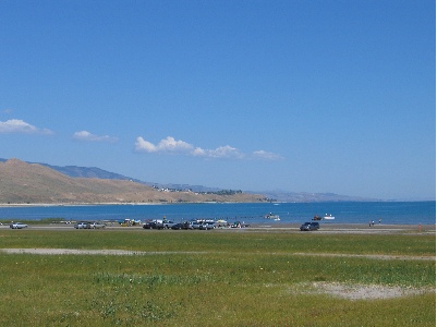
Bear Lake

Somewhere between Fish Haven and Garden City, I passed into Utah, the ninth state I’d visited on my trip. At Garden City, I got on route 30 and followed that around the south end of the lake. I climbed a hill and immediately realized that I had slipped into high desert terrain. The vegetation on both sides of the road consisted of tall grass, sage, and a variety of other desert plants. I was getting closer to home, leaving the water wonderland I’d enjoyed since entering Oregon more than a week before. I felt disappointed and did not look forward to what I’d drive through ahead: dry desert, hot sun, empty riverbeds. I realized that I’d fallen out of love with the desert.

I turned right on route 16 with a bunch of other cars, heading southbound. More farmland, but not much more. I passed the bunch of cars, tired of breathing their exhaust. Later, I turned right again onto route 39, heading west. The road climbed and climbed and climbed. I kept checking my GPS for elevation information and the number kept going up. I was certain that when I reached the top of the mountains, there would be a lookout where I could see Salt Lake. I crossed over the Monte Cristo Summit, at 9000 feet, and started down. There was no lookout. The road dropped into a canyon with a small stream on either side. It twisted and turned as it descended. I passed two pickup trucks and some kind of Volkswagen — a Jetta, maybe? — blew past me.

I spotted a restaurant on the left and made a harrowing turn into a parking space. I needed a bathroom and lunch, in that order. I asked for them in reverse order. It would be a 20 minute wait to eat outside on the patio, which looked like a good place to eat. I got directions to the ladies room and while I was doing my business, decided I didn’t feel like waiting. Instead, I’d find a shady spot in a park and eat some of the food in my cooler. So I left and continued on my way.

Trouble was, there was no shady spot in a park. All I passed were campgrounds, and since it was Sunday at midday, all of the campgrounds were full. So I kept driving.

The road dumped me down in Ogden. I got on a main avenue that was also labeled route 89 and headed south toward Salt Lake. I wasn’t in a hurry. I was supposed to meet Megg at around four and it was only 1:30. That meant I had time to kill.

I should have killed time up in Ogden, because when I got closer to North Salt Lake, all of the shops and businesses were closed again. It would not be a good place to kill time. I drove all the way down to the city, then came all the way back up to Bountiful, where I found a Barnes and Noble that was open. I killed over an hour in there, buying books for myself (as if I needed them) and for Megg’s son, Cooper. Then I hopped over to the Taco Bell for a bite to eat. Then I drove around some more. It was around four and I was in a Smith’s parking lot, after buying two pies for Megg and her family, when I finally connected with Megg. I was five minutes from her house. She gave me directions and I made my way over there.

Megg is one of my editors. She works with me on my Quicken Official Guide books, which I’ve been revising faithfully since the Quicken 99 edition back in 1998. Megg hasn’t been stuck with me that long. She inherited me from my first editor on that book, Joanne, about five years ago.

Megg has a lovely and very large house on a hill overlooking the North Salt Lake area. Excellent views, plenty of space. And a very comfy guest room. I met her son and her husband. I then proceeded to join her for a very relaxing afternoon and evening.

Elk and Bison and Bears — Oh, My!

Day 12 takes me through two national parks on my way south.

I slept better at Lynn’s house than anywhere I’d been so far. The bed was warm and cosy, the air was clean and fresh, and the sound of the creek rushing by the house was the perfect white noise for sleep.

I got up my usual time and soon realized that Lynn was awake, too. I had some coffee and Lynn had some tea and we chatted. Then I went up to take a shower while she put the horses back out to pasture.

She drove me to a town called Alder for breakfast. On the way, we stopped at a town called Laurin (which is not pronounced the way it’s spelled, but I can’t remember how to pronounce it) where Lynn showed me two small houses that had been built inside metal grain silos. She said that when she and Ray had farmed down near Klamath Falls, they’d had a bunch of those silos and never knew what to do with them — they didn’t grow grain and no one else in the area did either, anymore. This seemed to be a perfect solution.

We had egg sandwiches at a local farmer cafe and I picked up the tab. Then we went back to her place, where I packed up the car, said goodbye, and headed out.

I gassed up in Sheridan, at the only gas station. I then retraced our miles through Laurin and Alder on route 278. Along the way, I saw a bald eagle. It looked exactly like all the photos I’d seen of bald eagles, but it was picking on some road kill when I approached. It flew off to wait atop a fence post until I was gone so it could continue its meal.

I passed Nevada City along the way. My map indicates that it’s a ghost town, but there was plenty of activity there. Perhaps someone had fixed up the buildings alongside the road as a tourist attraction? Or built them from scratch to look like old western buildings? In either case, there were an awful lot of them and they were right on the road. A sign said that there would be living history events that day. A bunch of tourists had already gathered, including three motorcyclists who had found it necessary to take up a full parking spot for each of their Harleys. Ah, the good old American “I’m all that matters” attitude in action.

A few minutes later, I passed Virginia City, which has to be the most authentic western town I’ve seen so far. There were plenty of old buildings, in wonderful condition, housing shops and museums. Makes me sick to remember how Wickenburg tries to promote itself as “the west’s most western town,” when I pass through one that makes Wickenburg look like a shadowy imitation of something out of a sixties western. Somehow, the fast food joints ruin the effect.

Quake LakeI reached Ennis, which Lynn had told me was very touristy. I didn’t really notice that, but I made my turn there, so I may have missed that part of town. I was still on route 287, but it was heading southbound now. After a while, the road joined up with the Madison River, which I followed for quite some time. When I got to the turnoff for Quake Lake, I turned in. Lynn had told me a little about the place and said she’d wanted to see it when she and Ray had driven past. Ray hadn’t been interested at the time, so they’d gone past without stopping. The place was situated in a canyon where the Madison River flows. In the late 1950s, an earthquake had caused a landslide that dumped debris into the river bed. Twenty-eight people had been killed, although I don’t know how. Perhaps they were on the road there? In any case, the natural dam caused by the landslide had created Quake Lake. I read all this on the sign outside the visitor center. It was all I needed to know, so I didn’t go in. I took a picture of the little lake, then got back into the car and continued on the road as it wound alongside it. There were lots of dead trees sticking out of the water. I imagined a heavily forested canyon suddenly filled with water and the slow death of the trees that were submerged.

The road passed on the north side of Hebron Lake, a manmade lake along the Madison River. There were lots of homes on its shores, a few marinas, and some fishermen. Then, at the junction for route 191, I turned right, heading south.

My car’s odometer turned 14,000 miles about a mile outside of West Yellowstone, MT.

I was going to just drive through West Yellowstone when I spotted an IMAX theater. I enjoy IMAX movies — except the 3D ones, which look blurry to me — so I pulled in. They were showing three different movies: Yellowstone, Lewis and Clark, and Coral Reef. Although I wanted to see Lewis and Clark, Yellowstone was next up, so I bought a ticket to that. Since my cell phone finally had a decent signal, I called Mike while I waited and left him a message telling him where I was and where I was going.

The movie was good. Grand Canyon, which plays at Tusayan near the South Rim, was better, though.

YellowstoneI headed into the park, crossing over the border into Wyoming, the eighth state I’d visited so far. My National Parks pass got me in without a fee. (It works at Yellowstone but not Mt. St. Helens? What kind of bull is that?) I took the map and gave it a quick look. My objective was not to visit the park. My objective was to take a nice, scenic ride south toward Salt Lake City. The problem was, it was a Saturday in August. The park was full. And the tourists were of the most annoying variety: drive-through tourists who will stop their car anyplace someone else has stopped, just to take a picture of whatever that other person is taking a picture of. When I wanted to drive slowly, there was someone on my butt. When I wanted to drive faster, there was someone in front of me. When I wanted to stop in a place where no one else was stopped, two or three other cars immediately appeared, spewing occupants armed with cameras to take the same picture I was trying to take. At one point, I reached a traffic jam on a narrow, one-way road as at least 30 cars had stopped to photograph a grizzly bear on the other side of a creek. I was so wigged out by the crowd that I neither stopped nor saw the bear.

BisonI did see plenty of elk, though. The first herd was right inside the park, grazing along the Madison River. I guess seeing tourists have tamed them, to a certain extent, because some very gutsy tourists were approaching quite close and the elk didn’t seem to care. I also saw a few bison. Most of the bison, as I recall, are on the grassy east side of the park. I was on the west side. I saw four individual animals, each of which were the subject of many tourist photos. But the one that amazed me the most was the one walking alongside the road in a forested area. I think he was lost. But he was walking on the pavement, forcing vehicles to go around him. That, of course, caused a traffic jam because everyone wants the thrill of driving alongside a walking bison. When it was my turn to pass him, I didn’t stop. I just aimed my camera and pushed the button while I kept driving. He was so close that someone sitting in my passenger seat could have reached out and touched him. Although he didn’t seem interested in me (or anyone else), I could imagine what those horns would do to my car’s paint job if he decided he didn’t like the color red. I wondered what he thought of the long line of campers and SUVs and cars filing past him in slow motion. I also wondered where he was going. Probably to the administrative offices to complain about all the traffic and exhaust.

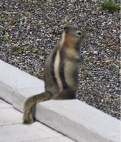
Old FaithfulI took the exit to the Old Faithful Inn, in search of a decent lunch. I got a great parking spot in the shade and got out with my camera. There was a huge crowd of people sitting on benches, facing the Old Faithful Geiser, which was spewing out various amounts of steam to keep them entertained. I tried two places and found a cafeteria and a buffet. I checked out the buffet and was surprised to find that the cafeteria food had looked better (although it didn’t smell better). As I was walking back to my car, Old Faithful let go and I managed to get a bunch of good photos. It was still bubbling water when I left. ChipmunkI also managed to get a photo of this little fellow. It’s unfortunate, but people at national parks find it necessary to feed the wildlife. As a result, they become tame, like this guy probably was, and they forget how to forage for themselves. In the winter, when there are fewer tourists around, they starve. That is if they don’t get sick and die from the junk the tourists feed them.
I found a restaurant with table service at the Snow Lodge. I had a nice salad with warm goat cheese cakes on it. Tasty. Then I got back into the car and made my way out, before a new post Old Faithful eruption could start another traffic jam.

I followed the signs to Grant Village, crossing the Continental Divide twice along the way. At one point, I caught a glimpse of Yellowstone Lake. I was surprised — I didn’t remember it being so big. And I saw plenty of evidence of forest fires: where I’d first come into the park, near Old Faithful, and now as I left the park, driving toward the South Entrance. I passed Lewis Falls, on the Snake River, the first waterfall Mike and I had seen when we’d come into the park from the south years before. I clearly remember the fresh forest fire damage at the falls — there was nothing alive back then. Now the dead trees were still there, but new pines were growing in. It would take a long time for the park’s forests to recover.

Grand TetonsThe road followed the Snake River down to Jackson Lake and Grand Teton National Park. The main feature of Grand Teton is the mountain with the same name, on the southwest side of the lake. It’s 13,770 feet tall, very rocky, and has a glacier not far from the top. In this photo, it’s the mountain that’s farthest away. It was after 3 PM and the sun was moving to the west, making it difficult to get a good photo of the mountains from the east. I followed the road, choosing the path that kept me close to the lake rather than the faster road that went direct to Jackson. A scenic drive.

I passed through the southern boundary of the park and, a while later, was approaching Jackson. By this time, I was exhausted. I’d left the top down most of the day and I had been slow-roasted by the sun. All I wanted was a clean, quiet motel room. I stopped about about a half-dozen places on the north side of town and was told that they only rooms left were either smoking or very expensive. I drove through Jackson, figuring I’d find a place somewhere outside of town, on the south side. Jackson, WY, is a tourist processing plant. Tourists go there, park their vehicles, and then proceed through a series of shops and restaurants and tourist attractions designed to wring their money out of them. I couldn’t believe the number of people on the streets. Traffic was horrendous. And I couldn’t understand what attracted these people, like flies to honey. The real tourist attraction was north of town, the lakes and mountains and wildlife. Gift shops and cheap t-shirt joints can be found anywhere. When I finally got out of town, I was glad I hadn’t found a room there.

I wound up at a motel along a creek, just where the creek merges with the Snake River. I took an upstairs room facing the creek. After getting some dinner at a restaurant 3 miles away, I sat on my patio with my maps and a bottle of wine, trying to figure out where I’d go next. I was on my way home — that was for sure. After nearly two weeks and over 3,000 miles on the road, I was ready for my own bed.