I camp out at a friend’s house and, later, in a mudders’ playground.
• The Long Drive
• At the Backwaters Campsite
• In Mesa and Gilbert
• A Quick Stop in Wickenburg and Forepaugh
• Off Plomosa Road
• Camping at the Big RV Show
• A Trip to Organ Pipe with the WINs
• The Tucson Gem & Mineral Shows
• Wickenburg Gold Rush Days
• Constellation Park Interlude
• White Tank Mountain Park
• Bumming It in Phoenix and Apache Junction
• A Dose of Civilization
• Return to the Backwaters
•
At this point, you may have noticed that I’m not keeping my trip account up to date as well as I should. In fact, I’m about a month behind in my travels. But I’ve updated the list of posts to include the ones that I should have (but haven’t yet) written about. With luck, I’ll get around to them.
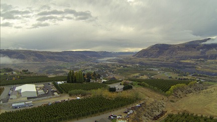
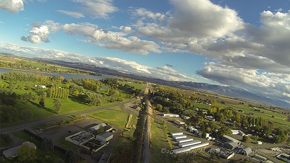
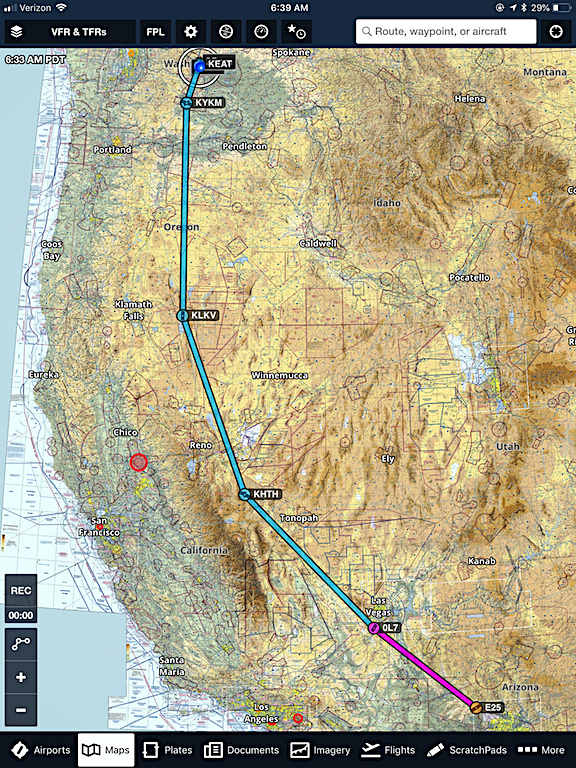
But for now, I figure it’s best to resume with my most recent trip segment: the six days I spent after leaving White Tanks Regional Park on Febrary 18.
One Thing Leads to Another
Did you ever have one of those days when you set out to do a simple task or two and other things start falling apart and need immediate attention? That was my Monday, President’s Day, after leaving the park.
There were two things that required attention that day:
- One of the four brackets installed on my truck that my truck camper ties down to was loose. Given that I very often drive on rough roads, I figured it would be a good idea if all four of those brackets were as sturdy as they should be.
- I needed propane. I was down to half a bottle. My rig carries two 5-gallon bottles and I like to have at least one of them full or nearly full at all times.
The first task was supposed to be the toughest. I got a recommendation from my friend Janet to try a place called State Trailer in Peoria, which was only about 10 miles from the park. I called first and the guy I spoke to, Scotty, told me they could look at it that afternoon.
I left the park at around 11:30 AM so I had time. I took Olive Avenue almost all the way. Along the way, I stopped for groceries at a Safeway with the nicest looking olive bar (coincidence?) I’d ever seen. So I loaded up on a few types of olives. I put my groceries away in the parking lot and continued on my way.
I got to State Trailer around 1 PM. I went in and met Scotty. He came out to take a quick look, agreed that it was loose, and directed me to park near one of their service bays. He then got another service guy out of the back of a truck he was working on and the two of them looked at the problem. It took a little research back inside before Scotty realized that there was supposed to be a sleeve inside the bracket. He had the other guy take the bracket apart and they found the sleeve where it had slipped inside where it didn’t belong. They got it put where it was supposed to go, put everything back together, and it was as good as new.
Meanwhile, I was shopping. State Trailer isn’t just a repair place. It also stocks and sells all kinds of RV parts and equipment. It has, by far, the best selection of RV gear I’ve ever seen. And that’s saying a lot. I’ve been in more RV shops than I can count. Camping World, which I always thought was pretty good, is a bad joke compared to this place. Seriously: if you’re in the Phoenix area and need anything for an RV, go here first. It will definitely save you time.
I wound up buying two things I need for my clamping setup back home: a propane powered instant hot water shower and a new two-burner propane stove. Best of all, they picked out the exact propane adapters and hoses I’d need to rig both devices up to one tank. I also bough RV toilet chemical, toilet paper, and chocks, all of which I needed for my current trip.
Good thing I bought that cargo trailer back in January. I had more crap to load into it. But for now, I just tossed it into the back seat of the truck.
State Trailer also sold propane so I figured I’d tank up there. I moved my rig around to the filling station and offloaded the empty tank. Then I decided I’d likely need my step to load it back in. The step was inside the trailer. I got the key and went to open the side door’s padlock.
The key wouldn’t work.
I jiggled and fiddled with it. I tried the other key. Crap. I’d known deep down inside that buying a “Brinks” brand lock in a Walmart would come back to haunt me.
I tried the key in the lock on the back door, which was keyed alike. That one opened. I got the step.
By that time, the propane guy was waiting for me. “Can’t fill it,” he said. “It’s expired.”
He showed me the manufacture date: April 2006. The tanks were only good for 12 years. For the past eight months, people had been illegally filling the tanks and he wasn’t going to do it, too.
I asked him where I could get it recertified. He handed me a slip of paper with the name, address, and phone number of a Ferrel Gas location closer to Phoenix. I tossed the empty tank into the back seat of the truck, locked the step back in the trailer, and got into the truck. I knew enough to call ahead; the place did certify tanks and would be open for another 90 minutes. I asked Google Maps to guide me there and got on my way.
Of course, I had to take Grand Avenue all the way down there. That means traffic lights. The 8-mile drive took about 30 minutes.
I pulled in and stopped by the filling station. There wasn’t much other room to park. I went inside the office and told the woman at the desk what I needed. A while later, I was handing the two tanks to a guy for him to do the certification.
While I waited, I fiddled with that damn lock again. No joy. I’d need it removed and replaced. I wasn’t in the mood to screw around with it. What if the other one decided to break, too?
The guy finished the certification process and filled the tanks. I installed one and he lifted the other into place. I connected them, opened their valves, and secured them. I put the step back into the trailer and locked it up. Then I went inside to pay.
The total was a little more than nine dollars.
“How much was the certification?” I asked the woman as I gave her a credit card. (I charge everything related to my business travel and this was business travel.)
“Normally, it’s $10 per tank, but it’s free if you fill the tank.”
That seemed like a pretty good deal to me.
Back in the truck, I asked Google Maps where the nearest locksmith was. There was one only a few miles away, almost due south. I called and explained my problem. He said he could help, so I started off.
The locksmith shop, which sold locks and safes, was in a neighborhood that made locksmithing a good business. They had a parking lot and, for a moment, I hesitated, not sure if I’d be able to turn around once I got in it. I envisioned a way and pulled in, then started backing up to point the truck back out toward the street.
The guy who’d answered the phone met me at the door. I showed him the key, praying it wouldn’t suddenly work and make me look like an idiot. It didn’t. He tried the key. He jiggled the key. No joy.
We went in. He sent someone else out to work on it. I assumed they’d cut it off — after all, that’s what the locksmith had done to get the lock off my hangar after my idiot wasband had changed the lock in a feeble attempt to lock me out.
Inside, the locksmith set me up with a pair of commercial Master brand locks that were keyed alike. I didn’t care if the other Brinks lock worked. I wanted it off the trailer.
The other guy came back in with the lock in his hand. It was in one piece. “How’d you get it off?” I asked.
“I picked it,” he replied.
Great.
They didn’t charge me to get the lock off. I paid for the new locks, went outside and installed them both on the trailer, and climbed back into the truck.
The Refrigerator
By this time, it was about 4 PM. I wanted to go to Cabellas and then figured I’d spend the night camped out in the parking lot for the casino near there. They were both off route 101, which was west of me. Traffic on I-10 westbound was just starting to get thick. I figured I’d parallel it on surface streets for a few miles before getting on I-10, taking it to the Loop 101, and heading north.
In the meantime, my friend Cheryl had called while I was in the locksmith shop. She and I were supposed to have lunch the next day. She’d also left a text message to call her as soon as I could. I called her back and spoke to her on speakerphone as I drove.
She wanted my advice about a refrigerator. She had a super fancy fridge in her kitchen with four separate compartments. Any of them could be configured as either refrigerator or freezer. She currently had one freezer and three refrigerator compartments. But it wasn’t enough. She wanted some more food storage space in her garage. Should she get a refrigerator with a freezer that she’d seen on Facebook Marketplace or a freezer she’d seen on Craig’s List?
She went back and forth between all the options until my head was spinning. Finally, I told her that the fridge she’d seen on Facebook seemed like the best solution.
That’s when she asked me where I was and where I was going and if I could go pick it up for her.
It took me a moment to comprehend that she was asking me to pick up a refrigerator for her. Not a quart of milk or a vacuum cleaner in a repair shop. A refrigerator.
I told her I was heading west on whatever road I was on and that I was going to Cabellas on the Loop 101. She told me that was very close to where Salvador, who owned the fridge, lived, which was off I-17. I blinked. Cabellas on Loop 101 was nowhere near I-17. There was miles of surface streets between them with many traffic lights. It would take at least 45 minutes to get from one to the other in rush hour traffic. When I tried to explain that to her, she sounded doubtful.
“I’ve been out that way and it’s very close,” she said.
I didn’t want to argue with Cheryl. She’s a very sweet lady. She and her husband Mike were incredibly supportive to me during my extremely ugly and (in hindsight) rather ridiculous divorce battle. So I told her to text me Salvador’s address, just to see where it really was. We hung up.
I was heading north toward I-10 when I stopped at a light and looked at his address on Apple Maps. I realized that if I got on I-10 heading eastbound I could hop on I-17 and be at his place in 20 minutes. The light turned green, I drifted into the right lane and got on the freeway heading east. I called Cheryl. “Tell Salvador I’ll be there in 20 minutes.”
“Okay,” she said and hung up.
As I drove, I wondered where the hell I was going to put a refrigerator. The trailer was pretty damn full. Maybe if I moved the generator and barbecue grill? But would it even fit though the side door? And wasn’t it a good thing I’d gotten that lock replaced?
Salvador lived in a quiet but rather run down neighborhood. I parked along the curb and went to his door. I rang the bell. Twice. Finally, the door opened a crack and a man’s eye appeared.
“I’m looking for Salvador,” I said.
He replied in Spanish. Of course. He said something about a dog — likely the one I could hear barking in the background. Then he opened the door wider. He was huge and not in a football player kind of way. More like in a “Biggest Loser” kind of way. A teenage girl came into view. And then a woman. They spoke English. After a moment, they directed me to go around to the back yard.
The fence, which was as tall as me, was locked. After a moment, someone on the other side opened the padlock. (It obviously wasn’t a Walmart Brinks.) All three of them were there. There was a nice pool and a relatively nice outdoor kitchen. They led me to the back patio where a small apartment-sized refrigerator stood. It was in good condition and clean inside. I told them I needed to make room in the trailer and would be right back.
Back at the trailer, I went in through the side door and moved the grill and generator to the back of the trailer. Then I went into my camper to fetch $125. Then I went back into the yard.

Here’s the refrigerator, jammed into an empty spot beside the side door. The E-track is mounted low on that side of the trailer so I kept worrying about the fridge falling over as I drove.
While I was gone, they’d fetched a hand truck. I’d brought a saddle blanket from the truck to prevent it from being scratched. I handed over the money and the three of us got the refrigerator onto the hand truck and out to the street. We worked together to get it in through the trailer’s side door and I pushed it into place. I fastened it to the E-Track I’d installed using an extra ratchet tie-down. I used a long bungee cord to keep the freezer door shut. Then we all said goodbye and I climbed back into the truck.
I asked Google Maps to take me to Cheryl’s house. It gave me the wrong directions. (You must approach Cheryl’s house from the east no matter how Google directs you.) Fortunately, I knew how to make the wrong directions right and navigated into her driveway.
I had to ring the bell twice to get her to the door. Then she was all excited about seeing me and Penny and getting the refrigerator. She called a neighbor to help get it out of the trailer and he arrived quickly. A while later, it was in its new home.
I moved my rig to a spot along a drive in their side yard that I thought was level enough for a one night stay. Then I grabbed an open bottle of wine, those olives, and Penny’s leash and went with Penny into the house.
At the Airpark
Cheryl and Mike live at an airpark. If you’re not familiar with the term, its a community built on a private runway. Mike flies for the airlines and has a helicopter services business. He also owns two Bonanzas — although I’m not sure why anyone needs two of the same plane, even if they do have different engines. They have an amazing custom home that overlooks the runway and the city of Phoenix to the north.
Mike was in Los Angeles on helicopter business. Cheryl and I ate leftover spaghetti and meatballs, salad, olives, and wine. We chatted for a long while, getting up to date on what we’d been up to since we’d last seen each other. The evening wore on.
Finally, I took my leave, going back to the camper with Penny. The night was cool and clear. As we walked through the yard, I could see planes on final approach to Sky Harbor.
I had a good night’s sleep in the camper. Although Cheryl and Mike have a guest house that I’ve stayed at in the past, it didn’t seem worth messing the place up for just one night. I was comfortable enough in the camper.

Kitty, lounging in the early morning sun.
Cheryl texted me in the morning, inviting me for coffee. I went over without Penny. Cheryl has a cat and was worried about it having a problem with Penny; the previous evening, she’d locked it in the laundry room.
She offered up a shower and because I’m no idiot and my camper’s shower is so disappointing, I said yes. A while later, she was punching buttons on their computerized shower stall, setting me up with her program: two shower heads, 105°F water. “Unless you prefer a steam shower,” she said.
I assured her that water was fine. It was actually better than fine. I took a long 105°F shower and enjoyed every minute of it.
Our plans for lunch were up in the air. Mike was coming back and would be home by 2 or 3, depending on what plane he caught. We finally decided to run some errands — Target, Ikea, Total Wine — first and then meet Mike at a Chinese buffet for an early dinner. I would, of course, spend another night.
We did all that and I was well-behaved, buying only a few small things at Target and Ikea. Total Wine, however, was my stop. I bought a few bottles of wine and some Mescal and Rakia for my bar at home. (Alcohol is heavily taxed in Washington state.)
It was good seeing Mike, who I hadn’t seen in about two years. The restaurant’s buffet was actually good and we all ate more than we should have.
Back at the house, we went our separate ways. I know Cheryl was tired and figured Mike would be, too, after traveling. But I was only in my camper for a short while when Mike texted. “Come on down to the hangar,” he said.
So Penny and I went down. We found him in there flying a small DJI drone knockoff. That’s when I saw the two Bonanzas and he explained that they had different engines so they really weren’t the same plane. (Okay.) He had one of his Hillers tucked against the far wall. Believe it or not, he’s still trying to get me to buy one.

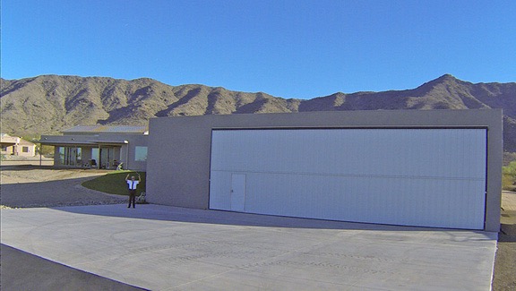
Here’s a pano shot of the inside of Mike’s hangar. The last time I was there, he had two different planes in there.
We chatted while he tried hard to fix the network problem he was having with his hangar’s internet connection. Once that was solved, he was done. We left the hangar and he locked it up while Penny and I went back to the camper.
Cheryl texted a while later, asking me to come over. So, once again, I ventured out to the house, this time without Penny. She’d taken a nap and was embarrassed about it. We chatted while Mike practiced bagpipes with a silent device he listened to with earphones. The cat sat on my lap.
They invited me to join them on a trip to Apache Junction to see a motorhome they planned to buy. They were leaving at 6:30 AM the next morning. I was noncommittal. I had a feeling it would take a long time and I really did need to leave.
Sure enough, they texted me at 6:30 Wednesday morning, telling me they were on their way. They’d left the casita open if I wanted to use it to take a shower.
I made coffee and brought my laptop over to the casita to charge the battery. Then Penny and I went for a 2-1/2 mile walk around the neighborhood. It was warm and sunny and I was stripped down to my tee-shirt before we were done. Properly sweated up, I headed for the shower. I think I took an even longer shower that day and washed my hair, knowing it might be my last good shower for a while.
I spent the next hour or so prepping the camper for the next leg of my journey and researching where my next stop might be. I had options, but the easy one might inconvenience some friends and I really didn’t want to do that. I knew I had three stops to make before I settled in for the night somewhere. I also knew that I had to be settled in before nightfall in a spot I could stay until Saturday morning. Arizona was expecting a major winter storm to hit that night and there was heavy rain in the forecast for Thursday and Friday. I didn’t want to be wandering around in the rain, wondering where I was going to spend the night. So I had to leave Cheryl and Mike’s place by 3 PM.
Cheryl got back at around 2:30. She apologized for not hanging around but told me she needed a nap since she would be entertaining other friends that night. I understood. Although I was disappointed that I wouldn’t see the new motorhome — Mike was still out and about with it — I really couldn’t wait. So we said our goodbyes and I headed out.
Errands in Mesa
I had three stops in the Mesa area.
First, I had to stop at Jan and Tiffani’s house, which is technically in Gilbert. They’d received two items in the mail for me and I needed them both. Although Tiffani had invited me to stay with them again, Jan was very sick with a cold and I didn’t want to be a bother. So I stopped there, got the packages from Jan, told him I hoped he’d feel better soon, and ran before he could get me sick.
Next, I had to stop to get a permit from BLM to camp in the Bulldog Canyon area. I’d researched the area and had spoken to the office earlier in the day. The permit was free and it came with the combination to the gate locks that kept unauthorized people out. The ranger suggested two areas for camping but claimed he knew nothing about the terrain and whether it was suitable for my rig.
Finally, I had to stop at Falcon Field Airport to pick up my orchid. I’d left the damn thing at Jan and Tiffani’s house in early January and it had gone into bloom since then. Tiffany had brought it to the office where it was still blooming. I fetched it, said hello and goodbye to other friends there, and got back on the road.
At Bulldog Canyon
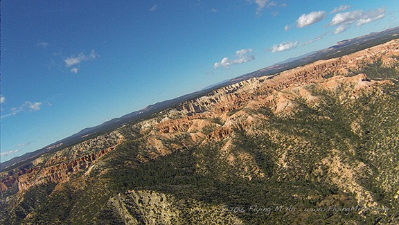
I used Google Maps to guide me to one of the gates into the Bulldog Canyon area: the Wolverine Gate. The roads ran through a neighborhood on the northern boundary of Apache Junction, turning to dirt along the way. There was a parking area with a few vehicles in it and the gate.
The gate was wide open.

The weather forecast called for a hell of a lot of rain and unusually cold temperatures. Remember — I was only about 25 miles from Phoenix.
I drove in. My goal was to find a suitable parking spot where I could hunker down during a severe winter storm that was expected to begin that night. It needed to be relatively level and, for sanity’s sake, not right near anyone likely to run a generator all hours of the day and night. Because I was towing, it also needed to be a space I could either pull through or back into with my rig, which was about 40 feet long in total length.
I drove for about a mile on the winding road as it climbed into the hills. Every single appropriate campsite was occupied. Lots of people were also driving around in off-road vehicles — mostly side by side ATVs. I stopped in a spot that might have been okay and consulted the satellite view to see what was farther up the road. Nothing — not even a place to make a U-turn. I decided to try the next gate so I turned around and drove back out.
By that time the gate was closed. There was an off-road vehicle in front of me and the driver got out to open the gate. We both drove through and he pulled over to close it behind me.
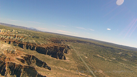
Relying on the Google Maps satellite image, I found the next gate and navigated towards it. This was the A1-Pit entrance. By this time, it was getting late and sunset was less than an hour away. I resolved to settle in the very first spot I found.
The road to the gate was in terrible condition, with deep potholes and huge winding ruts of erosion. My camper makes my truck very top heavy so I drove slowly and carefully, working hard to keep my rig as level as possible. Along the way, I passed a few other forlorn looking campsites that looked as if they’d been there for months, if not years. One had a torn awning; another had a lot of trash in bags outside. Squatters. I was starting to regret not saying with Jan and Tiffani.
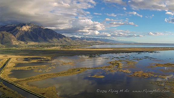
I was about 4/10 of a mile from the gate (per Google Maps) when I saw a big clearing to my right. There were signs that the area got very muddy in rain — tire tracks criss-crossed the whole area. But the north east edge looked higher with a fine gravel instead of dirt. It also looked as if it might be somewhat level. I decided to camp there.
For this particular campsite, I had no need to unhook the trailer or offload the camper. Instead, I disconnected the camper tie-downs and dropped its two back legs to lift the back end off my truck. This did two things: it leveled the camper (which was parked facing up a little slope) and it stabilized the whole setup (which was prone to rocking with my movement inside and/or the wind). That done, I fetched the generator out of the trailer and set it up under the back end of the camper, where it would be (mostly) out of the rain. I knew that if it was completely cloudy, my solar panels would not recharge my batteries and I certainly didn’t want to set up the generator in the rain. That done, I set up the grill and grilled up a piece of salmon I’d defrosted for dinner. Then Penny and I went in for the evening, which was already getting cold.

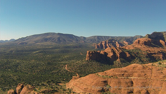
I had a clear view of Superstition Mountain from the back of my camper. At sunset the light got very good.
The rain started at about 3 AM. I know the time because I heard the rain on the camper’s roof. My summer work makes me very sensitive to the sound of rain and it always wakes me now.
The rain came and went. I got out of bed at around 6 AM and made coffee. Penny went out between rain squalls. Was this the big storm they’d been forecasting? If so, I wasn’t impressed.

Here’s the radar picture at 1:45 PM on Thursday.
I got impressed later, just after noon, when the rain started up again and didn’t stop. It rained nonstop for the remainder of the day and into the night. It was still raining when I went to bed and, fortunately, the steadiness of it didn’t wake me up. It was still raining in the morning when I woke up. In fact, it didn’t stop raining until 8 AM or 9 AM — and even then it was just a pause.
Meanwhile, Penny and I hunkered down in the camper. It was difficult getting her out for a pee in the rain before we turned in for the night, but she finally went. I watched her from the window as she tried to find the perfect spot for her business while being pelted with rain drops. At one point, it looked as if she thought, “Oh, fuck it,” and just went where she was before running back to the door.
Although my solar panels did pick up some power during the day, they could not keep up with the power use from my forced hot air propane heater. I had decided early on in this trip that I was not going to be uncomfortable, so I ran the heat as much as I needed to stay comfortable. Yes, this meant using up propane and wearing down the camper’s batteries. But hell, it wasn’t as if I couldn’t buy more propane or recharge the batteries. My rule-of-thumb target is to have 85% or more of battery power at sunset; when I didn’t have that, I went out and started the generator. I let it run for about two hours, when it ran out of fuel; I had purposely neglected to top it off because I wanted to make sure I had some fuel in reserve in the 2 gallon can I keep in the trailer.
Ever wonder what 40 feet of 18 gauge fine silver wire looks like? Here you go.
I pay by weight based on current silver prices. This weighed in at 3.31 Troy ounces. pic.twitter.com/XbBNZaAsTE
— Maria Langer 🌵🌞 (@mlanger) February 21, 2019
In case you’re wondering what I did in a tiny camper for two full days, I actually had a project to finish that required me to sit still for two days. One of my friends had admired a copper bracelet I made that I wear all the time. She wanted me to make her a three-strand fine silver necklace in the same design. I’d ordered the silver and it had arrived at Jan and Tiffani’s place — that’s one of the packages I picked up. I had all my tools in my camper with me — I’d moved them into cabinets while I was still at Cheryl and Mike’s place so I wouldn’t have to go out into the trailer in the rain. With everything I needed close at hand and nothing better to do with my time, I worked on the necklaces. I even live-Tweeted some of the progress.
Of course, the mudders started arriving around 5 PM on that first rainy day. These were mostly men in pickup trucks with loud engines and big tires. That’s when I realized that I was parked along the edge of their favorite playground. Seeing me there turned away a few of them — they found other places to play farther up the road. But some of the more stubborn ones played nearby anyway, revving their engines, spinning their tires, and fishtailing through the mud. I guess it was fun — for them. Not so good for the road or the vegetation alongside it since they just made the potholes deeper and occasionally ran off the road into the cholla cacti or mesquite and creosote bushes. One young woman, probably trying to show off that she could keep up with the boys, spun around dangerously close to my rig, spraying it with mud. Most of it washed off in the rain over the next 24 hours, but there was enough caught on my window to get into the doorframe when I rolled my window down. That took some effort on my part a few days later to fix.
They came and went throughout the evening and even after dark. By around 9 PM, they were gone, but they returned the next day. That day wasn’t quite as bad since most of them went past me and had their fun elsewhere.
When the rain paused on that second day, I poured the remaining gasoline I had into the generator’s tank. I had a little trouble getting it started, but it did roar to life after about a half-dozen pulls on the cord. (Those Honda generators really rock.) It had been so cold during the night that the heater was running almost non-stop and the batteries were very low. When the clouds cleared, I could see the Superstition Mountains with a heavy dusting of snow.

What a difference two days makes! Superstition Mountain on Friday morning, around 10:30 AM.
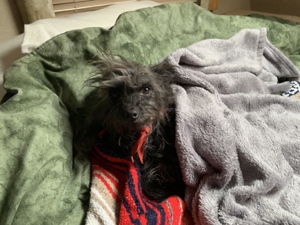
Penny spent a lot of time lounging on the bed during those two days.
Understand that a storm like this is very unusual for the Phoenix area. We got nearly 2 inches of rain (per Weather Underground weather stations in the area) and Phoenix Sky Harbor broke a 24-hour rain record. Phoenix normally gets less than 10 inches of rain a year and it got nearly 20% of that in two days. And the snow — well its very rare indeed to see snow on mountains close to Phoenix, yet the Superstitions, Red Mountain, the McDowells, and Four Peaks were all covered with the stuff. The snow level had come down to less than 3,000 feet. Down in Tucson, they got enough snow to build snowmen in some areas and the police made a hilarious video about it.
The rain continued on and off all Friday afternoon. It was still raining when I went to bed, which had me a bit concerned. I had to leave in the morning before 7 AM and I didn’t like the look of the road. Would I be able to get out without sliding off the road or getting stuck in one of those huge potholes made even bigger by the mudders? I honestly didn’t know.

Another shot of Superstition Mountain, this time at about 5:25 PM on Friday. You can see the damage done to the road by the mudders over the past two days. And yeah: that’s a rainbow.
The Apache Junction Art Show
I was out of bed making coffee by 5:30 AM the next morning. That gave me 90 minutes to have breakfast, pack up my generator and grill (which were both still out), raise the camper legs, strap down the camper to the truck, and get to downtown Apache Junction, where I was participating in an art show.
The rain had stopped during the night and the sky was clear. Although the sun hadn’t risen before I got under way, I had enough light to work and to see Superstition Mountain with its thick cap of snow. It was bitter cold, though — near freezing — and I did have to put on gloves to adjust the length of the tie-down straps to secure the camper properly. Then it was time to pull out.
If there’s one thing I’ve learned about traveling with a camper or trailer (or both, in this case) is that even though I have a AAA safety net for emergencies, I can save a lot of time and heartache by not having an emergency. So I pulled out slowly, shifted the truck into 4WD as soon as I was out of the sharp turn onto the road, and drove at idle speed back to pavement. Looking back, I saw that I had chosen my campsite well: it was the only spot in the area that didn’t have thick mud.
I was all over the road on the way back to pavement. That was on purpose — not once did I lose control. The road was covered with a fine gravel that seemed to prevent it from turning into that thick, snotty mud that’s so common on Arizona’s dirt roads after the rain. With no sliding to worry about, I could concentrate on avoiding the huge holes and ruts, or at least entering them carefully with all wheels. My tire tracks must have made it seem as if I were a drunk because I took no heed to sticking to one side of the road. I passed two vehicles coming in and each of them gave me right of way. They probably couldn’t believe I’d gone in with my rig in the first place.
Then I was on pavement. The run rose as I drove the five miles into town.
I arrived early enough to stop for fuel before homing in on the place I needed to go for the show. Once there, I handled some last minute paperwork and set up under a covered walkway — although that had been my preference (so I wouldn’t have set up a tent for this one-day show), the complete lack of sun kept my space very cool until well after noon.
It wasn’t a big show, but it did draw a respectable crowd. I was between a quilter who admitted that her price point was too far above the shoppers and a photographer who specialized in photos of wild horses and sold a ton of note cards. My sales got off to a slow start but picked up, making the small event worthwhile for me.
4 PM came and we all packed up. After loading my trailer, I was one of the last to leave.
The Other Bulldog Canyon
I found myself at 5 PM in Apache Junction with no campsite. There was a big event going on with a rodeo and a fair and traffic was crazy. I remembered one of the ranger’s recommendations from Wednesday and decided to try a north entrance to Bulldog Canyon. That (I thought) would put me in a good location for Sunday’s planned trip to Fountain Hills, where my friends Janet and Steve were selling her artwork at a huge art show.
So I headed out of town on Usary Pass Road and turned onto the Bush Highway heading east. All along the way, people were parked alongside the road taking pictures of snow in the mountains. It really was a big deal. Four Peaks looked amazing and I almost pulled over once myself. But I kept going; the last thing in the world that I wanted was to be searching in the dark for a campsite after a long day.
I found the entrance to the park and turned off Bush Highway. The gate was closed and locked but I had the combination and opened it. I think the hardest part was moving the heavy metal bar back into position after I’d driven through.
Beyond the gate was a road with pull-offs that were occupied by RVs — despite the fact that no camping is supposedly allowed within a half mile of the gate. I went past them all. I found a bigger site occupied by three separate rigs that I probably could have pulled into, but just beyond them was a road intersection that was wide enough for me to back into without blocking. Since I planned to be out before 9 AM and it would be dark soon anyway, I squeezed into that. I was very pleased to have a gorgeous view of Four Peaks out my back window.

Last light hits Four Peaks, which are uncharacteristically covered with snow. This is the view from my campsite.
I pulled out the grill and grilled up a nice pork tenderloin for dinner. Then I went in with Penny for the night and got started on this blog post.
Coyotes howled in the moonlight very close to us during the night, but I didn’t hear a single other sound. I slept like the dead.
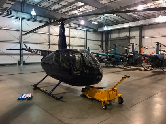
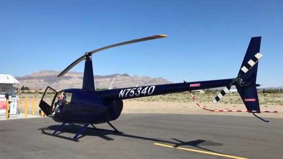
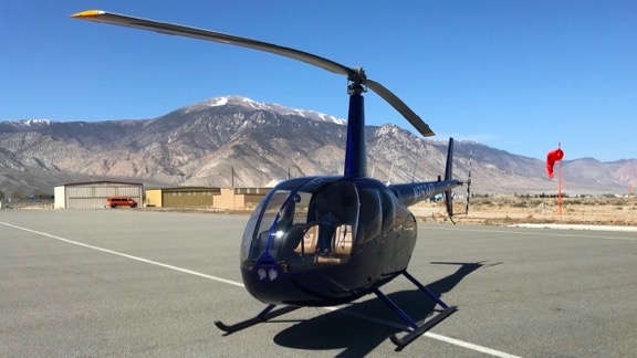
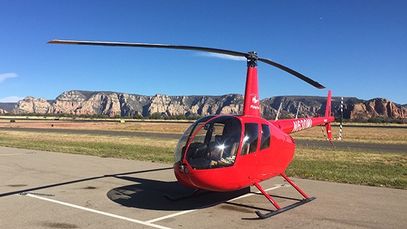
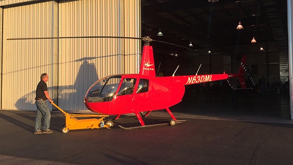 Paul wheeled the helicopter into the hangar where the overhaul work would be done.