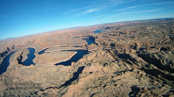
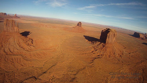
Helicopter Flight from Washington to Arizona, Day 2: Desert Heat and Familiar Terrain

Descending into the desert’s warmth and well-known flight routes.

I woke at around 5 AM. Actually, Penny woke me up that early. She left the bed and for a while I just lay there, half asleep, wondering where she’d gotten to in the vast attic guest room. Then I remembered that I hadn’t closed the door and realized that she might have gone downstairs. I jumped out of bed and headed down to find her.

She was in the kitchen at the back door with the other three dogs. I opened the door to let them all out. The morning was cool and the sky was clear with the waning gibbous moon hanging high in the western sky. The autumn leaves rustled in the gentle breeze. I waited patiently, then got the dogs back in, one at a time, and closed the door.

Megg was awake, getting ready for work. We talked quietly in the kitchen for a few minutes before she headed off to the shower and I headed back upstairs.

A while later, Megg was upstairs to say goodbye. I wasn’t sure how long we’d stay — it depended on when Jeremy could be ready — and she knew she wouldn’t be home until at least 10 AM. I hoped to be in the air by then. So we said goodbye, possibly until July, and she headed off to work.

Meanwhile Jeremy was still asleep and I wanted coffee. Megg had told me about a place walking distance from her home, Alchemy Coffee. I checked it out on Google Maps and saw that it was only 0.6 miles away and opened at 6:30 AM. I got dressed, grabbed my coat and Penny’s leash, and headed out for a walk — or more like a mission — in the predawn light.
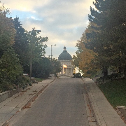
Salt Lake City Capitol Building
I got a neat view of the Capitol building as I walked back to Megg’s house. There was something kind of surreal about the way the first light illuminated the flag outside.

Megg lives in Salt Lake City proper, not far from Capitol Hill. If you think it would be very urban, you’d be wrong. It’s a really nice residential neighborhood with lots of houses of various styles and ages. Sidewalks on both sides of the street keep you off the road as you wander past front yards, often under overhanging trees. It wasn’t a long walk at all, but there was one steep hill, about two blocks long, just as Megg had warned me. I passed within two blocks of the Capitol building and arrived at Alchemy right around 7 AM.

I had my latte and an almond danish while sitting at an outside table with Penny. By that time, it was fully light, although the sun hadn’t cleared the mountains to the east yet. The coffee shop did a brisk business, with about half of its patrons parking briefly at the curb while they ran in for their coffee.

I caught up on Twitter and Facebook activity while I slowly drained my cup. I also checked in for my flight out of Phoenix the next day, very pleased that I’d gotten a First Class upgrade again. I switched my seat from an aisle to a window seat using the Alaska Airlines app. (Does anyone other than me remember the red paper tickets we used to have and waiting on line to change a seat?)

I texted Jeremy to let him know that I wanted to head out by 9 AM. He agreed that an early start would be best. Then I headed back on a slightly different route, really enjoying the variety of architecture along the way.

Back at the house, I let the dogs out again as Megg had asked me to. Her son was still asleep and I tried not to bother him. Jeremy was packing up. When he was ready to go — I’d already packed up before leaving for coffee — I used my phone to call an Uber. A car was at the curb less than 5 minutes later.

We talked Uber along the way. I’d recently become an Uber driver but didn’t drive much, mostly because demand was so low in Wenatchee that it was a waste of time to hang out in town waiting for a call. I learned a few things from the driver’s point of view. Unfortunately, he had trouble finding Skypark and I had to direct him the last mile or so. The fare was only around $12, which I thought was good for a 7-mile drive.

Leg 4: Salt Lake City to Bryce Canyon

After preflighting and adding a quart of oil — I added either a quart or half quart at every fuel stop — we loaded up the helicopter, climbed on board, and started up. It was probably about 9:15 when we got airborne.
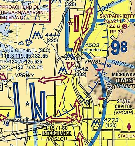
TAC for Salt Lake
This closeup of the Salt Lake TAC shows how close Skypark is to Salt Lake City’s surface airspace.

The first challenge was crossing through the surface area of Salt Lake City’s Class Bravo airport along the I-15 freeway. I had to get clearance and I wasn’t able to make contract until I was airborne. Because Skylark is right next to Salt Lake City’s surface airspace, I had to head due east to make contact and get clearance. I called on the wrong frequency (of course) and had to switch to another one, which I managed to screw up once. So I was orbiting a bit out there until we got it sorted out and I got the clearance I needed. Then it was an easy flight south.

The only thing I regret is not turning on the GoPro. Although I had remembered to turn on the wifi and camera, I’d forgotten to turn the camera on. It’s a real shame because I think I could have gotten a few nice shots as we flew past downtown Salt Lake City.

The last tower I had to talk to — at least for a while — was Provo. Again, I asked for and got clearance to follow I-15 south. Using a landmark like a freeway makes it very easy to tell a tower what you want and make sure you both know exactly where you’re supposed to be.
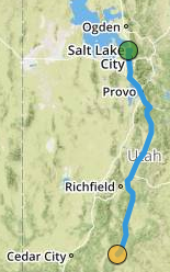
Leg Four
The fourth leg of our trip, recorded by ForeFlight.

Past Provo and abeam Spanish Fork, I veered to the east a bit to enter the valley that would take me along route 89 to Bryce Canyon. That put us in a series of long, relatively narrow valleys between mountain ranges that rose up to 9,000+ feet on the west and 11,000+ feet on the east. There were a few towns along the way and lots of farmland. Very rural, almost remote. And then another narrower, more remote valley with 11,000+ foot mountains on either side. It was 213 nautical miles from Skypark to Bryce Canyon and it took us nearly 2-1/2 hours to cover that distance. I’d been hoping to refuel at Page, AZ, but it didn’t look like we’d make it so we stopped at Bryce.
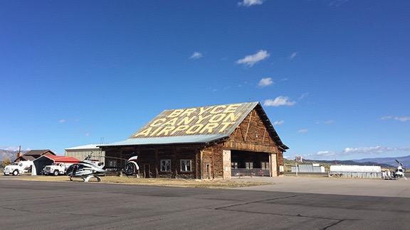
Bryce Hangar
The old log hangar at Bryce Canyon Airport.

The last time I’d been to Bryce Canyon Airport had been way back in January 2013 on a photo flight with a good client. He’d been assigned by Airpano to get pictures of Bryce Canyon in winter for their panoramic image project. We flew up from Phoenix and wound up getting snowed in for two nights before we could do the shoot. You can read a bit about it here. On that last visit, the airport guy had been extraordinarily helpful with weather-related problems — so helpful that my client and I had each tipped him $100. I still have the t-shirt he gave me when I wanted to buy one; I call it my “hundred dollar t-shirt.” I was looking forward to seeing him, just to see if he remembered me. But he wasn’t there. It was a different guy who was older and not quite as friendly. I think he was put off by Penny, who first came into his office off-leash. Oops.

Anyway, he fueled us up while we used the bathroom. I was out on the ramp again chatting with him when the local sheriff’s office guy came up, in uniform. I wondered if we’d done something wrong but couldn’t imagine what it might be. But he was just there to chat with his airport buddy, to kill time on a nice day.

And it was a nice day — unseasonably warm for October, especially at Bryce’s 7590-foot elevation. The kind of day you’d want to sit out in the sun on one of the chairs they had on the FBO porch. In the 50s, at least. I didn’t even need my jacket.

Leg 5: Bryce Canyon to Sedona

Of course, Bryce Canyon Airport is only a few miles from Bryce Canyon National Park, so there’s no chance we’d leave there without a nice little flyby. I felt bad for Jeremy, who’d really hoped to visit friends and his daughter on the way south. I thought of Bryce Canyon, which he’d never been to, as a sort of consolation prize.

Bryce Canyon is really a misnomer; it’s not a canyon at all. It’s basically a cliff face where Mother Nature has eroded rocks with wind and rain, exposing the red sandstone layers and carving out towers called hoodoos. These are visible from various lookout points along a rim road on the top of the cliff as well as from the air to the southeast of the park itself. At least one tour operator does helicopter tours there. Although the airspace is clearly marked for the National Park, I know the rules: pilots are requested to avoid flight within 2,000 feet of the ground or cliffs (or hoodoos) within that area. That doesn’t mean flight is forbidden. So a quick flyby wouldn’t break any rules and likely wouldn’t bother many tourists. After all, there’s a tour operator likely flying by multiple times in a day for a lot longer and a lot closer.

And I did keep it quick. I made a big loop out toward Tropic and then came in closer with Jeremy’s side facing the park. He shot a bunch of photos. The nosecam didn’t really get any good shots, but one was sharable. Then we continued on our way.
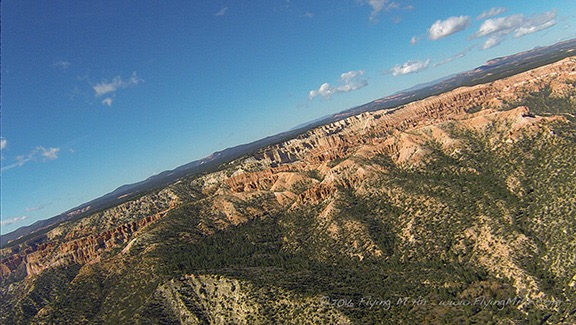
Bryce
Keep in mind that I was turning when the nosecam captured this image of Bryce Canyon.

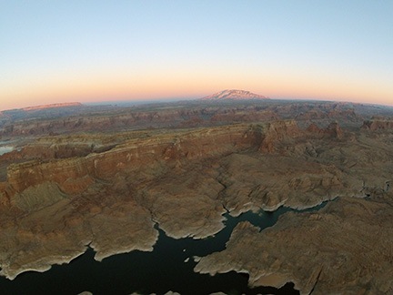
It was around then that I first caught sight of Navajo Mountain. This is a huge landmark for me. It means coming home, returning to a place that I know very well: Lake Powell. I can’t tell you how many hours I’ve spent over the lake with photographers on board. Easily over 200. I missed it and I wanted to fly it again, but I wasn’t interested in flying over it with a nearly timed-out engine that was making metal shavings. I’ve tentatively planned a photo shoot there in April 2017, before I bring the helicopter back to Washington from its California frost contract. If you’re interested, you might want to check this out. And tell your friends.
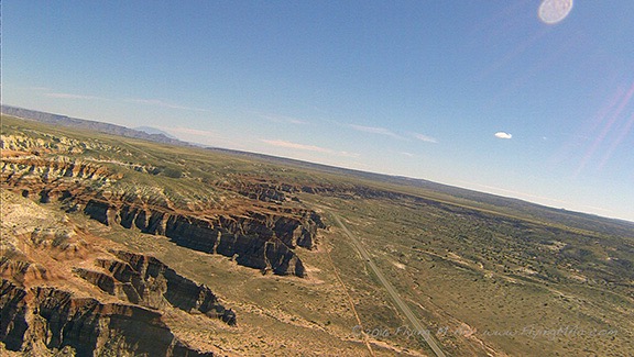
West of Page
Typical terrain west of Page, AZ. If you look closely at the horizon, you should be able to see Navajo Mountain off it in the distance.

We took an almost direct route to Page, AZ from there, taking a slight detour to visit the Wahweap Hoodoos. Then we flew past the Glen Canyon Dam, over Horseshoe Bend, and down toward Lees Ferry. I skirted the edge of the Grand Canyon Airspace, flying over the Navajo Reservation, seeing wild horses and the remains of old hogans. All of this was familiar to me but new to Jeremy. For some reason, the helicopter felt lighter, happier, faster. Probably my imagination, but maybe it knew it was returning to familiar terrain?
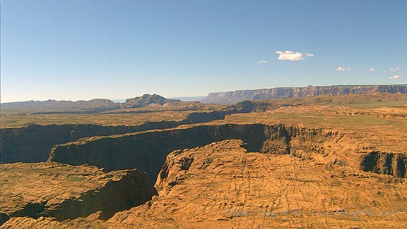
Horseshoe Bend
Horseshoe bend from about 700 feet up. Not nearly as impressive as it is from much higher looking almost straight down.
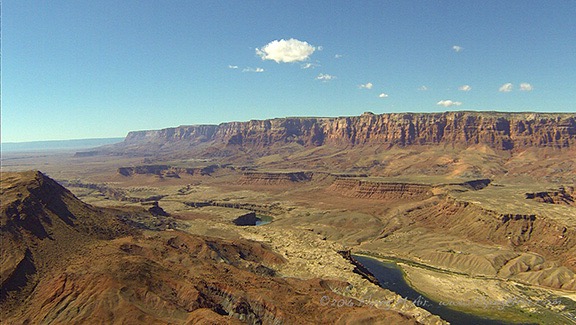
Vermillion Cliffs
Lees Ferry with the Vermillion Cliffs behind them.
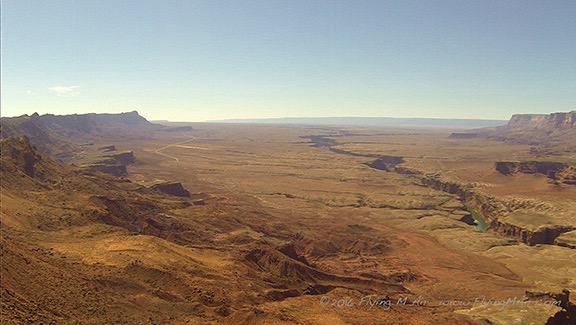
Marble Canyon
Marble Canyon looks like a giant crack in the earth as it winds across the plateau toward the Grand Canyon.

We reached the Little Colorado River Gorge and I flew along the top of it, keeping the nosecam in mind for a different view. I think I could have gotten better shots from higher up, with the camera pointing more down. Next time?
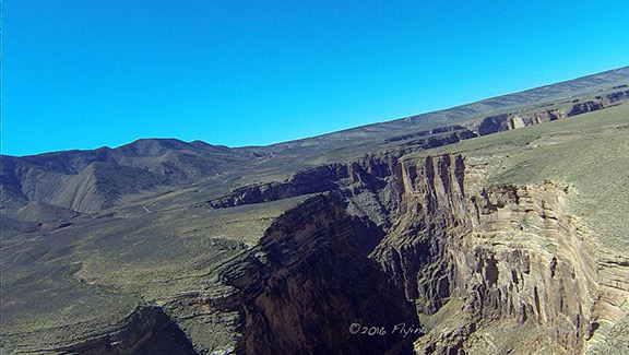
Little Colorado River Gorge
The Little Colorado River Gorge, heading toward the Grand Canyon.

Then we climbed up onto the Coconino Plateau and I steered almost due south toward Sedona. There’s a lot of nothing out there, but Jeremy managed to spot some wild horses where I’d never seen wild horses before.

Closer to Flagstaff, the air was smoky. There were fires burning but because there were no TFRs in the area, I assumed they were controlled burns. We dropped down into Oak Creek Canyon just west of Flagstaff Airport’s airspace. It was a bit bumpy as we followed the canyon down. We were flying into the sun again, so the nosecam didn’t capture any good images. I can’t remember, but I’m pretty sure this was Jeremy’s first time in Sedona. I think he was impressed by the red rocks.
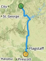
Leg 5
The fifth leg of our trip, as recorded by ForeFlight.

We lined up to land along the taxiway. I was just looking for parking on the ramp when I remembered that they liked helicopters to park in the remote helicopter landing area far to the southwest corner of the field. I decided to try landing with the planes, which was much closer to the terminal and restaurant. I chose a spot in the last row, isolated from the parked planes, with my tail rotor out toward the taxiway so I didn’t have to worry about anyone walking behind me. In the old days, someone would get on the radio and tell me to move. But that day there was silence. There was someone mowing out by the helipads and I figured they either didn’t care or weren’t using them that day. So I shut down.

Of course, the woman operating the mower came out to scold me when the blades had stopped. She claimed it was “safer” for me to park down in no man’s land. (Okay, not what she called the helipads.) Safer? I couldn’t see how, especially since it required us to walk along an active taxiway to get to the terminal. I feigned ignorance and said we’d be gone soon anyway. Knowing she couldn’t expect me to start it back up just to move it for an hour-long stay, she left us, looking frustrated and annoyed.
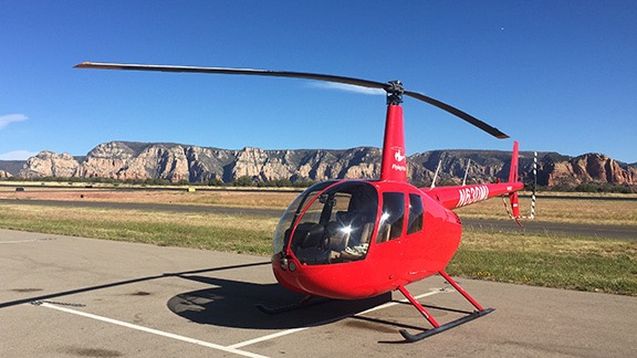
Parking at Sedona
I don’t see what’s so unsafe about this parking spot.

I ordered fuel and we chatted with the pilot of a Cessna on floats that was on a cross-country from Minnesota (if I remember correctly) to California. Seaplanes are pretty rare in Arizona (although the state does have more boats per capita than any other state in the country).

We went to the restaurant and got a table outside so Penny could sit with us. Our waiter, whose name was Ferrari, was very pleasant but not a very good waiter. It took forever for him to bring our drinks. (Penny actually got water before we did.) We were all famished so I ordered an appetizer to share. We both ordered salads. The food, when it came, was good and really hit the spot. I shared some of the chicken from my salad with Penny. I also had one of their mango cake desserts, which was just as delicious as I remembered it being. Jeremy picked up the extremely large tab, I paid for gas, and we headed back out to the helicopter.

Leg 6: Sedona to Phoenix

By this time, my dinner date in Wickenburg had been cancelled and I’d made arrangements to meet my friend Mike at his airpark home near Phoenix instead. He had to go to work so time was limited. Still, I couldn’t resist detouring through Wickenburg. Since my old house was sold in 2015, I’d become friends with the new owners. They’d made some improvements to the house since moving in and although I’d seen a few pictures, I hadn’t actually seen the house itself since I left it in May 2013. I thought it might be nice to do a flyby. Maybe Jeremy could get some nice aerial photos that I could pass along to the new owners.

So we left Sedona flying northwest, along the red rock cliffs. Although the light wasn’t quite right for photos, I did manage to get a few good images.
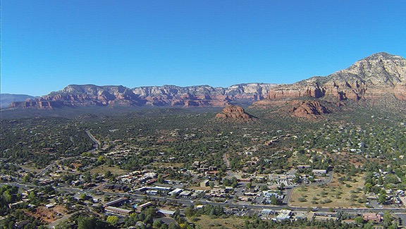
Sedona from Airport Mesa
Here’s a look at Sedona right after departing northwest bound from the airport, which sits atop a Mesa.
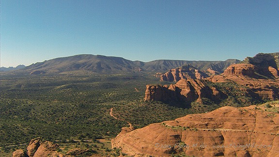
Sedona's Red Rock
The red rocks of Sedona, west of town.

After crossing Sycamore Canyon, I headed toward Prescott on a path that took us within sight of Jerome. From there, we transitioned the southeast side of Prescott’s airspace and followed the Hassayampa River all the way down to Route 93 in Wickenburg. I adjusted my course to intercept Cemetery Wash and followed that up past my old home. It looked great from the air — the new owners are really taking good care of it. I was amazed by the size of the Mexican fan palm in the side yard — I remember planting that tree when it was shorter than me and now it stands at least 30 feet tall. I circled the house and Jeremy shot photos. I still haven’t seen them, but I’m sure he got at least one good one to share.

From there, we headed southwest toward Vulture Peak. I did a quick flyby, pointing out the trail that wound up to the saddle for Jeremy’s benefit. I looked forward to hiking the peak in a few months when I was back in town with friends.

Then I headed southeast toward Hangars Haciendas, the airpark where my friends Mike and Cheryl live. I worked the GPS and radio. I had to connect with Luke Approach to enter and transition the jet training area northwest of Glendale. That was the biggest challenge since I was flying only about 700 feet up — my usual cruise altitude — and had to call from so far out that they couldn’t pick up my transmission. That meant climbing. We finally connected and I got a squawk code and transition instructions. They asked for my destination and I told them Hangars Haciendas.

“What airport is that near?” the controller responded.

“It is an airport,” I replied. “A residential airpark southwest of Sky Harbor.”
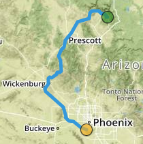
Leg 6
The sixth leg of our trip, recorded by ForeFlight. This was the scenic, time-wasting portion of the flight.

Clearly, he had no clue where I was going, but he understood that I had to go through Goodyear’s airspace so he handed me off to that controller when I got closer. That guy cleared me to transition eastbound along I-10. There was a tense moment when he pointed out an aircraft in downwind and I couldn’t see it. I offered to stay north of I-10 and he accepted that. Jeremy saw the plane before I did and it really was no factor. But I could tell by the controller’s voice that he was concerned. I’m sure he was glad to cut me loose.

Of course, Hangars Haciendas does not appear on my Garmin GPS, although it is on ForeFlight. I used that to zero in on it. It was very difficult to find! I finally caught sight of it and eventually saw Mike, in his uniform, waving us in to his concrete hangar apron. I landed in the corner and immediately popped my door open. It was hot!
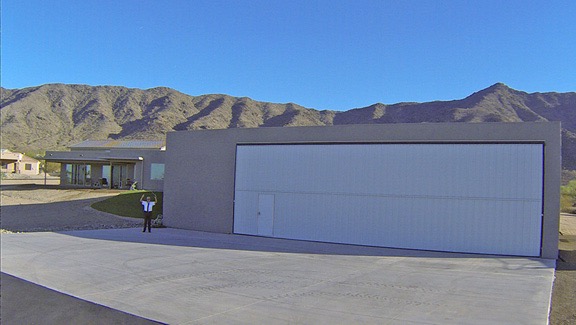
Mike Waves Me In
The nosecam caught this photo of my friend Mike waving me into parking on his hangar apron.

I cooled down the helicopter while Penny and Jeremy got out. It’s kind of funny when you think about it — the next stop would be the engine’s last stop before overhaul. Why bother doing a proper shutdown? Well, why not? Surely I could spare the extra two to three minutes to take care of an engine that had been so good to me for so long.
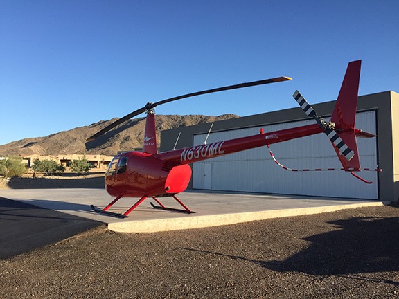
Parked at Mike's House
Zero-Mike-Lima parked in front of my friend Mike’s hangar.

Mike only had about 20 minutes to spare for us. He’d been on standby and had actually been called in to work. He needed to leave before 5 PM. So he wasted no time showing off his new plane and helicopter, both of which were tucked into his hangar. I also got a chance to see his home, which was still in its final construction phase the last time I’d been there. I didn’t get a chance to see his wife Cheryl because she was basking in the sun in Hawai’i that week. She’d be home later in the week, just before he left for China.

We parted ways a short while later. Mike drove off to the airport while Jeremy, Penny, and I went back to the helicopter for the last leg of our journey.

The Last Leg: Phoenix to Chandler

I have to say that the last leg was kind of bittersweet for me. Not only would it be the last time I flew until January or February, but it also marked the end of my helicopter’s first life. Its tired airframe, engine, rotor blades, and other components would be stripped down, rebuilt, and replaced. When I got it back, it would be the same helicopter, yet different.

We took off heading almost due east along the north side of South Mountain. Jeremy spotted another helicopter at our altitude nearby — he’s actually a pretty good flying companion — and I tuned into the Phoenix Air-to-Air frequency (123.025), which I hadn’t used in three years, to make a call. The pilot of the other helicopter, with a Firebird call sign — I’m thinking either DPS or Phoenix Police — responded immediately. They were doing some training work, hovering over a South Phoenix neighborhood. We exchanged pleasantries and I continued on my way.
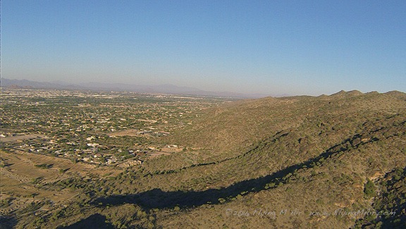
South Mountain
Flying eastbound along the north side of South Mountain near Phoenix. I don’t miss Phoenix’s smog layer at all. That day was actually clearer that most.

After I crossed I-10 and made my first radio call to Chandler tower, I turned on the cockpit GoPro, which had been set up for the entire flight but never turned on. I figured I’d document this last leg of the flight. I started off chatty enough, but soon lapsed into silence. I guess I didn’t have much to say. You can see for yourself in the video below. It’s a shame that the setting sun over my right shoulder puts so much glare into the cockpit.


For some reason, I thought it was a good idea to document the last leg of our flight with a video.
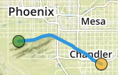
Last Leg
The last leg of our flight was very short. See it on ForeFlight.

It was a very short flight — less than 15 minutes from takeoff to landing. Again, cooled down the engine before shutting down. I patted the controls and talked to the helicopter. (Yeah, I do talk to my machines, even though none of them have names or genders.) When the blades had stopped, I got out with Penny and went to find the Director of Maintenance, Paul.

Post Flight
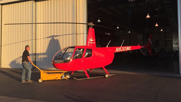
Into the HangarPaul wheeled the helicopter into the hangar where the overhaul work would be done.

The next hour or so was spent helping Paul bring the helicopter into Quantum’s big hangar, talking to him about the little problems it had that needed attention, and discussing core and replacement options. Together, Jeremy and I unpacked the helicopter, separating everything in it into three piles: his luggage, my luggage, and the stuff that would stay with the helicopter in the wheeled box I’d brought along. I was glad that my day pack had been lightly packed for the trip because I did have to take a few things home with me — my GoPros, Penny’s bed, and my Square card reader equipment. Finally, everything was organized and packed for taking or leaving. The sun was down and we were ready to leave.

I didn’t take one last photo. After all, I’ll see Zero-Mike-Lima again in December. I know they’ll have started work by then and it’ll be partially stripped. That’s okay. I’d rather remember it from the last few photos I took during that final flight. I left it parked between two other R44s, knowing that it was in good hands.

The folks at Quantum gave us a lift to the hotel I’d reserved off I-10. The driver was studying to be a helicopter mechanic and working toward his private pilot license. He refused to take the tip I offered when he dropped us off.

We checked in and got information about a restaurant with an outside patio that was within walking distance of the hotel. I was very pleasantly surprised by how comfortable and clean my room was. This was a Quality Inn — which allows dogs — and the room rate was only $65 with tax. I had very low expectations and was so glad they delivered a much nicer room than I expected.

We walked to the restaurant, which turned out to be a very nice Italian place in a strip mall. We sat outside, where the evening air was comfortable and cool. I had two drinks to celebrate the end of the journey. We had a light dinner — mostly because we’d eaten so much at lunch — and walked back to the hotel.

I slept like a log.

Return to Lake Powell

On what’s likely to be my last aerial photo gig here.

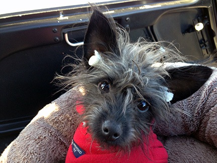
Penny wearing Earplugs
Penny with makeshift earplugs. They lasted about five minutes before falling out.

I flew my helicopter up to Lake Powell late this morning. With me for the ride (and the few days to follow) were a friend and Penny the Tiny Dog.

The Backstory

Way back in June, one of my good clients, Mike Reyfman, had booked three days of aerial photo flights with me starting January 1. He leads photo excursions for Russian photographers in various places throughout the world. I’m his Arizona/Utah helicopter pilot. I’ve flown for him on about a half dozen gigs since 2004: Lake Powell, Horseshoe Bend, Monument Valley, Goosenecks, Shiprock, and Bryce Canyon. Jobs last 2 to 7 days and involve 8 to 20 hours of flying. It’s good work not only because of the number of revenue hours I can fly, but because it takes me to some of the most incredible scenery in the southwest.

I had mixed feelings about the job. I wanted to go to Lake Powell again; it had been over a year since the last time I was up there. I own a hangar at the airport — purchased back when it looked as if I might do seasonal tour or charter work there — and I wanted to sell it. I needed to take a peek inside to see what the tenant had in there and then meet with a Realtor to get it listed. I also wanted to see the lake again. Over the past eight years — since buying my R44, in fact, I’d flown at least 200 hours at the lake, covering its length from the Dam to Hite at least a dozen times and even going as far as Canyonlands National Park two or three times. I’d worked with a video crew to make an aerial tour of the lake and was ripped off by the filmmaker, who disappeared with $26K of my money, leaving me with a hard disk of mediocre raw video and a hard lesson learned. (And no, I’m not interested in discussing this.) There’s no arguing that Lake Powell is one of the most beautiful places in the Southwest and the best way to appreciate that beauty is from the air.

But, at the same time, I was leery of winter photo shoots. Back in February 2011, I’d gone to Bryce Canyon for a 360° Panoramic photo shoot with this same client. A snow storm and cold weather had delayed our flight and made it damn near impossible to get the helicopter started when we were ready for the shoot. It required a gas-heater and generator under the helicopter’s engine compartment to warm the engine enough to crank it. The delay meant we couldn’t get out at first light as originally intended. When I checked the weather and saw freezing temperatures forecasted for dawn and dusk at Lake Powell, I remembered the Bryce Canyon problems and began worrying about a replay. Although my helicopter has a primer, no amount of priming will start that engine if it’s too cold. I also remembered another January photo gig up there and how cold it had been in flight. Those guys had kept me flying for about 3 hours — I even had to land for fuel at Cal Black Memorial halfway up the lake from Page. It was so cold that the back seat photographer had given up shooting and was leaning away from his open door as far as he could in an effort to keep warm. I never did like cold weather.

All of these thoughts were going through my head when I contemplated the job. But a revenue flight is a revenue flight and I had the possibility of being paid for 10 hours or more of flight time over four days at one of my favorite destinations. After losing at least $10K of revenue in Washington due to my early return, my inability to concentrate enough for writing jobs, and the huge sums of money I was paying my legal team to help me protect my business assets from the greedy, cheating liar I’d married six years before, I could really use the cash. So I convinced myself that I was glad about the work and prepped to make the trip.

Getting There

We flew up there around midday on New Year’s Day. The conditions were remarkably good. I’d flown through unforecasted low visibility and snowstorms on my way from Wickenburg to Winslow the day before, but there was none of that on Tuesday. The flight went well and I got a chance to show my companion even more of Arizona’s remote scenery from the air. This post with video gives you an idea of what we saw, although we weren’t flying from Phoenix so the actual route and views differ. (We got to see Sedona on our flight the day before.)

After a brief tour of Horseshoe Bend, the Glen Canyon Dam, and Wahweap Marina for my friend, we touched down at Page Municipal Airport. The folks from American Aviation were out to the helicopter with a van before my blades had even stopped spinning.

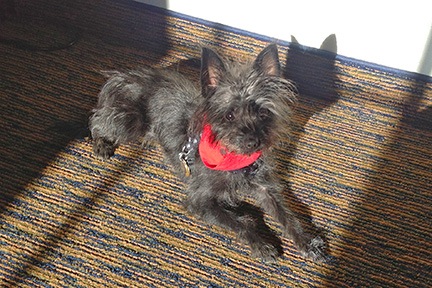
Penny Lounges in the SunPenny lounges in the sun under the desk in our hotel room.
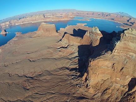
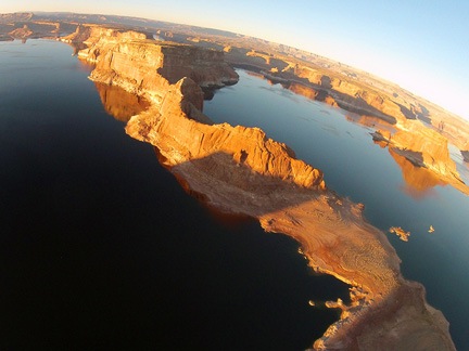
We grabbed the rental car I’d arranged for, stopped at Stromboli’s restaurant for a huge calzone to share, and checked into the Days Inn hotel. The pet-friendly room was clean and well appointed with a king-sized bed, refrigerator, desk, free (and fast) wifi, and a sliding door that made it easy to take Penny outside. Best of all, it was on the south (sunny) side of the hotel, so the afternoon sunlight streamed in through the window, giving Penny that patch of sunlight she always seems to enjoy.

First Flight

A while later, I was back at the airport. I had to prep the helicopter for the afternoon flight. That meant removing the two passenger side doors, adding a quart of oil, and laying out the life jackets. I make all my passengers wear flotation devices during photo flights over the lake. In more than a few places I fly there, an engine failure means a swim. I didn’t want anyone drowning because they couldn’t find or put on their life jacket.

Back in the terminal, Mike arrived with his group. He took one look at me and said he was seeing only 2/3 of me. I told him I’d lost only 20% of my body weight, not a third. I had already told him in email that the reason I had to lose weight was because he kept gaining it.

I gave his group a safety briefing. After each topic, Mike translated what I’d said into Russian. About half the group spoke some English and about half of those spoke it well.

I took the first group out to the helicopter: two photographers and a passenger. Normally, I won’t do a photo flight with three passengers on board, but the helicopter performs magnificently in cold weather, so it wasn’t an issue — even with nearly full tanks of fuel. They all climbed on board and I made sure they were strapped in. Then I started up the engine, warmed up, checked their seat belts one more time, and took off.

Mike’s instructions had been specific: start with Horseshoe Bend, which is near the airport. Then head uplake to Reflection Canyon, the San Juan Confluence, and an odd canyon I call “Canyon X” because of the way it looks from the air. Then back down lake to Padre Bay and Alstrom Point for a look at Gunsite Butte. So that’s what I did.

Oddly, when I first took off, I felt a bit hazy about the locations of all these points. It wasn’t until we were heading uplake, past Tower Butte that it all started coming back to me. Mostly it was the reporting points the tour pilots used. I’d learned these points so I understood where they were when they made their calls. I also used them so I could tell them where I was. Tower Butte, Padre Butte, Gregory Butte, Rock Creek, Dangling Rope, Rainbow Canyon. That’s as far as most of the tour planes went. I went a little farther, to the confluence.

Boundary Butte
At 3:56 PM, we were just passing the north end of Boundary Butte, heading uplake.

I flew uplake at about 5500 feet staying mostly over the river channel. The air was mostly calm and the water was glassy smooth in more than a few places, creating amazing reflections of the red sandstone cliffs. Just past Gregory Butte, the wind picked up a bit, ruining any chance of reflections on the lake surface.

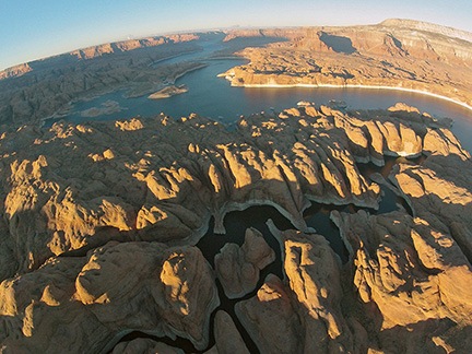
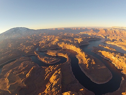
I reached Reflection Canyon — poorly named, in my opinion, because I’ve overflown it at least 100 times and have seldom seen any reflections there — at 5500 feet. I began a slow climb as I flew a racetrack pattern around the canyon, spiraling up in altitude. Our next destination was the twisting course of the San Juan River near its confluence with the Colorado and that was best viewed from 7000 feet or higher. When my photographers were finished with Reflection, I moved on to the San Juan and began circling it, spiraling up to 8500 feet as I circled it twice. Off in the distance, I could see the buttes in Monument Valley.

It was cold. The outside air temperature (OAT) gauge said -9. That’s -9°C, of course, or 15°F. I was wearing a pair of jeans and a long sleeved shirt under my leather jacket. I had a scarf and thin wool gloves on. Every part of me was cold. I hunched over the controls, trying to use my body to keep my body warm. I wasn’t succeeding. At times, my teeth chattered.

After the San Juan, I took them around Canyon X. Then we headed back toward Padre Butte. I was flying almost directly into the sun. I had a baseball cap on to offer some protection from the sun’s glare, but it didn’t help much. I kept at 6000 feet so I wouldn’t have to worry about flying into any buttes or canyon walls along the way.

East Side of Padre Bay
The east side of Padre Bay, shot from my helicopter’s nose cam from the south.

My passengers wanted to see the northeast side of Padre Bay, so we flew there first. I took them past Cookie Jar and the pockmarked rocks around it. There were some nice views of the canyon walls on the east side; my nose cam even got a nice shot. By the time we got to Gunsite, the sun was very low and the light had faded. The view wasn’t much to get excited about. My passengers had enough and we headed back.

We touched down at 5:20. The fuel truck was waiting.

Thawing Out

I was frozen solid. Or at least I felt as if I was. My right hand, which had been clutching the cyclic in a death grip, was probably the worst. I was shivering almost uncontrollably. I threw the doors back on the helicopter, locked it up, and headed back to the hotel.

It took me nearly an hour to warm back up.

Dinner with Russians
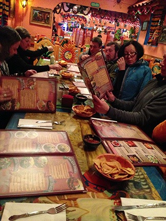
Mexican dinner with 11 Russians.

We went out to dinner at a Mexican place. If you ever want a weird experience, watch 11 Russians try to order Mexican food in English from a Mexican waiter. Dinner was good, but the portions were too large. Seriously: who needs that much food in a tourist town when you can’t even bring leftovers home? The bowls of soup looked as if they held a half gallon of the stuff.

Afterward, I went to Walmart to see if I could buy a pair of long johns and a turtleneck. I found a pair of leggings — the only pair in my size was brown. (Walmart offered all kinds of color options in sizes 2X and 3X.) I bought a few turtleneck shirts for the next few days.

Dawn Flight

The next morning, I layered my clothes: leggings under jeans and turtleneck under sweater under jacket. That should keep me warm, I reasoned.

I was out at the helicopter by about 6:45 AM. It was still dark, although I could see the sky brightening beyond the Navajo Generating Station. I took the doors back off and did a preflight with a flashlight. The quart of oil I’d brought into my hotel room overnight poured easily. I hooked up my GoPro with my skid mount so it would point the same general direction my passengers would be shooting. I drove the car back to the terminal building and parked it out back.

Ski Clothes
My passengers knew how to dress for freezing weather.

I greeted my passengers when they arrived at 7:20, got their life jackets on, and buckled them in. There were just two men. I realized that they were wearing ski clothes. They were Russians, accustomed to cold weather. And they were wearing ski clothes. You think that would have told me something.

I primed the engine a good ten seconds, pushed the starter button, and was surprised that the engine caught almost immediately. I fed it a little more fuel as I flicked the strobe, clutch, and alternator switches on. It sounded rough at first, but soon smoothed out. When the clutch light went out, I brought the RPM up to 68% and began the long wait for the engine to warm up.

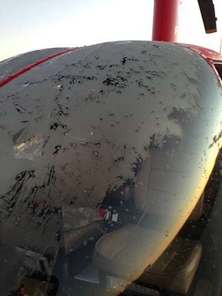
While I waited, I used my laminated startup check list to scrape the frost off the cockpit bubble. I suspected that even in full sunlight, at 17°F and 90 knots for a wind chill factor of -14°F, it was unlikely to melt off.

When I was ready to go, I made my radio call and started pulling up on the collective to pick up. Immediately noticed that the collective was heavy. When I got it into a hover, I realized that the cyclic was extremely stiff. Almost — but not quite — as if they hydraulics weren’t working. I checked the switch; it was in the correct position. Circuit breaker was fine, too. I hovered a tiny bit hack and forth over the helipad. Stiff but not too stiff to fly. I assumed the hydraulic fluid was cold and that the situation would improve as it warmed.

Dawn Light
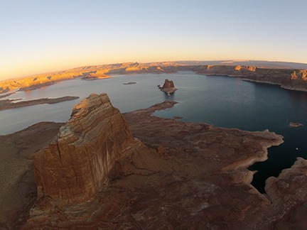
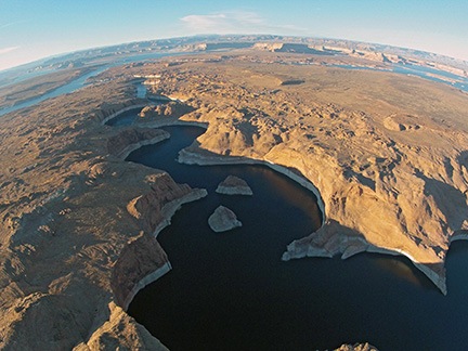
Padre Bay, by the dawn’s early light.

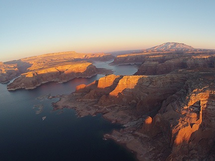
We took off just as dawn was breaking behind the power plant. We headed uplake at 5000 feet. As I flew, I admired the way the early morning light seemed to kiss the tops of the buttes and cliff faces.

Of course it was another perfectly clear morning. Some people might think that’s nice, but for photography, it sucks. The light gets harsh quickly and, without clouds and shadows, there’s little depth to the scenery. Besides all that, a clear blue sky is downright boring. But that’s part of life when doing photography in the desert southwest.

So we were racing uplake to the three target areas, hoping to get there and back to Padre Bay before the light got too bright.

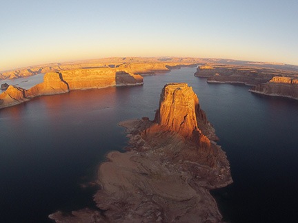
Gregory Butte
Gregory Butte at first light with a view up Last Chance Bay.

It was another beautiful flight — and I can prove that with hundreds of photos. Honestly, I’ve seen so much of Lake Powell from the air during the “golden hours” that none of the photos really impress me anymore. It has to be one of the most beautiful places on earth and there’s no better view than from a helicopter at dawn.

My passengers wanted me flying higher, so I climbed to 6000 feet. I was freezing cold again before we got to the San Juan Confluence. I started doubting the wisdom of doing these flights. And started wondering how many layers of clothes I needed to wear to keep warm. My hand on the cyclic seemed frozen solid. And my feet were freezing, too. But I kept flying, knowing that when the light got too harsh, we’d be done.

I circled each target area two to three times as instructed. My photographers snapped dozens of photos. I’d glance at them occasionally and see them moving their cameras in every direction, framing up their shots. Occasionally, the one who spoke English — and he spoke it very well — would give me instructions. But in general, they let me do what I liked.

When they were finished with the uplake target areas, we headed back down the lake. Along the way, they stopped me to photograph several other places where the light was hitting just right. All I could think about was how cold I was and how much I wanted to be on the ground.

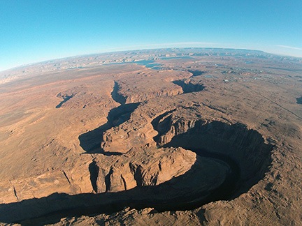
Horseshoe Bend
Horseshoe Bend from the south. The narrow canyon is usually full of deep shadows.

We finished up with Horseshoe Bend, which is best photographed when the sun is high. News flash: the winter sun is never quite high enough to photograph Horseshoe Bend without deep shadows.

Warming Up Again

We were on the ground by 9:20 AM. Shutdown went quickly; the engine had cooled considerably on my approach. I felt frozen and was shivering badly when the fuel truck pulled up to fuel us. My feet felt like stumps as I joined my passengers for the walk back to the terminal.

I left the doors off the helicopter and drove back to the hotel, stopping at McDonalds for a quick bite to eat and a more important glass of orange juice. I was shivering the whole time. In fact, it took me a full hour and a half to stop shivering. Then I stretched out on the bed and fell asleep. I didn’t wake up until after 1 PM. That had me really worried — I never sleep like that in the middle of the day. I was certain I was coming down with a cold.

With at least two flights left to do, I needed warmer clothes.

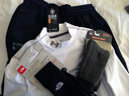
Armoured
My “armour” against the cold.

I headed out to a sporting goods store I found near Safeway. The saleswoman there set me up with some Under Armour. I didn’t care what it cost. I bought a shirt, a pair of pants, and a pair of gloves and left $180 with her. Then I headed back to Walmart and found a pair of thermal socks in the sporting goods department.

We hit Sonic for lunch and had another big glass of orange juice. We had a nice little walk with Penny while we waited for the food.

Then I went back to my room to dress all over again. Three layers of shirts under my leather jacket, 2 layers of pants, the thermal socks. I’d put the new gloves on before taking off.

I made it back to the airport by 3 PM, in time to prep for my afternoon flight.

Third Flight

My passengers were late and slow about getting on board. As a result, we didn’t take off until after 4 PM. This turned out to be very unfortunate for them.

Navajo Canyon
Navajo Canyon, from the south. Although the canyon walls are not very high here (compared to Horseshoe, anyway), there were already deep shadows.

Like the previous afternoon’s flight, these folks wanted to start with Horseshoe Bend. I thought it was a waste of time, but doubted whether they’d believe me so I kept quiet. We circled Horseshoe Bend twice, then headed uplake. Along the way, they caught sight of the pair of islands in the middle of Navajo Canyon and instructed me to circle them. I did that twice. It wasn’t until 4:28 that we continued heading uplake.

I was cold. Still. I realized that the gloves I’d spent $25 on weren’t much better than the junky gloves I’d worn on the previous two flights. I tried to put another glove over the one on my right hand, but couldn’t manage it while holding the cyclic. I was able to jam my left hand under my leg or between my legs to keep it warm. Occasionally, I’d wrap my left hand around my right hand on the cyclic in an attempt to warm my right hand. I don’t think it worked. My body was warm enough but my legs were not. My feet were nice and toasty — at least my $6 Walmart socks were doing their job. Overall, however, I was definitely warmer than I had been on the previous two flights.

Canyon X and Reflection Canyon were already in deep shadows when we got there 15 minutes later. Even the twisting course of the San Juan River was in shadow — although there were some decent reflections there. I circled and climbed and circled and descended. When I got the word, I headed back down lake.

By this time, it was after 5 PM. Sunset was 5:20. It would take at least 15 minutes to get all the way down to Padre Bay, the next target location. But I’d noticed on the previous day’s flight that the sunlight was already too soft to really show off the red rock glow by 5:10. My passengers were running out of light and there was nothing I could do.

Mouth of Rock Creek
The cliff faces across from the mouth of Rock Creek were nicely illuminated in the last light of the day.

Of course, since we were flying into the sun, my passengers could see it just as well as I could. I think they realized that we wouldn’t reach Padre Bay in time. So they had me circle a few areas that were still illuminated, like the cliffs across from the mouth of Rock Creek.
“Very dramatic,” my front seat passenger said. I couldn’t argue.

West Canyon
By the time we reached West Canyon, only the highest points — like Navajo Mountain — were still in sunlight.

After that, we tried to check out the area south of West Canyon. This area is normally outrageously beautiful in last light, but often overlooked by photographers who concentrate on the cliffs and buttes around the lake. But by that time, only the highest points still had light on them. I watched the sun’s orange globe sink below the horizon in the west.

“Go back?” I asked my clients?

“What is our choice?” the English speaker replied glumly.

I didn’t tell them that another photographer had once kept me out nearly an hour past sunset at the lake — so late that I needed my landing light to find the helipad. Instead, I just headed back.

Back on the ground, I walked them to the terminal. It was locked. The fuel guy was gone and my doors were inside the building. I helped them get through the gate, then drove around to the front of the building. A few people were still inside, so I was able to retrieve my doors. But no chance of getting fuel. Unless I was willing to pay a $50 after-hours callout fee — which I was not — the next morning’s flight might be a lot shorter than desired.

Talking My Client Out of Flying

I buttoned up the helicopter, grabbed a quart of oil to heat in my room overnight, and went back to the hotel.

I was cold and I didn’t want to fly any more than I had to. I was worried about getting sick.

I called Mike and told him about the fuel situation. I told him I thought we had enough for about an hour and a half in the morning. Then I talked to him about the second part of our photo gig: the Goosenecks of the San Juan, which is near Mexican Hat, UT. I had two logistical problems.

First, I didn’t have a landing zone less than 15 minutes flight time from Goosenecks. The only good landing zone was at Goulding’s Lodge, a private runway. That means that each flight would likely take 45 minutes to an hour.

Second, the closest fuel was at Cal Black Memorial Airport on Lake Powell, about 20 minutes flight time from Gouldings or Goosenecks. That meant a 40-minute refueling run.

Mike, of course, had to pay for all of my flight time. He could do the math as well as I could. It would likely add 4 to 5 hours of flight time if he decided to move forward on the Goosenecks flights. He said he’d talk to the photographers and see what they wanted to do. We hung up and I crossed my frozen fingers that they’d pass.

Fourth Flight

I was back at the airport at 7 AM the next morning, prepping for my flight. Since the fuelers for Classic Aviation were already there, I ordered fuel from them, topping off the tanks.

Frost on the Bubble
Frost on the bubble.

I repeated the previous morning’s routine, although I did scrape the frost off the bubble before my passengers arrived. There was a lot more of it. Later, when I returned, I’d still see tiny piles of the stuff on my helipad, where it had stuck to the ground but failed to melt.

I had three passengers: two photographers and an observer. They were all women.

I lifted off at 7:50 AM, 11 minutes after sunrise. The controls were so stiff that I was almost certain the hydraulics had failed. I set it back down, tested the controls, and realized that it was just the cold again. Worse than the day before. I decided to give it a go; I could always turn around and come back. Fortunately it was operating normally within 5 minutes.

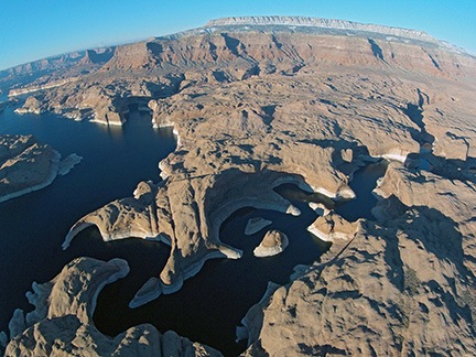
Canyon X
An early morning view of what I call Canyon X, from the air.

San Juan River
An aerial view of the San Juan River near its confluence with the Colorado at Lake Powell.

Reflection Canyon
Reflection Canyon from the air.

In my opinion, this flight had the best light along the way. The sun was high enough to illuminate the rock faces, but low enough to cast shadows that added depth to the scenery. And the light was soft and red — just perfect (in my opinion) for photographing the lake. Indeed, my uplake skidcam images are better from this fight than any other.

And because we’d gotten a later start than the previous morning, there was also better light on our target areas. Canyon X, for example, had lots of interesting light and shadows. The twisting course of the San Juan River seemed to glow in the morning light. Even Reflection Canyon was more interesting than in previous flights. There were even some reflections down there.

Because we weren’t racing to beat the sunset, the flight was more relaxed, too. Sure, the light wouldn’t be as “good” later on in the flight, but it wasn’t as if we’d run out of light. So we took our time and circled each point as many times as necessary. Stress free.

I was still cold, of course. I’d layered up a little better and was wearing two pairs of gloves. My hands and legs were still cold. I was not looking forward to the prospect of more flights that afternoon out near Monument Valley.

After finishing up near the Confluence, we headed back toward Padre Bay. We did a few circles in the area. The light was nice, but the golden hour was nearly over. They wisely decided to skip Horseshoe Bend.

We were on the ground by 9 AM. I didn’t hang around. I got into the rental car and headed back to the hotel to pack.

Finishing Up and Heading Out

Mike called when I was halfway finished packing and sucking down yet another orange juice. He came by the hotel to pay for the flights. Fortunately, he’d decided to skip the Goosenecks flights. I was relieved. I’d pretty much decided to say no and was wondering how I’d tell him. Now I didn’t have to.

Mike paid for the flight time and we said our goodbyes with a hug. It would likely be the last time we worked together. I was moving to Washington State and, unless he wanted aerial tours of the Palouse (another one of his destinations), he’d have no need for a helicopter in my area. I was sad to see him go.

Later, I met with a Realtor at the hangar I need to sell. We discussed terms and I was not happy to learn that an agreement with them would require me to pay them a commission even if I sold the hangar on my own. I still don’t get the logic in that.

We were loaded up — with the doors on! — and ready to depart by 12:45. I was really looking forward to getting home.

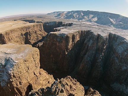
Little Colorado River Gorge
The Little Colorado River Gorge from about 200 feet above the rim.

The flight back was uneventful. I did a straight line to the Little Colorado River Gorge, which I flew over rather low to get a dramatic shot with the skidcam. Then I straight-lined it to my Howard Mesa property, which I always fly over when I’m in the area. From there, a straight line to the west side of Granite Mountain near Prescott and then a straight line to Wickenburg Municipal.

As I was coming in, a friend of mine from my Papillon days back in 2004 was leaving on a Game and Fish survey job. We spoke briefly on the radio; he’d join us for dinner later that evening.

I was glad to get the helicopter tucked away into the hangar and even gladder to be in my truck heading home. I was looking forward to at least a few days without travel — and even longer without freezing cold.

The Fruits of My Labor…

…or why I love my work as an aerial photography pilot.

Regular readers know that one of my jobs is as a helicopter pilot. Sure, my little company offers tours and day trips from Phoenix in the winter and dries cherries in Washington State in the summer, but my favorite kind of flying is for aerial photography.

To me, there’s nothing more rewarding than being a pilot for a talented still or video aerial photographer. These are the people who not only understand basic photographic concepts such as light and composition and exposure, but who also know what a helicopter can do and how they can use it as a tool to get amazing images of the world around us.

In August 2010, I had the privilege of working again with Mike Reyfman, a regular client, over Lake Powell in northern Arizona/southern Utah. He was there for the AirPano Project, capturing images that would become interactive 360° aerial panoramas, as well as still photos around the lake.

He emailed me yesterday to let me know that the Lake Powell Panoramas had finally been put online. There are four of them, including one shot over Reflection Canyon (see screen grab below). Each image is interactive, drag in the image to pan and zoom. You can click on the helicopter icons to switch from one viewpoint to the next. Here’s where you can find them.

Reflection Canyon

Aerial photo work is challenging, especially with a demanding photographer on board who knows exactly what he wants. Mike is one of those photographers. Not only does he know what time of day he wants to shoot, but he provides instructions regarding shooting location, direction, and altitude. For the panoramic shots, I need to get into an out of ground effect hover, sometimes as high as 3,000 feet above the ground, and hold it there for 5 minutes or more. This isn’t easy in my little R44, especially in windy conditions.

But it’s worth it, as Mike’s panoramic images and other shots prove.

I find it especially rewarding work, though. Although I didn’t create the incredible images the photographers on board make, I feel that I was instrumental in making those images possible. After all, my helicopter and I were part of the photographer’s equipment — almost like a tripod. Surely to say that the image would not exist without us isn’t too far from the truth.

And so despite the challenges and the relative dangers, I love flying aerial photographers. And I love seeing the work they create when they fly with me.

Phoenix to Lake Powell by Helicopter

Again, but this time with video.

The initial call about the January photo gig at Lake Powell came in December through one of my Russian connections. Apparently, two Russian businessmen who were attending the Consumer Electronics Show (CES) in Las Vegas wanted to photograph the Lake Powell area from the air. They were willing to pay me to fly up to Lake Powell from Phoenix and make at least two flights totaling 3 to 5 hours.

Trips like this are extremely costly — after all, the client has to pay for 4 hours of flight time just to get me up there and back — and I honestly didn’t expect it to happen. But a week before the chosen dates — January 12-13 — I got the green light and the all-important credit card number I needed to get paid for that 4 hour repositioning flight plus a standard overnight fee to cover my expenses and compensate me for my time away from home.

The Gig

Weight and BalanceI admit I wasn’t looking forward to the gig. The two photographers claimed to weigh 242 pounds (converted from kilos) and I knew they likely weighed more fully dressed and carrying camera equipment. I calculated the weight and balance as soon as I had this information and discovered that I’d have to strip all non-essential equipment out of the helicopter to lighten it up so we could take enough fuel for 2 hour flight segments (plus FAA-required reserves). Anything that was left on board would have to be shifted from under my seat to under the seat behind me, just to shift weight backwards. Having two fatties — yes, including me — up front would make us front-heavy. Having two fatties on the left side would make us heavy on that side. But even after adding 15 pounds of weight for each of them, I confirmed that’d be in balance with 2/3 fuel or less on board.

The other thing that bothered me was weather. Page, AZ was having unseasonably cold weather with daytime highs barely getting above freezing. Flying a helicopter with two doors off guarantees plenty of outside air inside the cabin and no amount of heat is going to win against 30°F outside air. So not only did I have a bit of a challenge ahead of me with a listing (but still within acceptable CG) aircraft to fly, I’d likely be freezing my ass off.

As far as the helicopter goes, I wasn’t worried about the cold weather affecting operations. My R44 Raven II is fuel injected, so carburetor ice is not an issue. I’d flown it in cold weather before and it was always peppy — once I got it started. In fact, that was my only real concern: Lake Powell photographers usually want to get off the ground at dawn for morning flights and with overnight temperatures under 20°F, I worried a bit about getting the helicopter started for its morning flight.

But the gig did have one big thing going for it: at least 4 hours of revenue time. And if there’s one thing I’m interested in, it’s getting paid to fly.

The Flight Up

Lake Powell is about 200 nautical miles north of the Phoenix area. Since my clients were paying for a 2-hour flight, my goal was to make it there in two hours. That meant flying as close to a straight line as I could.

CourseUsing Sky Vector, I plotted a course from Phoenix Deer Valley Airport (KDVT) to Page Municipal Airport (KPGA) with only one waypoint in between: the Little Colorado River Gorge (LCRG) on the east side of Grand Canyon’s Special Use Airspace. I wrote down the coordinates for the LCRG to punch them into my GPS — a recent GPS battery change had wiped my user waypoint list clean. The flight path would take me north along the east side of I-17, crossing it just before it dips down to Camp Verde. I’d cut across the Verde Valley between Sedona and Cottonwood, then climb the Mogollon Rim west of Sedona, pass east of the restricted area for the Navajo Army Depot, west of Flagstaff, and west of the San Francisco Peaks, the tallest mountain in Arizona. From there, I’d drop back down into the Navajo Reservation, flying over its western edge, hop the Echo Cliffs, and drop back down to Page, AZ.

And that’s mostly how it all came off.

I departed Deer Valley at about 8:45 AM under partly cloudy skies with little or no wind. It was a cool morning, with temperatures just climbing through the 50s. I crossed Deer Valley’s runways at 2000 feet MSL as required by the Tower there and got right on course, aiming for the LCRG waypoint I’d added to my GPS.

It was interesting and different to fly a straight line route through an area I knew so well. After all, I’ve been flying from the Phoenix area to Sedona, the Grand Canyon, Flagstaff, and Lake Powell for years, so it’s not as if the area I’d be flying over was new to me. But I usually fly with passengers on board and, to make the flight more interesting, I fly over or past various points of interest, such as towns, highways, mine sites, and canyons. On this flight, speed was the goal — I wasn’t interested in scenery. But I got scenery anyway — how can you fly a helicopter through Arizona without seeing something spectacular every mile?

As I flew, my GoPro Hero camera recorded a 720p widescreen video of the flight. Mounted up front, it offered an unobstructed view of everything ahead of me. The wide angle lens brought in details of what was close while pushing back distant points. Later that night, I’d watch much of the 2 hours of video and remember the various points of the flight.

Mountains north of PhoenixWhat fascinated me was the way the light changed throughout the flight. At first, it was partly cloudy. Then the sun slipped behind the clouds and it was cloudy. Then the sun began to break through, speckling the mountainsides with light. This still image, captured from the video, gives you an idea of what I mean. The light changed numerous times over the two-hour period of the flight — at one point, clouding over completely only 1,000 feet above me — giving the illusion that the flight was conducted over multiple days.

It wasn’t just the light that changed, of course. It was also the terrain. Flat desert in the Phoenix area, soft mountains studded with saguaro cacti as I headed north, flat mesas with steep basalt sides, deeply carved canyons, wide valleys, red rock cliffs and hoodoos, alpine forests blanketed with snow, tall mountains, ancient cinder cones, flat “painted” desert, deep gorges, buttes, uplifted cliff faces, slot canyons. I saw it all over the course of my two hour flight — all without trying to see it. My nearly straight line course simply put me over the top of all these things. I sat comfortable and warm in my seat, admiring the view as I glided over it.

Glided is definitely a good word. There was hardly a breath of wind during the entire flight so it was amazingly smooth. A pilot’s dream. And although outside temperatures dipped as low as -5°C, I was cosy and warm with the heat up only about halfway.

SedonaOne of the highlights of the flight was crossing the red rock cliffs west of Sedona and climbing up over the Mogollon Rim. The light was absolutely perfect, breaking through light scattered clouds to illuminate the rocks with a soft golden light. Absolutely breathtaking and the GoPro camera captured the whole thing.

Beyond that was a surprising amount of snow and a light overcast layer that shrouded the top of the San Francisco Peaks. The temperature there was around 0°C, but the Flagstaff ATIS reported -5°C — a real thermal inversion only 10 miles east. The low cloud layer and dimly lighted snowfields made me feel claustrophobic. Ahead of me, it looked as if some precipitation could be falling from the clouds. That got me a bit worried about icing, but I continued on. By the time I got to the point I thought I’d seen rain or snow falling, it had stopped — and so did my worries.

The only surprise on my flight was upon reaching the GPS coordinates for the LCRG. Simply said: it wasn’t there. It was about 10 miles northwest of where I’d plotted it to be. I can only assume that I’d punched in a wrong digit when I entered the waypoint into my helicopter’s GPS. So rather than fly over its most dramatic point, I crossed a bit to the east and kept going. I deleted that waypoint so I wouldn’t depend on it again. Oddly if I’d made a serious mistake in the entry, I would have noticed it a lot sooner. But because it was only off by a little bit, it wasn’t until I passed the waypoint that I realized the error. I’ll definitely be more careful in the future.

Over the RezWhen I got to the empty expanse of the Navajo Reservation, I dropped down and flew low over the ground. There were few homes in the hundreds of square miles and only a handful showed signs of life. In the video, my helicopter’s shadow is clearly visible: small when I’m flying higher and larger when I’m flying lower. The video makes it seem as if I’m going much faster during this portion of the flight, but I’m not. I managed to keep a steady 100-110 ground speed for most of the flight. It’s just an illusion: the closer the camera is to the ground, the faster I seem to be flying.

I crossed over the Echo Cliffs at Cedar Ridge — at least I think that’s where I was — and sped across more of the Navajo Reservation north. In all, I think about 45 minutes of the flight was spent over the Rez. It’s an amazing land of stark beauty, sprinkled with traditional homesteads, more modern yet simple homes, and, on its far western reaches, the ruins of abandoned homesites clearly visible as rock rings and corrals. The traditional Navajo home is a round or octagonal building called a hogan and they are clearly visible from the air. Also visible on most days are livestock such as cattle and sheep and wild horses.

I descended down toward the lake, flying at a low enough level that I didn’t actually see its clear blue water until I was about 15 miles out. Of course, I could see other landmarks — notably the bulk of Navajo Mountain about 50 miles to the east of Page and the Navajo Power Plant, with tall stacks belching ugly smoke into the air just outside of town. The radio frequency was silent as I descended toward the airport. I lined up with the taxiway and set down on one of the helipads.

The Video

Later, after doing 3.4 hours of photo flying around the lake and points east, I watched the video shot by my GoPro Hero. It was probably some of the best footage I’d ever captured with the camera. My only regret was that I hadn’t shot in in 1080p.

Over the course of two days, I assembled a movie from seven-second clips shot during that two hour flight. Last night I added titles and music. I exported it for my iPad and uploaded it to YouTube. Here it is. Enjoy.

Lake Powell to Monument Valley by Helicopter

Part of my Southwest Circle Helicopter Adventure.

This article was originally written for Aircraft Owner Online magazine. I write their monthly “Adventure Flying” column. I normally pull old blog posts for publication, but this time, I wrote an original piece for them. You can find it in their November 2010 issue.

Although I’m based in the Phoenix, AZ area, I spend an unusual of time at Lake Powell doing aerial photo flights for amateur and professional photographers. In September of this year, I flew a total of 20 hours over the lake with at least 20 different photographers on board. I usually get as far uplake as the San Juan River confluence, which is halfway to Monument Valley. But due to the difficulty and expense of getting aerial photo permits for Monument Valley, I rarely fly there.

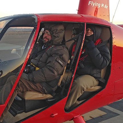
The one thing that does get me to Monument Valley is Flying M Air‘s Southwest Circle Helicopter Adventure. That’s a 6-day excursion by helicopter that starts in Phoenix and spends a night at Sedona, Grand Canyon, Lake Powell (at Page), Monument Valley, and Flagstaff before returning to Phoenix. I don’t do this trip often — frankly, it’s quite costly and there aren’t many folks who want to spring for it — but I happened to do one in October 2010. In fact, as I’m typing this on my laptop, I’m looking of the window of my room at Goulding’s Lodge at the first light striking the famous monuments of Monument Valley.

On this particular trip, I rigged up a GoPro Hero camera on my helicopter’s nose. Although I used this “nosecam” to shoot video on the first day of the trip, the mount introduced too much vibration to make the video usable. For the remaining days of the trip, I switched over to still photos. The camera automatically shoots a high resolution image every 5 seconds as I fly. With 720 photos per hour, I usually get a few good shots on each leg of the trip.

Wednesday was one of the most scenic legs of the trip. We flew from Page Airport (PGA) up Lake Powell to the San Juan confluence and then east to the airstrip at Goulding’s Lodge in Monument Valley (UT25). On board with me were my two excursion guests and all of our luggage for the 6-day trip. I pack the luggage on and under the seat behind me and sit my guests in the two right seats (front and back) so they get the same view. I then fly to put the best views on their side of the aircraft.

We lifted off from Page at about 2:30 PM. The ASOS reported wind at about 8 knots out of the north, but it sure didn’t feel that strong. I made my radio call and then departed right across the runway, heading uplake. A Citation jet called a downwind a few moments later; we caught sight of him high above us as we crossed the airport fence.

Departing PGA

Our shadow as we crossed the runway at Page Municipal Airport.

It was a beautiful day, with high, thin clouds tracing lazy lines across a clear blue sky. The October afternoon sun bathed the landscape with a soft light that illuminated the red rock cliffs and buttes, cast shadows in the canyons, and accentuated the blue of the water. Sure, the light was too harsh for the aerial photographers I usually take around there, but for my passengers and me, it was great for taking snapshots of our surroundings.

The first canyon we crossed was Antelope Canyon, which is just east of the airport. Normally, I just buzz across it, but the tour boat was inside the canyon, so I made a turn to the left so my passengers could get a photo of it. I didn’t circle, though. I’m extremely conservative with fuel on the fourth and fifth days of the excursion, since there’s no fuel between Page, Monument Valley, and Flagstaff (or, in this case, Winslow). I need every drop of fuel I have on board to get to my Day 5 destination on Thursday with required reserves on board.

Antelope Canyon

Most people see Antelope Canyon from the inside, where it’s a masterpiece of sandstone swirls carved by wind and water. But this is the view I see most often.

We continued uplake, passing Antelope Point Marina and the mouth of Navajo Canyon. I made a position call a mile north of iconic Tower Butte and changed from the Page airport frequency to the uplake frequency (122.75). I repeated the call on that frequency and got into a discussion with the returning tour pilots. They’d be coming my way at 5,000 feet; I’d stay out of their way by flying at 4,500 feet.

The tour traffic is a major concern for anyone flying at Lake Powell. It’s a very good idea to learn the tour routes, altitudes, and reporting points they use before exploring in your own aircraft. There’s nothing scarier than flying the lake and seeing a plane flying where you don’t expect it, especially if it’s not on frequency or doesn’t know where it is in relation to the usual reporting points. Ten minutes with a tour pilot and a chart at Page Airport is enough to get the basics.

We slipped between Dominguez and Boundary Buttes at the south end of Padre Bay and continued uplake. Winding canyons opened up on our right. I pointed out a cluster of kayaks near a powerboat in a canyon with water as smooth as glass. In the main channel, you could clearly see the wind on the water. Not enough to make whitecaps, but gusty enough to see round patterns of movement appear and disappear across the water surface.

Dominguez Butte

My usual uplake route takes me between Dominguez and Boundary Buttes. In the far left of this photo, you can see Padre Butte, referred to by local pilots as “submarine.” Navajo Mountain looms in the distance.

We passed the south side of Gregory Butte and Last Chance Bay as two tour planes flew by overhead. Last Chance is a long, wide canyon with steep sandstone walls. It’s a long boat ride to the end where there are a few sandy spots suitable for houseboat parking. Distance to parking and the cost of fuel are part of what keeps the canyon free of traffic, even during busy summer months. On this October day, however, the whole lake was quiet; I don’t think we saw more than 20 or 30 boats.

We flew over the main channel of the lake as the canyon narrowed. One of my passengers pointed out Dangling Rope Marina and asked me about it. I told her what I knew: it was a marina only accessible by water. There were no roads in or out. I then told her a story about our stop there 20 years before on a houseboating trip. How I miss cruising the lake in a houseboat!

Lake Powell from the Air

Over the main channel of Lake Powell just uplake from Last Chance Bay. The canyon walls rise about 800-1,000 feet off the water’s surface here.

We were nearing the mouth of the canyon that would take us to Rainbow Bridge. As I flew, I’d been listening to the radio and knew there was a female pilot in the area. I also knew there was another tour plane behind me, on its way to “the bridge.” It’s a tight squeeze in the canyon and my challenge is always to stay as low as possible to ensure my photography clients can get the shots they need. Over the years, I’ve perfected my approach.

The female pilot was just leaving the area when I reached the mouth of the canyon and turned in. I flew up the canyon at 5000 feet, telling my passengers what to look for as we flew: the dock, the trail, the giant stone arch of Rainbow Bridge. I was busy keeping an eye on the mesa to the right of the helicopter. On a day like that one, with occasional gusts of wind, I wouldn’t get any closer than 200 feet from it’s edge. I verbally pointed out Rainbow Bridge when I saw it, keeping both hands on the controls. We flew past and they snapped photos. I circled around the back, assuring the pilot behind me that I’d stay at or below 5000 feet until I was clear of the area. Then, when abeam the bridge a second time, I broke off to the left and climbed out toward the San Juan Confluence.

Rainbow Bridge

This wide-angle shot gives you an idea of how tricky the area around Rainbow Bridge is. I get very close to that mesa top. Can you see the bridge in the photo?

The trickiest bit of flying I’d have to do on the entire trip was behind me.

I climbed to 6500 feet to give my passengers a good view of the twists and turns of the San Juan River just upstream from the confluence. Then I punched in my user waypoint for Goulding’s Lodge, adjusted course, and headed east over the eroded desert terrain south of the San Juan River.

San Juan River

The San Juan River twists and turns dramatically before meeting the Colorado.

We were east of Navajo Mountain now and the area was riddled with water-carved canyons, windswept rocks, and stunted trees. Below us, here and there, were two-track roads leading back toward the river. One of the roads looked very well maintained, although there was no sign of any homesteads or other reason to use it.

We flew over the top of No Man Mesa, where two or three ranches are scattered. A pickup truck drove slowly along a two-track toward one of the ranches. We saw a herd of horses and a flock of sheep tended by a dog before crossing over the top of the mesa and beginning our descent toward Monument Valley. The famous monuments started coming into view as we rounded the edge of a cliff face.

Off No Man's Mesa

A wide canyon cuts across the desert just past No Man Mesa. While not as beautiful as the Grand Canyon, it offers a glimpse of what the Grand Canyon may have looked like before it became grand.

I switched to the Monument Valley frequency and heard several tour planes making calls. I leveled off at 5500 feet and flew directly over the first paved road we’d seen since leaving the airport. Ahead of us, at the airport, I could see three tour planes launch, one after the other. One crossed overhead in front of me, the others climbed out beside me and likely crossed behind me. All of them were returning to Page the quick way. They’d be back within 30 minutes; we’d taken 60.

Before landing at Gouldings, I always make a quick loop around the western part of the Monument Valley Tribal Park. That day was no different. I climbed to 6000 feet and followed the road into the park. Once I reached the visitor center area, I banked left toward the Mitten buttes. I flew between them, on a route the tour pilots refer to as “splitting the mittens.” Then I banked left again and headed back toward Goulding’s.

Splitting the Mittens

The two Mitten Buttes (East and West) are iconic Monument Valley images.

Monument Valley

I restrict my quick loop around Monument Valley to the west side of the park to minimize noise impact on the ground.

As we came in for a landing, a small herd of horses, spooked by the sound of my helicopter, galloped across the desert east of the airport, kicking up fine red dust.

Landing at Monument Valley

Monument Valley Airport has just one way in and out. Not the kind of airport where you want to overshoot the runway.

It had been a good flight with few bumps or unexpected challenges. Later, in my hotel room at Goulding’s Lodge, I was pleased with the quality of the images my Hero camera had captured. What a great way to document a flight.

Note to Pilots: If you do plan a trip to Goulding’s Lodge, remember that the airport there is private and for use by Goulding’s guests and tour clients only. Go to Goulding’s Web site at www.Gouldings.com to learn more about restrictions regarding airport use.