The Floating Bodies

An explanation of why there’s a honking huge splint on the end of my left arm.

I’ll make this short, if I can. I’m using dictation because I can’t type very fast with one hand. It’ll probably take me longer to edit this than to actually dictate it.

It all started back in August 2013. I had closed on the purchase of the property where I’d build my new home and was spending most afternoons at the property tearing out koshia, a type of invasive weed here. I left for the day, hot and tired and sweaty, and did some grocery shopping. I put the groceries in the back of my truck, which I never do. When I got back to my trailer, I climbed into the back of the truck, gathered up the groceries, and then attempted to vault off the tailgate up as I had done many times before. On that particular day, however, one of my feet got hung up on the tailgate’s spray-in bed liner and I didn’t make a clean jump. I landed on my left side and seriously sprained my left foot. You can read the details of that little accident in another blog post.

Wrist Lump
Here’s the lump at its least swollen state as I waited for surgery. When it was inflamed, it would triple in size and be quite painful. The knob below the swelling is a bone that’s supposed to be there. I have very thin wrists.

What I didn’t realize at the time is that I had also injured my left wrist. The problem manifested itself sometime later with some swelling in that wrist that never seemed to go away. Occasionally, after a hard day working at the house or in the yard, the swelling would increase and the rest will become very painful. On those days I had to turn to Ibuprofen and a wrist brace to keep the pain under control. Those little painful spells would often last several days, but the swelling would usually go down by the time I got to see a doctor about it. I did, however, get several tests done over the years, including x-rays, an MRI, and a cat scan.

This year, a bunch of little medical expenses added up to fill my deductible and I decided that it was time to fix this problem once and for all. The CAT scan identified what the doctor and I had suspected: there were tiny bone fragments loose in my wrist. He called these “floating bodies.” Apparently, when I moved my wrist under strain – for example, lifting something very heavy or twisting my wrist while I was holding something heavy —it caused these bodies to move, which would set off around of swelling and pain. The solution was to remove the floating bodies.

Cat Scan
Although the X-ray and MRI were inconclusive, the cat scan clearly showed the floating bodies in my wrist, including this big one.

I scheduled the surgery for a time after my helicopter had gone into overhaul so I wouldn’t need to fly. That surgery was scheduled for yesterday.

A neighbor drove me to the hospital at 7 AM and the surgery began promptly at 8 AM. I was under general anesthesia so I don’t remember anything from the moment I got into the operating room until I was in recovery. I was very surprised, however, to find my left arm in what looked like a cast from my elbow down to my hand. It turned out to be a clamshell type splint that would hold my wrist immobile. The whole thing was wrapped up in bandages that I would have to keep clean and dry for at least the next week.

Splint
I was not expecting this.

floating bodies
My souvenir.

The doctor came by and told me the surgery had gone well, taking about an hour and 45 minutes. I was shown (and then given) a tiny bottle containing the bone fragments, wrapped in cartilage, that he had removed. There was no need so end the lumps in for biopsy because we already knew what they were.

I’m one of the unlucky people who gets no pain relief from standard painkillers like oxycodone or Percocet or codeine. I know — I’ve tried them all several times as prescribed for various painful ailments. Fortunately, my doctor had another alternative, something called Dilaudid (generic called hydromorphone). They gave me some of this while I was in recovery and although it took about 30 minutes to kick in, it worked like a charm. I was assured that if the pain continued or got worse at home, I could combine this new medication with ibuprofen, which normally works like a charm for me.

A friend drove me home and, after letting Penny out and back in, I climbed the stairs and made myself some lunch. That was pretty easy — I just reheated the leftover pasta from the day before. I took my lunch and something to drink over to the sofa, sat down and got comfortable, and then turned on the TV. I was asleep before I even got a chance to touch my food or turn on Roku. I woke up about an hour later, reheated my lunch, took a painkiller (because it was time), and settled back on the sofa to have my lunch and watch some TV. And that’s how I spent the rest of my day — watching more television that I normally do in a week. The third time Netflix asked if I was still watching, I decided to go to bed. It was about 8:30 PM.

Fortunately, the pain never really came back. It was just a dull ache when I took three ibuprofen before going to bed. I had the stronger painkillers nearby in case I needed them but I slept straight through until about 3:30 AM. Even then, I had no serious pain. I wasted time on Twitter and Facebook and even worked on a crossword puzzle on my iPad. Then I put it all aside and fell back to sleep — until 8 AM!

This morning, I feel remarkably good. Not tired and not in much pain. In fact, as I write this now at 10 AM, I still have not had any painkillers. I’m pretty surprised about that but also very happy. I do not like to rely on painkillers — or any medicine — for comfort.

So life goes on with the addition of a clunky bandaged splint on the end of my left arm. I have full use of my fingers but feel pain anytime I try to grip something or twist my wrist. So I’ll just try to take it easy with that hand. I had no trouble making coffee or breakfast this morning. Using the dictation built into my Mac computer or my iPhone is making it a lot easier to communicate in writing. So I guess I can say that this really isn’t too much of a hardship. It’s more of an inconvenience.

My next doctor’s appointment is on Monday when they’ll remove the splint and bandages and take a look at the incision site. With luck, everything will be okay and they’ll replace the splint with the same old wrist brace that I’ve been using before. (Note to self: run brace through laundry.) It’ll be nice to not have that lump in my wrist and the occasional painful swelling that went with it.

I should mention that I got this done now, while I’m still relatively young, because I didn’t want it to become an issue as I aged. I refer to this as “body maintenance.” It’s a lot easier to maintain a young body than an old one — just like a car.

Slow-Cooker German Pork with Sauerkraut, Onions, and Apples

A twist on a family recipe…kind of.

My grandfather was German — born in Germany — and trained as a pastry chef. He owned a bakery in New Jersey and ran it with my grandmother until I was about 10 years old, when they retired to a life of leisure in their New Jersey home.

He was also an excellent cook who whipped up the real German dishes I grew up with. One of them was pork with sauerkraut. Years after my grandparents were gone, I got the recipe and whipped up a batch at home, which, if I recall, called for boneless country-style pork ribs. I’ve since lost the recipe and pretty much forgot all about it.

Until my friend Shirley shared a similar recipe on Facebook. That got me thinking about it. She linked to another recipe even more similar to the one I remembered. I decided to make it. I bought the pork. And then I got busy with other things (as usual) and forgot about making it (as usual). Fortunately, I’d put the pork in the freezer and when I was poking around in there thinking about what to make this weekend, I found it and remembered the recipe.

Pork w/Sauerkraut
Here’s a closeup of my version of the finished dish. (Do you really need to see more than one picture?)

Of course, by then I’d lost Shirley’s recipes. Rather than trying to find it on Facebook, I did a Google search, came up with a few recipes that were similar, and zoomed in on one of them. But since that wasn’t really what I wanted to make — I don’t remember potatoes being in the dish — I fine-tuned it to make it into something similar but different.

Following me after all that?

Anyway, here’s my version, which includes instructions specific to an Instant Pot. One of the things that sold me on Instant Pot was that it was a slow cooker, too; no need for multiple devices filling my pantry shelves.

Ingredients:

  • 1 2 to 4 pound boneless pork loin roast. This is not the same as a pork tenderloin. (I’ve said it before and I’ll say it again: do not waste a pork tenderloin in a slow-cooked or pressure-cooked recipe. It is naturally tender and is best grilled.) If there’s any visible fat on the roast, trim it off.
  • Salt and pepper to taste.
  • 2 strips uncooked bacon, chopped. I used buckboard bacon, since that’s what I had.
  • 1 tablespoon brown sugar. I bet you could substitute maple syrup or even honey.
  • 1 14 oz. can sauerkraut. Or whatever “standard” sized can or jar you find. You don’t want the big jar. Don’t drain it!
  • 1 large onion, cut into 1/4 inch wedges. That’s the way I cut them, anyway. I used regular yellow onions, but I suppose you can use any kind of onion you want.
  • 1 large apple, cut into 1/4-1/2 inch wedges. I used a Honeycrisp, because that’s all I had in the house. Silly me. I kept one segment for the cook. Quality control, you know.
  • 2 teaspoons caraway seeds. That’s the one part of the recipe that I definitely do remember, mostly because when I was a kid I hated caraway seeds and my baker grandfather would make me rye bread without it. (Talk about a spoiled kid.)

You know, if you’re really big on starches with your food, you could add potatoes. The original recipe called for 6 white ones, peeled and quartered.

Instructions:

  1. Season the pork with salt and pepper and set aside.
  2. Press Sauté on the Instant Pot and toss in the bacon. Cook it up to release its yummy aroma and fat. (Okay, so if you don’t have an instant pot, you’ll need to do this in a pot on stove.)
  3. Note about browning the meat:
    The recipe I based this (loosely) on instructed cooks to simply put the raw pork into the pot with the other ingredients and cook it. But my understanding is that browning meats helps increase flavor so that’s why I did it here — and nearly always do it in any slow cooker or pressure cooker recipe. I added the bacon merely as a source of tasty fat; you could, I suppose skip the bacon and use some sort of oil instead.

    Add the pork and brown on all sides. This could take a while. Be patient. Try to stir around the bacon so it doesn’t get all burned.

  4. Remove the pork and set it aside again.
  5. Deglaze the pan with about 2 cups of hot water. This means adding the hot water and using a wooden or silicone spoon to rub away the burned bits at the bottom of the pan. Along the way, the water will turn into bacon soup. (At this point, if you’re not using an Instant Pot, you might want to transfer everything in the pot to your slow cooker which you should then turn on high. And remember later, when you’re washing two pots, that Instant Pot users only washed one. Just saying.)
  6. Add the brown sugar and stir it in.
  7. Return the pork to the pan.
  8. If you’re including potatoes, I recommend putting them in the slow cooker around the pork right now.
  9. Add the sauerkraut (with all juices), onions, and apple. Just dump them in right on top of the roast.
  10. Sprinkle the caraway seeds on top.
  11. Cover and bring the mixture to a boil, then press Off. Then press Slow Cooker and adjust the temperature to Low and the Time to 6 hours. (If you’re using a regular slow cooker, you’ll probably need to cover it to get it up to temperature. Once it’s bubbling, turn the temperature down to low.)
  12. Slow cook 6 hours.
  13. Remove the meat from the pot, slice it as thin as you can (against the grain; good luck), and arrange it on a serving plate. Using a slotted spoon, scoop out the rest of the goodies and arrange them around the pork. You can put some of the juices in a milk pitcher or gravy boat for guests who might want to pour it over on their plates.
  14. Serve hot (duh), possibly with some crusty bread. Or rye bread, with or without seeds.

If you try this, please do let me know what you think.


Helicopter Flight from Washington to Arizona, Day 2: Desert Heat and Familiar Terrain

Descending into the desert’s warmth and well-known flight routes.

I woke at around 5 AM. Actually, Penny woke me up that early. She left the bed and for a while I just lay there, half asleep, wondering where she’d gotten to in the vast attic guest room. Then I remembered that I hadn’t closed the door and realized that she might have gone downstairs. I jumped out of bed and headed down to find her.

She was in the kitchen at the back door with the other three dogs. I opened the door to let them all out. The morning was cool and the sky was clear with the waning gibbous moon hanging high in the western sky. The autumn leaves rustled in the gentle breeze. I waited patiently, then got the dogs back in, one at a time, and closed the door.

Megg was awake, getting ready for work. We talked quietly in the kitchen for a few minutes before she headed off to the shower and I headed back upstairs.

A while later, Megg was upstairs to say goodbye. I wasn’t sure how long we’d stay — it depended on when Jeremy could be ready — and she knew she wouldn’t be home until at least 10 AM. I hoped to be in the air by then. So we said goodbye, possibly until July, and she headed off to work.

Meanwhile Jeremy was still asleep and I wanted coffee. Megg had told me about a place walking distance from her home, Alchemy Coffee. I checked it out on Google Maps and saw that it was only 0.6 miles away and opened at 6:30 AM. I got dressed, grabbed my coat and Penny’s leash, and headed out for a walk — or more like a mission — in the predawn light.

Salt Lake City Capitol Building
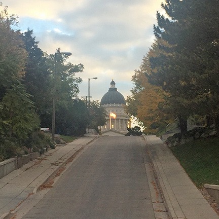
I got a neat view of the Capitol building as I walked back to Megg’s house. There was something kind of surreal about the way the first light illuminated the flag outside.

Megg lives in Salt Lake City proper, not far from Capitol Hill. If you think it would be very urban, you’d be wrong. It’s a really nice residential neighborhood with lots of houses of various styles and ages. Sidewalks on both sides of the street keep you off the road as you wander past front yards, often under overhanging trees. It wasn’t a long walk at all, but there was one steep hill, about two blocks long, just as Megg had warned me. I passed within two blocks of the Capitol building and arrived at Alchemy right around 7 AM.

I had my latte and an almond danish while sitting at an outside table with Penny. By that time, it was fully light, although the sun hadn’t cleared the mountains to the east yet. The coffee shop did a brisk business, with about half of its patrons parking briefly at the curb while they ran in for their coffee.

I caught up on Twitter and Facebook activity while I slowly drained my cup. I also checked in for my flight out of Phoenix the next day, very pleased that I’d gotten a First Class upgrade again. I switched my seat from an aisle to a window seat using the Alaska Airlines app. (Does anyone other than me remember the red paper tickets we used to have and waiting on line to change a seat?)

I texted Jeremy to let him know that I wanted to head out by 9 AM. He agreed that an early start would be best. Then I headed back on a slightly different route, really enjoying the variety of architecture along the way.

Back at the house, I let the dogs out again as Megg had asked me to. Her son was still asleep and I tried not to bother him. Jeremy was packing up. When he was ready to go — I’d already packed up before leaving for coffee — I used my phone to call an Uber. A car was at the curb less than 5 minutes later.

We talked Uber along the way. I’d recently become an Uber driver but didn’t drive much, mostly because demand was so low in Wenatchee that it was a waste of time to hang out in town waiting for a call. I learned a few things from the driver’s point of view. Unfortunately, he had trouble finding Skypark and I had to direct him the last mile or so. The fare was only around $12, which I thought was good for a 7-mile drive.

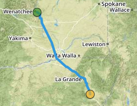
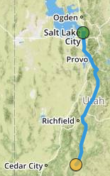
Leg 4: Salt Lake City to Bryce Canyon

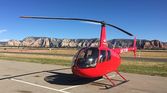
After preflighting and adding a quart of oil — I added either a quart or half quart at every fuel stop — we loaded up the helicopter, climbed on board, and started up. It was probably about 9:15 when we got airborne.

TAC for Salt Lake
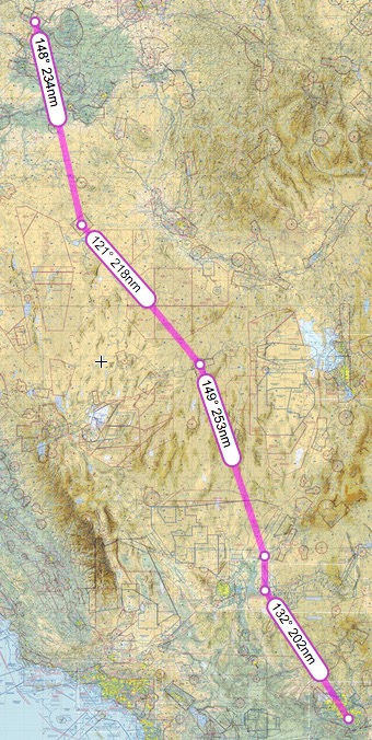
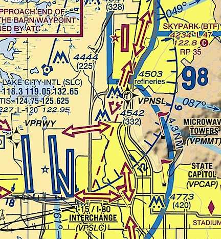
This closeup of the Salt Lake TAC shows how close Skypark is to Salt Lake City’s surface airspace.

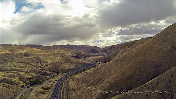
The first challenge was crossing through the surface area of Salt Lake City’s Class Bravo airport along the I-15 freeway. I had to get clearance and I wasn’t able to make contract until I was airborne. Because Skylark is right next to Salt Lake City’s surface airspace, I had to head due east to make contact and get clearance. I called on the wrong frequency (of course) and had to switch to another one, which I managed to screw up once. So I was orbiting a bit out there until we got it sorted out and I got the clearance I needed. Then it was an easy flight south.

The only thing I regret is not turning on the GoPro. Although I had remembered to turn on the wifi and camera, I’d forgotten to turn the camera on. It’s a real shame because I think I could have gotten a few nice shots as we flew past downtown Salt Lake City.

The last tower I had to talk to — at least for a while — was Provo. Again, I asked for and got clearance to follow I-15 south. Using a landmark like a freeway makes it very easy to tell a tower what you want and make sure you both know exactly where you’re supposed to be.

Leg Four
The fourth leg of our trip, recorded by ForeFlight.

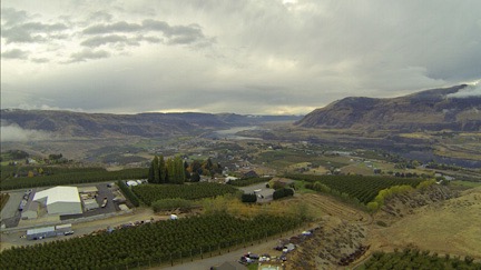
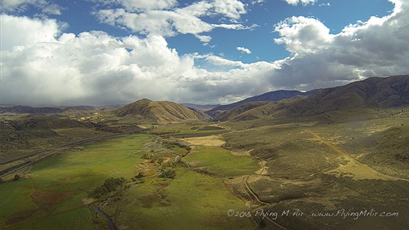
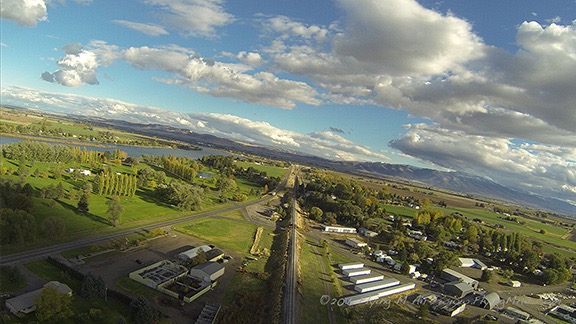
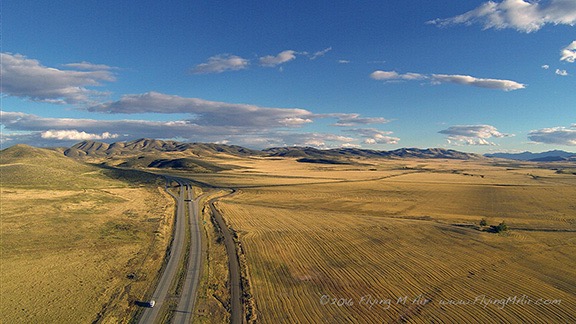
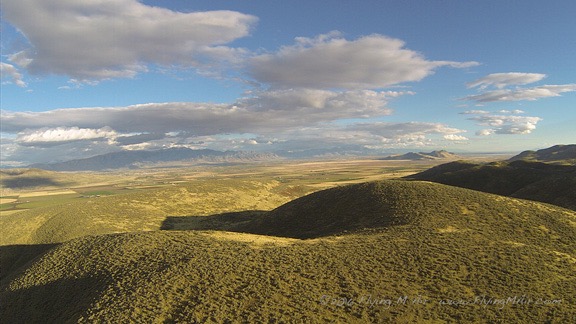
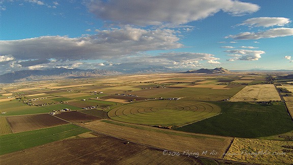
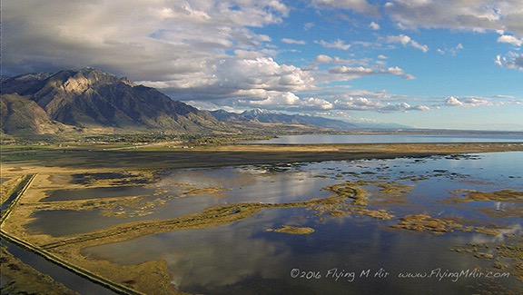
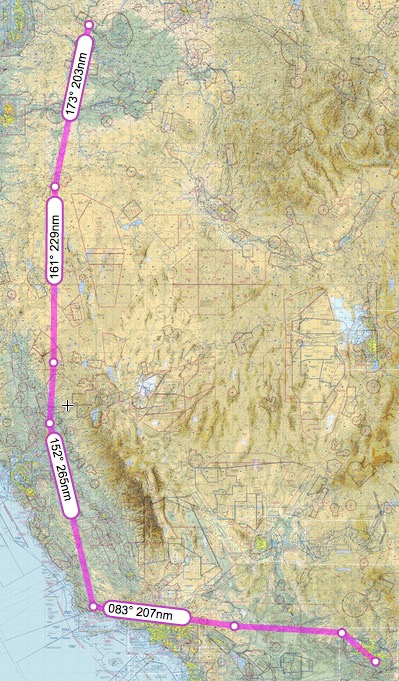
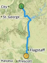
Past Provo and abeam Spanish Fork, I veered to the east a bit to enter the valley that would take me along route 89 to Bryce Canyon. That put us in a series of long, relatively narrow valleys between mountain ranges that rose up to 9,000+ feet on the west and 11,000+ feet on the east. There were a few towns along the way and lots of farmland. Very rural, almost remote. And then another narrower, more remote valley with 11,000+ foot mountains on either side. It was 213 nautical miles from Skypark to Bryce Canyon and it took us nearly 2-1/2 hours to cover that distance. I’d been hoping to refuel at Page, AZ, but it didn’t look like we’d make it so we stopped at Bryce.

Bryce Hangar
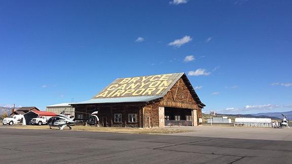
The old log hangar at Bryce Canyon Airport.

The last time I’d been to Bryce Canyon Airport had been way back in January 2013 on a photo flight with a good client. He’d been assigned by Airpano to get pictures of Bryce Canyon in winter for their panoramic image project. We flew up from Phoenix and wound up getting snowed in for two nights before we could do the shoot. You can read a bit about it here. On that last visit, the airport guy had been extraordinarily helpful with weather-related problems — so helpful that my client and I had each tipped him $100. I still have the t-shirt he gave me when I wanted to buy one; I call it my “hundred dollar t-shirt.” I was looking forward to seeing him, just to see if he remembered me. But he wasn’t there. It was a different guy who was older and not quite as friendly. I think he was put off by Penny, who first came into his office off-leash. Oops.

Anyway, he fueled us up while we used the bathroom. I was out on the ramp again chatting with him when the local sheriff’s office guy came up, in uniform. I wondered if we’d done something wrong but couldn’t imagine what it might be. But he was just there to chat with his airport buddy, to kill time on a nice day.

And it was a nice day — unseasonably warm for October, especially at Bryce’s 7590-foot elevation. The kind of day you’d want to sit out in the sun on one of the chairs they had on the FBO porch. In the 50s, at least. I didn’t even need my jacket.

Leg 5: Bryce Canyon to Sedona

Of course, Bryce Canyon Airport is only a few miles from Bryce Canyon National Park, so there’s no chance we’d leave there without a nice little flyby. I felt bad for Jeremy, who’d really hoped to visit friends and his daughter on the way south. I thought of Bryce Canyon, which he’d never been to, as a sort of consolation prize.

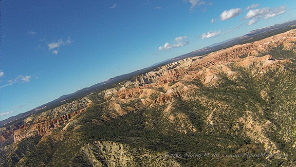
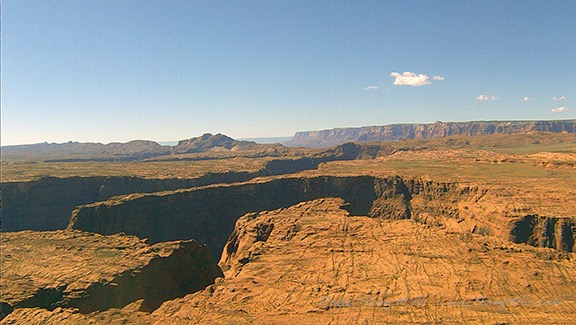
Bryce Canyon is really a misnomer; it’s not a canyon at all. It’s basically a cliff face where Mother Nature has eroded rocks with wind and rain, exposing the red sandstone layers and carving out towers called hoodoos. These are visible from various lookout points along a rim road on the top of the cliff as well as from the air to the southeast of the park itself. At least one tour operator does helicopter tours there. Although the airspace is clearly marked for the National Park, I know the rules: pilots are requested to avoid flight within 2,000 feet of the ground or cliffs (or hoodoos) within that area. That doesn’t mean flight is forbidden. So a quick flyby wouldn’t break any rules and likely wouldn’t bother many tourists. After all, there’s a tour operator likely flying by multiple times in a day for a lot longer and a lot closer.

And I did keep it quick. I made a big loop out toward Tropic and then came in closer with Jeremy’s side facing the park. He shot a bunch of photos. The nosecam didn’t really get any good shots, but one was sharable. Then we continued on our way.

Bryce
Keep in mind that I was turning when the nosecam captured this image of Bryce Canyon.

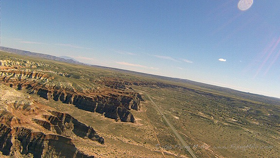
It was around then that I first caught sight of Navajo Mountain. This is a huge landmark for me. It means coming home, returning to a place that I know very well: Lake Powell. I can’t tell you how many hours I’ve spent over the lake with photographers on board. Easily over 200. I missed it and I wanted to fly it again, but I wasn’t interested in flying over it with a nearly timed-out engine that was making metal shavings. I’ve tentatively planned a photo shoot there in April 2017, before I bring the helicopter back to Washington from its California frost contract. If you’re interested, you might want to check this out. And tell your friends.

West of Page
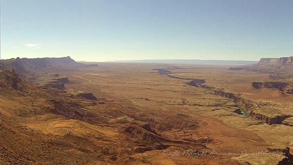
Typical terrain west of Page, AZ. If you look closely at the horizon, you should be able to see Navajo Mountain off it in the distance.

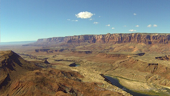
We took an almost direct route to Page, AZ from there, taking a slight detour to visit the Wahweap Hoodoos. Then we flew past the Glen Canyon Dam, over Horseshoe Bend, and down toward Lees Ferry. I skirted the edge of the Grand Canyon Airspace, flying over the Navajo Reservation, seeing wild horses and the remains of old hogans. All of this was familiar to me but new to Jeremy. For some reason, the helicopter felt lighter, happier, faster. Probably my imagination, but maybe it knew it was returning to familiar terrain?

Horseshoe Bend
Horseshoe bend from about 700 feet up. Not nearly as impressive as it is from much higher looking almost straight down.

Vermillion Cliffs
Lees Ferry with the Vermillion Cliffs behind them.

Marble Canyon
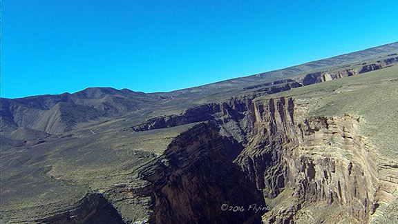
Marble Canyon looks like a giant crack in the earth as it winds across the plateau toward the Grand Canyon.

We reached the Little Colorado River Gorge and I flew along the top of it, keeping the nosecam in mind for a different view. I think I could have gotten better shots from higher up, with the camera pointing more down. Next time?

Little Colorado River Gorge
The Little Colorado River Gorge, heading toward the Grand Canyon.

Then we climbed up onto the Coconino Plateau and I steered almost due south toward Sedona. There’s a lot of nothing out there, but Jeremy managed to spot some wild horses where I’d never seen wild horses before.

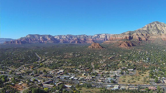
Closer to Flagstaff, the air was smoky. There were fires burning but because there were no TFRs in the area, I assumed they were controlled burns. We dropped down into Oak Creek Canyon just west of Flagstaff Airport’s airspace. It was a bit bumpy as we followed the canyon down. We were flying into the sun again, so the nosecam didn’t capture any good images. I can’t remember, but I’m pretty sure this was Jeremy’s first time in Sedona. I think he was impressed by the red rocks.

Leg 5
The fifth leg of our trip, as recorded by ForeFlight.

We lined up to land along the taxiway. I was just looking for parking on the ramp when I remembered that they liked helicopters to park in the remote helicopter landing area far to the southwest corner of the field. I decided to try landing with the planes, which was much closer to the terminal and restaurant. I chose a spot in the last row, isolated from the parked planes, with my tail rotor out toward the taxiway so I didn’t have to worry about anyone walking behind me. In the old days, someone would get on the radio and tell me to move. But that day there was silence. There was someone mowing out by the helipads and I figured they either didn’t care or weren’t using them that day. So I shut down.

Of course, the woman operating the mower came out to scold me when the blades had stopped. She claimed it was “safer” for me to park down in no man’s land. (Okay, not what she called the helipads.) Safer? I couldn’t see how, especially since it required us to walk along an active taxiway to get to the terminal. I feigned ignorance and said we’d be gone soon anyway. Knowing she couldn’t expect me to start it back up just to move it for an hour-long stay, she left us, looking frustrated and annoyed.

Parking at Sedona
I don’t see what’s so unsafe about this parking spot.

I ordered fuel and we chatted with the pilot of a Cessna on floats that was on a cross-country from Minnesota (if I remember correctly) to California. Seaplanes are pretty rare in Arizona (although the state does have more boats per capita than any other state in the country).

We went to the restaurant and got a table outside so Penny could sit with us. Our waiter, whose name was Ferrari, was very pleasant but not a very good waiter. It took forever for him to bring our drinks. (Penny actually got water before we did.) We were all famished so I ordered an appetizer to share. We both ordered salads. The food, when it came, was good and really hit the spot. I shared some of the chicken from my salad with Penny. I also had one of their mango cake desserts, which was just as delicious as I remembered it being. Jeremy picked up the extremely large tab, I paid for gas, and we headed back out to the helicopter.

Leg 6: Sedona to Phoenix

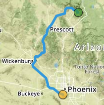
By this time, my dinner date in Wickenburg had been cancelled and I’d made arrangements to meet my friend Mike at his airpark home near Phoenix instead. He had to go to work so time was limited. Still, I couldn’t resist detouring through Wickenburg. Since my old house was sold in 2015, I’d become friends with the new owners. They’d made some improvements to the house since moving in and although I’d seen a few pictures, I hadn’t actually seen the house itself since I left it in May 2013. I thought it might be nice to do a flyby. Maybe Jeremy could get some nice aerial photos that I could pass along to the new owners.

So we left Sedona flying northwest, along the red rock cliffs. Although the light wasn’t quite right for photos, I did manage to get a few good images.

Sedona from Airport Mesa
Here’s a look at Sedona right after departing northwest bound from the airport, which sits atop a Mesa.

Sedona's Red Rock
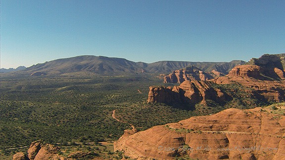
The red rocks of Sedona, west of town.

After crossing Sycamore Canyon, I headed toward Prescott on a path that took us within sight of Jerome. From there, we transitioned the southeast side of Prescott’s airspace and followed the Hassayampa River all the way down to Route 93 in Wickenburg. I adjusted my course to intercept Cemetery Wash and followed that up past my old home. It looked great from the air — the new owners are really taking good care of it. I was amazed by the size of the Mexican fan palm in the side yard — I remember planting that tree when it was shorter than me and now it stands at least 30 feet tall. I circled the house and Jeremy shot photos. I still haven’t seen them, but I’m sure he got at least one good one to share.

From there, we headed southwest toward Vulture Peak. I did a quick flyby, pointing out the trail that wound up to the saddle for Jeremy’s benefit. I looked forward to hiking the peak in a few months when I was back in town with friends.

Then I headed southeast toward Hangars Haciendas, the airpark where my friends Mike and Cheryl live. I worked the GPS and radio. I had to connect with Luke Approach to enter and transition the jet training area northwest of Glendale. That was the biggest challenge since I was flying only about 700 feet up — my usual cruise altitude — and had to call from so far out that they couldn’t pick up my transmission. That meant climbing. We finally connected and I got a squawk code and transition instructions. They asked for my destination and I told them Hangars Haciendas.

“What airport is that near?” the controller responded.

“It is an airport,” I replied. “A residential airpark southwest of Sky Harbor.”

Leg 6
The sixth leg of our trip, recorded by ForeFlight. This was the scenic, time-wasting portion of the flight.

Clearly, he had no clue where I was going, but he understood that I had to go through Goodyear’s airspace so he handed me off to that controller when I got closer. That guy cleared me to transition eastbound along I-10. There was a tense moment when he pointed out an aircraft in downwind and I couldn’t see it. I offered to stay north of I-10 and he accepted that. Jeremy saw the plane before I did and it really was no factor. But I could tell by the controller’s voice that he was concerned. I’m sure he was glad to cut me loose.

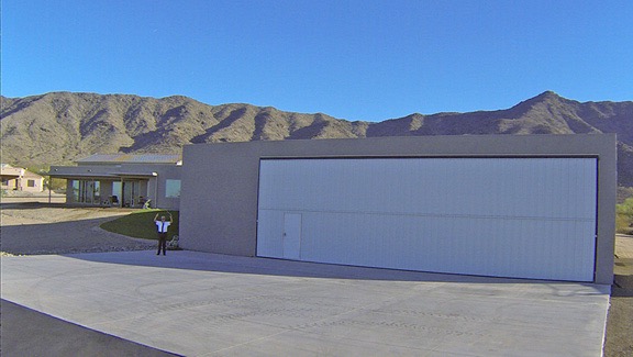
Of course, Hangars Haciendas does not appear on my Garmin GPS, although it is on ForeFlight. I used that to zero in on it. It was very difficult to find! I finally caught sight of it and eventually saw Mike, in his uniform, waving us in to his concrete hangar apron. I landed in the corner and immediately popped my door open. It was hot!

Mike Waves Me In
The nosecam caught this photo of my friend Mike waving me into parking on his hangar apron.

I cooled down the helicopter while Penny and Jeremy got out. It’s kind of funny when you think about it — the next stop would be the engine’s last stop before overhaul. Why bother doing a proper shutdown? Well, why not? Surely I could spare the extra two to three minutes to take care of an engine that had been so good to me for so long.

Parked at Mike's House
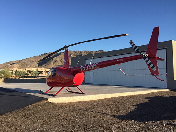
Zero-Mike-Lima parked in front of my friend Mike’s hangar.

Mike only had about 20 minutes to spare for us. He’d been on standby and had actually been called in to work. He needed to leave before 5 PM. So he wasted no time showing off his new plane and helicopter, both of which were tucked into his hangar. I also got a chance to see his home, which was still in its final construction phase the last time I’d been there. I didn’t get a chance to see his wife Cheryl because she was basking in the sun in Hawai’i that week. She’d be home later in the week, just before he left for China.

We parted ways a short while later. Mike drove off to the airport while Jeremy, Penny, and I went back to the helicopter for the last leg of our journey.

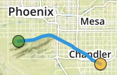
The Last Leg: Phoenix to Chandler

I have to say that the last leg was kind of bittersweet for me. Not only would it be the last time I flew until January or February, but it also marked the end of my helicopter’s first life. Its tired airframe, engine, rotor blades, and other components would be stripped down, rebuilt, and replaced. When I got it back, it would be the same helicopter, yet different.

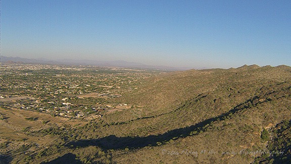
We took off heading almost due east along the north side of South Mountain. Jeremy spotted another helicopter at our altitude nearby — he’s actually a pretty good flying companion — and I tuned into the Phoenix Air-to-Air frequency (123.025), which I hadn’t used in three years, to make a call. The pilot of the other helicopter, with a Firebird call sign — I’m thinking either DPS or Phoenix Police — responded immediately. They were doing some training work, hovering over a South Phoenix neighborhood. We exchanged pleasantries and I continued on my way.

South Mountain
Flying eastbound along the north side of South Mountain near Phoenix. I don’t miss Phoenix’s smog layer at all. That day was actually clearer that most.

After I crossed I-10 and made my first radio call to Chandler tower, I turned on the cockpit GoPro, which had been set up for the entire flight but never turned on. I figured I’d document this last leg of the flight. I started off chatty enough, but soon lapsed into silence. I guess I didn’t have much to say. You can see for yourself in the video below. It’s a shame that the setting sun over my right shoulder puts so much glare into the cockpit.


For some reason, I thought it was a good idea to document the last leg of our flight with a video.

Last Leg
The last leg of our flight was very short. See it on ForeFlight.

It was a very short flight — less than 15 minutes from takeoff to landing. Again, cooled down the engine before shutting down. I patted the controls and talked to the helicopter. (Yeah, I do talk to my machines, even though none of them have names or genders.) When the blades had stopped, I got out with Penny and went to find the Director of Maintenance, Paul.

Post Flight

Into the Hangar
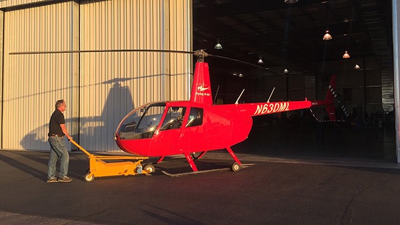
Paul wheeled the helicopter into the hangar where the overhaul work would be done.

The next hour or so was spent helping Paul bring the helicopter into Quantum’s big hangar, talking to him about the little problems it had that needed attention, and discussing core and replacement options. Together, Jeremy and I unpacked the helicopter, separating everything in it into three piles: his luggage, my luggage, and the stuff that would stay with the helicopter in the wheeled box I’d brought along. I was glad that my day pack had been lightly packed for the trip because I did have to take a few things home with me — my GoPros, Penny’s bed, and my Square card reader equipment. Finally, everything was organized and packed for taking or leaving. The sun was down and we were ready to leave.

I didn’t take one last photo. After all, I’ll see Zero-Mike-Lima again in December. I know they’ll have started work by then and it’ll be partially stripped. That’s okay. I’d rather remember it from the last few photos I took during that final flight. I left it parked between two other R44s, knowing that it was in good hands.

The folks at Quantum gave us a lift to the hotel I’d reserved off I-10. The driver was studying to be a helicopter mechanic and working toward his private pilot license. He refused to take the tip I offered when he dropped us off.

We checked in and got information about a restaurant with an outside patio that was within walking distance of the hotel. I was very pleasantly surprised by how comfortable and clean my room was. This was a Quality Inn — which allows dogs — and the room rate was only $65 with tax. I had very low expectations and was so glad they delivered a much nicer room than I expected.

We walked to the restaurant, which turned out to be a very nice Italian place in a strip mall. We sat outside, where the evening air was comfortable and cool. I had two drinks to celebrate the end of the journey. We had a light dinner — mostly because we’d eaten so much at lunch — and walked back to the hotel.

I slept like a log.

Helicopter Flight from Washington to Arizona, Day 1: Over the Mountains, IFR

A flexible flight plan, weather, and then smooth flying to someplace other than where I expected to be.

It was overcast with a handful of low-level clouds as we headed southeast from Wenatchee Airport at about 11 AM on Monday morning. Not very promising weather for the first day of our trip south.

Leg 1: Wenatchee to Baker City

Leaving Wenatchee
It looked pretty dreary when we left the airport heading southeast on Monday morning.

We left the Columbia River for the first time at the Gorge Amphitheater south of Quincy, WA. (We’d cross the twisting river two more times before leaving the area.) The air was really smooth and I found it difficult to believe that such high winds lay ahead on our planned route. But instead of taking that route, I headed toward Hermiston, which was closer to Pendleton than our original route would have taken us. I could always steer west again if I wanted to get back on that route.

The weather in Pendleton was moving northeast — per radar on my iPad — and it looked as if it might be gone by the time we got to Hermiston. I could check the weather at various points on my iPad as I flew and I did so, trying to decide what to do. But it wasn’t until we crossed over Benton City that I pretty much decided a more eastern route would be better; the winds at Benton City bounced us around in light turbulence that had Jeremy talking about the weather again. If a few bounces like that were bothering him, he’d either be sick or terrified when we hit the moderate turbulence forecast up ahead on our planned route. And although I was unlikely to be either, I still didn’t want a long day flying in turbulence. Been there, done that.

Fortunately, the weather that had been in Pendleton had moved off. I plotted a course for the airport there. We could clearly see rain in various places around us, but there was no lightning and the air was smooth. I talked to the tower at Pendleton and was cleared to cross over the field. The runways looked soaking wet. But what pleased me to no end was that I could clearly see the tops of the Green Mountains to the east. We’d have no trouble climbing them to follow the I-84 corridor.

Yes, IFR = I Follow Roads.

First Leg
Our first leg was from Wenatchee to Baker City. This is an actual track log from ForeFlight.

The next hour or so was a mix of sun and clouds and even some light rain as I plotted the straightest route I could that kept us within sight of the freeway. I turned the helicopter’s nosecam on and off depending on how nice it looked outside. When we were flying into the sun, the pictures are generally crappy with bad exposures so I didn’t have the camera on much. I had a GoPro 3 Black up there that I could control from my phone. It was set up to record HD video with still images every 10 seconds. With a 64 GB mini SD card and USB power source, it would last the entire length of the trip. The aerial photos throughout this post are from that camera.

Meanwhile, Jeremy was shooting pictures almost nonstop whenever there was something interesting to see. I felt kind of bad that he had to shoot through the plexiglas, which I knew could be very reflective. But taking a door off would be uncomfortable and slow us down. And because we had so much junk in the back, there was no place to store it on the flight anyway. The only good thing is that the occasional rain showers we passed through sometimes cleaned the bugs off the front windows.

Skeleton Crew
The folks at Baker Aircraft are serious about Halloween decorations. Photo by Jeremy.

FBO at Baker City
Yes, the fridge at the Baker City FBO is completely covered with airplane panels. How cool is that? I’ll let you fly in to discover what happens when you open the door.

We stopped for fuel at Baker City, OR. (I always stop at Baker City, whether I’m driving or flying.) I parked to one side of the pumps and the fuel guy came out and fueled me up while Jeremy and I made a beeline for the bathrooms. I asked about the courtesy car and they handed over the keys. After paying for fuel, we drove into town for lunch. I always eat at Sumpter Junction, a great little restaurant with a huge model train that passes by the booths at one side of the restaurant and that day was no different. They have a great breakfast all day; I had chicken fried steak and eggs. Back at the FBO, I bought some snacks — Pepperidge Farm Milano Cookies and some almond chocolate biscotti — for the flight.

Leg 2: Baker City to Burley

Before leaving, I texted my friend and former editor Megg, who lives in Salt Lake City, telling her that we might be overnighting in the area and asking if she was available for dinner. I knew Bountiful Skypark from having landed there several years before, and figured we could grab an Uber to a hotel for the night. It’s always good to have a plan, even if the plan changes.

Then it was back in the air, heading southeast through Oregon along the I-84 corridor again. More sun and clouds and light rain. Some snow around us (but not on us). Lots of green. Very few bumps. I was very happy I’d made the route change.

In Oregon
Along the I-84 corridor east of Baker City.

In Oregon
A bit further along the road. The weather was constantly changing but never became an issue for flight.

Leg 2
The second leg of our flight, as recorded by ForeFlight.

After about an hour or so, we finally dropped out of the mountains into the flatlands around Boise. We were back in civilization again, with lots of airports to monitor and traffic to see and avoid. (I didn’t have the nosecam running because we were pointing into the sun and the images would have been awful anyway.) I steered us through the Caldwell and Nampa airspaces, making calls along the way, then steered us eastbound, south of the Boise Class B airspace, partly because it was the most direct route, even though it took us away from I-84, and partly because I just didn’t feel like talking to a controller. We monitored the frequency, though, and heard the planes coming and going.

Then it was back out into the mostly flat lava fields east of Boise. The sky had cleared considerably and although there were still isolated rain showers in the area, it was very pretty and pleasant flying weather.

Over Idaho
We crossed over a few wind farms, including this one east of Boise. Jeremy got a great picture out the side window as we passed one of them. This is from the nosecam.

We fueled in Burley, ID. It’s another airport I’d stopped at before. I think it was back in 2008 when I was flying from Wenatchee, WA to Page, AZ with my wasband and another pilot. We’d overnighted there in a hotel not far from the airport. This time, we just fueled up as quickly as possible.

Leg 3: Burley to Salt Lake City

Megg had texted back with an invitation for us to spend the night at her house. I was eager to see her new home and spend more time with her so after conferring with Jeremy, I texted back that we’d try to get there before sunset. We were airborne minutes later.

East of Burley, ID
The nosecam picked up this image as we climbed out of the airport at Burley, ID.

By this time, it was nearly 5 PM local time and sunset at Salt Lake would be about 6:30. I did not want to fly in that area in the dark. So I put the pedal to the metal (so to speak) and cut some corners along the way to shave off a few minutes of flight time.

The light was magnificent for photography so I turned on the nosecam and left it on for the remainder of the flight. I picked up more than a few nice images along the way. The air was still smooth and we had a bit of a tailwind that hurried us along. We broke from the freeway corridor when we entered the Salt Lake basin, mostly to shorten up the route and avoid other airports along the way. There was fresh snow on the mountains and parts of the lake that we flew over were smooth enough to reflect the sky.

Heading toward Salt Lake
Heading south along on I-84 toward Salt Lake City in late afternoon.

North of Salt Lake
Although I cut some corners to save time, I was never very far from the freeway.

Salt Lake Basin
Dropping into the northeast corner of the Salt Lake Basin.

Reflections in Salt Lake
This is my favorite photo of the trip. I am such a sucker for reflections and will actually plan a route over water if it looks like the nosecam might get a few good shots.

I did have to talk to two towers along the way. The first was Ogden, which is north of Salt Lake City. To keep things simple, I asked for a transition along the I-15 freeway. The controller directed me to overfly one of the runways, basically cutting the corner and shortening up my flight path. He then handed me off to Hill Air Force Base tower, where I got clearance to continue my transition along I-15. Easy peasy.

Leg 3
Third leg of our trip, as recorded by ForeFlight.

We made remarkable time to Skypark. I tuned into the frequency, heard another plane in the pattern, and kept clear until I could see him. Although I probably could have darted across the runway to land on the ramp before he turned final, doing so would have had me looking right into the sun, making it difficult to see where I was going. So I joined the pattern in the downwind and followed him in to land.

Landing at Skypark
We landed at Skypark about 20 minutes before sunset. Can you see the plane landing in front of us? He’s about halfway down the runway.

I taxied over to self-serve fuel and topped off the tanks while Jeremy and Penny stretched their legs. I texted Megg to let her know we’d arrived; she said she’d be with us in 30 minutes. Then I fired up the helicopter and repositioned it over to an end parking space near the taxiway, leaving enough space between me and the next tied down aircraft to prevent complaints.

At Salt Lake City

Zero-Mike-Lima at Bountiful
Zero-Mike-Lima, parked at Bountiful Skypark at sunset after a long day of flying.

We unloaded the helicopter and I locked it up for the night, leaving the GoPro on the nose right where it was. We waited for Megg by the main terminal building. The light in the mountains to the east was spectacular.

Megg came and we exchanged hugs. I introduced her to Jeremy. She tried to pet Penny, but Penny danced around as usual. We loaded our luggage into Megg’s car and headed off to pick up her son at Boy Scouts. I could not believe how much he’d grown! He was 13 now — hell, I remember when he was born! — as tall as me, and had ditched the glasses in favor of contact lenses. We all went out to dinner at Cafe Rio. Then it was back to Megg’s wonderful little house, which was originally built in the 1890s and fully modernized. While Jeremy worked with his photos on his laptop and Penny dodged and teased Megg’s three big dogs, Megg and I chatted about things going on with both of us. It was really great to see her and I urged her to stop by my place for a day or two on her way to the Seattle area for a visit with her dad in July.

Then, with Megg needing a very early start in the morning for a meeting and me feeling pretty tired from a long day at the controls, we split up and hit the sack. I was asleep as soon as my head hit the pillows.

[read more]

Helicopter Flight from Washington to Arizona: Logistics and Flight Planning

Planning my last big cross-country flight before overhaul.

Last week, I flew my helicopter down to Chandler, AZ from Wenatchee, WA with Penny the Tiny Dog and my friend Jeremy. I needed to deliver it to Quantum Helicopters so they could get the helicopter’s first overhaul started by November 1. I’d need it back by mid-February at the latest and overhauls typically take 9 to 12 weeks.

Here’s the story of my two-day flight to Arizona, split into three parts for readability. It’s surprising how much I had to say about the flight — and how many photos I have to share. Enjoy.

Logistics and Flight Planning

With various activities scattered all over my October calendar — including a weekly wine tasting class on Wednesday nights and a weekend-long mushroom foray at Mount Rainier — I didn’t have many options to make the trip. I wound up letting Alaska Air pick the dates by searching for the best deal on a return flight to Wenatchee that would fit my schedule. That return flight was Wednesday, October 19, at 6 AM. Since I wanted one last oil change before I headed south and my mechanics usually don’t work weekends, that meant leaving late Monday morning and getting to Chandler before Quantum closed at 8 PM on Tuesday.

Some folks wonder why it was so important for me to get an oil change before making the long flight. After all, it was going in for overhaul. Surely it wouldn’t matter how dirty the oil was when it arrived. But only 8 flight hours before, on a 50-hour inspection, my mechanics had found more metal fragments in the oil filter than usual. (They had begun finding very small amounts of metal from the aging engine about six months before, but nothing to cause alarm. This was different.) Yes, the helicopter had gone a full 50-hours between changes so the amount of metal would likely be higher than usual. But was it critical? The only way to see how bad it was was to get one more oil change and take a look at the filter. They’d do this the morning before my departure and if things looked bad, I’d scrap the flight plans and arrange to trailer it down.

Fastest Route
The fastest route from Wenatchee to Phoenix. There aren’t many fuel options and there’s a lot of empty desert.

The fastest route between Wenatchee and Phoenix is a nearly straight line with fuel stops in Burns, OR; Elko, NV; and Mesquite, NV. I’ve taken this route several times and it can get me to Sky Harbor in eight hours with a light load and a nice tailwind. But at least 50% of this route is over empty desert, miles and miles from any road or town. There’s one stretch in particular where for 90 minutes all you’re flying over is grass and sagebrush, with herds of wild horses galloping away at the sound of your approach — no roads, no buildings, nothing else. If the engine got iffy, we might have to land someplace where getting help would be difficult. I honestly didn’t want to deal with it.

Planned Route
Our planned route was at least four hours longer with a handful more fuel stops along the way.

So I told my passenger, Jeremy, that he could pick the route. He got very creative. He suggested an overnight stop at Sacramento with friends of his on Monday night, then stops at the Hiller Museum at San Carlos Airport (south of San Francisco), and Santa Barbara for lunch with his daughter. That lengthened the route considerably, but kept us near roads, towns, or cities for much of the flight. I started working up a plan. Sacramento before sunset was doable — I’d done it in less than a day more than a few times — but we’d have to leave early and skip the San Carlos stop to make it to Santa Barbara with enough time for lunch before heading east. By that time, I’d also made early dinner arrangements with some friends in Wickenburg, AZ, and we needed to meet them by 4 PM to have an unhurried dinner and get to Chandler by 7 PM. (I had to chat with the mechanic and unload the helicopter before they closed and I certainly didn’t want to hold anyone up.) I plotted the new route, trying hard to find airports with decent fuel prices. Tuesday would be a long day, but I kind of looked forward to flying through the high desert north of the Los Angeles area, which I hadn’t done in several years.

Meanwhile, the weather wasn’t looking good. A pair of storm systems were due to arrive in the Pacific Northwest on the Thursday and Saturday before our trip. Cliff Mass, the Northwest weather guru, was predicting a storm equal to the famous Columbus Day Storm that had hit Seattle back in 1962. Jeremy, who lives on that side of the mountains, was getting nervous. While I was aware of the storm — heck, we were supposed to get a ton of rain in the Wenatchee area on both days — I also knew that storms come and go. The forecasts had it clearing up by Sunday and we weren’t due to leave until Monday. Monday’s forecast called for just 20% chance of rain and forecasts for our entire route, which I began tracking on Friday, looked pretty much the same. Worst case scenario was that we’d fly through some rain. And I’d done that enough times not to worry about it.

The storms came and went, pretty much as predicted. We got over an inch of rain here. Seattle and the coast got hit harder, but not nearly as hard as the weather folks expected. There were some scattered power outages and downed trees, but not the catastrophic storm damage expected.

Sunday was mostly cloudy here but there wasn’t any rain — at least not to notice. I picked up Jeremy at the bus station — he took a Greyhound (!) from Seattle — we had a late lunch, and headed home. I spent some time prepping the helicopter for the long trip, getting my GoPros hooked up and pulling out any equipment I wouldn’t need on the trip or after I picked up the helicopter in January or February. Jeremy made Manhattans and opened a bottle of wine he’d brought for dinner. My friend Alyse came for dinner — I cooked up some ribeye steaks and we had them with garden potatoes and carrots.

Eventually Alyse went home and, after chatting for a while, we turned in for the night.

A Change of Plans

I woke up early, as I usually do, and immediately used my iPad to check and file my flight plan. That’s when I got my first surprise: It would take more than three hours to reach our first fuel stop at Bend, OR. That wasn’t right. I woke up a bit more and took a closer look at the flight plan. The plan accounted for 25 knot headwinds.

Shit.

I checked the rest of the flight plan. High, gusty winds from the south were predicted for much of our route to Sacramento. Chances of rain had increased a bit, too. I started exploring other routes that would take us to Sacramento before nightfall. The high winds stretched far to the east, into the empty desert I’d been hoping to avoid. To the west, near the coast, rain was likely and, I knew from experience, visibility would be poor. The weather briefing backed this up, forecasting moderate turbulence inland and mountain obscuration along the coast.

So if we took the route I’d planned on, not only would we be bouncing all over the sky, but we’d be in the air an extra hour or more because of headwinds, with at least one additional fuel stop. I was looking at a miserable day of flying with a passenger who was already worried about the weather. It would not be a good day — certainly not the kind of pre-overhaul flight I was looking forward to.

At breakfast, I reported my findings to Jeremy. That only made him mention his previous weather concerns more. But it wasn’t as if I could call off the flight, or even postpone it. The flight was doable and I already had all my plans made for a return flight that would still get me back for my wine tasting class on Wednesday. (I do have my priorities straight.) I decided that we’d depart on schedule and see how things looked to the south.

So a while later, I was spinning up the helicopter while Jeremy watched from my front yard. I took off and headed to the airport for that oil change. Jeremy drove my truck to the airport so I’d have a way to get home from the airport on Wednesday.

I did treat myself to a nice tour of Wenatchee before heading into the airport. I needed to warm up the oil, after all. It was a beautiful morning with scattered low clouds. Through a gap in the clouds, I could see snow at the top of Mission Ridge. It was the second snowfall they’d gotten up there and I knew my ski-loving friends would be thrilled.

At the airport, the three mechanics of Alpine Aviation were waiting for me. I shut down and we pushed the helicopter into the hangar. They did the oil change while I chatted with the folks hanging out in the FBO lounge and consulted ForeFlight on my iPad for options. There was stormy weather to the east, near Pendleton and Walla Walla. One route I’d taken in the past climbed the Green Mountains near Pendleton and followed I-84 through the mountains and Boise beyond. It was a good route, but I’d also been stuck at the foot of those mountains, blocked by low clouds. It would be a time-wasting detour if that happened again.

The oil filter showed some more metal fragments, but not enough to cause serious concern. The engine was, after all, 2068 hours old. (And that’s based on the collective-based “maintenance” Hobbs — it likely had well over 2,200 hours of actual engine running time.) The engine would not cause a flight cancellation.

Penny on a Box
Here’s where Penny would sit for the entire duration of our trip south. She sleeps most of the time.

By 11, I was fueled up, paid up, packed up, and ready to go. I put Penny in her travel bed behind me on top of an empty wheeled box I’d brought along for storing helicopter equipment during overhaul. (I couldn’t bring all of that stuff home.) Jeremy’s wheelie bag and camera bag and tripod filled the space behind him. I shoved my day pack and jacket in the foot space behind my seat. Jeremy climbed into the passenger seat with his camera ready and buckled up. I got the front GoPro’s wifi fired up, climbed into my seat, buckled up, and started the engine.

We felt very heavy when I pulled pitch — was the engine really that tired? — but had no trouble lifting off. Soon we were heading southeast along the river. Our trip had begun.

[read more]