A Trip to California

I take a trip to California with my family to see Zero-Mike-Lima.

I’d been wanting to see my helicopter being built. And I’d been wanting to get a look at the recently expanded Robinson Helicopter factory in Torrance, CA. And I needed an interesting outing to take my sister, brother, and sister-in-law on. So I made a few phone calls and got an appointment for a factory tour.

I wanted to fly us all out there and make it a day trip, but it would have cost $200 per person and I wasn’t willing to dump $800 on airfare. So on Monday morning, we packed overnight bags and hopped in Mike’s new Honda Accord. Road trip!Torrance is about 350 miles from Wickenburg. MapQuest, which I consulted before the trip, said it would take about six hours. But I had some side trips planned for along the way.

The first was a brief stop at Quartzsite, AZ, where I hoped to do some helicopter rides in January. I needed to find a good landing zone that was highly visible and safe. I thought that the area near the first Quartzsite exit (coming from the east) would work. Sure enough, it had the right layout for an operation. But I had a strong feeling it would be occupied in January when I wanted to use it. We stopped for lunch at a McDonald’s drive-thru and I made a quick trip into the nearby truck stop to buy a map of California. (Yes, I’d actually left the house on a 350-mile road trip without a map.) Then we hit the road again.

The Langer KidsAbout an hour later, we passed through Chiriaco Summit, which is the highest point between Blythe, CA and Palm Springs, CA. Five minutes later, we turned on the exit for Joshua Tree National Park. This would be my third visit to Joshua Tree and, like all the other visits, it would be a visit where I just have a few hours to drive through. But one of these days, I need to come to Joshua Tree and spend some real time. It’s a great park, with mountains, valleys, two different deserts (Colorado and Mojave), and lots of vegetation. On Monday, it also had snow — quite a bit of snow, in fact, especially on the northern side of the park. We drove through the park, making a few stops here and there. Norb, my brother, and Missy, his wife, did a little hike to a dam. My sister, Laura, and I would have gone with them, but we were wearing the wrong shoes for a trip through the snow. So we hung out in the car and listened to the XM radio.

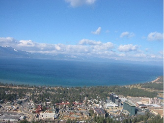
We exited the park on the north side, then drove down the west side, back to I-10. By this time, it was late in the day and the sun was sinking low in the horizon. Sun glare was a real pain in the neck for about 20 minutes. Then, with the sun behind the mountains, we emerged at I-10 near Palm Springs and the windmills. The windmills impressed my passengers quite a bit. I was more impressed by the high-rise casino hotel that had sprung up between Palm Springs and Banning.

We took I-10 to 60 to 91 to the 605. My companions were introduced to Los Angeles area traffic, which was as bad as usual. We wound up on the Pacific Coast Highway near Long Beach and, after driving through a few bad neighborhoods, made our way to downtown Long Beach. The Renaissance Hotel there looked very inviting after so many hours of driving and traffic, so we pulled in and got two rooms. Then, after a quick meal at the brewery across the street, we turned in for the night.

I was exhausted, but not too exhausted to sleep past 3 AM local time. I spent two hours lying in the dark, trying to get back to sleep, before my roommate, Laura, woke up. Then I busied myself with the previous day’s USA Today while I lounged in bed. Laura and I went down for breakfast an hour before my brother and his wife were due to appear. By the time we were eating, I’d already been awake five hours.

FishWe checked out, stowed our luggage in the car, and walked down to the Aquarium of the Pacific, which was just opening for the day at 9 AM. I’m rather fond of fish — I have a 55-gallon fish tank in my living room — and I think aquariums are very interesting. But this one went beyond that. The highlights: the jellyfish displays, the shark-petting tanks, and the lorikeet feeding aviary. We spent two hours there and enjoyed every minute of it.

After a brief stop at the Queen Mary — which I personally don’t think is worth $20+ to tour — we hit the road for Torrance. Our tour was set for 1 PM. We arrived 20 minutes early and Milly Donahue, who is in charge of dealer/factory relations, met us in the lobby. She took us for a quick walk-through both factory buildings. Robinson Helicopter Company has owned a 360,000 square foot factory on the southwest corner of Torrance Airport for quite some time now. This year, they added a 315,000 square foot building right beside it. They moved the machining equipment from the old building to the new building and bought a bunch of new machining equipment to help fill the space — and to help them fill orders for helicopters. Robinson makes almost every single part in the helicopter (other than the engine, which is Lycoming) and they’re all made on the premises. My personal highlight for the walk-through came only moments after stepping out onto the factory floor. The helicopters are built on a series of assembly lines. The serial number for each helicopter is plainly written on the back wall of the cabin. 10603, which is my helicopter’s serial number, was the second R44 cabin frame I laid eyes on. I was actually looking at my helicopter before it hit the assembly line!Milly let my companions take my picture standing beside what was essentially Zero-Mike-Lima’s skeleton. Then we did the walk-through, returning to the lobby just before 1 PM.

The tour, which was led by Milly’s assistant, Vanessa, was more comprehensive, although it didn’t go into the new factory building. We were accompanied by four Asian men, of which only one spoke English, and a man who turned out to be from Prescott, AZ, who was thinking of buying a helicopter. Vanessa led us around the factory, stopping to explain many of the assembly areas. That’s when I realized that the assembly line had shifted up one space, leaving an empty space at the end. The last helicopter on the line was 10602. We walked around the factory and into the finishing area. We also stepped into the old delivery room, which was being used by a maintenance class to work on helicopters. Ed Taylor, my mechanic, was there, working on the cyclic control for an R44 with two other mechanics. I stopped and said hello, then left him alone to learn. When the tour was over, we passed by the end of the assembly line again. The last spot wasn’t empty anymore. What would be N630ML was sitting in its place on the line.

N630ML Under ConstructionI ask you: what are the chances of visiting a factory the very day that the item you’ve purchased goes onto the assembly line?

We climbed back into the Honda, feeling good about the tour. After a quick stop at a fast food place (can’t remember the name of the place, but its logo has a smiling star), we hit the highways (and traffic) for the ride home. It was about 2:40 PM. Los Angeles has the worst traffic in the world. It took us a good two hours to clear it. We stopped at the new casino between Banning and Palm Springs for a bathroom break and gas. Norb drove the rest of the way home. We got home at 9:15 PM local time and went right to sleep, exhausted.

Arizona Strip Trip – Intro

About the trip I planned on the Arizona Strip.

I’d been planning the trip for weeks. I had a week off from work in the middle of September. The same week that the aspen trees on the north rim should be turning color. And that Rod Carr would be at Bar 10 Ranch on the west side of the North Rim. I’d finally make a trip up there to see the roads I flew over every day from the ground. And take Mike to see Bar 10, which is one of my favorite get-away-from-it-all places.

The plan was loosely set up as follows:
Day 1: Tusayan to Page, with stops in the Navajo Reservation and Antelope Canyon.
Day 2: Page to North Rim or Jacob Lake, with unpaved road excursions into the forest and stops at Point Imperial and the North Rim.
Day 3: North Rim or Jacob Lake to Bar 10, with stops at Point Sublime and Toroweap.
Day 4: Bar 10, with short trips to the rim and other points of interest.
Day 5: Bar 10 to someplace on Lake Mead.
Day 6: Lake Mead to Wickenburg (for a day of rest before back to work) or Tusayan (to pick up Mike’s truck).

But things don’t always come off the way you plan them and this trip was like that.

Dripping Springs

Mike and I search for one of my in-flight landmarks and almost find it.

I got Sunday off.

It was a weird thing. I showed up for work and discovered I was the fifth of five spare pilots. And because maintenance had a bit of a backlog, there were only seven helicopters flying. There was no way in hell that I would fly that day. So I asked for the day off. After all, why should Papillon pay me to sit around and do nothing? And why should I waste the day in the pilot break room, watching the crap the guys usually watch on television, when I could be doing something with Mike?

Mike had come for the weekend and although he planned to spend the day horseback riding and cleaning mouse debris out of the trailer, my day off changed his plans. We went into the park for breakfast at El Tovar, visited the new Visitor Information Plaza, and decided to search out Dripping Springs.

Dripping Springs is one of my in-flight landmarks on my return from a North Canyon or Imperial Tour. I fly south across the Grand Canyon, toward Whites Butte, up the right side of Travertine Canyon. There’s an odd-looking meadow there, formed by a forest fire years ago. Dripping Springs. Nearby is a nice view of the canyon with plenty of roads.

We bought two maps that, when used together, provided enough information to get us started. Leaving the park, we made a right at the Moqui Lodge, which is closed for renovations. We followed that improved dirt road west for a few miles, making a right near the railroad tracks. We followed the tracks, then crossed them. Then made a left at a closed-off picnic area and followed a narrow dirt road west southwest into the forest.

Things got sketchy for a while. We wound up at a locked gate near a clearing. The place looked familiar. Mike and I climbed the fence and walked into the clearing. It was the ponds! Another one of my landmarks. After Dripping Springs, I turn left and follow the boundary road until it turns left, then head for the sewer ponds. Here were the ponds. It was weird to see them from the ground.

We backtracked and made a turn we’d missed. Suddenly, the boundary road was before us, with a sign that said, “No vehicular traffic. Foot traffic only.” Not what I wanted to see.

But there was another road on one of the maps, a road that paralleled this one. We found it easily. And Mike began driving on a road that was almost too narrow for his truck.

The road wound through the forest, sometimes barely wide enough for us to pass, especially on tight turns. The surface was rugged and, more than once, Mike had to shift into 4WD. We reached Horse Thieves Tank, where the road on the map ended and a trail began. According to the map, the trail crossed the boundary road, where it turned into a road again. Mike stopped the truck and we got out to scout ahead. It was very narrow in a few spots, but opened up suddenly. From that point forward, it was easy. And there was the intersection I’d seen on the map, less than a half mile away.

We went back to get the truck and drove carefully to that point. Then we joined up with the boundary road. There was no sign there. We continued west.

The map showed a road leading off to the right. The road would go to Dripping Springs Trail. We followed the boundary road, but couldn’t find a turnoff. It wasn’t until we realized that we’d gone too far and were on our way back that we found it. The road had been blocked off by logs, turned into a trail. We parked at the trailhead while helicopters flew over us.

We were getting close.

Photo

We got out, grabbed our picnic lunch and water bottles, and started hiking. If the map were right, it would be about a mile to Dripping Springs. We followed the trail, keeping to the right when it forked. It was relatively flat and very quiet — except for the helicopters flying over to the west of us. Suddenly, we came upon a wooden structure made of logs that had been arranged vertically in a circle. Mike and I explored it a bit and guessed that it had been a corral. But it was old — there were small trees and cacti growing inside it. It had obviously been abandoned a long time ago. Near the end of the old road, we found an old corral made of logs dug into the dirt.

The road ended shortly after that, turning into a narrow trail that began a descent. But we weren’t near the big clearing I knew as Dripping Springs. And we weren’t near the canyon rim. It was very disappointing. Here I am, at the end of the road. No Dripping Springs here.

At Dripping Springs

While I settled down in the shade and unpacked our lunches, Mike explored a bit down the path. He returned a short while later and reported that the trail started down a hill and crossed a little wash. He thought the springs might have been up the wash, but everything was dry. He didn’t seem too enthusiastic about continuing down that way. So we had lunch in the shade, listening to the helicopters pass by to the west of us every now and then.

We hiked back a while later. The hike back seemed shorter — it always does. Mike drove back on the boundary road — there was no sign about foot traffic in that direction and we weren’t prepared to do the other road again. When we hit pavement, we stopped for beverages in Tusayan, then headed back to the trailer.

The next day, I flew over the area again. I realized that we parked the truck in the clearing I know as “Hermits” when doing my first position report to Grand Canyon Tower. As I flew over the area again and again, I clearly saw a good portion of the road-turned-trail that we’d hiked down. But I still haven’t been able to see the corral or the end of the road.

But I’m not done with Dripping Springs. I’ll find it one of these days.

Grand Canyon Airport Tower

I make a visit to the FAA tower without any loss of life.

Grand Canyon Airport has two control towers. (Well, three, if you count the vacant one.)

One is at Papillon’s heliport. Attached to the building and accessible by its own staircase, it rises four stories above the heliport. It’s a small, simple room with enough space for two “controllers” and two or three visitors. New pilots are encouraged to visit the tower, to get a good idea of how traffic is controlled by Papillon’s tower staff. It’s amazing, really. Not only do the tower folks keep track of all us pilots as we’re flying in and out of the airport, but they manage aircraft loading, arrange flight (and break) schedules, and open and close flight plans with Prescott Flight Service Station. It’s safe to say that Papillon’s tower is the nerve center for the whole operation.

The other tower is the big, FAA tower. It’s an impressive structure, brand new and very tall. I’ve seen lot of control towers, both as a pilot and as a passenger on an airline, and this tower ranks high in the tower hierarchy. It’s at least as big as the one in Phoenix and possibly as tall, a slim white structure with a glassed-in octagon on top.

(The old, vacant tower is one of those four-story structures that were built on many Class Delta airports. Chandler has one just like it. I’ve been in Chandler’s tower and it wasn’t much more impressive than Papillon’s. Grand Canyon Tower’s staff moved out of that building to the new one a few years ago. Now they look at it across the runway and remember the roaches that infested it.)

I’d been wanting to visit the “big tower” — as I call it — for a while. Since starting at Papillon a month ago, I’ve spent at least three hours in Papillon’s tower. I go up there when I’m not schedule to fly so I can watch the wind readings and listen to the other pilots coming and going. But the big tower was different. It was the official air traffic control center for the airport, the final word, authorized by the FAA. And it was so impressive looking from the outside. What was it like inside?

Today, I finished flying early. Most of us did, in fact — the afternoon was pretty dead. Although Papillon doesn’t like to let pilots go home early, I figured I’d ask if I could visit the big tower. After all, I could be back in minutes; all it took was a call. Permission granted from Papillon’s powers-that-be, I called the big tower to see if I could visit.

After 9/11, tower security is generally very tight. In fact, I seriously doubt whether just anyone could get in. But I introduced myself by name and told them I was a Papillon pilot. I asked if I could visit, but only if they weren’t too busy. Gary, the guy on duty, put me on hold, then came back and said yes. “Drive up to the gate and we’ll buzz you in,” he advised me.

I was out in the Jeep in a flash, zipping out of Papillon’s parking lot and driving past the terminal building. I went straight where signs advised that “All Traffic Must Turn Left” and passed a sign that said “FAA Control Tower. Authorized Vehicles Only.” Gary had authorized me. The road turned to gravel and I continued along it. Then, through the trees, I could see the tower before me, looming up out of the forest. I noticed for the first time that a low building was attached to it. And the whole thing was surrounded by a very serious looking fence with a electric gate.

A sign on the fence said something like “FAA Control Tower. Accidents or loss of life can result from loss of operations.” Something like that. I can’t remember exactly, but I do remember the phrase “loss of life.” I started wondering if my visit could distract the controllers enough to result in loss of life. I hoped not.

There were three boxes on the driver’s side of the entryway before the gate. One was a mystery box; I have no clue what it was for. Another had a camera that looked right at me, kind of like the robot in Short Circuit. The other was a speaking box with a button on it. I pushed the button and waited. Nothing happened.

I started thinking about making radio calls to the tower that weren’t answered. You know, “Copter 28 would like a Southwest departure with Zulu” followed by a lot of silence. The tower just not noticing your call. You hesitating to repeat it, not wanting to piss off the controller, who had probably heard you but was chewing his lunch or swallowing a mouthful of coffee.

I hesitated, then began to wonder whether the button was more like a mike button. I pushed it again and said, “Hello?”

The gate began to open. I waited until it was open enough for my Jeep to squeeze through, then drove through. I waited on the other side. That’s something you’re supposed to do at those kinds of gates. So that other cars didn’t piggyback in with you. It didn’t matter that I’d just driven a half mile down a dirt road and there was no one behind me. The controller could be watching from up above. And then, the next time I needed a clearance, he’d make me wait, even if he wasn’t having lunch or coffee.

I moved on when the gate closed. I noticed that there was a similar arrangement of boxes at the exit gate and wondered whether that was so that they could lock people in. I reminded myself to be on my best behavior as I drove up the concrete drive to the base of the tower.

The parking lot was paved in concrete and had at least ten parking spots. There was one car there. I parked next to it and got out.

I passed a bicycle leaning up against the side of the building as I walked to the front door. I guess you don’t have to worry about getting your bike stolen when you have a security fence with barbed wire and cameras around your place of business.

At the door was another voice box. I tried the door and found it locked. Then I pushed the button on the voice box. Nothing happened. I wondered again whether the button was a mike button, but before I could try my greeting, the door opened from the inside. Danni, one of the controllers, was there to greet me.

I’d met Danni at breakfast one morning about three weeks before. I’d gotten to Tusayan a half hour early and decided to check out the local Internet café to see if they had a wireless network I could tap into. (They didn’t.) As I ordered my latte, I noticed Marty, who’d been one of my flight instructors in Long Beach, sitting at a table with a woman. Marty had taken a job with Papillon the previous year and had come back for the season. Danni was his friend from the tower.

Danni is a really nice person. The first time she hears your voice on the radio in the morning, she says, “Good morning!” and expects a suitable response. And the last flight of the day will always get a “Have a good night!” Not very FAAish, but very nice. Kind of reminds me that we’re all in it together. We’re tourist babysitters. She helps us with our tourists while dealing with the occasionally Sunday pilot’s adventure of landing at GCN.

Danni gave me a tour of the low building. Lot of office space, a full kitchen, and equipment rooms. Everything brand spanking new and totally underutilized. We rode the elevator up to a floor marked 6 (the elevator can stop at 1, 2, and 6; there are no other numbers), then took a flight of stairs to the top level.

Ever wonder why you can’t take an elevator to the top floor in a control tower? It’s because the elevator shaft would block the view. A control tower is a big open room with windows on all sides. And this one had the best view of the Grand Canyon airport area. You could see for miles in every direction.

The room was surrounded with counter space. There were at least ten chairs, but only one had an occupant. Gary sat in the corner, in front of a laptop. A telephone receiver lay on the counter beside him. It turns out that the telephone receiver was actually a microphone, with a push to talk button between the earpiece and mouthpiece. It was on a very long curly cord, and as we chatted, he carried it around with him, talking into it now and then with his ATC voice.

Danni showed me around. I saw the radar screen, which tends to pick up ghost echoes and isn’t certified for use, but showed several aircraft in the area. I saw the wind reporting screen, which showed different winds for each of the three wind measuring locations on the airport, along with an average wind. The average was necessary because all three readings were different. I saw all kinds of screens that we didn’t really talk much about. I saw a device that printed out strips of paper with NOTAM and flight plan information on them. Danni showed me one for an incoming pilot’s flight plan. We looked at the time the pilot was expected in and realized he was due soon. He called in, got clearance, and landed during my visit.

My technical visit turned into a social call before I could stop it. Gary grew up in Wickenburg and wanted to know if I knew the people he’d grown up with. I didn’t. I’ve only been in Wickenburg since 1997; he left town in the early 80s. But that didn’t stop him from naming everyone he knew and making me come up with names of people I knew. Before long, my planned 15-minute visit to the tower had turned into 30 minutes. I told them I had to go.

Danni escorted me downstairs and outside. She told me to visit again. I promised I would.

Placerville, CA to Wickenburg, AZ – Day 1

Foiled by wind…again.

After sorting out my insurance problems (which required Mike to FedEx a check to the Bahamas) and spending a few pleasant days with Liz and Rod, it was time to head home. It was Friday, November 21 and I’d been away from home for four nights.

The weather was a mystery for quite a while. I used my laptop to connect to the Internet and check weather and flight planning info via Duats. The forecast called for clear skies and light winds. There was some mention of a storm coming in from the northwest later that afternoon, but I was pretty sure I could beat it out. So things looked good, at first. Of course, I did check all this at 5 AM, before it got light. When it got light, I found that the clouds were so low, we were in fog. Not a good thing.

Liz’s house is at 4800 feet. The airport is at 3600 feet. That meant that I’d have to fly through a layer of fog to climb above it. Not an option.

I said goodbye to Rod and he left for work at 6:30. I told Liz I wanted to be at the airport to fuel up and preflight by 8 AM. She got me there just as I requested. Three-Niner-Lima was completely covered with…well, I guess it must have been dew. But it was the dewiest dew I’d ever seen. It took six shop towels (you know, the blue paper ones on a roll?) to get the bubble dry. At least I’d been smart enough to leave the door vents closed so I didn’t have to dry the inside, too. And, of course, fog drifted across the runway as I worked. The mountains were completely obscured. Things didn’t look promising.

I fueled up anyway. We waited around the terminal for a while. I’d already decided that if I couldn’t leave by 9:30, I’d stay. I think Liz was hoping I’d stay. She talked me into going down into town to pick up a muffin for breakfast. That killed about 20 minutes. It was 9:30 when we got back. I called the flight service station (FSS) and the briefer told me he didn’t see any clouds at all. According to him, he could see snow covered mountains in our area on the satellite images. The fog broke up enough for me to give it a try. I said goodbye to Liz, started up Three-Niner-Lima, warmed it up, and took off.

I was glad I did. The fog was definitely burning off and most of it was below me. Once I got up a few hundred feet, I could clearly see the snowcapped Sierras. My route would take me along Route 50, through Echo Pass, where I would descend down into the Lake Tahoe area. Once I realized that I’d be able to give it a good shot, I found Route 50 and followed it closely, keeping about 500 feet off the road.

Liz and I had driven the road the day before, so I knew what to expect. Although I missed Bridal Veil Falls (I must have flown right over it), I did see Horsetail Falls. I also saw where a landslide had taken a huge chunk out of the mountain years before. I followed the road and the creek alongside it. I was surprised to see some kind of narrow canal running along the edge of the mountains on my right — I still need to check a map to see what that was.

All the time I flew, I climbed, getting higher and higher. I don’t remember what the elevation of Echo Pass is — I don’t have my charts in front of me right now — but it must have been about 7500 feet. Really not that high. Unfortunately, the clouds weren’t that high either. There were puffy clouds, like the fog down in Placerville, and they drifted about 100-200 feet above me. Going higher was not an option. Fortunately, I was high enough and the path in front of me was clear enough that I didn’t have to worry about terrain. And I was moving along at a good clip; with a 10-20 knot tailwind, my ground speed was about 100 knots.

For a few minutes as I neared the pass, things got a little tense. The clouds were close, the canyon was narrow. But then the canyon opened up to the valley beyond. The road veered off to the left, where it hugged the cliff for part of the way down. I could see Lake Tahoe airport ahead of me and, to my right, more of the Sierras. I started my descent to the Lake Tahoe area, a drop of about 2000 feet.

Photo
This photo taken just beyond Echo Pass, from the road the day before I flew though. Lake Tahoe Airport is dead center and you can see the lake beyond it, to the left.

Photo
Another photo taken just beyond Echo Pass, this time through my helicopter window as I cleared the pass.

I called in to Lake Tahoe Airport, requesting permission to transition to the east over the airport. Nothing was going on. The controller told me to proceed as requested. I crossed about 500 feet above the airport, to the south. I was quickly approaching the casinos of Stateline, NV. Liz and I had had lunch at Harrah’s the day before. The wind was howling that day, making it tough to walk across the parking lot. That morning, as I flew just south of the Casinos, the wind was calmer. Lake Tahoe tower called me again, asking where I was. I told him and he told me to have a nice flight.

Photo
South Lake Tahoe, CA and Stateline, NV. The two towns sit side by side. The highrises on the right are the casinos in Stateline; the green one is Harrah’s where we had lunch the day before.

I punched my next waypoint — Alpine, CA — into the GPS, then had to figure out the best way to get there. In all honesty, I didn’t want to go there. I wanted to go to the east of that point. I wanted to follow another highway, 395. But I wasn’t sure which of the roads leaving Lake Tahoe was the right road. And I didn’t want to go north, out of my way. I finally found a promising looking pass and headed for it, climbing with the terrain. There was a town there — I don’t know what it’s called — that has great views of the lake. As I flew over the lowest point, I saw another broad valley open up far below me. It had to be at least 3,000 feet down. I started my descent.

And that’s when the turbulence started. Gusts of wind slammed my ship repeatedly, knocking it all over the sky. Although I’d pushed the collective almost all the way to the floor to descend, at times I was climbing, carried up by updrafts. Three-Niner-Lima shook and rocked. For the first time in a long time, I felt a tang of fear. All I wanted was to descend to the valley floor. But the updrafts were making things very difficult. And against the huge backdrop of the Sierra Nevada Mountains, I felt like a tiny speck, an insignificant fly almost invisible to the world. It was scary.

It took about 10 minutes, but I eventually cleared the mountains and reached my cruise altitude of about 500 feet AGL. The turbulence were still with me, but greatly decreased. I continued on my way, feeling the fear subside.

After a few moments of confusion, I finally found the road I’d planned to follow. It would take me south, through a number of valleys along the east side of the Sierras. The view was stunning, with snowcapped peaks to my right and, in some cases, more to my left. I followed the road over small towns, through small mountain passes, past lakes, like Mono Lake. For the most part, I flew at about 7000 feet, but in some instances, I had to climb to 8000 or more.

Photo
Mono Lake, in the distance. I took this shot through the front of the bubble as I was flying; you can see my reflection (white shirt, black scarf).

Unfortunately, I couldn’t fully appreciate the view. The wind had kicked up and it was kicking me around. I don’t think I had more than 5 consecutive minutes of calm air at any one time. The turbulence definitely reached “moderate” levels. Although that doesn’t sound bad, believe me, it is. I was bobbing around like a cork on the ocean in a North Atlantic storm. I was having trouble keeping Three-Niner-Lima pointed in the right direction. I was starting to get airsick again. And I was not having fun.(And although I didn’t know it at the time, my Hobbs meter, which tracks engine running time, quit during this leg of my journey. I guess something got loose with all the shaking. I didn’t realize the Hobbs was dead until I got home, although the 1.3 hours it registered from Placerville certainly seemed low.)

Every time I reached one of my waypoints, I’d look down and see that there was nothing there for me. The airports I passed over were nothing more than paved strips. Some didn’t even have buildings. I didn’t bother making any radio calls; I would have been talking to myself. And the towns were never near the airports. They were always several miles away and very discouraging. I didn’t want to spend the night at another Rosamond.

So I’d set my GPS for the next waypoint and hope there was something better there. There wasn’t. But by the time I reached Mammoth, CA, I’d had enough. Mammoth, at least, had fuel. Supposedly, it had a restaurant. It would be a good place to take a rest.

Mammoth also had an AWOS. The recording reported winds of 18 gusting to 34 knots. Right across the runway. Nice. Good thing my wings weren’t bolted on. I made my radio call, then flew over the airport, planning a right crosswind toward the runway. I didn’t notice the hill in my path until it was close; I switched to the other side of the runway to make a left crosswind. My crosswind turn was more like a 180, so I was heading back the way I’d come. And that’s when I saw it: the storm that had been on my tail for the past hour and a half. All I could see was bright gray clouds and blowing snow. It didn’t look good.

I did my best to land along the taxiway. By that time, a golf cart had driven out to the ramp area. I used the radio to ask where I should park. He said something about a box that I didn’t see. The wind was making hover-taxiing very difficult. I had to move sideways, keeping my nose into the wind. I parked on a T-spot not far from the golf cart and told the driver it would take me a few minutes to cool down and shut down. Three-Niner-Lima was ready for shutdown in less than a minute. The outside air temperature was about 40Ôø? and the wind was howling.

The golf cart guy told me he was surprised to hear me coming in. He reported that a twin had tried twice to land and had given up and gone to Bishop (30 miles south) instead.

The golf cart guy took me to the terminal, which was beautifully appointed and warm. Two women sat at a desk. I hit the ladies room, then went to them for help. It was obvious that I wouldn’t be going any further that day. They helped me find a room at the Holiday Inn in town (7 miles away) and told me they’d call a taxi for me. They also told me that they were expecting snow that night and that there could be a lot of it. I asked about hangars and was told that they had one. A few minutes later, the two line men and I were dragging my helicopter across the ramp, tied to the back of a golf cart. I was never so glad that I’d brought along my ground handling wheels. When Three-Niner-Lima was tucked in for the night, I took my luggage back to the terminal and waited for a cab. It was about 1 PM local time.

The taxi driver took me to town, chatting the whole time. He recommended the restaurant across the street from the hotel. he saw me inside and drove away.

I got a room on the second floor at the front of the hotel, with a great view of the parking lot, a gas station, and Mammoth Mountain. But I couldn’t see much of the mountain because of the descending clouds. I relaxed for a while in my room, then went out to get lunch. It was cold outside, mostly because of the wind chill. I ate at a place across the street (not the one the taxi driver recommended), then went in search of warm clothes. Although I had my leather bomber jacket with me, I was wearing lace-up keds and didn’t have a hat or gloves. There was a row of “outlet” shops nearby and I hit a few stores, where I bought socks. (I’d buy winter shoes there the following day.) I then went to a ski outfitter shop where I picked up fleece headband, gloves, and a turtleneck. (For some idiotic reason, I’d left my scarf in the helicopter.)I spent the rest of the day back in my motel room, watching television. It wasn’t Rosamond, but I was beginning to wish I was home already.