On Saying Yes When You Want to Say No

Never turn down an opportunity to hang out with new friends.


Here’s a time-lapse on YouTube of moving the helicopter. I didn’t realize at first that I had blogged about it.

The other day, I was invited to a steak dinner at what I call the Huey Camp: the area where three Huey helicopters are parked for cherry season. I met one of the pilots, Stan, late last season when I brought him and the other pilot a pizza after chatting with him on the radio while we were all drying cherries. Later, he let me fly his helicopter and I returned the favor by helping him load the helicopter onto its trailer while it was attached to my truck.

Huey Behind Truck
As I tweeted when I shared this photo on Twitter, I think that helicopter looks pretty good behind my truck.

I ran into him again in Arizona over the winter and was glad to hear he was coming back to Washington for cherry season, camping in his motorhome at the same place. He and another one of the Huey pilots came for my annual pilots’ BBQ a few weeks ago. So when he invited me for a steak dinner with all the Huey pilots and some others in attendance, I said yes.

Thinking of Excuses

Of course, when that afternoon rolled around, I wasn’t feeling like going out. The heat really knocks me out sometimes and I’d spent the afternoon napping after doing too much work in my garden. It was hot outside in the sun and I didn’t think there would be much shade up at his camp. I thought about all the excuses I could use to back out.

Falconer
It was dark out when I captured this image of a falconer with one of her birds last August.

But then I thought about the previous year’s steak dinner up there. (I apparently didn’t blog about it because a quick search came up empty.) In any case, it was one of those magic evenings when things are just a little bit weird and a little bit wonderful. One of those evenings you remember for a long time, mostly because they’re out of the ordinary. That one involved a frantic trip to a car parts shop with a woman I’d met just an hour before, arriving just before they closed to get a part she needed for her truck. Then repairs on the truck with steaks coming off the grill after 10 PM. It was after that that I learned the woman was a falconer and I got a really neat shot of her with one of her birds.

That night might be just as interesting, I told myself. Or more. You can’t experience new things when you stay home. Get the hell out.

At Huey Camp

So I showered and dressed and hopped in the truck for the 20 minute drive up to Huey Camp. I left my pups behind — I didn’t want to have to worry about them wandering off into the weeds where there might be snakes. The only reason I took the truck was because it was the only one of my three vehicles with a top — I keep the top down all the time on the Honda and the Jeep was in the process of getting a new roof — so it had the best air conditioning.

Huey camp is situated between two ponds that are linked by a waterway when the water levels are full. Two Hueys were parked on one side and the third was parked some distance away. Stan’s motorhome and dune buggy were parked between them, near one of the ponds. He’d positioned it so the side we’d sit on was in the shade of the big rig. The helicopter’s truck (with crane) and trailer were parked nearby, along with all kinds of orchard equipment. The spot is on a flat area on a hillside, surrounded by apple and cherry orchards, including one I’m contracted to dry. It had an excellent view of the sky, which came in handy later on.

Huey Camp
Huey Camp from across one pond.

Huey Camp
Two of the helicopters at Huey Camp.

We settled into chairs in the shade to chat while Stan prepped his portable BBQ grill. Stan, Brandon, and Dave were the Huey pilots. Brandon’s friend Emma, who is a new helicopter pilot, was also there. (I’d invited both of the pilots still working for me this season, but one had taken his paraglider to Spokane (!) again and the other was taking a motorcycle training course out at the airport.) Later, CJ (a JetRanger pilot) and Isaac (a falconer) joined us.

It turned out that we knew a lot of the same people and helicopters. Brandon had flown my helicopter when he was training at Quantum in Arizona, although he claims it was a different color. He’d also flown my friend Ed’s old S55 with the turbine conversion, which was now based up in Brewster on cherry work. One of the Hueys had actually been flown in Vietnam by a local guy who had come up to visit it all these years later.

Isaac had to do some work in two of the orchards and invited us to come watch. Some cherry growers use falconers to help chase birds away from their orchards. By repeatedly flying the falcons (or hawks, etc.) over the orchard blocks, birds like robins, which like to eat cherries, become convinced that a predator has moved in and they leave. That’s the idea, anyway.

Issac with Bird
Here’s Issac with one of his birds after the bird flew in the orchard. Hooding the bird is common and does not hurt the bird.

We all loaded into my truck and followed Isaac to his first worksite, which turned out to be very close. We watched him get a bird out and attach a GPS tracker to it (just in case the bird decided it wanted an extended break). Soon he’d removed the bird’s hood and it was flying over the cherry trees. Isaac had a long pole with a string and bait attached to it and swung the bait around. The goal was to get the bird to dive at the bait but not let him get it. He did this from a few locations alongside the orchard block before the bird “won” — it caught the bait. That cut that bird’s session a bit short, but Isaac had another bird with him and moved on to the next orchard. We went back to camp, mostly because Dave was hungry and I think Brandon and Emma were bored.

Stan started cooking right after that. He’d bought a rib roast and had carved it up into enormous bone-in steaks. I’d brought along my little grill and some uncooked marinated tri-tip that someone had left at my house at the BBQ and I’d frozen. I got that going and it was a good thing I did because Stan didn’t have enough room on his grill for all of the steaks so one ended up on mine. A while later, the sun was setting and we were eating steak — with horseradish, of course — potato salad, and salad off paper plates. Isaac was back by then and he joined us; I wound up giving him half the trip-tip for later in the week because there was enough regular steak for all of us.

Stargazing

After dinner, we moved over to a spot where we could see the sky to the northwest more clearly. Comet NEOWISE was a feature in the sky after sunset and I think we were all vying to be the first to spot it. One of the younger people saw it first — Brandon, I think — and over time we all saw it. The view from up there didn’t include the lights from the city, but it did include the glow from sunset.

We all started watching the sky, pointing out stars that flickered weirdly or seemed to change color. I saw a fast moving white light pass by and consulted the GoISSWatch app on my phone — sure enough, it was the space station. When I pointed it out, some of my companions were blown away. “You mean that’s the actual space station in orbit?” Dave asked. I told him it was and that there would be an even better pass just before 11 PM, right overhead.

That got us looking for satellites. Again, the younger folks with their sharper eyes spotted them quickly. Brandon got excited when he realized that he was seeing a bunch in a row. Believe it or not, I had an app for that, too: Find Starlink. Sure enough, we were seeing a Starlink satellite train that was passing overhead. I’d tried before to see one and failed miserably — now I know why: they really aren’t that bright at all.

We spent the next hour or so just watching the sky and talking. It was relaxing and kind of interesting. Our ages ranged from early 20s (Emma) through possibly 70s (Stan and Dave?). We talked about things we knew and told stories about experiences. No one had their head buried in a phone. No one argued. There was a lot of laughter. Politics stayed pretty much out of our discussions.

At 10:56, right on schedule, one of my companions spotted the space station again. We watched it travel across the sky, right overhead. I thought about the people on board and how tiny they were but how many people on earth watched them go by whenever they could. When it was gone, I decided it was time to leave. It had been a pretty good night for stargazing: a comet, two ISS passes, a Starlink train, and did I mention seeing Jupiter and Saturn in the southeastern sky?

Finishing Up the Night

It was a quick drive home. I left my truck on the driveway apron instead of putting it in the garage, mostly because I knew I’d need to drive it again the next morning on a garbage run. I let my pups out and my cats came over from wherever they were hunting to say hello. It was nearly midnight when I climbed the stairs.

But I wasn’t done. Outside, Comet NEOWISE was hanging in the sky near the lights of Wenatchee. I set up my Nikon and took a few shots with various settings, pausing now and then to study it through my binoculars and wonder what it would look like through my telescope.

NEOWISE
Comet NEOWISE with the Wenatchee night skyline.

I was asleep by 1 AM.

Postscript

I love living alone for the privacy and freedom that it gives me. I don’t get lonely because I stay busy. Sometimes, I’m so busy that I forget to get out and socialize when I should.

But one thing I’ve come to realize: any time I’m at a gathering with friends is time well spent, especially when the friends have unusual lifestyles that involve travel and unique jobs. The other day, I had dinner with five other helicopter pilots and a falconer. How can a gathering like that not be full of fun, interesting stories and experiences?

I have a friend I call “the man of a thousand excuses” because he’s far more likely to say NO when he’s invited to do something different than YES. I don’t think he has any idea of what he’s missing.

I have an idea of what I could be missing, so I try to say YES whenever I can.

Another Waste of Taxpayer Money

I knew the FAA was slow, but this is ridiculous.

I’m terrible about opening my mail. I routinely fetch it from my mailbox (which is two miles from my home) and leave it on the dashboard of whatever vehicle I’m driving. Or toss it behind the seat. Or bring it inside, but leave it in my “inbox” pile. No matter where it enters my life, it sits there for a long time. Truth be told, there’s a six-month period in early 2014 when I just stuffed it all in a box and lost it in my garage. (I honestly think there’s a black hole in there.)

This time of year, when I’m actually expecting checks, I pay a little closer attention to what comes in the mail. That’s why I noticed the letter from the FAA and opened it within two weeks of receipt. (Heck, I knew the FAA wasn’t sending a check, so why rush?)

Inside was the letter dated 5/19/2017 that you can see below.

FAA Letter
So the FAA basically waited 17 years to give me an opportunity to opt out of releasing my address to the public.

It basically says that back on April 5, 2000 (not a typo), Congress and the President — Bush 43, I guess — enacted a law that required the FAA to make pilot addresses available to the public. Fortunately, I can opt-out of this invasion of my privacy by signing the letter and sending it back to the FAA.

But I have to hurry! Even though it took them 17 years to send me this letter, I only have 90 days to respond.

Can you believe this crap?

My first thought was what a waste of taxpayer money this is. Wikipedia reports that there were 590,039 certificated pilots in the United States as of 2015 year-end. That means the FAA had to print and mail 590,039 letters just like the one I got.

Maybe that’s why it took so long? Maybe they just got up to the Ls?

So the FAA has blown through 1181 reams of paper and a similar number of boxes of envelopes. Even if they got bulk rate on mailing all those envelopes, they’ve still spent well over $100,000 on postage. Somebody had to handle the mailing — even if a machine stuffed the envelopes, someone still had to tend to that machine and get them to the post office. How many trips to the Post Office is that? Do they have trucks standing by for mass mailings like this?

So how much money have they pissed away on this so far? A quarter million? More?

And then there’s the processing. I’m not going to the website. I’m going to sign the letter and mail it back. There’s got to be some poor slob in Oklahoma City who’s sitting at a desk just waiting for envelopes with signed letters to come in. He or she has to look up each one in the system and toggle a check box to say we want our addresses kept private. And then what? Do they actually file all that paper? Stick it in filing cabinets? How many filing cabinets do they have? How many rooms does that fill? Do they have buildings filled with filing cabinets of paper?

Paper!

And for what? What gives Congress and the President the right to decide that the public is entitled to the addresses of certificated pilots? What is the benefit of such a rule? Why would they even do this?

And who the hell wouldn’t opt out?

This is stupid from start to end. it’s wallpapered with stupid.

But that’s our tax dollars at work. Imagine how many educational programs the cost of this mailing would have funded. How many Meals on Wheels dinners. How many airport improvements, for Pete’s sake.

Why are the people in Washington so damn stupid with our money?

Phoenix to Sacramento by Helicopter

Another ferry flight with a pilot friend.

[Note: I’ve been working on this post for the past two weeks. Just so busy with other things! Finally got it done today. Better late than never, no? (Cynics need not answer that one.)]

For the fifth February in a row, my company, Flying M Air, has been contracted by an almond grower to provide frost protection for one of his Sacramento-area ranches. Frost protection is one of the lesser-known services a helicopter pilot can provide. We basically fly low-level up and down rows of trees to pull warm air from a thermal inversion down into the tree branches where developing crops — in this case, almonds — are growing. Almonds are susceptible to frost damage for a 4 to 8 week period starting around the time that flowers are pollinated. Because the temperatures are most likely to be lowest at night, most of the flying is done then or, more likely, right around dawn.

Before the Trip

My helicopter had been in Chandler, AZ (near Phoenix) since October when I dropped it off for its 12-year/2200 hour overhaul. Although it technically didn’t need to go in for overhaul until January 2017, I needed it done by mid-February for this work. The overhaul, which I blogged about here, takes a minimum of three months to complete, so I made sure the excellent maintenance crew at Quantum Helicopters got an early start. I don’t fly much in the winter anyway and planned to fill my downtime with some snowbirding, most of which would be in Arizona and southern California. I like snow, but not months of it, and I really do need to be in the sun in the winter time. I’ve structured my work life to give me time to go south every winter.

Paul from Overhaul
Director of Maintenance Paul Mansfield pulls my R44 out of the Quantum hangar after its overhaul on February 20, 2017. At that point, I hadn’t flown for four months and I was ready.

I picked up the helicopter on Monday, February 20 and spent much of the week flying it around Arizona with friends: up the Salt River, to Wickenburg, to Bisbee for an overnight trip, and to Sedona for breakfast. Along the way, I got to fly some familiar routes and see some familiar sights: along the red rock formations of Sedona, down the Hassayampa River Canyon, over the Salt River lakes, and over herds of wild horses in the Gila River bed. I needed to put some time on the helicopter to make sure there weren’t any problems before I left the area.

A lot about the helicopter felt or sounded different — and I tell you, you really get to know an aircraft when you’ve put over 2000 hours on it in 12 years. The auxiliary fuel pump sounded different, the blades sounded different, and the engine start up felt different. I immediately noticed that it was running at a higher cylinder head temperature. The guys who worked on it assured me that was normal until the rings on the newly rebuilt engine were set and I took it off mineral oil, which was recommended for the first 50 hours. The belts were also too loose when the clutch was disengaged and needed to be adjusted. And my strobe light, which had been working intermittently when I dropped it off, was now not working more often than it was. These were all minor things and I had them taken care of on Friday afternoon, when I flew it back from Wickenburg to Chandler. While I was there, the head of maintenance offered to do an oil change and, since the oil was getting dirty, I let his crew do it. I suspect the strobe light fix — which required a new part — was the most bothersome of all the fine-tuning work they did. They’d keep it in their hangar overnight.

My Ride
My ride from Chandler to Mesa with Captain Woody at the controls.

While they got to work, my friend Woody picked Penny and me up in Chandler in his company’s newly leased R44 — with air conditioning, that he had turned on, likely to impress me (it worked) — and flew me to Falcon Field in Mesa, where his company is based. For some reason, I decided to live broadcast the flight via Periscope — how often do I get to be a passenger? — and Periscope decided to feature it. Soon 450+ people were watching our progress across the Chandler/Gilbert/Mesa area. By the time we’d landed, over 4,000 people had seen all or part of it. I think Woody got a kick out of that.

Woody, Jan, and Tiffani operate Canyon State Aero, a helicopter flight school that also does tours and aerial photo work. They have a modest fleet of Schweizer 300s, plus the newly added R44 and an R22 that should arrive next week. I hung around the office while they finished up paperwork and other things, occasionally answering their questions about R44s and R22s. I’m hoping to see that R44 again in Washington this summer for cherry drying.

Afterwards, Jan, Tiffani, and I went out for dinner. We tried for seafood and wound up with Chinese food. Back at their house, we talked and drank wine and watched some amazing time-lapse videos of the desert on Netflix while Penny played with their dogs and stared at their cats. I had an allergic reaction to something — likely the cats — and made the mistake of taking two Benadryl. That pretty much knocked me out for the night.

I woke up early (as usual), feeling refreshed and allergy-free. Woody showed up around 7:30 AM. After some coffee and goodbye hugs all around, Woody, Penny, and I hopped into Woody’s Prius and headed back to Chandler. We hoped to be off the ground by 9 AM.

Getting Started

I’d planned the flight via Foreflight, with fuel stops at Twentynine Palms and Porterville, CA. The total time was estimated at about 6-1/2 hours with a slight headwind. It was a variation of a flight I’d done a few times before, starting with a solo R22 flight in the 2003 from my Wickenburg home to Placerville, CA and ending, most recently, with the 2013 trip that took my helicopter out of its Arizona hangar for the last time and brought it to California for its first frost season. This was the first time I’d be doing the route from Chandler and I worried a bit about making it all the way to Twentynine Palms for fuel. There aren’t any fuel options between Blythe and Twentynine Palms, so having almost enough fuel to get there wasn’t an option. But Foreflight and my own personal experience with the helicopter said I could do it, so that’s what I planned.

Planned Route
Our planned route, as shown on the SkyVector website. Good thing we didn’t fly today when I plotted that for illustration here; there’s a 22 knot headwind.

The weather was absolutely perfect for flying. I’d been monitoring various forecasts for points along our route and it all looked good with the possibility of some wind in the Tehachapi area and a slight chance of rain near our destination. Visibility was good. It would be a bit cool — even in the California desert — but the helicopter has good heat if we needed it. I was looking forward to a good, although somewhat long, flight.

Woody would fly. Woody’s an airline pilot nearing retirement. He’s got a bunch of hours in helicopters and recently got his R44 endorsement. Now he was interested in building some time in R44s. We agreed that he’d pay for fuel — which accounts for less than 1/3 of my operating costs — for the whole trip in exchange for stick time. I didn’t need the time — I have about 3500 hours in helicopters (R44, R22, 206L) — and I’d been flying around all week. And I really don’t mind being a passenger once in a while, especially with a good pilot at the controls. Still, I sat in the PIC seat and he sat in the seat beside me, using the dual controls.

Penny, of course, sat in the back. The back of the helicopter was completely full of stuff, including the wheeling toolbox I’d brought along to hold helicopter parts and accessories — think headsets, charts, log books, etc. — while the overhaul crew stripped down the helicopter to its frame, my luggage, Woody’s luggage, Woody’s pilot uniform, a box of Medifast food (long story), and Penny’s travel bag. I’d forgotten to bring along a bed for Penny, so I folded up my cotton sweatshirt and put that on top of the toolbox for her. She perched up there and slept for most of the flight.

Chandler to Twentynine Palms

I took off from Chandler, crossed the runway per the tower’s instructions, and struck out almost due west. As soon as I got to cruising altitude — 500 feet above the ground (AGL), which was 1700 feet above sea level (MSL) — I offered the controls to Woody. He took them and I settled back for the first leg of the flight.

We flew west along the south side of South Mountain, where we saw a flight of four Stearman airplanes. Woody was pretty sure he knew one of the pilots, but since we didn’t know what frequency they were on, we couldn’t raise them on the radio. (We tried 122.85, 122.75, and 123.45, which are common air-to-air frequencies around Phoenix.) I was kind of surprised to see that we were gaining on them and eventually passed them. (Did I mention that my helicopter is now about 10% faster than it was before the overhaul and now cruises easily at 110-115 knots?) We crossed the north end of the Estrella Mountains just south of Phoenix International Raceway (PIR), mostly to avoid having to talk to the tower at Goodyear. We did tune in, though, and that’s how we learned that Luke Approach was closed so we wouldn’t have to talk to them to cross Luke’s Special Air traffic Rule (SATR). Woody wasted no time getting right on course; I’d already dialed my Garmin 430 GPS in to KTNP for Twentynine Palms.

Flight of Four Stearman
Flight of four Stearman planes, in formation.

Captain Woody
Captain Woody flying past some mountains in California near the Colorado River.

There wasn’t much of anything exciting for the next two hours. We crossed over Buckeye Airport as another plane was coming in, flew north of the steaming cooling towers of the Palo Verde Nuclear Power Plant, paralleled I-10 for a while, and then drifted north of it, crossing SR60 just east of where it joined I-10. Then we crossed a little mountain range and entered the Colorado River Valley about halfway between Parker and Blythe. The Colorado River was a ribbon of blue snaking from north to south beneath us. Then we were in the southern reaches of California’s Mohave Desert, crossing a sandy desert landscape that looked as inhospitable as the Sahara but without the tall dunes. Woody kept pretty close to the GPS track, but did detour around the tallest parts of any mountains in our path. Our altitude varied from 300 to 1000 feet AGL, depending on where we were. For a good portion of the flight, we were the only living things in sight.

Rice Valley
There’s a whole lot of nothing in the California desert between Joshua Tree National Park and the Colorado River.

I did a lot of talking, telling Woody about the helipad on top of Harquahala Mountain where I’d landed my R22 years ago and later my R44, and sharing some of the stories of my flights with low-time pilots who had done ferry flights with me over the years. We agreed that most helicopter pilots didn’t get much real-life experience as they built time as flight instructors. He asked me a bunch of questions about my time working for Papillon at the Grand Canyon. I told him about the excellent learning opportunities a season at the Canyon offered, but lamented about the fact that some of my coworkers had been either immature or cocky head cases. We talked a little about pilots we’d known who had died flying. We agreed that it was ironic that so many people said “he was a great pilot” about pilots who had died in crashes; if he was so great, why was he dead? (There are old pilots and bold pilots but no old, bold pilots.)

We flew through the very northernmost edge of Joshua Tree National Forest, along a road there. When the park fell away to the south, the abandoned buildings started up, one after the other. It was as if hundreds of people had made sad little homes on five-acre lots out there, only to abandon them to the desert wind years later. Many of them had completely blown away, leaving only concrete slabs and scattered debris. I remembered this part of the flight very clearly from my other trips through the area and didn’t take any photos this time around. But if you look on a zoomed-in satellite image of 29 Palms Highway east of Twentynine Palms, you’ll see what I’m talking about. It’s kind of eerie.

East of 29Palms
A satellite image from Google of an area east of Twentynine Palms shows a sample of the scores of abandoned or wrecked buildings out in the desert.

We reached the airport in just over two hours — which is about 15 minutes quicker than I’d planned for. (All my flight plans are for 100 knots airspeed; I’d rather over-estimate time than underestimate it, especially when flying out in the desert.) Woody landed in front of the pumps. We cooled down the engine and shut down. Woody handled the fueling while I cleaned the windows and then added a quart of oil. An old guy with a taildragger flew in and came to a stop nearby; he’d wait for us to leave before refueling. A friend of his drove into the airport and they chatted for a while. They came over to look at the helicopter and Penny, who I’d let out to get some exercise and take a pee. Woody used the bathroom and I took a picture of the helicopter. Then we all climbed back on board, I started up, and I took off to the west.

At TNP
Zero-Mike-Lima at Twentynine Palms.

Twentynine Palms to Porterville

The next stop was Porterville, which was in California’s Central Valley. Unfortunately, we couldn’t fly a direct path to the Porterville because of the restricted airspace between it and Twentynine Palms. So I plotted a course that took us to Apple Valley and Victorville and on to Rosamond before climbing over the pass at Tehachapi and then dropping down into the Central Valley. The route would keep us clear of all the restricted airspace, including Edwards Air Force Base, which is east of Rosamond at the edge of a not-so-dry lake bed.

The desert west of Twentynine Palms was almost as empty as the desert east of it — but not quite. There were homes and small communities scattered about the immediate area, growing ever more rare as we continued west. After a lot of mostly empty desert, the population climbed as we passed near Lucerne and Apple Valley. Woody talked to Victorville’s tower and got permission to cross over the top — we were the only one the controller talked to the whole time we were tuned in. There were dozens of planes mothballed on the tarmac beneath us.

Planes at Victorville
Some of the planes stored at Victorville.

We passed near El Mirage Lake, another dry lake bed that Woody knew from gliders or racing or something I’ve forgotten. Then more empty desert in an area the chart warned us had Unmanned Aerial System operations below 14000 feet. We tuned into Joshua Approach’s frequency as the chart suggested, but never did hear anything about drones.

Then we were south of Edwards Air Force Base and could see the huge dry lake bed where they occasionally landed the space shuttle off in the distance. But because of all the rain California had been having, it looked more wet than dry.

We turned the corner of the restricted airspace and Woody steered us northwest, over the town of Rosamond, where I had the misfortune of being stuck overnight once back in 2003, and toward the windmills on the south side of Tehachapi Pass. There had been windmills — or, more properly, wind turbines — on that hillside for as long as I could remember, but every time I came through the area, there seemed to be more. This time, I decided to share the view on Periscope. Although my voice couldn’t be heard above the sound of the helicopter’s engine and blades, I moved the camera around a lot, showing off the turbines, Woody, and even Penny perched atop the rolling toolbox in back.

Green Foothills
The foothills of the Sierra Nevada, on the west side, just north of Tehachapi. Despite the gray day, they were very green.

We crossed over the pass and began the descent down the other side into California’s Central Valley. It was like a completely different day. On the south side of the pass, in the desert, it had been mostly sunny, bright, and warm. But on the north side, it was mostly cloudy, gray, and cool. But the foothills were so lush and green!

Our flight plan had us heading northwest bound through the valley with our next fuel stop in Porterville. As usual, I tuned in the radio for the next closest airport so we could listen in on any traffic and make a radio call if necessary. There wasn’t much to hear or report on.

When we landed at Porterville, we found a nice looking Bell 47 already parked there. We squeezed in in front of it. While Woody handled the fueling, I wiped down the windows, and Penny began exploring our surroundings, the helicopter’s owner and a friend came out. “You’re from Washington!” the helicopter’s owners — whose name I’ve already forgotten (sorry!) — exclaimed. It turns out that he reads this blog and put two and two together when he saw me. (After all, how many red R44s are piloted by a woman who often travels with a small dog?) We all chatted for a while and Woody asked for a picture of us with my helicopter. Penny made new friends, too — a pair of small dogs that hang out in the airport office. Woody and I visited the rest rooms before climbing back on board, starting up, and continuing our trip.

Maria and Woody
Woody and I posed for a photo with the helicopter at Porterville.

Porterville to Woodland

The last leg of the trip wasn’t very exciting. We flew over a lot of farmland — California’s Central Valley is a major food producer — including more than a few almond orchards in full bloom. We’d already been in the air for more than four hours and I was ready to be at the destination.

Airport
One of the many general aviation airports we passed near or over as we made our way northwest through California’s Central Valley.

One by one the small general aviation airports ticked by beneath us or within sight: Visalia, Selma, Fresno Chandler, Madera, Chowchilla, Oakdale, Lodi, Franklin.

Just past Stockton is when I began to notice the flooding below us. Farmland inundated with water. A broken levee. Closed roads. When we reached the Sacramento River and ship channel, we saw a sea of silty water with occasional “islands” of homes and equipment yards. It was sobering.

California Flooding California Flooding
A few shots (through Plexiglas) of the flooding we flew over just south of Sacramento, CA.

Just past Davis, I asked for and took the controls. I wanted to overfly Yolo County Airport, where I was based last year. The orchard I’m contracted to cover for frost season is adjacent to it; I wanted to fly by and see the condition of the orchard and trees. There was no flooding down there — at least not that I could see — and the trees were in full bloom. Pallets of beehives were scattered among the trees. Business as usual.

I steered us north and zeroed in on our final destination, a small privately owned airport nearby where my camper was already set up and waiting for me. A while later, I was touching down at the fuel pumps, ready for Woody to top off the tanks after our long trip. Once that was done, I started it back up and hover-taxied to a parking spot on the ramp.

Then I was on to my next adventure with Woody and Penny: getting a cab to take me to where my truck was waiting, having dinner at one of my favorite restaurants in town (I highly recommend the venison osso buco), and driving Woody to Sacramento International Airport for his flight back to Arizona. I returned to the helicopter to retrieve my luggage not long after dark and, a few minutes later, was letting myself into my camper where I was soon dead asleep after the long day.

Postscript

The arrangement I had with Woody worked out for both of us, especially since fuel prices have come way down in recent months. He got more than six hours of flight time that cost him less than $500; I saved about $500 on fuel, got company for my flight, and even got treated to dinner with cocktails when we arrived at our destination. And because Woody is an airline pilot, he was able to catch a company flight back to Phoenix at no cost. Win win.

I didn’t mind letting Woody do the flying. I’d put about 10 hours on the helicopter since picking it up from overhaul and knew I’d be putting more time on it soon. Sometimes its nice to be a passenger — especially when you have confidence in the flying capabilities of the guy at the controls. (With a certain “Sunday pilot” flying, I’d rather remain on the ground.) I got to sit back, take a few photos, and enjoy the scenery.

Best of all, my helicopter is now officially back at work, earning me money — even while parked in a deluxe hangar in California.

When I Became a Pilot

An essay from years ago.

Let me start with an introduction.

Thanks to the enthusiastic encouragement of a local writing group I joined a few months ago, I’m working on a book project about my flying experiences.

I’d started a book about flying back in 2010, intending to document my first 10 years as a pilot, but set it aside when life got busy with other things. Then, when my crazy divorce started, I forgot all about it. Rebooting my life in a new place and building a new home kept it on the far back burner of my mind. I recently discovered the manuscript on my computer’s hard disk and submitted one of the stories to the group. They seemed to love it and asked for more. With an overabundance of free time during the winter months, it seemed like a good idea to dive back in and possibly get it ready for publication by this spring.

I spent most of yesterday learning to use Scrivener, the writing tool of choice among so many of my writing friends. I moved the manuscript into Schrivener and organized the existing content into subchapters while expanding the outline. Then I continued the process of tracking down old blog posts to form the basis of stories that would make up the subchapters for the book.

I have a lot of blog posts about flying.

Although many of the early posts never made the transition from my original iBlog-based blog to the WordPress-based blog I started in January 2006, some of them did. Among them is a post called “The Big, White Tire,” which I wrote on November 6, 2003. (Yes, I’ve been blogging for more than 12 years now.) Near the beginning of that post, I wrote:

In my essay, “When I Became a Pilot” (which has since been lost in various Web site changes), I discuss the various flights I’ve made that have led up to me finally feeling as if I really am a pilot. One of these flights was my private pilot check ride. And in one of those paragraphs, I mention the big, white tire.

I got curious about the essay. Was it really lost? When had I written it? Was it possible that it was on my computer somewhere, hiding in plain sight?

So I did a computer search for “when I became a pilot” and found a Word document with the same name. It was the “missing” essay.

Here it is.


When I Became a Pilot

I became a helicopter pilot this past year, although I’m not sure exactly when.

It wasn’t the day I took my introductory flight. That 0.9 hours on the very first line of the very first page of my logbook isn’t even a clear memory to me. I know my instructor, Paul, and I left Chandler Municipal for the practice area at Memorial field, as we would do for most lessons over the course of my private pilot training. I assume he spoke to me about flying and I have a vague memory of handling the controls, although not all of them at once. I certainly wasn’t a pilot that day.

It wasn’t the day I first soloed, after months of squeezing hour-long training flights into my busy schedule. I remember that day clearly. After doing a few traffic patterns at Memorial, Paul told me to set down. He had a hand-held radio with him and he tuned it and the one in the helicopter to the frequency the flight school used.

“Now when you pick up,” he told me, “the front left skid will lift off first. You’ll have to compensate with forward and left cyclic. Do a few traffic patterns. Make all your radio calls. I’ll be listening and keeping an eye out for traffic.”

He lowered his head as he walked away from the helicopter and its spinning blades. Then he stood facing me, only thirty feet away. I could see his face clearly.

“Go ahead,” his voice came though the radio.

I pulled the collective up slowly. The helicopter became light on its skids. Then the left skid came up while the helicopter seemed to tip backwards. I panicked a little and jerked the collective up. The helicopter popped up ten feet. Paul’s eyes opened wide and his face displayed his concern. I’m sure mine did, too.

I did three or four patterns, landing near him on the cracked asphalt of the runway on each pass. Then he told me to set it down and he got back in. I could tell he was proud of me. (He told me later that the reason he remained a flight instructor so long was because he felt a real sense of achievement every time a student soloed for the first time.) But I still wasn’t a pilot.

It certainly wasn’t the day I did my first cross-country flight. Paul and I had planned the flight and I had circled all the waypoints I expected to see. The chart was folded and strapped to my leg with the flight plan clipped on top of it. It was a warm day in April and the doors were off. But the late afternoon thermals were brewing as we flew south to Eloy and they were particularly nasty as we flew over the Santan Mountains. That’s when I started feeling sick.

Studying a map on my lap while the helicopter bumped through rough air was too much for me. I found all the waypoints and we stayed on course, but about ten miles short of Gila Bend, our second stop, I’d had enough. I asked Paul to take over.

I didn’t get sick. Keeping my eyes on the horizon and off the damn map saved me. I was able to land at Gila Bend. Paul decided we should get out and walk around a bit, so we shut down on the ramp near a small building. Inside was a table, a few chairs, and a soda machine. We bought Cokes. A Mexican man was sitting at the table, patiently cutting the spines off young cactus pads that were neatly spread out in a flat cardboard box. Napolitos. We spoke briefly to him; he didn’t speak English very well.

A while later, we were back in the helicopter, starting up. The wind was howling. I felt Paul’s steadying grip on the controls as we took off. We had a tailwind, and according to the winds aloft information I had, it might be even stronger higher up. So instead of flying back at 500 AGL, we climbed to 2000 AGL. According to the helicopter’s GPS, we had a ground speed of 103 knots. The airspeed indicator read about 85. We were in a hurry to make up for lost time, so we let the wind help us out. I learned a lot about flying and the remote airports of Arizona that day. I also learned not to study a map strapped to my leg while I was flying in bumpy air. But I still wasn’t a pilot.

New Pilot Maria
I found this photo in my logbook case pocket. My flight instructor, Paul, snapped this right after I passed my first check ride in April 2000.

It wasn’t the day I took and passed my private pilot rotorcraft helicopter check ride, either. At that point, I was flying out of Scottsdale, which was a bit closer to home. Although more than a year had passed since my first lesson, Paul was still my instructor. I’d spent the whole week at Scottsdale, staying at a local hotel, flying during the day and studying at night. I think I did more autorotations that week than I did in all my months of training.

The oral part of the check ride went pretty well. The examiner was the flight school owner and he did a good job putting me at ease. Then we went out to fly. I don’t remember much, but I do remember thinking that I was flying pretty badly. I didn’t think I’d pass.

I think it was the tire that killed my meager confidence. It was a huge truck tire, painted white. It was out in the desert and one of these days I’m going to go find it. The examiner told me to hover up to it, facing it. Then he told me to hover around it, facing it the whole time. I did a terrible job, and I couldn’t even blame it on the wind.

I was feeling pretty bad by the time we went back, certain I’d failed. But I did make the absolute best approach and landing I’d ever made to the confined space we parked in at Scottsdale. Maybe that’s what saved me. Or maybe my performance wasn’t any better or worse than most student pilots on their check rides. I passed. When the examiner shook my hand, he told me I was a pilot.

But he was wrong. I wasn’t a pilot yet.

I knew I wasn’t a pilot the following month, when I took my first passenger for a ride. We’d rented the same helicopter for two hours. We drove the 70 miles to Scottsdale to pick it up and I did my preflight as I had so many times before. It was warm and the doors were off. I took off and headed back toward home. The plan was to fly over our town, then bring it back. We had just enough time and fuel to make the trip without rushing.

Although the air wasn’t any more turbulent than it had been on my check ride or when I flew with Paul, it seemed different. I was sharply tuned to the sound of the rotor blades, which changed based on their pitch and the pockets of air they sliced through. It seemed to me that there was an unusual amount of blade slap. My passenger, Mike, was also tuned to the sound and it made him nervous. He held onto the doorframe. He made me nervous. I made myself nervous.

It wasn’t a bad flight, but it wasn’t a good one, either. I wasn’t any more a pilot than I had been during my check ride.

I know I wasn’t a pilot when I started my commercial pilot training at a flight school in Prescott. My new instructor, Raj, didn’t baby me. When he realized that I was afraid to fly in heavy wind, he made me face my fear by having me spend twenty minutes on a very windy day, practicing hovering. I remember the lesson well; it was the first time I’d ever been told to make a hover turn using only one foot on one pedal.

Three-Niner-Lima
My first helicopter, an R22 Beta II, in a friend’s driveway in Aguila, AZ not long after I got it.

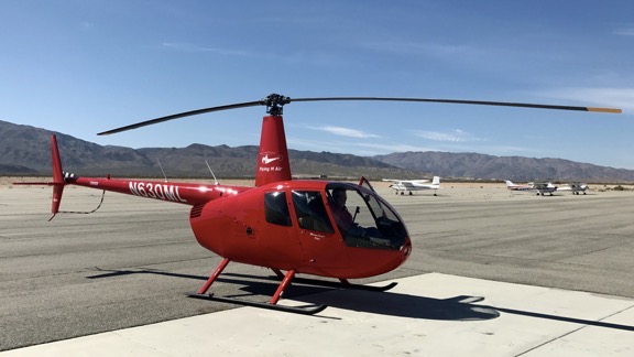
I still wasn’t a pilot when I bought my helicopter, a 1999 Robinson R22 Beta II with only 168 hours on its Hobbs meter. I’d gone back to my first flight school and had a new instructor there, Masohiro. He flew with me around the Phoenix Sky Harbor surface airspace to show me how I could fly from Chandler to Wickenburg without talking to ATC. Then I was on my own, to fly Three-Niner-Lima home with Mike.

I don’t recall feeling nervous that day, although I’d logged less than ten hours since our first flight together from Scottsdale five months before. I don’t recall him seeming nervous either. Perhaps I was overwhelmed by the significance of what I was doing: flying my own helicopter.

But I certainly didn’t feel like a pilot a few days later when I flew solo for the first time in over a year to bring Three-Niner-Lima back to Chandler. (I was leasing it to the flight school and I only got it on weekends.) As I took off from Wickenburg, I choose a poor departure route, over the hangars, and for a brief moment, I thought I wouldn’t clear them. (I haven’t done that since.) And I was nervous all the way down to Chandler.

I didn’t feel like a pilot the following month, when I checked out to rent a helicopter in St. Augustine, FL. I wanted to take my stepfather for a ride. The autorotation I did for the flight instructor who checked me out, Ziggy, was so bad, he asked for another one. It must have been okay, though, because they let me rent it. But I wasn’t a pilot yet.

I almost felt like a pilot the month after that, when I participated in a Young Eagles rally in Aguila, AZ. I followed all the rules and worked with a ground crew to give safe rides to five kids. I told them about the helicopter and answered their questions. I knew what I was talking about and what I was doing. And it was clear that everything there thought I was a pilot. But I still wasn’t sure.

I didn’t feel much like a pilot a month later, though, after making my first bad decision regarding weather. The weather forecast called for ceilings of 900 feet along my route from Wickenburg to Chandler and I figured that was enough, since I normally flew at 500 AGL. We took off to the south and soon discovered that the ceilings were lower than expected. They seemed too low along my preferred route, so I decided to take my backup route, which looked a little better. Soon, they were low there, too, and I was flying at 350 to 400 feet AGL, with wisps of cloud bottoms passing the cockpit bubble. The ceilings rose when I was halfway there, but then the rain started to fall. The temperature dropped to freezing and I began to wonder about icing on the blades. The visibility deteriorated to about three miles—still within minimums. But to a fair-weather flyer like me, it seemed as if I were flying in a fog.

I was just about to set it down in the desert and wait out the weather when I picked up Chander’s ATIS and was encouraged by the ten mile visibility it reported. I was five miles out and still couldn’t see the airport, but I followed the familiar route in. I was glad to be on the ground. And fortunately, my passenger—who was from the San Francisco Bay area and accustomed to such weather—never knew about my concerns.

Two months later, on my first long cross-country trip, I realized that I still wasn’t a pilot. I stretched my fuel supply almost to exhaustion with 2.9 hours of flight time. I must have been running on fumes when the fuel guy in Boulder City put 28.5 gallons into a pair of tanks that hold 29.7 gallons. Another few minutes of flight and the Low Fuel (or “Land Now”) light would have come on—possibly while still over Lake Mead.

But a week later, I certainly felt like a pilot. The comment in my log book for that 1.2 hour flight says simply “Yarnell Hill!” I’d followed the Hassayampa River north through the Weaver Mountains and into the valley beyond. Then I’d followed Waggoner Road to Route 89 and followed that to the town of Yarnell. At about 4,500 feet elevation, Yarnell is nestled near the edge of a cliff that the locals call Yarnell Hill. Beyond it, the earth falls away to the Sonoran desert floor near Congress, 1,500 feet below. Worried about the possibility of downdrafts, I’d approached the cliff edge at about 6,000 feet MSL. But the air was smooth. As I cleared the cliff, I lowered the collective almost to the floor and entered a sort of “powered autorotation.” Gliding down at the rate of 1500 feet per minute at about 80 knots airspeed, I got the most amazing rush. I pulled in the collective gently to level off at 3500 MSL feet over the dairy farm, close enough to smell the manure. Now that was flying!

A few off-airport landings for the $200 hamburger also made me feel not only like a pilot, but like a helicopter pilot. My favorite spot is Wild Horse West, about a mile east of Pleasant Valley Airport near Lake Pleasant. I line up with the old pavement of what used to be Route 74 (before it was moved to bypass the restaurant) and land near the entrance to the parking lot. Then I hover-taxi off the road into a clearing where Three-Niner-Lima will be out of the way. A helicopter near the parking lot turns a few heads, but I haven’t gotten a parking ticket yet.

Of course, a new flight instructor who was impossible to please didn’t make me feel much like a pilot at all. I reached new levels of frustration, not long after my departing instructor told me I was ready for my commercial check ride. The only thing that impressed the new guy was my GPS skills—a fact he noted boldly in my student folder. I decided to complete my training elsewhere.

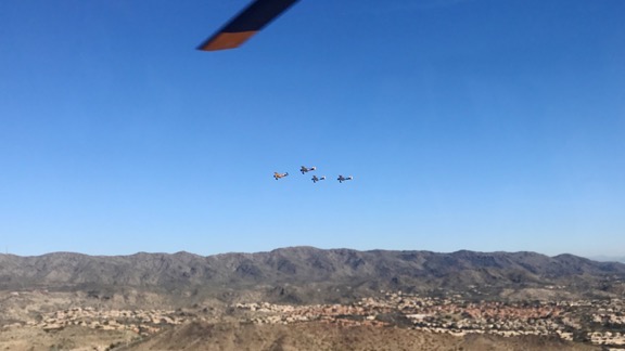
I started feeling like a pilot again when my friends Mark and Gary gave me some formation flying lessons. It was June and I was scheduled to fly along with the world’s largest airworthy biplane (piloted by Mark) to AirVenture in Oshkosh the following month. Gary took off in his Cub and we took turns being lead and wing. It was tough flying slow enough for him to keep up with me when I was lead—and Mike complains that helicopters are slow! I wish I could have seen what we looked like from the ground. I bet it was a sight to see.

The Oshkosh trip fell through but I came up with another cross-country alternative: Colorado. I took a leisurely three-day solo flight, logging 7.0 hours of flight time to Eagle County Airport. Maybe it was that trip that made me a pilot. I learned a lot about flight planning, mountain flying, and weather. And I saw so much! Of course the ride home was tough, especially the 6.1 hours logged in one day, flying from Moab, UT to Wickenburg, AZ with my friend Janet. Heavy departures from high altitude airports, multiple fuel stops, and turbulence combined to make it a flying day I’d rather forget.

But a few months later, I was again doubting whether I was really a pilot.. I had to fly Three-Niner-Lima from Wickenburg to Long Beach, CA to finish my commercial training, and I didn’t think I could do it alone. A private pilot from the flight school took a commercial flight to Phoenix to make the trip to California with me. He wanted to build time; I wanted someone to guide me through the complex Los Angeles area airspace. But when he took the controls on the leg from our lunch stop in Chiraco Summit to our fuel stop at Banning, I knew I was more a pilot than he was. He couldn’t maintain airspeed and let our ground speed drop as low as 52 knots in a 20 knot headwind. Cars on I-10 were passing us! I took control again from Banning to El Monte and showed him how to push into the wind.

I finished my commercial training in just over a week and passed my commercial check ride. (So much for the opinions of difficult-to-please flight instructors in Chandler.) Was I a pilot then? Maybe. Or maybe I became one on the way home the next day. I had to navigate from El Monte to Wickenburg, alone with a late start, handling all radio communications. I had to request special VFR clearances to fly through two Class D airspaces. I had to decide whether to spend the night at Thermal, near Palm Springs or push onward to reach Blythe or Parker before nightfall. I made all the right decisions and had a good, safe flight. I even enjoyed the overnight stay at Thermal, where the FBO generously gave me a brand new car for transportation to and from the hotel.

Trailer Landing
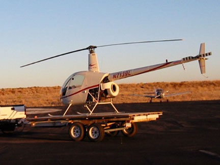
This trailer landing was a piece of cake compared to the platform I regularly land my R44 on at home these days.

I must have been a pilot when I took my first two paying customers up for rides a few weeks later. Or when Mike and I flew to Falcon Field for dinner at Anzio’s and enjoyed the light of the full moon on the otherwise dark trip back to Wickenburg. Or when Mike’s cousin Ricky and I landed at Swansea, in the middle of nowhere, to explore the ghost town’s ruins without making the five hour round trip car ride. Or when I landed Three-Niner-Lima on the back of a 8×16 flatbed trailer so I could show it off in the Wickenburg Gold Rush Days parade. Or when I stayed on the controls with Mark so he could try out a few maneuvers in the only type of aircraft he’s not rated to fly.

Things felt right during all those flights. I felt confident and my passengers had confidence in me. I didn’t do anything foolish, anything I would scold myself for later on. I was still learning from every flight, but I felt that I had built a solid base of knowledge and skills to fly safely—and enjoy almost every minute of it.

But maybe it was the flight that gave me the idea to write this article. It was just the other morning. I’d gone to the airport at 6 AM and had Three-Niner-Lima out on the ramp and preflighted by 6:30. A few minutes later, we were airborne, just me and my ship, headed south.

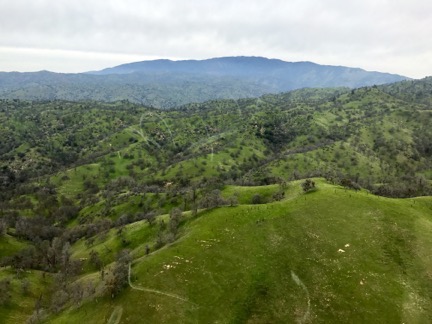
The doors are off, the cool morning air rushes through the cockpit. The radio is strangely quiet; am I the only person aloft on that normally busy shared frequency? We pass over the top of Vulture Peak, then make a steep descent and continue south and then west, riding along Aguila Road toward Aguila. Trucks hauling rocks make lines of dust in the distance; soon I’m flying right over one of the trucks on the road. A manmade structure atop a mountain to the south of us catches my eye and we go to investigate. Just a radio tower, but down in the foothills, the ruins of a mining building. A good place to land nearby; I mark it on my GPS for investigation with Mike when the weather cools down. Weaving around the mountains, circling around, looking for anything interesting in the empty desert. There’s the mountain near where we found that saguaro skeleton several years ago. And there’s the old quarry we saw later that day. I mark a few other interesting points, then look ahead. Harquahala looms huge in front of me, rising 3,500 feet from the desert floor. I decide to climb, to see if any other early riser has made the 11-mile, 90-minute journey by four-wheel-drive vehicle to the top of the mountain.

I reduce speed to 60 knots and climb at 500 feet per minute. The ground falls away through my open door and the world spreads out as I gain altitude. It’s a clear, calm morning and I can easily see 50 miles or more in any direction. I notice a road along the ridge that I’d never noticed before. Then I begin to pick out the details at the top of the mountain: the antenna array, the solar panels, and the remains of the Smithsonian Solar Observatory. But the observatory is partially demolished and covered with scaffolding. I circle and check the windsock. There’s no wind. I land at the tiny helipad.

I’m the only human being on top of the mountain that morning as I get out to explore. The observatory is undergoing renovations. I sign the guest book, noting that I arrived by helicopter. Then I walk around, enjoying the silence of the mountaintop and the views all around me. For a while, I feel perfectly in tune with the world.

Time slips away and I have to leave to be back in time for an appointment at 9:00. I climb back into Three-Niner-Lima and start the engine. I bring it up into a hover, then move forward, toward the edge of the cliff. Once clear, I push down the collective and go into a steep glide, following the canyons around to the back of the mountain, where the dirt road winds down to the valley floor. I level off at three thousand feet, then make my way back to Wickenburg.

As I put Three-Niner-Lima back into the hangar, I know that I’m finally a pilot.


After reading this, I pulled out my original logbook and searched for the flight to Harquahala, the one that made me realize that I was a pilot. It was on May 29, 2002, about two years after I got my private pilot certificate. I logged 1.6 hours for that flight and, at that point, had less than 300 hours logged as a pilot in command.

I remember that flight as if it were just yesterday — flying around the desert, then climbing to the top of the tallest mountain in the area and setting my little R22 down on the tiny helipad up there. It was dead quiet that morning and I felt like I was the only person in the world. It was still cool that early in the day and I could see for miles. There was something magical about it.

Of course, there would be many, many magical flights to come.

Anyway, I thought I’d rescue this essay and put it on my blog where it belongs. Consider it a taste of the book to come.

Kind Words from a Client

Really made my day.

These days, I make most of my living doing cherry drying work in Washington State. It’s an extremely short season — I consider myself lucky to get 10-11 weeks of work — and 2015 will be my eighth season doing it.

Each year I’ve managed to build up my client base from the handful of clients originally contracted by the guy who brought me up from Arizona to help him in 2008. I now have a total of 10 clients managing 15 orchards. At the peak of the season, I hire three pilots to help me provide adequate coverage for all of it. This year, I might hire a fourth.

Each year, as cherry season approaches, I get more and more stressed. Will last year’s clients sign up with me again? Can I get more acreage to cover? Can I find enough reliable pilots to help me? Will a late-season frost wipe out half the crop, as it did in 2008?

Even when I have all the answers to those questions — usually yes, yes, yes, and no — and cherry season is under way, the stress doesn’t stop. I watch the weather incessantly — several apps on my phone with forecasts and a very good radar app to watch storms moving around the area. I stare at the sky and watch the clouds. I worry about my helicopter being fueled, preflighted, and ready to fly. I worry about the guys working for me and I worry about their helicopters. I worry about whether I trained the new pilots well enough and whether they’ll be able to find the orchards I showed them.

And when a weather event is possible, I worry even more. Which direction is the weather moving? How hard is it raining? Is it windy, too? Will it drench all of the orchards at once? Do my clients have people on hand to monitor the moisture and call me to fly? Will it stop raining early enough in the day to finish drying before it gets dark? Are my pilots really at the airport waiting to launch? Did the pilots get the GPS coordinates for the orchards so they can get there fast enough? Can that new pilot cover the acreage I assign to him effectively in a reasonable amount of time?

Then the rain happens and the phone starts ringing. I fire up my helicopter and launch, sometimes even as I’m dispatching the other pilots. I hover over the trees, at first trying to judge how wet they are after this particular event, trying to get my speed just right to dry them enough without wasting time. I do my job, stealing glances at the radar on my iPad so I know just which client will call next and when. I listen to the radio to hear from my pilots or other pilots in the area. I answer the phone and place calls, sometimes while still hovering within 10 feet of the tops of cherry trees.

Cherry Drying

And I’m always beating up on myself if I can’t get someone to an orchard as fast as I’d like. Last year, I felt that I’d failed one of my best clients. I even worried that I would lose his contract for this year. So this year, when I emailed him to ask if he wanted my services again this year, I pointed out where I could have done better and told him how I planned to handle it.

His response made my day (names changed to protect privacy):

ABC is very pleased with the opportunity to work with Flying M Air again for the 2015 season!

I’m sure that Joe can attest to this also, when the call is made to dry cherries you or a member of your team is on site drying within 15 minutes.

That’s a relationship that I want to continue!

All the stress and worry somehow seem worthwhile now. Our work is appreciated. I have another season full of clients to serve this year.

And the cherries are early. Can’t wait to taste some!