I finally make a trip I’d postponed for four years.
I need to start this account with some back story to put it into perspective. If you’re tired of reading about my old life, skip the following section and start reading at The Drive.
The Back Story
One of the things that bothered me most in the last years of my marriage was the fact that my husband’s 9 to 5 job and his insistence on living in a condo in the Phoenix area instead of our Wickenburg house made it very difficult for us to have any fun together. Although my time was extremely flexible — I was still in my declining writing career and didn’t do much flying when I wasn’t away for my summer job — his wasn’t. He worked every weekday. Even when I moved into the condo with him that last winter we were together, we seldom did anything during the week. Dinner and a movie gets old after a while, but not nearly as old as watching him channel surf every evening we didn’t go out. On weekends, he insisted on making the 90-minute drive back to Wickenburg on Friday afternoon, returning with a 90-minute drive back to Phoenix on Sunday evening or Monday morning. I tagged along when I could, but the irony of our work schedules was that I was more likely to fly on weekends than weekdays. Besides, on weekends he’d spend a lot of time catching up on car shows he’d DVRed from Dish Network. Doing something “different” meant taking the same old motorcycle ride up to Prescott. He wouldn’t take his plane out unless the weather was perfect and forecasted to be perfect until after his return.
To make matters worse, he was nearly constantly in a foul mood. His job — like the others in Phoenix before it — had become a dead end, with an unpleasant work environment and a micro-managing boss who made it difficult for him to make the sales he needed to earn a better living. He was struggling financially to not only cover the high cost of the condo he refused to sell, but the loan on his Mercedes, expenses for a plane he seldom flew, his other living expenses, and his regular contributions to his niece’s education, which had entered the PhD candidate phase. He couldn’t see how his debt and expenses had made him a slave to his job. He was never happy and he seemed to take it out on me, accusing me of being the reason “we had no friends,” and complaining when I preferred reading or doing crossword puzzles over spending another frustrating evening in front of the television while he channel surfed.
When that job came to an end in early February and he seemed to have another job lined up behind it, I pushed hard for us to go away for a five-day trip to Death Valley. We’d take the Mobile Mansion, set up camp at one of the park’s campgrounds, and take our cameras out to explore Death Valley. February was the time of year when the wildflowers started blooming. Our previous trip together to Death Valley — way back in the 1980s — had been limited by the rental car we’d had; we’d be able to go a lot farther off the beaten track in a 4WD truck.
I saw the trip as an opportunity to leave troubles behind, to remember the other great trips we’d had together, to go back — at least mentally — to a better time when our relationship was better and our love for each other was stronger. I hoped it would recharge our relationship and bring us closer together again.
Unfortunately, the trip was not to be. His mother was in town — as she was every winter for a month or two — and although we’d put her in a great two-bedroom home that was part of an assisted living community in town, she was at our house every single day and long into the night. For some reason — fear, perhaps? — he didn’t tell her about our upcoming trip. As the days to departure ticked down, I kept waiting for him to tell her. Surely she could live without us for five lousy days.

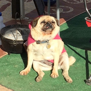
Lucy, the toothless pug, basking in the morning sun at our Colorado River backwaters campsite. She survived that February 2012 night in the desert by hiding under a neighbor’s porch.
And then the day before we were supposed to leave — the day we should have been packing — he let our dog and my friend Janet’s dog out and later let our dog in without remarking on the absence of the little toothless pug. It was hours before I realized that she was gone, lost in the desert. After spending the entire day looking for her and feeling nearly as heartbroken as Janet about her loss, I snapped. I told him I’d had enough of him and cancelled the trip. The next day, I went down to Phoenix to work on a book in the office I’d ironically moved there to be closer to him.
I cooled down after a week or two and agreed to go with him to a marriage counsellor. And although I thought things were on the mend and looked forward to him starting yet another job that would give him more free time, he apparently had other ideas. When I left in May for my summer job in Washington, he signed up at Chemistry.com. A month later, he was sleeping with the desperate old whore who convinced him to dump me — after a 29-year relationship — and go after my money. He even told the judge at the first hearing that I had abandoned him. (WTF?) You can read about the rest elsewhere in this blog.
Anyway, that’s the back story. I’ve been wanting to visit Death Valley for the spring wildflowers for at least four years. This year, I finally got a chance to make that happen.
(Funny how much I can make happen without a sad sack old man holding me back.)
The Drive
It wasn’t an uneventful drive.
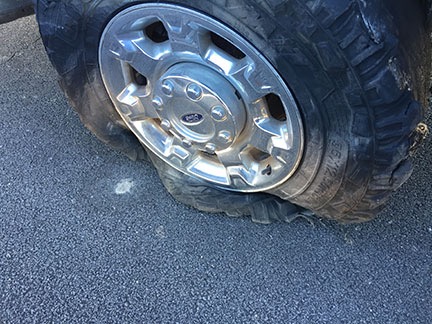
I left Valley of Fire around 10:30 AM and got on I-15, heading southwest. I was just settling in for the three-hour drive with the cruise control locked in at the highway speed of 65 MPH when I felt a weird vibration in the truck. I got into the right lane and killed the cruise control about the same time the right rear tire on the truck blew.
I’d always wondered what it felt like to have blowout at highway speed when towing a 15,000 pound trailer. Now I know.

Ouch.
I kept control of the truck and managed to bring it to a stop within about 1,000 feet on the narrow shoulder of a very long overpass. Because highway traffic was just three feet away from my door, I lifted the center console and slid across the seat to get out on the shoulder side. The tread on the tire was nearly completely gone. Moving forward to get off the overpass was not an option unless I didn’t mind destroying the rim. The tire would have to be changed right where I was.
For the second time in less than two months, I called AAA.

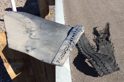
My damaged mud flap, sitting up on the guardrail with a big hunk of tire tread on the shoulder beside it.
While I waited, I walked back along the highway. I recovered a big chunk of the tire, but more importantly, I also recovered the mudflap that had been torn off when the tire blew. I brought them back to the truck and threw the mudflap into the bed.
A flatbed tow truck arrived an hour later. A guy came out and set about lifting my truck’s rear end with a hydraulic jack and lowering the spare tire fastened under the truck bed. In just a few minutes, the tire was changed. Of course, the spare’s pressure was low, but that wasn’t a problem. The truck had a compressor and the tire was soon inflated and I was ready to go.
Honestly, anyone who travels — especially alone — really should have roadside assistance like AAA. This was the second time it helped me on this trip. And yes, I probably could have changed the tire. But it likely would have taken me hours to do it and the tire pressure still would have been low. I got the job done without getting dirty for the cost of a $20 tip.
While I’d been waiting, I’d been working the phones. I called Discount Tire in northwest Las Vegas — a location that was along my route to Death Valley — and arranged for a set of replacement tires. In all honesty, I never did like the off-road tires that had come with the truck. I just hoped I’d get a year out of them. I obviously wasn’t going to. Best to just replace them all now with an all-terrain tire that was better able to handle the weight I was towing. I wound up with a set of four Toyo Open Country tires. Even with a $100 rebate, it was quite a chunk of change. With luck, however, I won’t have to replace them for at least 5 years.
So my next stop was the Discount Tire location I’d called. There was a long line inside. I was told it might be two hours. I secured my place in line, paid for the tires, and then pulled my rig into an empty lot next door. I disconnected the Mobile Mansion, topped off the truck’s tank with diesel, and parked it back in the lot. Then Penny and I went into the RV and had lunch.
That’s one of the nice things about traveling with a house. The fridge and bathroom are always handy.
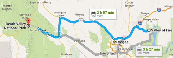
It was about 3:30 PM by the time the new tires were on and I’d hooked up the Mobile Mansion again. Sunset was two hours away and it didn’t look as if I’d get to Furnace Creek by then. But I put the pedal to the metal and drove. I got on Route 95 and followed that to Amargosa Valley. Then south on route 373 to Death Valley Junction. Finally 190 west to Furnace Creek. There wasn’t much traffic at all and I was able to do (at least) the speed limit all the way. The new tires felt great — and were amazingly quiet compared to the old ones.

I took the highlighted (blue) route from Valley of Fire to Death Valley.
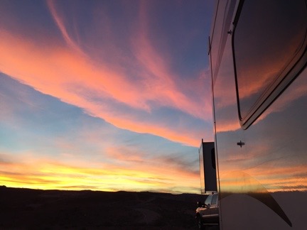
On the descent down to the valley, the sky to the west, which was full of high, light clouds, turned brilliant pink and orange and then violet. It was probably the best sunset of the trip.
It was nearly dark when I pulled to the curb across from the office for Furnace Creek lodging. I checked in for the campsite I’d have for the next two nights. Then I walked back to the truck and drove it the final half mile to the campground. It was a back-in site between a giant luxury motorhome and some tent campers. I’d never parked the Mobile Mansion at night, but it wasn’t as if I could wait until morning. I set out a lantern on the driver’s side at the back of the site and a flashlight on the driver’s side in the front. And then, with a little guidance from the tent campers, I backed it in.
Got it on the first try. Sometimes I really surprise myself.
Setting up camp was easy because the site was level and there were no hookups. I disconnected the Mobile Mansion from the truck and put out the slides. Done.
The only drawback: that luxury motorhome had a generator running and it was loud. (What is it with these people?) Fortunately, they shut it off at 7 PM sharp.
Dawn at the Dunes
Although I’d hoped to get some exploring in on the afternoon when I arrived, arriving in the dark made that impossible. So I started my explorations early the next morning after a quick breakfast. Penny and I climbed aboard the truck before dawn and headed north toward Stovepipe Wells. I had the idea of photographing the dunes near there around sunrise. Unfortunately, so did a bunch of other people. When I arrived, the parking lot was half full and there were people all over the dunes. Getting a shot without a bunch of footprints or a tourist in it was not likely.
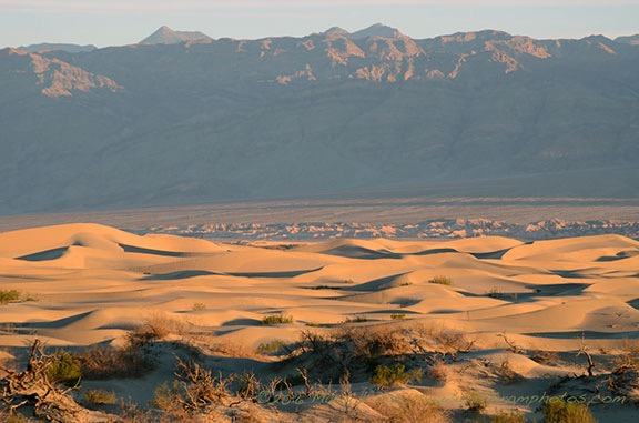
So I backtracked down the road and parked on the shoulder. I climbed into the back of the truck with my tripod and camera and framed a few shots using my 85-300 telephoto zoom lens. The focal length compressed the perspective, as I suspected it would, bringing the distant mountain tops closer. I got a few shots I liked before climbing back into the truck to continue on my way.

Not long after sunrise along the road between Furnace Creek and Stovepipe Wells in Death Valley.
On the Road to Skidoo
And here’s where I made my mistake. Back in January, I’d had lunch with my friend Rebecca, who had been to Death Valley earlier in the year. She’s showed me some locations on a National Geographic map that I bought and had shipped out to me when I was staying at the Colorado River backwaters south of Ehrenberg. I’d studied the map and had decided to try finding a set of dunes to the west of Ubehebe Crater in the north part of the park. But I guess I hadn’t “studied” the map enough — for some reason, I thought the road through Stovepipe Wells was the right road. It wasn’t until I was at Emigrant Campground that realized something wasn’t quite right and pulled over to check where I was going. I’d gone about 40 miles the wrong way.
Pro tip: Maps can only help you when you use them. Duh. (I should have grabbed one of these maps at the Visitor Center. It’s not as detailed as what I had, but it’s easier to manage in the truck.)
So I came up with a Plan B: explore the west side of the park up Emigrant Canyon Road. The map showed two interesting townsites: Skidoo and Harrisburg. I like wandering around ghost towns and figured I’d check them out.
I headed south on Emigrant Canyon Road, climbing ever higher into the mountains on the west side of the park. Outside, the air was cooler — in the low 40s, according to the truck’s outside air temperature gauge. But it was clear and I knew it would warm up. I found the sign to Skidoo and turned left onto a nicely maintained gravel road. Ahead of me, in the near distance, were two white SUVs and a white pickup truck. Soon, I caught up with them and was driving in their dust. When I saw an old cabin on a short road off to my left, I turned and used it as an excuse to let some miles get between us.

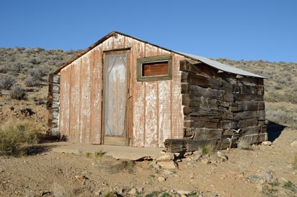
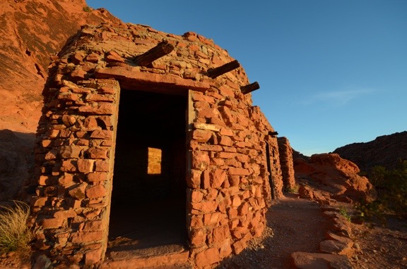
One of the neatest abandoned buildings I’ve ever come upon.
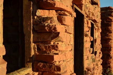
The cabin wasn’t anything interesting other than the fact that it was in remarkably good condition and would still make a very usable shelter. That in itself was remarkable: most unused buildings in this country — especially those in remote places — are targets for vandals who destroy for the pure satisfaction of destruction. There were no signs to keep out so I did what any explorer would do: I opened the screen door and wooden door inside it for a peek. I found an old spring bed frame and some litter inside. No smashed beer bottles, no graffiti, no vandal debris. I carefully closed both doors up the way I found them.

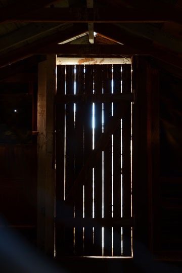
I don’t know why, but I like this image.
In general, the place wasn’t very photogenic. The most interesting shot I got was through a hole in the boards covering the back window: the light shining through cracks on the door. It was the cleanest abandoned building I’d every seen. I hope it stays that way forever.

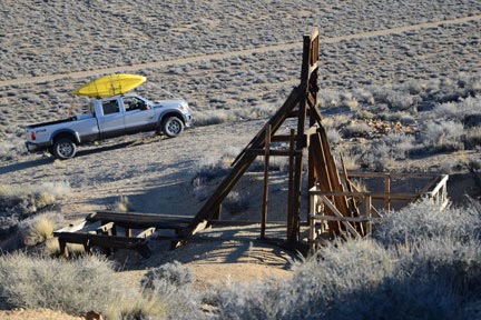
Yes, I do realize that I probably looked pretty silly driving around Death Valley with two kayaks on my roof.
Penny and I got back into the truck and crossed the road. Soon we were climbing up a hill to an old mine site on the opposite hillside from the cabin. I left Penny in the truck — I don’t like to worry about her falling into mine shafts — and explored on my own. There wasn’t much there that I hadn’t already seen before at countless mine sites in Arizona and Nevada: the support structure beside the main shaft, several smaller horizontal mine shafts going into the hillside, and the remnants of old buildings. The site was neat and clean. Thinking back on this, I have to wonder if the park service or volunteers clean these places up. Or if vandals simply avoid National Parks.
We got back on the road and continued the drive to Skidoo. In most places, the road was wide with gentle curves and a bit of washboarding. In other places it was narrow and rocky as it wound along the edge of a steep drop-off. I passed the ruins of another building on my left and decided to explore it on the way back. I was eager to see Skidoo and wanted to be there before the sun had risen much farther.

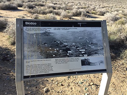
Here’s the sign that tells you you’ve arrived at Skidoo. At the top is a quote: “Here the golden goddess is again singing her siren song of enchantment and California is again beckoning the world with a finger of gold: the world is listening, and coming — TO SKIDOO!” Apparently, the Rhyolite Herald was pretty good at dishing out bullshit back in 1907. All I could think about was where did they get their water?
When I got there, I didn’t even know I was there. It was just a flat area among the hills with lots of dirt roads going off into different directions. I drove up to an interpretive sign set alongside a turnoff in the road that announced I’d reached my destination. Wikipedia calls Skidoo a “virtual ghost town” but I don’t see any “virtual” or “town” about it. There’s really nothing of the town left other than foundation rubble and broken glass.
I’ve been doing some video journalling lately and apparently made one from the top of the hill. I didn’t turn toward the sun, probably because I knew the video in that direction would be crappy. I sound nasal because I was fighting a cold and I’m not sure if the snowcapped mountains are the Sierras.
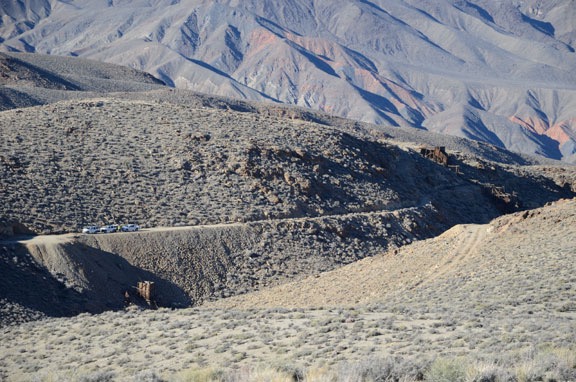
I saw a road going up a steep hillside and decided to check it out. It would be a good test of my new tires. I drove over to the bottom of the hill, popped the truck into 4WD and started a steep climb. There was plenty of room at the top to park and (fortunately) to turn around. So I parked, shut the engine, and climbed out with Penny for a good look. From my vantage point, I could clearly see where the town had been (despite there being no real traces of it), as well as several mine shafts with towers. The two SUVs and pickup truck I’d seen earlier in the day were parked by one of the mines far below me. Off to the northwest, I could see snowcapped peaks.

I could see the white trucks and the men who had been in them near a mine site across the ravine from my observation point. A photo shot with my 300 mm lens revealed the Noreas logos on the SUVs. One of the men was dressed as a ranger and had likely come in the unmarked pickup with the big antenna on the roof.

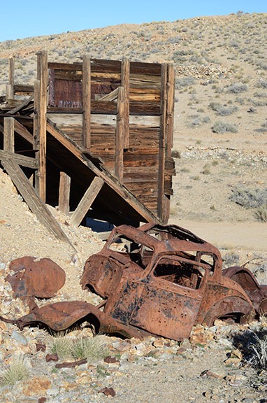
There wasn’t much left of the truck and what was left was half-buried in mine tailings.
I turned the truck around and headed back, realizing that the road looked a lot steeper from the top than it had from the bottom. I took it slow in 4WD low gear. Then I found my way to another mine site I’d seen from the top of that hill, parked off the road, and got out for a look, again leaving Penny in the truck. What interested me most about this site was the wrecked truck there. For some reason, I like to photograph abandoned vehicles so I really spent quite a bit of time on this one.


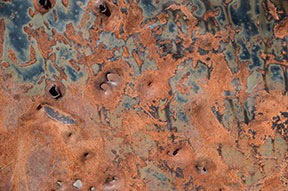
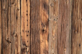
I like the textures you can find among old, ruined things: a rusty car door, a wall made out of wood planks.
By then I was pretty sick of Skidoo and ready to skiddoo. (Sorry, but I couldn’t resist that one.) I turned the truck around again and retraced my route back to pavement eight miles away. I did stop along the way to visit that other abandoned building, but there wasn’t much there of interest so I didn’t stay long. Not even worth sharing a photo of it.
Harrisburg / Aguereberry Camp
Back at Emigrant Canyon Road, I had to make a decision: go back into Death Valley and explore elsewhere or continue on my way. I decided to go a little farther down the road to see if anything else was interesting. That’s how I wound up taking the turn to see the ghost town of Harrisburg, which was partially visible from the paved road.
I drove about a mile or two down the unpaved Aguereberry Point Road and parked with two other vehicles in a tiny parking area in front of a closed gate. The folks from the other vehicles were just leaving their cars and walking toward the ruins about a quarter mile away. They had a dog with them, too, so Penny and I hung back to give them space. I’d later discover that they were part of a group of three, two of which were in period costumes for a photo shoot. We were the only people there.

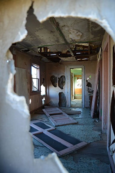
A look through the wall of Pete Aguereberry’s old house.
Although maps identify this spot as Harrisburg, a sign at the ruins called it Aguereberry Camp. The main site consisted of three buildings, an outhouse, and the remains of a mine. Farther up the road I’d walked was the ruins of an old Roadmaster sedan and still farther were the ruins of the Eureka Mine, which I did not visit. (There are only so many mine shafts a person can see in a day.) While the photo shoot folks were working around the car, I explored the buildings. They were in disrepair and vandalized, just as I’d come to expect of ruins, but not nearly as bad as I’d seen at other vandalized sites.
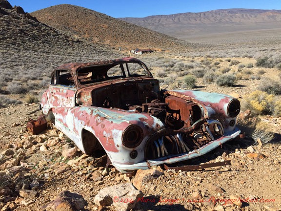
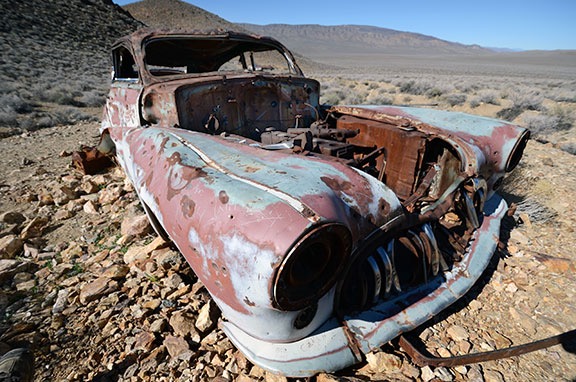
From there, Penny and I hiked another 1/8 mile or so to the old car, passing the photo shoot folks on their way back. The car made a remarkably interesting subject for photography — at least in my mind. The original color, teal (?), could still be seen among the rusty patches. Even the logo of the car was visible in one spot — which is how I knew it was a Roadmaster. I took quite a few shots, many of which featured Aguereberry Camp’s buildings in the background. I even got to play a bit with my 10-24 mm lens, which I seldom use these days.

A wide angle (16 mm or 24mm full frame) shot of the car with Aguereberry Camp in the background.

A very wide angle (10 mm or 15 mm full frame) shot of the car with the buildings visible through the windshield.
We walked back to the building a while later and spent some time chatting with the photo shoot folks. The two models — a man and a woman — had changed back into regular clothes. They were all sitting in the shade, snacking on peanut butter and apples and other tasty treats. They offered me some, but I declined. We talked about Death Valley and photography and they urged me to continue up Aguereberry Point road to the point. “The view is amazing,” the photographer assured me.
Aguereberry Point
Although I felt as if I’d had enough driving along bumpy back roads for the day, I’m not one to pass up a view — especially one that isn’t crowded with tourists. So when I left the photo shoot folks, I continued along the road.
Aguereberry Point was only about six miles from pavement, but much of the road was very narrow for most of the way. There was a section that it wound through a narrow canyon that I could imagine being treacherous in a rainstorm. Then it came out onto a hillside and continued climbing out in the open. Up and up and up, finally ending in a small parking lot that looked as if it were at the top of the world. Penny and I were the only ones there.
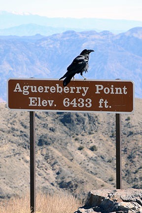
The view was good from the parking lot, but the photographer had advised me to take the trail to the point. After walking (and climbing) a bit on the wrong trail, I got on the right one and followed it as far as I could go. The view of Death Valley was unobstructed to the northeast and southeast, with a mountain due east that blocked the view that way. At an elevation of 6,433 feet, we were at least that high above the valley floor, much of which is below sea level. It was dead quiet.
Photos really can’t convey the full picture of what this place is like, but here’s a panoramic image to give you an idea. Was it worth the drive? Hell yes.

Here’s a panorama taken at the point. Click the image for a larger version that you can scroll to see details.

Ravens like dog food. Who knew?
I walked back to the car and put out some food and water for Penny. A young couple drove up and parked next to the truck. As they donned backpacks, we chatted about places to visit in the park. I had nothing to offer except a recommendation to skip the drive to Skidoo. They told me that the wildflowers were amazing down near Ashford Canyon, where they’d camped overnight. Then they were off down the trail, leaving me to chase off the ravens that were eating Penny’s food.
On the Trail of Wildflowers
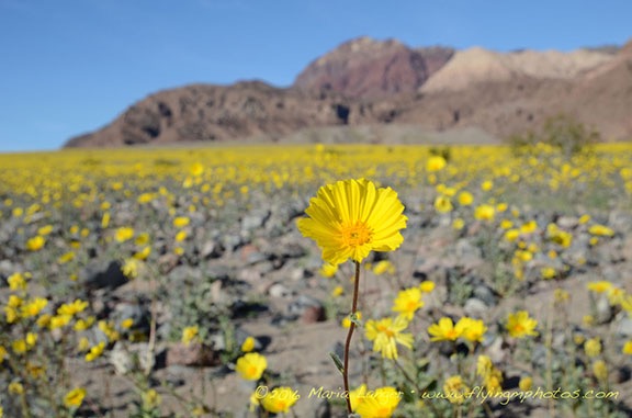
From there, I retraced our route back to pavement and, from there, back down into Death Valley. We passed through Stovepipe Wells and headed toward Furnace Creek. That’s when I noticed the wildflowers I’d missed that morning on my predawn drive. The roadsides were full of them. I didn’t realize it, but Death Valley was heading for a once-a-decade “super bloom.”

I thought there were a lot of flowers here, north of Furnace Creek. But this was nothing compared to what was about 50 miles down the road.
After a brief stop to check out the desert pupfish at Salt Creek, I continued past Furnace Creek on Badwater Road. I was back among the tourist crowd, with lots of cars and buses along the way, especially at Badwater, which is the lowest point in the U.S. at 282 feet below sea level. There were lots of people walking out on the salt flats there, but I didn’t bother to stop. I was aiming for Ashford Canyon, where the young backpackers had said there were so many flowers. The further south I got, however, the more flowers there were. People were parked alongside the road where the flowers were thickest, taking photos and walking among the bright yellow blooms. I couldn’t resist a few stops myself, although I knew I’d get better shots when the sun was lower in the sky.

The light wasn’t as good as it could have been, but I couldn’t resist stopping for a few photos along the way to Ashford Canyon.
I was also surprised to see standing water in various places alongside the road. I’d heard that there had been a lot of rain in Death Valley that fall, but I’d assumed the water had run off or seeped into the ground. Instead, there were a few dry lake beds that weren’t exactly dry. Some were almost swampy. Although I hoped for an opportunity to get some good reflection shots, conditions were unfavorable; a breeze put just enough ripples on the water surface to break up any good reflections.

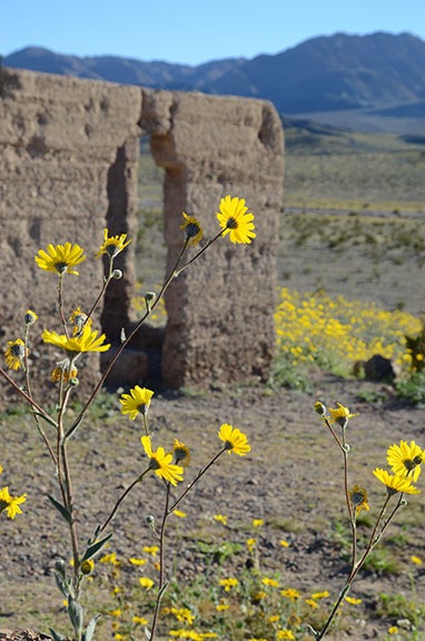
Desert gold wildflowers at Ashford Mills.
I arrived at the remains of Ashford Mills after 4:30 PM. The same big yellow flowers — appropriately named “desert gold” — I’d been seeing along the way were scattered all around the ruins. I wandered around the ruins and took photos while Penny sniffed here and there. It was amazing to see hills in the distance yellow with blooms.


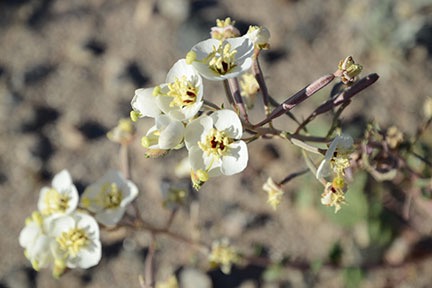
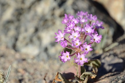
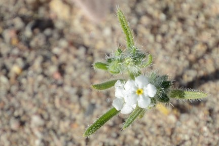
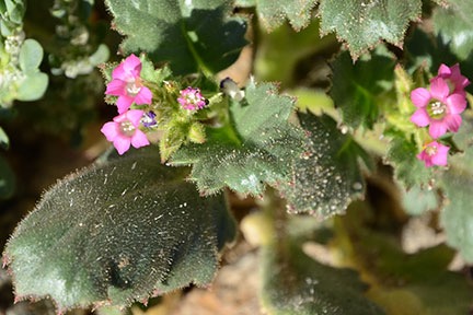
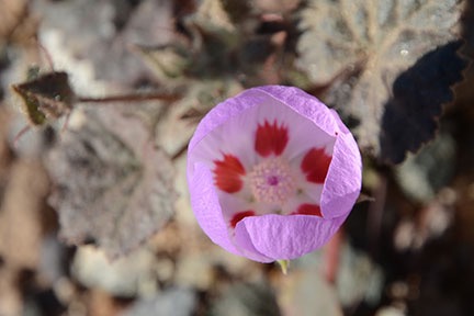
Here are several close-up shots of some of the smaller flowers I spotted while wandering around.
There were also some smaller flowers that were less obvious and required careful attention to spot. I did a lot of crawling around with my 16-85 mm lens — I don’t have a macro lens — to get close-up images of them. The group of four people sitting out at a picnic table near the parking lot, eating a late lunch or early dinner, must have thought I was nuts. I was really getting into it.
The turn for Ashford Canyon was right across the road from the road to Ashford Mills. It was a narrow two-track road that wound up a hillside and then into the canyon. The young backpackers had said the flowers were good up there, but as I began the slow bumpy drive I began wondering whether they meant that the flowers were good in that general area. They certainly were amazing. I drove for about a mile when I realized it wasn’t going to get any better than what I was already seeing. I found a place to turn around and started back.
By this time, the sun was sinking quite low. Mountains on the west side of the park would make sunset a lot earlier than I expected after consulting Siri that morning. (Ask Siri what time sunrise or sunset is and she’ll tell you and provide a weather report.) I wanted to head back for a late afternoon shot of a particularly flower-filled area along the road. So I headed back toward Badwater and Furnace Creek. I reached the location I was thinking of just as the light was getting very good and got out to take a few photos.

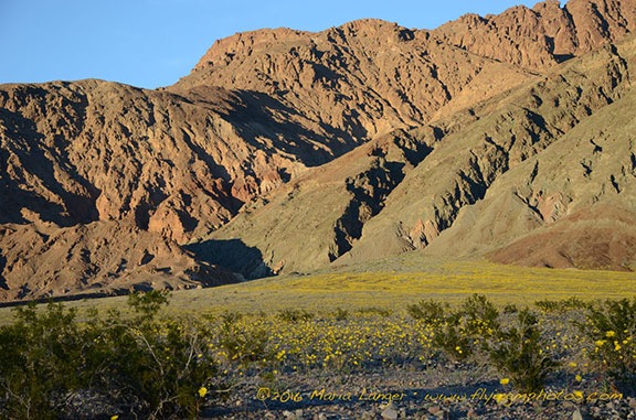
The carpet of yellow flowers is a stark contrast to the bare rock walls on either side of Death Valley.
Leaving the Valley
By the time I was ready to go back, the hillsides were in shadow. It was dusk when I pulled up to the Mobile Mansion.
If you’re wondering why I bothered to give you the backstory at the beginning of this post it’s because of this: While I drove and hiked around and explored and photographed Death Valley with my dog, I spent a lot of time thinking of what the trip might have been like four years earlier with the man I
thought was my life partner. With five days to spend in the park, we would have seen a lot more. But would the trip together have gone as smoothly as I’d hoped? Or would he have been stressing about his mother left behind? And would the trip have been a repeat of all those amazing road trips we’d taken together in the 1980s and 1990s? Or would we have bickered over every little thing we did?
I know now, in my heart, that our relationship was like the walking dead — existing with no life, no future. In February of 2012, I wanted to go back to the way things were when our relationship was good and strong, when we were two people of one mind who shared ideas and dreams. But he had already given up and was just biding his time, waiting for his escape. I loved and trusted him too much to see the truth about what he’d become: a bitter old man, blaming me for his failures in life, eager to take revenge on imagined offenses.
Although my trip had been short — too short, I think! — it had been taken on my terms, without pressure or a need to compromise. I’ve been traveling alone since long before my 19-day “midlife crisis road trip” back in 2005. While it’s nice to travel with a companion, good travel companions are hard to come by. I lost mine years ago, many years before my divorce. While I’m sad that he’s gone, there’s no denying how much better off I am without him.
Although I’d considered doing a little early morning photography the next day, I realized that the locations I wanted to visit were too far away to get there and back and still leave the park by 10 AM. It would be better to come back another time, when I had more time to spend. My next stop was in the Sacramento area of California, where I’d be based with the helicopter for a frost contract. It was a six-hour drive and I looked forward to seeing a few friends when I arrived. Wednesday would be my travel day and Thursday would be a day to kick back and relax before taking Alaska Air home to fetch the helicopter.
To minimize the noise I’d make on departure the next morning — keeping in mind that my tent-dwelling neighbors would hear every sound I made — I decided to hook up the Mobile Mansion that evening. So I cranked down the landing gear, backed the truck into place, and lowered the front end of the Mobile Mansion onto the hitch. Within a few minutes, the chains and power plug were in place and the landing gear was up and locked. All I had to do in the morning when I was ready to go was to close up the slides.
I had a nice salad for dinner. I tried hard to ignore the sound of the generator next door. I don’t understand how I can camp day after day in my rig without running a generator when these people in their fancy motorhomes can’t seem to spend any time in theirs without their generator running full-time. Fortunately, they turned it off at 7 PM sharp.
After dinner and a quick clean up, I relaxed in bed with a book. Penny curled up in her bed beside me. I was dead asleep by 9 PM.
In the morning, we were on the road by 7 AM, heading west on the road past Stovepipe Wells toward Panamint Springs. That drive didn’t go anywhere near as planned — but that’s another story.
