Flying before the day begins.
I had an early flight in Scottsdale yesterday. Three passengers wanted a custom tour of the Phoenix area.
The man who booked it kept asking to do it earlier and earlier. First 8 AM. Then 7:30 AM. Then 7:00 AM. And then 6:30 AM. “We’ll meet you at 6:15 AM,” he finally said. “Will the pilot be ready to fly right away?”
I assured him that the pilot would be ready to fly within 10 minutes of meeting them. I didn’t mention that the pilot would be me. I hung up, glad he hadn’t shifted the flight another fifteen minutes earlier.
The helicopter was in Wickenburg. Although I’ve been storing it in Deer Valley for most of this season, I took the month of March off. There were a few reasons for it, including two trips (that were eventually postponed). So I had to fly the helicopter down to Scottsdale from Wickenburg — a 35-minute flight — before meeting the clients. When I calculated my departure time, I realized I’d have to leave my house by 5:00 AM to make it on time.
I set my alarm for 4:20 AM. I woke up at 3:30 AM. I showered and thoroughly enjoyed a cup of coffee with Alex the Bird and Jack the Dog. Then I packed up my laptop and flight manifest, shut off the lights, and stepped out to start my day.
It was dark outside. The moon had set, but I could see stars. That meant it was clear. The weather forecast looked as good as it usually does, so I wasn’t expecting any difficulties on the flight. The only questions were about the client: Had he lied about the weights of the passengers? Would he really give me 90 minutes of flight time, making the trip worthwhile? (He wasn’t paying for my ferry time, so a short flight would make the trip a loss.) Would he really be at the airport by 6:15?
I drove to the airport in my Ford truck, passing just a few cars and trucks along the way. The green-white-green-white sweep of the rotating beacon cut through the night as I pulled into the drive. I paused long enough to enter a combination on a keypad and wait while the metal gate rolled aside with a beep-beep-beep. Then I steered the truck down the asphalt drive, turned into the first row of hangars, made a broad U-turn, and parked in front of my hangar’s left door, with my headlights facing out. Even though the motion-sensor lights we’d installed over the hangar door went on, I’d need my truck’s headlights to see the combination on the padlock that secured the hangar. Once unlocked, I rolled the right door all the way open on the track and flicked on the lights. The big box hangar filled with light and the steady hum of the overhead fluorescents. I killed the lights on my truck before they killed the battery.
I’d done most of my preflight the afternoon before, after washing the helicopter and putting it away. I’d debated leaving it out overnight, but decided against it in case the client cancelled at the last minute. If I’d left it out, it would have saved me 15 minutes of time that morning. Instead, I had to use the ground handling equipment — a golf cart, a tow bar, and a set of ground handling wheels — to get the helicopter out onto the ramp. I backed the golf cart out of the hangar, towing the helicopter out nose first. Then I turned off the lights in the hangar and rolled the big door shut, securing it with the padlock again.
It was quiet and dark as I backed the cart out onto the ramp. Some of the overhead lights out on the ramp don’t work. It didn’t matter much to me — I wouldn’t park under any of them anyway. I needed room for my rotors to spin; it simply didn’t make sense to park next to a pole. But the ramp was too dark to see what I was doing. I had to turn on the golf cart’s headlights to unhook the tow bar. I’d never used them before and was rather surprised to find that they worked.
With the ground handling equipment out of the way, I climbed into the cockpit and went through my startup procedure. It took two tries to start the engine; not enough priming the first time for the cold. The engine roared to life and I flicked the appropriate switches to get the blades turning, battery charging, and radios working. I clearly heard the relatively high-pitched whine the engine — or something else back there — makes when it’s cold out. I knew from experience that the sound would go away as the engine warmed up. I turned on the navigation lights, which also illuminated the instruments. The green position light beneath my door reflected in the dusty surface of my side window.
I plugged my iPod into the intercom system. I’d listen to music on the way down.
It took a long time for the engine to warm up. While I waited, the guy in the hangar across from mine drove up and parked in front of his hangar. It was 5:30 in the morning — a full hour before sunrise — and the guy didn’t have a plane. What the hell was he doing there? He spent more time at the airport than most aircraft owners did, usually just sitting in his truck and talking on the phone. It creeped me out.
When the cylinder head temperature had sufficiently warmed, I did my mag check and needle split. I loosened the frictions and brought the engine and rotor RPM up to 102%. I was ready to go.
It was still very dark.
I made my radio call: “Wickenburg traffic, helicopter Six-Three-Zero-Mike-Lima is on the ramp, departing to the southeast.” I flicked on my landing lights, surprised, as always, by the sudden glow and the brightness of the dust particles swirling around in my downwash. Then I lifted into a hover, used the pedals to point the nose at the taxiway, and eased forward, climbing gently. When I reached the taxiway, now eight feet off the ground, I banked right and followed the pavement on a heading of 50°.

This photo by Jon Davison of us landing at Wickenburg at night gives you an idea of what the view from the cockpit looks like with the runway lights on.
The landing light shined down on the taxiway and out ahead of me as I gathered speed and altitude. I was about a quarter of the way down the taxiway when I realized I’d neglected to turn on the runway lights. I pressed the mic switch seven times. Nothing happened. I tried again, more slowly. The runway lights came to life: two strands of glistening white pearls turning to orange and then to red as they receded into the distance. The taxiway lights, glowed blue in a pair of light strings to their right beneath me. Beyond them was the dark void of empty desert and the greedy dreams of a failed real estate project. Aligning myself with the taxiway lights, I climbed out into the night. I flicked the switch to kill the landing lights.
The lights of Wickenburg spread out before me like a handful of gems cast into the desert by a giant. As I gained altitude to clear the invisible mountains just south of the town’s center, the distant glow of the Phoenix area came into view on the horizon, blocked here and there by the dark shapes of mountains that lay between me and the city beyond. I continued to climb. My goal would be to clear all those little mountains so I wouldn’t have to worry about hitting them in the dark.
I’ve flown the route between Wickenburg and Scottsdale many times. I even flew it at least one other time before dawn. But this time, I was tuned in to the darkness and silence of the night. I pressed the play switch on my iPod, letting some classic rock accompany the steady hum of my engine and the beat of my rotor blades. I climbed to 4,000 feet MSL — more than fifteen hundred feet over the desert below me — and leveled out. I was clear of all mountains between me and my destination.
Once away from Wickenburg, below me was only the darkness of the empty desert. With no moon, there was barely enough starlight to make out the meandering lines of dry washes and the occasional dirt road. Without visual landmarks, I realized I didn’t know where I was. Was that the Santo Dominguez Wash? Or one of the lesser washes in the area? And how about those lights to the left? Campers? Or that ranch off Constellation Road, viewed from a different angle? Only my GPS and the view of Phoenix’s lights spread out in the distance before me assured me that I was heading in the right direction.
The sky brightened ever so slightly as I glided southeast. The air was calm and smooth; my helicopter could have been a skiff floating on glassy water. I crossed over a well-defined dirt road that had to be Castle Hot Springs Road. Then I recognized the lights of the Quintero golf course and vehicles on Carefree Highway. The brightening sky reflected in Lake Pleasant, far to my left.
After ten minutes of flying over empty desert, I was returning to civilization: the northern reaches of Peoria.
I descended through 3500 feet, feeling ridiculously high above the ground as the glow from lights below me started reflecting in the inside of my cockpit bubble. I turned up the brightness on my instrument lights just a bit. Still descending, I flicked the radio to listen to the ATIS at Deer Valley. It was 5:50 AM and the tower was still closed. The automated weather observation system reported calm winds and an altimeter setting of 30.04. I adjusted my altimeter while listening to the recorded voice of the controller who’d closed the tower the night before. The tower would open at 6 AM. I wondered whether I’d reach the airport before then. I tuned the radio to the common traffic advisory frequency for Deer Valley, made a radio call with my position ten miles out, and continued on a course that would take me right over the top.

The lights of the Phoenix area, at night. Photo by Jon Davison.
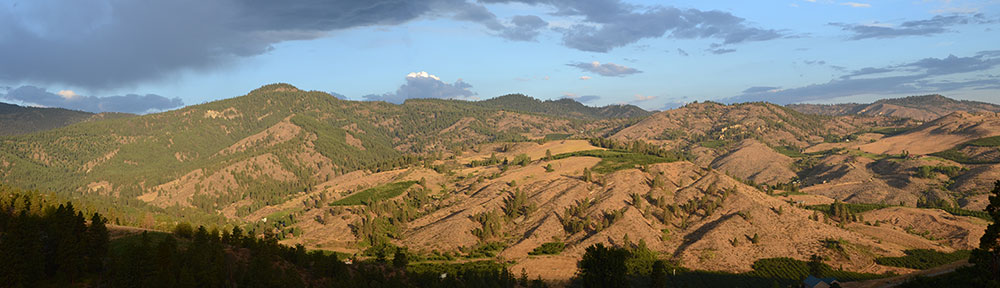
To the south, the brightness of lights on the ground intensified. The area was packed with new subdivisions, some completed before the housing bubble burst while others still had empty, weed-filled lots beneath their street lamps. It was a sharp contrast to the empty desert I’d been flying over for most of the trip. It amazed me that people wanted to live like that — packed like sardines into bulldozer-groomed lots — when there was so much beautiful desert, with rolling hills, cactus, and natural landscaping only a half mile away. The wide open spaces are what drew us to Wickenburg in 1997, but even that small town wasn’t immune to the greed of developers. Town planning restrictions were overturned on a case-by-case basis — often against voter’s wishes — for favored developers, resulting in smaller and smaller lots. Land zoned as horse property was rezoned to keep horses out and make lots too small to have them anyway. The retirees bought second homes in town to escape the cold of the midwest, doubling the population — for half the year, anyway. A friendly little western town turned into a retirement community right before our eyes. All of our young friends moved on to places like Colorado and New Mexico and California, leaving us with the retirees.
But I’m not ready to retire from life.
I descended to 2500 feet — a good 500 feet above where I normally flight during daylight hours — and leveled off. At five miles out, I made another call to Deer Valley traffic. I was now crossing into Deer Valley’s airspace; if the Tower had been occupied, I’d have to establish radio communication with the controller. I was the only one on the radio though — no one else spoke up. I crossed over the Central Arizona Project (CAP) canal where it meets the I-17 freeway. The sky, now quite bright, reflected in its smooth waters, drawing a bright line to the southeast.
Two miles from Deer Valley, I made another position call. No answer. I was close enough to see the tower; there was some light up there. Towers are normally kept dark so the controllers can see outside without bothersome reflections. A moment later, the airport’s two runways stretched out below me. I didn’t bother turning on the lights; I wasn’t landing and didn’t need them. But I could still see them quite clearly in the predawn light. It was about 5:58 AM and I expected the tower to open at any minute. I used the radio to announce that I was over the top and transitioning to Scottsdale. No answer. I glided on my way, descending down to 2300 feet.

In this last shot by Jon Davison, you get an idea of how the horizon looks before dawn. (This shot was actually taken after sunset.)
Now the lights were bright below me as I flew over one subdivision after another. I crossed the Loop 101 freeway. Ahead of me, I could see the rotating beacon at Scottsdale Airport, about 12 miles away. The black bulk of the mountains on the horizon were well defined with sharp edges against the bright sky. Four Peaks was clearly identifiable by its four individual peaks.
I used my second radio to listen to Scottsdale’s ATIS while remaining tuned into Deer Valley. That airport was still closed, too. The automated weather system reported light winds and an altimeter setting just a few hundredths off from Deer Valley’s. The recorded controller’s voice warned of an unlighted 150-foot construction crane and advised that the tower would open at 6 AM. I flicked the recording off.
Now I was wondering about my client again, wondering whether he’d show up on time, whether he’d lied about his weight, whether he’d give me more than the 90 minutes of flight time he promised. I’d know soon enough.
The sound of a telephone dial tone came through the radio in three short bursts. Then the Deer Valley controller came on. He sounded tired and depressed, as if he’d just woken up to bad news, as he read the standard tower opening statement over the radio. It was long. I was still in his airspace, so I listened. At the end, he said, “Helicopter Zero-Mike-Lima, traffic ahead and to your left is a helicopter at twenty-five hundred feet. Frequency change approved.”
I’d already seen the helicopter flying west along the north side of the Loop 101. I replied: “Zero-Mike-Lima has that traffic in sight. Changing frequencies. Have a good day.”
I switched over to Scottsdale tower with the flick of a button. A female controller with a bright, bubbly voice was giving instructions to a jet preparing to take off.
I waited until she was finished and the pilot had replied, then made my call: “Scottsdale Tower, helicopter Six-Three-Zero-Mike-Lima is seven to the west off Deer Valley landing at the terminal.”
“Helicopter Zero-Mike-Lima, proceed inbound, report a half mile west.”
“Will report a half mile west, Zero-Mike-Lima.”
I continued inbound, crossing over Route 51. The sky was much brighter now; dawn was only 30 minutes off. I continued my descent to 2000 feet, roughly 500 feet over the ground. I listened to the tower talk with a female airplane pilot with the call sign “Traffic Watch” and wondered what kind of traffic she could watch from an airplane. Maybe I’d misheard them. She was using Runway 3.
Then I was less than a mile out and ready to start my final approach. I reported my position and was cleared to land on the ramp with the usual “use caution; ramp uncontrolled” and “remain west of the runway and taxiway at all times.” I repeated the “remain west” restriction as I steered to the south, descending. When I was abeam the approach end of runway 3, I swung northeast and lined up with the ramp, parallel to runway 3 and the taxiway beside it. I came in behind all the jets parked on the ramp and hover-taxied beyond them to transient parking for small airplanes. I set down at the end of the “Reserved” row and started my shutdown procedure.
In front of me, the terminal’s empty windows reflected the bright glow of the predawn sky, along with the flash of my helicopter’s strobe light. It wasn’t night anymore, but it wasn’t really day, either. It was that in-between time, the time of day when you put the secrets of the dark night behind you and prepare to embrace the day. It’s a special time, a time that’s always calm, always reflective. A time that makes me feel good to be alive.
I shut down and went inside the terminal. It was 6:10 AM.
And in case you’re wondering, the passengers did show up, they lied by a total of 50 pounds about their weights, and they flew with me for a full two hours.


 Things seem different lately, and I’m not sure why. I’ve begun getting fan mail from readers of my articles in