Back to the Desert

Day 13 brings me to the mountainous desert around Salt Lake.

Despite my less than perfect accommodations, I slept reasonably well. I think it’s because of the sound of flowing water that came in through the door to the back deck. I’d left the door open a few inches, trusting the lock on the screen door to keep out any hotel guests who might be wandering around on the deck. I was in the end room, so the chance of someone walking by my door on their way to another room was remote.

I showered. It was the first motel shower I’d encountered in a long time that couldn’t keep a steady water temperature. Every time one of my neighbors flushed the toilet, I’d come close to getting scalded. The third time this happened, I shut the water off and called it quits.

I packed up the car, checked out, and headed south on 89. I had a Doubleshot to meet my caffeine needs. (My friend Lorna, who has been reading these entries faithfully from her home in Maine, e-mailed me to ask what a Doubleshot is. In case you don’t know, here’s the scoop. A Doubleshot is a canned Starbucks coffee drink. It’s an easy way to get a caffeine fix when I’m on the road. I usually buy a couple of them when I’m in a supermarket and keep them in my cooler. When I can’t find decent coffee elsewhere, I drink a doubleshot. I don’t really like them — they’re too sweet for my taste — but they’re easy.)The road began by following the Snake River through a canyon. When it reached the town of Alpine, WY, the Snake River curved to the northwest while I headed south. Alpine was a nice little town with a lot of tasteful new construction and small businesses. The town was very quiet — it wasn’t even 8 AM yet. I almost passed a drive-up coffee stand. When I spotted it, I hit my brakes hard and pulled in for a latte.

The building was tall and it was quite a reach up to the woman inside it. My Clarkston reused coffee grinds experience had left me a little leery of coffee stands, but I had nothing to worry about here. The woman, who was very friendly, made me an excellent large triple latte. I asked her whether she owned the booth and she told me she didn’t. In fact, it was her last day at work. She was moving back to Spokane, WA. The woman who owned the booth was doing okay, but it was hard to do well in the town because of its heavy Mormon population. I later discovered that Mormons don’t drink coffee. I guess a coffee shop in a Mormon town would be like opening up a pork store in New York’s Lower East Side.

From Alpine, I headed due south on 89, which lies on the east side of the Wyoming/Idaho border. I was in farmland again, but at an elevation well over 5,000 feet. Wheat and alfalfa seemed to be the big crops. One alfalfa field had just been cut — probably the previous day — and the smell of the fresh alfalfa was rich and sweet.

I think I was in Afton when I saw the car wash and pulled in. I’d managed to call Megg on my cell phone and arrange to go to her house in North Salt Lake City that afternoon. My car was dirty and I didn’t want to make a bad impression. So I washed it for the third time on my trip. This time, it was the dirtiest it had been so far. The bug situation in Idaho, Montana, and Wyoming is bad and the front of the car was pretty much plastered with dead bugs of all shapes, sizes, and colors. It took six minutes worth of car wash time to get it all off. I dried it with my rags and dusted off the dashboard. Much better.

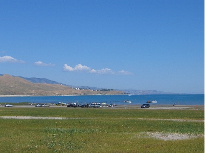
I crossed into Idaho at Geneva Summit, which was 6,938 feet. That put me into a long valley with a succession of towns: Montpelier, Ovid, Paris, St. Charles, Fish Haven, and Garden City. Every town I drove through was remarkably quiet — nothing seemed to be open. Except the church, of course. All the church parking lots were full and I saw more than a few well-dressed people out on the streets, walking to or from church. Things changed a bit when I got near Bear Lake. Lots of people were out and about at the lake, in boats and in public access areas. There was a lot of housing on the lake side of the road with plenty of Private and No Beach Access signs to keep people out.

Bear Lake

Somewhere between Fish Haven and Garden City, I passed into Utah, the ninth state I’d visited on my trip. At Garden City, I got on route 30 and followed that around the south end of the lake. I climbed a hill and immediately realized that I had slipped into high desert terrain. The vegetation on both sides of the road consisted of tall grass, sage, and a variety of other desert plants. I was getting closer to home, leaving the water wonderland I’d enjoyed since entering Oregon more than a week before. I felt disappointed and did not look forward to what I’d drive through ahead: dry desert, hot sun, empty riverbeds. I realized that I’d fallen out of love with the desert.

I turned right on route 16 with a bunch of other cars, heading southbound. More farmland, but not much more. I passed the bunch of cars, tired of breathing their exhaust. Later, I turned right again onto route 39, heading west. The road climbed and climbed and climbed. I kept checking my GPS for elevation information and the number kept going up. I was certain that when I reached the top of the mountains, there would be a lookout where I could see Salt Lake. I crossed over the Monte Cristo Summit, at 9000 feet, and started down. There was no lookout. The road dropped into a canyon with a small stream on either side. It twisted and turned as it descended. I passed two pickup trucks and some kind of Volkswagen — a Jetta, maybe? — blew past me.

I spotted a restaurant on the left and made a harrowing turn into a parking space. I needed a bathroom and lunch, in that order. I asked for them in reverse order. It would be a 20 minute wait to eat outside on the patio, which looked like a good place to eat. I got directions to the ladies room and while I was doing my business, decided I didn’t feel like waiting. Instead, I’d find a shady spot in a park and eat some of the food in my cooler. So I left and continued on my way.

Trouble was, there was no shady spot in a park. All I passed were campgrounds, and since it was Sunday at midday, all of the campgrounds were full. So I kept driving.

The road dumped me down in Ogden. I got on a main avenue that was also labeled route 89 and headed south toward Salt Lake. I wasn’t in a hurry. I was supposed to meet Megg at around four and it was only 1:30. That meant I had time to kill.

I should have killed time up in Ogden, because when I got closer to North Salt Lake, all of the shops and businesses were closed again. It would not be a good place to kill time. I drove all the way down to the city, then came all the way back up to Bountiful, where I found a Barnes and Noble that was open. I killed over an hour in there, buying books for myself (as if I needed them) and for Megg’s son, Cooper. Then I hopped over to the Taco Bell for a bite to eat. Then I drove around some more. It was around four and I was in a Smith’s parking lot, after buying two pies for Megg and her family, when I finally connected with Megg. I was five minutes from her house. She gave me directions and I made my way over there.

Megg is one of my editors. She works with me on my Quicken Official Guide books, which I’ve been revising faithfully since the Quicken 99 edition back in 1998. Megg hasn’t been stuck with me that long. She inherited me from my first editor on that book, Joanne, about five years ago.

Megg has a lovely and very large house on a hill overlooking the North Salt Lake area. Excellent views, plenty of space. And a very comfy guest room. I met her son and her husband. I then proceeded to join her for a very relaxing afternoon and evening.

On Old GPSes and New Activities

I discover geocaching and plan to take it to the extreme.

Years ago — I really don’t know how long — I bought a Garmin GPS 12Map. At this time, it was hot stuff. It was one of the first 12-channel receivers, which means it acquired satellites quickly and managed to hold enough of them in transit to be useful. It had a grayscale screen with a moving map. It had about 1.4 MB of memory, which you use to store detailed maps, so that detail would be available when you were using it. Although it didn’t talk to my Mac, it did talk to my PC. I downloaded Garmin maps into and uploaded waypoints and routes from it to another, more detailed software package.

I used it a lot. This was before I seriously got into flying and I had my Jeep, which we used to take on back roads once in a while. We’d load up the maps for where were were going and take a drive. We always knew exactly where we were and could consult the map to find our way in or out of a location. We also knew the names of all the land forms and other named places we passed.

I also used it for horseback riding. The GPS had an automatic tracking feature. I’d start it up, clear the track log, and attach it to my saddle, antenna side up. It would faithfully record every twist and turn in the trail. When I got to a gate, I’d mark it as a waypoint. Then, when I got back to my office, I’d upload the route information to the mapping software and display the horse trail on a topographic map. Do that a few times on all different trails and, before you know it, you’ve mapped all the trails on a topo map. Cool.

Although I stopped using the GPS regularly, I never really stopped using it. (Not like I stopped using my Palm or my Newton. But let’s not go there, huh?) Most recently, back in September, I pulled it out, loaded a few topo maps into it, and took it on a driving trip on the north side of the Grand Canyon. (I’m pretty sure I wrote about that trip in these blogs somewhere, probably in the “Travels with Maria” category.) Basically, any time I plan to take the Jeep off pavement, I bring the GPS, loaded with appropriate topo maps, with me. I have mounting hardware in the Jeep and a cable that provides power to the GPS. So as long as the engine’s running, I don’t have to worry about batteries.

For the record, I don’t use the GPS to drive from point A to point B on paved roads. If you need a GPS to do highway or city driving (“Turn left here.”), you really shouldn’t be driving. Take a cab or hire a chauffeur. Or ride Greyhound, and leave the driving to them. Or learn how to read a damn map!

Now, five or more years later, my GPS is outdated. Sure, it still does what it always did, but there are so many more GPSes out there with so many more features and so much more power. Color screens, more than 50 MB of memory, more waypoints, etc. For the past year or so — actually, every time I take out the GPS and use it — I think about how nice it would be to store 100 topo maps instead of just 4 or 5. That would certainly save a lot of trips to the PC in my office, just to load up maps. I could load all the maps I normally need and have that detail every time I went out.

But I don’t use it all that much and I can’t really justify the expenditure of $400 to $500 for the latest version of a “toy” I already have. (Hey, at least I could write paying articles about the iPod Photo.) So I haven’t replaced it.

Then I discovered geocaching. Wow, what a silly sport. Person A takes a weatherproof container that can be as small as a film canister or as large as an ammo can and fills it with trinkets like tiny stuffed animals, keychains, stickers, and beads, adds a small notepad with a pencil, marks it as a geocache, and hides it somewhere. He then takes the GPS coordinates (several times, to make sure they’re right) and publishes them on a Web site like www.geocaching.com, along with a name for the cache and a description or hints. Person B, having nothing better to do with his time, gets those GPS coordinates off the Web site and looks for the cache. When he finds it, he removes one relatively worthless item — perhaps the keychain — and replaces it with another relatively worthless item — perhaps a pin-on button. He also makes a note or two in on the notepad and then, when he’s back in front of his computer, he logs his find.

It may sound easy, but it isn’t. I went in search of one yesterday, just to see if I could find it. Named “Airport,” it was on the side of the road, not far from Wickenburg Airport. We zeroed in within 40 feet, stopped the Jeep, and got out to look. Unfortunately, our wet winter had resulted in tall grass and weeds that are now dead and likely hiding places for snakes. We arrived not long after sunset, while it was still dark, and cautiously searched the brush. At one point, my GPS told me I was within 4 feet. But I just couldn’t find it and I wasn’t prepared to push aside dead grass to look harder for it. So we let it go. I’ll try again another day, when I’m better prepared with a stick, a gun full of snake shot, boots, and gloves.

What I like about the idea of geocaching is the challenge of it and the fact that it forces you to go outdoors and explore off pavement. This alone is a good reason for people to do it. Think of all those mall walkers, trying to get exercise by walking in the mall. Now take off their walking shoes and replace them with hiking shoes, give them a GPS, and tell them to find a cache. They’re still getting exercise, but they’re breathing fresh air. They’re also seeing trees and bushes and grass and sky and maybe a few animals rather than whatever’s playing in mall shop windows. And there’s no Starbucks to lure them in for a mochachino. The terrain may be a bit more rugged and not suitable for some of the less steady folks, but I think it could work for lots of people. And even if they don’t find it, they’ll still probably have some fun.

I can imagine it now: five women and a man aged 60 to 75, out in the desert on a trail. They’re wearing sweatsuits that they bought in Wal-Mart, one of them has a sweatband around her head, and another has a walking stick she bought at the Grand Canyon. One woman, the tallest, is holding the GPS up, looking at it through the lenses of her half-frame glasses. (She got the GPS away from the man early on, when it was clear to her that he couldn’t program it.) “It’s this way,” she announces, pointing to her left. The group starts walking.

But seriously, it seems like an interesting activity and a great excuse to get outdoors.

Of course, I’ve started thinking of making it really challenging, not by hiding the cache in tall, potentially snake-filled weeds at the side of the road, but by placing it in a location that’s difficult to get to. A location with no roads or trails. A location that — you guessed it — is accessible by helicopter.

I call it extreme geocaching and it’s for people who need an excuse to go beyond the boundaries of civilization, to places no one ever goes.

All the cache locations would be within a mile of a Jeep-accessible road, but there may not be trails to get to them. It would take real skill and determination to reach them. But it would be worth it, not only for achieving a difficult goal, but for the destination itself. You see, the GPS coordinates wouldn’t take you to a bush or hollow tree. They’d take you to an interesting site with ruins, abandoned buildings, swimming holes, or hot springs. Someplace to explore. And you wouldn’t find dime-store novelties in the caches — there would be stuff with value, like current maps, books, flashlights, CDs, and gift certificates.

There would, of course, be a safe helicopter landing zone within a quarter mile of each of the caches. That would make extreme geocaching the perfect helicopter sport.

Of course, I feel pretty silly talking about extreme geocaching when I can’t even find a metal container on the side of route 60 just outside of Wickenburg.

Anyway, if you have an interest in geocaching, visit the Geocaching Web site. You can enter a zip code near the top of the Home page window to search for caches near you. I was amazed to find that there are about 6 of them within half a mile from my house. (We’ll take the horses out to find them when the weather cools down a bit.)

And if you live in Arizona and want a real challenge, keep checking in here. I expect to establish my first extreme geocache later this month. Use the comments link for this entry if you have any suggestions for what the cache should include. Keep in mind that my budget is $100.

Traffic Works!

My TIS System is up and running.

PhotoWhen I bought Zero-Mike-Lima, I ordered it with all the features I wanted. After all, I was only going to have a new helicopter once in my life so I’d better make the most of it, right? One of the must-haves I ordered was the extremely costly but extremely functional Garmin 420 Nav/Com GPS. We’re talking moving map in color, with a database that includes roads, towns, lakes, rivers, airspace boundaries, instrument approaches (although my ship is not certified for IFR operations) and more other features than I’ll ever use. The book that comes with it is big and fat and I’ve only gone through 10% of it. I love the GPS and am very glad I bought it.

PhotoI also bought a Garmin Mode S transponder. Mode S is a relatively new thing. Mode C is required for Class A, B, and C airspace. It sends a signal from the aircraft to ATC to provide them with your location and altitude. ATC can then use this information to advise other aircraft and control traffic. Mode S takes this a step further. It receives information from ATC about other traffic. So now the transponder knows where other traffic in your area might be.

Trouble is, a transponder has no way of telling you about this traffic. So Garmin has made it possible for its Mode S transponder to communicate with certain GPSes. Like mine. The GPS gets the traffic info and puts it right on the moving map. Cool.

Well, I had one problem with this. The Robinson factory would not connect the two units together in the factory so they could talk to each other. Frank Robinson reportedly said that he didn’t want pilots looking at the GPS while they were flying. (Mr. R is extremely liability conscious, probably because he owns the company — it isn’t a corporation — and he doesn’t want to give anyone any reason to sue him.) This bugged me, especially since I never got information from the factory or my dealer about what they had done or not done during the installation.

I spent $90 at Corporate Jet in Scottsdale so a technician could spend 20 minutes trying to program the GPS to receive the transponder’s signal. It didn’t work. Needless to say, I won’t be getting avionics work done in Scottsdale anymore.

John Stonecipher at Guidance Helicopter suggested Mile High Aviation in Prescott. So when I finally had enough time to go up there for a day, I brought it in. They said it would take about 6 hours to install the wiring behind the panel. I took my Toyota, which lives in Prescott these days, and spent the day shopping, getting an eye exam, and meeting with the Verde Valley Fair manager in Cottonwood about doing helicopter rides there. I was in Jerome, waiting for my lunch at the Haunted Hamburger (okay, so I’m a tourist sucker), when Mile High’s receptionist called to tell me my “airplane” was ready. When I got the bill, I was very pleased. Only three hours. At $60/hour. And they’d tested it so they knew it worked.

It looked the same, until I started up. The blinking MSG light, that had started annoying me after Corporate Jet’s work, wasn’t flashing. No more error messages. That was already an improvement.

But it wasn’t until yesterday that I saw the TIS in action. You see, because it picks up signals from ATC, you need to be in range of an ATC transmission point. Normally, that’s around a Class B airport, like Sky Harbor. I don’t fly down to Phoenix that often and I fly too low in my area to get the line-of-sight reception I need. So traffic is not available in Wickenburg and many of the places I fly.

Yesterday, however, I flew down to Buckeye. And while I was flying south in the vicinity of the Toyota Proving Grounds, I saw a weird symbol on my GPS: a circle with a line coming out of it (reminding me of a tadpole) with the number 2 beside it. “What the heck is that?” I said to my passenger, Jay, who I’d brought along for company. “I never saw a symbol like that before.”Then it hit me. Duh. It was the traffic reporting system at work. The circle was the target and the line was the projected path. It was either at 2000 feet or 2000 feet above me. (I guess I’d better read the book.) Cool!Of course, I found myself staring at the darn GPS, just like Frank Robinson didn’t want me doing. I realized that and stopped looking. Instead, I tried looking for the target, which should be at the 11 o’clock position. I couldn’t see it. When I looked back at the GPS, the target was gone. A moment later, the White Tank Mountains cut off the transmission and traffic was unavailable.

But now I know it works! How cool is that?

And if you’re wondering why I bought this cool toy when I could just as easily look out the window to see traffic, here’s my explanation. This is cutting edge technology. Today. In five or ten years, when I finally run out of money and have to sell Zero-Mike-Lima, it’ll be standard equipment on all new aircraft. Having in on board will make my helicopter more marketable when the time comes to turn it over to a new owner. That’s my story and I’ll stick to it.

In the meantime, I have a cool new toy to play with when I’m down in the Phoenix area.

A Birthday Flight

I take a 90-year-old woman, her 88-year-old brother, and her son on a helicopter tour.

I’ve been getting a lot of calls lately from people in Scottsdale, interested in helicopter tours. There’s a charter company down there named Westcor Aviation (associated with the Westcor malls and other real estate ventures) and my very first flight instructor, Paul, works for them as a pilot. They occasionally get calls from people who want to charter a helicopter and get “sticker shock” when they hear the rate: $1,500 per hour. So when asked to recommend other operators in the area, Westcor has begun recommending me, along with the others.

Doing flights out of Scottsdale isn’t exactly good for me. I ask $495 per hour for flights originating in the valley, with a one-hour minimum. But I don’t charge people for the amount of time it takes me to get from Wickenburg to the valley and back again. So I don’t really make much money on these flights. But they’re good experience and they do help pay for the helicopter. And they give me an excuse to fly.

I did one of these flights on Sunday. I’d gotten a call during the week and made arrangements with someone named Brad to fly his grandmother on a tour of the area for her 90th birthday. He’d fill the other two seats, too, and he’d make sure the total weight was below 650 for the three passengers. I just had to meet him at Scottsdale Airport at 10:00 AM.

This worked out well for Mike and I. Mike had gotten Greyhawk Members Club tickets to see the FBR US Open in Scottsdale, which wasn’t far from the airport. The tickets got us entrance to the event as well as entrance to hospitality tents scattered around the course. We could eat and watch the golfing from comfortable, shaded seats — all for free. We figured we’d head over to the course when my flight was finished.

We arrived at Scottsdale Airport about 40 minutes early and got a great parking spot right out in front of the terminal. We went into the restaurant for some weak coffee and a bite to eat and I spent some time reviewing the Phoenix Terminal Area Chart to see where I could take them. At 9:50, I headed out to the lobby to wait for my passengers. There were three young people there and one of them approached me. It was Brad.

I looked at him and his two companions. “I thought you said it was for your grandmother.”

“She’s on her way,” he said.

I tried to review the route I’d planned with him, hoping it would meet his approval. He didn’t seem to care. “She wants to see the Superstition Mountains,” he said.

I wanted to take her up the Salt River, which would take us near the Superstitions but not over them. I didn’t want to fly over or around the Superstitions. It’s rocky, dangerous terrain and I didn’t think it would make for an interesting or comfortable one-hour flight, given the wind conditions and the descending clouds out that way.

“She doesn’t know she’s doing this,” he added.

A while later, his grandmother arrived. With about twenty other people. She was a petite 90-year-old woman. They escorted her up to the window where she could see Zero-Mike-Lima parked on the ramp. “That’s your birthday present,” someone told her.

She was thrilled. They quickly sorted out who would be flying with her: her brother, who I can accurately describe as a little old man, and her son, who was considerably larger. I don’t think their total weight even reached 500 pounds. I escorted them outside to the security door and told them that only one person could accompany us through the gate to take photos. Out at the helicopter, I gave them the safety briefing. I put the birthday girl in the front, her brother behind her, and her son behind me. As I warmed up Zero-Mike-Lima, my passenger’s entourage watched from behind the glass partition.

We departed to the southwest to remain west of Runway 21. Although the controller told me he’d call my turn to the east, he was so busy with other traffic that I was clear of his airspace before he had a chance to. I passed north of Camelback, then headed east toward the Salt River. I skirted the north edge of Falcon Field’s airspace, then continued up the Salt River Canyon.

The desert was absolutely beautiful. I’d never seen it so green. And all the lakes we flew over — Saguaro, Canyon, Apache — were completely filled with water. The sunlight through the low clouds made a patchwork of shade over the entire scene, illuminating some hillsides and rock formations and shadowing others. The Superstitions were clearly visible, just below the clouds, to the south of us, so my passengers got to see what they wanted to, and so much more.

About 0.6 hours out, I made the turn to come back, using my GPS to give me a more direct route. The goal was to make the flight exactly 1.0 hours. Soon we were heading toward Fountain Hills. I looked at the clock on my instrument panel. It was nearly 11 AM. Is it possible that I’d overfly Fountain Hills just as they turned on the fountain? It was. We were still about three miles out when the water started to rise. It was an added bonus for my passengers to see it from the air.

We approached Scottsdale Airport from the west. Fortunately, the controller wasn’t nearly as busy as he’d been when we left and we had no trouble approaching the airport, crossing the runway, and landing right where we’d begun.

My passengers were very pleased with the flight. I was too.

And when the woman’s daughter handed me a check, a little voice in the back of my head reminded me, “And they pay you to do great stuff like this, too.”

Getting Even Closer

I take (and pass) my Part 135 check ride

I spent most of yesterday with an FAA inspector named Bill. Bill is my POI for Part 135 operations. Frankly, I can’t remember what those letters stand for. But what they mean is that he’s my main man at the FAA in all Part 135 matters.

Yesterday was the second day this week I spent time with Bill. On Wednesday, I’d gone down to Scottsdale (again) to set up my Operating Specifications document on the FAA’s computer system. The FAA has been using this system for years for the airlines and decided to make it mandatory for the smaller operators, including Part 135 operators like me. Rather than put me on the old system and convert me over to the new one, they just set me up on the new one. That’s what we did Wednesday. It took about two hours that morning. Then Bill and I spend another hour reviewing my Statement of Compliance, which still needed a little work, and my MEL, which needed a lot of work.

I had lunch with Paul, my very first flight instructor, and headed back up to Wickenburg, stopping at a mall in a vain attempt to purchase a quality handbag. (Too much junk in stores these days, but I’ll whine about that in another entry.) I stopped at my office and my hangar to pick up a few things, then went home. By 4:00 PM, I was washing Alex the Bird’s cage and my car. (I figured that if I had the hose out for one, I may as well use it on both.) After dinner with Mike, I hit the keyboard to update my Statement of Compliance so it would be ready for Bill in the morning. I added about eight pages in four hours.

A word here about the Statement of Compliance. This required document explains, in detail, how my company, Flying M Air, LLC, will comply with all of the requirements of FARs part 119 and 135. In order to write this, I had to read every single paragraph in each of those parts, make a heading for it, and write up how I’d comply or, if it didn’t apply to my operation, why it didn’t apply. (I wrote “Not applicable: Flying M Air, LLC does not operate multi-engine aircraft” or “Not applicable: Flying M Air, LLC does not provide scheduled service under Part 121” more times than I’d like to count.) Wednesday evening was my third pass at the document. In each revision, I’d been asked to add more detail. So the document kept getting fatter and fatter. Obviously, writing a document like this isn’t a big deal for me — I write for a living. But I could imagine some people really struggling. And it does take time, something that is extremely precious to me.

I was pretty sure my appointment with Bill was for 10:00 AM yesterday. But I figured I’d better be at the hangar at 9:00 AM, just in case I’d gotten that wrong. That wasn’t a big problem, since nervousness about the impending check ride had me up half the night. By 4:00 AM I was ready to climb out of bed and start my day.

Bill’s trip to Wickenburg would include my base inspection as well as my check ride. That means I had to get certain documents required to be at my base of operations, all filed neatly in my hangar. Since none of them were currently there, I had some paperwork to do at the office. I went there first and spent some time photocopying documents and filing the originals in a nice file box I’d bought to store in my new storage closet in the hangar. I used hanging folders with tabs. Very neat and orderly.

I also printed out the Statement of Compliance v3.0 and put it in a binder. I got together copies of my LLC organization documents, too. Those would go to Bill.

I stopped at Screamer’s for a breakfast burrito on the way to the airport. Screamer’s makes the best breakfast burrito I’ve ever had.

I was at the airport by 8:45 AM. I pulled open the hangar door so the sun would come in and warm it up a bit, then stood around, eating my burrito, chatting with Chris as he pulled out his Piper Cub and prepared it for a flight. He taxied away while I began organizing the hangar. By 9:00 AM, I’d pulled Zero-Mike-Lima out onto the ramp. At 9:10 AM, when I was about 1/3 through my preflight, Bill rolled up in his government-issued car.

“I thought you were coming at 10,” I told him.

“I’m always early,” he said. “Well, not always,” he amended after a moment.

Fifty minutes early is very early, at least in my book.

He did the base inspection first. He came into the hangar and I showed him where everything was. But because I didn’t have a desk or table or chairs in there (although I have plenty of room, now that the stagecoach is finally gone), we adjourned to his car to review everything. That required me to make more than a few trips from his car to the hangar to retrieve paperwork, books, and other documents. He was parked pretty close to the hangar door on my side, so getting in and out of his car was a bit of a pain, but not a big deal.

“You need a desk in there,” he said to me.

I told him that I had a desk all ready to be put in there but it was in storage and I needed help getting it out. I told him that my husband was procrastinating about it. I also said that I’d have a better chance at getting the desk out of storage now that an FAA official had told me I needed it. (Of course, when I relayed this to Mike that evening, Mike didn’t believe Bill had said I needed the desk.)

Chris returned with the Cub and tucked it away in Ed’s hangar before Bill could get a look at it. Some people are just FAA-shy. I think Chris is one of them.

Bill and I made a list of the things I still needed to get together. He reviewed my Statement of Compliance, spot-checking a few problem areas. We found one typo and one paragraph that needed changing. He said I could probably finalize it for next week.

My ramp check came next. I asked him if it were true that the FAA could only ramp check commercial operators. (This is something that someone had claimed in a comment to one of my blog entries.) He laughed and said an FAA inspector could ramp check anyone he wanted to. And he proceeded to request all kinds of documents to prove airworthiness. The logbook entry for the last inspection was a sticky point, since the helicopter didn’t really have a last “inspection.” It had been inspected for airworthiness at 5.0 hours. It only had 27.4 hours on its Hobbs. Also, for some reason neither of us knew, the airworthiness certificate had an exception for the hydraulic controls.

Then we took a break so he could make some calls about the airworthiness certificate exemption and log book inspection entry. He spent some time returning phone calls while I finished my preflight.

Next came the check ride, oral part first. We sat in his car while he quizzed me about FAA regulations regarding Part 135 operations, FARs in general, aircraft-specific systems, and helicopter aerodynamics. It went on for about an hour and a half. I knew most of what he asked, although I did have some trouble with time-related items. For example, how many days you have before you have to report an aircraft malfunction (3) and how many days you have before you have to report an aircraft accident (10). I asked him why the FAA didn’t make all the times the same so they’d be easier to remember. He agreed (unofficially, of course) that the differences were stupid, but he said it was because the regulations had been drafted by different people.

That done, we went out to fly. I pulled Zero-Mike-Lima out onto the ramp and removed the ground handling gear. Bill did a thorough walk-around, peaking under the hood. He pointed out that my gearbox oil level looked low. I told him that it had been fine when the helicopter was level by the hangar and that it just looked low because it was cold and because it was parked on a slight slope. Every aircraft has its quirks and I was beginning to learn Zero-Mike-Lima’s.

He asked me to do a safety briefing, just like the one I’d do for my passengers. I did my usual, with two Part 135 items added: location and use of the fire extinguisher and location of the first aid kit. When I tried to demonstrate the door, he said he was familiar with it. “I’m going to show you anyway,” I said. “This is a check ride.” I wasn’t about to get fooled into skipping something I wasn’t supposed to skip.

We climbed in and buckled up. I started it up in two tries — it seems to take a lot of priming on cold mornings — and we settled down to warm it up. Bill started playing with my GPS. The plan had been to fly to Bagdad (a mining town about 50 miles northwest of Wickenburg not to be confused with a Middle East hot spot), but when he realized that neither Wickenburg nor Bagdad had instrument approaches, he decided we should fly to Prescott. I told him that I’d never flown an instrument approach and he assured me it would be easy, especially with the GPS to guide me. So we took off to the north.

It had become a windy day while we were taking care of business in my hangar and the car. The winds on the ground were about 10 to 12 knots and the winds aloft were at least 20 knots. This did not bother me in the least and I have my time at Papillon at the Grand Canyon to thank for that. I’d always been wind-shy — flying that little R22 in windy conditions was too much like piloting a cork on stormy seas. But last spring at the Grand Canyon, flying Bell 206L1s in winds that often gusted to 40 mph or more, turned me into a wind lover. “The wind is your friend,” someone had once told me. And they were right — a good, steady headwind is exactly what you need to get off the ground at high density altitude with a heavy load. But even though gusty and shifting winds could be challenging, when you deal with them enough, flying in them becomes second nature. You come to expect all the little things that could screw you up and this anticipation enables you to react quickly when they do. Frankly, I think flying in an environment like the Grand Canyon should be required for all professional helicopter pilots.

Bill and I chatted a bit about this during part of the flight and he pretty much agreed. But when he told me to deviate around a mountaintop I’d planned to fly right over, I realized that he wasn’t comfortable about the wind. Perhaps he’d spent too much time flying with pilots with less wind experience. Or perhaps he’d had a bit of bad wind experience himself. So we flew south past Peeples Valley and Wilhoit before getting close enough to Prescott to pick up the ATIS at 7000 feet.

Bill made the radio calls, requesting an ILS approach. Prescott tower gave us a squawk code and Bill punched it in for me before I could reach for the buttons. Then Prescott told us to call outbound from Drake. That meant they wanted us on the localizer approach (at least according to Bill; I knew nothing about this stuff since I didn’t have more than the required amount of instrument training to get my commercial ticket). I think Bill realized that they weren’t going to give us vectors — Prescott is a very busy tower — so he punched the localizer approach into the GPS and I turned to the northwest toward the Drake VOR, following the vectors in the GPS. All the time, the GPS mapped our progress on its moving map, which really impressed Bill. At Drake, I turned toward Humpty and Bill called the tower. When they asked how we would terminate the approach, he told them we’d do a low pass over Runway 21L. I just followed the vectors on the GPS toward some unmarked spot in the high desert. We did a procedure turn and started inbound. Five miles out, the tower told us to break off the approach before reaching the runway and turn to a heading of 120. Traffic was using Runway 12, with winds 100 at 15 knots and the tower didn’t want us in the way. So I descended as if I was going to land, then turned to the left just before reaching the wash (which was running). Once we cleared Prescott’s airspace, we headed south, back toward Wickenburg.

We did some hood work over Wagoner. I hate hood work. It makes me sick. I did okay, but not great. Fortunately, I didn’t get sick. But I did need to open the vent a little.

Then we crossed over the Weavers, did a low rotor RPM recovery, and began our search for a confined space landing zone. Personally, I think the spot he picked was way too easy — I routinely land in tougher off-airport locations than that. Then we did an approach to a pinnacle. No problem. On the way back to the airport, we overflew the hospital because he wanted to see LifeNet’s new helipad there. He agreed with me that it was a pretty confined space.

Back at the airport I did an autorotation to a power recovery on Runway 5. It was a non-event. With a 15-knot quartering headwind, only two people on board, and light fuel, Zero-Mike-Lima floated to the ground. I did a hovering autorotation on the taxiway, then hover-taxied back to the ramp with an impressive tailwind and parked.

“Good check ride,” Bill said.

Whew.

After I shut down, we went back to his car, which we were now referring to as his mobile office, and he filled out all the official FAA forms he had to fill out to document that I’d passed the check ride. Then he endorsed my logbook. Then he left. It was 2:30 PM.

I fueled up Zero-Mike-Lima, topping it off in preparation for flying on Saturday, and put it away. I took the rest of the day off. I’d earned it.