How I Spent My Autumn Vacation, Part 4: Killing Time in New Jersey

A day trip to the shore, a hike among abandoned buildings, a rock show, and more.

(Continued from Part 3: In Washington DC)

My brother had to work on Saturday. He does that sometimes just to catch up when there’s no one in the office. I have vague memories of working in an office environment every day and know how distracting it can be. Meetings, phone calls, co-workers coming in to chat, long lunch breaks. I honestly don’t know how people in an office can get much done.

He took his truck to work and left me the keys for the Maserati. He was gone when I woke up around 5 AM. I washed up, got dressed, grabbed Penny and my camera, and headed out. My destination was Sandy Hook on the north end of the Jersey Shore. (And no, this Sandy Hook isn’t the one famous for the tragic school shooting. That’s in Connecticut.)

Breakfast at Dunkin Donuts

But first, breakfast. My brother had been telling me about these breakfast wraps he gets at Dunkin Donuts. We don’t have Dunkin Donuts in Washington state — at least I haven’t seen any — and since I used to like their coffee, I used Google to find one on the way. The one I went to was in a small strip mall not far from the Garden State Parkway. I went in, stood on a fast-moving line, and ordered a coffee with one of those wraps.

“How do you want the coffee?” the no-nonsense woman behind the counter asked me.

I had completely forgotten that they add milk and sugar to your coffee behind the counter in a lot of places in the New York City area. I looked around quickly; there was no milk or sugar out for me to add myself. This was a dilemma for me. My morning coffee is important to me and I like it a certain way. I knew they’d screw it up. I looked up at the woman and could see that my hesitation was trying her patience. This was the Metro area and I was slowing things down.

“A small amount of sugar and milk,” I told her.

I paid and got my coffee. They called me up to get my breakfast wrap a moment later. I sat at a hightop table to eat my breakfast. Although they’d done okay with the quantity of milk and sugar, the coffee was terribly weak. I forced myself to drink it, knowing I’d have a headache from caffeine withdrawal in two hours if I didn’t. The breakfast wrap was tasty but tiny. I could have eaten three of them.

A Visit to Sandy Hook

As I walked back to the car, a woman getting out of the car next to me said, “I love your car! I’m trying to get my husband to buy me one of those.”

I thought to myself: A Maserati? She must have a very generous husband. Out loud, I said, “It’s my brother’s. He’s loaning it to me.”

“You have a great brother!” she replied, laughing.

The Garden State Parkway

I need to talk briefly about the Garden State Parkway in New Jersey. (You might know it as part of an old Joe Piscopo joke on Saturday Night Live: “I’m from Joisey? You from Joisey? What exit?”) It stretches from the New York State border in the north to Cape May at the southern tip of the state. I drove part of it every day in my last office job. What I didn’t realize then and know now is that it’s basically a racetrack.

You see, even though the speed limit is posted 55 or 60 in various places and I cruised at around 70 to 75, people were passing me. Not just a few people, either. Most of the other drivers. Apparently, the speed limit signs are suggestions and most people are in a big hurry. I didn’t realize this when I was one of those drivers.

The good thing about the situation is that the New Jersey drivers ignoring the speed limit signs are mostly great drivers. They probably drive a lot of miles and they likely have a lot of experience with the terrible drivers putting on the road with them. Driving on the Parkway reminded me of my commuting days when I felt as if I were in a sport boat speeding down a river and the slower cars were boulders in rapids that I had to avoid hitting. I was an expert at weaving between them without making a single one of them hit their brakes. (It’s a matter of looking far enough ahead and seeing the big picture of the flow.) It had been a very long time since I drove like that, but it came back quickly — as long as the pavement was dry. Later in my trip, after it rained, I took it easy, not wanting to test the new tires my brother had put on the car when I went to Washington. The car was perfect for the aggressive driving style popular in the New York City Metro area and, when I dialed in, I really enjoyed it.

I gave Penny some of the bacon and egg I’d saved from my breakfast wrap, and headed out of the parking lot. A short while later, we were driving south on the Garden State Parkway, headed for the Jersey Shore.

The drive way uneventful. The Parkway doesn’t pass through any really scenic places along the way. My brother had an E-ZPass on the car — yes, not only did he loan me his car, but he also paid my tolls — so I didn’t have to stop any any of those super annoying tollbooths along the way. I got off at the exit for Keyport and followed route 36 through some of the northern shore towns I’d never visited in all the years I’d lived in New Jersey: Hazlet, Keansburg, Atlantic Highlands, Highlands. Then the road climbed over a high bridge over a waterway. At the top, my first look in many years of the sparkling blue Atlantic Ocean took my breath away.

Even though I’d never lived on the Jersey Shore, I felt as if I’d come home.

I followed signs to Sandy Hook, which put me on a northbound road. There was a fee booth — Sandy Hook is part of the Gateway National Recreation Area, after all — but it was unoccupied and there way no fee. Back east, “the season” ends on Labor Day in so many places.

I pulled into the first beach access parking lot and got out. Signs reminded me that dogs had to be on a leash so I dutifully hooked up Penny’s and walked her out on path to a wooden observation deck and then down onto a sandy path that cut through the dunes. Out on the beach, a handful of people were walking or jogging or fishing or flying enormous kites.
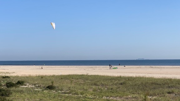
Sandy Hook Beach
The scene at the beach at Sandy Hook that fine September day.

Penny strained at her leash; she loves the beach and doesn’t like being on a leash when she wants to run. I didn’t want to get cited for letting her off-leash, so I waited until we were almost all the way down to the water to let her go. She ran south along the water’s edge, chasing seagulls, while I walked behind her. It was too cool to take off my shoes and socks, but warm enough to really feel comfortable. Although I’m not much of a swimmer and I hate sunbathing, I really do like the seashore.
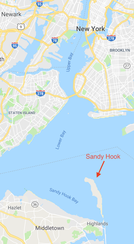
Sandy Hook on Map
Sandy Hook has a strategic location on the approach to New York City — which is why there are so many battlement remains and an active Coast Guard base there.

I let Penny run away, then called her back, then let her run away again. I wanted to tire her out a bit. This would likely be the only opportunity all day for her to be off leash. I think that’s the worst thing about traveling with her. She isn’t used to being on a leash and, when we’re in an open place like that, she doesn’t understand why she has to be on one. I don’t, either. If she doesn’t bother people or animals or destroy anything and I pick up after her when she poops, what difference does it make if she’s on a leash or off it? We were two specks on a miles long stretch of sand with only maybe a dozen people nearby. What was the big deal?

I put her back on the leash and walked back to the car. We continued on the road, looking for some sort of visitor center where I could plan my visit a little better. We wound up at the Sandy Hook Lighthouse a few miles away.
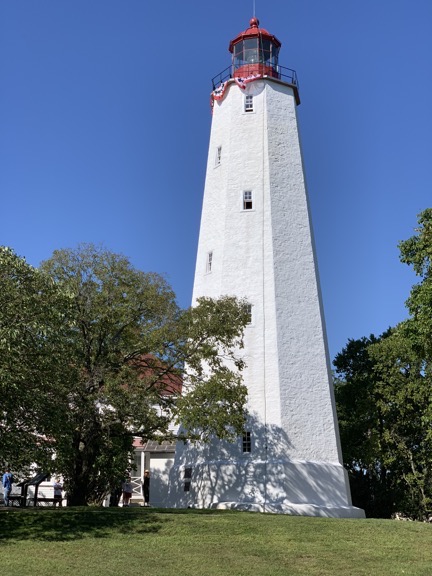
Sandy Hook Lighthouse
The lighthouse at Sandy Hook.

There was a visitor center there and I went in for a look. There were a few typical light house displays, but also a neat map that showed the locations of all the light houses that had been in the area over time. You could dial up a year and lights would indicate which lighthouses existed at the time and were functioning. Sandy Hook is at the south end of the entrance to New York’s Lower Bay and apparently it’s a crucial point for navigation, with lots of shallow water and obstacles in the mouth of the bay.

I went into the gift shop where a ranger sat at the counter. We talked a bit about off-season travel and the popularity of the area for birders. Then I went outside where I’d left Penny tied to a tree. There was a group of boy scouts in their teens, along with a few adults and a ranger at the base of the light house. I managed to wrangle myself a trip to the top of the lighthouse with the group. They were just waiting for the previous group to come down.

I went up last on the climb up a narrow spiral staircase to the top of the lighthouse, right behind a guy of about 16 years old who had to weigh at least 250 pounds. At the top landing was a ladder that we’d have to climb though a hatch. The big kid let me go first, which I appreciated; I honestly didn’t know if he’d fit through the hatch. Upstairs, the space around the fresnel lens was tightly packed with people. It got a little tighter when the big kid joined us.
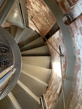
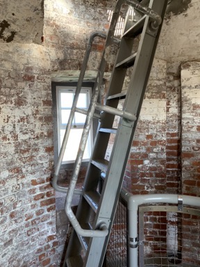
Spiral Stairs LighthouseLadder
A look down the spiral staircase from near the top (left) and the ladder to get up to the top of the lighthouse (right).

The views in every direction were amazing. It was a relatively clear day and we could see Manhattan’s skyscrapers to the north, as well as the endless expanse of the Atlantic Ocean, New Jersey, and the shoreline to the east, west, and south.
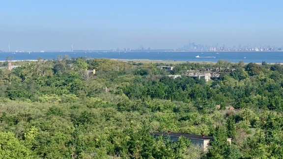
Manhattan in Distance
You can see the Verrazzano Narrows Bridge on the left and the downtown Manhattan skyline on the right through the haze on the horizon in this photo. In the foreground, you can see the ruins of the various batteries built and abandoned over time.

We didn’t stay long. I was one of the first back through the hatch — mostly because it was so tight up there that no one could easily get around me — but the last down the stairs. Afterwards, I fetched Penny from her tree and we took a walk among some nearby ruins. I love photographing old, disused things and this place was full of them. Unfortunately, so many areas were blocked off — as is common in the eastern part of the country. (Out west, they let you go pretty much anywhere you want but in the east, they’re constantly fencing things off to supposedly prevent people from getting hurt.)
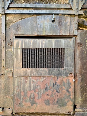
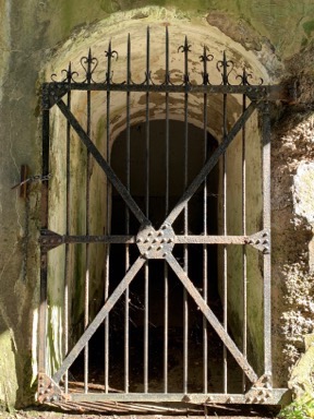
Rusted Door Rusted Gate
I like taking photos of old things, especially if they’re rusty. Why knows why?

Eventually, we went back to the car and drove to the end of the peninsula. There was apparently some sort of major Boy Scout camping event going on — tents with flags for various troops filled one of the parking lots. We walked out to an observation deck that looked out over some marshy lands, a beach, and the ocean and lower bay beyond. There were two rangers on the deck and several men with binoculars and spotting scopes. They were looking for birds. One of them claimed to have Shoreham Power Plant focused in his spotting scope and I accepted his invitation to take a look. Back in 1977, my family moved to Long Island so my stepdad could work on the construction of the Shoreham nuclear plant. I saw the smokestacks in the spotting scope, but I’m not convinced that was Shoreham, which was on the north shore of Long Island at least 100 miles away.
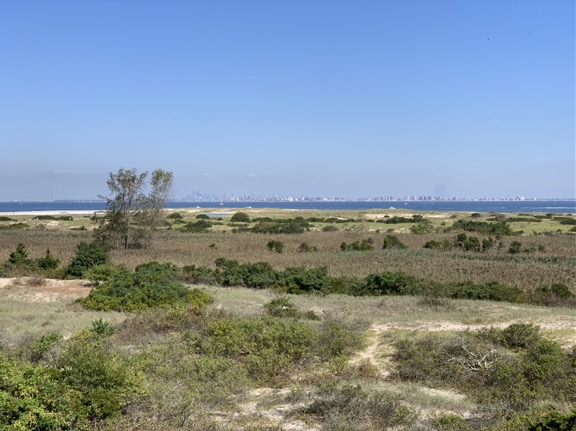
North Beach
The view from the observation platform which was about one story above the dunes.

We hung out for a while, listening to the guys talk and get excited when they saw a bird. Huge tankers passed remarkably close to the beach; later, when I looked at a nautical chart of the area, I saw that the channel was right there with lots of shallow water between it and lower Manhattan in the distance. One of the men seemed knowledgable about marine navigation in the area and I asked him a few questions about the easiest way to get from the ocean into New York Harbor: a channel under the Verrazzano-Narrows Bridge or up the west side of Staten Island. He didn’t know. I hope to find out for myself one day.

We walked back toward the car and then beyond it to the remains of a big 9-Gun Battery from World War II. I’d seen lots of old batteries like this on the west coast — most recently on a trip out to the coast of Washington that I never blogged about — but this was my first in the New York area. It was a huge poured concrete structure with lots of rusting metal doors and rails and you can bet I took lots of photos of various parts of it — even though a fence kept me from getting close. I guess they wouldn’t want tourists climbing all over the ruins (like they can out west).
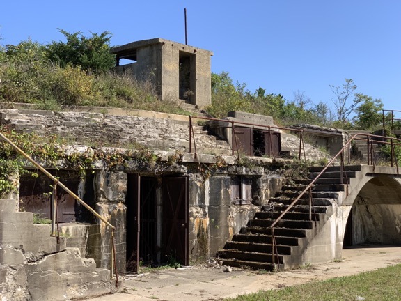
Battery
Here’s a very small part of the 9 Gun Battery at Sandy Hook.

Lunch at Sea Bright

After our walk, we went back to the car. I drove past some of the old housing on the west side of the peninsula in an area called Fort Hancock. Then we drove south off Sandy Hook in search of lunch. The weather was perfect and I was hoping to find a place with outdoor dining where I could take Penny. After pulling into a place with valet parking and deciding I didn’t want to turn over my brother’s car to a valet — remember that scene in Ferris Beuller’s Day Off? — I eventually found a parking spot at Tommy’s Tavern + Tap, a sports bar with a big family outdoor dining area. I carried Penny through, ordered a Bloody Mary and a clam pizza (don’t knock it until you’ve tried it), and settled down to enjoy my meal.
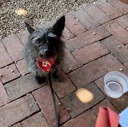
Penny Waits for Pizza
Penny waits for pizza. She ate nearly a whole slice.

One highlight: two women with a kid in a stroller and another kid about 4 years old walked by. The 4-year-old wanted to pet Penny but didn’t ask me or her mother if she could. The mother didn’t ask me, either. Maybe they were waiting for me to offer? I’m not going to offer to let a small kid touch my dog — what if she has allergies or scares Penny into yapping at her? It’s their job to ask me. But they kept walking by and then the kid started screaming because she couldn’t pet the dog. She kept at it for about 10 minutes. It was seriously annoying to everyone on that patio.

Meanwhile, Penny waited patiently until I shared my pizza with her.

We strolled down one side of the street in Sea Bright, looking into shop windows. Several stores had closed down. Remember, the season was over; I’m willing to bet that many businesses on the Jersey Shore get short term leases and close right after Labor Day. We crossed over and followed a path to a big board walk on a new embankment along the ocean. It looked brand new. I suspect the area had been pretty badly ravaged by Superstorm Sandy; there were a few homes under reconstruction on the land side of the walkway. There weren’t many people on the beach and I honestly didn’t feel like taking another walk there with Penny straining at the leash the whole way. So when we were abeam the restaurant, we followed a path off the boardwalk and returned to the car.

Back to Base

I made a few stops on the way back to my brother’s place.

First, an auto parts store. I wanted to get a cell phone holder for his car. He’s got a magnetic thing in there that works with his phone case. I wanted something that would stand the phone up. I wound up with one of those cell phone holders that sits in a cup holder. It worked a lot better than I expected it to. I was going to leave it for him but wound up taking it home and will likely use it in my truck since my new phone doesn’t fit quite as well as the suction cup mount I have.

Next, a Maserati dealer, to try to get the battery replaced in the key fob. There’s a long story about the key fob but it really isn’t worth telling. Let’s just say that the trip to the dealer was a huge waste of time.

Finally, Wegman’s. That’s a chain of premium grocery stores. Think of Whole Foods but without the attitude. (Although now that Amazon owns Whole Foods, the attitude might be gone; I don’t know.) I had the idea of buying something for dinner. But when I got my brother on the phone, he wanted to go out for Mexican. So I satisfied myself with buying some car snacks for the next day and headed back to his place.

We went to a Mexican restaurant that he likes and had a good meal. Then we hung out at his place until it was time for bed.

Heading Out on My Road Trip

In the morning, I got up at the same crazy early hour as my brother. He was going to a match in Pennsylvania that day — did I mention that he’s a competitive shooter? — and needed an early start. We chatted for a while before he left. Then he headed out and I prepped for my big road trip to Vermont.

But I wasn’t going straight to Vermont. Instead, I planned to spend the day in northwestern New Jersey. I figured I’d start with a hike at Watchung State Park, then hit a rock show in Franklin, and spend the night somewhere near Port Jervis where New York, New Jersey, and Pennsylvania meet.

I planned to bring all of my luggage. I had no idea what the conditions would be where I was going and I didn’t want to run out of clothes. I also wanted to spend some time organizing my luggage and shipping back some heavy things I bought before I headed home. Besides, did my brother really need my giant suitcase on his floor any longer?

It took three trips to get everything out to his car. Then, with Penny on her blanket on the seat beside me, I asked Google Maps to guide me to a coffee shop in Westfield and took off.

Watchung Reservation

I had coffee and an egg sandwich at Rock ‘n’ Joe. Although it was a bit chilly, I ate it at a high top table outside with Penny at my feet. Westfield was a completely different town at the same time of day I’d been there the previous week.

I let Google Maps guide me to the Watchung Reservation, a large park with miles of wooded trails. My brother had suggested it as a destination; he and his ex-wife used to take their dogs there. I wanted Penny to get some quality off-leash time and I wanted to go for a nice walk in the woods. But I didn’t know where to start my visit. I figured I’d wing it, as I so often do.

In the end, I let signs guide me. Once I got into the lush, green park, I started seeing signs pointing to various areas within the park. One of them directed to a “Deserted Village.” Since I’m always up for a walk through a ghost town, that’s where I headed.

I parked among about 20 other cars in a parking lot, but rather than head down the paved road to the deserted village, Penny and I struck off on a nice trail into the woods. I let her off her leash almost immediately and she ran off in front of me as she usually does, stopping occasionally at the base of a tree when she saw a squirrel up above. We don’t have squirrels where I live — not many trees and plenty of predators like eagles and owls — so it’s always a treat for Penny to go for a hike in the woods where squirrels are plentiful. I’ve been with her at campsites in the north cascades where she’s parked herself at the base of a fir tree for a half hour or more just waiting for a squirrel to come down.

I used an app on my phone to keep track of my path so I wouldn’t get lost. The trail had side paths and I chose them almost randomly with a goal of not straying too far from the parking area and getting closer to the deserted village. One trail I took was narrow and wound down a little hill before heading back toward where I imagined the deserted village might be. I only passed one other hiker: a woman walking alone in the opposite direction. We greeted each other and kept walking.
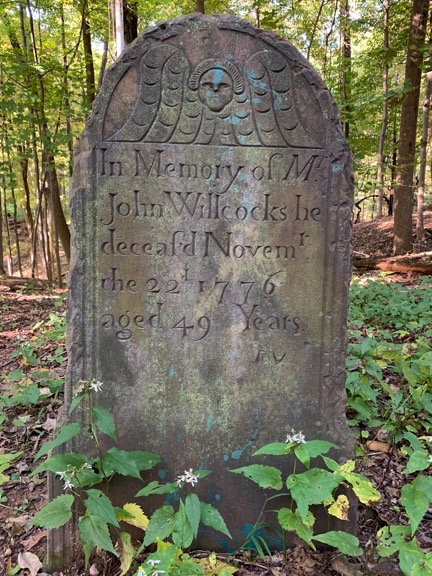
Gravestone
The sole remaining original gravestone in this tiny burial ground.

Eventually, I wound up at a tiny cemetery. There was just one old gravestone still standing — it marked the grave of a man who’d died in 1776. I don’t know if I mentioned this elsewhere in this series of posts, but there are plenty of Revolutionary War error buildings and other sites. This was one of them. There were five headstones there, four of which were installed in the 1960s to replace missing ones.

Across a stream and up an embankment I could see some buildings, so that’s where we headed, crossing a bridge and climbing a path. I put Penny back on her leash, not wanting to get into trouble with any park rangers. We wound up on the Main Street of what was left of Feltville, which had been built starting in 1844 as a mill town, and Glenside Park, which had converted that mill town into a summer resort in 1882. There were a lot of old buildings, many of which were boarded up. There were also a lot of foundations, including that of the mill, which had been torn down in 1930.

We followed the roads and paths all over town to take in the various sights. There weren’t many people around on that pleasant Saturday morning; maybe because it was still early? Back down at the creek, I let Penny back off her leash while explored the mill site and a dam site. I took some pictures.
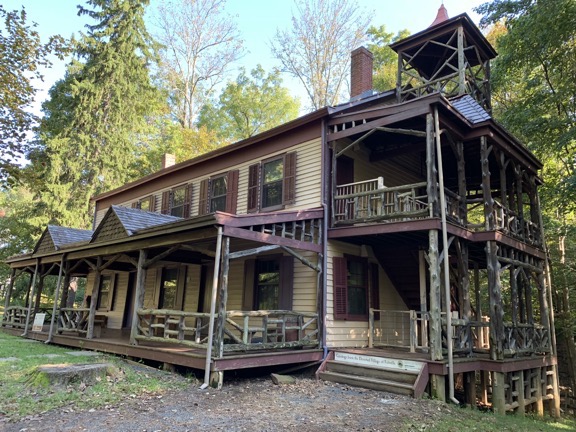
Feltvill Building
One of the buildings still in use a the Deserted Village. I was still getting use to my iPhone’s wide angle camera and didn’t expect this kind of distortion; I know now that putting it in 2x mode will prevent weird angles like this.
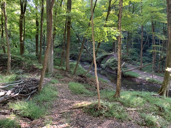
Dam Site
The dam site along the creek. You can just make out the berms on either side. This dam held back a small lake that channeled water to the mill downstream.
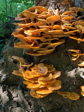
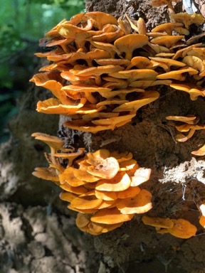
Regular Mushrooms Portrait Mushrooms
The obligatory mushroom photo(s). I played a little with the iPhone’s improved Portrait Mode in the photo on right. See how the background is out of focus? I think the mushrooms are a little out of focus because I was too close to them.

We were there about two hours and I only walked about 2 miles. But I was done and ready to move on. So I put Penny back on her leash and followed the paved road back up to the parking lot.

The Rock Show

I make jewelry out of gemstones. It’s a hobby gone wild that began with a lapidary in Quartzsite, AZ gifting me a small piece of bacon agate in January. I’ve since learned to use sterling silver and copper wire to create pendants and have branched off to making bracelets and earrings and even polishing my own stones. I now sell my jewelry online and at various venues in Washington and beyond.

The question I get most often from people who see my work and my sizable collection of gemstone cabochons — I have about 200 of these polished stones — is “Where do you get your stones?” My response, which tells only part of the tale without actually lying, is “I go to rock shows.” So when a chat with a gemstone dealer in Westfield the previous Saturday morning included him telling me about a rock show in Franklin, NJ that weekend, I put it on my list of things to do.
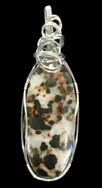
Franklinite Pendant
Franklinite in a sterling silver pendant.

Franklin, by the way, is where you can find Franklinite, a minor ore of zinc, manganese, and iron that was discovered at two mines in the Franklin area. I have a Franklinite cabochon that I used in a piece of jewelry (which is still available as I type this). The Franklin Mineral Museum has been hosting the Franklin-Sterling Gem & Mineral Show for 62 years. It was held in the Littell Community Center in Franklin, NJ. I learned what I needed to know to find it by working Google after talking to that rock dealer in Westfield. (Seriously: how did we survive before Google?)

Google Maps guided me there. I paid a $7 fee, got a wrist band, and drove into the parking lot. Since part of the show was outdoors, I put Penny on her leash and we walked from one outdoor vendor booth to the next. There were a lot of rocks, but not much of what I was looking for: affordable, interesting cabochons and slabs that I could cut and polish into cabochons at home. I bought a few small, cheap pieces: a pair of matched ammonites that I’ll make into separate pendants, a few polished agate slices, and some heart-shaped beads for earrings. Then I put Penny in the car and went inside.

(I should note here that when Penny is in the car, I can’t lock it; the alarm system in the Maserati is so freaking sensitive that a 7-pound dog moving around in there sets off the alarm and there doesn’t seem to be a way to lock the doors without turning on the alarm. So any time I left Penny in the car, the doors were unlocked. That’s normal for back home when I’m driving a 19-year old Jeep but not normal in the NYC metro area when I’m driving an exotic sedan.)

Inside was more of the same, although most of what was there was nicer. There was one booth with some incredible cabochons, but they were very expensive. My artist friend Janet says I need to buy good stones to sell my jewelry, but I know my local market. I can’t spend $50 on a stone when most of my local market balks at paying more than $49 for a pendant. The only pendants I can sell for more are the ones with popular, well-known stones like malachite and turquoise, and even then it’s tough to get more than $69. I’m hoping that if I sell at shows in Arizona this winter I can find a market with deeper pockets.

I did find some large cabochon beads with holes right down the middle. I’ve been using these to make “budget pendants” and, for a while, they were selling really well. I also found some small, inexpensive rose quartz cabochons. I chatted for a while with a dealer who goes to Quartzsite and Tucson every year; I’m wondering if I’ll find him down there in January.

Back outside, I made a conscious effort to find the rock dealer I’d spoken to in Westfield. I’d walked right past his booth on my first pass. We chatted for a while and he remembered me kind of vaguely. I noticed that he had a nice big labradorite slab with really nice blue highlights. He made me a deal on it and, although it’s a bit more than I wanted to spend, I know I’ll get at least a dozen cabochons out of it so it will definitely pay for itself with dividends. There’s even a chance that I might sell part of it for what I paid for the whole thing — I’m thinking about selling some of the slabs I’ve accumulated lately.

I should mention here that I do sell the cabochons that I buy. Although I began by showing them off at my day table as a way to interest customers in custom pendants — buy a stone and pay an extra $30 to have it made into a pendant in two hours — I’ve been selling quite a few stones to other jewelry makers and people who just like stones. The other day, in fact, a woman bought five stones, spending over $100. Although I make more money when I sell the stone in a pendant, I have a markup on the stones and selling them loose is a lot quicker and easier than making a pendant so I’m not complaining.

In all, I spent about an hour and $50 at the show, not including that $7 entrance fee. It was a nice little show, with “little” being the important word. When I go to Arizona in the winter, I see a thousand times more gems and minerals at just one of the venues. Prices are much better, too. I’m spoiled.

High Point

From there, we headed out towards Port Jervis. I had it in my head that I wanted to see High Point, so that’s what I asked Google Maps to guide me to.

Along the way, I stopped at a funky little restaurant in Sussex, NJ called the Sussex Inn Restaurant. It was on the lower level of a hotel. I sat in a booth and had a calzone (of all things). In one of the booths behind me was a very loud (and apparently old) British couple talking about the war — yes, World War II — and another equally loud Trump supporter. The calzone was huge and I wound up taking it with me but later throwing it away.
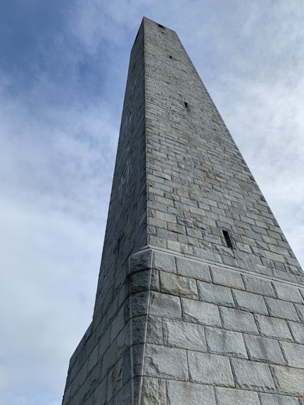
High Point Tower
A wide angle view up the High Point Monument from its base.
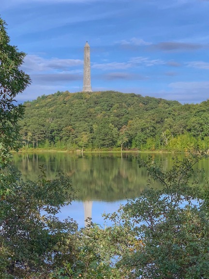
Tower Reflection
On the way out of the park, I stopped for a more artistic shot of the Monument. I really am a sucker for reflections.

At High Point State Park, I followed the signs to get into the park. High Point gets its name because it’s the highest point in the State of New Jersey — a whopping 1600 feet above sea level. The entrance fee booth was closed — remember, it was after Labor Day — but there were plenty of people in the park. I followed the road up to the High Point Monument, a 220-foot tall obelisk built in 1928-1930 to honor veterans. I parked, put Penny on a leash, and got out for a walk. We went to the base of the monument, stepped inside but didn’t climb to the top, and took a hike in the woods. I got some nice views, especially out to the west where the Delaware River separated New Jersey from neighboring Pennsylvania.

A Night in Port Jervis

We didn’t stay long. After our hike, I worked Google Maps a bit to find a place to spend the night. Traveling with Penny is a bit of a challenge sometimes; many places don’t allow dogs. I found the Erie Hotel and Restaurant in Port Jervis and gave them a call. Apparently, the only phone was at the bar and it took a while for the bartender to find a manager who would say whether dogs were allowed. I finally got the green light and a rate and told them I’d be there within an hour.

It took considerably less than an hour to get there. Along the way, I stopped for gas and some dog food. I had a cooler with me — I’d bought some Italian pastries for my friends in Westfield that morning — so I bought some orange juice and yogurt, too. I was hoping to get some dry ice, but the supermarket didn’t sell it.

The hotel was one of those old railroad hotels built in 1890. Restored in 1994 after a fire, it still had the small rooms it might have had when built, although each room also had a bathroom which I doubt it had when first built. It was comfortable and quiet and cheap enough. I had a light dinner and a cold hard cider in the restaurant downstairs, which seemed to allow gambling via a keno-like game. After dinner, I fetched a bucket of ice and put it into the cooler to keep those pastries and other items cold. Then I took a quick walk up and down the main street in town — which was pretty dead on a Sunday night — and went up to my room with Penny.

We were asleep before 10.

(Continued in Part 5: On the Road to Vermont)

Snowbirding 2016: Death Valley

I finally make a trip I’d postponed for four years.

Posts in the Snowbirding 2016 Series:
Introduction
The Colorado River Backwaters
Quartzsite
Wickenburg
Phoenix
Home
Back to the Backwaters
Return to Wickenburg
Valley of Fire
Death Valley
– Back to Work

I need to start this account with some back story to put it into perspective. If you’re tired of reading about my old life, skip the following section and start reading at The Drive.

The Back Story

One of the things that bothered me most in the last years of my marriage was the fact that my husband’s 9 to 5 job and his insistence on living in a condo in the Phoenix area instead of our Wickenburg house made it very difficult for us to have any fun together. Although my time was extremely flexible — I was still in my declining writing career and didn’t do much flying when I wasn’t away for my summer job — his wasn’t. He worked every weekday. Even when I moved into the condo with him that last winter we were together, we seldom did anything during the week. Dinner and a movie gets old after a while, but not nearly as old as watching him channel surf every evening we didn’t go out. On weekends, he insisted on making the 90-minute drive back to Wickenburg on Friday afternoon, returning with a 90-minute drive back to Phoenix on Sunday evening or Monday morning. I tagged along when I could, but the irony of our work schedules was that I was more likely to fly on weekends than weekdays. Besides, on weekends he’d spend a lot of time catching up on car shows he’d DVRed from Dish Network. Doing something “different” meant taking the same old motorcycle ride up to Prescott. He wouldn’t take his plane out unless the weather was perfect and forecasted to be perfect until after his return.

To make matters worse, he was nearly constantly in a foul mood. His job — like the others in Phoenix before it — had become a dead end, with an unpleasant work environment and a micro-managing boss who made it difficult for him to make the sales he needed to earn a better living. He was struggling financially to not only cover the high cost of the condo he refused to sell, but the loan on his Mercedes, expenses for a plane he seldom flew, his other living expenses, and his regular contributions to his niece’s education, which had entered the PhD candidate phase. He couldn’t see how his debt and expenses had made him a slave to his job. He was never happy and he seemed to take it out on me, accusing me of being the reason “we had no friends,” and complaining when I preferred reading or doing crossword puzzles over spending another frustrating evening in front of the television while he channel surfed.

When that job came to an end in early February and he seemed to have another job lined up behind it, I pushed hard for us to go away for a five-day trip to Death Valley. We’d take the Mobile Mansion, set up camp at one of the park’s campgrounds, and take our cameras out to explore Death Valley. February was the time of year when the wildflowers started blooming. Our previous trip together to Death Valley — way back in the 1980s — had been limited by the rental car we’d had; we’d be able to go a lot farther off the beaten track in a 4WD truck.

I saw the trip as an opportunity to leave troubles behind, to remember the other great trips we’d had together, to go back — at least mentally — to a better time when our relationship was better and our love for each other was stronger. I hoped it would recharge our relationship and bring us closer together again.

Unfortunately, the trip was not to be. His mother was in town — as she was every winter for a month or two — and although we’d put her in a great two-bedroom home that was part of an assisted living community in town, she was at our house every single day and long into the night. For some reason — fear, perhaps? — he didn’t tell her about our upcoming trip. As the days to departure ticked down, I kept waiting for him to tell her. Surely she could live without us for five lousy days.

Lucy the Pug
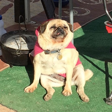
Lucy, the toothless pug, basking in the morning sun at our Colorado River backwaters campsite. She survived that February 2012 night in the desert by hiding under a neighbor’s porch.

And then the day before we were supposed to leave — the day we should have been packing — he let our dog and my friend Janet’s dog out and later let our dog in without remarking on the absence of the little toothless pug. It was hours before I realized that she was gone, lost in the desert. After spending the entire day looking for her and feeling nearly as heartbroken as Janet about her loss, I snapped. I told him I’d had enough of him and cancelled the trip. The next day, I went down to Phoenix to work on a book in the office I’d ironically moved there to be closer to him.

I cooled down after a week or two and agreed to go with him to a marriage counsellor. And although I thought things were on the mend and looked forward to him starting yet another job that would give him more free time, he apparently had other ideas. When I left in May for my summer job in Washington, he signed up at Chemistry.com. A month later, he was sleeping with the desperate old whore who convinced him to dump me — after a 29-year relationship — and go after my money. He even told the judge at the first hearing that I had abandoned him. (WTF?) You can read about the rest elsewhere in this blog.

Anyway, that’s the back story. I’ve been wanting to visit Death Valley for the spring wildflowers for at least four years. This year, I finally got a chance to make that happen.

(Funny how much I can make happen without a sad sack old man holding me back.)

The Drive

It wasn’t an uneventful drive.

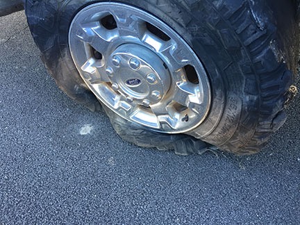
I left Valley of Fire around 10:30 AM and got on I-15, heading southwest. I was just settling in for the three-hour drive with the cruise control locked in at the highway speed of 65 MPH when I felt a weird vibration in the truck. I got into the right lane and killed the cruise control about the same time the right rear tire on the truck blew.

I’d always wondered what it felt like to have blowout at highway speed when towing a 15,000 pound trailer. Now I know.

Flat Tire
Ouch.

I kept control of the truck and managed to bring it to a stop within about 1,000 feet on the narrow shoulder of a very long overpass. Because highway traffic was just three feet away from my door, I lifted the center console and slid across the seat to get out on the shoulder side. The tread on the tire was nearly completely gone. Moving forward to get off the overpass was not an option unless I didn’t mind destroying the rim. The tire would have to be changed right where I was.

For the second time in less than two months, I called AAA.

Mud Flap and Tire
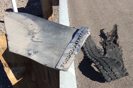
My damaged mud flap, sitting up on the guardrail with a big hunk of tire tread on the shoulder beside it.

While I waited, I walked back along the highway. I recovered a big chunk of the tire, but more importantly, I also recovered the mudflap that had been torn off when the tire blew. I brought them back to the truck and threw the mudflap into the bed.

A flatbed tow truck arrived an hour later. A guy came out and set about lifting my truck’s rear end with a hydraulic jack and lowering the spare tire fastened under the truck bed. In just a few minutes, the tire was changed. Of course, the spare’s pressure was low, but that wasn’t a problem. The truck had a compressor and the tire was soon inflated and I was ready to go.

Honestly, anyone who travels — especially alone — really should have roadside assistance like AAA. This was the second time it helped me on this trip. And yes, I probably could have changed the tire. But it likely would have taken me hours to do it and the tire pressure still would have been low. I got the job done without getting dirty for the cost of a $20 tip.

While I’d been waiting, I’d been working the phones. I called Discount Tire in northwest Las Vegas — a location that was along my route to Death Valley — and arranged for a set of replacement tires. In all honesty, I never did like the off-road tires that had come with the truck. I just hoped I’d get a year out of them. I obviously wasn’t going to. Best to just replace them all now with an all-terrain tire that was better able to handle the weight I was towing. I wound up with a set of four Toyo Open Country tires. Even with a $100 rebate, it was quite a chunk of change. With luck, however, I won’t have to replace them for at least 5 years.

So my next stop was the Discount Tire location I’d called. There was a long line inside. I was told it might be two hours. I secured my place in line, paid for the tires, and then pulled my rig into an empty lot next door. I disconnected the Mobile Mansion, topped off the truck’s tank with diesel, and parked it back in the lot. Then Penny and I went into the RV and had lunch.

That’s one of the nice things about traveling with a house. The fridge and bathroom are always handy.

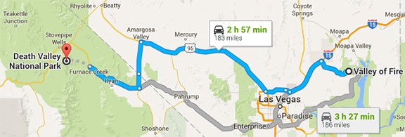
It was about 3:30 PM by the time the new tires were on and I’d hooked up the Mobile Mansion again. Sunset was two hours away and it didn’t look as if I’d get to Furnace Creek by then. But I put the pedal to the metal and drove. I got on Route 95 and followed that to Amargosa Valley. Then south on route 373 to Death Valley Junction. Finally 190 west to Furnace Creek. There wasn’t much traffic at all and I was able to do (at least) the speed limit all the way. The new tires felt great — and were amazingly quiet compared to the old ones.

Route to Death Valley
I took the highlighted (blue) route from Valley of Fire to Death Valley.

On the descent down to the valley, the sky to the west, which was full of high, light clouds, turned brilliant pink and orange and then violet. It was probably the best sunset of the trip.

It was nearly dark when I pulled to the curb across from the office for Furnace Creek lodging. I checked in for the campsite I’d have for the next two nights. Then I walked back to the truck and drove it the final half mile to the campground. It was a back-in site between a giant luxury motorhome and some tent campers. I’d never parked the Mobile Mansion at night, but it wasn’t as if I could wait until morning. I set out a lantern on the driver’s side at the back of the site and a flashlight on the driver’s side in the front. And then, with a little guidance from the tent campers, I backed it in.

Got it on the first try. Sometimes I really surprise myself.

Setting up camp was easy because the site was level and there were no hookups. I disconnected the Mobile Mansion from the truck and put out the slides. Done.

The only drawback: that luxury motorhome had a generator running and it was loud. (What is it with these people?) Fortunately, they shut it off at 7 PM sharp.

Dawn at the Dunes

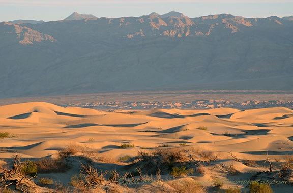
Although I’d hoped to get some exploring in on the afternoon when I arrived, arriving in the dark made that impossible. So I started my explorations early the next morning after a quick breakfast. Penny and I climbed aboard the truck before dawn and headed north toward Stovepipe Wells. I had the idea of photographing the dunes near there around sunrise. Unfortunately, so did a bunch of other people. When I arrived, the parking lot was half full and there were people all over the dunes. Getting a shot without a bunch of footprints or a tourist in it was not likely.

So I backtracked down the road and parked on the shoulder. I climbed into the back of the truck with my tripod and camera and framed a few shots using my 85-300 telephoto zoom lens. The focal length compressed the perspective, as I suspected it would, bringing the distant mountain tops closer. I got a few shots I liked before climbing back into the truck to continue on my way.

Death Valley Dunes
Not long after sunrise along the road between Furnace Creek and Stovepipe Wells in Death Valley.

On the Road to Skidoo

Death Valley Map
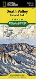
I highly recommend this map, which is available from Amazon.

And here’s where I made my mistake. Back in January, I’d had lunch with my friend Rebecca, who had been to Death Valley earlier in the year. She’s showed me some locations on a National Geographic map that I bought and had shipped out to me when I was staying at the Colorado River backwaters south of Ehrenberg. I’d studied the map and had decided to try finding a set of dunes to the west of Ubehebe Crater in the north part of the park. But I guess I hadn’t “studied” the map enough — for some reason, I thought the road through Stovepipe Wells was the right road. It wasn’t until I was at Emigrant Campground that realized something wasn’t quite right and pulled over to check where I was going. I’d gone about 40 miles the wrong way.

Pro tip: Maps can only help you when you use them. Duh. (I should have grabbed one of these maps at the Visitor Center. It’s not as detailed as what I had, but it’s easier to manage in the truck.)

So I came up with a Plan B: explore the west side of the park up Emigrant Canyon Road. The map showed two interesting townsites: Skidoo and Harrisburg. I like wandering around ghost towns and figured I’d check them out.

I headed south on Emigrant Canyon Road, climbing ever higher into the mountains on the west side of the park. Outside, the air was cooler — in the low 40s, according to the truck’s outside air temperature gauge. But it was clear and I knew it would warm up. I found the sign to Skidoo and turned left onto a nicely maintained gravel road. Ahead of me, in the near distance, were two white SUVs and a white pickup truck. Soon, I caught up with them and was driving in their dust. When I saw an old cabin on a short road off to my left, I turned and used it as an excuse to let some miles get between us.

Abandoned Shack
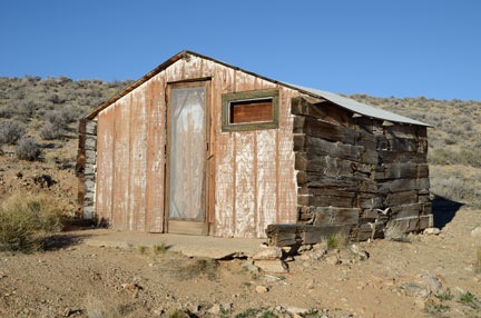
One of the neatest abandoned buildings I’ve ever come upon.

The cabin wasn’t anything interesting other than the fact that it was in remarkably good condition and would still make a very usable shelter. That in itself was remarkable: most unused buildings in this country — especially those in remote places — are targets for vandals who destroy for the pure satisfaction of destruction. There were no signs to keep out so I did what any explorer would do: I opened the screen door and wooden door inside it for a peek. I found an old spring bed frame and some litter inside. No smashed beer bottles, no graffiti, no vandal debris. I carefully closed both doors up the way I found them.

Door Light
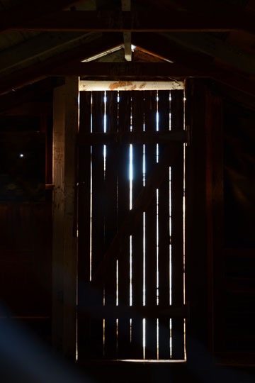
I don’t know why, but I like this image.

In general, the place wasn’t very photogenic. The most interesting shot I got was through a hole in the boards covering the back window: the light shining through cracks on the door. It was the cleanest abandoned building I’d every seen. I hope it stays that way forever.

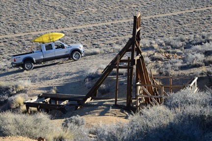
Mine Shaft and Truck
Yes, I do realize that I probably looked pretty silly driving around Death Valley with two kayaks on my roof.

Penny and I got back into the truck and crossed the road. Soon we were climbing up a hill to an old mine site on the opposite hillside from the cabin. I left Penny in the truck — I don’t like to worry about her falling into mine shafts — and explored on my own. There wasn’t much there that I hadn’t already seen before at countless mine sites in Arizona and Nevada: the support structure beside the main shaft, several smaller horizontal mine shafts going into the hillside, and the remnants of old buildings. The site was neat and clean. Thinking back on this, I have to wonder if the park service or volunteers clean these places up. Or if vandals simply avoid National Parks.

We got back on the road and continued the drive to Skidoo. In most places, the road was wide with gentle curves and a bit of washboarding. In other places it was narrow and rocky as it wound along the edge of a steep drop-off. I passed the ruins of another building on my left and decided to explore it on the way back. I was eager to see Skidoo and wanted to be there before the sun had risen much farther.

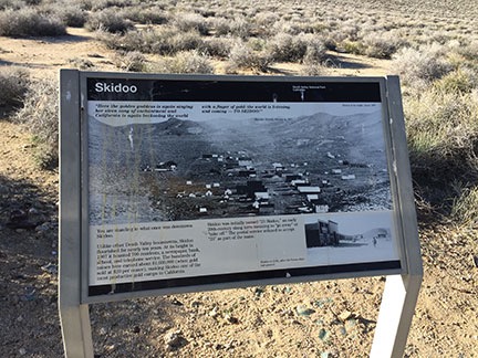
Skidoo Sign
Here’s the sign that tells you you’ve arrived at Skidoo. At the top is a quote: “Here the golden goddess is again singing her siren song of enchantment and California is again beckoning the world with a finger of gold: the world is listening, and coming — TO SKIDOO!” Apparently, the Rhyolite Herald was pretty good at dishing out bullshit back in 1907. All I could think about was where did they get their water?

When I got there, I didn’t even know I was there. It was just a flat area among the hills with lots of dirt roads going off into different directions. I drove up to an interpretive sign set alongside a turnoff in the road that announced I’d reached my destination. Wikipedia calls Skidoo a “virtual ghost town” but I don’t see any “virtual” or “town” about it. There’s really nothing of the town left other than foundation rubble and broken glass.

I’ve been doing some video journalling lately and apparently made one from the top of the hill. I didn’t turn toward the sun, probably because I knew the video in that direction would be crappy. I sound nasal because I was fighting a cold and I’m not sure if the snowcapped mountains are the Sierras.

I saw a road going up a steep hillside and decided to check it out. It would be a good test of my new tires. I drove over to the bottom of the hill, popped the truck into 4WD and started a steep climb. There was plenty of room at the top to park and (fortunately) to turn around. So I parked, shut the engine, and climbed out with Penny for a good look. From my vantage point, I could clearly see where the town had been (despite there being no real traces of it), as well as several mine shafts with towers. The two SUVs and pickup truck I’d seen earlier in the day were parked by one of the mines far below me. Off to the northwest, I could see snowcapped peaks.

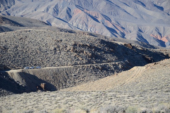
At Skidoo
I could see the white trucks and the men who had been in them near a mine site across the ravine from my observation point. A photo shot with my 300 mm lens revealed the Noreas logos on the SUVs. One of the men was dressed as a ranger and had likely come in the unmarked pickup with the big antenna on the roof.

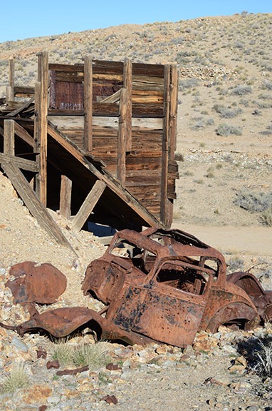
Mine Site with Truck
There wasn’t much left of the truck and what was left was half-buried in mine tailings.

I turned the truck around and headed back, realizing that the road looked a lot steeper from the top than it had from the bottom. I took it slow in 4WD low gear. Then I found my way to another mine site I’d seen from the top of that hill, parked off the road, and got out for a look, again leaving Penny in the truck. What interested me most about this site was the wrecked truck there. For some reason, I like to photograph abandoned vehicles so I really spent quite a bit of time on this one.

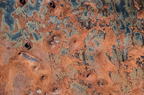
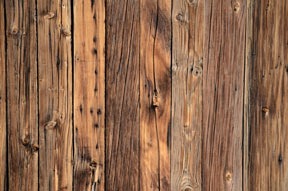
Rusty Car Door Wood Planks
I like the textures you can find among old, ruined things: a rusty car door, a wall made out of wood planks.

By then I was pretty sick of Skidoo and ready to skiddoo. (Sorry, but I couldn’t resist that one.) I turned the truck around again and retraced my route back to pavement eight miles away. I did stop along the way to visit that other abandoned building, but there wasn’t much there of interest so I didn’t stay long. Not even worth sharing a photo of it.

Harrisburg / Aguereberry Camp

Back at Emigrant Canyon Road, I had to make a decision: go back into Death Valley and explore elsewhere or continue on my way. I decided to go a little farther down the road to see if anything else was interesting. That’s how I wound up taking the turn to see the ghost town of Harrisburg, which was partially visible from the paved road.

I drove about a mile or two down the unpaved Aguereberry Point Road and parked with two other vehicles in a tiny parking area in front of a closed gate. The folks from the other vehicles were just leaving their cars and walking toward the ruins about a quarter mile away. They had a dog with them, too, so Penny and I hung back to give them space. I’d later discover that they were part of a group of three, two of which were in period costumes for a photo shoot. We were the only people there.

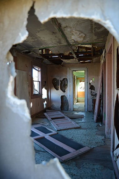
Through the Wall
A look through the wall of Pete Aguereberry’s old house.

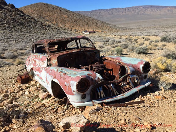
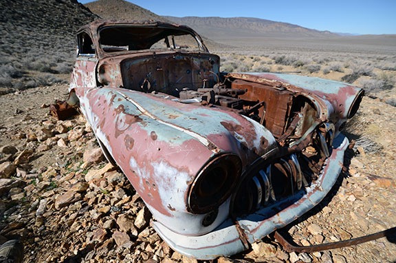
Although maps identify this spot as Harrisburg, a sign at the ruins called it Aguereberry Camp. The main site consisted of three buildings, an outhouse, and the remains of a mine. Farther up the road I’d walked was the ruins of an old Roadmaster sedan and still farther were the ruins of the Eureka Mine, which I did not visit. (There are only so many mine shafts a person can see in a day.) While the photo shoot folks were working around the car, I explored the buildings. They were in disrepair and vandalized, just as I’d come to expect of ruins, but not nearly as bad as I’d seen at other vandalized sites.

From there, Penny and I hiked another 1/8 mile or so to the old car, passing the photo shoot folks on their way back. The car made a remarkably interesting subject for photography — at least in my mind. The original color, teal (?), could still be seen among the rusty patches. Even the logo of the car was visible in one spot — which is how I knew it was a Roadmaster. I took quite a few shots, many of which featured Aguereberry Camp’s buildings in the background. I even got to play a bit with my 10-24 mm lens, which I seldom use these days.

Roadmaster
A wide angle (16 mm or 24mm full frame) shot of the car with Aguereberry Camp in the background.

Wide Angle Car
A very wide angle (10 mm or 15 mm full frame) shot of the car with the buildings visible through the windshield.

We walked back to the building a while later and spent some time chatting with the photo shoot folks. The two models — a man and a woman — had changed back into regular clothes. They were all sitting in the shade, snacking on peanut butter and apples and other tasty treats. They offered me some, but I declined. We talked about Death Valley and photography and they urged me to continue up Aguereberry Point road to the point. “The view is amazing,” the photographer assured me.

Aguereberry Point

Although I felt as if I’d had enough driving along bumpy back roads for the day, I’m not one to pass up a view — especially one that isn’t crowded with tourists. So when I left the photo shoot folks, I continued along the road.

Aguereberry Point was only about six miles from pavement, but much of the road was very narrow for most of the way. There was a section that it wound through a narrow canyon that I could imagine being treacherous in a rainstorm. Then it came out onto a hillside and continued climbing out in the open. Up and up and up, finally ending in a small parking lot that looked as if it were at the top of the world. Penny and I were the only ones there.

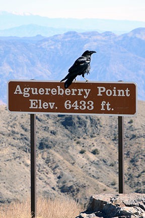
The view was good from the parking lot, but the photographer had advised me to take the trail to the point. After walking (and climbing) a bit on the wrong trail, I got on the right one and followed it as far as I could go. The view of Death Valley was unobstructed to the northeast and southeast, with a mountain due east that blocked the view that way. At an elevation of 6,433 feet, we were at least that high above the valley floor, much of which is below sea level. It was dead quiet.

Photos really can’t convey the full picture of what this place is like, but here’s a panoramic image to give you an idea. Was it worth the drive? Hell yes.

Aguereberry Point Panorama
Here’s a panorama taken at the point. Click the image for a larger version that you can scroll to see details.

Raven
Ravens like dog food. Who knew?

I walked back to the car and put out some food and water for Penny. A young couple drove up and parked next to the truck. As they donned backpacks, we chatted about places to visit in the park. I had nothing to offer except a recommendation to skip the drive to Skidoo. They told me that the wildflowers were amazing down near Ashford Canyon, where they’d camped overnight. Then they were off down the trail, leaving me to chase off the ravens that were eating Penny’s food.

On the Trail of Wildflowers


This video was released by the park service less than a week before my visit. Watch it full-screen.

From there, I retraced our route back to pavement and, from there, back down into Death Valley. We passed through Stovepipe Wells and headed toward Furnace Creek. That’s when I noticed the wildflowers I’d missed that morning on my predawn drive. The roadsides were full of them. I didn’t realize it, but Death Valley was heading for a once-a-decade “super bloom.”

Flowers
I thought there were a lot of flowers here, north of Furnace Creek. But this was nothing compared to what was about 50 miles down the road.

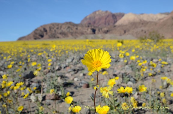
After a brief stop to check out the desert pupfish at Salt Creek, I continued past Furnace Creek on Badwater Road. I was back among the tourist crowd, with lots of cars and buses along the way, especially at Badwater, which is the lowest point in the U.S. at 282 feet below sea level. There were lots of people walking out on the salt flats there, but I didn’t bother to stop. I was aiming for Ashford Canyon, where the young backpackers had said there were so many flowers. The further south I got, however, the more flowers there were. People were parked alongside the road where the flowers were thickest, taking photos and walking among the bright yellow blooms. I couldn’t resist a few stops myself, although I knew I’d get better shots when the sun was lower in the sky.

Death Valley Flowers
The light wasn’t as good as it could have been, but I couldn’t resist stopping for a few photos along the way to Ashford Canyon.

I was also surprised to see standing water in various places alongside the road. I’d heard that there had been a lot of rain in Death Valley that fall, but I’d assumed the water had run off or seeped into the ground. Instead, there were a few dry lake beds that weren’t exactly dry. Some were almost swampy. Although I hoped for an opportunity to get some good reflection shots, conditions were unfavorable; a breeze put just enough ripples on the water surface to break up any good reflections.

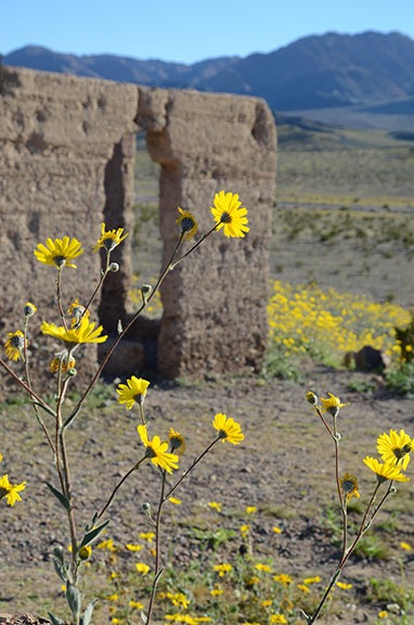
Flowers at Ashford Mills
Desert gold wildflowers at Ashford Mills.

I arrived at the remains of Ashford Mills after 4:30 PM. The same big yellow flowers — appropriately named “desert gold” — I’d been seeing along the way were scattered all around the ruins. I wandered around the ruins and took photos while Penny sniffed here and there. It was amazing to see hills in the distance yellow with blooms.

Death Valley Flowers

Death Valley Flowers

Death Valley Flowers

Death Valley Flowers

Death Valley Flowers
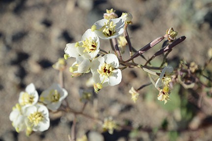
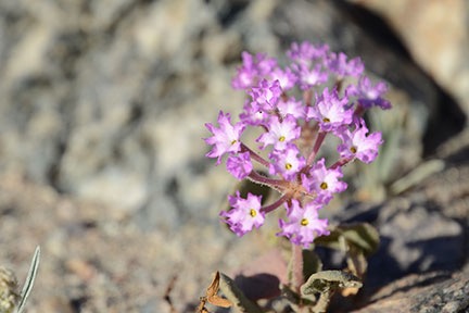
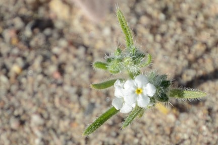
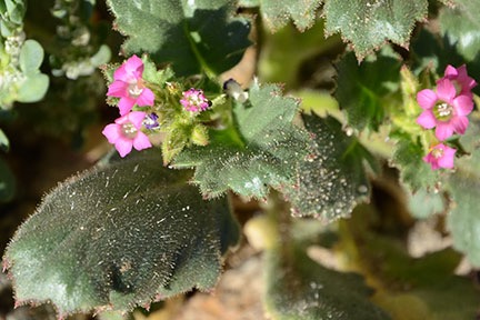
Here are several close-up shots of some of the smaller flowers I spotted while wandering around.

There were also some smaller flowers that were less obvious and required careful attention to spot. I did a lot of crawling around with my 16-85 mm lens — I don’t have a macro lens — to get close-up images of them. The group of four people sitting out at a picnic table near the parking lot, eating a late lunch or early dinner, must have thought I was nuts. I was really getting into it.

The turn for Ashford Canyon was right across the road from the road to Ashford Mills. It was a narrow two-track road that wound up a hillside and then into the canyon. The young backpackers had said the flowers were good up there, but as I began the slow bumpy drive I began wondering whether they meant that the flowers were good in that general area. They certainly were amazing. I drove for about a mile when I realized it wasn’t going to get any better than what I was already seeing. I found a place to turn around and started back.

By this time, the sun was sinking quite low. Mountains on the west side of the park would make sunset a lot earlier than I expected after consulting Siri that morning. (Ask Siri what time sunrise or sunset is and she’ll tell you and provide a weather report.) I wanted to head back for a late afternoon shot of a particularly flower-filled area along the road. So I headed back toward Badwater and Furnace Creek. I reached the location I was thinking of just as the light was getting very good and got out to take a few photos.

Death Valley Flowers
The carpet of yellow flowers is a stark contrast to the bare rock walls on either side of Death Valley.

Leaving the Valley

By the time I was ready to go back, the hillsides were in shadow. It was dusk when I pulled up to the Mobile Mansion.

If you’re wondering why I bothered to give you the backstory at the beginning of this post it’s because of this: While I drove and hiked around and explored and photographed Death Valley with my dog, I spent a lot of time thinking of what the trip might have been like four years earlier with the man I thought was my life partner. With five days to spend in the park, we would have seen a lot more. But would the trip together have gone as smoothly as I’d hoped? Or would he have been stressing about his mother left behind? And would the trip have been a repeat of all those amazing road trips we’d taken together in the 1980s and 1990s? Or would we have bickered over every little thing we did?

I know now, in my heart, that our relationship was like the walking dead — existing with no life, no future. In February of 2012, I wanted to go back to the way things were when our relationship was good and strong, when we were two people of one mind who shared ideas and dreams. But he had already given up and was just biding his time, waiting for his escape. I loved and trusted him too much to see the truth about what he’d become: a bitter old man, blaming me for his failures in life, eager to take revenge on imagined offenses.

Although my trip had been short — too short, I think! — it had been taken on my terms, without pressure or a need to compromise. I’ve been traveling alone since long before my 19-day “midlife crisis road trip” back in 2005. While it’s nice to travel with a companion, good travel companions are hard to come by. I lost mine years ago, many years before my divorce. While I’m sad that he’s gone, there’s no denying how much better off I am without him.

Although I’d considered doing a little early morning photography the next day, I realized that the locations I wanted to visit were too far away to get there and back and still leave the park by 10 AM. It would be better to come back another time, when I had more time to spend. My next stop was in the Sacramento area of California, where I’d be based with the helicopter for a frost contract. It was a six-hour drive and I looked forward to seeing a few friends when I arrived. Wednesday would be my travel day and Thursday would be a day to kick back and relax before taking Alaska Air home to fetch the helicopter.

To minimize the noise I’d make on departure the next morning — keeping in mind that my tent-dwelling neighbors would hear every sound I made — I decided to hook up the Mobile Mansion that evening. So I cranked down the landing gear, backed the truck into place, and lowered the front end of the Mobile Mansion onto the hitch. Within a few minutes, the chains and power plug were in place and the landing gear was up and locked. All I had to do in the morning when I was ready to go was to close up the slides.

I had a nice salad for dinner. I tried hard to ignore the sound of the generator next door. I don’t understand how I can camp day after day in my rig without running a generator when these people in their fancy motorhomes can’t seem to spend any time in theirs without their generator running full-time. Fortunately, they turned it off at 7 PM sharp.

After dinner and a quick clean up, I relaxed in bed with a book. Penny curled up in her bed beside me. I was dead asleep by 9 PM.

In the morning, we were on the road by 7 AM, heading west on the road past Stovepipe Wells toward Panamint Springs. That drive didn’t go anywhere near as planned — but that’s another story.

On the Road Again

Notes from halfway down the long drive from Wickenburg to Seattle.

I’m writing this from a Walmart parking lot. I’m propped up in a queen sized bed with three pillows behind my back and my laptop on my lap. It’s 3:30 in the morning and I’m pretty much wide awake after just over five hours of sleep. It isn’t noise that woke me — this Susanville, CA parking lot is remarkably quiet. I guess I’m just done sleeping for the night. But it’s too early to continue my travels along winding mountain roads, so I figured I’d share an update on my blog.

This isn’t a pleasure trip — although parts of it have been very pleasant. It’s for work; I’m repositioning a truck and my new RV from Arizona to Washington State for the summer. The RV will be my home away from home as I work on cherry drying contracts for central Washington growers. The truck is needed not only to pull this massive fifth wheel trailer but to carry the refueling system I need to meet my contractual obligations.

The Truck

I’ve written about my new RV elsewhere in this blog, so I won’t repeat that here. But I’ve probably neglected the truck. It’s my husband’s truck: a 2001 Chevy Silverado 3/4 ton pickup. It has a Duramax Diesel engine with towing package and an Allison transmission. A “man’s” truck, capable of towing more than 15,000 pounds. (We bought it new in 2001 to tow a horse trailer with living quarters that I’ve since sold.) Inside, it has many creature comforts, including heated leather seats, power windows, and stereo system with iPod connection. The truck runs well and is up to the task of towing my home away from home over 1,000 miles.

I’ve mounted my old Garmin 60c GPS over the dash and have it wired into one of the DC power outlets. I’d loaded in topo maps (my preferred map type) for my entire route and then some. I’m using it mostly as a trip computer, to calculate distance driven, average speed, etc. I’m keeping close track of fuel consumption so I can calculate burn rates.

I’ve also clipped my cell phone case to the visor and connected it to another DC outlet. I’m wearing my Bluetooth earpiece for most of the trip for safer hands-free communication — when I can get a signal. Verizon has the best network — which is why I use it — but even Verizon doesn’t cover some of the places I’ve driven through on this trip. I can hear the signal fade in and out with beeps in my right ear as I drive.

The Route and Stops

Track Me!
If I’m traveling — whether by helicopter or on a long drive — you can usually follow my SPOT Messenger track online at tinyurl.com/FindMaria

Every year I choose a different route for this drive, shunning freeways as much as possible. This year, the route included stops to visit with friends in Las Vegas and Reno, NV, and Ashland, OR. The route began in Wickenburg, AZ and headed west on route 60. What followed was a numeric alphabet soup of route numbers: 72 and 95 to Parker, 62 and 95 to Needles, 40 and 95 to Boulder City, 95 and 215 to Las Vegas, etc. You get the idea.

In Vegas, I visited with my friends Jim and Judith. Jim is a helicopter pilot who flies a Hughes 500c. He and his wife, Judith, lived in Wickenburg for quite a while but, like most of our other friends, bailed out when the saw the reality of the situation there. They moved to the San Diego area for a while, then various places in California, and finally in Las Vegas.

Jim, an airline pilot who took early retirement years ago — luckily, before the airline went belly up — is an inventor. He designs, manufactures, and sells power external aircraft power units called StartPacs. They’re used primarily for starting turbine engines, although he has a whole range of power products now, from power sources a pilot can use while fiddling with his avionics on the ground to big, self-propelled APUs for bizjets. When they left Wickenburg, they took their business with them. They now employ a handful of people in their Las Vegas office and manufacturing facility. Jim gave me a tour after lunch on Monday and showed me some of the new designs he’s gotten patents for.

I left Vegas and headed west and then north through Pahrump. Another road took me west again. By 4 PM, I was in Death Valley. Although the temperatures should have been topping 100°F there this time of year, it was unseasonably cool, in the high 80s, with plenty of cloud cover. There were also signs of rain coming from the clouds, but the ranger at the Visitor Center assured me that it was unlikely for any drops to reach the ground.

On one ranger’s suggestion, I made my way to Panamint Springs. After a long, slow climb up over the mountains, I experienced a harrowing descent down a 9% grade. The truck’s tow package really helped out, downshifting to 2nd gear automatically to reduce my need to ride the brakes. Note to self: avoid Route 190 between Stovepipe Wells and Panamint Springs when towing a 36-foot RV.

Panamint Springs is still inside Death Valley National Park, but it overlooks the Panamint Valley, which is one valley west. It consists of a motel-like lodge, restaurant, and dirt lot dressed up as a campground. I paid $15 for a water-only hookup for my RV for the night. (I didn’t bother hooking up; I didn’t need water.) I had a heck of a time getting the RV into its pull-through spot. Although it was plenty long enough, the campground designers had placed large boulders at either side of the driveway. Making the turn without damaging the RV’s underside was tough. But I eventually managed and Alex the Bird and I settled in for the evening. I watched the changing light on the mountainsides from a patio table at the restaurant. At night, it was dead quiet and very dark. I stepped outside to admire a sky full of stars with a crescent moon before turning in for the night.

The next morning, I was on the road at 7 AM, continuing west on Route 190. After fueling up just outside of Lone Pine, I continued north on Route 395. I didn’t realize that route was so mountainous. After leaving Bishop, the truck did a lot of climbing, eventually reaching over 8,000 feet elevation. (This was the day after descending to -230 feet in Death Valley.)

On the urging of my friend, Rod, I detoured to the Ghost Town of Bodie. That required me to negotiate 14 miles of narrow, windy road, the last three of which were unpaved. I was extremely pleased to see that the parking area was large enough to make a U-turn in without having to back up. I put Alex in the camper while I went to explore the townsite on foot with my camera. I’ll likely write about that in another blog post, when I get the photos off my camera.

I met Rod for lunch in the Reno area, not far from where route 395 intersects with I-80. Rod lives in Georgetown, CA; I’d visited him and his wife, Liz, there by helicopter several times in the past. This time, I was on the other side of the Sierra Nevada mountains and wasn’t planning on crossing. But Rod made the 2+ hour drive from Georgetown to Reno to meet with me. Rod’s also a helicopter pilot — he flies fires in twin-engine helicopters like Hueys — in the summer. The rest of the year, he does odd jobs around home. We had a very late lunch in a Chinese restaurant in Sparks, NV.

Then I continued my drive north on route 395, ending up here in Susanville.

Highlights of the Trip

I’ve driven through some beautiful scenery over the past two days. Snow-capped mountains, sheer granite cliffs, dry lake beds, sand dunes, layered rock thrust up on an angle and eroded to expose lines of color. Blue lakes, rushing rivers, puffy white clouds in otherwise clear blue skies. Herds of wild burros, pastures full of horses and cattle, deer. The ruins of a town in the middle of nowhere that once was home to over 10,000 people.

It’s all a blur. A trip like this on a route like this shouldn’t be crammed into a few days. It should be slowed down and savored, with stops here and there to take in the sights and sounds and smells. This isn’t quality sightseeing — it’s motoring. I may as well be on a freeway.

Later today, I’ll drop down from the mountains to I-5 near the Oregon border. From there, I’ll follow the Interstate north into Oregon. After another lunch with another helicopter pilot friend, I’ll make my way north to the Seattle area. I’ll camp out in yet another helicopter pilot friend’s yard. Whether I can get there today depends on how twisty and mountainous the roads between Susanville and I-5 are; I’ll know by lunchtime.