Helicopter Flight from Washington to Arizona, Day 1: Over the Mountains, IFR

A flexible flight plan, weather, and then smooth flying to someplace other than where I expected to be.

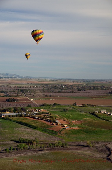
It was overcast with a handful of low-level clouds as we headed southeast from Wenatchee Airport at about 11 AM on Monday morning. Not very promising weather for the first day of our trip south.

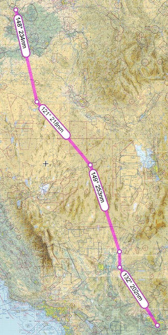
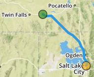
Leg 1: Wenatchee to Baker City

Leaving Wenatchee
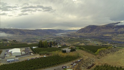
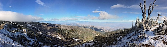
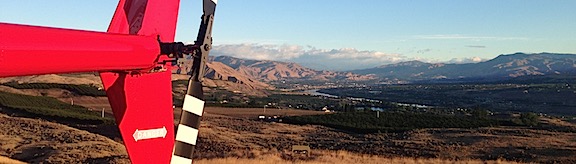
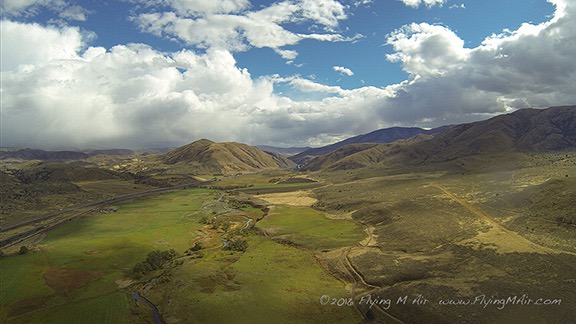
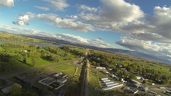
It looked pretty dreary when we left the airport heading southeast on Monday morning.

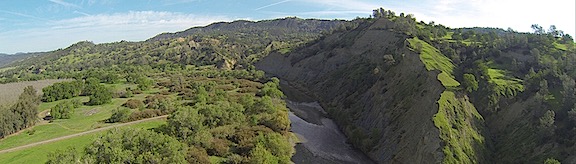
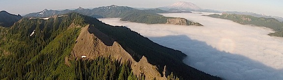
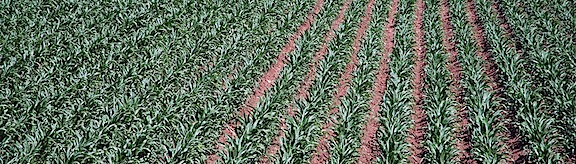
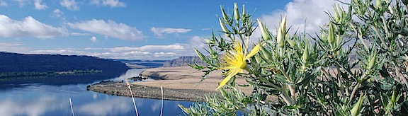
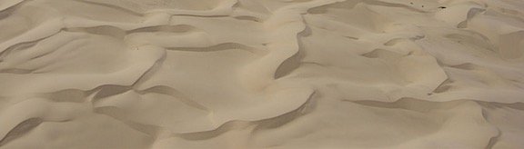
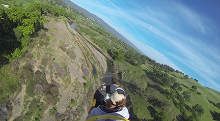
We left the Columbia River for the first time at the Gorge Amphitheater south of Quincy, WA. (We’d cross the twisting river two more times before leaving the area.) The air was really smooth and I found it difficult to believe that such high winds lay ahead on our planned route. But instead of taking that route, I headed toward Hermiston, which was closer to Pendleton than our original route would have taken us. I could always steer west again if I wanted to get back on that route.

The weather in Pendleton was moving northeast — per radar on my iPad — and it looked as if it might be gone by the time we got to Hermiston. I could check the weather at various points on my iPad as I flew and I did so, trying to decide what to do. But it wasn’t until we crossed over Benton City that I pretty much decided a more eastern route would be better; the winds at Benton City bounced us around in light turbulence that had Jeremy talking about the weather again. If a few bounces like that were bothering him, he’d either be sick or terrified when we hit the moderate turbulence forecast up ahead on our planned route. And although I was unlikely to be either, I still didn’t want a long day flying in turbulence. Been there, done that.

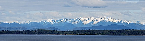
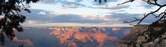
Fortunately, the weather that had been in Pendleton had moved off. I plotted a course for the airport there. We could clearly see rain in various places around us, but there was no lightning and the air was smooth. I talked to the tower at Pendleton and was cleared to cross over the field. The runways looked soaking wet. But what pleased me to no end was that I could clearly see the tops of the Green Mountains to the east. We’d have no trouble climbing them to follow the I-84 corridor.

Yes, IFR = I Follow Roads.

First Leg
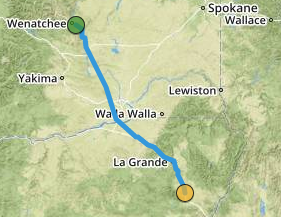
Our first leg was from Wenatchee to Baker City. This is an actual track log from ForeFlight.

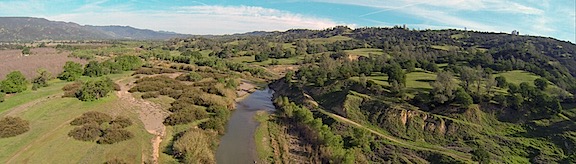
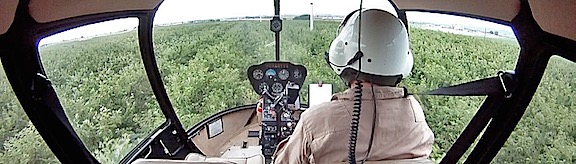
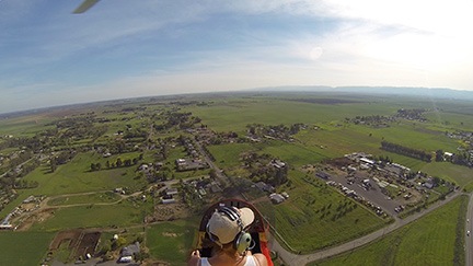
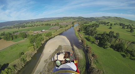
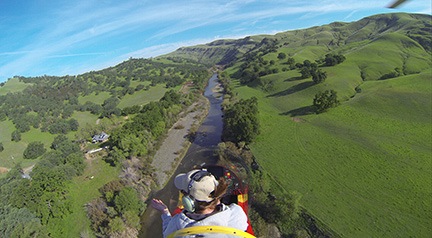
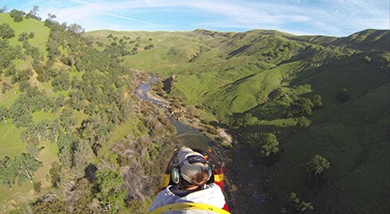
The next hour or so was a mix of sun and clouds and even some light rain as I plotted the straightest route I could that kept us within sight of the freeway. I turned the helicopter’s nosecam on and off depending on how nice it looked outside. When we were flying into the sun, the pictures are generally crappy with bad exposures so I didn’t have the camera on much. I had a GoPro 3 Black up there that I could control from my phone. It was set up to record HD video with still images every 10 seconds. With a 64 GB mini SD card and USB power source, it would last the entire length of the trip. The aerial photos throughout this post are from that camera.

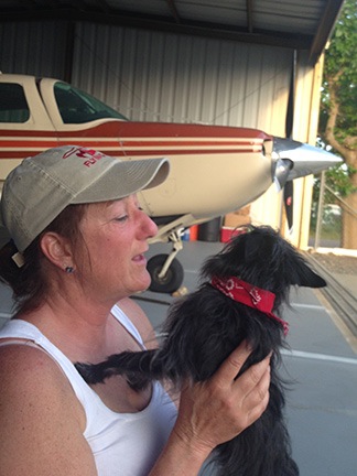
Meanwhile, Jeremy was shooting pictures almost nonstop whenever there was something interesting to see. I felt kind of bad that he had to shoot through the plexiglas, which I knew could be very reflective. But taking a door off would be uncomfortable and slow us down. And because we had so much junk in the back, there was no place to store it on the flight anyway. The only good thing is that the occasional rain showers we passed through sometimes cleaned the bugs off the front windows.

Skeleton Crew
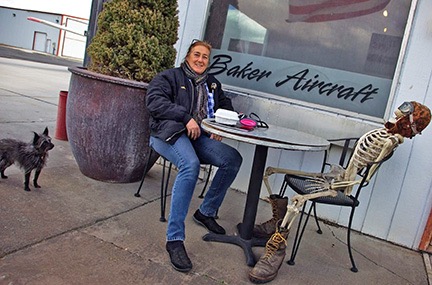
The folks at Baker Aircraft are serious about Halloween decorations. Photo by Jeremy.

FBO at Baker City
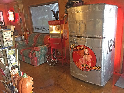
Yes, the fridge at the Baker City FBO is completely covered with airplane panels. How cool is that? I’ll let you fly in to discover what happens when you open the door.

We stopped for fuel at Baker City, OR. (I always stop at Baker City, whether I’m driving or flying.) I parked to one side of the pumps and the fuel guy came out and fueled me up while Jeremy and I made a beeline for the bathrooms. I asked about the courtesy car and they handed over the keys. After paying for fuel, we drove into town for lunch. I always eat at Sumpter Junction, a great little restaurant with a huge model train that passes by the booths at one side of the restaurant and that day was no different. They have a great breakfast all day; I had chicken fried steak and eggs. Back at the FBO, I bought some snacks — Pepperidge Farm Milano Cookies and some almond chocolate biscotti — for the flight.

Leg 2: Baker City to Burley

Before leaving, I texted my friend and former editor Megg, who lives in Salt Lake City, telling her that we might be overnighting in the area and asking if she was available for dinner. I knew Bountiful Skypark from having landed there several years before, and figured we could grab an Uber to a hotel for the night. It’s always good to have a plan, even if the plan changes.

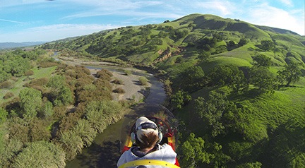
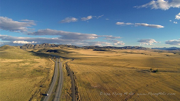
Then it was back in the air, heading southeast through Oregon along the I-84 corridor again. More sun and clouds and light rain. Some snow around us (but not on us). Lots of green. Very few bumps. I was very happy I’d made the route change.

In Oregon
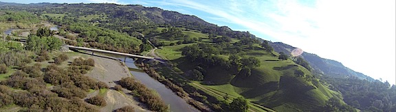
Along the I-84 corridor east of Baker City.

In Oregon
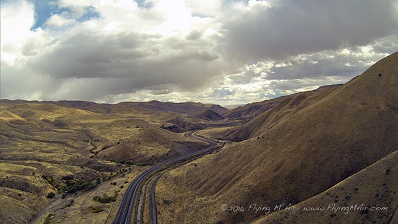
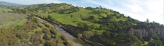
A bit further along the road. The weather was constantly changing but never became an issue for flight.

Leg 2
The second leg of our flight, as recorded by ForeFlight.

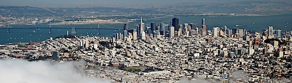
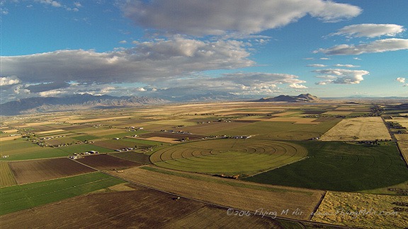
After about an hour or so, we finally dropped out of the mountains into the flatlands around Boise. We were back in civilization again, with lots of airports to monitor and traffic to see and avoid. (I didn’t have the nosecam running because we were pointing into the sun and the images would have been awful anyway.) I steered us through the Caldwell and Nampa airspaces, making calls along the way, then steered us eastbound, south of the Boise Class B airspace, partly because it was the most direct route, even though it took us away from I-84, and partly because I just didn’t feel like talking to a controller. We monitored the frequency, though, and heard the planes coming and going.

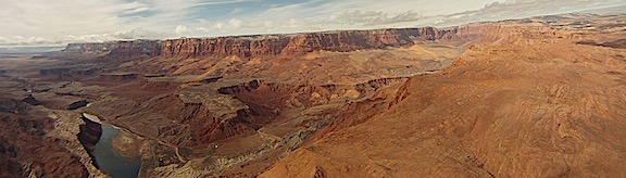
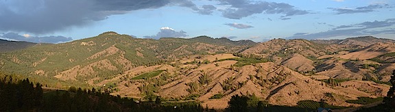
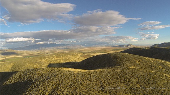
Then it was back out into the mostly flat lava fields east of Boise. The sky had cleared considerably and although there were still isolated rain showers in the area, it was very pretty and pleasant flying weather.

Over Idaho
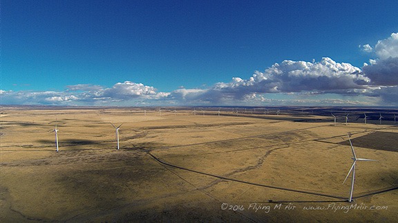
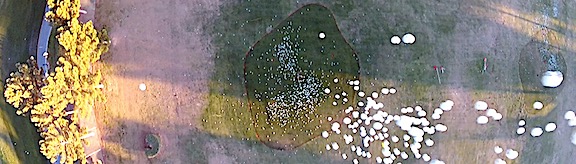
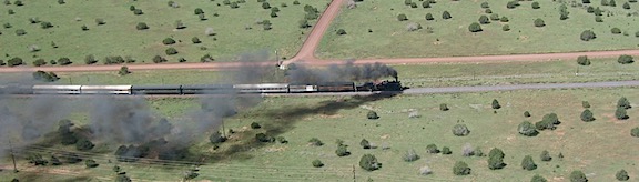
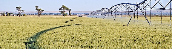
We crossed over a few wind farms, including this one east of Boise. Jeremy got a great picture out the side window as we passed one of them. This is from the nosecam.

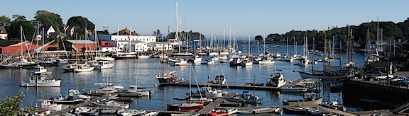
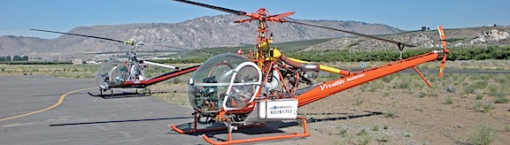
We fueled in Burley, ID. It’s another airport I’d stopped at before. I think it was back in 2008 when I was flying from Wenatchee, WA to Page, AZ with my wasband and another pilot. We’d overnighted there in a hotel not far from the airport. This time, we just fueled up as quickly as possible.

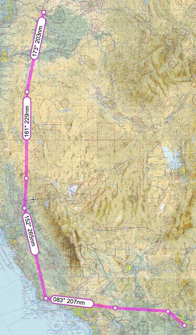
Leg 3: Burley to Salt Lake City

Megg had texted back with an invitation for us to spend the night at her house. I was eager to see her new home and spend more time with her so after conferring with Jeremy, I texted back that we’d try to get there before sunset. We were airborne minutes later.

East of Burley, ID
The nosecam picked up this image as we climbed out of the airport at Burley, ID.

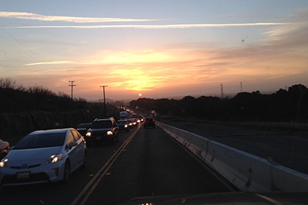
By this time, it was nearly 5 PM local time and sunset at Salt Lake would be about 6:30. I did not want to fly in that area in the dark. So I put the pedal to the metal (so to speak) and cut some corners along the way to shave off a few minutes of flight time.

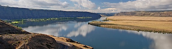
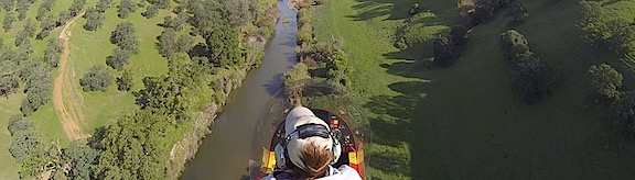
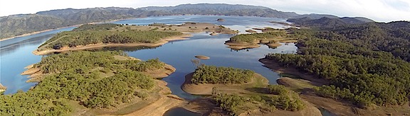
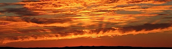
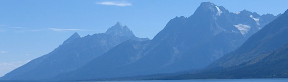
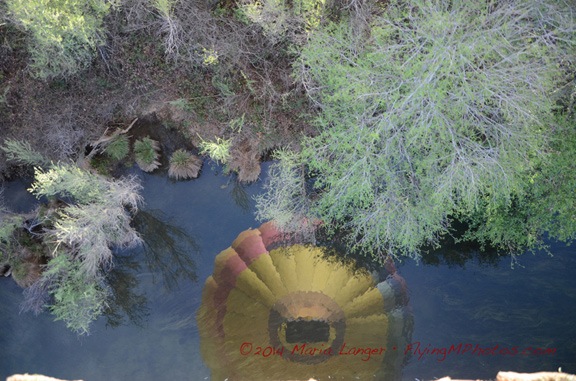
The light was magnificent for photography so I turned on the nosecam and left it on for the remainder of the flight. I picked up more than a few nice images along the way. The air was still smooth and we had a bit of a tailwind that hurried us along. We broke from the freeway corridor when we entered the Salt Lake basin, mostly to shorten up the route and avoid other airports along the way. There was fresh snow on the mountains and parts of the lake that we flew over were smooth enough to reflect the sky.

Heading toward Salt Lake
Heading south along on I-84 toward Salt Lake City in late afternoon.

North of Salt Lake
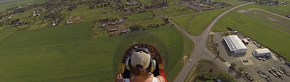
Although I cut some corners to save time, I was never very far from the freeway.

Salt Lake Basin
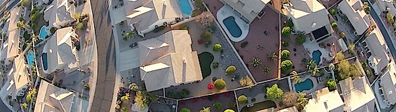
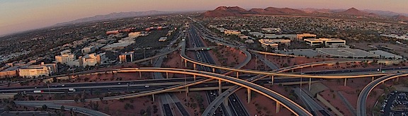
Dropping into the northeast corner of the Salt Lake Basin.

Reflections in Salt Lake
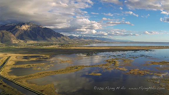
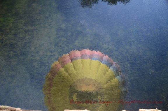
This is my favorite photo of the trip. I am such a sucker for reflections and will actually plan a route over water if it looks like the nosecam might get a few good shots.

I did have to talk to two towers along the way. The first was Ogden, which is north of Salt Lake City. To keep things simple, I asked for a transition along the I-15 freeway. The controller directed me to overfly one of the runways, basically cutting the corner and shortening up my flight path. He then handed me off to Hill Air Force Base tower, where I got clearance to continue my transition along I-15. Easy peasy.

Leg 3
Third leg of our trip, as recorded by ForeFlight.

We made remarkable time to Skypark. I tuned into the frequency, heard another plane in the pattern, and kept clear until I could see him. Although I probably could have darted across the runway to land on the ramp before he turned final, doing so would have had me looking right into the sun, making it difficult to see where I was going. So I joined the pattern in the downwind and followed him in to land.

Landing at Skypark
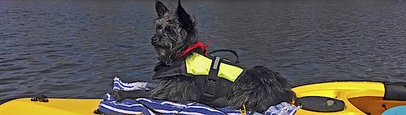
We landed at Skypark about 20 minutes before sunset. Can you see the plane landing in front of us? He’s about halfway down the runway.

I taxied over to self-serve fuel and topped off the tanks while Jeremy and Penny stretched their legs. I texted Megg to let her know we’d arrived; she said she’d be with us in 30 minutes. Then I fired up the helicopter and repositioned it over to an end parking space near the taxiway, leaving enough space between me and the next tied down aircraft to prevent complaints.

At Salt Lake City

Zero-Mike-Lima at Bountiful
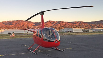
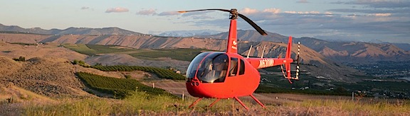
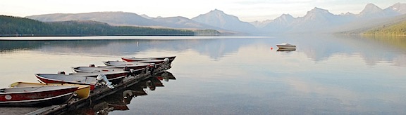
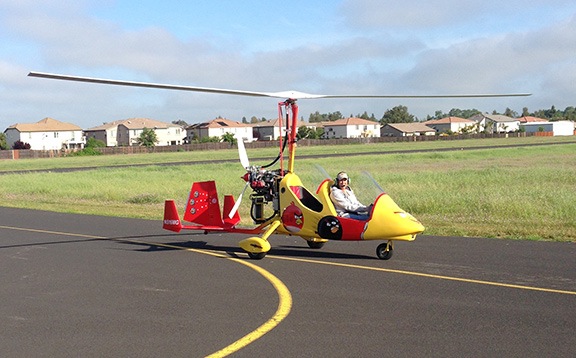
Zero-Mike-Lima, parked at Bountiful Skypark at sunset after a long day of flying.

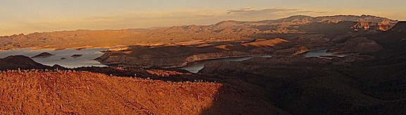
We unloaded the helicopter and I locked it up for the night, leaving the GoPro on the nose right where it was. We waited for Megg by the main terminal building. The light in the mountains to the east was spectacular.

Megg came and we exchanged hugs. I introduced her to Jeremy. She tried to pet Penny, but Penny danced around as usual. We loaded our luggage into Megg’s car and headed off to pick up her son at Boy Scouts. I could not believe how much he’d grown! He was 13 now — hell, I remember when he was born! — as tall as me, and had ditched the glasses in favor of contact lenses. We all went out to dinner at Cafe Rio. Then it was back to Megg’s wonderful little house, which was originally built in the 1890s and fully modernized. While Jeremy worked with his photos on his laptop and Penny dodged and teased Megg’s three big dogs, Megg and I chatted about things going on with both of us. It was really great to see her and I urged her to stop by my place for a day or two on her way to the Seattle area for a visit with her dad in July.

Then, with Megg needing a very early start in the morning for a meeting and me feeling pretty tired from a long day at the controls, we split up and hit the sack. I was asleep as soon as my head hit the pillows.

[read more]

Helicopter Flight from Washington to Arizona: Logistics and Flight Planning

Planning my last big cross-country flight before overhaul.

Last week, I flew my helicopter down to Chandler, AZ from Wenatchee, WA with Penny the Tiny Dog and my friend Jeremy. I needed to deliver it to Quantum Helicopters so they could get the helicopter’s first overhaul started by November 1. I’d need it back by mid-February at the latest and overhauls typically take 9 to 12 weeks.

Here’s the story of my two-day flight to Arizona, split into three parts for readability. It’s surprising how much I had to say about the flight — and how many photos I have to share. Enjoy.

Logistics and Flight Planning

With various activities scattered all over my October calendar — including a weekly wine tasting class on Wednesday nights and a weekend-long mushroom foray at Mount Rainier — I didn’t have many options to make the trip. I wound up letting Alaska Air pick the dates by searching for the best deal on a return flight to Wenatchee that would fit my schedule. That return flight was Wednesday, October 19, at 6 AM. Since I wanted one last oil change before I headed south and my mechanics usually don’t work weekends, that meant leaving late Monday morning and getting to Chandler before Quantum closed at 8 PM on Tuesday.

Some folks wonder why it was so important for me to get an oil change before making the long flight. After all, it was going in for overhaul. Surely it wouldn’t matter how dirty the oil was when it arrived. But only 8 flight hours before, on a 50-hour inspection, my mechanics had found more metal fragments in the oil filter than usual. (They had begun finding very small amounts of metal from the aging engine about six months before, but nothing to cause alarm. This was different.) Yes, the helicopter had gone a full 50-hours between changes so the amount of metal would likely be higher than usual. But was it critical? The only way to see how bad it was was to get one more oil change and take a look at the filter. They’d do this the morning before my departure and if things looked bad, I’d scrap the flight plans and arrange to trailer it down.

Fastest Route
The fastest route from Wenatchee to Phoenix. There aren’t many fuel options and there’s a lot of empty desert.

The fastest route between Wenatchee and Phoenix is a nearly straight line with fuel stops in Burns, OR; Elko, NV; and Mesquite, NV. I’ve taken this route several times and it can get me to Sky Harbor in eight hours with a light load and a nice tailwind. But at least 50% of this route is over empty desert, miles and miles from any road or town. There’s one stretch in particular where for 90 minutes all you’re flying over is grass and sagebrush, with herds of wild horses galloping away at the sound of your approach — no roads, no buildings, nothing else. If the engine got iffy, we might have to land someplace where getting help would be difficult. I honestly didn’t want to deal with it.

Planned Route
Our planned route was at least four hours longer with a handful more fuel stops along the way.

So I told my passenger, Jeremy, that he could pick the route. He got very creative. He suggested an overnight stop at Sacramento with friends of his on Monday night, then stops at the Hiller Museum at San Carlos Airport (south of San Francisco), and Santa Barbara for lunch with his daughter. That lengthened the route considerably, but kept us near roads, towns, or cities for much of the flight. I started working up a plan. Sacramento before sunset was doable — I’d done it in less than a day more than a few times — but we’d have to leave early and skip the San Carlos stop to make it to Santa Barbara with enough time for lunch before heading east. By that time, I’d also made early dinner arrangements with some friends in Wickenburg, AZ, and we needed to meet them by 4 PM to have an unhurried dinner and get to Chandler by 7 PM. (I had to chat with the mechanic and unload the helicopter before they closed and I certainly didn’t want to hold anyone up.) I plotted the new route, trying hard to find airports with decent fuel prices. Tuesday would be a long day, but I kind of looked forward to flying through the high desert north of the Los Angeles area, which I hadn’t done in several years.

Meanwhile, the weather wasn’t looking good. A pair of storm systems were due to arrive in the Pacific Northwest on the Thursday and Saturday before our trip. Cliff Mass, the Northwest weather guru, was predicting a storm equal to the famous Columbus Day Storm that had hit Seattle back in 1962. Jeremy, who lives on that side of the mountains, was getting nervous. While I was aware of the storm — heck, we were supposed to get a ton of rain in the Wenatchee area on both days — I also knew that storms come and go. The forecasts had it clearing up by Sunday and we weren’t due to leave until Monday. Monday’s forecast called for just 20% chance of rain and forecasts for our entire route, which I began tracking on Friday, looked pretty much the same. Worst case scenario was that we’d fly through some rain. And I’d done that enough times not to worry about it.

The storms came and went, pretty much as predicted. We got over an inch of rain here. Seattle and the coast got hit harder, but not nearly as hard as the weather folks expected. There were some scattered power outages and downed trees, but not the catastrophic storm damage expected.

Sunday was mostly cloudy here but there wasn’t any rain — at least not to notice. I picked up Jeremy at the bus station — he took a Greyhound (!) from Seattle — we had a late lunch, and headed home. I spent some time prepping the helicopter for the long trip, getting my GoPros hooked up and pulling out any equipment I wouldn’t need on the trip or after I picked up the helicopter in January or February. Jeremy made Manhattans and opened a bottle of wine he’d brought for dinner. My friend Alyse came for dinner — I cooked up some ribeye steaks and we had them with garden potatoes and carrots.

Eventually Alyse went home and, after chatting for a while, we turned in for the night.

A Change of Plans

I woke up early, as I usually do, and immediately used my iPad to check and file my flight plan. That’s when I got my first surprise: It would take more than three hours to reach our first fuel stop at Bend, OR. That wasn’t right. I woke up a bit more and took a closer look at the flight plan. The plan accounted for 25 knot headwinds.

Shit.

I checked the rest of the flight plan. High, gusty winds from the south were predicted for much of our route to Sacramento. Chances of rain had increased a bit, too. I started exploring other routes that would take us to Sacramento before nightfall. The high winds stretched far to the east, into the empty desert I’d been hoping to avoid. To the west, near the coast, rain was likely and, I knew from experience, visibility would be poor. The weather briefing backed this up, forecasting moderate turbulence inland and mountain obscuration along the coast.

So if we took the route I’d planned on, not only would we be bouncing all over the sky, but we’d be in the air an extra hour or more because of headwinds, with at least one additional fuel stop. I was looking at a miserable day of flying with a passenger who was already worried about the weather. It would not be a good day — certainly not the kind of pre-overhaul flight I was looking forward to.

At breakfast, I reported my findings to Jeremy. That only made him mention his previous weather concerns more. But it wasn’t as if I could call off the flight, or even postpone it. The flight was doable and I already had all my plans made for a return flight that would still get me back for my wine tasting class on Wednesday. (I do have my priorities straight.) I decided that we’d depart on schedule and see how things looked to the south.

So a while later, I was spinning up the helicopter while Jeremy watched from my front yard. I took off and headed to the airport for that oil change. Jeremy drove my truck to the airport so I’d have a way to get home from the airport on Wednesday.

I did treat myself to a nice tour of Wenatchee before heading into the airport. I needed to warm up the oil, after all. It was a beautiful morning with scattered low clouds. Through a gap in the clouds, I could see snow at the top of Mission Ridge. It was the second snowfall they’d gotten up there and I knew my ski-loving friends would be thrilled.

At the airport, the three mechanics of Alpine Aviation were waiting for me. I shut down and we pushed the helicopter into the hangar. They did the oil change while I chatted with the folks hanging out in the FBO lounge and consulted ForeFlight on my iPad for options. There was stormy weather to the east, near Pendleton and Walla Walla. One route I’d taken in the past climbed the Green Mountains near Pendleton and followed I-84 through the mountains and Boise beyond. It was a good route, but I’d also been stuck at the foot of those mountains, blocked by low clouds. It would be a time-wasting detour if that happened again.

The oil filter showed some more metal fragments, but not enough to cause serious concern. The engine was, after all, 2068 hours old. (And that’s based on the collective-based “maintenance” Hobbs — it likely had well over 2,200 hours of actual engine running time.) The engine would not cause a flight cancellation.

Penny on a Box
Here’s where Penny would sit for the entire duration of our trip south. She sleeps most of the time.

By 11, I was fueled up, paid up, packed up, and ready to go. I put Penny in her travel bed behind me on top of an empty wheeled box I’d brought along for storing helicopter equipment during overhaul. (I couldn’t bring all of that stuff home.) Jeremy’s wheelie bag and camera bag and tripod filled the space behind him. I shoved my day pack and jacket in the foot space behind my seat. Jeremy climbed into the passenger seat with his camera ready and buckled up. I got the front GoPro’s wifi fired up, climbed into my seat, buckled up, and started the engine.

We felt very heavy when I pulled pitch — was the engine really that tired? — but had no trouble lifting off. Soon we were heading southeast along the river. Our trip had begun.

[read more]

About the Header Images

A quick summary of where the current images were taken and who I was with.

You may not realize it, but I shot all of the photos that appear in the header on this site. There are currently more than 90 of them and they’re set up to appear randomly. Each time you visit this site or click a link to another page here, the image up top should change.

I noticed just the other day that although all images were shot within the past 10 years, the vast majority were shot when I was alone. That made me realize how much I traveled by myself, even when I was married, and how the places and things I saw were beautiful or interesting enough to capture an image of.

Anyway, here are the images, with summaries.

Alfalfa

Alfalfa

This was an alfalfa field near where I spent my summer in Quincy, WA. I think I shot this in 2008. Alone.

American Coot Family 1 & 2

American Coot Family

American Coot Family 2

I shot these two images at Quincy Lakes in Quincy, WA in 2008. Alone.

Bark

Bark

Birch Bark 2

I like photos that show texture. These close up photos of bark were shot at Quincy, WA in 2008. Alone.

Barn Roof, Wagon, and Waterville Farmland

Barn Roof

Barn Wagon

Waterville Farmland

These three images were shot on the Waterville Plateau near Douglas, WA, probably in 2009. I was with my wasband.

Basalt Cliffs

Basalt Cliff

I’m pretty sure this photo was shot while repositioning my RV from Washington to Arizona by way of Glacier National Park with my wasband — one of the last “vacations” we had together — in 2009. I think it’s at Palouse Falls.

BC Mountains Pano

BC Mountains Pano

This was shot from a cruise ship on an Alaska Cruise with my wasband in 2007. Our last day on board took us between Vancouver Island and the mainland.

BHCB

BHCB

This was shot at Quincy Lakes in 2008 or 2009. I assume BHCB is an abbreviation for the type of bird. Alone.

Birch Leaves

Birch Leaves

I liked the way the sun shined through these leaves in the late afternoon. Shot at Quincy near the golf course in 2008. Alone.

Blue Heron & White Heron

Blue Heron

White Heron

I was kayaking with my dog at Lake Solano in Central California in 2014 when I shot these photos of herons.

Bowman Lake

Bowman Lake

This was shot at Glacier National Park in 2009 while traveling from Washington to Arizona with my wasband.

Bryce and Bryce Dawn

Bryce

Bryce Dawn

These two photos were shot at Bryce Canyon in 2011. I’d gone there with a client in January on a photo flight for this 360 interactive panorama: Bryce Canyon in Winter, Utah, USA.

Cache Creek

Cache Creek 1

Cache Creek 2

Cache Creek 3

Cache Creek 4

These four images of Cache Creek were taken from my helicopter’s nosecam on an early morning flight up Cache Creek in Central California in 2014. I was alone.

Cascades

Cascades

This image of a ridge and cloud-filled valleys was taken from my helicopter’s nosecam on a flight between Wenatchee, WA and Hillsboro, OR in 2012. I blogged about the flight here and shared video from the flight here. It’s notable not only for the perfect weather and amazing scenery, but because it was my dog Penny’s first helicopter flight — 90 minutes long! And yes, that is Mt. St. Helens in the background.

Cherry Drying Cockpit

Cherry Drying Cockpit

This is a shot from a GoPro camera mounted in the back of my helicopter during a cherry drying flight. It was probably taken in 2011.

Close Up Wheat

Close Up Wheat

This closeup of wheat growing in a field in Quincy, WA was shot in 2009. I was alone.

Combine

Combine

This aerial shot of a wheat combine at harvest on the Waterville Plateau in North Central Washington was shot in 2011 during a flight between Wenatchee and Coeur d’Alene, ID. My friend Jim was flying his helicopter; I was on board with a camera.

Corn

Corn

I like patterns. This field of young corn plants in Quincy, WA was capture in 2009. I was alone.

Cows in the Road

Cows in the Road

I was on my way up to my old Howard Mesa, AZ place one bright winter day when I came upon these cows following tire tracks in the road. When I approached, they just stopped and stared. I took a photo before continuing, herding them along with my Jeep. I can’t be sure of the date, but I expect it was around 2003 or 2004. I was probably with my friend Jeremy.

Cracked Mud

Cracked Mud

I shot this alongside the road to Alstrom Point on the northwest end of Lake Powell in Utah. It was probably shot in 2008. I was alone.

Crescent Bar View, Yellow Flowers

Crescent Bar View

Yellow Flowers

I shot these photo of Crescent Bar in Quincy, WA in 2009 not long after drying a cherry orchard down by the river there. I was alone.

Dandelion

Dandelion

I shot this photo of a dandelion seed puff in Quincy, WA in 2008. I was alone.

Desert Still Life & Desert Wildflowers

Desert Still Life

Desert Wildflowers

I shot these photo of hedgehog cacti blooms and California poppies near Wickenburg, AZ between 2009 and 2011. It was probably on one or two Jeep outings and I was probably with either my wasband or my friend Janet.

Fern

Fern

Patterns and textures again. This was shot in Alaska sometime during a cruise with my wasband in 2007.

Float Plane

Float Plane

I shot this image of a float plane taking off at an Alaska port while on a cruise with my wasband in 2007. It was shot from the balcony of our stateroom.

Golden Gate Bridge

Golden Gate Bridge

This image of the Golden Gate Bridge was shot during a trip to San Francisco in 2011. Not sure if I was alone — isn’t that odd? — but I was probably there for a Macworld Expo speaking gig.

Glacial River Rocks

Glacial River Rocks

I shot this closeup of rocks in a river bed while on a trip to Denali National Park in 2007 with my wasband.

Golf Balls

Golf Balls

Attach a GoPro to the bottom of a helicopter with the lens pointing down. Then hover over a golf course green and drop hundreds of golf balls. This is what it might look like. Shot in late 2011 or early 2012. My client was dropping the balls.

Grand Canyon Sunset

Grand Canyon Sunset

I’ve been to the Grand Canyon countless times so I don’t know exactly when this was taken or whether I was alone. I know it was shot before the summer of 2011.

Gyro Cache Creek & Gyro Pattern

Gyro Cache Creek

Gyro Pattern

I learned how to fly a gyroplane in the spring of 2014. These two shots were made with a GoPro mounted on the mast. In the first shot, I’m flying up Cache Creek; in the second, I’m doing a traffic pattern at Woodland Airport. Both were shot in Central California.

Hay Bales

Hay Bales

I’m pretty sure this was shot on the road between Upper Moses Coulee and Waterville in North Central Washington in 2009. I was alone.

Helicopter

Heli Header

This is a photo of my helicopter right after sunrise parked out near my new home in Malaga, WA. I shot this in 2014; I was alone.

High Tension

High Tension

This was shot in 2008 near the Chief Joseph Dam near Bridgeport, WA. I was on a daytrip with my wasband.

Hopi House

Hopi House

Another trip to the Grand Canyon. I suspect I was alone when I shot this one, possibly on a day trip by helicopter with clients from Phoenix. Sometime between 2009 and 2011.

Houses

Houses

Here’s another straight down image shot with a GoPro from my helicopter. This was Peoria, AZ in 2011 or 2012. I was alone.

Inspecting Bees

Inspecting Bees

I set up a GoPro on a tripod to record a beehive inspection in 2013. That’s me in the picture; I was alone.

International

International

This is a closeup of an old International truck parked outside the bakery at Stehekin, WA. I was there with my wasband and another couple on a helicopter trip in 2011.

Juvenile Robin

Juvenile Robin

Shot in 2008 at Quincy, WA. I was alone.

Ladders, Side

Ladders Side

Patterns again. These are orchard ladders neatly stacked at an Orchard in Quincy, WA. Shot in 2008.

Lake Berryessa

Lake Berryessa

An aerial view of Lake Berryessa in Central California, shot with my helicopter’s nosecam in 2014. I was alone.

Lake McDonald Sunset

Lake McDonald Sunset

This was shot on a trip to Glacier National Park with my wasband in 2009.

Lake Pleasant

Lake Pleasant

Another nosecam image from my helicopter. This is a dawn flight over Lake Pleasant near Phoenix, AZ. I was alone.

Maine Coastal Town & Main Fog

Main Coastal Town

Maine Fog

I shot these during a trip to Maine to visit some former friends with my wasband back in 2008 or 2009.

Marble Canyon

Marble Canyon

Another nosecam image from my helicopter. I’m pretty sure I shot this one on my way back from a Bryce Canyon photo shoot with a client in 2011.

Mini-Stack

Mini-Stack

An aerial view of the so-called “mini-stack” of at I-17 and Route 101 in north Phoenix, AZ. Probably shot in 2011 or 2012.

Mission Ridge Pano

Mission Ridge Pano

I shot this photo from Wenatchee Mountain near Wenatchee, WA during a jeep ride to Mission Ridge with my friend Don in 2014. What an amazing day!

Monument Valley

Monument Valley

I’ve flown over Monument Valley dozens of times. Once in a while, there’s a camera on the helicopter’s nose. This was probably shot in 2011. I was either alone or with aerial photo clients.

Monument Valley Wide

Monument Valley Wide

I used to do multi-day excursions by helicopter to Arizona destinations that included Monument Valley. While my clients took tours, I’d explore on my own. This is Monument Valley from the overlook, shot in 2010 or 2011.

Moonset Sunrise

Moonset Sunrise

I used to camp out at a friend’s place overlooking Squilchuck Valley near Wenatchee, WA. This was one of the early morning views from my doorstep. I was alone.

North to the Future

North to the Future

I shot this in Girdwood, AK in 2008. I’d gone up there alone for a job interview. I got an offer but turned it down. Beautiful place.

No Wake

No Wake

I shot this with my 10.5mm fisheye lens at Lake Pateros, WA in 2008. I was with my wasband.

Orchard Still Life

Orchard Still Life

These are apples culled from the trees in Quincy, WA. Shot in 2008; I was alone.

Peacock

Peacock

This is one of the dozens of peacocks strolling around at the Lake Solano campground in central California. I shot this in 2014; I was alone.

Penny Kayak

Penny Kayak

This is one of the few images I didn’t shoot. I was on a kayak trip in the American River near Sacramento with a Meetup group and one of the other members shot this and sent it to me.

Petrified Wood

Petrified Wood

I’m not sure, but I think this was shot in Vantage, WA in 2008 or 2009. I was probably alone.

Phoenix

Phoenix

Another nosecam image, this time of downtown Phoenix. Shot in 2011 or early 2012; I was likely on a tour with passengers.

Poppies and Chicory

Poppies and Chicory

Another desert jeep trip near Wickenburg, AZ. I could have been alone, with my wasband, or with my friend Janet.

Poppies Plus

Poppies Plus

This wildflower closeup was shot on a trip to the Seattle area, possibly in 2007 with my wasband and his cousin.

Quail Mom

Quail Mom

A Gambols quail hen and her chicks, shot from my doorstep in Wenatchee Heights, WA in 2012. I was alone.

Rafting

Rafting

Put a GoPro in a head mount, get in a raft, and head down the Wenatchee River and this is the result. I was rafting with a bunch of friends in 2013.

Red Wing Blackbird

Red Wing BlackBird

Red Wing Blackbird 1

Red Wing Blackbird 2

I shot these at Quincy Lakes in Quincy, WA in 2008. I was alone.

Rocks Under Water

Rocks Under Water

I’m pretty sure I shot this in 2009 at Glacier National Park on a trip with my wasband.

Saguaro Boulders

Saguar Boulders Big

I shot this photo of saguaro cacti among sandstone boulders near Congress, AZ on a Jeep trip in 2009 or 2010. I was probably with my wasband.

Sand Dunes

Sand Dunes

This is an aerial shot of the sand dunes west of Yuma, AZ. This was probably shot in 2008 on a flight to the San Diego area with my wasband.

San Francisco

San Francisco

What a memorable flight! This was on a ferry flight from the Phoenix area to Seattle in 2008. Another pilot was flying my helicopter so I got to take photos. Low clouds over the coast forced us high over San Fransisco. Amazing views!

Sedona

Sedona

The red rocks of Sedona at Oak Creek. Shot in 2010 or 2011 while on a multi-day excursion with passengers.

Squilchuck View

Squilchuck View

The view from where I spent several late summers at Wenatchee Heights. This was probably shot in 2012.

Steam Train

Steam Train

This is an aerial shot of the old Grand Canyon Railroad steam train. I used to buzz that train with my helicopter any time I saw it from the air. This was probably shot in 2007. I was alone.

Stucco Scroll

Stucco Scroll

I shot this on a photo walk at the San Xavier Mission in Arizona with my wasband and a group of photographers.

Sunset

Sunset

I can’t be sure, but I think I shot this from Howard Mesa in 2006 or 2007.

Surprise Valley Drugs

Surprise Valley Drugs

I shot this in California during my 2005 “midlife crisis road trip.” I was alone. It was one of the best vacations in my life.

Helicopter Tail

Tail Header

An early morning shot of my helicopter parked out near my new home in Malaga, WA. Shot in 2014; I was alone.

Tetons

Tetons

Another shot from my 2005 “midlife crisis road trip.” This was at the Grand Tetons.

Turtle

Turtle

Shot while I was kayaking with my dog at Lake Solano in 2014.

Two Hillers

Two Hillers

I shot this at Brewster Airport in Brewster, WA on a day trip with my wasband in 2008.

Wheat Irrigation

Wheat Irrigation

Textures and patterns. What’s not to love about them? Shot in Quincy, WA in 2008. I was alone.

Yellow Headed Blackbird

Yellow Headed Blackbird

Yellow Headed Blackbird 2

I shot both of these photos at Quincy Lakes in Quincy, WA in 2008. I was alone.

Yellow Flower

Yellow Flower

A yellow flower. Probably shot somewhere in Washington state in 2011 or 2012. I’m sure I was alone.

Yellow Kayak

Yellow Kayak

Although my kayaks are yellow, this isn’t one of them. This was shot at Glacier National Park on a trip there with my wasband in 2009.

Learning to Fly Gyros

Tricky, but ultimately not as tough as I expected.

Angry Bird
George’s angry bird, a Magni M-16 gyroplane.

Earlier this month, I learned to fly a gyroplane.

It actually came about quite suddenly. My friend George owns a Magni M-16 gyroplane. It’s a funky little plane with an Angry Birds themed paint job. (In George’s defense, he bought it that way.)

I met George when he was at the airport where I was living for my frost contract in the Sacramento area. He was teaching another pilot, Jason, how to fly his angry bird. George took me for a ride that demonstrated the full range of the aircraft: low flight, slow flight, power-off flight, long landings, short landings, etc. It was a lot of fun.

Angry Bird
Who paints this on a plane? Too fun!

And a hell of a lot cheaper to fly than my R44 helicopter.

George is a CFI with multiple ratings: gyro, airplane, and helicopter. When I voiced some interest in learning to fly the gyro — hell, I didn’t have any real work to do during the day — we cut a deal to swap a certain amount of gyro time for a certain amount of helicopter time.

Then George went to Alaska to teach a 17-year-old kid how to fly a Piper Cub. He didn’t provide a return date. And when a week had passed and my California departure date appeared on the current calendar page, I figured I’d missed my opportunity.

Until I got a text message from George with an arrival time at Sacramento Airport and a request for a pickup. I met him on Sunday and brought him to the airport where I was living to fetch his car. Flight training began the next day.

Understand that I’m a helicopter pilot. I have about 3,100 hours of flight time as I type this. Just about all of my time is in R44, R22, and B206L helicopters. I don’t fly airplanes.

Although my wasband had a plane and offered me the controls on more than one occasion, I had absolutely no interest in flying it. It was a get-there plane — a plane designed to get from point A to point B. That’s not the kind of flying I like to do. I like to fly low and slow and see the world around me. If he had a Cub or a Citabria, especially if it had big tires for off-airport landings, things might have been different. But it was a Grumman Tiger, a pampered hangar queen that likely never saw a gravel runway or cruised just above stall speed through a canyon.

To me, getting there was not the point of flying. The journey mattered more than the destination. That’s why I became a helicopter pilot.

Autogyro vs. Gyroplane vs. Gyrocopter

I learned to fly an autogyro or gyroplane. These terms are pretty much interchangeable. Gyrocopter, however, is a trademark of the Bensen Aircraft company. Gyro is a good general use term that, for some reason, doesn’t sound as antiquated as autogyro.

Like helicopters, gyros are categorized by the FAA as rotorcraft. After all, they do have those big rotor blades on top that provide lift. But unlike helicopters, those rotor blades are not driven by the engine. Sure, you use a clutch to get the blades spinning prior to takeoff. But then you disengage the clutch and the blades are kept spinning by the forward motion of the aircraft, which is propelled, in the case of the Magni, by a pusher engine. You can learn more about how gyros fly on Wikipedia.

First Lesson

George started by getting me into the pilot seat, explaining how everything worked, climbing into the passenger seat behind me (which has controls but no instruments), and taxiing out to the runway. The weather that Monday morning was perfect — clear blue skies and no wind — perfect for learning to fly any aircraft. There was no traffic in the pattern. I couldn’t ask for better learning conditions.

At the end of the runway, he explained how to engage the clutch to get the blades spinning. At 100 RPM, I moved the cyclic stick into a neutral position. As the blades spun up, I added power. At about 170 RPM, I released the parking break, and we entered the runway.

“Full throttle!” George’s voice yelled into my headset.

I pushed the throttle forward and we gained speed as George aimed us down the runway.

“Release the clutch at 220!”

I consulted the digital tachometer and I released the clutch on cue. The blades kept gaining speed.

“Cyclic back!”

This was completely opposite to taking off with a helicopter, which requires you to push forward to get through ETL. I pulled it back a bit.

“All the way back!” George yelled.

I obeyed and the nose lifted off. Then we were airborne, wiggling a bit from side to side.

“Hold it at 60!” I did my best to adjust our pitch with the cyclic to climb out at 60 miles per hour. We climbed upwind.

“Turn!”

Downwind
Flying the downwind leg at Watts-Woodland Airport.

Right cyclic put me into a tight bank to the right. I came all the way around into a close downwind.

“Level off at 500 feet!”

I leveled the nose abeam midfield. We gained speed.

“Throttle back!”

I pulled the throttle back a bit.

“Twenty-nine inches!” George advised.

I adjusted the throttle to 29 inches of manifold pressure. The speed leveled off at about 85 miles per hour. By then, we were abeam the end of the runway and it was time to descend. I reduced the throttle and started my descent, slowing down as I did so. After all, that’s how helicopters descend.

“Stick forward, stick forward!” George yelled.

I pushed the nose forward into what seemed like a dive.

“Reduce throttle!”

I pulled back the throttle to about 25 inches. I pushed the cyclic right to turn base and line up with the runway for final, pulling back the stick again to slow down.

“Nose down, nose down!” George screamed.

I felt him push the stick forward. We were speeding toward the runway in what seemed to me like a nosedive.

“Cut throttle!” he yelled.

Before I could do it, he’d throttled all the way back to the lowest power setting. We were diving for the runway with no power. We crossed the road only 50 feet above passing cars.

“Line up with the centerline!”

I tried to line us up with the centerline, using the cyclic stick.

“Left pedal! Right cyclic! Nose down!

I was overwhelmed. The runway was rushing up toward us. Once again, I tried to flare.

“Not yet!” George yelled, pushing the stick forward again. “Five feet!”

I felt his firm grip on the controls as we continued to dive, now over the threshold. Right when I thought it was too late, he pulled the stick back gently, bringing the gyro into level flight over the numbers.

“Let it settle!” he yelled.

We drifted down toward the ground, still moving at at least 60 miles per hour.

“Okay, now flare!”

He pulled the stick back some more, bringing the nose up so we’d touch down on the main gear. Then the nose wheel touched and we were on the ground.

“Full throttle, full throttle!”

I didn’t get a chance to enjoy that landing before we were speeding down the runway again.

So this was the “touch and go” that airplane pilots practiced all the time. Despite the rotors spinning over my head, this was all new to me.

Training Continues

Each traffic pattern we did went pretty much the same. We were turning them in about two minutes. This video from the afternoon of the second day gives you a (shaky) idea of the process.

My two biggest problems were pulling the cyclic back on takeoff and pushing it forward on landing. Both were completely opposite to what I do in a helicopter. What I’d been doing for 3,100 hours of flight time. It wouldn’t be easy to break those muscle memory habits.

Penny and Maria
Penny and I relaxing at George’s hangar between flights. That’s George’s Mooney behind us.

My landings proved to be the biggest problem. You see, gyros can’t hover. (Well, they can hover if they’re in a strong enough headwind, but then again, so can an airplane.) They require forward speed to take off and land. And that’s where I was having the most trouble — landing while I was still moving. Remember, I’m a helicopter pilot and I’m generally not moving in any direction when I touch down on the ground. I wanted to flare, I wanted to bring the aircraft into a hover or at least slow down that forward movement before touching the ground. And I simply couldn’t stop myself from pulling the stick back.

We did a thorough preflight before the second flight on Monday. I learned what everything was, what it does, and how to check it for airworthiness.

We flew 2 hours on Monday, 2 hours on Tuesday, and 1.6 hours on Wednesday. The weather cooperated perfectly.

We took the helicopter to lunch on Monday to Nut Tree Airport and Wednesday to Sacramento Executive Airport. George flew. I even let him sit in the right seat. He was a good pilot and, even though I had the duals in, I felt no inclination to touch the controls. It was great to be a passenger in my own helicopter with a skilled, confident pilot at the controls.

Frustration and Breakthrough

Cache Creek Flyby
Cache Creek Flyby
Cache Creek Flyby
Cache Creek Flyby
Cache Creek Flyby
Some random still images from our gyro flight up Cache Creek. These are not cropped or retouched other than being resized for the web; it really was that green. I repeated the flight on Friday with my helicopter and got some stunning video.

Wednesday morning, we took a break from traffic patterns and did a low-level flight up Cache Creek with the GoPro connected. The video is as shaky as above, but still shots from the flight came out pretty good. Then it was back to the airport for more pattern work.

Wednesday is also when we made the breakthrough. I was flying like shit that afternoon and George was at peak frustration. I just couldn’t get the landings right, mostly because he kept yelling so many instructions at me during the last 15 seconds of each flight: left cyclic, right pedal, nose down, watch your airspeed, right cyclic, left pedal, watch the centerline, nose down. The rapid fire commands were overwhelming me and my brain was shutting down.

After one particularly rough landing, George called it quits for the day. As we taxied back to the hangars, letting the rotor blades spin down, he suggested that maybe I just wasn’t going to get it.

Later, over dinner, I asked him whether I was the first helicopter-only pilot he’d trained. When he realized that I was, that all of his other students had been airplane pilots, he started to understand my problem. Gyros landed like airplanes and I simply didn’t know how to land an airplane.

I asked him to stop yelling so many commands at landing. I told him my main problem was knowing when to flare and asked him to concentrate on instruction for that.

The next day, he had some things to attend to in the morning and then had lunch with another pilot. When we taxied out to the runway in the gyro, I reminded him about what I needed. We took off and started pattern work again.

It was different that afternoon. George stayed mostly quiet, letting me do everything and occasionally commenting on my speed or power setting or other aspect of the pattern flight. He even threw out a few words of praise when I made a descent he liked or set the power just right. He focused his instruction on the proper time and amount to flare for landing — rather than also bugging me about the centerline and staying in trim. There was no yelling.

I relaxed. I got us lined up with the centerline. I kept us in trim. And I was able to make one decent landing after another. I had gotten over the hump. I was proving that I got it by demonstrating that I could do it on my own.

We flew for an hour. George was pleased. Later, at dinner, as he was updating my log book, he debated whether he should sign me off for solo flight. But I think he wanted me to solo in his aircraft with a few more takeoffs and landings right before the solo flight. So he held back on the endorsement.

The next day, Friday, I had business in San Francisco. I was visiting a friend that I’d met seven years before online and had never met in person. We were going for a dim sum lunch just off Market Street. I planned to fly the helicopter to Concord by way of Napa Valley and walk to the BART station, dropping Penny off for grooming and doggie day care along the way. A quick train ride into San Francisco, time spent with an old new friend, some shopping, and then a return to Woodland. The day went off as planned, but I didn’t get in until after 5 PM and I was exhausted after walking more than 5 miles on city streets.

George and I had dinner together when I got in. He came back to the mobile mansion to watch the video I’d shot with my GoPro’s nose mount. We tried to figure out why that video was rock solid while the video from the same camera mounted on his gyro’s mast was so shaky.

Solo Flight

Saturday morning, we headed out for another lesson. George was pretty quiet. I flew. When I made my third landing and began to throttle up, he pulled the throttle back.

“I’m going to get out,” he said.

I realized that solo time had come. “One more,” I begged. I pushed the throttle forward and I made yet another good takeoff, pattern, and landing. There was no excuse to put it off any longer. I taxied off the runway to the intersection and let the blades spin to a stop. George got out.

“Are you going to watch?” I asked.

“I’ll probably head back to the hangar,” he replied.

I taxied away, trying to remember everything I needed to know to spin up the blades, take off, do a pattern, and land. I was expected to do three patterns.

I made my radio call and launched down the runway. The gyro responded quite differently with just one person onboard, shooting into the sky quicker and easier than I thought possible. It wasn’t until the second pattern that I figured out how to set the power properly for solo flight.

I was high and hot when it came time for the first landing. I really did dive for the runway, cutting power to just above idle when I was over the road. Down, down, down — I caught myself pulling back on the stick and pushed forward again. I could see George still standing where I’d left him, watching me as I touched down remarkably smoothly. Then full throttle to take off for the second trip around the pattern.

The second landing was a bit rougher, but certainly acceptable. I’ll do better on the next, I told myself. And I did. I touched down lightly, right in the middle of the runway, at what seemed like a jogging pace. So slow, in fact, that I was able to exit the runway at the first turn.

I taxied toward where George was still waiting and he snapped a photo.

Solo Flight
George snapped this photo of me as I taxied off the runway after my first solo flight.

I’d soloed in a gyro after just 7 hours of training.

Ready for Rating

Because the gyro is a light sport aircraft and because I already have a rating for another aircraft in the same category (rotorcraft category, helicopter class), George says I can get a sport pilot rating for the gyro by taking a check ride with another gyro CFI. The trick is to find one of those. In the meantime, since George flew the helicopter down to San Carlos and back with me later that day, he owes me another 2 hours (or so) in the gyro. So I’ll need to come back to California to collect on that debt — if not in May, then perhaps in August or September. (With luck, I’ll overfly it and owe him some more helicopter time so he’ll have to come up and visit me to even things out.)

In general, George was a great instructor. Why? Because he barely touched the controls at all. He yelled instructions and I followed them to the best of my ability. He’d let me get in trouble and then yell commands for me to follow to get out of trouble. The only time I ever felt his hands on the controls was when I was in trouble so deep that I needed help getting out of it. And that was rare after our first two hours of training.

As for my outlook on fixed wing aircraft — well, that’s changed a bit. Now that I know how to land while I’m still moving, airplanes are a tiny bit more interesting to me. But what’s really interesting is this little bird. Maybe I’ll add a seaplane rating someday soon.

Hot Air Balloon Flight

Drifting through Napa Sacramento Valley by balloon.

Napa Valley Balloons
These guys are the best in the business: professional, safety-conscious, and fun!

As I mentioned in a recent blog post about Thursday’s helicopter flight through Napa Valley, I’d been invited to take a spot on a hot air balloon flight with Napa Valley Balloons, Inc. on Friday morning out of Yountville (just north of Napa). I actually did the flight on Friday as planned. Well, sort of.

I was invited to fly by Bob, the pilot I’d met a few weeks before at the airport where I’m currently living in the Sacramento area. Bob had landed with his passengers in what I consider my “backyard” here — the ramp I can see from the back window of my RV. I’d taken some photos of his landing and had sent the best one to him. He said he’d try to get me on a future flight; I told him I’d take him and two friends up in my helicopter. After too many windy days, the weather had finally calmed down and I was scheduled for the first flight with an opening: Friday, March 21.

I got my confirmation with instructions via email. All passengers were supposed to meet at Domaine Chandon in Yountville at 6:30 AM. Google Maps told me that was about an hour away. And because I don’t like to be late to anything, I gave it an extra half hour of drive time. That meant leaving at 5 AM.

I’m an early riser and didn’t have any trouble making that departure time. With my first cup of coffee in a travel mug, I put Penny and her breakfast into the truck and we headed out.

I’d just passed the exit for Winters when my cell phone rang. It was Bob. “Don’t leave yet,” he told me. “I think there’s fog in the valley. We might depart from Winters instead.”

“I just passed Winters,” I told him.

“Wow. You’re running early. Why don’t you hang out there and I’ll let you know when I have a better handle on the weather.”

We hung up and I gave it some thought. It was dark out, but I could clearly see the moon and stars. No fog here. But also no place to just “hang out.” I kept driving, thinking of maybe pulling over in Vacaville, which was coming up. I could see the rotating beacon of the airport there, Nut Tree. Maybe I could find a coffee shop close to the freeway to wait at?

But then I started thinking about how long it would take me to continue the drive if Bob gave me the green light to keep coming. I didn’t want to be the last one to arrive. And I was hoping to see them inflate the balloons. I’d keep going and, if I had to drive back to Winters, I’d do it with them.

So I kept going.

I was just entering Napa when I started seeing the low clouds of a marine layer creeping into the valley. Still clear overhead. I called Bob.

“I don’t know what to tell you,” he said. “It’s a tough call. The crew and passengers are still meeting at Chandon.”

“I’ll be there in 10 minutes,” I told him. “No bother if I have to drive back. I don’t want to hold anyone up.”

We hung up again.

I pulled into the Chandon driveway at 6 AM and followed the signs to the parking area. I took Penny for a quick walk before following more signs to the reception area. I’d been to Domaine Chandon years before — probably on my very first trip to Napa Valley with my future wasband. My memory of the place did not match the grand establishment I was at that morning. Gardens, ponds, fountains, patios, catering rooms. The place was huge and, even in the dark, impressive. I looked forward to seeing it in the daylight.

I was the first passenger to arrive. I signed in and signed a waiver, grabbed a cup of coffee and a tiny croissant, and then chatted with the two receptionist and the pilots as they arrived. Bob was no where in sight, probably still trying to figure out whether it would be clear enough to fly.

The answer came with a phone call to one of the pilots who then began briefing the 40 or so passengers who had arrived. Safety first, legal matters second. Bob had determined that the flying conditions in Napa that morning were neither safe nor legal. We’d be departing from Winters, in the Sacramento Valley.

While the passenger briefing continued, I asked one of the pilots where they were departing from in Winters. He showed me on Google Maps on my phone. Bob’s crew and the other two crews were already enroute with plans to have the balloons fully inflated when the rest of the passengers arrived in the shuttle vans.

Apparently, I wouldn’t see Domaine Chandon in the daylight that day after all.

I got directions, told the pilot and crew in the reception area that I’d go on ahead, and left. Before I left, one of the receptionists gave me two Chandon bags. I could tell there was a bottle in one of them. Consolation prize for missing breakfast with the rest of the passengers. How nice!

Sunrise
I got to see the sun rise through the marine layer on my way back.

It was a quick drive back. The fog was settling in and, although it was high still over the highway, I could see that Bob had made a good call. As the sun came up through the marine layer, it was pretty obvious that low clouds were filling in the valley.

There was a balloon company setting up beside the freeway at the Winters exit. I called Bob, thinking they might have relocated. He said that was their competition. Before he could give me directions, I told him I knew where to go. I hung up, followed Google’s guidance, and wound up in a field north of town where crews were spreading out three large balloons.

Balloon Setup
The crews were already beginning to set up the balloons when I arrived.

I’d been ballooning twice before. The first time was at a balloon festival in New Jersey, back in the 1990s, before I’d moved to Arizona. My future wasband had taken his niece and me for a flight. It was a great experience in what was probably considered a medium balloon. I don’t remember there being many people in our basket. I do remember being in a crowd of brightly colored balloons ascending into the sky over southwestern New Jersey farmland. I remember drifting silently on the breeze over people’s backyards while dogs barked. I remember seeing a woman in her bathrobe coming out to ge the morning newspaper. I remember grabbing the leaves off the top of a tree. And I remember the loud rush of gas and flames as the pilot added heat to the balloon envelope to keep us afloat.

The second time had been much more recently and I’d honestly almost forgotten it. It was back in January 2012 when I did a charter job that also involved a balloon. (Long story.) It was a tethered flight out in the desert west of where I lived in Arizona at the time. I blogged about it here.

This was different. This was real ballooning with a real commercial balloon company and pilot. The basket and balloon were huge; the basket could hold 17 people, including the pilot, and the balloon had to be large enough to lift that. The basket was carried to the site in a large truck with a hydraulic lift gate in the back. It took a lot of brute strength to get it down and into position on the ground beside the empty balloon.

Balloon Setup
The baskets for these balloons are huge.

I put Penny on her leash and wandered over with my camera to watch.

If you’ve never seen a hot air balloon inflated, here’s how it’s done. They start by spreading out the empty balloon envelope on the ground. They lay the basket on its side beside the bottom of the balloon and fasten the balloon to the basket with a series of ropes and carabiners. Then they put out one or two large fans that are fastened to generators, fire up the generators, and use the fans to start pushing air into the balloons. One or two members of the crew hold the balloon open at the bottom for the air to go in.

Inflating the Balloon
Bob (left) and a crew member hold open the balloon while two large fans begin filling it with air.

Inside the Balloon
It’s odd seeing people walking inside the balloon as it is inflated.

Meanwhile, crew members work in and around the balloon to make sure all the rigging is properly organized and there aren’t any tangles. I’m sure they do other stuff, too. It’s actually quite odd to see them walking around inside the balloon as it’s being inflated.

At a certain point, the balloon has enough air in it to begin holding its shape. But that air is the same temperature as the rest of the air. The balloon won’t fly. It’s time to add hot air. The pilot lights up the burners and adds fuel to shoot flames into the balloon. The fans and generators are shut off and moved away. As the hot air enters, the balloon starts to rise.

Adding Heat to Balloon
Adding heat to the balloon completes the inflation and makes it rise. You can see the other two balloons also being inflated on the right side of this picture.

Me in a Balloon
Yes, that’s me in a balloon.

At some point, the balloon has enough lift to bring the basket to the upright position. That’s when it’s time to load up.

The passengers on our flight arrived during the inflation process. Most of them hung back, although a few came closer to take pictures. I snapped a photo of a couple for them. No one else seemed to want to get that close.

The basket had five compartments: one on each corner for passengers and one in the middle that ran from the front to the back of the basket for the pilot and the fuel canisters. Bob and the crew loaded us up with two couples in each compartment except mine; I shared with just two people. It was cosy but not crowded. A member of the ground crew took a photo of me just before we lifted off.

And then we were off the ground, drifting into the sky. Bob snapped a photo with a GoPro he had mounted off the balloon envelope.

Basket of People
Is this a great picture, or what? Gotta love those GoPros! Bob sent about a dozen shots and I like this one the best.

Balloon Lift Off
I took this photo of our companions still on the ground as we were lifting off; you can see our shadow on the right.

Balloon in Flight
I got this nice shot of one of our companion balloons not long after takeoff.

The flight was wonderful. If you’ve never been in a hot air balloon and you can scrape together the cost of a flight, you really owe it to yourself to do it. It’s a completely novel experience, floating above the ground with this massive structure above your head keeping you aloft. There’s nothing like it.

We were the first ones from our group off the ground, so Bob did most of the navigating — which meant climbing and descending to test the direction of the wind at different altitudes. When he’d find an altitude that took us in the direction he wanted to go, he’d stick to that altitude. We buzzed along in what seemed like a gentle breeze, sometimes reaching in excess of 10 miles per hour. We moved mostly south down the valley with our companions behind us and the balloons from the other company mostly out to the east.

Navigation seems to be the big challenge — and fun — for a balloon pilot. Bob decided to do a “splash and dash” — that’s when the balloon touches down gently in a body of water and then takes off quickly again. He aimed us for Putah Creek, where it ponds up just upstream from a small dam. It was amazing to see him home in on the small pond with nothing to steer with except the wind. We cleared the trees on one side of the pond, descended quickly, and splash! Some water came into the bottom of the basket, soaking our shoes as we climbed out. I looked straight down into the pond and shot two photos of our reflection as we continued drifting south.

Balloon Reflection
Here’s our reflection just after lifting off. That’s the edge of the basket in the bottom of the shot.

Balloon Reflection
Here’s another shot a few moments later when we were drifting away from the pond past the tops of the trees.

Splash
Here’s the second balloon from our group going for a splash and dash. Can you see the reflection of his basket in the pond surface?

We continued drifting mostly south for a while. Meanwhile, the ground crew had packed up and were chasing us on the ground. One of the crew members was driving my truck with Penny inside. Bob talked on the radio occasionally, suggesting potential landing zones. We passed them one by one, occasionally seeing the ground crew below us, my truck easily recognizable by the big white fuel transfer tank on the back.

Balloons in Flight
Here’s another shot of our companions.

Eventually, the flight had to end. We’d flown south nearly to I-80. There were a number of office complexes down below us that had plenty of room for landing. We wound up coming in on the grounds of a college campus in a very gentle breeze — so gentle, in fact, that the basket didn’t even tip when landing. We touched down several times — each time, Bob would say, “We’re not done yet.” — before coming to a rest against a curb on an empty cul de sac. Bob began deflating the balloon as the crew came out to grab ropes. The balloon fell gently to the ground ahead of our flight path.

Landing Zone
X marks the spot of our landing zone.

The passengers climbed out while the ground crew worked on getting the balloon and basket gathered up and loaded. Bob said goodbye and hurried off with half the passengers in one of the vans. They’d go back to Domaine Chandon for a champagne breakfast. I could have come along, but didn’t see any reason to be a burden. After all, I’d been a guest on the flight. Just experiencing that was enough for me.

Champagne
My parting gift from Friday’s flight.

I watched the ground crew work on the balloon for a while, then went back to the truck where Penny was waiting. I let her out for a little walk before we headed out. I stopped in Winters along the way and had a late breakfast at a sidewalk cafe.

I’d forgotten all about the two Chandon bags in the truck, but caught sight of them when I was getting out back at the airport where I’m living. I brought them inside and unwrapped a bottle of Chandon sparkling wine and a glass to toast with.

That champagne is chilling in the fridge right now.