Nature + intelligent people + good conversation = a great time.
One of the reasons I’ve been so unhappy living in Wickenburg over the past few years is the lack of friends my own age who have similar interests.
As the years went by and Wickenburg shifted from being a ranching/tourist town to being a retirement community, all of our young friends moved away. There was Barb and Barry, who moved to New Mexico. Then Janet and Steve, who moved to Colorado. Then Lance and Keri, who moved to (of all places) Michigan. Some of our young, seasonal friends — John and Lorna come to mind — prefer hanging out with the old folks at the retirement community where they park their RV for half the year, opting for an ice cream social over a Jeep ride in the desert or a coffee gathering over a hike up Vulture Peak.
Because the town doesn’t offer enough employment opportunities for young people, it’s population continues to age, with more older folks coming here to retire, at least seasonally. I — or we, I guess I could still say — have quite a few friends old enough to be my parents. Sadly, most of these folks are not nearly as active as we are. And every year, when I return from my annual migration to Washington for work, I discover that one or more of them has died: Pete, Bill, Danny — rest in peace.
It’s depressing for someone like me who wants to remain active. While it was tolerable while I still had a husband at home — at least we could do things together on weekends — with him gone, the situation is bad. I decided to get proactive to find some friends.
I turned to Meetup.
Meetup
Meetup is a social networking service that makes it easy to find and meet up with — in person — people with similar interests for all kinds of activities. I’ve been a member for years and, in the past, have used it to hook up with a photography group based in the Phoenix area and a social group in the Wenatchee area. Last week, I worked it hard, looking for Meetup groups that might do activities near where I live. I didn’t expect to find any in Wickenburg — indeed, there are no Meetup groups within 25 miles of Wickenburg — but I found quite a few in the Phoenix area that do activities all over the state.
Last week, after hitting the Arrowhead Mall for a makeup consultation, I joined the 39 and Holding Club‘s “Hump Day” dinner, which was being held at Chili’s in Surprise, AZ. Although it was more than 30 miles from my Wickenburg home, it was still on the way home from the mall. It was a nice evening out with pleasant people. I met an interesting woman — I’ll call her “M” — who is also going through an ugly divorce that has been going on for two years now. (I sure hope mine doesn’t take that long.) M is the one who told me about Couch Surfing, which I linked to in one of my “Interesting Link” posts. So not only did I get to spend a nice evening out with new people, but I learned about some services I might want to take advantage of in the future.
I signed up with a bunch of groups for a bunch of activities ranging from wine tasting/pairing to hiking to archery lessons. My calendar is now quite full. And with new activities listed all the time, I don’t think I’ll have much trouble at all finding something interesting to do with others.
The Phoenix Atheists
Yes, I’m an atheist. If you’ve been reading this blog regularly for a while and have somehow missed that point, shame on you. It’s not as if I hide it. If this is news to you and it upsets you, I’m sorry. I’d like to assure you that I have very strong moral convictions that don’t require an all-mighty being to supervise. I’m not a militant atheist — one who’s blasting believers all the time — I’m a live-and-let-live kind of person. If you want to believe in god, fine. Just don’t expect me to do it just because you and others do.
That said, I believe that atheists or “freethinkers” or “secular humanists” or “skeptics” — some of the names we apply to ourselves — are generally better educated, more intelligent, and better able to reason things out than the average person. I’m not saying all atheists are smarter than everyone else. I’m just saying that as a group, they tend, on average, to be brighter than the general population, better able to think before speaking, and better able to express their thoughts without offending others.
I’m not a dummy and I like talking to smart people. I like talking to people who are as smart as or smarter than me. People who can challenge me to think in a conversation. People who are able to discuss things deeper than what they saw on television last night, what’s in the news, or what they got in the latest Obama-bashing (or Romney-bashing) email in their in box. People who make me think about things that are interesting or important. People who can help me get a new angle on things, to possibly see things in a new way and build my own new conclusions. I like talking to people who can challenge me to think and to discuss things as an equal.
 I figured that a group of atheists should fit the bill. So when I found out that The Phoenix Atheists Meetup Group was going for a hike at Grapevine Canyon in Mayer, AZ, I decided to join them.
Because the trailhead required a 1-1/2 mile drive down a narrow, rough road, I took my Jeep and offered up rides to anyone who didn’t have a high-clearance vehicle. I got a call from another member — we’ll call him “D” — who was driving up from Yuma in his Toyota. We agreed to meet at the shopping area at I-17 and Carefree Highway, which was on my way north to Mayer. At 7:00 AM yesterday morning, I loaded up Penny, a fanny-pack full of frozen water bottles and snacks for both of us, my camera, and my monopod, and we headed out.
I got to the rendezvous point early. I topped off the Jeep’s gas tanks, then parked by McDonalds and started looking for others in the group. Another Jeep was supposed to meet there. What I discovered is that the McDonalds there is a popular meet up place for all kinds of groups of people. I’d stop at a small group and say, “Are you here for the hike?” (I didn’t want to mention atheists because some people get silly.) One of the people in the group would respond, “No, we’re going off-roading up by Crown King. You can come with us if you want.” Or, “No, we’re going scuba diving. Want to come with us?” Or, “No, we’re with the Miata Club.” (No invitation there.) I realized that even if I had nothing planned, I could go to the McDonalds, ask around, and go with the group that seemed to be doing the most fun thing. Whoa.
I finally found the other Jeep driver, “G,” and his companion. Then D. We chatted, loaded up, and headed north on I-17 to Mayer. I followed G’s Jeep.
I thoroughly enjoyed my chat with D during the 45-minute ride to Mayer. He’s a civil engineer who works with traffic control — light timing, traffic pattern design, etc. We talked about his work and mine and about each of our divorces. He was very supportive and offered some general advice from his own experiences. Although we didn’t talk much about that — I really didn’t want to — our chat helped clear my head and put me in a more positive mood for the hike ahead.
At the turnoff, there were more members of the group. I took on another passenger and followed a Toyota FJ Cruiser down a mildly rough road, with G’s Jeep taking up the rear. At the end of that little drive were more people and vehicles. I think our group wound up with a total of 14 hikers. A good sized group.
We parked and unloaded our gear. After a briefing from the group leader, we started off up the trail.
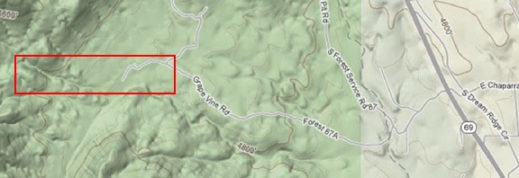
After driving down a rough forest road and parking, we did our hike in the area marked in red. We followed Grapevine Canyon most of the way.
We were on the eastern foothills to the Bradshaw Mountains. The Bradshaws aren’t very big — I think the tallest peaks might be around 6,000 feet — and the hills climbing up to them are mostly metamorphic rock and low bushes such as holly and manzanita. I kept Penny on her leash, mostly because there had been talk of mountain lions in the area and I didn’t want her wandering off. She walked with us like a little champ and only had to be lifted over one fallen log.
The trail started as a road, then narrowed to a wide trail. At a marked fork, we took the left fork, which was supposed to be level. It wasn’t. It climbed pretty steadily but not too steeply. Because we were hiking near a dry stream bed, there were some tall tress, including oaks and various pines. Scattered clouds and the trees helped keep the sun off us. Still, I’d dressed wrong in a pair of jeans instead of shorts. It wasn’t long before I was working up a good sweat.
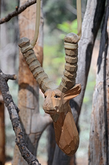
We found this hand-carved slingshot hanging from the vertical poles of what may have been a hunting blind in a clearing along the trail. Magnificent workmanship! Of course, we left it where we found it; I hope other hikers do the same.
Members of the group split into smaller groups and chatted as they walked. Occasionally, the front groups would stop to let the stragglers catch up. It was very rewarding to me to be able to get into a conversation with any group I wound up walking beside. I was never excluded, other members seemed to go out of their way at times to engage me in conversation. It was exactly what I wanted from the experience: a good workout with good conversation.
Meanwhile, as the trail narrowed and climbed along the dry creek bed, it became tougher to follow. Soon, we were following cairns — piles of rock left to mark the trail. After a while, I was glad I’d worn long pants — others were getting their legs scratched walking through brush. Penny kept up very well, surprising me and others.
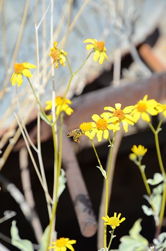
Eventually, we reached a dry waterfall with a seep-like spring. Thick green moss, which is rare in the desert, carpeted the rocks. Small flowers bloomed here and there. Butterflies flitted about. Facing an even narrower trail up the canyon, about half of us settled down to wait for the others to continue their explorations. Because various members had hand-held radios, we were able to keep in touch with all the groups. It wasn’t long before they’d had enough and began coming back.
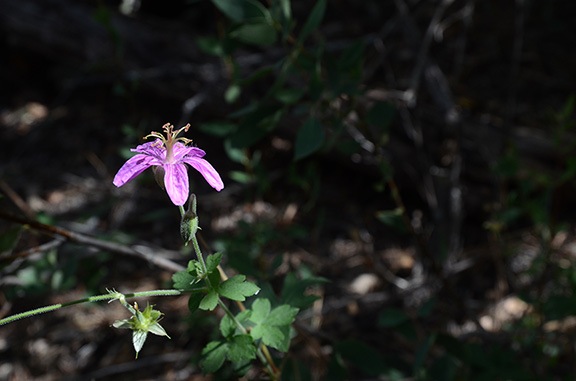
I captured this flower in a beam of bright sunlight.
The hike back was easier, probably because it was mostly downhill. Again, I found myself walking with different people along the way, talking about different things. It really helped keep my mind off my personal tragedy and the pain it was causing me. Being able to meet and talk to so many interesting people really pumped up my spirits.
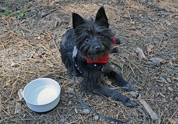
We stopped for a long rest on the way back, mostly to gather the whole group together. I took this opportunity to give Penny some more water and let her rest.
Afterwards, we went to Leff-T’s Steakhouse in Dewey. The group insisted on us sitting on the outdoor patio so Penny could join us. I’m in the process of weaning myself off my diet — I’m very close to my final weight goal — so I ordered steak fajitas and ate about 1/3 of the portion, taking the rest home for the next two days. One of my companions kindly gave me a taste of his chicken fried steak — I love that stuff but will probably never be able to enjoy a full portion again. (Which really is a good thing, after all.)
We split up after that. D and I climbed back into the Jeep with Penny and headed back down toward Phoenix. Although it probably would have been closer for me to drive through Prescott, I admit that I looked forward to D’s company for part of the drive. We talked a lot more about what I was going through — he seemed genuinely interested and offered up all kinds of supportive words and advice. He also gave me some specifics about his post-divorce recovery process that I could apply to my own life and what I might face. It was extremely helpful to me.
After I dropped him off at McDonalds, Penny and I headed home. It was hot — seriously, I don’t understand how people could bear to live in Phoenix when the temperature is still hovering around 100°F on the first day of autumn. We made good time getting back and I was glad to pull the Jeep into the garage just as it was beginning to get dark outside. I gave Penny a much needed bath and took a hot shower to wash off the day’s sweat and dirt.
I was tired but I felt happy and hopeful for my future.
I’m really looking forward to my next outing with this group.
Postscript:
 The hike leader, Al, posted a huge batch of photos that he shot before, during, and after the hike. Among them was this gem.
The ugly divorce I’m dealing with right now has been eating away at me day after day and night after night. But Al managed to capture the truth in this photo: my spirit is still alive and strong, I can still have fun, I can still be happy.
Thank you, Al. Seeing this photo really made my day.


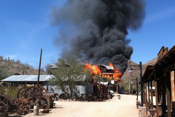
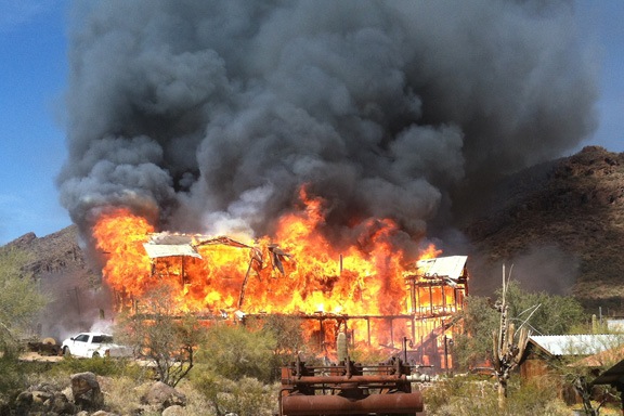


 The original owner was apparently obsessed with collecting old mining and farming equipment — I can’t imagine a larger collection anywhere else in the world. It’s mostly heavy metal stuff made of iron so thick that even the rust can’t hurt it. White numbered boards precariously attached to some of the more interesting items serve as reminders of the walking tour visitors were encouraged to take.
 Finishing up a special iBooks 2 interactive edition of
  Prepare scripts for a revision of my