That is the question every damn year.
It’s that time of year again: the time when the days start getting crazy short and the nights start getting crazy long. The days when, because of geographic features near my home — namely, the 1000 foot cliff less than a quarter mile south of my property — direct sunlight reaches my home for fewer and fewer hours. The days when the leaves start turning brilliant autumn colors in preparation for the one big freeze that’ll turn them brown before colors actually peak and the one stiff wind that’ll blow them all away.

Today is a gray day at the aerie. Although the orchards haven’t started turning autumn colors yet, other trees have. It’s just a matter of time before the trees are bare and gray is the predominant color.
In other words, pre-winter.
Every winter since I moved here “full time” in 2013 I’ve spent at least part of the winter south of here in an RV. In the early years, it was the big fifth wheel I’d owned since 2010; later it was the big truck camper I bought to replace it, and, more recently, it’s been the slightly smaller big truck camper I bought to replace that. I leave my home in the able hands of a house-sitter (or two or three) in November or early December, and drive south until it’s warm enough to sleep in my camper at night without being plugged into a power source. I stay south until just past the point where I’m ready to come home, which is usually in February or March.
But before that, every year I have the same debate with myself: do I stay home this winter or migrate south?
The Argument for Staying Home
The best argument for staying home is that home is comfortable.
Although it gets cold outside — sometimes into the single digits at night — my home’s heat works fine. Because local power is renewable and so damn cheap, I have no qualms about cranking up the heat as high as I like to stay warm. My garage isn’t heated, but my jewelry shop down in the garage is insulated and the portable heater I use down there keeps it warm enough to work in comfort.
At home, I have everything I need to do anything I need to do. Want to cook a meal in a big oven or Insta-Pot? No problem. Need to store something large in the fridge or freezer? I’ve got space. Want to edit a bunch of video and upload it to YouTube? I can use a desktop computer with two monitors and upload via a super fast fiber connection to the Internet. Feeling under the weather? I can lounge in a comfy bed or on a sofa in front of a TV with a book close at hand. Want to explore new jewelry designs or techniques? The shop is already set up with any equipment I might need.
Staying home is easy.
The Difficulty of Travel
Traveling, on the other hand, is not. While moving from place to place in my truck/camper rig is not difficult — heck it’s as easy to drive and park as my truck is — finding a good overnight or multi-day spot can be. My problem is that I’m picky and a bit cheap. I don’t want to pull into a campground, hook up, and pay $40 per night for the privilege of having neighbors 15 feet away out my windows on all sides. I don’t care if that campground has full hookups, a laundry room, a heated pool, and a dog run. Places like that are like suburbia (or worse). I don’t live like that at home and I certainly don’t want to live like that when I travel.
I want to live out in the desert or in the mountains or at a lake or river or in the forest with the same kind of privacy I have at home. I want to let my dogs out by simply opening the door and letting them out — just as I do at home. I don’t want to hear a stranger’s voice or vehicle or generator or barking dog. I want to experience sunrises and sunsets without seeing them through wires or around buildings or over the tops of other RVs. I want to hear the wind and rain and see wildlife.
Last Year
Last year I camped at a site I knew well along the Colorado River south of I-10 in Arizona. It’s BLM land and, technically, you’re only supposed to stay there for 14 days before moving on. I stayed considerably longer. My friend Janet was with me for about half that time; she moved on to Quartzsite as she normally does in January.
I was set up with a little compound that included my camper and the cargo trailer I’d dragged down there. My mobile shop, I told myself. I later realized that it was a sort of anchor, limiting my travel possibilities. Because of it — and because the spot I’d set up in was so damn comfortable — I didn’t travel much at all last year once I’d parked and set up. It wasn’t until I hooked up with my friend Bill that I actually travelled.

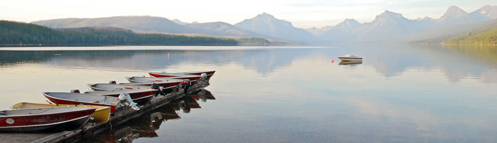
Here’s my truck camper, set up for a long stay at camp last year. You can read more about life at camp last year here.
My biggest fear in that spot was that some yahoo with loud equipment — generators, ATVS, radios, etc. — would pull into the area — it was big enough for multiple rigs, after all — and set up camp nearby, totally spoiling the peace and quiet I was able to enjoy. Yes, the spot did have visitors — there was a boat ramp there that saw some activity from fishermen — but no one (other than friends) spent the night. The fear of being intruded on by someone loud and obnoxious made my stay a little less enjoyable. And the knowledge that I was wasting time on a piece of desert when I could have been exploring new places convinced me not to spend more than a week at that spot again.
The realization that my cargo trailer was limiting my travel capabilities convinced me to leave it home in the future.
The Prospect of Traveling Light
Of course, not having the cargo trailer along would limit my comfort on the road. I couldn’t easily take the things I might “need” with me. After all, my truck’s huge cargo bed was full of my camper. My camper had some storage space, but not for large items. The back seat area of my truck was limited and there were some things I really needed to bring, including my generator and my bicycle (which folds).
It would also limit my ability to participate in art shows while traveling. I was all prepared to do shows last winter — I had all of my show equipment stowed in my cargo trailer — but COVID canceled most shows and the few that remained lacked the precautions that would have made me comfortable participating in them. (So yes, I lugged all that stuff all over the southwest for no reason.) Without the cargo trailer, would I be able to bring the tent, tables, displays, and other items I needed to do shows? I doubted it.
That meant that the trip would be strictly a vacation with no income-earning potential — and that didn’t jive with other plans I had for my life.
But This Is How It Works
I go through versions of this same debate every single year around this time. Lately, in the end, I make the same decision: stay home.
It’s a great idea. I can be comfortable and get work done. I can write, edit videos, and make jewelry — all of which have revenue potential for me. I can spend holidays with friends. I can go cross-country skiing for Christmas on some of the best groomed ski trails in the country. (And I do mean that literally; look up Methow Valley skiing.) I can spend the winter without worrying about where to camp, where to dump RV tanks, where to get water, and whether there’s enough solar power to top off my batteries before nightfall. Sounds great!
And then something happens that gets me packing my RV for the trip south: we change the clocks.
Suddenly, instead of the sun setting here at 5:46 PM, it sets at 4:34 PM. By December 5 of this year, it’ll be setting at 4:10 PM.
As someone whose life is governed by an internal clock powered by sunlight, I’m mentally ready for bed at 6 PM. And I can assure you that waking up at 2 AM after a full 8 hours of sleep is not optimal.
But before that, on around December 1, the Shadow Time will have begun here. And, most likely, the inversions will have started, shrouding the Wenatchee Valley in low clouds or fog that, because of my elevation, I’m often seeing directly out my windows. I remember being here one December or January when for three days in a row, when I looked out any of my windows, all I saw beyond the deck was white. I was living in a fog bank.

Last year, I left home early, on November 15. With a cold snap and snow already on the ground, I couldn’t wait to get out of here. The trailer stays home this year.
This Year
I that’s where I stand today: I would like to stay home this winter but I know that as soon as we change the clocks, I’ll be eager to get out of here.
I have house-sitters all lined up and I know it would be disappointing to them if I told them I wasn’t leaving. So I’ll keep my current mindset to myself, knowing that it will change on the evening of November 7.
In the meantime, I have two Christmas art shows to attend in Washington State this November: one in Pasco on November 5-7 and one in Spokane on November 19-21. I’ll be taking my truck camper to both of them and I MUST be able to get all of my show gear on board. I’ve also started looking for shows in Oregon, California, and Arizona for December. If I can successfully pack for Pasco, I’ll head south right after Spokane.
Another winter south of the 45th parallel? You can bet money on it.


