We take the Jeep on some forest roads at the local park.
Now that work on our shed at Howard Mesa is just about complete, we can spend more of our time in the area on recreational activities. Yesterday, we spent the day doing one of my favorite activities: back road driving in my Jeep.
I need to clarify something here. A lot of people think that when you drive on some of the unmaintained yet marked dirt roads that wind through places like national forests and state parks, that’s off-roading. It isn’t. After all, how can it be off-roading when you’re following a road? Sure, the roads are in terrible shape sometimes. Sure, they have huge erosion ditches running down one tire track or the other or sometimes right across the middle. Sure, there are no signs other than those with the secretly coded forest road number, which may or may not match the number on your detailed forest service map. But they are roads. So when you drive on them, you’re not off-roading. You’re driving off-pavement.
Of course, if you’re a city slicker and your SUV tires have never had dirt or gravel between their treads, you probably wouldn’t even attempt the roads I’m talking about. After all, my sister-in-law, on her first visit to our house, exclaimed, “Wow! This is the first time I’ve ever been off-road!” That would have been fine if we were driving off-road at the time. But we weren’t. We were driving down the only road to get to our house. And her husband, my brother, owns a Nissan Pathfinder.
I remember when my mom and stepdad came to visit years ago, driving to Arizona from Florida in their Mercury Mountaineer. We decided to take them to Box Canyon, which is up the Hassayampa River a bit. Rather than all cram into my Jeep, we climbed into their SUV. I can’t remember who drove, but I do remember my parents’ cries of alarm when they realized that we were actually going to drive in the river to get there. “But this is an SUV,” we countered. “It’s designed to drive places like this.” Needless to say, their vehicle stayed parked in our driveway for the rest of their stay, lest they should be tricked into taking it off pavement again.
Can someone explain to me why people buy SUVs when they’re afraid to drive them on anything but paved roads and highways?
Did you ever notice how I can take a short story and make it really long?
Anyway, that’s what we did yesterday. We took a 40-mile off-pavement drive.
I had my extremely detailed forest service map for the Kaibab National Forest, Tusayan Ranger District. That’s the area of the Kaibab National Forest that butts up against the southern part of Grand Canyon National Park. The map included dozens of forest roads with numbers like 305, 301A, and 311. Narrow, two-track roads that wound their way through the ponderosa, pinyon, and juniper pines, along ridges, over creeks, and alongside rocky outcroppings. The map included several “places of interest” marked with red “i” icons. One was the Grandview Lookout tower, which I had visited two years before (and wrote about it in this blog; try searching for Grandview; I can’t link to it while composing offline). Another was someplace called Russell and yet another was a place called Hull Cabin in the Hull District. I wanted to visit all of these places. And I didn’t want to get there the fast way.
Although I can provide the road numbers here, they aren’t much use unless you either have a map to consult or are in a high clearance vehicle — I didn’t use 4WD at all — and want to follow my path. I suggest the latter.
We took Route 64 north, toward Tusayan and the Grand Canyon. A bunch of miles past Valle (crossroads with route 180 from Flagstaff), and just past Red Butte, we turned right onto Forest Road (FR) 305, which is indicated as an “improved” gravel road on the map. The map is from 1995 and that may be the last time they laid down gravel there. We followed 305 east and then northeast. We were in the vicinity of the old Grand Canyon airport, but since it was not marked on the map or my GPS and there were many trees, we only got a single glimpse of what might have been it.
I should mentioned here that Grand Canyon’s current airport is at Tusayan, just south of the park entrance. It has a nice, long paved runway and more helipads than I’ve seen anywhere else. It also has an old tower and a new tower. The new tower, which I had a chance to visit about two years ago, is quite modern and very nice. But a long time ago — I really don’t know how long — the Grand Canyon airport was in a big open field north of Red Butte, east of highway 64. That’s about 10 miles south of the current airport. I know the old airport from the air — Papillon does all of its pilot training in that area — but I’ve never driven there. That’s one of the things I hope to do sometime next week, just to check it out from the ground. The old airport doesn’t have any pavement — I don’t think it ever did. I recall that a hangar is still standing and there are two decrepit fuel trailers parked nearby.
Yesterday, we didn’t see any of that — although I think we drove right through the tiny clearing that I was asked to land in on my check ride. At the time, I’d replied — correctly — that it wasn’t a safe landing zone and I hadn’t actually landed there. But it was weird to drive through it and see it from the ground.
From FR 305, we got on FR 305A and then the rather challenging FR 343. I say challenging because the turnoff to this road was extremely eroded with hugh ditches. It was a matter of putting the wheels in the right places to avoid getting stuck or toppling over. Once past that, the road was much better, although parts of it were extremely bumpy.
Of course, there were plenty of other roads intersecting our road. Most of them — and more! — showed up on my GPS’s moving map, which I had preloaded at my office a few days before. Some of them showed up on the Forest Service map. The only way we knew where we were on the map was by comparing landmarks we passed that were labeled on the GPS or signed alongside the road. For example, we passed right by Gallo Tank — for some reason all the tanks out there had names and all the names were on the map and the GPS. We saw the Gallo Tank sign and matched it to Galo Tank (with one L) on the map. That’s how we knew we were halfway between the start of FR 343 and its intersection with FR 2732 at Skinner Ridge. So getting lost out there was not a concern at all. We always knew where we were and, since we had a map, always knew what road we needed to get where we were going. And since most of the roads were clearly marked at intersections, we usually knew which one we were on.
 The forest was cool and quiet and the air smelled fresh, with the fragrance of pine and whatever small trees were flowering. We saw some birds but nothing else. No other vehicles, either. It was 9 AM on a Saturday morning and the forest south of the Grand Canyon, where thousands of people were peering into a big ditch, was completely ours.
At Skinner Ridge, we stayed on FR 343 and followed that to FR 302. FR 302 is the “main road” from Tusayan to Grandview Fire Tower, an improved gravel road that really is maintained. We took that east to FR 301A and then to FR 301. That took us southeast. We eventually hit FR 320 at Bucklar Ranch, one of several privately owned “islands” of land in the sea of national forest. We took a wrong turn there, mostly because the intersection on the map didn’t match the intersection in reality. We figured it out pretty quick and backtracked, then got on FR 311 northbound.
The point of interest named Russsell turned out to be a tank with a log corral. I should probably explain what a “tank” is in Arizona. Tank is short for cattle tank. It’s a man-made pond created by damming up the downstream end of a wash. When the wash runs, the water comes down the wash until it hits the dam. It then pools up behind the dam to store water for cattle to drink.
As I mentioned earlier, all of the tanks in the area were named and had signs in front of them. This one also had an extremely clean pit toilet building, animal-proof trash cans, and a sign board that had few signs on it. We parked at the end of the road and, after utilizing the facilities, walked down the path to the tank. Jack the Dog was with us and he ran ahead, very glad to be out of the Jeep. We wound up on the bank of a very large tank with fire rings and a log corral — which was long broken — nearby.
It was a very picturesque place so I took some pictures.
The Arizona Trail runs right through the Russell Tank area. The Arizona Trail is a hiking/horseback riding trail that I believe runs the full length of Arizona, from Utah all the way to the Mexican border (someone please correct me if I’m wrong). From Russell Tank, it heads north not far from FR 311, then heads northwest along the Coconino Rim. Eventually, it gets to the rim of the Grand Canyon, where it follows one of the existing trails down into the canyon, across one of the bridges near Phantom Ranch on the bottom, and up the other side, most likely on the Bright Angel Trail.
After about 20 minutes exploring the area, we climbed back into the Jeep and continued north on FR 311. It dumped us out on FR 310, which winds along the Coconino Rim — but not close enough to offer any views. We followed that northwest. A few miles short of Lockett Lake, we passed the first vehicle we’d seen since leaving route 64 at least two hours before: a pickup truck parked on the side of the road.
Mike wanted to check out Lockett Lake — he’s always looking for a place to go swimming — so we made the turn and drove the 1/4 mile to the lake. It was another tank — actually smaller than Russell Tank. A female elk and her youngster had been drinking from the lake when we drove in; of course we scared them away before we could get any photos.
We continued on toward Grandview Fire Tower, which was quite close, but made the right turn onto FR 307 toward what’s called the Hull District. We were on Grandview Ridge at the northwest end of the Coconino Rim. To the south, the earth climbed up to this point. To the northeast, the earth dropped off suddenly into what’s called the Upper Basin. From the southwest edge of this basin right up to the rim of the Grand Canyon, the earth rises slowly again.
I was intimately familiar with this terrain — but from the air. When I worked as a helicopter pilot at the Grand Canyon in the summer of 2004, our east end tours flew right past Grandview Tower and over the upper basin before crossing into the canyon at Zuni Point. I’d climb to 7800 feet, make my radio call at Grandview as I passed the tower, and then descend back to 7500 feet. The trees at the edge of the canyon seemed to rise up to the helicopter and then, suddenly, we were past them, over the abyss. That few minutes of flying, crossing over the rim of the canyon and hearing the passenger beside me gasp with surprise, was my favorite part of my summer job that year.
FR 307 wound down the steep side of Grandview Ridge with, at one point, a sheer cliff on the right. On the left there was some sign of another, older road or path; the downhill side had been shored up with rocks and logs many years before. At the bottom was Hull Tank and, as I drove by slowly, I saw the heads of some wild turkeys near the water. I stopped the Jeep and Mike and I both got out to see them and take photos, but they ran off. I managed to catch a few of them in the underbrush with my little Canon Powershot. (Thank goodness for 7.1 megapixel cameras and the ability to crop.) There were at least 20 of them and they ran across the road in front of the Jeep and disappeared into the forest.
There was a drag gate across the road for Hull Cabin, but since no sign told us to keep out, Mike got out and opened the gate while I drove through. He closed it behind us and we continued on our way.
Hull Cabin was built in 1889 as part of a sheep ranch. It includes two cabins and a barn, all made out of logs. In 1907, the Forest Service converted it into a Ranger Station. It’s still used once in a while as a camp for workers during the summer months. No one was there that day. We peered into the windows of the main cabin. It had four rooms, one of which had a nice stone fireplace. There was a porch on front and a modern portable toilet building out back. After exploring down two roads that went past the cabin and finding dead ends on each, we backtracked to SR 307. A left turn would have brought us to SR 64 between Desert View on the east end of Grand Canyon National Park and Cameron in the Navajo Reservation. But we turned right to go back to Grandview.
There was no sign of the wild turkeys at Hull Tank. Instead, there was an enormous bull elk with a huge rack. He took one look at my red Jeep and ran off into the woods.
We climbed back up Grandview Ridge. That’s when we saw our second vehicle on the back roads, a bright yellow Jeep heading down the hill.
We followed FR 310 past Grandview Tower and into the park. A lot of people don’t know about this back road into the park — probably because most people wouldn’t subject their vehicles to the unpaved roads. The most direct route is to take FR 302 from Tusayan eastbound. I think it’s about a 16 mile drive through the forest.
What’s really amazing is that you can camp for free almost anywhere in the National Forest — including in the Grandview Tower area. That puts you less than two miles from East Rim Drive in Grand Canyon National Park, far to the east of the crowds, yet close to Grandview Point and other Canyon view areas and hiking trails. And you don’t have to take the 16-mile drive on dirt roads. Instead, go through the park and then exit at Grandview. A mile or two on dirt and you can find any number of great campsites. I’m talking about dry camping, of course. There are no full hookups for trailers and motor homes out in the forest and generators are definitely not welcome.
We made our way to Grand Canyon Village, hitting a ton of tourist traffic at Mather Point. A few years back, the National Park Service (NPS) decided that the Grand Canyon needed a centrally located information center. They put it right near Mather Point but then, for some reason unknown to me, didn’t build a parking lot for automobile traffic anywhere near it. There’s a parking lot for buses, but since most of the buses drop off their passengers in Grand Canyon Village a few miles to the West — which is also where the hotels and restaurants are — it’s severely underutilized. As a result, people park at the Mather Point parking lot — which isn’t terribly large — and then alongside Rim Road on both sides. The result is a traffic nightmare, with pedestrians, tourists cruising slowly for parking, and drivers who aren’t really looking where they’re going.
By some miracle, we found a spot in the parking lot near El Tovar in Grand Canyon Village. We settled Jack in by opening up the windows halfway and filling his water dish. He barked a little as we left him, but soon settled down.
The weather, of course, was perfect. Mid 70s, partly cloudy, gentle breeze. It had been cloudier and cooler in the morning. Now it was 1 PM and it was quite pleasant.
We had lunch in El Tovar, which used to be my favorite restaurant. In the old days — ten or years ago — it featured an eclectic menu with a rustic twist: lots of wild game and truly original appetizers and desserts. Service was excellent from highly trained servers and other staff. Eating their was a special occasion as well as a treat for the taste buds. But nowadays, things aren’t quite as special. The menu is more basic, the service is more ordinary. You don’t feel bad walking in for lunch in a pair of shorts and a t-shirt. And I think it still is the best restaurant on the rim.
We took Jack for a short walk along the rim there. It’s always good practice to make him walk on a leash and not bother every single person he passed. A mean dog tried to get him into a fight but we pulled him back. There were a lot of people there. And one of those ugly yet magnificent California condors sitting out on a ledge. I didn’t bother taking photos of the bird; I’d gotten some good ones the last time I was in the park. (Search this blog for “condor” to see them.)
We moved the Jeep over to the parking lot by Shrine of the Ages, put Jack back on his leash, and went for a walk on the rim trail from there to the Yavapai Observatory. It was a mile each way and paved with asphalt — a very easy trail. Yet few people were on it.
At one point, a small group of people were sitting on the wall at the edge of the trail, looking toward the rim. They seemed interested in something. Then a young mountain goat — or possibly a bighorn sheep? — crossed the trail right in front of me to join his friends near the rim. There were four of them there when I got into position for a good look and a man there told me that a few had already descended down into the canyon. I took some video and still photographs. The youngster watched us from less than 20 feet away. He seemed very interested in Jack, although Jack wasn’t the least bit interested in him.
That’s one of the weird things about wildlife in the national parks. The animals have become almost tame from being exposed to so many people. Some animals — for example, squirrels and chipmunks — will actually beg for food. And that’s why they beg — because people will feed them. Although no one was offering food to these animals, they didn’t look as if an offer would scare them away.
We continued on to the Yavapai Observation Station, which was recently reopened after a renovation. Mike and Jack waited outside on a bench while I went in. Inside, it has tinted windows that look out over the canyon, making the red rock cliffs look even redder and more beautiful. A ranger had set up a small telescope and was showing close-up views of points of interest far below: Phantom Ranch, one of the two suspension bridges, the Colorado River with river runners on it. I stood nearby for a few moments, looking at Phantom Ranch. Less than a year before, I’d hiked on the north side of the canyon from the ranch. I couldn’t believe how far we’d hiked when I saw it from across the canyon.
We headed back to the car soon after that. I was pooped. I’m terribly out of shape these days — why else would a 2-mile walk on pavement (for heaven’s sake!) make me so tired? (Okay, so we were walking around at an elevation of nearly 7,000 feet.) Clearly I need more exercise.
After a quick stop at the supermarket in the park for the next night’s dinner and Cokes with ice for energy, we headed back to Howard Mesa. We rolled through the gate at 5:30 PM after putting only about 120 miles on the Jeep all day.
 I won’t go into details about the roads I tried and the wrong turns I took. Suffice it to say that I finally homed in on it. After driving down a two-track road that cut diagonally across the main runway, I parked my Jeep right in front of the gaping hangar door.
 One thing is for sure: visiting the old airport and looking up at the faded paint over the door spelling out “Grand Canyon Airlines” has given me a real thirst for knowledge about the place. When I’m finished with my road trip book project and trip to Canada (for work), I might start doing a little research.
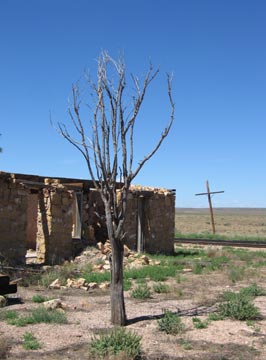 The road crossed the tracks at a place called Willaha. Formerly a train station, the site has the ruins of a building, foundations of at least one other building, and a huge cattle holding pen overgrown with grass and weeds. I could imagine ranchers moving their cattle to this spot, putting them into the pens until the train with cattle cars stopped at the station. Then the cattle would be moved up onto the train and brought to market. Nowadays, the only train that uses the tracks is the Grand Canyon Railway, which runs one or two trains a day on scenic rides between Williams and Grand Canyon. I don’t think any cattle have passed through the corral in years, if not decades.
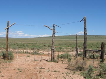 Back at the tracks, I took a left, heading northbound on a two-track road on the west side of the tracks. This road was not on my map, but it was on my GPS. It was easy enough to follow, although it did have quite a few gates to pass through. Most of them were drag gates, like the three-way gate shown here. You may have heard this type of gate referred to as a “cowboy gate” because they’re relatively common out on the range where only the cowboys go.
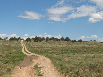 The road followed the tracks north. In most places, it was both smooth and dry. But in some places, water had gathered in the wheel ruts and that water was muddy. I drove through the first spot like that and managed to get mud all over the Jeep as I slid around in the muck. The next muddy spot I reached showed evidence that someone else had driven around it, so I did the same. In other places, the road climbed up a rocky outcropping and got rough with broken rocks, forcing me to slow down. I certainly didn’t want to break a tie rod or something out there.
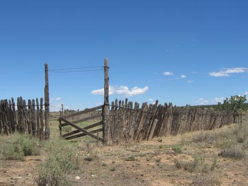 We reached Anita Station, where several roads intersected at the remnants of another cattle pen. Jack and I got out and walked around a bit. I saw the remains of several other buildings, reduced to mere concrete slabs. It was already close to 11 AM and I expected the train soon. But I couldn’t hear it coming, nor see its black smoke on the horizon. I decided to continue up the two-track road.
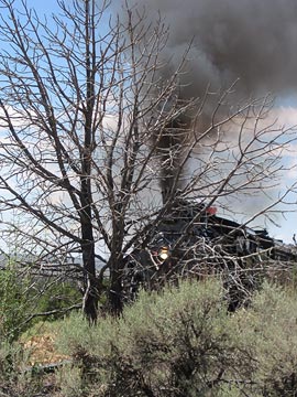 I heard the train coming and returned to my photo spot. As the train came puffing into view, I realized I’d picked a terrible spot for photos. I was too close to the tracks and there were too many trees in the way. For some reason, I’d imagined the train being bigger. It wasn’t. I offer this photo as an example of a good plan gone bad. I laughed at myself as the train passed and I walked back to the Jeep.
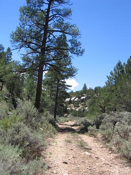 The canyon and road ended at an intersection: FR 2615 again. I wanted to go north, to the other side of the tracks. So I turned left. I realized about two miles down the road that left was wrong — it would just bring me back to the mud puddle — and backtracked yet again. I headed northeast on FR 2615, following it up Rain Tank Wash. The open meadow-like area closed up to another canyon and I followed the road through it. Although my map showed that the road ended not far after I’d gotten on it, I had become accustomed to roads continuing beyond their map ends. This one continued for a good two miles up the wash while steep walls and pine trees closed around us.
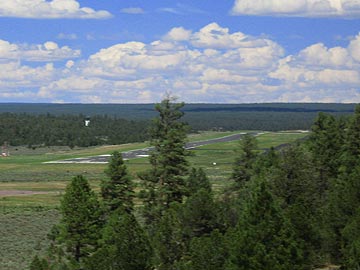 The road reached a clearing where the earth dropped away in front of us. There, in the near distance, was the approach end of Runway 3 at Grand Canyon Airport.
 The forest was cool and quiet and the air smelled fresh, with the fragrance of pine and whatever small trees were flowering. We saw some birds but nothing else. No other vehicles, either. It was 9 AM on a Saturday morning and the forest south of the Grand Canyon, where thousands of people were peering into a big ditch, was completely ours.
 As I mentioned earlier, all of the tanks in the area were named and had signs in front of them. This one also had an extremely clean pit toilet building, animal-proof trash cans, and a sign board that had few signs on it. We parked at the end of the road and, after utilizing the facilities, walked down the path to the tank. Jack the Dog was with us and he ran ahead, very glad to be out of the Jeep. We wound up on the bank of a very large tank with fire rings and a log corral — which was long broken — nearby.
 FR 307 wound down the steep side of Grandview Ridge with, at one point, a sheer cliff on the right. On the left there was some sign of another, older road or path; the downhill side had been shored up with rocks and logs many years before. At the bottom was Hull Tank and, as I drove by slowly, I saw the heads of some wild turkeys near the water. I stopped the Jeep and Mike and I both got out to see them and take photos, but they ran off. I managed to catch a few of them in the underbrush with my little Canon Powershot. (Thank goodness for 7.1 megapixel cameras and the ability to crop.) There were at least 20 of them and they ran across the road in front of the Jeep and disappeared into the forest.
 Hull Cabin was built in 1889 as part of a sheep ranch. It includes two cabins and a barn, all made out of logs. In 1907, the Forest Service converted it into a Ranger Station. It’s still used once in a while as a camp for workers during the summer months. No one was there that day. We peered into the windows of the main cabin. It had four rooms, one of which had a nice stone fireplace. There was a porch on front and a modern portable toilet building out back. After exploring down two roads that went past the cabin and finding dead ends on each, we backtracked to SR 307. A left turn would have brought us to SR 64 between Desert View on the east end of Grand Canyon National Park and Cameron in the Navajo Reservation. But we turned right to go back to Grandview.
 At one point, a small group of people were sitting on the wall at the edge of the trail, looking toward the rim. They seemed interested in something. Then a young mountain goat — or possibly a bighorn sheep? — crossed the trail right in front of me to join his friends near the rim. There were four of them there when I got into position for a good look and a man there told me that a few had already descended down into the canyon. I took some video and still photographs. The youngster watched us from less than 20 feet away. He seemed very interested in Jack, although Jack wasn’t the least bit interested in him.
 We continued on to the Yavapai Observation Station, which was recently reopened after a renovation. Mike and Jack waited outside on a bench while I went in. Inside, it has tinted windows that look out over the canyon, making the red rock cliffs look even redder and more beautiful. A ranger had set up a small telescope and was showing close-up views of points of interest far below: Phantom Ranch, one of the two suspension bridges, the Colorado River with river runners on it. I stood nearby for a few moments, looking at Phantom Ranch. Less than a year before, I’d hiked on the north side of the canyon from the ranch. I couldn’t believe how far we’d hiked when I saw it from across the canyon.
 I took this photo on the hiking trail to…well, I can’t remember the name of the place now. I think it’s called Red Mountain. It’s off route 180, between Valle and Flagstaff in northern Arizona.
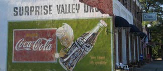 Yes, it’s the side of a building. But it’s also an old billboard for a drugstore that probably doesn’t even exist anymore. And there’s something about it that I really like.