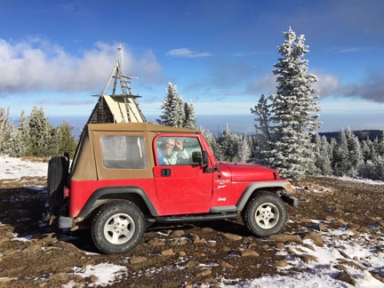
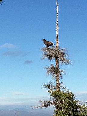
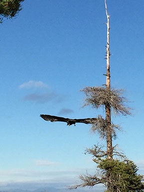
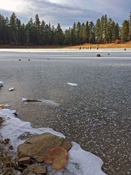
About the Header Images

A quick summary of where the current images were taken and who I was with.

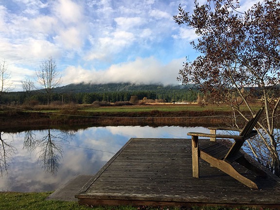
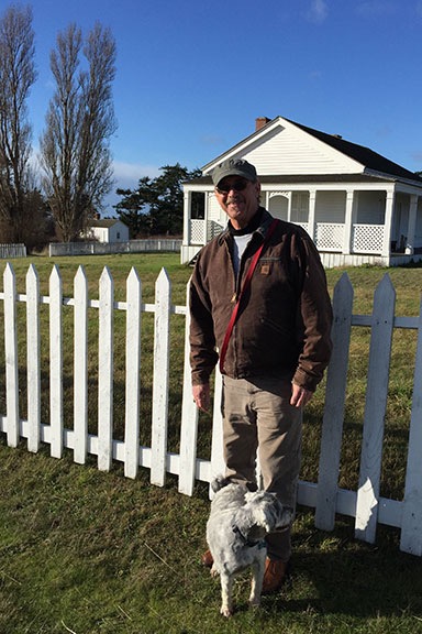
You may not realize it, but I shot all of the photos that appear in the header on this site. There are currently more than 90 of them and they’re set up to appear randomly. Each time you visit this site or click a link to another page here, the image up top should change.

I noticed just the other day that although all images were shot within the past 10 years, the vast majority were shot when I was alone. That made me realize how much I traveled by myself, even when I was married, and how the places and things I saw were beautiful or interesting enough to capture an image of.

Anyway, here are the images, with summaries.

Alfalfa

Alfalfa

This was an alfalfa field near where I spent my summer in Quincy, WA. I think I shot this in 2008. Alone.

American Coot Family 1 & 2

American Coot Family

American Coot Family 2

I shot these two images at Quincy Lakes in Quincy, WA in 2008. Alone.

Bark

Bark

Birch Bark 2

I like photos that show texture. These close up photos of bark were shot at Quincy, WA in 2008. Alone.

Barn Roof, Wagon, and Waterville Farmland

Barn Roof

Barn Wagon

Waterville Farmland

These three images were shot on the Waterville Plateau near Douglas, WA, probably in 2009. I was with my wasband.

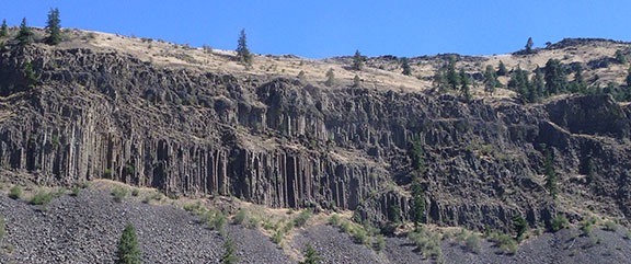
Basalt Cliffs

Basalt Cliff

I’m pretty sure this photo was shot while repositioning my RV from Washington to Arizona by way of Glacier National Park with my wasband — one of the last “vacations” we had together — in 2009. I think it’s at Palouse Falls.

BC Mountains Pano

BC Mountains Pano

This was shot from a cruise ship on an Alaska Cruise with my wasband in 2007. Our last day on board took us between Vancouver Island and the mainland.

BHCB

BHCB

This was shot at Quincy Lakes in 2008 or 2009. I assume BHCB is an abbreviation for the type of bird. Alone.

Birch Leaves

Birch Leaves

I liked the way the sun shined through these leaves in the late afternoon. Shot at Quincy near the golf course in 2008. Alone.

Blue Heron & White Heron

Blue Heron

White Heron

I was kayaking with my dog at Lake Solano in Central California in 2014 when I shot these photos of herons.

Bowman Lake

Bowman Lake

This was shot at Glacier National Park in 2009 while traveling from Washington to Arizona with my wasband.

Bryce and Bryce Dawn

Bryce

Bryce Dawn

These two photos were shot at Bryce Canyon in 2011. I’d gone there with a client in January on a photo flight for this 360 interactive panorama: Bryce Canyon in Winter, Utah, USA.

Cache Creek

Cache Creek 1

Cache Creek 2

Cache Creek 3

Cache Creek 4

These four images of Cache Creek were taken from my helicopter’s nosecam on an early morning flight up Cache Creek in Central California in 2014. I was alone.

Cascades

Cascades

This image of a ridge and cloud-filled valleys was taken from my helicopter’s nosecam on a flight between Wenatchee, WA and Hillsboro, OR in 2012. I blogged about the flight here and shared video from the flight here. It’s notable not only for the perfect weather and amazing scenery, but because it was my dog Penny’s first helicopter flight — 90 minutes long! And yes, that is Mt. St. Helens in the background.

Cherry Drying Cockpit

Cherry Drying Cockpit

This is a shot from a GoPro camera mounted in the back of my helicopter during a cherry drying flight. It was probably taken in 2011.

Close Up Wheat

Close Up Wheat

This closeup of wheat growing in a field in Quincy, WA was shot in 2009. I was alone.

Combine

Combine

This aerial shot of a wheat combine at harvest on the Waterville Plateau in North Central Washington was shot in 2011 during a flight between Wenatchee and Coeur d’Alene, ID. My friend Jim was flying his helicopter; I was on board with a camera.

Corn

Corn

I like patterns. This field of young corn plants in Quincy, WA was capture in 2009. I was alone.

Cows in the Road

Cows in the Road

I was on my way up to my old Howard Mesa, AZ place one bright winter day when I came upon these cows following tire tracks in the road. When I approached, they just stopped and stared. I took a photo before continuing, herding them along with my Jeep. I can’t be sure of the date, but I expect it was around 2003 or 2004. I was probably with my friend Jeremy.

Cracked Mud

Cracked Mud

I shot this alongside the road to Alstrom Point on the northwest end of Lake Powell in Utah. It was probably shot in 2008. I was alone.

Crescent Bar View, Yellow Flowers

Crescent Bar View

Yellow Flowers

I shot these photo of Crescent Bar in Quincy, WA in 2009 not long after drying a cherry orchard down by the river there. I was alone.

Dandelion

Dandelion

I shot this photo of a dandelion seed puff in Quincy, WA in 2008. I was alone.

Desert Still Life & Desert Wildflowers

Desert Still Life

Desert Wildflowers

I shot these photo of hedgehog cacti blooms and California poppies near Wickenburg, AZ between 2009 and 2011. It was probably on one or two Jeep outings and I was probably with either my wasband or my friend Janet.

Fern

Fern

Patterns and textures again. This was shot in Alaska sometime during a cruise with my wasband in 2007.

Float Plane

Float Plane

I shot this image of a float plane taking off at an Alaska port while on a cruise with my wasband in 2007. It was shot from the balcony of our stateroom.

Golden Gate Bridge

Golden Gate Bridge

This image of the Golden Gate Bridge was shot during a trip to San Francisco in 2011. Not sure if I was alone — isn’t that odd? — but I was probably there for a Macworld Expo speaking gig.

Glacial River Rocks

Glacial River Rocks

I shot this closeup of rocks in a river bed while on a trip to Denali National Park in 2007 with my wasband.

Golf Balls

Golf Balls

Attach a GoPro to the bottom of a helicopter with the lens pointing down. Then hover over a golf course green and drop hundreds of golf balls. This is what it might look like. Shot in late 2011 or early 2012. My client was dropping the balls.

Grand Canyon Sunset

Grand Canyon Sunset

I’ve been to the Grand Canyon countless times so I don’t know exactly when this was taken or whether I was alone. I know it was shot before the summer of 2011.

Gyro Cache Creek & Gyro Pattern

Gyro Cache Creek

Gyro Pattern

I learned how to fly a gyroplane in the spring of 2014. These two shots were made with a GoPro mounted on the mast. In the first shot, I’m flying up Cache Creek; in the second, I’m doing a traffic pattern at Woodland Airport. Both were shot in Central California.

Hay Bales

Hay Bales

I’m pretty sure this was shot on the road between Upper Moses Coulee and Waterville in North Central Washington in 2009. I was alone.

Helicopter

Heli Header

This is a photo of my helicopter right after sunrise parked out near my new home in Malaga, WA. I shot this in 2014; I was alone.

High Tension

High Tension

This was shot in 2008 near the Chief Joseph Dam near Bridgeport, WA. I was on a daytrip with my wasband.

Hopi House

Hopi House

Another trip to the Grand Canyon. I suspect I was alone when I shot this one, possibly on a day trip by helicopter with clients from Phoenix. Sometime between 2009 and 2011.

Houses

Houses

Here’s another straight down image shot with a GoPro from my helicopter. This was Peoria, AZ in 2011 or 2012. I was alone.

Inspecting Bees

Inspecting Bees

I set up a GoPro on a tripod to record a beehive inspection in 2013. That’s me in the picture; I was alone.

International

International

This is a closeup of an old International truck parked outside the bakery at Stehekin, WA. I was there with my wasband and another couple on a helicopter trip in 2011.

Juvenile Robin

Juvenile Robin

Shot in 2008 at Quincy, WA. I was alone.

Ladders, Side

Ladders Side

Patterns again. These are orchard ladders neatly stacked at an Orchard in Quincy, WA. Shot in 2008.

Lake Berryessa

Lake Berryessa

An aerial view of Lake Berryessa in Central California, shot with my helicopter’s nosecam in 2014. I was alone.

Lake McDonald Sunset

Lake McDonald Sunset

This was shot on a trip to Glacier National Park with my wasband in 2009.

Lake Pleasant

Lake Pleasant

Another nosecam image from my helicopter. This is a dawn flight over Lake Pleasant near Phoenix, AZ. I was alone.

Maine Coastal Town & Main Fog

Main Coastal Town

Maine Fog

I shot these during a trip to Maine to visit some former friends with my wasband back in 2008 or 2009.

Marble Canyon

Marble Canyon

Another nosecam image from my helicopter. I’m pretty sure I shot this one on my way back from a Bryce Canyon photo shoot with a client in 2011.

Mini-Stack

Mini-Stack

An aerial view of the so-called “mini-stack” of at I-17 and Route 101 in north Phoenix, AZ. Probably shot in 2011 or 2012.

Mission Ridge Pano

Mission Ridge Pano

I shot this photo from Wenatchee Mountain near Wenatchee, WA during a jeep ride to Mission Ridge with my friend Don in 2014. What an amazing day!

Monument Valley

Monument Valley

I’ve flown over Monument Valley dozens of times. Once in a while, there’s a camera on the helicopter’s nose. This was probably shot in 2011. I was either alone or with aerial photo clients.

Monument Valley Wide

Monument Valley Wide

I used to do multi-day excursions by helicopter to Arizona destinations that included Monument Valley. While my clients took tours, I’d explore on my own. This is Monument Valley from the overlook, shot in 2010 or 2011.

Moonset Sunrise

Moonset Sunrise

I used to camp out at a friend’s place overlooking Squilchuck Valley near Wenatchee, WA. This was one of the early morning views from my doorstep. I was alone.

North to the Future

North to the Future

I shot this in Girdwood, AK in 2008. I’d gone up there alone for a job interview. I got an offer but turned it down. Beautiful place.

No Wake

No Wake

I shot this with my 10.5mm fisheye lens at Lake Pateros, WA in 2008. I was with my wasband.

Orchard Still Life

Orchard Still Life

These are apples culled from the trees in Quincy, WA. Shot in 2008; I was alone.

Peacock

Peacock

This is one of the dozens of peacocks strolling around at the Lake Solano campground in central California. I shot this in 2014; I was alone.

Penny Kayak

Penny Kayak

This is one of the few images I didn’t shoot. I was on a kayak trip in the American River near Sacramento with a Meetup group and one of the other members shot this and sent it to me.

Petrified Wood

Petrified Wood

I’m not sure, but I think this was shot in Vantage, WA in 2008 or 2009. I was probably alone.

Phoenix

Phoenix

Another nosecam image, this time of downtown Phoenix. Shot in 2011 or early 2012; I was likely on a tour with passengers.

Poppies and Chicory

Poppies and Chicory

Another desert jeep trip near Wickenburg, AZ. I could have been alone, with my wasband, or with my friend Janet.

Poppies Plus

Poppies Plus

This wildflower closeup was shot on a trip to the Seattle area, possibly in 2007 with my wasband and his cousin.

Quail Mom

Quail Mom

A Gambols quail hen and her chicks, shot from my doorstep in Wenatchee Heights, WA in 2012. I was alone.

Rafting

Rafting

Put a GoPro in a head mount, get in a raft, and head down the Wenatchee River and this is the result. I was rafting with a bunch of friends in 2013.

Red Wing Blackbird

Red Wing BlackBird

Red Wing Blackbird 1

Red Wing Blackbird 2

I shot these at Quincy Lakes in Quincy, WA in 2008. I was alone.

Rocks Under Water

Rocks Under Water

I’m pretty sure I shot this in 2009 at Glacier National Park on a trip with my wasband.

Saguaro Boulders

Saguar Boulders Big

I shot this photo of saguaro cacti among sandstone boulders near Congress, AZ on a Jeep trip in 2009 or 2010. I was probably with my wasband.

Sand Dunes

Sand Dunes

This is an aerial shot of the sand dunes west of Yuma, AZ. This was probably shot in 2008 on a flight to the San Diego area with my wasband.

San Francisco

San Francisco

What a memorable flight! This was on a ferry flight from the Phoenix area to Seattle in 2008. Another pilot was flying my helicopter so I got to take photos. Low clouds over the coast forced us high over San Fransisco. Amazing views!

Sedona

Sedona

The red rocks of Sedona at Oak Creek. Shot in 2010 or 2011 while on a multi-day excursion with passengers.

Squilchuck View

Squilchuck View

The view from where I spent several late summers at Wenatchee Heights. This was probably shot in 2012.

Steam Train

Steam Train

This is an aerial shot of the old Grand Canyon Railroad steam train. I used to buzz that train with my helicopter any time I saw it from the air. This was probably shot in 2007. I was alone.

Stucco Scroll

Stucco Scroll

I shot this on a photo walk at the San Xavier Mission in Arizona with my wasband and a group of photographers.

Sunset

Sunset

I can’t be sure, but I think I shot this from Howard Mesa in 2006 or 2007.

Surprise Valley Drugs

Surprise Valley Drugs

I shot this in California during my 2005 “midlife crisis road trip.” I was alone. It was one of the best vacations in my life.

Helicopter Tail

Tail Header

An early morning shot of my helicopter parked out near my new home in Malaga, WA. Shot in 2014; I was alone.

Tetons

Tetons

Another shot from my 2005 “midlife crisis road trip.” This was at the Grand Tetons.

Turtle

Turtle

Shot while I was kayaking with my dog at Lake Solano in 2014.

Two Hillers

Two Hillers

I shot this at Brewster Airport in Brewster, WA on a day trip with my wasband in 2008.

Wheat Irrigation

Wheat Irrigation

Textures and patterns. What’s not to love about them? Shot in Quincy, WA in 2008. I was alone.

Yellow Headed Blackbird

Yellow Headed Blackbird

Yellow Headed Blackbird 2

I shot both of these photos at Quincy Lakes in Quincy, WA in 2008. I was alone.

Yellow Flower

Yellow Flower

A yellow flower. Probably shot somewhere in Washington state in 2011 or 2012. I’m sure I was alone.

Yellow Kayak

Yellow Kayak

Although my kayaks are yellow, this isn’t one of them. This was shot at Glacier National Park on a trip there with my wasband in 2009.

The Return of the Sun

The one drawback of having those magnificent basalt cliffs out behind my home is the Shadow Time.

I live on a shelf of land at the base of some 1000+ feet tall basalt cliffs. My home faces the big views to the north, toward East Wenatchee, the Columbia River, and the Wenatchee Valley. My entrance faces my driveway, which comes up from the east. Those cliffs are to the south and begin less than 1/4 mile from my home.

The cliffs are beautiful, with layers of tall basalt columns, tumbled rock making up talus slopes, and ponderosa pine trees. On summer mornings and late afternoons, the brown rock glows with warm golden hour light. Bighorn sheep jump from rock to rock up there and I can often hear the tiny landslides of rocks they set tumbling down the cliffs. Once in a while, they’ll come down as far as my neighbor’s yard to graze in his grass. I haven’t seen them across the road at my place. Yet.

Cliffs
Here’s a shot of the cliffs behind my home, taken last summer from my driveway. The talus slopes go almost all the way down to my neighbors’ homes on that side of the road. In fact, my neighbors’ lots actually include the cliff faces. (Not exactly usable land.)

Lay of the Land
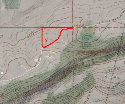
I threw together this hybrid topo/satellite map to show the lay of the land. The odd shaped red box is my 10 acre parcel; the south property line follows the road — hence the odd shape. The X is my homesite. If you know how to read topo maps, you know that closely spaced lines indicate steep hills. In this case, the cliffs behind my home rise in two steep steps about 1,000 feet above me.

Of course, living so far north means that the angle of the sun is low during the winter months. While the whole area has long nights and short days, the folks on my road have another winter issue to contend with: living in the shadows. You see, for a period ranging from weeks (in my case) to months (in some neighbors’ cases) straddling the winter solstice, the sun does not rise high enough above the cliffs to clear them and shine on our homes.

I call this the Shadow Time.

I knew this was going to be an issue when I bought my place. It had me so concerned that in the winter of 2013, when I was still living in Arizona, I took a week-long trip up to Washington state to see for myself. It had been a very long time since I’d lived in a four-season place with a snowy winter. I wanted to experience it firsthand so I knew what I was getting into by buying here. Every day during that week, I drove the rental car — a minivan — up into the hills to look at my place. I wanted to see what the light was like. I wanted to see how much shadow there was.

That was my first exposure to January’s fog, which engulfs the valley 25% to 50% of the time — my place can be above, below, or in it. And the snowy roads. And the shadow.

But I didn’t think it was so bad. Besides, I expected to travel during the winter each year and probably wouldn’t experience it at all. So I went forward with my plans and bought the place in July 2013. I don’t regret it one damn bit.

This is my first full winter living up here. It’s hard to tell with the variable weather we get here in the winter time — it’s mostly sunny most of the year — but it seems to me that the Shadow Time starts in the first week of December and ends in the second week of January. I marked my calendar with January 15 so I could remember to pay close attention.

But as this past week whizzed by, the weather was not cooperative. There’s that January fog to contend with. Even the sunny days had some clouds to the south or southwest. It might be blazing sun down in the valley with brightness up here. Was that the sun trying to get through the clouds? Or was it still back behind the cliffs?

Yesterday dawned bright and clear, with just a few clouds scattered about. It had snowed overnight and I measured 3 inches of fresh snow on my concrete driveway apron. A low fog settled over the river; it would clear once the sun hit it.

Low Fog
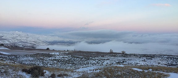
A low fog settled over the river and Wenatchee just as the sun was rising. This was shot from the deck outside my bedroom door; my elevation is about 800 feet above the river. If you look closely, you can see my Lookout Point bench.

I went about my day, watching the shadows get shorter and shorter, seeing how the direct sunlight came closer and closer to my shelf. The insulation guys were hard at work, stuffing the space between studs with brown batting. Downstairs, in one of my garage bays, the framing guy was boxing around my plumbing so the drywall work could meet building codes for fire safety requirements. I had ribs on the Traeger and, at about 2 PM, we all took a break upstairs for lunch.

And that’s when I noticed the sun shining on my Lookout Point bench. As we ate ribs and salad and chatted about the view and construction and other things, I watched the shadow retreat to the south. Then the sun was shining through my high windows and my west side bedroom window. Outside, I could see the shadow of my building and the tall pole with its multicolored wind streamers.

The sun was back. Shadow Time was over.

Bragging
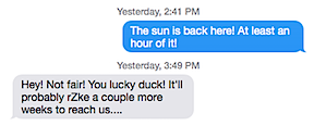
I bragged to my neighbor that the sun was back and I think she was envious.

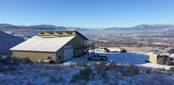
I had at least an hour of direct sun yesterday — possibly more. It didn’t start until about 2 PM and it was still full on my place at about 2:40 PM when I drove away for a doctor’s appointment. I stopped to take a photo and texted my next door neighbor, whose home is higher up but tucked back closer into the hillside. Her response an hour later showed a bit of envy.

The Sun is Back!
I shot this photo from the road behind my home as I drove into town for an appointment. Those high windows really catch the winter sun.

I suspect that the Shadow Time really ended a few days ago but I couldn’t tell because of the cloudy weather. That’s okay. I’ll get more and more sun every day now — probably 15-30 minutes, depending on the sun’s arc in the sky and the shape of the cliffs it has to clear. The cliffs get lower and farther away to the southwest — that’s why I get afternoon sun first.

In about a month — or maybe sooner — I’ll start getting sun on the east side of my building as early as 10 or 11 AM. I’m hoping to have my front deck done by the time the dawn sun hits it so I can drink my coffee out there as each new day is born.

I’ll admit that I’m disappointed that I don’t get full sun all year like the folks farther north of the cliffs. But, at the same time, it was never my intention to live here year-round.

This year I have a job to do: finish my home. Next year I’ll go south, likely before Christmas or perhaps right after my annual Christmas ski trip. I’ll miss the January fog and much of the Shadow Time, returning in late February or early march to fully enjoy the orchard blooms and get my garden started.

For now, I’m just happy Shadow Time is over and look forward to more sunny winter days ahead.

Thanksgiving at Friday Harbor

New friends and great food on a busy weekend.

Since I live so far from family, I’ve gotten into the habit of spending Thanksgiving with friends. Although I got four Thanksgiving invitations this year — thanks, everyone! — I accepted the one I got first, well over a month ago: to accompany my friend Bob to Friday Harbor for Thanksgiving at his friends’ home.

The Trip Out

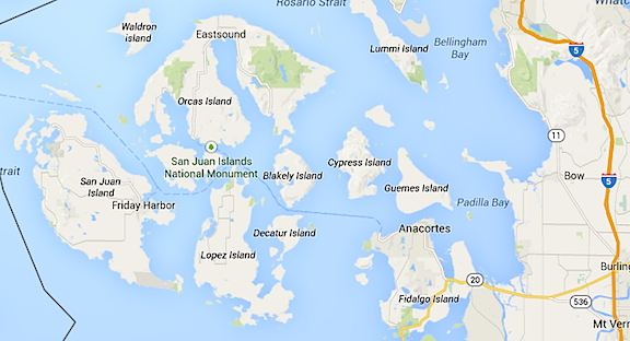
Friday Harbor is on San Juan Island at the very northwest corner of Washington State. It’s so far north, in fact, that it’s north of the lower end of Canada’s Vancouver Island. Getting there requires a 3-hour drive to Anacortes followed by a 1+-hour ferry ride — and that’s if Route 2 through Stevens Pass is clear and open. If Stevens is closed, add another hour to get through Blewett and Snowqualmie passes on Route 97 and I-90. Back in August, when I spent a week with a friend out at Lopez Island, I’d elected to take the helicopter out to avoid the long drive. But in winter, that didn’t seem like a reasonable possibility given the usual low clouds over the Cascades and real possibility of bad weather so I didn’t even suggest it.

San Juan Island on Map
San Juan Island is the farthest west island on this map, which also shows the mainland to the east. The black line you can see in the left top and bottom of this image is the U.S.-Canada Border.

Penny and I packed up on Wednesday and spent the night at Bob’s house. We were making an early start to catch the 8:30 ferry out of Anacortes and Bob wanted to leave at 4 AM. It was my job to keep track of the conditions in the passes so we could pick an appropriate route. WADOT offers a wealth of information about its highways and passes on its Website, including up-to-the-minute pass information and webcams. Fortunately Stevens looked good so we headed out the most direct route in Bob’s pickup. Although I’d offered to take my 4WD pickup on the trip — its tires had less than 5,000 miles on them — Bob had prepped his 2WD pickup with a set up studded snow tires, just in case weather turned bad along the drive.

Penny and Bob’s dog, Skip, settled down in the back seat for the long drive. There was no one on the road. Well, no one going our direction, anyway. We did pass a few cars coming east on Route 2. The road was clear and dry and other than a few foggy areas, easy to drive. Crossing Stevens Pass was a non event and we headed down the west side, still in the dark. The days here are short this time of year and it wasn’t until we got near I-5 that it started getting light.

We stopped for coffee at one of Washington’s ubiquitous drive-up coffee stands — honestly, how do coffee-drinking people live without these? While I chatted with the girl at the window — who was working a 6:10 AM on Thanksgiving Day, mind you — Bob took the dogs for a quick walk. Before leaving, I thanked the girl for being there and gave her a big tip to really show my appreciation. The eggnog latte was good and hot.

We stopped at Safeway in Anacortes before getting on the ferry queue. We’d brought along the fixings for quiche — 15 eggs from my chickens, along with chopped ham and scallions from Bob’s fridge — but needed a pie crust, cheese, and half-and-half. I ran in to get all these things while Bob waited with the dogs. I also bought a small Poinsettia for our hosts. I hate going anywhere empty handed — not that we were going empty-handed. In addition to our quiche ingredients, I’d brought 2 bottles of wine, a bottle of local hard cider, and a jar of honey and Bob had brought 6 bottles of Martinelli’s sparkling cider in two flavors. We had a cooler and a box full of goodies in addition to our luggage.

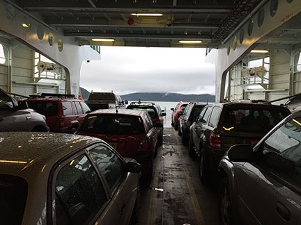
Inside the Ferry
Inside the ferry to Friday Harbor.

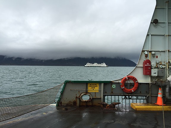
The wait for the ferry wasn’t long, but we did have time to get out and stretch our legs with the dogs one more time. Then we loaded up with the rest of the cars, winding up in the middle of the main deck on the Elwha. We hung around in the truck for a while, then went upstairs to take in the view of the islands as we sailed past. By then, it was fully light out, but overcast. The ferry boat moved along at a good clip and I used Google Maps on my phone to identify the islands as we zipped past them.

Another Ferry
Our ferry boat wasn’t the only one on the water that gray morning.

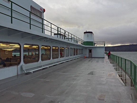
Ferry View
A look back down the deck of the ferry.

Thanksgiving Day with Friends

The ferry was an express that stopped at Friday Harbor and Sidney, B.C. only. We got into Friday Harbor just before 10 AM. From there, it was a short drive to Liz and Brad’s house on 20 acres. I think they were surprised to see us so early. Liz was just putting in the turkey.

The Pond
The pond behind Liz and Brad’s house shortly after Penny chased away all the ducks.

Bob and Skip
Bob and Skip pose for a photo at American Camp. Skip seems more interested in what Penny is doing than the camera.

After quick introductions, we established that Bob was hungry and Liz and Brad had already eaten. So Bob and I headed back out to find some breakfast in town. We wound up at a bustling local market, which was just the kind of upscale small supermarket I love, and ate breakfast sandwiches on the tailgate of Bob’s truck. Then we drove around the island to kill some time. We wound up taking a walk out at a place called American Camp, the site of an almost-war back in the 1800s. It was a good opportunity for the dogs to run around. By that time, the sky had cleared and it was becoming a beautiful day. We got as far south as the lighthouse I’d flown over back in August before heading back to the house.

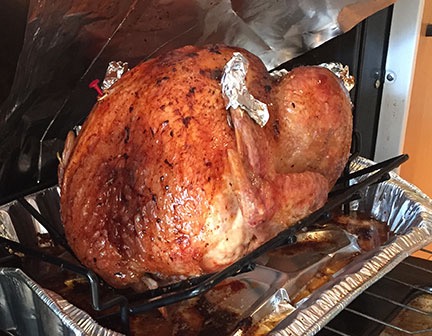
The Turkey
The turkey tasted as yummy as it looked here.

Back at Liz and Brad’s house, we relaxed while the turkey cooked. Liz and I popped open that bottle of hard cider and drank almost all of it before the other guests began arriving. And there were a lot of guests. Soon the house was crowded with adults and young people drinking cider and wine and munching on crab dip, salmon spread, and hummus, chatting and having a good time.

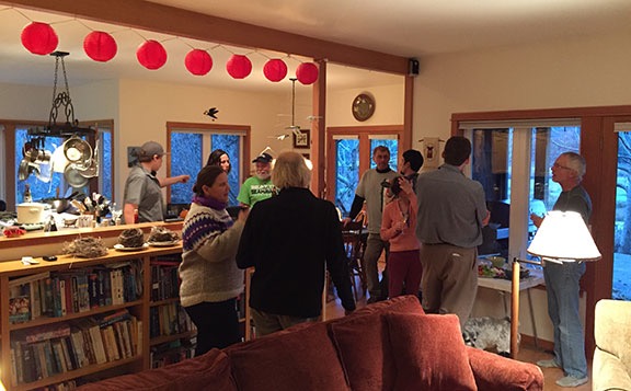
Party Time
I took a break to snap this photo, not realizing that only half the guests had arrived at this point.

Brad carved the turkey and Liz set up a buffet line at her kitchen island. Soon, 15 of us were sitting at a pair of tables put together on an angle to fit in the dining room. The food was great — as you’d expect a Thanksgiving dinner to be — and there was a ton of it. Fortunately, I was boxed into my seat so I couldn’t easily get up for seconds. I made up for that by trying both the homemade cheese cake and apple pie for dessert.

Cleanup went quickly with so many people helping and about half of us went into the living room to watch the football game. The local team, the Seattle Seahawks, were playing the San Francisco 49ers — the perfect game for a Washington crowd. The game had started about a half hour before and Brad had DVRed it so he could fast-forward through all the commercials. I settled down on the floor with Penny on my lap. But since I’d been up since 2:30 AM — thanks to Penny needing to take a pee at Bob’s house — I was exhausted and fell asleep. I missed most of the game but woke up at the end to find the Seahawks victorious again.

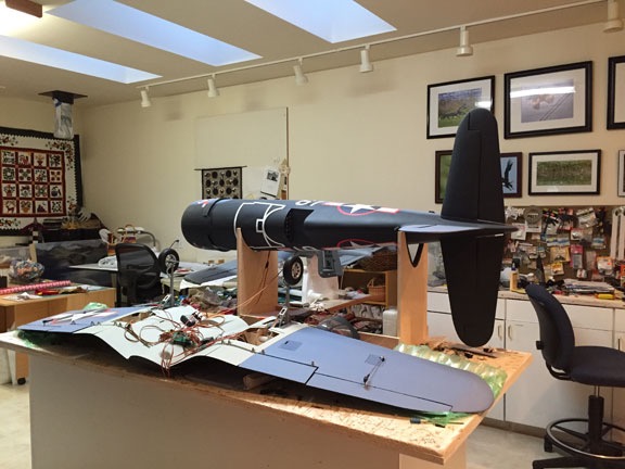
The guests left in small groups after that. Soon it was just Liz, Brad, Bob, and me. We cleaned up a bit more, then retired to sleeping quarters. Penny and I were staying in the “craft room,” which was where Liz does her quilting and Brad builds large scale radio controlled airplanes that he flies on a grass strip in his back yard. The walls of the room were covered with quilts and Brad’s photos of wildlife and airplanes.

Craft Room
One of Brad’s projects in the craft room.

Black Friday — without Shopping

I slept reasonably well, waking up only once to wonder where I was. Hearing noise outside my room, I put on my slippers to join Liz while Penny went looking for and eventually found Skip. Soon Liz and Bob and I were drinking coffee while I was whipping up two quiches — one with cheddar and the other with mozzarella. I was horrified to see that I’d bought fat-free half-and-half — I mean, what’s the point, right? — but that quiche turned out just as good as the one I made with Liz’s regular half-and-half. The three of us polished off a whole quiche. Brad missed out; he had to go to work.

Afterwards, we dressed and went out for a drive in Bob’s car. It was cloudy again and cool. Liz took us to see the lavender farm, which was closed, and a handful of parks. Then we drove up to the top of a ridge where some private developer had tried (and failed) to sell 20-acre parcels that were virtually unbuildable for $210K+ each. The land now belonged to the San Juan County Land Bank, which buys up land in the area to prevent development. In the future, it would be a park with trails. We drove through Roche Harbor, where I’d flown in by helicopter for dinner with my friend Don years ago, and then headed back to Friday Harbor.

Back in town, we met up with Liz’s son Chris, his wife Kelly, and their two kids at a local holiday market. There were about 30 artists and other vendors there, selling their wares. It was refreshing to attend one of these that wasn’t full of the same southwestern stuff I’d seen over and over in Arizona when I lived there. I bought a beeswax lip balm and some locally sun-dried sea salt. I was sorely tempted by some wall sculptures, but held back by my new rule: No buying anything for my home until it’s done.

Afterwards, we went with Chris and Kelly to a house Chris and his partner are refurbishing. (Chris is a carpenter.) Originally built in the 1940s, it’s a small place with a lawn that goes down to the harbor and has the added luxury of its own boat dock. With lots of trees on its end-of-road lot, it was a pleasant location. They’d gutted the house and rebuilt it from the inside out. Although they’d been working on it for about 16 months, they were still at least a few months from completion. I looked around and got some ideas for wood trim around my windows and flooring. The countertop material, PaperStone, was amazing and I will definitely check it out for my own kitchen countertops.

From there we went back to Roche Harbor to look at another house that Brad is overseeing the construction of. This was an upscale home, 3800 square feet, with vaulted ceilings, sweeping staircases, and lots of extras. Pretty amazing for a 2-bedroom home. The two projects — Chris’s and Brad’s — couldn’t be any more different. Here, I took mental notes on the great room’s ceiling, which was tongue-and-groove cedar planks, and bathroom tile work. I also liked the track lighting, which I’d already decided to use in my hallway, which would double as a photo gallery. The home’s owner was there, fiddling around with his computer and the various light switches that made up his smart home system. Although I plan to include some smart home accessories in my place, I don’t expect to do it to the extent that he did.

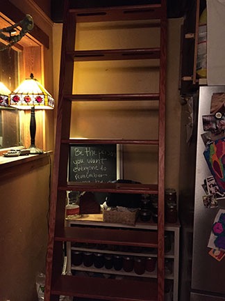
Loft Ladder
I shot this photo of the ladder to the loft in Chris’s house so I could remember some of its details. My home also has a loft — mostly for storage — and I’ve been thinking of how it could be easily reached from below.

We headed back to Liz’s house and took it easy for a while, just chatting in the kitchen over tea. Later, when Brad got home from work, we headed out to Chris’s house for a taco dinner. His family lives in an expanded cabin at the end of a long, steep dirt road. We arrived and departed after nightfall, so I didn’t get a chance to really see it. But it was cosy inside, with an eat-in kitchen, sunken living room, and wood-burning fireplace. After dinner, I got so comfortable on the sofa that I almost fell asleep again.

The Trip Home

We were up at 5 on Saturday, packing up for the trip home. Bob wanted to get on the 8 AM ferry and we’d been advised to get the car on line by 6:45 at the latest. We headed out there and got the first spot in lane 3, then walked up to The Hungry Clam, which was already almost full by then. Apparently, the place exists for ferry traffic meals. Liz and Brad joined us for a big farewell breakfast.

Outside, it was very cold and very windy. There were whitecaps on the harbor. We paid the bill just as the ferry rounded the corner and headed into the dock. We said our goodbyes with a lot of hugs and promises by Liz and Brad to come see us on “the dry side,” then hurried down to the truck. Poor Penny and Skip needed a lot of hugging and rubbing to warm up!

Because the second car in line 1 was empty and there was a truck in line 2, the ferry loaders waved us aboard as the second car on the boat. This positioned us right at the front — although they didn’t load us all the way to the line. (It later became apparent why they didn’t have us drive up closer to the edge.) Ahead of us, the water was more than a little choppy and the wind was mostly blowing right in. I got out to take a photo closer to the edge and thought I was going to get blown away.

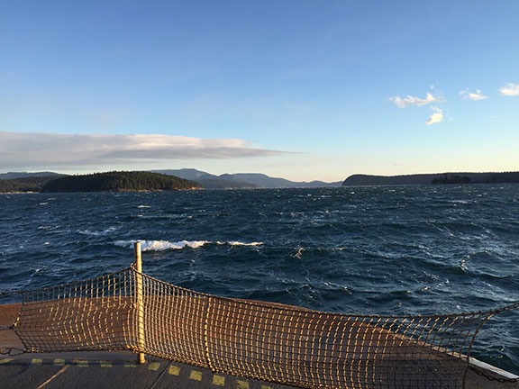
Choppy Water
I got got right up to the pedestrian rope to take this shot. It was wicked windy and cold!

We stayed in the car for the whole trip, mostly so we could periodically start it and warm it back up for the dogs. I was glad we did. The water got progressively rougher as we got closer to Anacortes. About 30 minutes out, a loudspeaker warned of the rough ride ahead. The boat rolled in the waves and we could clearly hear waves breaking across its side. Occasionally, the front end would dip down just enough to send a wave of water onto the deck. One wave came so far into the boat that it splashed the hood of the truck. There was water sloshing around all over the deck. Several of the chocks the loaders had placed around the front tires of the cars at the head of the lines got loose and washed back and forth. I think a few might have gone overboard.


This minute-long video gives you an idea of what we experienced. A larger wave than these washed over the hood of our truck, which was at least 50 feet back from the bow. You can see Mount Baker in the distance throughout much of this video.

After hearing about so many ferry accidents overseas, I admit that I was more than a little nervous — especially when the captain kept cutting power to slow us down more and more. But then we got closer to Anacortes and the water calmed a bit. Soon we were pulling into the dock and the crew was moving the ramp into position. I was very glad when Bob steered us off the boat and onto dry land.

Of course, that wasn’t the end of our homeward bound adventure. All morning long, I’d been checking conditions in the passes. Stevens Pass, our preferred route, was reporting 24° with compact snow on the roadway and snow falling. Restrictions were “traction tires advised, oversized vehicles prohibited.” But things were worse at Snowqualmie: falling snow, areas of low visibility, and chains required. It looked as if Stevens would be our route.

All around us was fresh snow that had likely fallen overnight. It was beautiful to see — I don’t think they usually get much snow on the Seattle side of the mountains. There were a lot of cars on the road, too, but not enough to make what I’d consider “traffic.” We got on Route 2 eastbound and stopped at the Sultan Bakery for some baked goods to snack on along the way. One more stop at a park-and-ride nearby for the dogs to take a break. Then back on the road for our climb up into the mountains.

Soon it was snowing on us. The road looked remarkably as it had in the webcam photos I’d studied all morning on my phone: covered with snow with just patches of pavement showing through. Bob’s studded snow tires came in handy as we followed the other cars up the mountain. Snow fell all around us. I was glad Bob was driving. I absolutely detest highway driving in the snow.

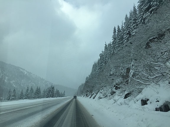
Snow on Highway 2
Snow on Highway 2 on our way to Stevens pass and beyond.

We were both very surprised to see most of the cars turn into Stevens Pass ski resort, which I didn’t realize was open. The road was worse on the west side of the pass, but soon cleared up, although snow continued to fall past Coles Corner. By the time we got to Leavenworth, it was mostly sunny — a beautiful day with fresh snow on the ground and in trees. There was less snow in Wenatchee and, when Bob dropped me off at home, I estimated only about an inch of fresh stuff at my place.

I’d had a wonderful weekend away with Bob and his friends. Not only had I met some great new people, but I’d come away with a lot of new ideas for finishing my home. It was well worth the drive — and the adventure that had gone with it.

A Snowy Weekend

First snow of the season is just right.

It started snowing Friday afternoon.

It had been forecasted, so I was expecting it and got all my errands done early in the day. There was a sleety mix coming down in town as I headed home. By the time I pulled into my driveway, the sleet was more snow-like. It could have been our elevation — my home’s elevation is about 800 feet higher than town at the river’s edge. I put my Jeep away in the garage, let Penny out, and settled down to an afternoon catching up on paperwork.

First Snow Reading
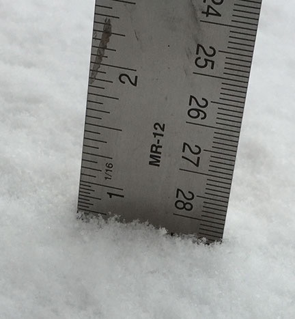
By mid-afternoon, there was just three quarters of an inch of accumulated snow.

By 2:47 PM, there was 3/4 inch on the ground. Not very impressive.

But it kept snowing. I chatted with a few different friends on the phone, watching the white stuff come down in big flakes outside. Inside was toasty warm and smelled of the ham and cheese quiche I had in the oven. I was sipping a hot coffee with eggnog and milk — a do-it-yourself eggnog latte.

Later, after dark, I let Penny out to do her business. She stood at the doorway just looking at the snow, completely uninterested in stepping out. Later, before bed, when the snow was deeper but still coming down, I had pretty much the same luck with her. I suspected I might have a problem.

Of course, a tiny dog can only hold it for so long. She woke me at 3 AM, needing to go out. I obliged, standing at the doorway while she managed to find a satisfactory spot under the front deck to take care of business. It had stopped snowing and the sky was full of stars with just a few low clouds floating around. The cliffs behind my home were illuminated by the starlight and reflected light from town miles away. It was a beautiful night — perfect for some photography.

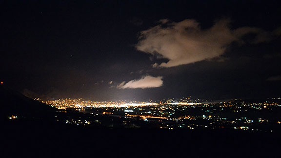
Now wide wake, I went back inside and set up my camera and tripod. I experimented with some shots from the deck outside my bedroom door and then the front deck. Although I couldn’t get a satisfactory shot of the cliffs, I did get an acceptable one looking down toward town. (I need to get my camera checked; there’s something screwy going on with exposures.)

Wenatchee at Night
I made this photo of the lights of Wenatchee from the deck outside my bedroom door.

Total Snowfall
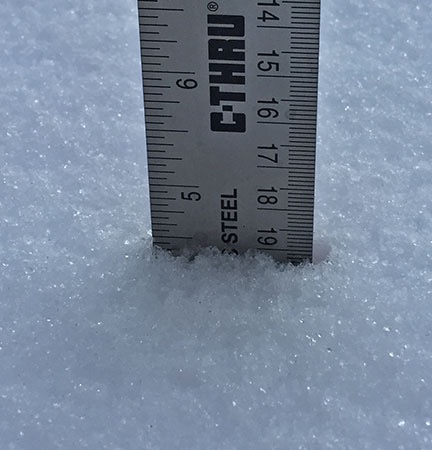
Total snowfall was about 4-1/2 inches at my place.

I went in to have coffee, write in my journal, and do some blogging. I had some quiche for breakfast. Somewhere along the way, it got light out. I went back out with my ruler and stuck it in the virgin snow on my driveway apron. Four and a half inches.

The stuff was not wet but not quite powdery. The temperature was right around 32°F and didn’t feel cold at all. There was no wind. And it was amazingly beautiful with all that untouched snow on the ground.

I put on my Sorrels and walked back out to check on the chickens. They were out and about in their yard and looked up at me, as they usually do, expecting food. Their water was free of ice — I’d bought them a heated waterer — and although there was snow in their food dispenser, it didn’t look wet. I threw them a scoop of scratch and checked for eggs. There were three of them, one of which was still warm. Apparently, my chickens hadn’t gotten the memo about cutting back on egg production when the days got short.

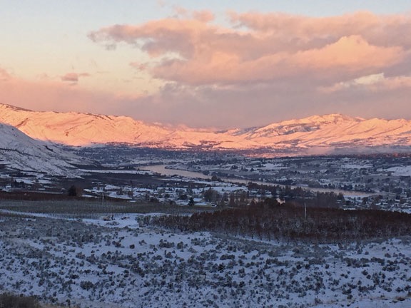
First light was just hitting downtown Wenatchee. I went back upstairs and took in the view from the deck outside my bedroom. The light was pink as it touched the mountains and valley to the northwest. I felt as if I could have watched the view change all day, but it was time to get some work done outside.

First Light on a Snowy Morning
First light hits the Wenatchee Valley on a snowy morning.

Although my driveway is quite long, I don’t plan on ever shoveling or plowing it. I have a Jeep and its tires are still good. The driveway doesn’t have much of a slope to it. I don’t expect getting in or out with the Jeep to ever be much of a problem, especially since snow doesn’t usually stick around long here. Even my truck has 4WD, so if I need to get out with that, I know I can. How do I know? I used it to pull my RV out last February after a heavy snowstorm for a two-month trip to California. The Honda? Well, the Honda is in for the winter at this point.

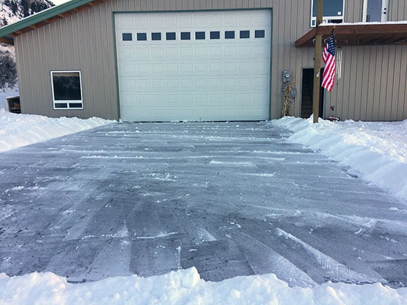
But I also have a concrete driveway apron, which I need clear if I want to get my helicopter out for a flight. I didn’t have any flights scheduled until after Thanksgiving, but who knows what might come up? I had already decided to keep it clear of snow and ice. I had a good shovel and a bag of ice melt. With temperatures expected to rise during the day, I wanted to shovel now, before the snow got soft and heavy.

It didn’t take long and I have to admit that it felt good. That might sound weird to the people who consider snow-shoveling a chore, but I do it so infrequently (so far) that it’s more of an excuse to move around outdoors than any kind of real work — especially when the snow is still light and there’s no ice to contend with. I felt the same way last year when I shoveled the walk at the home I was housesitting at after a snowfall. The whole job took about 20 minutes — the driveway apron is only 22 x 30 feet — and I barely broke a sweat in my fleece sweatshirt.

Shoveled Driveway
My shoveled driveway apron, just in case I need to pull the helicopter out for a flight.

I didn’t spread any ice melt on it. The way I see it, there’s no reason to spread that crap around unless there’s ice to melt. I figured I’d monitor the condition of the driveway apron and, if the little snow left did turn to ice, I’d spread some ice melt to get rid of it. But as the day wore on, the snow melted and the resulting water dried. No ice.

While I was out with the shovel and still energized, I shoveled a path from my front door to the chicken yard. This would give Penny a better place to run and do her business. But she had already figured out that she could stay under the front and side decks to get around the building without having to walk through much snow. In fact, while I was shoveling she disappeared around the back of the building, possibly tracking the scent of a rabbit that had left tracks in the snow back there.

Snowy Home
A look back at my home from Lookout Point on a snowy morning.

Before going back inside, I walked down to Lookout Point, my little bench overlooking the valley. I’d brought the bench cushions in when the weather began changing two weeks ago and the bench looked abandoned and kind of forlorn with its covering of snow. I looked back at my home and liked what I saw: the neat symmetry of the building, the smooth blanket of snow on its big roof, the pine trees on the cliffs behind my home, accented with white. The path back to my home from the bench looked inviting. I looked forward to mornings like this when I could stoke up a fire in the fireplace and sip hot cocoa while looking out over the valley.

And that’s when I realized that I liked winter.

It’s odd because I left New Jersey to escape the cold. That put me in Arizona, which I soon grew to dislike for many reasons, not the least of which was the brutally hot summers. But my home in Arizona also lacked seasons — the only thing that changed was the average daytime high and nighttime low. There were no fall colors, there was no snow, there was no springtime leafing out. The seasons were more subtle, marked by temperature changes, wildflower and cactus blooms, and thunderstorms.

We bought some vacation property in northern Arizona, mostly to escape the hot Phoenix area summers. We went up there pretty regularly in the summer early on, and I spent much of the summers of 2004 and 2005 in my old RV up there. But we also enjoyed going up there in the winter time. How many Thanksgivings and Christmases did we spend in the cabin we built together? I remember waking once to a hushed, snow-covered landscape, cosy and warm under a thick comforter up on the loft, going downstairs to make a hot breakfast of Pillsbury orange danish. We spent part of that day at the Grand Canyon, walking the shoveled rim trails, before dinner with friends at El Tovar. That property, bought for summer use, became my winter treat. The chain of Christmasy red and white stars I’d bought still hung from the loft the last time I was there.

Now I’m back in a four-season place. Indeed, the winter here is remarkably like the winters in northern New Jersey, where I spent more than half of my life. But there’s the added benefit of a wide variety of winter sports nearby: downhill skiing, cross-country skiing, snowshoeing, and skating. There’s life here — that’s another thing I’ve been missing for too long.

I didn’t spend much time outside that morning. I had things to do inside before heading out to visit a friend and then participating in a cider tasting outing with other friends. Dinner out came afterward. The temperature rose throughout the day but it got cloudy. The roads were icy on the way home, but I threw the Jeep into 4WD and had plenty of traction.

The next day, Sunday, was even warmer. My garage got up to 50°F before I realized I didn’t need the space heater on while I did my warm glass work. Snow was melting everywhere and my driveway apron was dry. The chicken yard was snow-free — they’d trampled it all down into wet dirt and they were still making plenty of eggs. It was 46°F outside when I left at 1 PM for a football party at a friend’s house. I took my truck because I needed to run my trash cans out to the main road. It had no trouble on the unplowed driveway.

Temperatures this week will continue to rise, with a daytime high on Wednesday expected to be 50°F. The National Weather Service is predicting a warmer than normal winter here and if the cold snap we had earlier this month is an anomaly — which I believe it is — we might not get much more snow at all. Although I hope to get some cross-country skiing in before I head south for a month or two, I don’t really care one way or another. This snowfall was a treat and I’m sure there will be many snowy weekends in my future.

A Jeep Trip to Mission Ridge

A surprisingly wonderful midday out.

I’ve been debating what to do this winter. I don’t have much work here in the Wenatchee area other than writing, which I can do anywhere. I will likely be heading down to California in January anyway to record a new course for Lynda.com. I’ve been thinking about spending a month or two in Arizona — after all, I do still own a home there — and I have friends to visit and hike with. But local friends are encouraging me to stick around and even do something crazy (for me): take up downhill skiing.

So I have options.

Heli Skiing

A chat with a pilot friend yesterday morning got me thinking about heli skiing — where you use a helicopter as a ski lift to take you (very) quickly to the top of the slopes. And that got me thinking of my friend Don and Mission Ridge.

Don is an avid skier. He’s rejoicing over the early opening of the local ski resort, Mission Ridge, and is determined to be one of the first on line for the lift on Saturday.

Don’s been talking to me on and off about offering heli skiing at Mission Ridge. He says I can drop off skiers at the microwave towers at the top of the ridge. And then he offered to drive up there with me.

I didn’t realize we could drive up. But since there are towers up there, of course you can drive up. I didn’t know how to get there but offered to drive. I met him with my Jeep at his house at about 10:30 AM. The plan was to scout for a landing zone so I could propose a heli-skiing service to the folks at Mission Ridge.

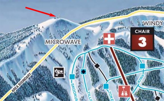
Top of Mission Ridge
This ski trail map by the folks at Mission Ridge really exaggerates the mountains and distances. The arrow points to my proposed landing zone.

The Drive Up

We took two cars — my Jeep and Don’s truck — to the turnoff for Jumpoff Road off of Stemilt Loop Road. No sense in me driving all the way back to Don’s house when we were done, especially since the Jumpoff turn was closer to my place than his.

Jumpoff, by the way, is the name of the ridge behind my home. There’s a basalt cliff face to the south of me that soars at least 500 feet straight up. The top of that is called Jumpoff Ridge. There’s a road that winds up the side of the mountain near Stemilt Hill to the west of me. From there, another road turns off to follow power lines up the mountain. And then another road breaks off to the microwave towers overlooking the resort on Wenatchee Mountain, elevation 6742 feet.

It was not a short drive. It wasn’t smooth, either. Although the first road, Jumpoff Ridge Road, was relatively smooth and well-maintained, the next two roads weren’t maintained at all. The power line road was pretty straight in most places, but was filled with large rocks that forced me to drive slowly. Most of it was in clearings filled with bunch grass and sagebrush much like I have at my home. Whenever we left the power line, the road got windy and sometimes steep. That’s where it made its way through forests of tall pine trees.

Snow appeared on the road after the first seven or eight miles and was a few inches thick a bit farther up. I had to switch into four wheel drive at a particularly steep spot. My tire tracks were the first ones in the snow, which may have fallen overnight. Although we were on a ridge for much of the time, low clouds made it impossible to see very far in any direction. Indeed, by the time we reached the first antenna installation, a light freezing fog was blowing past. Beneath it, out to the south, we could see glimpses of where the valley dropped down toward Ellensburg.

If you’re curious about our exact route, you can find it here on Gaia GPS. I tracked it with their app on my phone.

After about an hour of driving, Don opened his backpack and pulled out a snack. He fed me cheese, crackers, and smoked turkey as I drove. That was a good thing since I’d forgotten to eat breakfast.

We made one stop along the way. There was a weird trail across the road and Don wanted to check it out. While he did that, I made a pit stop behind a tree. Then we were on our way again.

The drive to the end of the road took about 1-1/2 hours. We’d driven 15.7 miles and climbed more than 3000 feet in elevation.

At Wenatchee Mountain

At the end of the road was the Communication Facility at Wenatchee Mountain. It consists of two small buildings — both locked up tight — and a bunch of antennas. I shut off the Jeep and we all got out — Penny, too — to take a look. It was surprisingly windy up there — it wasn’t windy down below — and the wind chill must have brought it down to the teens. Exposed skin froze quickly, but the rest of me was pretty warm in heavy jeans and three layers (cotton shirt, fleece sweatshirt, and the junky polyester winter shell I’d bought at Costco for just $20). I was wearing a scarf (of course) which I soon used to cover my head and ears. (My hair, which is longer now than it’s been in about 30 years, does a good job keeping my ears warm, but not when it’s windy.)

I was thrilled to see a large, level spot that would be perfect for landing the helicopter — provided the snow wasn’t too deep there. There wasn’t much snow on the ground that day — the wind had blown the powder mostly away. I assumed the wind would almost always be coming from the south so I’d have to land into that direction. There was a clearing between trees to the north that would make that easy. And the departure off the top of the ridge to the south would be a piece of cake. A quick turn back to the north and then an autorotative descent to the starting point. I suspected I’d be able to turn a ride with two passengers on board in less than 10 minutes. With at least $50/person, I few hours each weekend morning could be lucrative enough to make me stay in Wenatchee all winter.

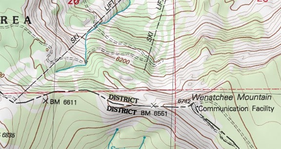
Wenatchee Mountain
Here’s a topo map of the top of the mountain. The terrain drops off sharply to the north, south, and west.

We turned to the larger of the two buildings and the lookout point to its south. The view from Wenatchee Mountain was breathtaking in almost every direction. There were still clouds off to the southwest, trying to drift over the ridge but not quite making it. The entire ski resort lay spread out before us — we could see trails, lifts, and buildings along the way.

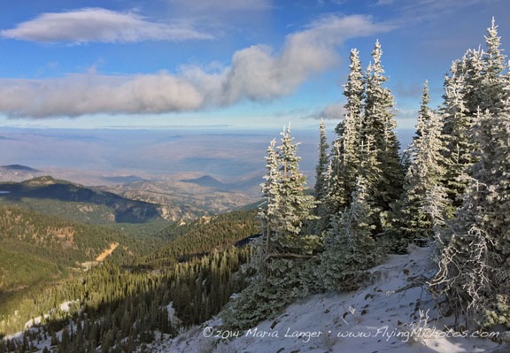
Christmas Card Image
The small pine trees at the northwest edge of the mountaintop were still wearing the snow coats they’d acquired the night before. Wenatchee sits in the valley in the center left of this shot. I think this is a perfect Christmas Card photo, don’t you?

Panorama
Did you say you wanted a panorama? Here you go. You should see it in full size. I think this will look great enlarged and hung over my stairs — I really didn’t want that Monument Valley canvas triptich anyway.

Don explained how skiers would get up to the spot where we stood: a ride up on Lift 2 followed by a trip along the boundary and a climb on foot to where we stood. He said the area where the Jeep was parked was a natural snow bowl surrounded by a windbreak. He was clearly excited about the prospect of getting up there by helicopter. Despite the wind, I was getting excited about the possibility of bringing him and others.

Dognaldo in the Jeep
Don in the Jeep at the top of Wenatchee Mountain.

We hung out for a while and I took a bunch of photos while he shot off some bottle rockets to encourage snowfall. Before we started the drive back, I took a picture of Don in the Jeep, making a face at me.

Clear Lake

We took a slightly different route back that avoided much of the power line and wound down the side of the mountain toward Stemilt Hill, completely avoiding Jumpoff Ridge Road. Our path took us past an area where the mostly eaten carcass of an elk lay and an eagle sat stood up in a tree. I suspected that we’d interrupted his meal.

I stopped the Jeep but left it running and left Penny inside. Don and I each tried to approach the eagle to get a better photo. We spooked him, of course, and I got a decent shot of it taking off.

Eagle in a Tree Eagle Taking Off
An eagle watched us from a perch in a tree, then took off when we got too close.

We continued down the mountain, snacking on chocolate chips and honey roasted nuts. The road wound into the forest and took us close to Clear Lake, where Don suggested we stop for a look.

On the Shore of Clear Lake
On the shore of Clear Lake.

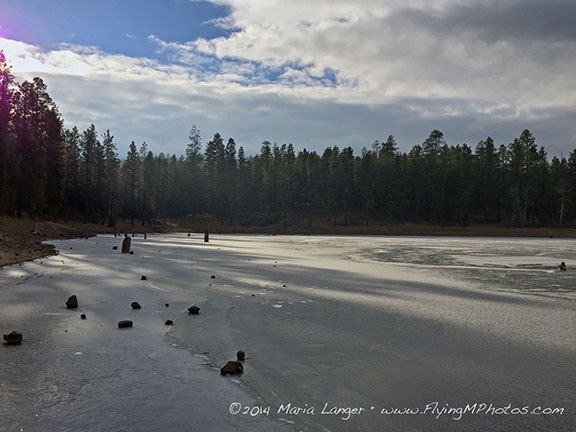
The lake is really just a small reservoir used to irrigate orchards on Stemilt Hill. Irrigation was turned off that time of year and the lake looked about half full. It was also frozen. Frozen enough to walk on. We figure the ice was anywhere from 3 to 6 inches thick.

Understand that our area of Washington was hit with a cold snap about a week ago that lasted a full week. We’re just coming out of it now. Low temperatures at my place have been in the teens for most of that time with highs below freezing. Today was the warmest day in a while, reaching about 35°F. I’m talking cold.

So it was no surprise to me that a lake at least 2,000 feet higher in elevation than where I live should be frozen. What was a surprise was (1) how thick that ice was and (2) how many rocks were sitting on the ice.


I shot this video of Don with my iPhone. Look at it in full screen with sound full up.

We walked around on the ice. Don slid around. We both agreed that if we had ice skates, we could be skating. He tossed large rocks across the ice so we could listen to the weird sounds they made. He fired a shot from his 22 pistol into the ice away from us. Later, we went to find the spot the bullet hit. A scratch was dug about an inch and a half into the ice and the bullet was nowhere to be seen.

I took a lot of artsy photos. At least I tried to. Later, I stuffed Penny into my jacket to keep her warm while we walked along the edge of the lake.

Clear Lake, Frozen
Clear Lake was frozen. Suitable for skating frozen.

Parting Company

We climbed back in the Jeep and followed the road the rest of the way down the mountain. It intersected with Stemilt Loop Road less than a half mile from where we’d left Don’s truck.

We talked briefly about trying to set up a meeting with the folks at Mission Ridge. I’m not sure if they’ll go for the heli-skiing idea, but it doesn’t really matter. I’d enjoyed our day out no matter what came of our “research.”

We said our goodbyes and went our separate ways. Fifteen minutes later, I was home. Not only did the four hour midday break leave me with a head full of good memories from an outing with a friend, but I had lots of ideas for places to camp and take my ATV and Jeep when spring and summer return. It never ceases to amaze me how many truly incredible spots are so close to where I live.