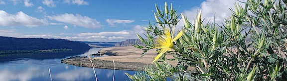
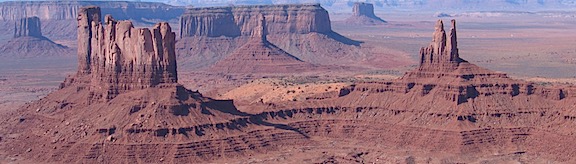
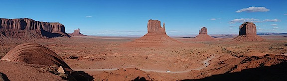
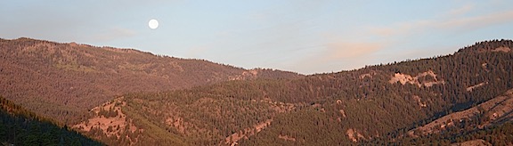
A tale of two parks.
– Day 1: The Road to Mazama
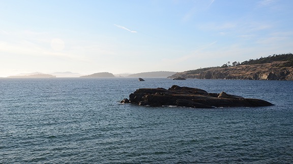
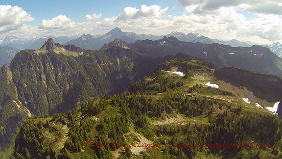
– Day 2: Mazama to Colonial Creek
– Day 3: Colonial Creek to Baker Lake
– Day 4: Baker Lake to Mount Baker
– Day 5: Mount Baker to Chilliwack Lake
– Day 6: Chilliwack Lake to Hozomeen
– Day 7: Hozomeen to Copper Creek
– Day 8: Winetasting My Way Home
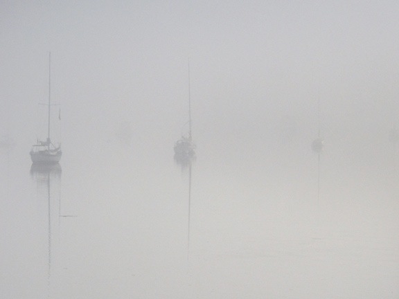
It began raining very early in the morning, maybe around 3:30. I was wakened by the first drops — my years as a cherry drying pilot have fine-tuned my senses to react to the sound of rain overnight. At first, I thought the sound was caused by tiny pine cones hitting the top of the Turtleback. Click, click, click. I could count the impacts if I wanted to. It was only when they were falling too frequently to count that I realized it might be rain. At first, I couldn’t believe it — after all, the day before had been perfectly cloudless day nearly all day. I looked up through the clear plastic sunroof over the bed, trying to see stars. When I couldn’t, I knew it was rain.
It might be my years of living in Arizona followed immediately by years of living on the desert side of the Cascade Mountains in Washington that make me forget that it sometimes rains when you don’t want it to. Yes, we had a rainy cherry season at home this summer: more than a dozen days with rain in the 10 weeks I was on call. But the weather for the week before my departure had been drier than dry — normal, in fact. The grass that had managed to stay green since spring was finally turning to gold, the wildflowers were withering, the blackcap raspberries I’d planted in the spring needed watering almost every day. Surely it wouldn’t be raining anytime soon. Especially not on my vacation.
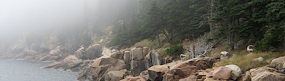
But there it was: a heavy shower in the campground. The sound of the rain on my roof and in the trees almost drowned out the sound of the rushing water in nearby Colonial Creek. Almost.
Even after the rain stopped about fifteen minutes later, I couldn’t get back to sleep. I read for a while and did a crossword puzzle. Then I slipped out of bed, made a cup of coffee, and finished up the blog post I’d started the afternoon before. When it got light, I made myself a bowl of cereal with some of the blueberries I’d picked on Saturday morning and kept working. I pulled photos off my phone with a USB cable, not realizing that the cable was keeping the phone charged at the expense of my laptop’s battery. When I was done, my laptop’s battery was down to 24% power. That meant using the inverter to charge it so I could publish the post later when I was back in cell phone coverage later. The inverter has a noisy built-in fan and I only use it when I’m not around to listen to it.
Back on the bed, Penny got up out of her bed and stretched. I lifted her off the bed — it’s too high for her to jump down safely — and put her on the floor. It had drizzled a few times since I got up and it was raining then. She didn’t seem to mind too much when I let her out. She did her business under the truck — one of the benefits of being a tiny dog is that she can just walk under it. She came in when she was done and I gave her some breakfast while I got dressed.
It was a lazy morning, to be sure. None of my neighbors seemed to be awake. No noise from the RVers on either side of me. I could imagine the tent campers snug inside their nylon shelters, dreading breakfast on a wet picnic table. We’d had heavy rain one day on my last tent camping trip which, coincidentally, had been at the same campground the previous year. I’d been prepared with a tarp and ropes and we’d rigged up a good shelter over our table. So good, in fact, that we invited a family of four tent campers to join us under our shelter for dinner since they didn’t have a similar shelter at their site. But RV camping makes tarps and temporary shelters from the rain unnecessary. It makes the whole camping experience easier. Is it still camping, though? I guess that depends on how much of a purist you are.
I grabbed a nylon rain jacket and put it on over my long-sleeved shirt, just in case it started raining again. Then Penny and I took a walk to the garbage dumpster. I visited the very clean restroom I hadn’t noticed the day before and enjoyed the luxury of a real flush toilet. On the way back to our site, I noticed the family of tent campers at the creekside spot two spots down from us sitting dejectedly in folding chairs around a cold, wet fire pit. I hoped their day would get better.
After washing the dishes and stowing my loose belongings, I closed up the Turtleback and got into the truck with Penny. It was about 9 AM when we rolled out of the campground. We hadn’t used the picnic table or fire pit once.
On the Road Again
My plan had been to explore the area on the west side of Baker Lake, which was in the Baker-Snoqualmie National Forest. I was hoping for a lakeside campsite, possibly in one of the campgrounds I saw on my North Cascades area map. I wanted to get in a hike before the end of the day and thought I might find a good one along the way. Or possibly a good walk from my campsite once we’d parked. In any case, I was in no hurry to get there.
I did want to make at least one stop: the park Visitor Center in Newhalem, which was along the way. I knew from experience that my cell phone would work there. I wanted to check messages and texts, update my house-sitter and a friend with my current location, publish my blog post, and post my two hiking track logs with photos. And maybe check in on Facebook and Twitter. In other words, check in with the rest of the world.
I have to say this about being off the grid: On one hand, it’s wonderful to not have communication and social media distracting me and taking up so much of my time. But on the other hand, it sucks to not have access to basic information such as weather forecasts and maps. The weather had completely taken me by surprise, which would not have been the case if I’d had access to the Internet.
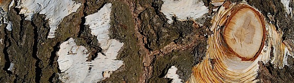
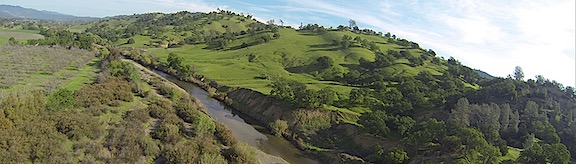
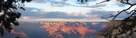
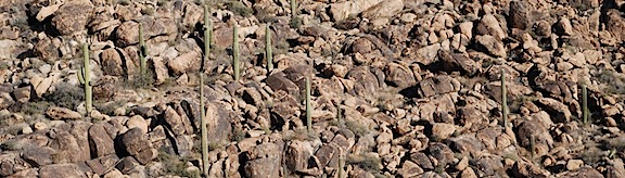
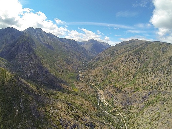
Along the way to Newhalem, I saw some of the damage wrought by the fires that had swept through the area after my camping trip last year. Thousands of tall fir trees standing dead, their needles burned off, skeletons of what they once were. There were dozens of patches like this along the mountainsides, climbing high into the low-hanging clouds. I wondered why I hadn’t noticed the extent of the damage the previous autumn when I was in the area for a mushroom course at the North Cascades Environmental Learning Center. Had I been too distracted by the autumn colors? Or had the weather that weekend been so much worse that I just couldn’t see the burned up trees? It had certainly rained very hard on our mushroom hunting day.
My phone pinged to life about a mile short of Newhalem. Text messages, social media notifications, missed call notifications. The usual. (My house-sitter texted to say that she couldn’t believe how many tomatoes and eggplants were in my garden.) Nothing pressing. But it did mean that I was back on the grid.
I parked in a regular spot near the Visitor’s Center in Newhalem. It was pretty much deserted at about 9:30 AM. I fiddled around with my devices, posting my track logs with photos from my phone first and then using my iPad as a hotspot for my laptop to publish my blog post. It sounds a lot more complex than it is. While the blog post and its photos were being uploaded, I used my phone to check Twitter and Facebook and reply to some comments there. Then I posted links to my track logs and new blog post. The whole chore took less than 15 minutes. When I was done, I closed up all my devices, put away my laptop and iPad, put my phone in my pocket, and went to see if I could find a decent map of British Columbia at the Visitor Center.
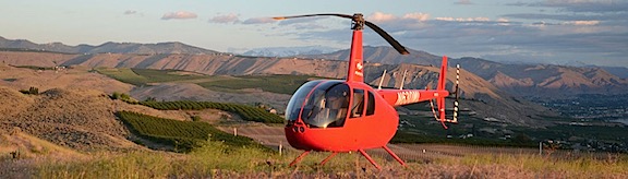
I was chatting with the ranger when my phone rang. Seriously: I would only be on the grid for about an hour but someone managed to catch me. It was a woman who wanted me to do helicopter rides at Quincy’s Farmer Appreciation Day in September. She needed details for an article in the newspaper. I answered her questions while I looked at the books offered for sale. When I hung up, I chose a small book about easy hikes in the North Cascades. (I later discovered that I had already done all or part of six of those hikes, including the two hikes I’d done the previous day.) I also bought a “2016 National Park Service Centennial” refrigerator magnet. And I got a free map of Washington State’s Scenic Byways. The ranger and I chatted briefly about the road to Baker Lake before I left.
I made a quick stop in the store across the street, looking for velcro, which they didn’t have. Then I was back in the truck with Penny, heading out of town.
Although Newhalem is still inside the park, it feels as if it’s outside. The road winds mostly down to the west from there, out of the mountains. I stopped briefly at the convenience store in Marblemount, still looking for velcro, and emerged with a small tube of Gorilla Glue, a pint of milk, and some Hostess Cupcakes. Then more winding, descending road. I was now farther west than I’d ever been on Route 20. But I hadn’t really missed much. Once I’d left the park, it was typical foothills driving on the west side of the Cascades: cloudy with rain showers through rural land with the occasional town. Seriously: does it ever not rain on that side of the mountains?
I took a detour off route 20 through the historic area of Concrete. This is a cute little town that might be (but probably isn’t) popular with tourists on weekends. I did find what I was looking for, though: a True Value hardware store. These small town hardware stores are really gems. They’re loaded to the gills with everything you might need to build, repair, or decorate your home. This one occupied two storefronts with an open area between them. Because my truck was protruding into the main road, I wasted no time getting someone to help me find what I needed: adhesive velcro and a outdoor folding chair. If I’d had more time, I would have wasted an hour in there and probably bought a lot more than I needed. There’s something about a good hardware store that I really like.
Back on the road, I almost missed the turn for Baker Lake. The narrow, winding road climbed up a steep hill with lots of 10 mph switchbacks. I had to take it slow and started wondering how long it would take to get to the lake. I hadn’t expected the road to be quite like that. But then it ended abruptly at the road I should have turned on: Baker Lake Road (Route 11). I’d unwittingly taken a “shortcut” that wasn’t very short.
On Baker Lake Road
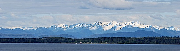
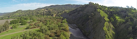
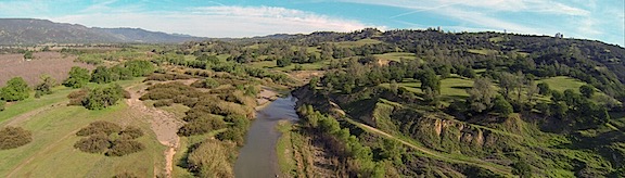
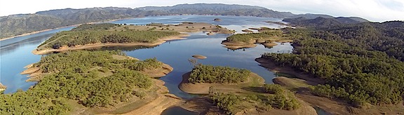
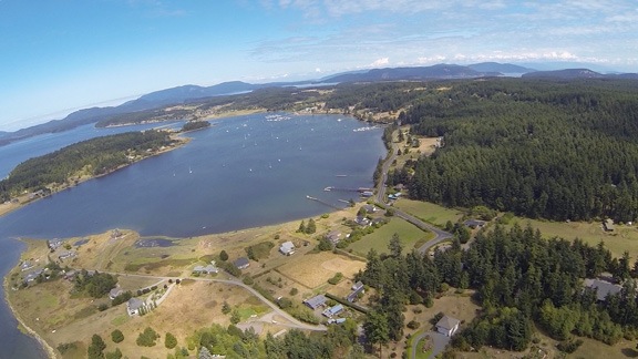
Baker Lake Road was wider, better maintained, and straighter than the one I’d been on. It headed north, paralleling Lake Shannon and then Baker Lake. I passed the turnoff for Route 12, which led westward to the Mount Baker Recreation Area. Soon — very soon, it seemed to me — I was at the turnoff for the Upper Baker Dam, which created Baker Lake. I turned in to check it out.
About two miles down the road was a mostly vacant campground with parking lot like sites. Beyond that, a fork in the road with the right leading to the road over the dam and the left leading to the boat ramps. For reasons I still can’t determine, I went left. I wound up in a parking area full of boat trailers and fishermen taking their boats out of the water. It was busy; I guess Baker Lake is a real hit with fishermen. I noticed I had a cell signal there and consulted the map on my phone. I was exactly where thought I was. And I didn’t need to be there. So I turned around and retraced my route back to the main road.
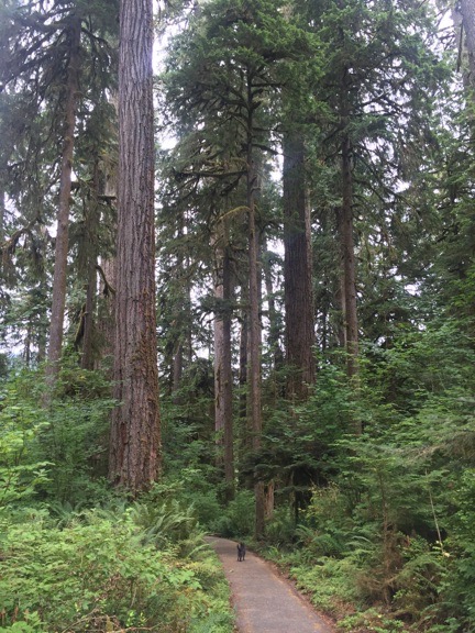
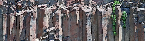
The main features of the Shadow of the Sentinels Nature Trail were the old growth trees towering well over 100 feet into the sky.
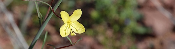
Shadow of the Sentinels Nature Trail was my next stop — and not a moment too soon. Penny was eager to get out and run around. This is one of those stops built to help the casual tourist get in touch with nature — without much effort. It doesn’t matter if you’re young or old, fit or a couch potato, tuned in with the world or out of touch with reality. Who can’t take 20 minutes to walk on a boardwalk among old growth trees in a densely vegetated grove? The half-mile loop trail wound into the forest with plenty of interpretive signs along the way. The forest floor was absolutely carpeted with moss, fern, lichen, and countless kinds of shrubs. The trees grew straight up into the cloudy sky, draped with what looked like Spanish moss. If it weren’t for the boardwalk, the trail would likely get grown over weekly. And yes, a 680-year-old tree is very big. Think redwoods big.
There weren’t many people there, although one group was a family with two small, loud boys whose shouts seemed to echo throughout the forest, audible no matter how far away I was. Penny and I walked the trail quickly, more for the exercise and experience than to learn anything new from the interpretive signs. I would have stayed longer on a nicer day, especially if the loud kids weren’t around. As it was, I think I was more fascinated by that winding boardwalk than anything else.
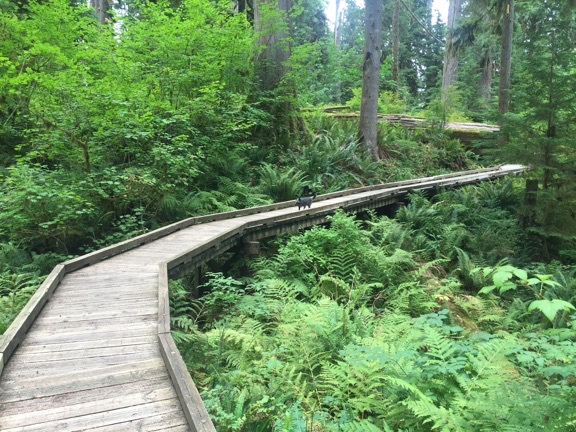
To me, raised boardwalks like this one, forming a nearly a half mile long trail through the forest, are the real attractions of nature trails like Shadow of the Sentinels.
Back on the road, I skipped the turnoff for campgrounds at Horseshoe Cove and Bayview, preferring to go farther uptake. It wasn’t much of a drive. The map made everything look farther away than it was. I drove through Boulder Creek and Panorama Point campgrounds. They were similar: very small campsites nearly right on the road, some adjacent to the ones beside them. Very little privacy. Most had Reserved signs on them; it was a while before I realized that the dates were in the future and most of the empty sites were not reserved for that night.
It was around this time that I started getting a bad vibe about the area. I can’t really describe it. It kind of reminded me of old, off-season resorts in the Catskills: busy and popular at one time, but now neglected and decaying. This feeling would nag at me as I continued up the road, visiting one campground after another. It got especially strong when I drove through what my map referred to as Baker Lake Resort but the sign identified as Swift Creek Campground. It may have been a resort at one time, but now it was just a collection of campsites, a closed down store, and a boat ramp. In many of the campgrounds, there appeared to be squatters — people who had been living there for a long time with lots of junk spread out in their site. It was unclear whether these sites had a nightly fee or if a Northwest Forest Pass was sufficient. At one campground, a very nice site overlooking the water was being used as overflow parking with three cars in it — but no sign of camping. I felt almost as if I were intruding just by driving through.
I continued up the road. Past a certain point, people were camping alongside the road. They’d park in narrow turnouts and set up their tents between the road and the lake. Some of these sites were quite spacious — but they were still right next to the road.
Camping is pretty much legal anywhere in National Forest or BLM land where it isn’t prohibited. In other words, if you find a nice parking spot down a side road in a National Forest and there isn’t a No Camping sign around, you can camp there. Campfires may or may not be allowed depending on local burn bans. Firewood collection might not be allowed; again, it depends on local rules. There likely won’t be any facilities and you’ll have to pack out your trash. Although there’s often a 14-day limit, it’s usually free.
That’s how I camped for free on my first night of this trip. I also did it in for weeks on BLM land along the Colorado River in Arizona with some friends this past winter. There’s nothing nicer than free, private waterfront living.
I kept going past the Pavement Ends sign and continued on gravel. No big deal for me and my big 4WD high clearance truck, but I assumed it would weed out a lot of city dwellers who liked to keep their cars clean. (Although I suspect it’s hard to keep a car clean in a place where it seems to rain all the time.) There were still people camped along the road. In one place, there were two empty boat trailers parallel parked alongside the road; I still can’t figure out how they got their boats off, through the narrow stretch of woods, and into the water.
As I neared the top end of the lake and passed the Road Narrows sign, I realized that I was probably not going to find a campground site I liked. I started looking at options along the road. Near the end, I found a nice turnout that had obviously been used for camping. Although large rocks prevented me from driving all the way in, there was plenty of room to back in far enough off the road. Beyond the rocks was a trail leading down to the water. But it wasn’t the lake anymore; it was the rocky delta of Baker River. I got back into the truck and kept driving. A half mile farther, the road ended at a trailhead parking lot for the Baker River Trail — coincidentally one of the trails in the book I’d bought that morning. People were parked along the edge of the parking area and tents were set up in the woods nearby. A makeshift campground.
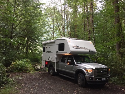
Here’s where I parked for the third night of our trip. It was far enough off the road, surrounded by drippy trees with the river a few hundred feet away out back.
I backed the Turtleback in beside another truck camper, thinking I might spend the night right there. But when I got out to take a look around, I got those bad vibes again. This is not where I wanted to spend the night. Who knows what these people might be like? Would they be crazy drunks who get loud after dark? Would their dogs be barking on and off all night, triggering Penny to do the same? Did I really want to be parked right next to another RVer and have to lower my blinds for privacy? Suddenly, that spot back up the road looked really good. So I got into the truck, drove back to it, and backed the truck in as far as I could go.
Not what I’d envisioned for the night, but it would do.
Lunch and a Hike
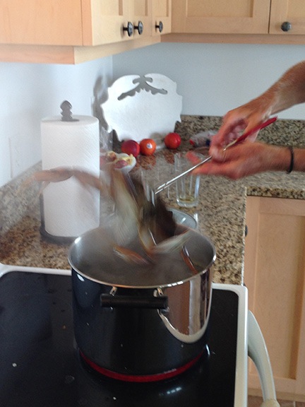
By this time, it was after noon and I was hungry. I heated up some leftover steak and ate it with a salad that included the last of the tiny tomatoes from my garden. I drizzled the steak juices over some kibbles for Penny.
Then we headed out for our afternoon hike. I figured we’d follow the short of the river back up to the trailhead and then follow the trail for a mile or two. My goal was to make sure I got my 10,000 steps a day on this trip and I wasn’t even halfway there. Three or four miles would be enough.
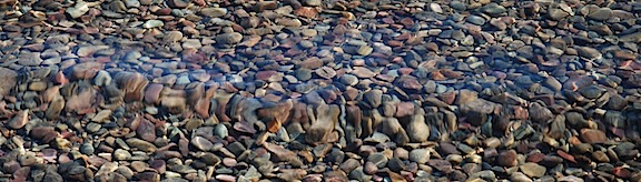
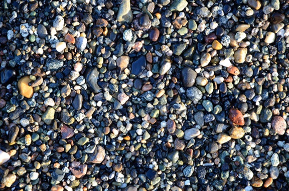
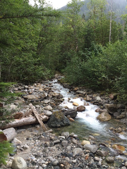
The shore of the river was rocky, with smooth river stones carved by glaciers far upstream and carried down by spring floods. Huge, old growth trees, torn out by wind and water, lay scattered like so many matchsticks on the rocks. The river’s channels wound through the delta, its water rich with glacial flour that gave it a milky color. The sound of the rushing water competed with the sound of the drizzle on the hood of my nylon rain jacket.
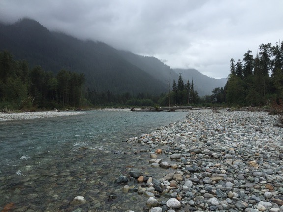
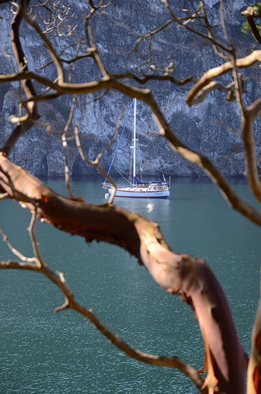
Looking down Baker River, from the shore right behind my campsite. Every once in a while, the sky would brighten, leading me to believe that it might clear up, but it never did.
It wasn’t an easy walk. The rocks were large and required carefully footing to navigate without mishap. The logs often blocked the most direct route, requiring me to go around or over them. Penny accompanied me, sometimes in front of me, sometimes lagging behind to sniff at a stump or clump of weeds.
We reached the trailhead parking lot/camp area a while later. I was surprised to see that we’d already walked almost three quarters of a mile.
We passed a few of the people there. None of them acknowledged us. One guy walked right past us without so much as a nod. Unfriendly. That vibe again. I was glad we weren’t camping among them.
We got on the trail and headed north. It was a very wide, very smooth, very level trail. Easy. I set a brisk pace. My goal was to walk a total of two miles — as measured by the Gaia GPS app on my phone — and then turn around and walk back, taking the road from the trailhead to our camp. A brisk pace would make it a good workout and hopefully get us back before the rain soaked us.
It was a nice walk through old grove forest. Every once in a while, I’d notice a particularly huge tree or interesting bit of vegetation. There were few wildflowers, but I think that’s mostly because the forest floor probably got very little sunlight.
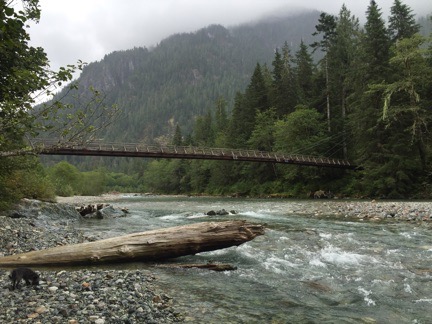
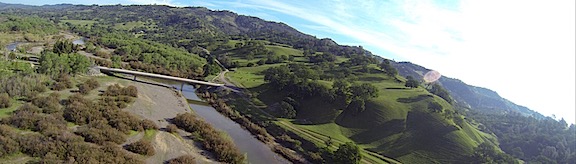
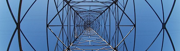
This sturdy wood and steel suspension bridge spans Baker River for hikers and horseback riders. This is our tax dollars and park fees at work, folks.
After a while, I caught sight of a bridge across the river. It was a wood and steel suspension bridge, designed for foot and horse traffic. The trail spilt here. The Baker River Trail continued north as a narrow path for hikers only. The Baker Lake Trail turned right over the bridge and continued south down the other side of the river back to the lake. I chose the wider trail, mostly because I wanted to be able to keep an eye on Penny, who is easily hidden by tall brush alongside narrow trails, and to keep my jeans dry.
I really admire the structures like this, especially when they’re so well-built and out in the middle of nowhere.
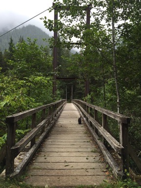
As we walked over the bridge, I took a moment to look at the solar panels attached to it, wondering what they could be powering. The answer was on the other side: a USGS flood gauging system that likely broadcast information to a base somewhere.
Blum Creek, near where it enters Baker River. You might think that all this flowing water is from the rain. It isn’t. This is glacial runoff.
We crossed another small footbridge, this one over Blum Creek, and continued through the woods. The rain started to pick up, but, at the same time, my quick pace was causing me to work up a sweat under my layers of clothing: long sleeved shirt, fleece hoodie, nylon rain jacket. I stopped to pull off the hoodie and leave the rain jacket draped over my shoulders. We’d walked just short of two miles when I’d had enough. We turned around and went back the way we came.
It was a good thing we did. The rain started coming down harder. Back on our side of the river, we passed a family hiking north; I figured they had to be from Seattle and used to the rain.
I put the leash back on Penny as we finished the hike along the road from the trailhead parking lot to our camp. Although she’s usually pretty good around cars, I didn’t know how people would be driving.
It was good to be back in the Turtleback.
Repairs
After stripping off my wet clothes and putting on some dry ones, I did a few repair chores.
The first was the velcro. Apparently one of the three pilots who had stayed in the Turtleback during cherry season had snapped off the plastic latch that holds the medicine cabinet door closed. The result: the door swings open and closed during travel, spilling medicine cabinet contents all over the bathroom. Not acceptable. I’d found a temporary remedy with a bungee cord, but it was a royal pain in the butt to deal with.
I decided to try velcro: one small piece in the top corner of the door. I prepped the areas by cleaning and drying them thoroughly and then sticking the stuff on. The instructions say maximum adhesive strength is in 24 hours, so I left the door open for now and will close it before moving on.
The second was the latch to the cabinet under the sink. All of the cabinets have push-latches that keep the doors closed until the button on the latch is pushed. But the one under the sink doesn’t catch properly. The result: the door swings open and closed during travel. Although nothing falls out, it bugged me that the door wouldn’t stay closed. Surely there was something I could do.
I compared the door latch on that door with another cabinet door and discovered that its position wasn’t quite right. I used a screwdriver to loosen the latch, shifted it back a bit, and tightened it back up. Voila! The door works perfectly.
The Turtleback needs one more repair that’ll require parts from Lance: the latches that hold sunroof over the bed in the full down position broke off. I think this is because they’re plastic and have spent a lot of time in the sun. I’ll have to order and install new latches. Until then, I’ve discovered that I can keep the sunroof in the slightly open position while driving; not locking it in that position causes it to swing wide open, which isn’t a good idea in rainy weather or at high speeds. When I’m parked, it’ll stay full down, even without the latches.
I’d like to make a few improvements, too. For example, there are key hooks over the door; the previous owner likely put them there. Trouble is, you need to be in the camper to reach them. In the Mobile Mansion, I’d mounted the key hooks near the floor at the door. This made them easy to reach from inside or outside with the door open. Instead of key hooks up there, I’d like to put a shelf. I already had a charging station for my phone installed on the side of the cabinet there, which is close to the stereo so I can plug in my phone for music while charging it. It would be nice to lay the phone and other things, like my sunglasses and wallet, on a shelf up there, out of the way.
And hooks. I need hooks in the bathroom to hang items I want to dry.
I’m still debating whether to remove the stove lid and use my big cutting board there as a lid and additional counter space. The stove lid in the Mobile Mansion broke off within a few months of buying it and I never missed it. The cutting board has feet that fit solidly over the stove grating. I can stand it up behind the stove when not in motion. I think it all depends on whether I can remove the stove lid neatly, without breaking it. I’ve already removed a cabinet door in the sleeping area because the mattress I added makes the bed too tall to get the door open.
These are all things that get hashed out when an RV is in use. I like to customize my space, especially when I know I might spend months traveling with it, as I hope to this winter.
R and R
When I was done with the repairs, I relaxed at the table with a crossword puzzle. I’m just starting to figure out how to get comfortable in the Turtleback and I admit that I sorely miss the Mobile Mansion’s La-Z-Boys. It it hadn’t been so nasty out, I probably would have tried out my new chair, possibly set up along the river bank.
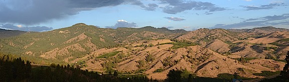
A panoramic view of the back end of the Turtleback from my seat at the table. We were surrounded by lush, green forest, dripping from the rain. You can see the trail down to the river on the right side of this photo.
Penny wanted to nap, so I lifted her up onto the bed and she got into her bed. I thought she had the right idea and climbed up beside her. Soon, I was drifting off to sleep. When it got chilly, I went down to fetch a blanket. Then I was out like a light.
Until 8:30 PM.
Sheesh. I couldn’t even use a long hike as an excuse for such a long nap.
Miraculously, I wasn’t hungry when I woke up. That didn’t stop me from eating the pudding I’d made that morning and left in the fridge for dessert.
It was nearly dark when I let Penny out to do her business for the last time that evening. I gave her some dog food, which she turned her nose up at. Then I put her back on the bed and she went back to sleep.
I stayed up at the table for three hours writing this blog post. Outside, it rained hard for a while. I cracked one of the windows open so I could hear the sound of the river not far away.
I decided I wanted an early start in the morning. I’d be heading back into civilization, staying at a State Park campground on the coast after making stops at Trader Joe’s and a supermarket. I might even have a full hookup Wednesday night.
I just hope it stops raining.
It was nearly midnight when I went to bed. When I turned off the light, it was pitch black dark — darker than I’ve been in for a long time. And other than the faint sound of the river out back and the dripping of the trees, it was dead quiet.