A Trip around the Peninsula, Day 3: Port Angeles to Clallam Bay

We take a road trip around the Olympic Peninsula in Washington state.

After three months contractually bound to the Quincy and Wenatchee areas of Washington, I was finally off contract at the end of August. Mike flew out to Washington and we went on a road trip to the Olympic Peninsula. This series of blog posts is a summary of that trip, with photos.

Back on the road, exploring Olympic National Park and the Pacific Coast of Washington.

We left the hotel in Port Angeles early on Wednesday. With half a cup of unsatisfactory hotel room coffee in my stomach, I hit the Starbucks in the local Safeway supermarket while Mike topped off the truck with diesel. Then we started up the road to Hurricane Ridge in Olympic National Park, leaving Port Angeles behind.

It was so early that when we reached the park entrance, no ranger was there to check our park pass.
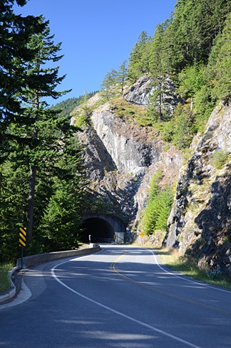
Tunnel on Hurricane Ridge RoadThe road climbed south slowly into the mountains on a narrow strip of park land. We found a parking area right before one of two tunnels and Mike parked the truck. There was a view to the northeast and we could clearly see the Juan De Fuca Strait, which runs between Washington and Canada’s Vancouver Island. It was relatively hazy and the conditions weren’t good for photography.

I spotted a paved path that wound into the woods and we followed it with our coffee cups and bags of breakfast pastries in hand. At the end of the short path was a viewpoint that looked southeast. The air was hazy; a wildfire was burning out in that direction beyond the mountains. Some interpretive signs talked about the rivers that ran invisibly in the cuts between mountain arms in front of us. I wasn’t sure, but I thought I could hear the water rushing in the distance.

We sat down on some steps and had our breakfast. A few people came and went.

Back in the car, we continued up the road. I should mention here that it was a remarkably beautiful day for that area of the country — not a cloud in the sky. Apparently, the area gets a lot of rain. We didn’t see any for the entire time we were traveling there, although we did run into some marine layer fog banks — more on that later.
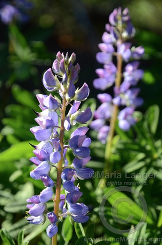
LupinesNear the end of the road was the Hurricane Ridge visitor center, a building with a gift shop, food, and great views to the south. There were also a few paved and unpaved paths that wound through grassy, flower-strewn meadows. We parked the truck and went for a walk. The quantity and size of lupine were phenomenal. Tall stalks of magnificent purple flowers seemed to grow everywhere.

Although the views in every direction were magnificent, a layer of smoke and haze from the wildfires miles away made it difficult to capture images of what should have been pristine wilderness. There was still snow on the peaks to the south of us and, with a pair of binoculars, we could examine the few remaining glaciers from afar. (There was also snow at our elevation, mostly on the north side of hills that would get little direct sunlight during the day.)
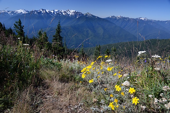
Snow-Capped Mountains

Mike and I spent quite a bit of time photographing the wildflowers. Although lupines dominated the scenery, there were some other wildflowers to capture in pixels. You can see two of my better closeup shots below. (You can click any photo with a watermark to see a larger version in my photo gallery.)
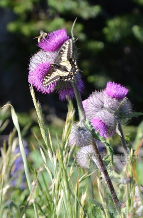
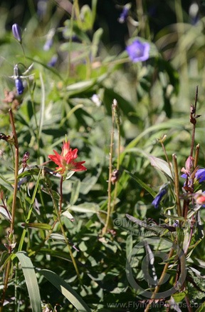
Butterfly and Bee Indian Paintbrush

We weren’t the only photographers up there, either. I saw at least two other people with tripods. (I was using my monopod.) You really needed some kind of platform to steady the camera when doing closeup images of the flowers.

After close to two hours exploring the area, we hopped back in the truck and continued down the road to the trailhead for Hurricane Hill. We wandered about a half mile up the trail, trying hard to lose a group of noisy hikers who seemed to pause every time we did. We finally turned around and walked back to the truck, eager to continue our trip.

We retraced our route back down the road, turning just after the park gate onto Little River Road. This road, which was mostly outside the park limits, was a “shortcut” that would take us to the Elwha area of the park. It was mostly paved; the unpaved part was smooth enough. We drove past patches of clearcut forest, along with areas of obviously new growth. The Olympic Peninsula — as well as much of Washington and Oregon states — have many tree farms where trees are planted and harvested for lumber. Most of the old growth forest is gone; the trees in the new forests have straight, narrow trunks.

We turned into the park road toward, heading toward an observation point. We flashed out park pass at the ranger and got a map for our efforts. Then we followed the Elwha River south. The water was rushing — even this late in the year — and there were huge pileups of tree trunks deposited by seasonal flooding.
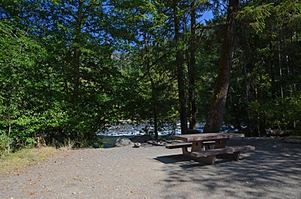
Picnic SpotWe were hungry and planned to dig into some of the cheese we’d brought along when we got to the observation point near the end of the road. But the road was closed for some kind of construction. So instead, we turned into the Altair Campground, which was mostly empty, and pulled into the first campsite, which was right along the river. We carried the cooler over to the picnic table, opened it up, and had a great meat, cheese, cracker, and cucumber lunch.

Afterwards, we headed out of the park, following route 101 northwest. A Piedmont on Crescent Lake, we turned north on a road that wound through more forest to Route 112. Eventually, we were back on the north coast of the peninsula.

We made a brief stop at a small park where we walked along a rocky beach. The tide was mostly out and the weeds that had been deposited on the shore were stinky and buzzing with flies. We didn’t stay long.

Route 112 left the shore and came inland, intersecting with Route 113. We followed 112 north to Clallam Bay. From there, we passed through the small communities of Sekiu, which appeared to be a very large RV park, and Neah Bay, a town on Makah Reservation. We followed the signs to Cape Flattery on a road that cut through the tip of the peninsula to bring us to the ocean side. We followed the road to the end where there was a relatively full parking area for the Cape Flattery trail.

Despite the fact that this trail is so far away from “civilization,” it’s really worth visiting. It immediately dives into the forest on an easy-to-follow pathway that descends gently under a dense canopy of evergreen trees. Most times, this trail is likely dripping wet with typical coastal rain forest weather, but the day we visited it was damp but mostly dry, with bright afternoon sunlight filtering through the branches. Where the trail was likely to encounter mud, it was “paved” with wooden planks or round cross-sections of large logs. It gave off a sort of magical feeling, as if we’d entered into a fairy tale, following the path of Little Red Riding Hood or Hansel and Gretel — but without the danger at the end.
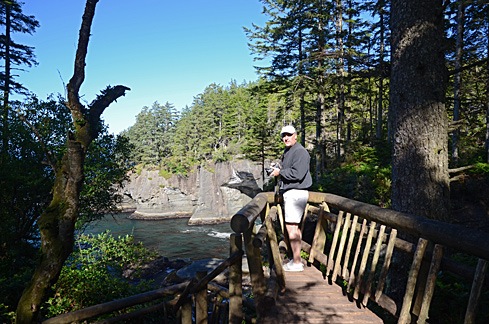
Mike At Cape FlatteryAs we got closer and closer to the point, we could clearly hear the ocean waves crashing against rocks. There were a handful of short side trails to points where you could see the rocky shoreline. Some of them had been built up with rustic log rails to prevent a fall into the water below.
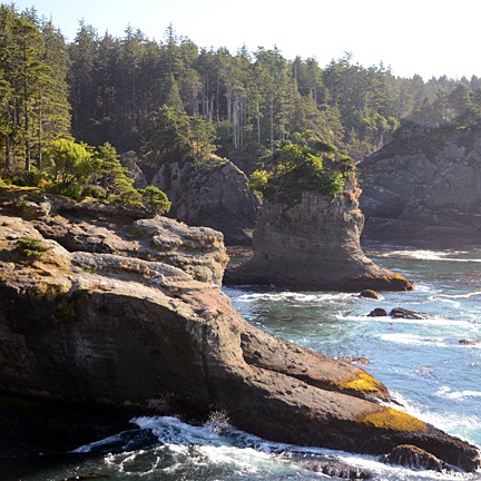
StacksAt the end of the trail was a platform that looked out to the northwest. There was an island out there with a lighthouse on it. To the north, was the opening of the strait and Vancouver Island; a container ship slowly made its way in toward the ports. Waves crashed on the shore against odd-looking formations called “stacks.”

Natural BonsaiBeyond the platform, a lone tree grew like a natural bonsai right at the edge of the cliff. Its gnarled trunk was twisted and curved from years of exposure to the elements. It made an interesting foreground subject for a view of the ocean and stack beyond it. I can imagine the shot being much better, with first light on the scene and a coastal mist partially obscuring the offshore landmarks.

By this time, it was late afternoon and we needed a place to spend the night. We debated about driving all the way back to Forks, which was on the way south. The Maps application on my phone — once I got back within range of the network — mentioned lodging farther south on the coast. I called the phone number. A recording answered and said the office was closed. It was 5:30 PM. I couldn’t understand how a place with cabins could just close at 5. We drove past and saw a bunch of relatively nice cabins, mostly unoccupied, adjacent to an RV park. The office was indeed closed. Their loss.

So we backtracked through Neah Bay and headed toward Forks. Despite very promising signs at Neah Bay about lodging, there was no place there I’d even consider staying. Between Sekiu and Clallam Bay, we spotted a motel with a restaurant next door. We pulled in.

I can’t remember the name of the place and that’s probably a good thing. It was not pleasant. The unit they put us in was at the end of a single-wide manufactured building. It consisted of two very small rooms, one of which had a kitchen it it. Although the place was clean, it was extremely run down and had a weird smell. I think it caters to fishermen. It did have a full sized refrigerator, which was good for us, because it let us store our remaining cheese and re-freeze the bottled water and freezer packs we were using to keep them cold. And it was quiet. And the restaurant was next door.

And, oh yeah: it was pretty cheap.

We had dinner in the restaurant next door. I had a fried fish platter, which was actually pretty good. We shared an ice cream sundae. Then we went back to our room with its cardboard walls, and called it a day.

I was exhausted.
Our Route:

A Trip around the Peninsula, Day 2: Victoria, BC

We take a road trip around the Olympic Peninsula in Washington state.

After three months contractually bound to the Quincy and Wenatchee areas of Washington, I was finally off contract at the end of August. Mike flew out to Washington and we went on a road trip to the Olympic Peninsula. This series of blog posts is a summary of that trip, with photos.

On the recommendation of several people, we spend the day in Canada.

We started the second day of our trip with a quick breakfast at the hotel and a trip to the ferry terminal. The plan was to spend the day in the Canadian city of Victoria, a 90-minute ride from Port Angeles on the Black Ball Ferry Line’s M.V. Coho.

We’d learned, belatedly, that if you wanted to take a car on the ferry to Canada, you needed to get to the terminal for security inspection 90 minutes before the 8:20 AM sailing. That was not possible. So we walked on board, assured that there was plenty within walking distance of the ferry terminal on the other side. There was also the usual collection of taxis and other means of transportation.

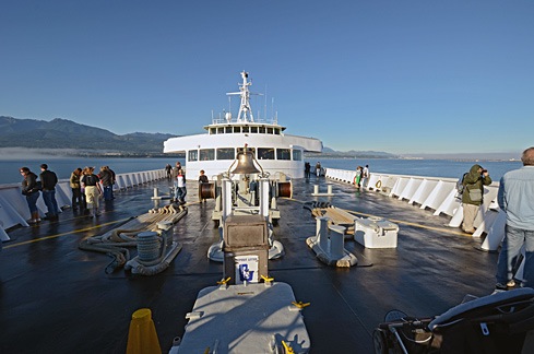
MV CohoAlthough the sky was clear in Port Angeles, we hit fog within 15 minutes of departure. The crew shooed all passengers away from the bow of the boat and we went inside. We filled in our immigration paperwork and found a comfortable place to sit. I was feeling more than a little queasy from the rocking of the boat, but that cleared up soon enough. So did the fog. We went back out on deck as we came into Victoria Harbor. A seaplane was just landing. It was another beautiful day.
We spent the entire day touring the harbor area — and a bit beyond it — on foot.

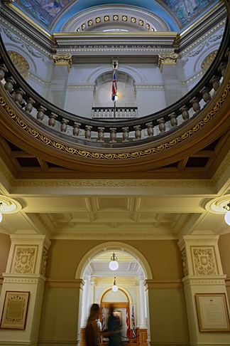
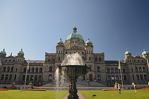
Assembly BuildingFirst up was the Legislative Assembly of British Columbia, a large domed building clearly visible from the ferry terminal. Mike and I are big fans of architecture, so we wandered over to take a closer look. We walked past a very large statue of Queen Victoria and an ornate fountain to get a closer look at the building’s symmetry. Then we walked down the main path and up the steps to the public entrance.

Inside the Assembly BuildingWe were pleased to learn that the building was open to the public and wasted no time exploring the public areas inside. The building, which was completed in 1898 and restored in 1973 is in magnificent condition, full of wonderful architectural touches. I picked up the self-guided tour booklet but didn’t really consult it much. It was nice to simply wander around, from room to room, although I do wish we’d taken the guided tour.
Afterward, we walked north on Government Street to the Empress Hotel. I’d read somewhere that the hotel was the place to get afternoon tea, so we found the reservation desk and made reservations for 4:15 PM. That meant we’d be taking the 7:30 PM ferry back to Port Angeles.

Mike had a tourist map with him which identified Fort Street as the place for shopping and dining. So when we reached Fort, we turned east and continued walking. Gradually, we left the tourist area and its shops and tourists behind. The farther we walked, the more “regular” people (i.e., not tourists) we saw.

We also started to get hungry. We wound up at the Saigon Harbour Restaurant on Blanshard Street for a good meal of Vietnamese food. I’ll be honest — we picked it based on the way it looked from outside. It’s just another example of how eating at a small, local place can provide just the kind of dining experience we want.

After lunch, we continued up the south side of Fort Street and walked back on the north side. We stopped at a bakery for a chocolate croissant for dessert, which we ate while walking. We then continued up Government Street, visited a few shops, and bought a few odds and ends.

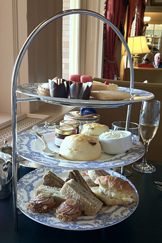
High Tea at the EmpressAt 4 PM, we headed back to the Empress for tea. Despite our shabby appearance — I was wearing my usual henley t-shirt and jeans and Mike was similarly dressed — they sat us at a table by the window where we could look out at the harbor and watch the people go by. We started with a pair of champagne cocktails. Our waiter was excellent, recommending a tea that suited both of our tastes — I prefer mine without milk; Mike floods his with milk. Then he brought the customary three-tiered plate of goodies, including sandwiches, scones, and sweet treats. I’ve had afternoon tea about a half dozen times and this one was, by far, the best. Highly recommended.
Afterwards, we went back to Hemp & Company, a shop that sells clothes made of hemp and I bought two collared shirts to replace some linen shirts that were wearing thin. We also bought some maple cookies in a tourist shop for some friends of mine in Quincy and some candies from Roger’s Chocolates that turned out to be amazing.

We wandered back toward the ferry terminal. It was about 6:30 by then, but the ferry hadn’t arrived. There were a few horse-drawn carriages nearby and I hired one for a half-hour ride to the south side of the city. The weather was still clear and, when we reached the coast, we could clearly see the mountains of Washington’s Olympic Peninsula in the near distance. It was a nice, slow ride with a talkative young driver who told us a lot about historic buildings, including the limitations on repairs.

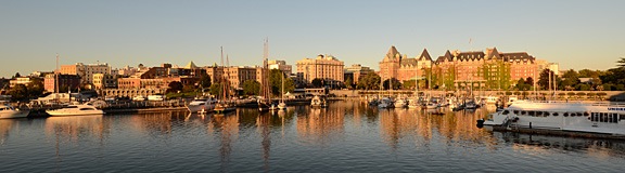
We got back to the terminal just in time to board the ferry. I photographed the city as the sun set, casting a golden light over the buildings and boats in the harbor.

Sunset over Victoria

The ride back was smooth. A waxing gibbous moon hung in the east when we disembarked in Port Angeles. We drove the truck back to the hotel and settled in for the night, exhausted by our long day of walking.

A Trip around the Peninsula, Day 1: Wenatchee to Port Angeles

We take a road trip around the Olympic Peninsula in Washington state.

After three months contractually bound to the Quincy and Wenatchee areas of Washington, I was finally off contract at the end of August. Mike flew out to Washington and we went on a road trip to the Olympic Peninsula. This series of blog posts is a summary of that trip, with photos.

The start of our five-day vacation.

After fueling our diesel pickup — the only vehicle available to us here — we headed out of Wenatchee on Route 2 toward Stevens Pass. We made a number of stops along the way.

First, Anjou Bakery in Monitor, which makes an outrageously good pear danish. It’s in a funky old building with indoor and outdoor seating. They make coffee drinks, too, but I’ve decided to avoid that on my next trip. Their coffee isn’t very good — at least in my opinion — and it takes far too long for them to prepare it.

Next, Leavenworth. If you’ve ever been to Leavenworth, you’ll know that it’s a manufactured tourist town. They redid the entire town with a Bavarian theme, making it feel almost as if you’re in a Black Forest village somewhere in Germany. (I’ve actually been to Germany’s Black Forest, so I can attest to this.)

For the record, I don’t like Leavenworth. It’s a fake place that exists primarily for tourism. The parking and traffic situation is horrendous. Its multiple shops and restaurants are designed to suck tourists in and relieve them of their money. Little of what they offer is any better than you’d find at any other similarly themed tourist shop or town. I know that all tourist towns are like this and I don’t like any of them. Frankly, I don’t know why so many people go there.

But Leavenworth does have two shops that I love:

  • The Cheesemonger is possibly the best cheese shop I’ve ever been to. Not only do they have an amazing selection of cheeses from around the world, but they are well-staffed with knowledgable and helpful counter people. Cheese tasting is not only allowed but encouraged. This shop is my primary reason for subjecting myself to a trip to Leavenworth.
  • Cured is a smoked meat shop where you can get excellent bacon, sausage, wursts, jerkies, and more. Their buckboard bacon is to die for. If I make a cheese run, I also stop here for meats. Bonus: there’s motorcycle parking right across the street.

On this visit, we also stopped at the Bavarian Bakery on the right as you come into town from Wenatchee. It was recommended by the folks at Cured for bread; they hadn’t received their delivery yet and I like their rolls with the cheese. My grandfather was German and owned a bakery in Cresskill, NJ when I was a kid. For a while, my family lived in an apartment upstairs. So visiting a real German bakery was a treat for me. We bought some plum cake (which my Grandfather also made), pretzels, a coffee cake, and the rolls. I wasn’t terribly impressed with any of it, but it wasn’t bad. I’m just picky.

We loaded up the cooler that we’d brought along and headed out of town on Chumstick Road. That would take us winding through the mountains, though the tiny town of Plain before reaching Lake Wenatchee. At Route 207, we headed northwest, following 207, then Little Wenatchee Road, then National Forest Development Road 65. I’d ridden this route on my motorcycle the week before but had turned back after 10 miles or so because I wasn’t sure whether it was paved the entire distance.

We took a side trip, following a sign that promised a View Point 4 miles up an unpaved road. The road wound up and around through dense forest, finally depositing us at the promised viewpoint. We could see Lake Wenatchee in the light haze.

Another couple was there — a bit older than us and seriously out of shape. They were wrestling with something heavy in a blanket, trying to get it into the back of their pickup. We didn’t snoop until they were gone. Then we followed the short trail they’d come from and discovered a place where people had been cutting stone from the side of the hill. Cutting, like with a stone-cutting saw. The kind of equipment that requires a generator and probably water to cool the blade. I don’t think they had that equipment; they might have been taking a loose rock. It looked like granite to me, but it could have been something else. (What do I know about rocks?) The whole thing was weird; it had taken us 20 minutes to drive the 4 miles; why would anyone lug stone-cutting equipment up there?

We continued along the Forest Road and, sure enough, not far from where I’d turned around on my motorcycle, the pavement ended. We followed the road through the forest, enjoying the views along the way. At one point, a Jeep caught up to us and we pulled aside so it could pass. Otherwise, there wasn’t much in the way of traffic.

Old Growth TreeI should mention that much of this was old growth forest. An absolutely huge tree grew close to the road and we got out to take a closer look. Its amazing to me that trees this large exist and that so many of them have been cut down. Actually seeing one is a real treat.
The road we were on ended at Route 2 and we continued through Stevens Pass and down to the west side of the Cascades. That’s when the traffic started up. It was Labor Day afternoon and everyone who had journeyed east for the weekend was heading home. I whipped out my iPad and the Maps app and found some alternate routes that paralleled Route 2. We probably saved about 30 minutes of drive time by taking these longer routes, each of which dumped us back on Route 2 after a pleasant drive through farmland or forest. Then we abandoned Route 2 completely in favor of Routes 522 and 524.

We stopped at Snoqualmie Ice Cream shop in Malby. The ice cream was good, but, in my opinion, not worth the very high price we paid for it. And the girl at the counter who served it had the personality of a wet rag.

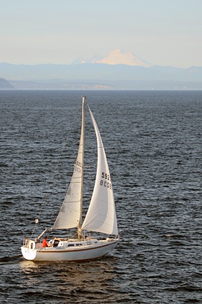
Sailboat on Puget Sound with Mount Baker in BackgroundBack on the road, we continued along Route 524 to Edmonds and got on line for the ferry to Kingston. We’d timed it well and didn’t have to wait more than 15 minutes to get on the boat. We went up on deck to check out the view. Mount Baker was clearly visible to the northeast and even Mount Rainier could be seen through the haze to the south. I passed the time photographing sailboats we passed, trying to get Mount Baker in the background.
In Kingston, we didn’t hang around. It was getting late and we were hungry and unsure of where we’d be spending the night. We’d already planned on spending Day 2 in Victoria, BC, so we wanted an overnight stay someplace close to Port Angeles, where we’d pick up the ferry. So we headed that way on Route 104 and then 101.

We detoured to Dungeness. I don’t know what we expected to find there, but we didn’t find any interesting lodging opportunities. We did, however, find the Three Crabs Restaurant right on the bay. If I had to rate this place on service or atmosphere, I’d pan it. It had all the charm of a cheap family restaurant catering to people with low expectations. But the food — well that was a pleasant surprise. I had the best fried oysters ever — and I don’t toss around the word “best” very often at all. That made it worth the visit. (And here’s a tip to restaurant-goers who rate restaurants on Google, Yelp, etc.: don’t order steak in a seafood place.)

We got back on the road and headed toward Port Angeles. By this time, it was getting dark. My maps app suggested the Olympic Lodge and we homed in on it. It was a bit bigger and fancier than we expected. But it was evidently also empty. We went to the desk and they offered us a discounted rate within our price range. We took it. The room was large and comfortable. A fountain at ground level outside our window offered a nice soundtrack to a good night’s sleep.

Our Route:

Silver Falls

A motorcycle ride and a hike.

I had my 1992 Yamaha Seca II motorcycle shipped up to Washington State so I’d have something other than the pickup truck to ride around in while I’m here. Not only does it get about 50 mpg (compared with the trucks 15 or so mpg), but it’s a hell of a lot more fun to get around in.

When it first arrived, I discovered — without any real surprise — that my motorcycling skills were extremely rusty. I took it for a few short rides to get get the feel for it again. Then I took it to Chelan to visit a friend. And I’ve been riding it a few times a week since then.

But it was yesterday that the rust finally shook off.

Along Entiat Road

I decided that it was high time to take it out on some mildly challenging twisty roads. After consulting a map, I decided on Entiat Road (County Highway 19), which winds up the side of the Entiat River. The road is only about 38 miles long — or at least that’s what I gathered by the “Road Ends 38 miles” sign near where I picked up the road in Entiat on the Columbia River. I figured I’d ride it until either it or the pavement ended.

I left Wenatchee Heights at noon and, after winding my way through the city of Wenatchee and up route 97 toward Chelan, reached the turnoff for Entiat road at about 12:30. It was a typical two-lane road in good condition, smooth with no loose gravel. I was able to open up the bike and get some good practice leaning into the curves at speed. I drove past orchards snuggled into the valley — the apples and pears still hung, ripening, while the cherries had already been picked.

I was hungry — I hadn’t eaten before leaving — and figured I’d stop for lunch at the first place I found along the road. That first place happened to be about 10 miles up the road at Ardenvoir, a place called Cooper’s Store. It was also the last place; a sign nearby said “No services past this point.” It didn’t look very appealing, but I didn’t have a choice, so I parked the bike and pulled off all my gear: helmet, gloves, denim jacket. A sign outside said “Food voted five stars by Odee.” So, of course, when I went inside I asked who Odee was. Turned out to be the owner’s dog, an aged terrier that came up to sniff my hand when he heard his name.

I had a chili burger. In Arizona, that’s a burger with a green chili on it. At Cooper’s Store, it’s a burger under a heap of chili con carne with chopped onions and shredded cheese. To put a positive spin on it — it’s always nice to stay positive, no? — I can confirm that it was edible. I grabbed a popsicle out of the freezer in the store for dessert, paid up, and went outside. I sat on a bench out front to eat my popsicle. Three vehicles went by. A Jeep stopped at the store and the driver went inside while the passenger looked at me sitting on the bench. I guess there was nothing else to look at. Finished, I geared up and continued on my way.

The road continued up the river, sometimes quite close, past farms and homes and unlikely subdivisions that had never been sold. Many of the homes were for sale. Lots of waterfront property. A beautiful log house, brand new, with a “For Sale” sign on it. A real homesteaded property. An area that had obviously suffered a forest fire only a few years before — the weathered skeletons of burned trees were all that remained with tall grass on otherwise bare hills.

I have no idea how far up the road I was — 20 miles? 30? — when the pavement became rough and a sign informed me that I was entering the Wenatchee National Forest. No more homes along the side of the road. Now it was just tall pines along steep inclines with sharp curves in the bumpy road. I slowed down after being jarred violently going over a bump. A sign mentioned a place called Silver Falls 8 miles farther up and I figured that was as good a destination as any.

The Hike

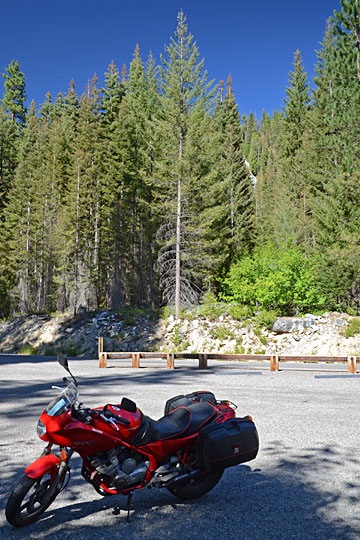
My Yamaha at Silver FallsThere were National Forest Campgrounds along the side of the river. I passed two before I reached the parking area and campground for Silver Falls. I parked and stripped off my gear, locking it up in my bike’s Givi saddlebags. Looking up, I saw the top of the falls — can you see it in the photo? It didn’t seem that far away.
I checked the information kiosk. There was no information about the hike, although I could clearly see a trail disappearing into the forest across the road. I did see that there was a $5 day use fee. Although it was midweek and I thought I’d only be there a short while, I know how much the parks are struggling. So I filled out the form on an envelope, put a $5 bill in it, and tucked it into the payment slot. Then I grabbed my camera and started the hike.

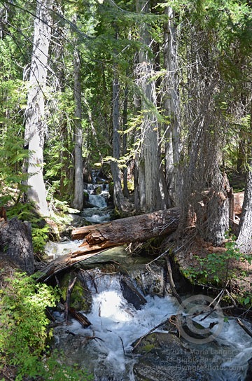
At Silver FallsI immediately found myself in a deep, somewhat dark pine forest. As my eyes adjusted to the light, my nose picked up the scent of pine and moisture and my ears heard the sound of rushing water. I came upon the creek immediately — a healthy stream of water gushing over rocks between trees. For me — a desert dweller — it was a real treat.
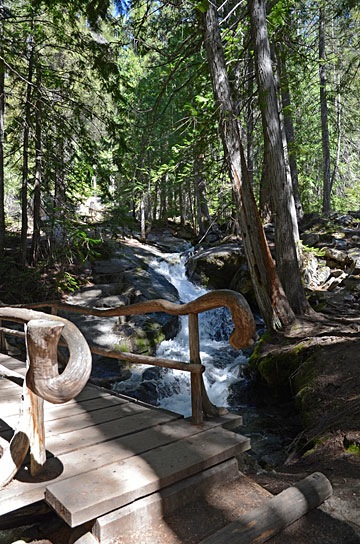
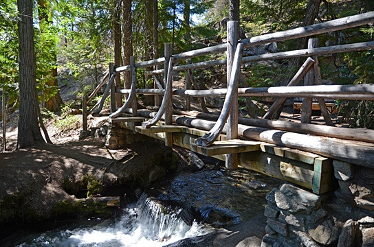
Rustic BridgeThe path was well-maintained, with rustic protective barriers to prevent hikers from accidentally falling into the stream. The bridges were especially rustic looking, sometimes with curved logs making attractive rails. It was surprising to find something so attractively designed on a trail. I began to wonder how much of the trail dated back to the CCC days, when National Forest trail projects were a source of employment during the Great Depression.
I followed the path as it climbed gently upstream, first on one side, then the other. The trail forked at a bridge where I stopped for a rest. A family of three was just coming down the right side of the creek. “It’s worth it,” the Dad assured me.

I continued up the way they’d come down. The trail began to climb. It moved away from the creek and then back to it, offering stunning views of the rushing water. The farther I went, the steeper the trail got. In many places, it was rock steps. I paused at another rest spot. The mist from the falls chilled the otherwise hot air. I could see the main falls above me. When another family joined me, I asked whether the trail went all the way to the top. The Dad told me it did. Remembering the other guy’s assurance, I continued the hike.

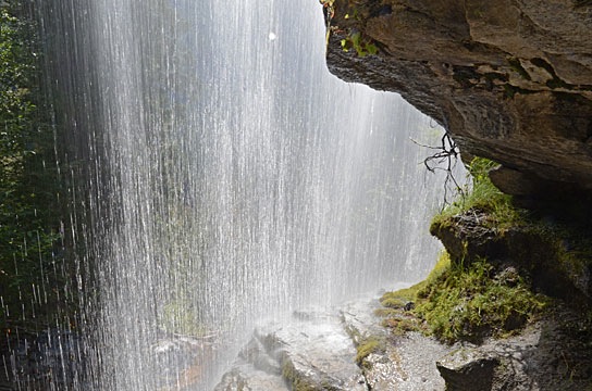
At one point, the trail came back to the creek just beneath a large fall. Although the rustic wooden logs made it clear where the trail stopped, I did as many others had likely done and slipped beneath the two rails. I was able to safely get to a spot beneath the waterfall, tucked under a rocky ledge. I experimented with my camera, trying hard to protect it from the mist, until mosquitos found me and I decided to move on.

Behind the Waterfall

After that point, the trail swung far from the stream — so far that I could no longer hear the water’s flow. It also leveled out. Perhaps I’d misunderstood the other hiker? Perhaps that spot under the falls was as high up as the trail would go? Perhaps it would continue back along the mountainside, away from the falls?

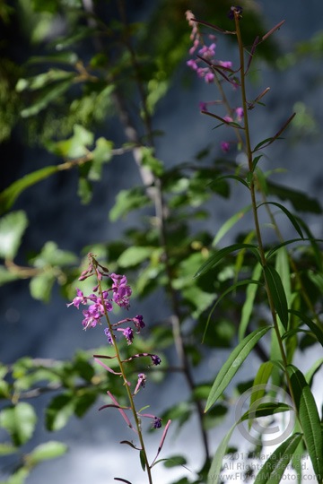
Purple FlowersBut I stuck with it and was rewarded with a switchback and another climb. A while later, I was back alongside the stream at yet another streamside bench, photographing some beautiful purple flowers just past the peak of bloom.
It was then that I noticed a similar rest area on the other side of the creek. The trail had split and, apparently, the other trail climbed up the other side. Would they meet again at the top, forming a loop? Could there possibly be another bridge? It was too much to hope for. I’d assumed I’d be returning the way I’d come. Now I was starting to wonder.

I continued on my way, up more stairs and another turn away from the creek. After another switchback, I returned to the creek and saw the bridge over a smaller falls. I spent a lot of time up there, relaxing in the shade, snapping photos of the water falling over the rocks. Again and again I wished I’d had a tripod or at least my monopod along with me — the shade was dark in the dense forest.

Bridge at the Top  of the Falls

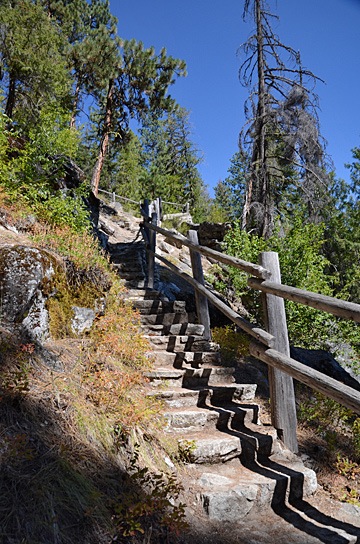
Stairs on the TrailThen I started down the other side of the creek. At first, it was one long flight of stairs after another. Then the trail moved away from the falls in a series of relatively level paths with switchbacks. In some places, the trail emerged from the forest into the sun; not only could I feel the heat on my skin, but I could smell it. Then back into the trees for cooling shade and pine aromas.
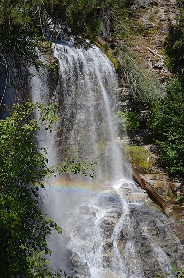
Waterfall with RainbowAt one point, the trail came back to the falls just below where I’d walked along the ledge on the other side. The mist and sun worked together to produce a small rainbow. I did the best I could to capture the scene with my camera; I really do need to learn how to photograph waterfalls properly.

A while later, I was back near place where the trail had split. I took my time following the trail back out to the main road. The parking lot was empty except for my motorcycle.

It was 4:30 PM. I’d been there for nearly 2 hours.

I’d gotten my $5 worth of nature — and more.

The Ride Back

Although the road continued farther up the river, I was tired and thirsty. I figured I’d save it for another day — perhaps a day when I could share it with someone. So I geared up and pulled out.

I did take time to check out the three campgrounds I passed on the way back. The first and third were partially occupied and had nice sites looking out over the Entiat River. I’m not sure, but I think I could get the mobile mansion into at least some of the spots if I wanted to. It would be tough, though. The second campground was deserted and I could understand why; the sites were small and unappealing. None of the campgrounds had utilities, although they all had centralized water spigots and outhouses. The single campground host was not around.

I rode more aggressively on the way back. I felt as if I’d regained a lot of the motorcycling skill I’d had back in the 90s when we rode all the time. It felt good to lean deeply into the curves and accelerate through them, especially when I was out of the National Forest and the road conditions were a little better.

I passed Cooper’s Store with only a momentary thought of stopping in. I do wish I’d taken a photo, though. The Odee sign was pretty funny.

The motorcycle started losing power about 5 miles from the end of the road. I was able to switch to the Reserve setting while moving and before the engine quit.

At the junction of Route 97, I turned left toward the town of Entiat. My first concern was fuel; I took 3.6 gallons. Then I pulled up to 97 Brew, one of Washington State’s ubiquitous drive-through coffee stands. I rode up on the shady side and after getting my smoothie, asked if it was okay to stay parked there in the shade until someone else pulled up. No problem. I sucked my smoothie down while reading an article on the Web on my phone.

Then I geared up again and headed south on 97. About 40 minutes later, after winding my way through Wenatchee traffic, I was back in my RV. It was 6 PM.

So You Want to Be a Helicopter Pilot, Part 8: Be Willing to Travel

Simply put: you have to go where the jobs are.

Back in July, I got an e-mail message from a reader with a question. His message is reproduced below, with his name changed to protect his privacy:

Hello, my name is Joe. I am 16. I live in Indiana, and I have been thinking a lot about my future career. I was thinking about all of the jobs that I would be interested in doing, and one of the big ones was a helicopter pilot. I read all of your posts about getting a job as a helicopter pilot, and I am confident that I have a chance in piloting as a career. I am willing to move around the country to get the right training on being a helicopter pilot, and I am willing to find a way to make it through all of the expensive training that you talked about. The only thing that really bummed me a lot about being a helicopter pilot was that once you make it through all of the training that it takes to actually get a job, the hours for piloting jobs can be unappealing, and I was just wondering if that is the case with all piloting jobs. Because some of them require you to be away for long periods at a time, and I was curious if all piloting jobs have strange hours, because I am kind of a family guy, and I don’t know if being away for long periods at a time on the job would be the thing for me.

I think it’s an excellent lead-in to my next topic in this series: travel.

Look at it Logically

For a moment, think about the kinds of jobs that are out there: doctors, mechanics, lawyers, restaurant servers, bankers, construction workers, accountants, supermarket managers, insurance agents — the list goes on and on. These jobs might be very different, but they all have one thing in common: there are job opportunities everywhere. Unless you live in the middle of nowhere, chances are that you could find people in all of these jobs within 5 or 10 miles from your home.

Now think about pilot jobs or, more specifically, helicopter pilot jobs. How many helicopter pilot jobs do you think there are within 5 or 10 miles from your home? Unless you live in a big city or tourist town, you can probably count them on two hands. Even if there are more jobs, they’ll likely have strict requirements for experience, certification, and skills, making them difficult to qualify for until you’ve been flying for a while.

Travel May Be Unavoidable

Let’s look at the big picture based on time:

  • Flight Training. If there’s a suitable flight school in your area, you might not need to travel to get your training. My first flight school was 90 miles from my home; I later trained at a second location of the same school that was only 70 miles away. That’s a lot of driving, but I was able to sleep in my own bed at night. When I had a falling out with my flight school and needed to finish up my commercial rating elsewhere, I went to Long Beach, CA, which is not driving distance from my home. (Fortunately, I only needed 10 more days to get my rating.) Whether you have to travel for training is dependent on what’s available near where you live. And don’t pick a flight school just because it’s the only one nearby; consult Part 4 of this series, “Choose a Reputable Flight School,” for more on choosing a flight school.
  • Time-Building Job. Your first job as a pilot is very likely to be as a CFI. This is, for most people, a time-building job. In other words, the only reason you’re doing it is to build flight time so you qualify for another job. If you’re lucky, you’ll be able to get a CFI job either at the flight school you trained at or another one close to home. But again, this isn’t always the case. That first job is often very difficult to get — especially when, for a while, flight schools were churning out new helicopter pilots at an alarming rate. If you want to move forward in your career, you must get a time-building job. If the job market is tight, you might have to take the first job you’re offered, no matter where it is.
  • First Pilot Job. Once you’ve build enough time, you’ll be eligible for a “real” pilot job — one where you’re actually doing all the flying (as opposed to sitting beside someone else who is trying to). Again, there aren’t many entry level jobs. Some of them are seasonal tour jobs, meaning they’re only available during the season. I wound up at the Grand Canyon, which I recommend because of the challenging flying conditions. Other people go to Alaska. The more time you have, the more options will be open to you. In many cases, this first job will also be your introduction to turbine helicopters. (Frankly, I don’t see much difference between turbine and piston helicopter operations — except how much damage you can do if you don’t start it right or try to pull too much power.) Employers make a big deal about turbine time it so you should probably try to get into a turbine ship as soon as possible. The point is, once again you’re required to travel to where the job is available. And there’s probably no coming home on weekends if you’re working in Alaska.

Sometime after that first “real” job, you’ll begin qualifying for other flying jobs. In my mind, they fall into three categories:

  • Contract Jobs. A contract job is where you are hired as a pilot to fulfill a contract for specific work. The cherry drying work I do in Washington State is an example of a contract job: I’m hired to provide services for a short length of time. I’m paid a per diem amount to be available each day of the contract and I’m paid an hourly rate when I fly. My duty hours are all daylight hours, 7 days a week until the end of the contract, which is normally 2 to 6 weeks. I’m not employed by anyone — in other words, I don’t get a paycheck, have taxes deducted, or have benefits. I’m also out of work when the contract is up. Firefighting is another example of a contract job. Contract jobs tend to be seasonal and require specific skills, equipment, and/or certifications. These jobs require the most travel — you could be in Arizona fighting a fire one week and two weeks later be in Montana waiting for a fire call.
  • Schedule Jobs. What I’m referring to as a “schedule” job is when you work for a specific employer on a schedule — for example 7 days on and 7 days off or 14/14. I worked 7/7 at the Grand Canyon, but they also offered 4/3 schedules (I think; my memory isn’t as good as it was). 7/7 and 14/14 is common with EMS and Gulf operation jobs. Some contract jobs — especially firefighting — work on 14/14 (or similar) schedules. These schedules are designed, in part, to make it possible for pilots to “go home” between work shifts. They’re recognizing that pilots don’t always live where the job is and, indeed, they don’t. When I worked at the Grand Canyon, most of the pilots on the 7/7 schedule went home on their off days, including me.
  • Regular Jobs. What I’m calling a “regular” job is one where you work “regular” hours at the same place for a specific employer. ENG and law enforcement jobs are good examples. An ENG pilot might have to fly morning and afternoon rush hours and be available during the day for breaking news. But he might get nights and weekends off. A law enforcement or EMS pilot might work a 12-hour day shift for a week, get a week off, and then work a 12-hour night shift at the same base. These are the folks most likely to live where they work. And if their job is stable enough, they can have a home life pretty much like anyone else’s.

Of course, there is overlap between these three broad categories and someone else might come up with a different way to distinguish between them. This is just my way of looking at them and how travel is involved.

I should also point out that a “regular” job might require travel. For example, you could argue that Phoenix-based Flying M Air is my employer and I normally work out of a Phoenix airport. However some photography or survey assignments require that I travel to other locations — Lake Powell, Bryce Canyon, Kingman, Winslow, etc. — for a day or more. If clients need a helicopter where there isn’t one, I’m sometimes called to bring mine to them.

In general, however, to answer Joe’s question about hours, I’d say that 95% of helicopter jobs have what you might consider “odd hours.” If you’re looking for a 9 to 5 job, a career as a helicopter pilot is not for you.

Living Conditions on the Road

A humorous look at this aspect of being a helicopter pilot.

It’s worth a moment to look at some of the living conditions you might find if you do get a job away from home. While they’re not always terrible, they’re not usually very good.

At the Grand Canyon, pilots were offered housing in double-wide mobile homes about 30 miles from the airport. For a reasonable fee, four pilots shared one four-bedroom house in a subdivision of mobile homes. I was fortunate in that I had other living arrangements available to me, so I didn’t need to take advantage of this opportunity. My understanding was that living conditions depended on your roommates and and their habits. The area was so remote with such limited facilities that our employer actually warned us before we were hired about the lack of night life and social activities so we couldn’t use that as an excuse to back out later on.

In Central Washington State, I now live in a fifth wheel RV that I own and transport to my various bases of operation. It’s very comfortable, although it does have limitations that vary based on where it’s parked. In previous years, I spent a whole month at a motel in a very cramped room with no cross-ventilation. (The motel did have a pool, so I really can’t complain.) Other pilots doing this work are often called on to live in housing provided onsite — usually small travel trailers. One pilot I know was put in an 18-foot travel trailer with no bathroom; she had to use a portable toilet (think blue or green outhouse) and walk to the orchard owner’s home to shower. Her cell phone didn’t work there either, so the only way she could get or make calls was to drive into town.

A friend of mine who works fire contracts is typically put up in a motel near the base. Because the base can change at any time and he has to carry his gear with him from base to base — sometimes in the helicopter when he repositions — he’s limited on what creature comforts he can bring along. Motel quality and cleanliness can vary widely depending on what’s available.

Yet another friend of mine who works fire contracts typically travels to Greece, Italy, and Australia for work. I don’t know the details of his living conditions, but I sure do like the idea of going to places like these with someone else footing the travel bill.

Living conditions are a crapshoot that depends on many factors. If you’re picky about where you sleep at night, a career as a helicopter pilot might not be for you.

Be Willing to Travel

The point of all this is that you need to be willing to travel and willing to deal with less-than-perfect living conditions to move forward in a career as a helicopter pilot. But that’s part of paying dues — which is up next.