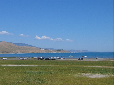
A flexible flight plan, weather, and then smooth flying to someplace other than where I expected to be.
– Logistics and Flight Planning
– Day 1: Over the Mountains, IFR
– Day 2: Desert Heat and Familiar Terrain
It was overcast with a handful of low-level clouds as we headed southeast from Wenatchee Airport at about 11 AM on Monday morning. Not very promising weather for the first day of our trip south.
Leg 1: Wenatchee to Baker City
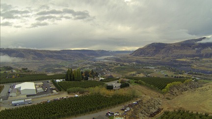
It looked pretty dreary when we left the airport heading southeast on Monday morning.
We left the Columbia River for the first time at the Gorge Amphitheater south of Quincy, WA. (We’d cross the twisting river two more times before leaving the area.) The air was really smooth and I found it difficult to believe that such high winds lay ahead on our planned route. But instead of taking that route, I headed toward Hermiston, which was closer to Pendleton than our original route would have taken us. I could always steer west again if I wanted to get back on that route.
The weather in Pendleton was moving northeast — per radar on my iPad — and it looked as if it might be gone by the time we got to Hermiston. I could check the weather at various points on my iPad as I flew and I did so, trying to decide what to do. But it wasn’t until we crossed over Benton City that I pretty much decided a more eastern route would be better; the winds at Benton City bounced us around in light turbulence that had Jeremy talking about the weather again. If a few bounces like that were bothering him, he’d either be sick or terrified when we hit the moderate turbulence forecast up ahead on our planned route. And although I was unlikely to be either, I still didn’t want a long day flying in turbulence. Been there, done that.
Fortunately, the weather that had been in Pendleton had moved off. I plotted a course for the airport there. We could clearly see rain in various places around us, but there was no lightning and the air was smooth. I talked to the tower at Pendleton and was cleared to cross over the field. The runways looked soaking wet. But what pleased me to no end was that I could clearly see the tops of the Green Mountains to the east. We’d have no trouble climbing them to follow the I-84 corridor.
Yes, IFR = I Follow Roads.
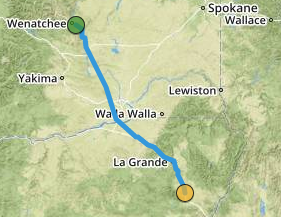
Our first leg was from Wenatchee to Baker City. This is an actual track log from ForeFlight.
The next hour or so was a mix of sun and clouds and even some light rain as I plotted the straightest route I could that kept us within sight of the freeway. I turned the helicopter’s nosecam on and off depending on how nice it looked outside. When we were flying into the sun, the pictures are generally crappy with bad exposures so I didn’t have the camera on much. I had a GoPro 3 Black up there that I could control from my phone. It was set up to record HD video with still images every 10 seconds. With a 64 GB mini SD card and USB power source, it would last the entire length of the trip. The aerial photos throughout this post are from that camera.
Meanwhile, Jeremy was shooting pictures almost nonstop whenever there was something interesting to see. I felt kind of bad that he had to shoot through the plexiglas, which I knew could be very reflective. But taking a door off would be uncomfortable and slow us down. And because we had so much junk in the back, there was no place to store it on the flight anyway. The only good thing is that the occasional rain showers we passed through sometimes cleaned the bugs off the front windows.
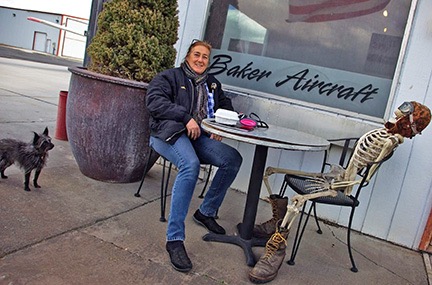
The folks at Baker Aircraft are serious about Halloween decorations. Photo by Jeremy.
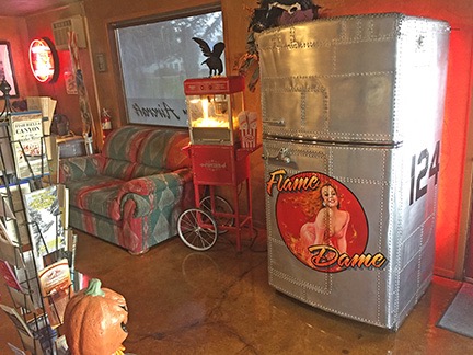
Yes, the fridge at the Baker City FBO is completely covered with airplane panels. How cool is that? I’ll let you fly in to discover what happens when you open the door.
We stopped for fuel at Baker City, OR. (I always stop at Baker City, whether I’m driving or flying.) I parked to one side of the pumps and the fuel guy came out and fueled me up while Jeremy and I made a beeline for the bathrooms. I asked about the courtesy car and they handed over the keys. After paying for fuel, we drove into town for lunch. I always eat at Sumpter Junction, a great little restaurant with a huge model train that passes by the booths at one side of the restaurant and that day was no different. They have a great breakfast all day; I had chicken fried steak and eggs. Back at the FBO, I bought some snacks — Pepperidge Farm Milano Cookies and some almond chocolate biscotti — for the flight.
Leg 2: Baker City to Burley
Before leaving, I texted my friend and former editor Megg, who lives in Salt Lake City, telling her that we might be overnighting in the area and asking if she was available for dinner. I knew Bountiful Skypark from having landed there several years before, and figured we could grab an Uber to a hotel for the night. It’s always good to have a plan, even if the plan changes.
Then it was back in the air, heading southeast through Oregon along the I-84 corridor again. More sun and clouds and light rain. Some snow around us (but not on us). Lots of green. Very few bumps. I was very happy I’d made the route change.
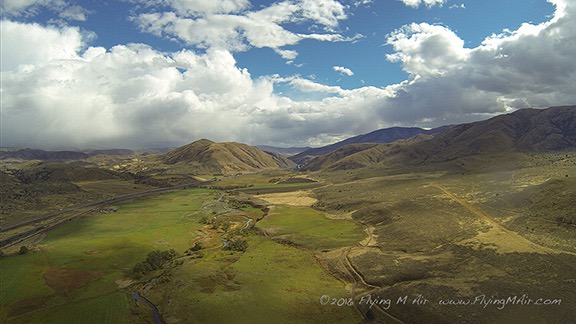
Along the I-84 corridor east of Baker City.
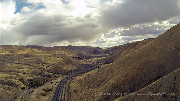
A bit further along the road. The weather was constantly changing but never became an issue for flight.
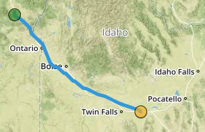
The second leg of our flight, as recorded by ForeFlight.
After about an hour or so, we finally dropped out of the mountains into the flatlands around Boise. We were back in civilization again, with lots of airports to monitor and traffic to see and avoid. (I didn’t have the nosecam running because we were pointing into the sun and the images would have been awful anyway.) I steered us through the Caldwell and Nampa airspaces, making calls along the way, then steered us eastbound, south of the Boise Class B airspace, partly because it was the most direct route, even though it took us away from I-84, and partly because I just didn’t feel like talking to a controller. We monitored the frequency, though, and heard the planes coming and going.
Then it was back out into the mostly flat lava fields east of Boise. The sky had cleared considerably and although there were still isolated rain showers in the area, it was very pretty and pleasant flying weather.
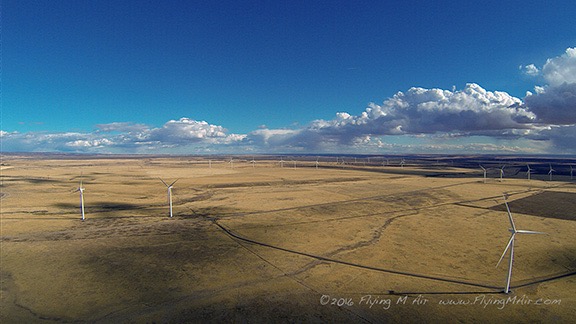
We crossed over a few wind farms, including this one east of Boise. Jeremy got a great picture out the side window as we passed one of them. This is from the nosecam.
We fueled in Burley, ID. It’s another airport I’d stopped at before. I think it was back in 2008 when I was flying from Wenatchee, WA to Page, AZ with my wasband and another pilot. We’d overnighted there in a hotel not far from the airport. This time, we just fueled up as quickly as possible.
Leg 3: Burley to Salt Lake City
Megg had texted back with an invitation for us to spend the night at her house. I was eager to see her new home and spend more time with her so after conferring with Jeremy, I texted back that we’d try to get there before sunset. We were airborne minutes later.
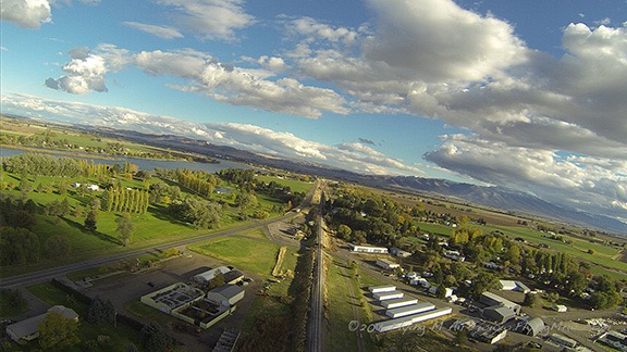
The nosecam picked up this image as we climbed out of the airport at Burley, ID.
By this time, it was nearly 5 PM local time and sunset at Salt Lake would be about 6:30. I did not want to fly in that area in the dark. So I put the pedal to the metal (so to speak) and cut some corners along the way to shave off a few minutes of flight time.
The light was magnificent for photography so I turned on the nosecam and left it on for the remainder of the flight. I picked up more than a few nice images along the way. The air was still smooth and we had a bit of a tailwind that hurried us along. We broke from the freeway corridor when we entered the Salt Lake basin, mostly to shorten up the route and avoid other airports along the way. There was fresh snow on the mountains and parts of the lake that we flew over were smooth enough to reflect the sky.
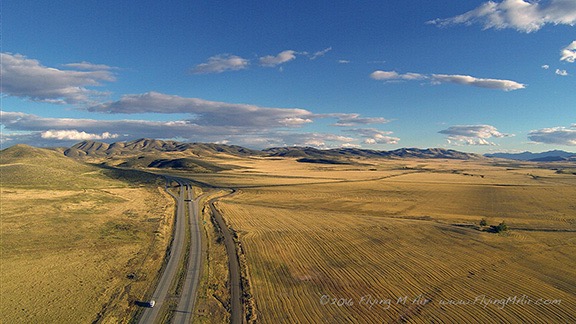
Heading south along on I-84 toward Salt Lake City in late afternoon.
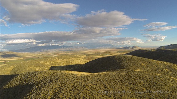
Although I cut some corners to save time, I was never very far from the freeway.
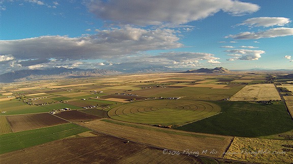
Dropping into the northeast corner of the Salt Lake Basin.
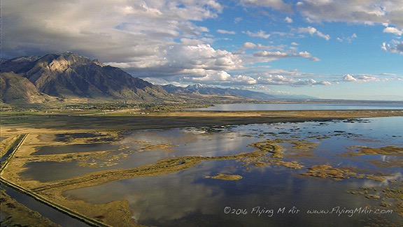
This is my favorite photo of the trip. I am such a sucker for reflections and will actually plan a route over water if it looks like the nosecam might get a few good shots.
I did have to talk to two towers along the way. The first was Ogden, which is north of Salt Lake City. To keep things simple, I asked for a transition along the I-15 freeway. The controller directed me to overfly one of the runways, basically cutting the corner and shortening up my flight path. He then handed me off to Hill Air Force Base tower, where I got clearance to continue my transition along I-15. Easy peasy.
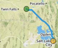
Third leg of our trip, as recorded by ForeFlight.
We made remarkable time to Skypark. I tuned into the frequency, heard another plane in the pattern, and kept clear until I could see him. Although I probably could have darted across the runway to land on the ramp before he turned final, doing so would have had me looking right into the sun, making it difficult to see where I was going. So I joined the pattern in the downwind and followed him in to land.

We landed at Skypark about 20 minutes before sunset. Can you see the plane landing in front of us? He’s about halfway down the runway.
I taxied over to self-serve fuel and topped off the tanks while Jeremy and Penny stretched their legs. I texted Megg to let her know we’d arrived; she said she’d be with us in 30 minutes. Then I fired up the helicopter and repositioned it over to an end parking space near the taxiway, leaving enough space between me and the next tied down aircraft to prevent complaints.
At Salt Lake City
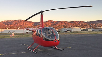
Zero-Mike-Lima, parked at Bountiful Skypark at sunset after a long day of flying.
We unloaded the helicopter and I locked it up for the night, leaving the GoPro on the nose right where it was. We waited for Megg by the main terminal building. The light in the mountains to the east was spectacular.
Megg came and we exchanged hugs. I introduced her to Jeremy. She tried to pet Penny, but Penny danced around as usual. We loaded our luggage into Megg’s car and headed off to pick up her son at Boy Scouts. I could not believe how much he’d grown! He was 13 now — hell, I remember when he was born! — as tall as me, and had ditched the glasses in favor of contact lenses. We all went out to dinner at Cafe Rio. Then it was back to Megg’s wonderful little house, which was originally built in the 1890s and fully modernized. While Jeremy worked with his photos on his laptop and Penny dodged and teased Megg’s three big dogs, Megg and I chatted about things going on with both of us. It was really great to see her and I urged her to stop by my place for a day or two on her way to the Seattle area for a visit with her dad in July.
Then, with Megg needing a very early start in the morning for a meeting and me feeling pretty tired from a long day at the controls, we split up and hit the sack. I was asleep as soon as my head hit the pillows.

 I left Wenatchee Heights with my 5th wheel RV hooked up behind my husband’s Chevy pickup. The first day’s drive was relatively short: from Wenatchee Heights to Walla Walla, a distance of only 190 miles. Only a small portion of the drive was on a freeway (I-90); the rest was on back roads through farmland.
 In Walla Walla, I stayed at the
  On Friday night, I got the trailer hooked up again and mostly ready to go. I needed to be on the road early for the next leg of my trip: from Walla Walla, WA to Draper, UT (south of Salt Lake City), a distance of 606 miles. I was on the road not long after dawn. The route took me south almost to Pendleton, OR, then onto I-84 through Oregon and Idaho and down into Utah, where I picked up I-15. The landscape started with farmland, then mountains, then more flat farmland, then more mountains, and then finally into the Salt Lake basin. I’d driven the route before with my underpowered Ford F150 pickup towing my old 22-foot Starcraft. It wasn’t fun then; Saturday’s drive was much more tolerable. I stopped three times for fuel and twice for food. It was very unlike me to make so many stops; I usually try to get food and fuel on the same stop, but the situation made that tough. I rolled into Draper, UT’s Camping World parking lot at 6:15 PM local time, just 15 minutes after the store closed. I’d called the week before and knew I could park out back, so I did. I even got to hook up 50 amp power.
 On Sunday, @AnnTorrence picked me up for a drive to Ft. Bridger, WY. There was a
 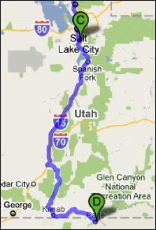 Monday — Labor Day — was my last drive day. I drove from Draper, UT to Page, AZ, a distance of 370 miles. I got a very early start, pulling out of the parking lot at 6:30 AM local time. By the time I stopped for fuel two hours later, I’d already gone more than 100 miles. (I parked with the big rig trucks and discovered that my rig was about as long as theirs.) This part of the drive was mostly on I-15, but started east on route 20 to Highway 89, which took us all the way to Page. The roads were mountainous and there was a lot of climbing and descending. There were also a lot more vehicles on the road, making driving a bit more of a chore.
 The only food stop I made along the way was at the Thunderbird Restaurant at Mount Carmel Junction. The place is a bit of a tourist trap, but it does have good “ho-made” pies (whatever that means). Odd thing happened when I tried to leave. They couldn’t give me a bill because the computer was down. Apparently no one knows how to do basic math. All I had was a piece of pie with ice cream and an iced tea. They apparently expected me to wait until the computers came back online. With Alex the Bird in the front seat of the car, that was not an option. Finally, my waitress disappeared into the kitchen where she may have used her “lifeline” to get help with this difficult math problem. The verdict was $7.79. I was afraid to count my change.
 My husband, who’d flown up in his plane and spent a few hours swimming in the lake, met me at the lodge restaurant for lunch. Afterwards, we put fuel in the truck and parked it (temporarily) at Page Municipal Airport. I gathered my belongings — forgetting only two things, one of which was vital — and we loaded into Mike’s plane. Then we started the long (90 minutes), hot (90°F+), and bumpy (I almost got sick) flight to Wickenburg. The only sights of interest along the way — keeping in mind that I make that flight about 1000 feet lower at least a dozen times a year — were a handful of forest fires east of our Howard Mesa place and a heavy rain shower coming out of a remarkably small cloud near Granite Mountain.


 I spent the morning cleaning out my hangar at Quincy for departure the next day. Then I flew up to Chelan and met my friend Jim. He flew us in his helicopter to Spokane, ID for lunch and then on to Coeur D’Alene, ID where he’s based. He demonstrated a confined space landing by setting down in the parking area of his business property in downtown Coeur D’Alene to offload a bunch of stuff. Then we went to the local airport, fueled up, and picked up his wife for the return flight to Chelan. I got some great photos of
  My destination was Walla Walla, WA, about 150-200 miles away. I chose a route that kept me on back roads. I don’t think I ever saw so much wheat in my life. My chosen route took me past
  But we headed out to the Snowbird ski resort area, where we took a hike in Albion Basin. The area had been recommended by photographer and
  I pulled out of the RV park at 6 AM sharp and continued south on I-15 to SR 20 to