More bull from our lawmakers.
This country — especially this part of this country (the American Southwest) has an abundance of public land. It comes in the form of state parks and forests, state trust land, national forests, BLM (Bureau of Land Management) land, and National Parks. It’s basically safe to say that if the land isn’t owned by a specific person or indian tribe, it falls into one of these categories of public land.
Public land belongs to the public. That’s you and me. Or at least every American citizen. But don’t think that you can use public land the same way you use your backyard. There are rules. And some of the rules are not only very restrictive but they’re downright stupid.
The main thing the government seems to be worried about is that someone will make money on public land without the government getting a piece of the pie. With state and national parks, that’s pretty understandable. These are normally above-average pieces of land that are heavily managed and have a great deal of costs associated with them. If a person or company is going to make money using these lands, they probably should pay a portion of the costs.
They way they collect these costs is through a permit system. You apply for a permit, sending all the required paperwork to the proper office with a non-refundable application fee. Then you wait. And wait. And wait. Eventually, after enough follow-up calls, you get a request for more info. You provide and and wait some more. Then, maybe if you’re lucky and the stars are aligned just right, you get a call telling you you’re going to be approved and how much each operation will cost you. You wait some more until the final paperwork — the permit you wanted — is sent to you. Now you’re good to go.
 I went through this for a permit to take passengers in my helicopter to the Swansea Town Site. It’s a ghost town in western Arizona, that’s pretty close to the middle of nowhere. A 4-hour drive from Wickenburg, you can get there in 40 minutes by helicopter. While I can land there all I want by myself or with people who aren’t paying me, as soon as I collect a penny from a passenger, it becomes a commercial flight and I need a permit. I coughed up the $90 application fee and waited 18 months to get the permit. I have to pay 3% (I think) of the gross revenues for these trips with a minimum of $90 per year. Of course, I got the permit right before my season ended, when it started getting too hot for desert day trips. So although I’ve had the permit for more than 6 months now, I haven’t taken a single passenger.
What bothered me most about the whole process is that they said they needed to do an environmental impact study before they could give me the permit. If I paid for the study, the process would go faster. This pissed me off because the site is a common destination for people on quads with gnarly tires that eat up the terrain. My helicopter touches the ground in only two places on each visit: two eight-foot by 3-inch strips under my skids. Environmental impact? What environmental impact? I didn’t pay for the study and waited 18 months.
Now I have a new gripe. It concerns taking photos on National Forest land.
I’m in the process of putting together a promotional DVD for Flying M Air to advertise its Southwest Circle Helicopter Adventure. I’m going out with a professional photographer next week to trace the steps of our passengers on all of their tours. We’ll take photos along the way to use in promotional material or for the photographer to sell as stock photography.
The problem began in Sedona. The Jeep tour company (which will main nameless) told me we couldn’t take pictures for commercial use while on National Forest land. The man I spoke to was rather insistent and told me that if we did, his company could lose its permit. He was willing to give (or possibly sell?) me some stock footage. But I wasn’t interested in that. I wanted to show potential passengers exactly what they would see then they took the tour.
So I called up the National Forest ranger district office. Of course, they were unable to connect me to anyone who knew what I needed to know. They were all out in the field doing what it is that rangers do when they’re not in the office. The last person I spoke to was married to the person I needed to speak to. He assured me that she’d call me back and let me know if I needed a permit.
In the meantime, I got on the Web and did some research. I wound up downloading a 22-page PDF from the Federal Register that covered the government’s policy on photography in National Forests. And what I learned that you can take still photos in national forest land without a permit as long as the job does not:
- Use models, sets or props that are not part of the site’s natural or cultural resources or administrative facilities;
- Take place where members of the public are generally not allowed; or
- Take place at a location where additional administrative costs are likely.
Well our photography shoot met these requirements, so we are indeed allowed to take photos on national forest land. We just can’t take any photos of the Jeep or driver or either one of us (props and models) once we cross over into national forest land. So we’ll stop the Jeep just before we get into the land and take the photo there.
Take a picture of the Jeep here, you’re breaking the rules. Take the picture 12 feet to the west and you’re fine.
Does that sound as stupid to you as it does to me?
I canceled my Jeep tour with that company and booked with another company. I like to work with people who know what they’re talking about. And I don’t like people who insist on rules without really knowing what the rules are.
Now oddly enough, the rules governing video or film photography (moving images) are different. From the document:
A permit is required for all commercial filming activities on public lands. Commercial filming is defined as the use of motion picture, videotaping, sound recording, or other moving image or audio recording equipment on public lands that involves the advertisement of a product or service, the creation of a product for sale, or the use of actors, models, sets, or props, but not including activities associated with broadcasts for news programs. For purposes of this definition, creation of a product for sale includes a film, videotape, television broadcast, or documentary of participants in commercial sporting or recreation event created for the purpose of generating income.
Well, although I am not creating a product for sale, I am creating a product to advertise my service. Thus, I’d need a permit to videotape on public land.
This is not a major setback, although I admit that it is (1) a disappointment and (2) just plain stupid. You can take photos of the land, but you can’t take videos? What the hell is the difference?
So for my DVD, I’ll create moving images from the still images using the “Ken Burns Effect” built into iMovie HD. Since the rocks and trees don’t really move anyway, there really won’t be a difference between simulated motion (by panning a still image) and moving a video camera to pan over the terrain.
Which makes me say again, what the hell is the difference?
The rules actually make my job easier. Working with video is a pain.
And since they don’t have any rules about photographing public land from an aircraft — at least I couldn’t find any — we can still take photos and videos as we fly over or past stuff that’s scenic enough to photograph.
Of course things got weirder when dealing with the Navajo Nation for photography in Monument Valley. This was an ordeal. But I can understand it better. The Navajo Nation is a nation — a separate country within our country. They own the land. I am a foreigner passing through. They have the right to make the rules over the land. I don’t own any part of it and my tax dollars don’t pay to maintain it. So I can understand them wanting to get as much money as they can from anyone they can get it from.
 I had to work with the Navajo Nation Film Commission. I had to write a letter and fill out forms. I had to answer questions over the phone. I was told that I’d have to get permits from them and from the Monument Valley Tribal Park people. And the cost of the Film Commission’s permit was simply over my budget. I told the person who gave me this bad news that we’d just cancel our trip to Monument Valley. Canceling would save me about $2,000, including the cost of the permit, lodging, meals, and transportation costs for the overnight stay and half-day photo shoot. She told me she’d talk to her boss again. When she called back, the price had gone down, but we weren’t allowed to use the photos for stock photography. Sheesh. I wrote a check, faxed a copy of it to prove that it existed, and mailed it later in the day.
What’s weird about all this is that I can include the photo shown here in my blog — see? — but not on my Flying M Air Web site or brochure. More people are likely to see it here — after all, this site gets way more hits than Flying M Air’s site — but because this picture is not for sale and not trying to sell anything, I don’t need a permit to take it or show it.
Go figure, huh.
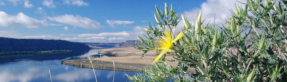
 This photo was taken at Lees Ferry, which was once the site of a ferry service to cross the Colorado River. Before Navajo Bridge was built to cross the river at Marble Canyon nearby, this was the only river crossing for hundreds of miles in either direction. (The new Navajo Bridge is one of only two crossings for hundreds of miles; to the southwest, the next crossing is at the Hoover Dam, hundreds of miles downstream, on the other side of the Grand Canyon.) Situated several miles downstream from the Glen Canyon Dam, the site is a popular starting point for river runners on trips down the Colorado.
 Rick took the photo you see here as I was flying into Phoenix yesterday at around noon. As helicopters enter the Phoenix Class B airspace, they’re instructed to stay below 2,000 feet (Sky Harbor is at around 1,200 feet, I believe) and normally approach the airport by flying down the west side of Central Avenue. That’s what you see here out the front windows. The red thing on the left (that’s reflecting on my window) is one of the back doors. We took a door off each day so Rick could take glare-free videos and photos. This photo will probably be the opening shot of the first video podcast I put together.
 I went through this for a permit to take passengers in my helicopter to the Swansea Town Site. It’s a ghost town in western Arizona, that’s pretty close to the middle of nowhere. A 4-hour drive from Wickenburg, you can get there in 40 minutes by helicopter. While I can land there all I want by myself or with people who aren’t paying me, as soon as I collect a penny from a passenger, it becomes a commercial flight and I need a permit. I coughed up the $90 application fee and waited 18 months to get the permit. I have to pay 3% (I think) of the gross revenues for these trips with a minimum of $90 per year. Of course, I got the permit right before my season ended, when it started getting too hot for desert day trips. So although I’ve had the permit for more than 6 months now, I haven’t taken a single passenger.
 I had to work with the Navajo Nation Film Commission. I had to write a letter and fill out forms. I had to answer questions over the phone. I was told that I’d have to get permits from them and from the Monument Valley Tribal Park people. And the cost of the Film Commission’s permit was simply over my budget. I told the person who gave me this bad news that we’d just cancel our trip to Monument Valley. Canceling would save me about $2,000, including the cost of the permit, lodging, meals, and transportation costs for the overnight stay and half-day photo shoot. She told me she’d talk to her boss again. When she called back, the price had gone down, but we weren’t allowed to use the photos for stock photography. Sheesh. I wrote a check, faxed a copy of it to prove that it existed, and mailed it later in the day.
 Our hotel was on the beach, with a private patio overlooking the ocean. It was very pleasant. I took this photo just after sunset one evening.