Archiving a Life

Deleting photos is the first step.

I don’t know why I waited this long. Perhaps it’s because I thought some small part of a 29-year relationship could be salvaged. But the venomous hatred with which my wasband has attacked me emotionally and legally over the past two plus years has made it pretty obvious that he has no intention of salvaging anything from our lives together.

Not that I’m the least bit interested in that anymore either.

I’ve moved forward to the best of my ability. I’ve built a new life in a new place with new friends and a new home. I have new hobbies and interests and the freedom to explore them as I see fit. It feels good to finally have a positive outlook on my life, one without a risk-adverse “partner” who apparently liked living the same dreary existence every day.

While I brought along many of my possessions from that past life, most of them remain packed (so far) and I’m hoping that time cleanses them of memories associated with the man I often shared them with. I think there’s a pretty good chance of that. After all, my wasband occasionally accompanied me on trips in my helicopter and I know he drove my Honda, even as he searched for my replacement while I was away. (Leaving a dated park receipt in the cup holder was the tipoff there.) Yet those two possessions aren’t tainted by memories of his presence. Maybe it’s because I had so many more good times in these two vehicles without him.

A Lost Man
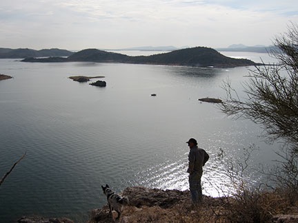
My wasband and our dog Jack on a Jeep outing in 2010 at Lake Pleasant. Despite the numerous back road trips we made in my Jeep, it (fortunately) triggers no memories of him.

But what will never be cleansed are the photos — hundreds of photos — where he appears. They were taken at various times throughout our lives together. Sometimes he’s smiling at the camera, sometimes he’s making a face. Sometimes he doesn’t even know he’s being photographed — a candid image that reveals some of the deep thoughtfulness of the man he was. It’s those older photos that are the hardest to look at. They remind me of the man he once was, the man I fell in love with, the man who no longer exists.

The photos are in my iPhoto gallery, copied there over the years from digital cameras and cell phones. Some were scanned in from prints when I first returned home from Washington in 2012 to pack up my life. Back then, I wanted to remember him, I wanted something to cling to. But things are different now. Now I just want to forget.

Boating
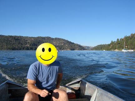
I snapped this during a weekend trip to Big Bear in 2006. He used this photo on Chemistry.com when he started shopping for my replacement just seven days after I left for my summer work in Washington state. How do I know he used this photo? He showed up as a match for me 6 months later. Ah, the irony.

Opening up iPhoto to track down another image has become a nasty, jarring experience for me. Seeing his face, often in places where we shared good times together, is like a cold slap. Memories are triggered, sadness and feelings of loss and betrayal stab hard. For a long time, I avoided opening iPhoto, much as someone might avoid going into the bedroom of a recently deceased loved one. But that’s not a long-term solution for someone who wants to move on.

So every few days, I dive into my iPhoto gallery. I drag the photos of him from the window into a folder on my computer desktop. And then I delete the photo from iPhoto so I never have to accidentally see it again.

I can’t do them all at once. Sometimes, the task is heart breaking. I don’t want to cry anymore.

My few wedding photos were especially painful to see again, not because of the love I lost but because they represented how the man I loved had conned me into a legal connection that he’d later use to try to steal everything I’d worked so hard to build.

I’m trying to think of it as a clean-up task. As if I’ve dropped a tin full of thumbtacks and they’ve worked their way into the cracks and crevices of my living room furniture. I don’t know how many there are, but I don’t want to be surprised by finding one. So every few days, I go hunting and pull them out and put them in their tin. When I think I’ve got them all, I’ll put the tin away in a safe place where I’m not likely to open it by accident.

But I’m not permanently deleting the photos. I’m archiving them. Once they’re all sorted away into that folder, I’ll copy the folder to a CD or DVD and put that in my Divorce box — the box full of court documents and evidentiary files that I’ll have to keep for who knows how long. That’s also where I’ll put the financial records related to the last home we lived in together. And the few loving cards and notes that he sent me over the years that I kept. Then I’ll delete that folder of photos from my hard disk so I won’t even have to think of it.

I don’t know why I waited this long. I suppose I thought I’d do it when the ordeal of our divorce was over. But after 28 months, it’s still not over. He won’t let go.

How long is a person supposed to wait before cleaning up the detritus of a wrong turn in life? I think this is long enough.

My Lopez Island Vacation

A quick recap, with photos.

It’s hard to believe it’s already been a full month since Penny and I got back from our week-long vacation to a friend’s home on Lopez Island. Time seems to zoom by these days.

I thought I’d take a moment to document the trip, mostly to help me remember it in the years to come. It was a great vacation — laid back but with enough activities to not only keep me entertained but to prevent me from gaining a pound despite all the wine and cheese I consumed with my friend.

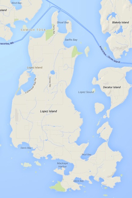
Lopez Island

Lopez Island
Lopez Island is one of the San Juan Islands in the northwest corner of Washington state.

Steve and I had gone wine tasting in Napa Valley, CA in March and Woodinville, WA in May. It was at dinner after four Woodinville wineries that he’d invited me to stay at his Lopez Island place in August. That’s when my responsibilities for cherry season were finished and he would be taking his vacation. It was too good an offer to pass up.

Lopez Island is one of the San Juan Islands in the northwest corner of Washington State. It’s less than 30 square miles in size with a population of fewer than 3000 people.

Lopez Island can only be reached two ways: by boat or air — there’s no bridge. Ferry service is available from the mainland at Anacortes with stops at other San Juan Island ports such as Friday Harbor and Shaw Island. According to Google Maps, the 200-mile trip from my home would take just over five hours — assuming I reached the ferry terminal in time to drive right onto the ferry. Six hours is probably more accurate.

Needless to say, I wasn’t very excited about the prospect of driving there. So I treated myself to a helicopter flight. That was only about 90 minutes.

The Trip Out

Of course, before Penny and I departed that Saturday we had things to do. I put two racks of baby back ribs on the smoker at 9 AM and spent much of the day packing and running errands. I wanted to bring some goodies from Wenatchee, including Quincy corn, two kinds of fresh-baked bread, and buckboard bacon from Pybus Market’s Saturday Farmer’s Market, as well as fresh blueberries that still needed picking at a friend’s house. The ribs would pair perfectly with some “Singed Cat” Cab Franc wine from Malaga Springs Winery just down the street from my home. The wine was sort of smoke infused due to the smoke from wildfires in the area back in September 2012 when the grapes were picked. I packed two bottles of that, along with another four bottles of local wine for sharing with my host. I also had five different cheeses that I’d picked up from Beecher’s in Seattle on my way home from Phoenix earlier in the week. I never go to anyone’s home empty handed, but I think I took things to extremes on this trip.

By 1 PM, I’d loaded my big cooler with veggies from my garden and all the other perishables that I’d bought or picked. The wine had its own cooler. Both of these went into the back of the helicopter. My luggage went on the other back seat with my camera bag on the floor. I laid the ribs, wrapped in thick foil, on the floor beneath the coolers. I put Penny’s bed on the front passenger seat, but after a moment sitting there in the sun while I ran up the engine, she wanted to sit in back. The only place to put her bed was on top of the cooler, which was about level with my head. She seemed comfortable enough there. I lifted off around 1:15 PM. After a quick stop at Pangborn Airport to top off both fuel tanks, I pointed the helicopter northwest.

Leaving Wenatchee
It was a beautiful day in Wenatchee, warm with scattered clouds that seemed to thicken to the west.

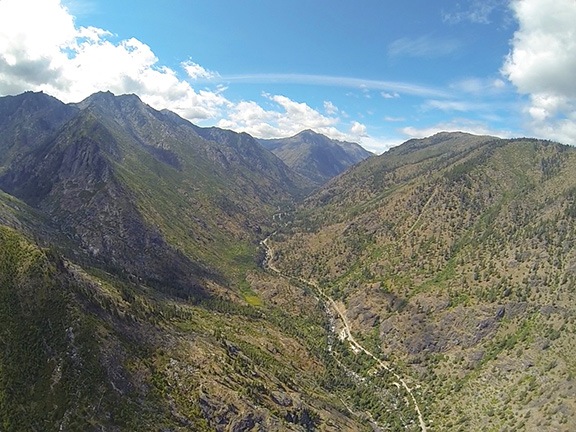
The flight was mostly uneventful. I tried to keep my route as straight as possible, but there were TFRs (temporary flight restrictions) in the area due to the wildfires we’d been having. One of them was in my path just west of Leavenworth. I kept south of it, flying up Icicle Creek and hugging the base of Cashmere Mountain so as not to stray into it. It was an extremely pleasant flight, cradled at the base of the mountains over the creek, to the end of the paved and then dirt road and beyond.

Icicle Creek
A flight up Icicle Creek.

The farther up the creek I got, the thicker the clouds ahead of me got. The higher I climbed up the drainage, the closer I got to all those thick clouds. I dropped down closer and closer to the trees to stay under the clouds. I slowed down as the path ahead began to look more and more iffy.

A quick look at my location on a sectional chart in Foreflight told me I was just south of Stevens Pass, the highest point on my trip west. If I could just get over the pass, I would probably be okay. Probably.

I started getting hopeful at 35 seconds into this GoPro nosecam clip from my flight. If you listen closely to the audio, you’ll hear the blade flap when I slowed way down before crossing over the ridge.

Finally, I was within about 50 feet of the Ponderosa pine trees, moving ahead cautiously at about 60 knots. Wisps of clouds were tangled in the treetops on either side of me. I looked ahead anxiously at the gap I’d have to pass through. All I saw were clouds — at first. Then an opening with trees beyond it. Could I get through?

I could, but barely. I squeezed through the pass under the low clouds and wound my way between clouds at my elevation, descending over Route 2 just west of Stevens Pass.

Whew.

The rest of the trip was under overcast skies. I beelined it for the coast, flying over Arlington Airport along the way. I detoured north around the surface airspace for Whidbey Island NAS, not really interested in talking to the tower there. That’s when I started noticing a light fog over the water up ahead. Dang!

Fog Over Puget
Fog drifted about 50 feet over the surface of the water west of Anacortes.

I called my host to see what conditions were like at his home. It went right to voicemail. I left a message and pointed the helicopter across the Rosario Strait. The fog below me was light — I could see an occasional boat down there — but I wasn’t sure what lay ahead.

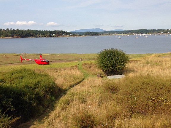
I was over Decatur Island when Steve called back. It was clear, he reported. By that time, I’d gotten the feeling it would be. The fog seemed localized between Decatur Island and Anacortes. I told him I was five minutes out. Five minutes later, I flew over Fisherman’s Bay on Lopez Island. I scanned the shoreline and saw Steve and his sister waving. I circled around and came in for a landing, touching down lightly on the sea grass between the shore and his home.

Sure beats driving.

A Week of Fun and Relaxation

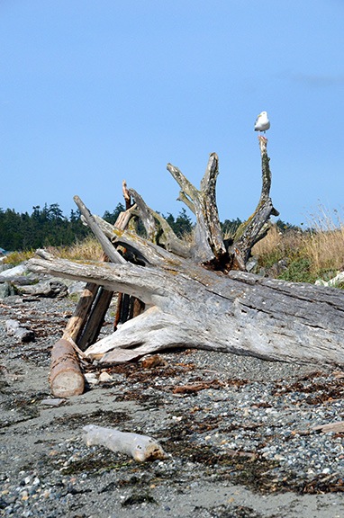
Seagull on Log
The rocky beach was full of driftwood logs that made perfect perches for seagulls.

Steve greeted me with a hug and introduced me to his sister, Kathi. Then we offloaded the helicopter and brought everything up to the house. (The ribs were still warm.) I brought my luggage up to the guest room and then set up an area in the corner of the kitchen for Penny’s food and water. Then we unloaded my groceries and stowed everything in his already packed refrigerator.

After we were settled in, Steve, Penny, and I went for a walk to the beach and walked the length of the causeway that separates Fisherman’s Bay from Griffin Bay and San Juan Island beyond it. Penny ran ahead of us, sniffing at the kelp washed up on shore and chasing seagulls and killdeer.

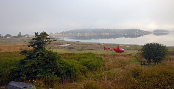
Helicopter at Lopez Island
I shot this photo of Steve’s back yard from the guest room balcony not long after arriving. I had to admit that my helicopter looked even better in Steve’s backyard than it does in my front yard.

Later, we sat on an upstairs deck to munch on wine and cheese and watch the sun set. Then we came downstairs and fixed up a dinner of Quincy corn on the cob, sliced cucumbers from my garden, sea asparagus Steve had harvested from his yard, and smoked ribs from my Traeger, finished off with some homemade barbecue sauce on Steve’s grill. Steve and Kathi seemed to like the Singed Cat as much as I did — the three of us polished off both bottles. We talked until well after dark and turned in for the night.

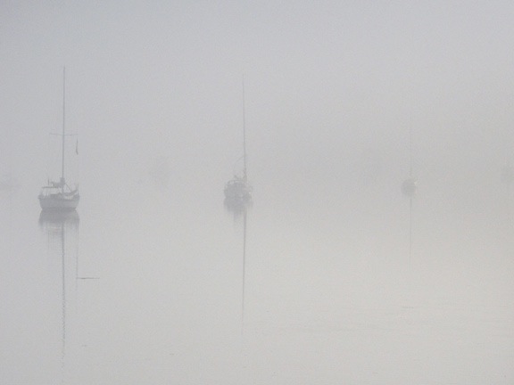
More Fog
In the morning the bay was shrouded in a thick fog that took some time to lift.

After breakfast, Steve, Penny, and I headed out on Steve’s little boat to drop the crab traps. We both had fishing licenses that allowed us to catch dungeness crabs and wanted to get the traps in the water as quickly as possible because they needed to be pulled on Monday per fishing rules.

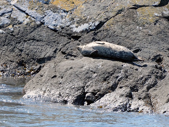
Later in the day, we headed out to Shark Reef, with a great hiking trail that wound through woods before emerging at the shore where giant elephant seals sunned themselves on the rocks and bull kelp floated on the water.

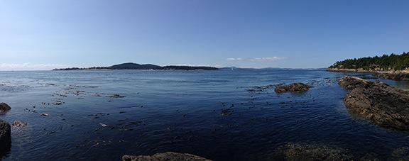
Shark Reef
Panoramic view of the poorly named Shark Reef, which has elephant seals instead of sharks.

Elephant Seal
Does this look like a shark to you?

We spent a lot of time just talking and walking and taking photos. Steve is into photography even more than I am and I enjoyed seeing his 6’4″ frame folded up to get a closeup shot of a flower or interesting rock. It’s refreshing to go on a photo walk with someone who understands the importance of light in photography; we did almost all of our photo walks late in the afternoon when the sun was low in the horizon, casting a golden light.

For dinner back at the house, we had salmon that Steve marinated and then grilled. More wine, this time some Chardonay from Steve’s collection.

Sunrise
Sunrise varied from one day to the next; this one, shot from my window on Monday morning, was especially colorful.

Monday morning’s activity included a drive out to Fisherman Bay Spit Preserve at the entrance to Fisherman Bay. That’s where I got my introduction to sea glass — broken glass pieces that have been ground down by the sand and motion of the water. I eagerly joined in the hunt, although I only seemed able to find very small pieces of the stuff while Steve managed to find lots of large ones.

We also visited the local transfer station and a spot the locals call Neil’s Mall — a place where people leave possessions they no longer want and take possessions others have left behind. Steve was looking for a new coffee maker or a carafe for the one he’d broken on the coffee maker he had. Neil’s had both. We wound up taking a gently used Braun drip coffee maker that seemed to have all the parts. Later, we cleaned it up, set the clock, and even programmed it for the next morning’s coffee.

Kathi left around midday and Steve, Penny, and I went out in the boat again to try some salmon fishing. Steve piloted the boat up the bay and out the mouth of it, then back down the shoreline to a point not far (as the crow flies, anyway) from his house. We tried various places, spending a total of about 2 hours without any luck at all.

Crabs for Dinner
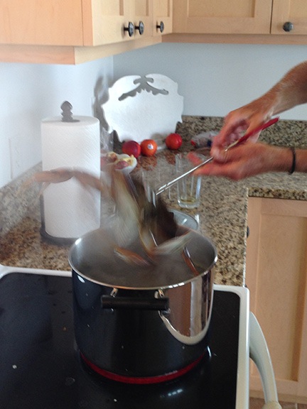
We caught three good-sized dungeness crabs on Monday and enjoyed them for dinner that night.

On the way back, however, we stopped to pull in the crab traps we’d set the day before and were rewarded with three keepers. Guess what we had for dinner that evening with the champagne I’d brought along to go with a shellfish dinner?

Kathi’s husband John arrived that evening, too. He’d be with us for the rest of the week, attending a golf tournament on the island and doing work with his computer when he wasn’t out golfing.

I think it was Monday night that Steve and I ventured out onto the back lawn after nightfall for some star photography. I’d come without a tripod, but Steve had his. He said he didn’t have much experience doing star photography, but he certainly had a good helping of beginner’s luck — almost every one of his shots included an amazing star field.

After breakfast on Tuesday, we headed out in the helicopter for pie. A friend of mine had told me that the best airport pie could be found at Port Townsend Airport. Although Steve had been flying with me before — I’d taken him and his sister Kriss on an aerial tour of Napa Valley back in March — neither he nor I had been flying around the San Juan Islands. Airport pie seemed like a pretty good excuse to get airborne.

I pulled both front doors off the helicopter for airflow and so Steve could use his camera without worrying about window reflections in his shots. I loaded Penny in the back seat on her bed. Then we took off from Steve’s backyard.

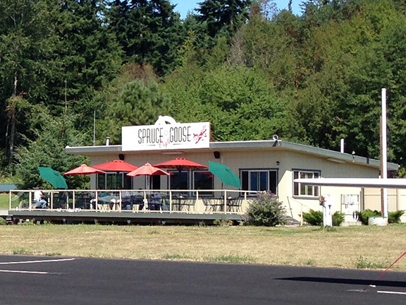
We flew east over Decatur Island and Anacortes, then followed the shoreline of the mainland south before crossing Skagit Bay to the east side of Whidbey Island. We flew just south of Oak Harbor and over San de Fuca, then crossed the bay to Port Townsend. The airport was south of town. We landed at the end of the parking area and walked to the Spruce Goose restaurant.

Spruce Goose Restaurant
The Spruce Goose does indeed have the best pie at any airport I’ve ever been to.

Although the restaurant had an outdoor eating area, Penny wasn’t allowed to sit with us there. So I tied her up nearby while Steve and I sat down for some pie. I had rhubarb (my favorite) with a glass of milk. I honestly can’t remember what Steve had. But I do remember that both were excellent.

After our pie, we fetched Penny and walked around the airport ramp area, looking at the planes. I told Steve what I knew about each model we saw — which wasn’t much. Steve isn’t a pilot but was interested in the planes. Actually, like me, he seems to be interested in most everything.

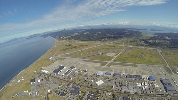
When we left, I decided on a more direct route back. Not the direct route — that would have had us flying over water for about 15 miles — but a route that took us up the west coast of Whidbey Island, past the navy airbase. That meant talking to the tower. I was pleasantly surprised when they cleared us to fly per my request. (I think Steve was impressed.) Later, as we neared the airbase, they amended our instructions to fly at 1500 feet over the field. As we did, we watched two F18s (in formation) and an air tanker take off below us. Very cool.

Whidbey Island
Overflying the airbase at Whidbey Island.

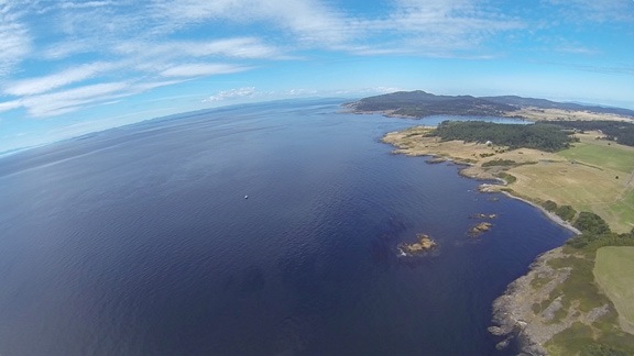
We crossed the Strait of Juan de Fuca for the southeast corner of Lopez Island. But rather than go in for landing, we continued west to the west coast of San Juan Island. That’s where the orcas travel and we were interested in seeing them from the air. We flew up the coast and saw plenty of boats on the water and tourists at Lime Kiln Point State Park, a primary orca viewing area. But no whales.

San Juan West
The west coast of San Juan Island. I was about 10 miles from Canada here.

Low on fuel, I headed over to Friday Harbor Airport. I landed near the pumps and topped off the main tank; I knew I’d get more fuel in Bellingham or Arlington on the way home later in the week. Again, we decided to take a quick flight along the coast to look for whales. This time, we scored. There was an orca pod of at least six whales traveling south along the coast. Steve took a few pictures, but I didn’t dare fly any lower than the 500 feet I was at — the area was full of boats and spectators. I didn’t want to be blamed for “scaring off” the whales. We went past and I cruised away from the scene to give Steve time to change his lens. But when we returned, the whales were gone and the spectator boats were breaking up and going their separate ways. The show was over. We headed back to Steve’s place on Fisherman’s Bay.

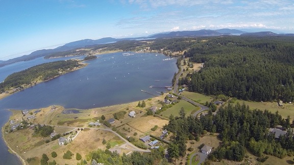
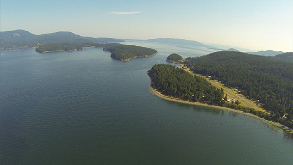
Fisherman's Bay
Fisherman’s Bay from the air.

Later that day we headed out for yet another seashore hike. This time, we went to Iceberg Point on the southern tip of the island. (No, there weren’t any icebergs, either.) After a pleasant mile or so walk through cool forest, we emerged on a rocky, grassy point overlooking the mouth of Puget Sound and Strait of Juan de Fuca. It was clear and I was able to point out the Whidbey Island air base, mostly because its tower made a good landmark. We spent some time walking on pathways that wound among the rocks. Steve showed me some cacti that grew there — yes, cacti do grow in the Pacific Northwest. At first, I thought they were some form of cholla, which we have in Arizona, but they’re apparently brittle prickly pear, which is likely the same variety my neighbor gave me last year to plant in my garden. I realize now that I didn’t even take a picture of them, although I do have a picture of Steve taking a picture of them. (Don’t worry, Steve, I won’t share it here!)

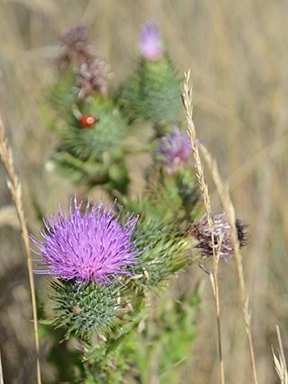
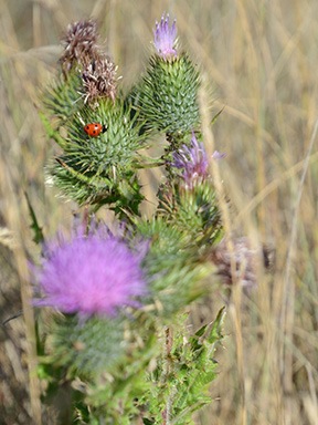
Thistle Ladybug
I played around a bit with depth of field and focus on my Nikon with this view of a thistle and ladybug.

We spent hours there, walking, talking, exploring, taking photos. After a while, we found a quiet spot sheltered from the wind and just stretched out on the grass among the late summer wildflowers, listening to the sound of the waves on the shore and the gulls that flew by. Penny stretched out nearby in the tiny shade cast by my camera bag. It was nice to be unplugged and to go back to the basics of a more simple time. I thought about the countless trips I’d made to the shore on the east coast, alone or with a companion, and how I’d just soak in the scenery and the world around me. What happened to those times? It was good to get a chance to remember them, especially with a companion who seemed to feel the way I did about the experience.

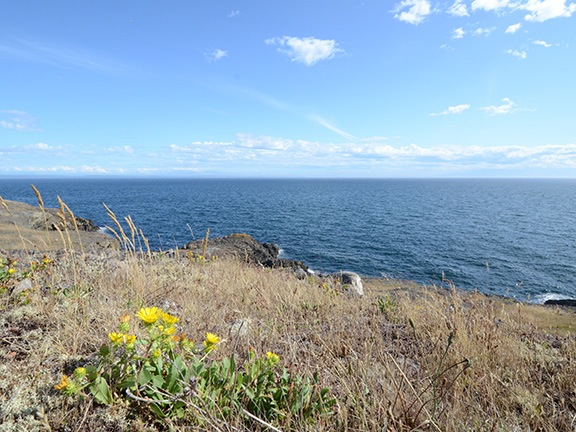
Iceberg Point View
At one point, I sat up to take this photo of the view from where we lounged just listening to the sound of the waves and the birds.

The sun got ever closer to the horizon. When the temperature started to drop, we headed back out.

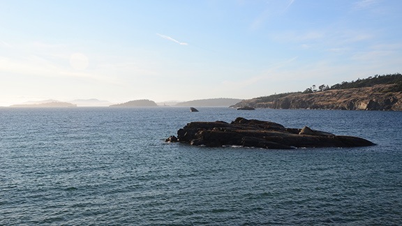
Near Iceberg Point
Here’s a look at Outer Bay on the walk back to where the car was parked t Agate Beach County Park.

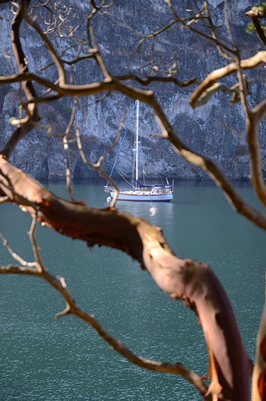
Watmough Bay
A sailboat spied through the trees along the trail at Watmough Bay.

On Wednesday morning, after a search and rescue for Steve’s boat — I hadn’t tied it quite securely enough on Monday afternoon and the wind and tide took it for a short cruise without us — we did some work around Steve’s house, helping John set up some badly needed storage shelves in the garage.

Afterwards, we took another hike, this time along the south side of Watmough Bay, a sheltered cove surrounded by tall cliffs that’s apparently popular with sailors — there were three sailboats anchored there. The trail wound through thick, lush forest that offered glimpses of the bay beneath us as we climbed. Soon, the trail dropped us down into a tiny gravel beach where we spent some time looking for sea glass. Penny wandered off and found something super stinky to roll in. We hiked back to the head of the cove and walked along the beach there for a while.

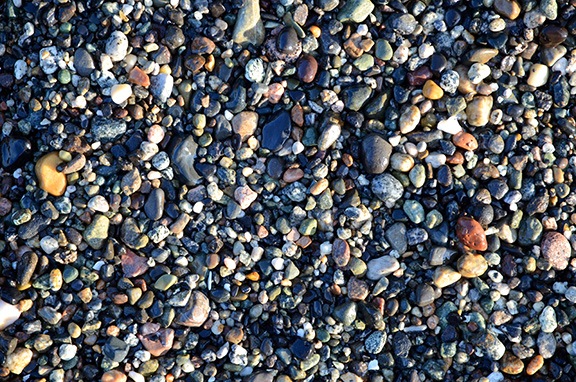
Pebbles
It’s not easy to find sea glass when the beach is full of pebbles like this.

Back at the car, I had to wrap Penny in a tablecloth that Steve happened to have to prevent her from stinking up his car. A bath for her outside with the hose was the first order of business when we got back to Steve’s house.

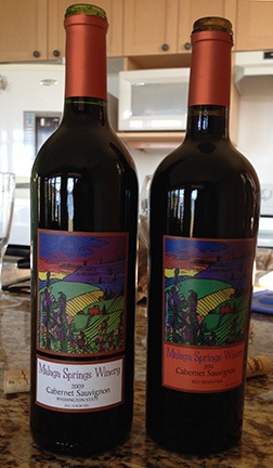
Cabernet Sauvignon
I brought along these two Cabs specifically for a taste test.

That evening, we did a side-by-side taste test with the two Malaga Springs cabernets I’d brought along. They both went very well with the steak Steve grilled up for us. I think we both preferred the 2009 over the 2011, although Steve’s blend of the two was probably best of all.

On Thursday, we spent some time setting up a satellite dish antenna in Steve’s side yard. That meant digging a hole and planting a post, then mixing up some concrete and using it to secure the post in place. (We’d put the antenna on the post the next day, once the cement had cured.)

Steve put the crab traps back out that afternoon. Afterwards, we went for a bike ride out to Fisherman’s Bay Spit Preserve again. That’s when I realized how completely out of shape I was. I hadn’t ridden my bike in about two years and it really showed. The ride was short — only about 2 miles each way — and on relatively flat terrain. Steve loaned me a 21-speed bike quite similar to mine while he handicapped himself (so to speak) with a one-speed. Clearly I’d need to get more time in the saddle if I expected to go riding with him again.

Out at the point we spent some time just overlooking the entrance to the bay while boats came and went. A couple on a road trip from Maryland (if I recall correctly) stopped and chatted with us for a while. The air was warm and comfortable on yet another beautiful day. There’s something to be said about the rain shadow east of the Olympic Mountains and Lopez Island is definitely in it.

Fisherman's Bay Entrance
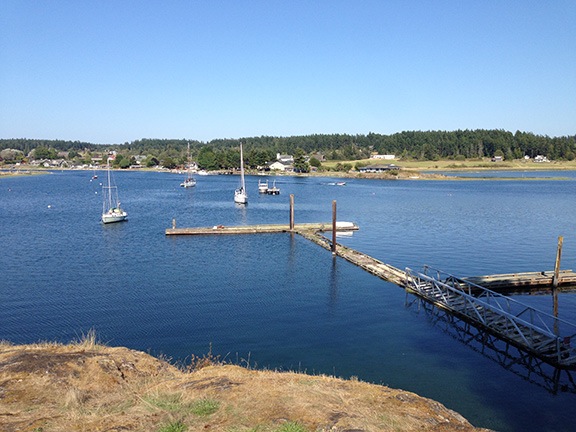
The bench we sat on at the point overlooked the mouth of the bay and this disused dock with the village of Lopez Island directly across from us.

We went out for dinner that night — my treat — at restaurant just up the road: The Galley. We had seafood (of course) and shared a bottle of wine. The food was excellent; the portions were huge. Outside the window, the sun set over the bay. I realized that my vacation was quickly coming to an end.

On Friday, after fiddling around a bit with the satellite dish, we each did our own thing. Steve went for a real bike ride and since we both knew that I’d just hold him back, he did it solo. Penny and I walked into town, a distance of about two miles. Along the way, I took photos of some of the flowers that were growing alongside the road and took a moment to check out the library, which is located in the original schoolhouse.

Flowers
I don’t know what these are but they were all over the place alongside the road.

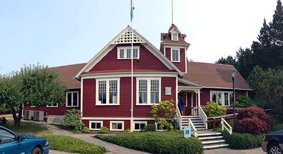
Lopez Island Library
A panoramic shot of the Lopez Island Library, which is in an historic schoolhouse. I highly recommend stopping in if you’re ever out that way. It’s a really wonderful place.

While we were in town, I picked up some gifts for my host and a few small pieces of jewelry for myself; chatted with a gallery owner about glass work, helicopters, and the recent flash floods in the Twisp area; tasted some wine; and bought a whole salmon for dinner. The walk home wasn’t exactly fun — the bags were heavy! I refreshed myself with a quick shower before Steve returned, then faced the challenge of filleting the salmon. (Let’s just say I need practice.) Steve grilled up the salmon for dinner and we all feasted on it with some white wine from Steve’s collection.

The next day was Saturday, the day I had a good weather window for my flight home. It certainly didn’t start that way, though: the morning fog was accompanied by the sound of fog horns off in the distance. It took a while to burn off and when it did, we had yet another beautiful day.

Fog at Fishermans Bay
Saturday started with fog, but soon cleared up again.

While I waited for the fog to clear, I packed and did some laundry, then restored the guest room to the way it had been before I arrived, all ready for the next guest. We finished up the last of the blueberries with some yogurt and cereal — we’d actually eaten most of the food I’d brought, although a few pesky cucumbers and zucchini remained. Steve and I lounged in the living room together one last time and Penny curled up to nap on Steve’s lap.

I’d made plans to meet some friends of mine from Wickenburg in Bellingham; when the fog cleared, I texted them to give them an ETA. Then we packed up the helicopter, I put Penny on her perch atop the big cooler, and I said goodbye to my host. A while later, I was lifting off as Steve and his neighbors waved goodbye.

Bellingham and Beyond

The flight to Bellingham was quick — only about 15 minutes — and took me between Blakely and Obstruction Islands, up the coast of Orcas Island, and over Lummi and Portage Islands. I had become accustomed to flying longer than usual distances over water, but still kept higher than I normally would fly, watching out for the seaplanes I kept hearing on the radio.

Blakely Island
Most of the islands have airports; this is the one on Blakely Island.

The tower cleared me to land near the FBO. I shut down, put Penny on a leash, and went inside. My friends Stan and Rosemarie were waiting for me. We shared hugs and went out to their car. A while later, we were sitting on the patio at Anthony’s on the harbor. I had fried oysters — my favorite and not easy to come by in Wenatchee. We talked about all kinds of things, from what was going on in Wickenburg to how we’d spent our summers to the progress I was making on my new home. I hadn’t seen them since I moved out of Arizona in May 2013, although we’d spoken and texted several times since then and it was really good to catch up.

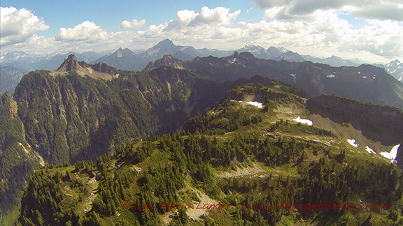
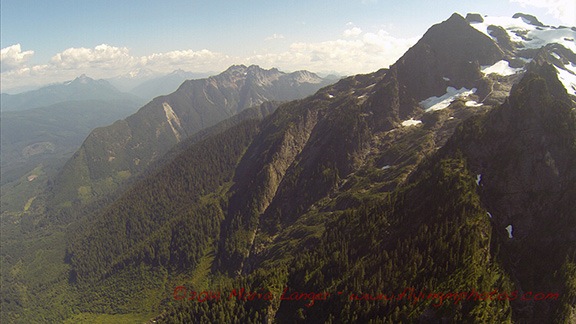
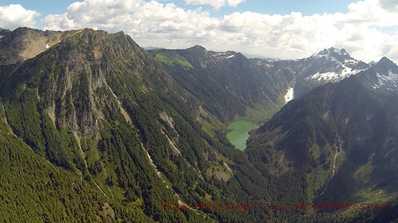
They had me back at the airport by 3 PM for my flight home. The flight was mostly direct, taking me right past or over more than a few very tall, rugged mountains. At least twice I found myself looking at the blue ice of small glaciers on north facing mountain tops. I spied hidden valleys and lakes and dozens of waterfalls. It was a really amazing flight, only slightly marred by the haziness caused by forest fires in the area.

Cascade Mountains
The North Cascades offer a rugged landscape with patches of snow in August.

Glacier View
I don’t know why I was so surprised to see glaciers, but there were at least two along my way.

Mountain Lake
Lakes like this one were hidden away up in high valleys, seldom seen by anyone other than pilots and adventurers on foot.

I did detour a bit to the north to avoid the TFR near Leavenworth. This time, I made a point of flying over Lake Wenatchee, which I’d never flown over. It looked smaller than I remembered it.

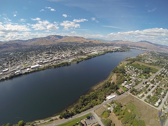
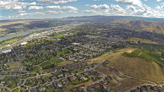
Then I was in familiar terrain, passing Cashmere, flying along the Wenatchee River, popping out at the confluence with the city of Wenatchee spread out before me.

Wenatchee from the Air
Wenatchee awaited me with yet another beautiful day.

I overflew my friend Bob’s house in East Wenatchee before turning toward home. As I touched down in my front yard, I thought about what a great vacation I’d had — including my trip there and back — and reminded myself how fortunate I am to have such great friends.
Another Reason Why I Love It Here

Wildlife watching from the door to my front deck.

I’d been told that there were bighorn sheep in the cliffs up behind my home. And more than once I’ve heard them knocking rocks around up there as they move along the cliff face. And occasionally Penny will bark like a crazy dog at the cliffs, obviously hearing or seeing something I can’t. But despite purchasing and using a set of binoculars last autumn, I haven’t been able to see the animals up on the cliffs.

Until last week. That’s when Penny’s urgent barking caught my attention and I spotted three bighorn sheep — two adults and a yearling — in my neighbor’s front yard. I rushed Penny into the RV to shut her up and grabbed my binoculars.

Unfortunately, I got more of an eyeful than I expected. Not only did I get a close look at one of the animals, but I also got a too close look at my neighbor, who’d come out stark naked to photograph them.

Life’s different out here.

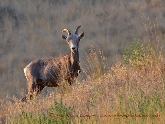
Today, more barking got my attention. And this time, when I rushed Penny into the RV, I grabbed my Nikon, 300mm lens, and monopod. Then I went into my unfinished building, climbed the stairs, and opened the door to my future front deck. I zoomed in on one of the animals grazing in the yard. Her head was down but I waited. No sense taking a picture of her back. After about a minute, I was rewarded. She popped her head up and looked right at me.

Bighorn Sheep
Captured in pixels from the door to my future front deck.

This isn’t the only interesting animal we have around here. There are also golden and bald eagles and other birds of prey that I see daily. There are quail — which have youngsters right now — as well as robins, magpies, and hummingbirds. I hear owls but have never seen one here. There are coyotes, which I occasionally see but more often hear at night. There’s elk and deer in the area, but I’m not sure if they ever make appearances near my home. And, of course, there are bull snakes and rattlesnakes.

It’s nice to live in a place that’s remote enough for wildlife viewing out my window without being too remove to take advantage of the conveniences a small city like Wenatchee has to offer. I really like it here — I only wish I’d moved here sooner.

Creating Time-Lapse Movies

How I do it.

I’ve been fascinated with time-lapse photography for as long as I can remember — and believe me, that’s a long time. I love the idea of compressing a series of still images into a short movie. But what I love more is the way it speeds up the process of things that happen slowly: clouds moving across the sky, shadows changing with sun angles, and things being built or moved. There are a lot of time-lapse movies on this site; click the time-lapse tag to explore them. I do want to stress that my time-lapse movies are very simple. If you want to see something amazing, look at the work of a master like Ross Ching’s Eclectic series.

I rely on certain equipment and software tools to create my time-lapse movies. Since I’ve been sharing daily time-lapse movies of the construction of my home, I thought I’d take a minute to explain how I make them.

The Camera

Hero HD
I use my old Hero HD for most time-lapse work these days.

The first thing you need to create a time-lapse movie is a camera capable of snapping an image at a regular interval. These days I use a GoPro. Although I have three of these great cameras — Hero HD, Hero 2, and Hero 3 — I tend to use the oldest (the Hero HD) for this kind of work so if it’s lost, damaged, or stolen, it’s not a huge deal.

The GoPro has an interval or time-lapse mode that I use quite often. Because the process of building my home is relatively slow, I set it to the most amount of time between images: 1 minute.

(In the past, I’ve used a Pclix intervalometer — that’s a time-lapse timer that triggers a shutter release on a camera at a preset interval — attached to an old Canon G5 digital camera. Again, the camera was old and worthless so if someone walked off with it, no big deal. Losing the intervalometer would have been worse.)

Skeleton Housing
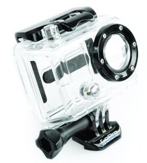
The skeleton housing gives me access to the USB port and SD card on the GoPro.

Power is an issue when you run a camera for hours on end. I use the GoPro Skeleton housing around the camera so I can run a USB cable to it. The cable then feeds into a window on my RV where it plugs into a power source. The added benefit is that I can remove the SD card without opening the housing and changing the camera angle. I use electrical tape to cover up the two sides of the housing to keep dust and rain out.

The Camera Mount

For time-lapse photography, it’s vital that the camera be held still (or moved smoothly, if you’re going for that kind of effect). That means a tripod or camera mount.

Pedco UltraClamp
This is a must-have mount for anyone with a GoPro or lightweight digital camera.

I routinely use a Pedco UltraClamp with my GoPros. I can’t say enough things about this clamp-on camera mount. With a GoPro, all you need is a tripod mount adapter and you’re good to go.

For my construction project time-lapse movies, I clamped it onto one of my RV slide-outs, pointing at the construction site. Easy.

The Software

Okay, so the camera has been running for hours and it has collected hundreds of images. Most of my time-lapses run from 6:30 AM to 4:30 PM. That’s 10 hours with 60 shots per hour. 600 images.

The images are 2592 x1944 pixels. That’s way bigger than I need. In addition, I want a 16:9 aspect ratio, which is better suited for video projects these days. So I need to do some processing.

EasyBatchPhoto IconThe first thing I do is run the images through a program called EasyBatchPhoto. (Remember folks, I’m using a Mac.) I have the app set up to crop the image to 1920 x 1080 — that’s standard high definition. This basically crops away the edges of the image, focusing on what’s in the middle. The app also slightly sharpens the image and applies a date and time stamp watermark based on the EXIF data saved with the original file. It then saves it as a medium-high quality JPEG in a folder I specify. I do this for only the images I want to include in the movie; no reason to process them all. The rest of the images are discarded when I wipe the SD card.

EasyBatchPhoto Settings
EasyBatchPhoto can process huge batches of images at a time.

I should mention that you could probably do all this with another app. This happens to be the one I use. I’m sure some readers will share their solutions in the comments.

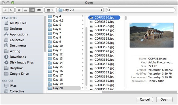
QuickTime Player 7 IconOnce I have the images in a folder, I open up QuickTime Player 7, which I’d updated to the Pro version years ago. This is an old version of QuickTime. The current version does not have the feature I need, which is the Open Image Sequence command. I use that command to get a dialog box prompting me to choose an image. I select the first image in the folder containing all of the images for the movie.

Choose the First Image
Use this dialog box to select the first image in the folder of images for the movie.

Image Sequence Settings
Use this dialog box to set the frame rate.

I’m then prompted to set the image sequence settings — basically the frame rate for the movie. There are a lot of options on that pop-up menu. After some experimentation, I decided on 15 frames per second for this project. That compresses 10 hours worth of images into about 40 seconds. Any faster and you miss a lot of the action. When I click OK, QuickTime makes the movie and displays it in a window. After taking a look at it, I save it to disk, usually in the same folder as the images.

Why YouTube?
I was really pissed off to discover that Viddler, the site I used years ago to host video, has made my videos unavailable for viewing. I think it’s because they expect me to pay for hosting, which just ain’t gonna happen. This screwed up a lot of embedded video on this site. Because some of the videos are very old, I can’t find the source files so those videos are gone forever. So I’ll use YouTube on a go-forward basis for all video sharing. It’s free and very easy to access.

The last thing I do is upload the movie to YouTube. I do this with the current version of QuickTime. I just double-click the movie’s icon to open QuickTime and use the share command to share it on YouTube. QuickTime prompts me for a movie description and tags. Within minutes, it’s online and available to anyone who wants to see it.

The entire software process takes about 5-7 minutes and is mostly automated.

If you make time-lapse movies and use a different set of software tools, please do use the comments to share your process. It’s always nice to learn about new software that might make things easier or just plain better.

Whale Watching at Point Reyes

And so much more.

I went whale watching yesterday. At least that was the excuse I used to make the two-hour drive to Point Reyes National Seashore. The motivation to get out there by 9:30 AM was provided by the Sacramento Paddle Pushers, a Meetup.com group that had suggested the trip. (I’d gone on a 9-mile paddling trip with the SPP a few weeks before; they’re really active and do a lot more than paddling. Thought I’d blogged about it, but I guess not!)

I didn’t carpool with the group. Although I like the idea of carpooling — saving gas, companionship for a drive, etc. — I don’t like the idea of being tied to another person who I may or may not know very well. I like the freedom to make things up as I go along. And I absolutely detest waiting for other people to get organized or to give the green light for setting out on the next part of a drive. So I didn’t carpool. I drove out on my own, with Penny beside me and Google providing turn-by-turn driving instructions.

It was dark when I left at 6:30 AM. I not only wanted to get there on time, but I wanted the freedom to stop wherever I wanted to along the way. I headed westbound on I-80 as it got lighter and lighter and foggier and foggier. By the time I’d exited at Route 37, the fog was thick — so thick that I had to slow down going through the San Pablo Bay National Wildlife Refuge. Then it lifted just enough to make normal speed possible and I continued on my way.

The route Google chose took me through some residential areas before sending me toward the coast on Novado Boulevard. There were cows grazing on lush green hills along the way. The road wound up and down and around, past small lakes as wisps of fog got caught up in trees and floated on lake surfaces. The early morning sun shined brightly above the marine layer, trying so hard to break through. I stopped at Stafford Lake Park to let Penny take a walk while I shot a few photos.

Stafford Lake
The scene at Stafford Lake Park yesterday morning.

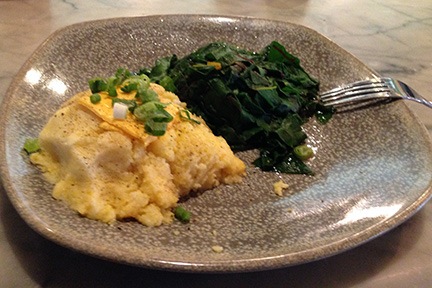
Interesting Breakfast
Not sure how I wound up with a veggie breakfast, but it was good. It’s always nice to try something different.

Eventually, we wound up at Point Reyes Station. It was early — only 8:30 AM. I had a whole hour to go the last 16 miles, which Google said would take me 33 minutes. I decided to stop for breakfast. I wound up at the Station House Cafe, which was pretty much empty. (Heck, the whole town was empty at 8:30; it would be very different later on.) I sat at the counter and although my brain really wanted an omelet as good as the one I’d had in Winters the morning before, I went with something completely different: cheese grits and sauteed Swiss chard. As I told a Facebook friend later in the day, it was good, but bacon would have made it better.

Please don’t lecture me about leaving my dog in the car. First of all, I only do this when I’m certain that the temperature in the car won’t exceed a balmy 70° or 80°F or get below 40°F. On warm days, I always park in the shade if possible. And if I’m parked in town, I always leave the doors unlocked so anyone could simply open them up if there was a concern.

Penny has spent a lot of time in the car — whether it’s my Honda, Jeep, truck, or a rental car — and is quite accustomed to it. She usually just settles down and goes to sleep.

On that particular day, the high in the area was forecasted as 50°F and although there was no shade, I did leave both front windows down a good 4 inches. I locked the doors, but anyone with a long, skinny arm could have unlocked them.

I was back in the truck, finishing up my drive by 9:00 AM. The road wound through the tiny town of Inverness on Tomales Bay before cutting west across the peninsula into the park. I followed the signs and wound up in the nearly empty Drakes Beach parking lot. I took Penny out for another quick walk and moved the truck to a spot closer to the ranger station. Then I gathered my camera equipment together, made sure Penny was set with food and water, locked up the car, and went to find the others.

I brought all my good camera equipment with me that day: my Nikon D7000 and 3 lenses, including my 300 mm lens, which I thought might be good to capture images of the whales. I also had my Manfrotto monopod. Yes, I know a tripod would be better, but I detest using one in situations involving moving subject matter. My monopod gives me enough steadying on full-sun shoots.

And there was plenty of sun that day. The fog was mostly burned off, although there was a definite white haze in the air. I went to the building just as the ranger was unlocking it. There were a handful of people milling about, but no one I recognized. I didn’t think it worth querying people to see if they were with the group. Again, I was leery of tying myself to one or more people until I knew how the day would unfold.

Like most other people there, I paid $5 for a shuttle bus ticket. Then I went outside and followed the group to a nice charter coach that was being used to shuttle park visitors to two points of interest: the Point Reyes Lighthouse and a spot called Chimney Rock. The bus pulled away from the curb and the driver, a big man who obviously had a lot of passion about the park and his job, told us a little about the wildlife we were already seeing: black-tailed deer and Tule elk. He then put in a short CD that explained a little of the park’s history and told us about the dairy farms we were passing along the way.

We were making the final climb up the road toward the lighthouse, when the man in front of me and I saw the same thing out on the ocean to our left: a whale! We’d already made our first spotting.

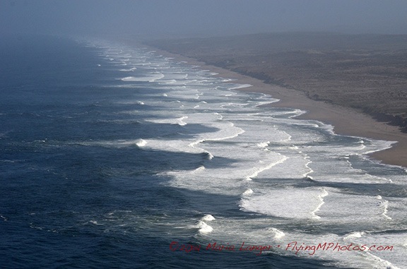
At the bus stop, we all got out and headed up the hill toward the lighthouse. There were about 20 of us in this first trip of the day. I took my time, taking in the view of the surf on the beach stretching out to the north. This was my third trip to Point Reyes and this particular view has become iconic for me. No matter when I come — late afternoon, midday, or morning — the pounding surf seems to disappear into the far distance, perfectly illustrating one of the themes I like to capture in my photography: infinity.

Infinity Waves
It looks like this pattern of waves against the shore could go on forever, no?

I caught sight of movement over a small hill and moved farther up the trail to investigate. On the other side of a clump of trees, on the hillside sloping down to the cliffs, were two black-tailed deer, grazing. I moved in among the trees for some photos while other bus passengers hurried by behind me, talking at full volume about anything other than their surroundings, oblivious to nature around them. Finally, someone spotted me with my camera and took a closer look. By the time I was finished, a small crowd had gathered with people snapping photos of the deer less than 100 feet away. To their credit, no one tried to approach them more closely.

Black-Tailed Deer
Shot with a 300 mm focal length lens, cropping this photo was not necessary; this deer was close.

I reached the top of the steps leading down to the lighthouse and stopped for a moment to take in the view. We were on a point of land facing due west with sweeping views to the south and northwest. There wasn’t a cloud in the sky. The blue of the sky and the blue of the ocean met in a somewhat blurred line out in the distance. The sound of the waves and calling birds laid a background soundtrack to the chatter of the people around me. There was almost no wind at all. An absolutely perfect day to be at Point Reyes.

Map View of Point Reyes
Google’s Map view of Point Reyes. The lighthouse is on the left (west) point; Chimney Rock is on the right (east) point.

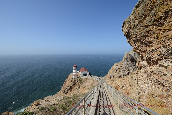
There were 300 steps down to the lighthouse. A sign at the top of the steps warned that the climb back up was the equivalent of climbing a 30-story building. (I seriously doubt that. The stairs were shallow and easy. Maybe 20 stories.)

Lighthouse at 70 mm

This is an interesting illustration of the way various lens focal lengths affect the appearance of distances. The top image was shot from the top of the stairs at 70mm. The bottom image was shot about halfway down the stairs (on my way back up) at 10mm. Neither image was cropped; both are shown here at the same size. Doesn’t the stairway look longer in the second image?

Lighthouse at 10mm

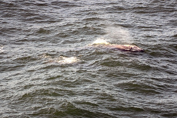
Once at the lighthouse, I joined a few other people there who were actively looking for whales. We were rewarded many times. A pair of young whales, maybe 20-25 feet long, were making their way around the point. They’d surface together every 5 or 10 minutes quite close to us, send up two sprays of misty air, give us a good look at their backs, and then disappear under the waves. They did this at least a half-dozen times while I watched with the others. Good photos weren’t possible — there just wasn’t any exciting activity. These whales were motoring, not auditioning for SeaWorld. This is the best I could do.

Whales
Yes, there are two gray whales in this photo. No NatGeo photo op yesterday.

Lighthouse Tower
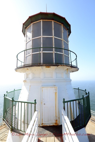
An example of symmetry — or as much as possible, considering the light and rust patterns.

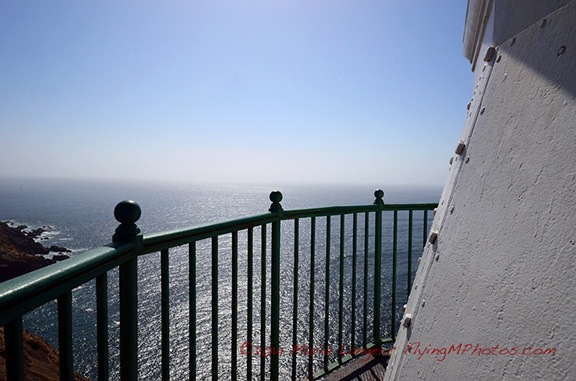
Since I wasn’t getting any satisfying whale photos, I started looking at other things that were interesting. The lighthouse, flowers along the stairway, equipment in the lighthouse building. Other themes and techniques I like to explore in my photography include symmetry, patterns, filling the frame with an image, and putting foreground items against out-of-focus backgrounds.
Detail from Lighthouse
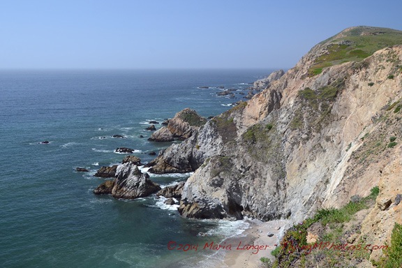
I don’t know why I like this photo so much, but I do. It seems to me that anyone can take a picture. But when a picture evokes an emotion — as this one does for me — it’s something worth looking at.

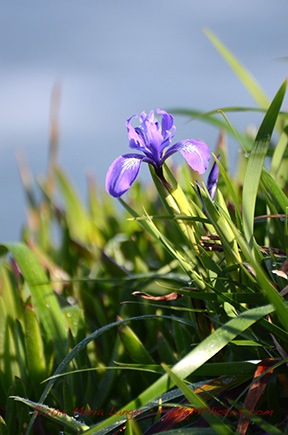
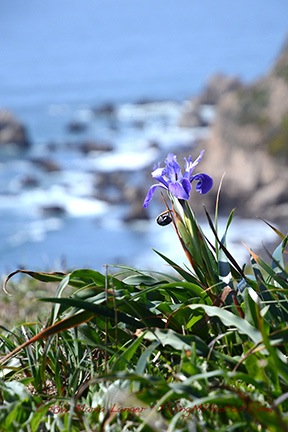
Iris Iris
Two examples of an interesting foreground — irises in bloom — against an out-of-focus background. Which do you think works better?

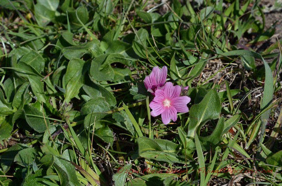
Red Maid
I’m not sure, but I think this one is called red maid.

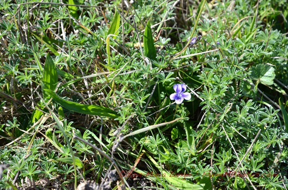
Voilet
And I’m pretty sure this is a violet.

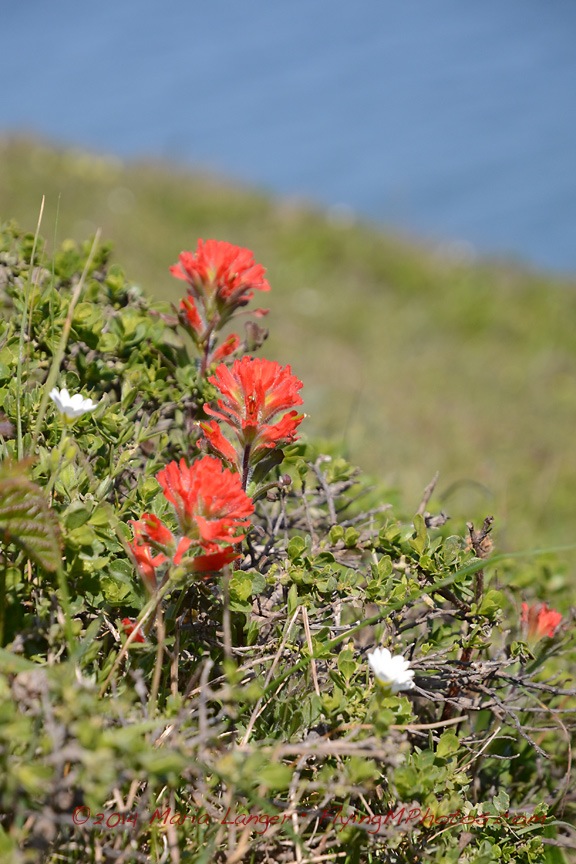
Indian Paintbrush
I’m pretty sure this is Indian Paintbrush.

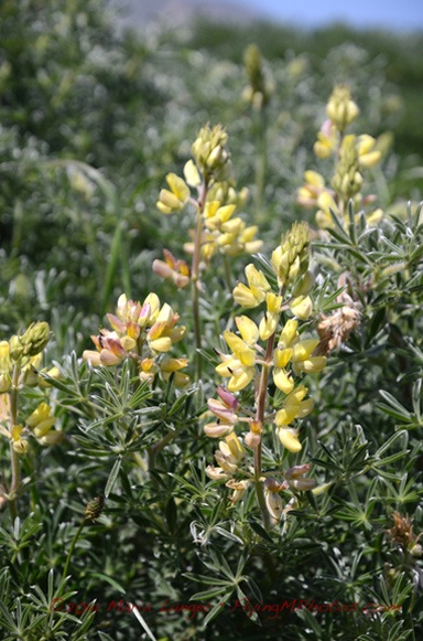
Yellow Bush Lupine
Yellow bush lupine grows in huge clumps out on the peninsula.

One of the huge benefits of traveling alone is that you can spend your day the way you want to do it. No one to compromise with. No one to get bored and hurry you along. No one to drag you places you couldn’t care less about.

That was me yesterday. Spending as much time as I liked, seeing what I wanted to see. I know a companion would have lost patience with the amount of time I spent kneeling or even lying in the dirt to frame up some of these photos. I’ve had traveling companions like that in the past and I can’t begin to imagine the things I missed because of them.

(You could also argue that traveling companions can reveal a whole new world for you. I think that’s possible — with someone who is imaginative, open to seeing new things, and not opposed to changing plans as opportunities arise. But I haven’t had a companion like that for many, many years. Instead, I spent a lot of time stuck with someone who was tied to a schedule. Any suggested change resulted in, “But I thought we were going to….” I’d rather travel alone than deal with that ever again.)

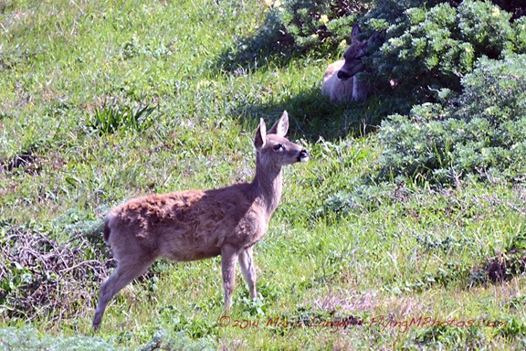
Once I’d finished up at the lighthouse and made the climb up the 300 steps, I walked back to the bus stop. Along the way I peeked through the row of trees to see if the deer were still there. They were. And that’s when I noticed a third deer lying in the shade of a bush.

Two Deer
Can you see the deer in the background?

While I was enjoying my day, taking lots of photos, and really having a great time being outdoors in such a beautiful place, I was also chatting with the folks around me. One by one I met up with about a dozen of the SPP members, including Lynn, who’d organized the meetup. The group had broken into smaller subgroups of twos and fours, each wandering around the park at their own pace. Nice. No pressure.

I rode the bus to the Chimney Rock stop. There were three points of interest there: the elephant seal beach, the historic life boat station, and Chimney Rock point. The elephant seals were closest, so I took that path, getting into a conversation along the way with a woman from Las Vegas who was also traveling alone — and enjoying every minute of it. She and I would cross paths a few more times before the end of the day.

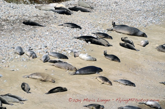
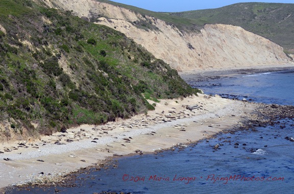
At the end of the path was a lookout point where we could clearly see hundreds of young elephant seals and their mothers stretched out on the sand, sunning themselves. Every once in a while, one of them would start barking or screeching or making some other weird noise. Seals would swim out of the water and shimmy up onto the beach. A harbor seal splashed around in the weeds just offshore. There were no breakers in the sheltered cove, making it ideal for the young animals to rest and learn how to swim.

Elephant Seals
Elephant seal weanlings sun themselves on the beach with their mothers.

Seal Beach
There were hundreds of seals along the stretch of sheltered beach.

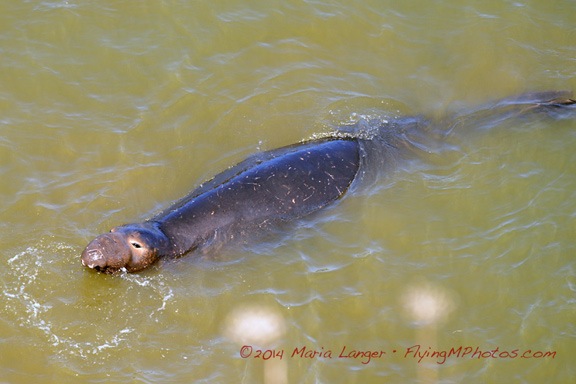
I chatted with a volunteer naturalist about the seals and the flowers I’d been seeing throughout the day. She was extremely informative and had some visual aids to show how the features of the elephant seals change throughout their lifetimes. While we chatted, a male seal swam up to the base of the cliff right below us. Meanwhile, a ranger worked with some kids to teach them about the seals. (Really, parents, why aren’t you taking your kids to places like this?)

My Ex Brother In Law
You can kind of get an idea why they call them elephant seals — the males get an elongated nose as they age.

Chocolate Lily
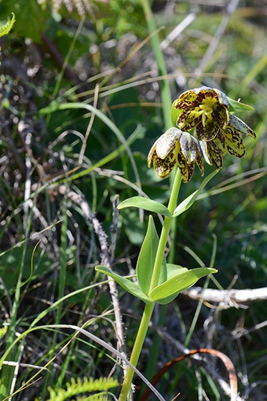
Chocolate lily. This plant also grows in the mountains near where I live.

Afterwards, the naturalist walked back along the trail with me and another member of the group to show us a relatively rare chocolate lily in bloom. I’d only seen one before — on a wildflower hike in Washington State near where I live — and it was nice to see one again out in the wild.

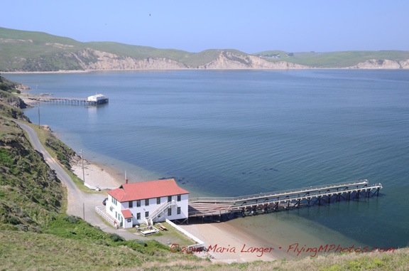
Although the historic boathouse was open that day for tours, I decided to skip it. Instead. I walked out along the 1.6 mile trail to Chimney Rock. I got a nice photo of the boathouse and Drakes Bay from along the trail. I also snapped some photographs of some of the flowers I’ve already shown above.

Historic Boathouse
The historic life boat station with the old pier and seal beach in the distance.

The trail to Chimney Rock was interesting mostly because it ran along a relatively narrow spit of land with open ocean on one side and Drakes Bay on the other. The ocean side had dramatic rock cliffs with more seals sunning themselves on small beaches. At the end was a rocky point, a fence to discourage wandering along the cliff, and some benches. Off the point, a buoy bounced it the waves, making a mournful sound. Some members of SPP were having lunch.

From Chimney Rock
View from along the trail to Chimney Rock. The beach was full of sunning seals.

I’d chosen to carry camera equipment instead of food and was quite hungry by that point. It was after 2 PM. I was starting to get a little worried about Penny being stuck in the car for 4-1/2 hours. It was time to head back.

I met up with Lynn again at the bus stop. Most of the group was going to stop in Point Reyes Station — coincidentally, at the restaurant I’d had breakfast — for a meal. Others were going to the Cowgirl Creamery nearby. Neither plan sounded that good to me; I wanted to try something different and preferred to avoid the temptations of cheese. And I knew I couldn’t wait around for the group to gather. So I decided to stick to my solo plan for the day.

Back at the main parking lot, Penny was fine but glad to see me. I put her leash on and walked her out along one edge of the parking lot where there was a picnic area with grass. Despite the No Dogs sign, there were four other dogs on leashes nearby. Penny got a lot of pee and barking out of her system before we climbed back into the truck and headed out.

My stomach did the driving, retracing our route past the cows and various park turns toward Point Reyes. When I got to Inverness, I spotted Vladimir’s Czech Restaurant, which had outdoor seating. Soon Penny and I were sitting beneath the shade of an umbrella, eating stuffed cabbage with a hearty grain bread. The sound of live musicians playing Irish music (for some reason) drifted out the restaurant’s open doors, flooding the patio with a cheerful sound.

I made a few more stops on the way home — Point Reyes Station, which was packed with people, and Muir Woods, which was just emptying out — before heading home. I’ll cover Muir Woods in another blog post; it deserves one.

It had been another great day out. Yes, I’d seen some whales, but I’d also enjoyed experimenting with photography again, doing some good walking, and being out in great weather. Although I’d debated spending the night in the area and doing more the next day, I soon realized that an overnight trip would be better during the week when it wasn’t so crowded. I have a month left here in California; I need to plan a nice two or three day trip with Penny before I head back home.

Maybe next week? Got nothing else planned and the only schedule I need to check is my own.