A Story about Questioning Authority

If something doesn’t sound right, it might not be.

Those of you who follow the aviation-related posts in this blog — and there are a lot of you — might recall how I balked last year when the FAA told me I was required to buy a radar altimeter to continue Part 135 charter operations in my VFR-only aircraft. I argued that a radar altimeter’s sole purpose was to tell a pilot how far the aircraft was from the ground and that VFR operations, by definition, meant that the pilot could see the ground. If I wanted to know how far I was from the ground, all I had to do was look out the window. I didn’t need to spend $8K to $20K for an instrument inside the cockpit to tell me how far from the ground I was.

The argument apparently had some merit because a handful of Part 135 operations like mine, who apparently have more reasonable FAA oversight, got a waiver of the requirement. To this day, they still have that waiver.

I fought long and hard on this issue and, in the end, lost. Through the efforts of someone at Helicopter Association International (HAI), I got a temporary waiver that gave me until this coming October to comply. I wound up having one installed on Mr. Bleu (my new old helicopter) because the kind folks I bought it from offered to do the labor for free. It still cost me $10K. (Unfortunately, I have to pass that cost on to my charter clients with a $25/landing fee for all Part 135 flights.)

A lot of people might think that my experience with this would convince me that it isn’t worth fighting when you think something is wrong. That’s simply not true. I will always fight for what I think is right — if it’s important to me. Yes, I pick my battles.

And that brings me to the topic of today’s blog post: two FAA findings in yesterday’s aircraft inspection.

A Tiny Bit of Backstory

When Zero-Mike-Lima was totaled, I had no helicopter. One of the requirements of a Part 135 certificate — the FAA certification that enables me to legally do air-taxi work — is that I have at least one helicopter on my certificate. When I informed my local FAA Flight Standards District Office (FSDO) that Zero-Mike-Lima was gone, they waited a week or two before kindly informing me that if I didn’t replace it soon, they’d cancel my certificate.

This is a huge deal. It took just four months for me to get my certificate in the beginning of 2005 and that was considered lightning fast. These days, it’s rare to get the process done in less than two years.

Admittedly, I don’t use my Part 135 certificate much anymore. Most of my work centers around cherry drying, with a dose of aerial photo/survey work, scenic tours within 25 miles of the starting point, and hop rides at outdoor events. For a while I was doing a lot of wine tasting tours, but I’ve dialed that down to hour-long trips that are a bit pricey for the average wine lover. Still, I want to keep my Part 135 certificate because it enables me to say yes to the odd charter flight that comes my way. When you have a small business with limited activity, being able to say yes can make a big difference in your bottom line.

So I was motivated to get a replacement. I blogged about my shopping experience here and about picking up Mr. Bleu and flying it home with a friend here. Once it was here and I had all the paperwork I needed the FAA to review, I contacted my guys at the FSDO to arrange for an inspection.

You see, it isn’t enough for me to get a helicopter. The FAA has to inspect it. There’s a laundry list of requirements for Part 135 work, as well as the general airworthiness of the aircraft itself. That’s why I was so picky about what I bought and why I wound up buying the helicopter I did. I knew it would comply with all requirements so it would be easy for me and for the FAA to get it on my certificate.

The Inspection

The FAA scheduled the inspection for May 3. I was expecting my Primary Operations Inspector (POI) and Primary Maintenance Inspector (PMI). That’s two guys. So imagine my surprise when a small car rolled into my driveway that morning and four guys got out of it.

Apparently, my inspection was part of a training exercise. Lucky me.

They all came upstairs and I handed over all of the helicopter’s paperwork to them. I pulled out my big dining room table — I normally keep it stowed against a wall — and the three maintenance related guys sat around it. I sat at the breakfast bar with my POI to talk about operations stuff. It seemed that they were combining the aircraft inspection with a base inspection and a post-crash interview. That was fine. I had nothing to hide and I was confident that the aircraft would meet their requirements.

I have to say that I did the right thing when I bought a helicopter with just one previous owner from a place with a well-managed maintenance shop. Every single document that they were looking for was in the packet I had for them. The only two things they brought to my attention is my need to register my ELT (Emergency Locator Transmitter; a piece of emergency equipment) and the possibility that I might need to update my Pilot Operating Handbook (POH) with a manual for the radar altimeter. That second finding actually came later, when they looked at the helicopter.

And that’s where we went next: to the helicopter. After I asked my PMI to take off his FAA hat and help me get my new printer up onto my loft and a chair down from my loft — a matter of handing a box up to me and taking a lightweight chair I handed down — we went back downstairs. They all climbed into their car — which, by that point, I had begun thinking of as a clown car, mostly because of so many big guys being in such a relatively small car — and I pulled my Jeep out of my garage. I led the way back down my road and around to my neighbor’s airstrip, where the helicopter was parked. (Long story there; it’ll eventually get blogged about.) We parked next to the helicopter and got out. I pulled off the cover and opened the doors. The four guys moved in.

At one point, I almost got a photo of them all poking their heads into various parts of the helicopter, but as soon as I took my phone out, one of them moved away and I skipped the shot.

I answered questions. We talked about the fire extinguisher (the Spokane FSDO seems obsessed with it — in 9 years the Scottsdale FSDO never even looked at it) and I was told that it needed to be inspected monthly by a mechanic who would put an entry in the aircraft logbook. We talked about the POH and my possible need to add a manual to the Supplements section for my radio altimeter — although no one seemed to know for sure if such a supplement existed or was actually required. We talked about the level of the main rotor gearbox fluid. We talked about how clean the helicopter was.

And we talked about safety wire.

The Safety Wire

Safety wire, in case you don’t know, is thin wire that’s used to secure nuts and other removable items. It prevents them from loosening and potentially spinning off. Look at any aircraft long enough and you’ll find these thin wires here and there, twisted tight.

The maintenance guys pointed out that there was no safety wire on the tail rotor gearbox or oil filter. This was a “finding” — that’s a word that auditors use when they find something wrong. I don’t know what FAA guys call it. Exception? Non-Compliance?

I was embarrassed. I should have caught that on preflight but didn’t. It looked fine to me. But what really surprised me was that the maintenance shop had let it go like that. I decided to rib them about it later.

I told the FAA guys that I’d fly it to the airport to have the mechanic there add the wire. They told me I needed a ferry permit. Apparently the aircraft was not airworthy without it. I said I’d get a ferry permit, imagining some form I’d fill out online. They asked if I’d ever gotten one before. I said no. They said that I’d have to fill out a form and then get a mechanic out to look at the aircraft and sign off on it.

“Since the mechanic has to come out here anyway, can’t he just add the wire while he’s here?” I asked.

“Bingo,” one of them replied.

I made a mental note to get in touch with the local airplane mechanic when the FAA left.

The Doors

At that point, we seemed to be done. But then my PMI said, “And we need to talk about the doors.”

They had sent me a document a week or two before (InFO 18002) that talked about helicopters on fire contracts, removing and installing doors in remote areas, and cargo doors (which I don’t have). It didn’t seem to apply to my operation.

Robinson helicopters have simple door attachments: two hinge pins with round cotter pins to prevent them from slipping out, combined with little hydraulic do-dads that keep the door open when you open it. Of course, there’s a latch to hold the door closed in flight or when parked. Pretty simple stuff. As a student pilot in Arizona 20 years ago, one of the first things I learned was how to remove and install the doors on the R22s I trained in. With daytime shade temperatures in triple digits six months out of the year, I think we flew more often with doors off than doors on. That was certainly the case when I bought my first helicopter in 2000.

After reading the document, I’d emailed my PMI to tell him I didn’t think it applied to my operation. He said we’d talk about it at the inspection. This was the talk.

It wasn’t good news. According to the Spokane Gang of Four, I was not permitted to remove or install the doors on my helicopter since it was used for Part 135 operations. In the judgement of someone in Washington (who really needs a hobby), removing and installing doors is a “maintenance item.” Because it’s a maintenance item, it needs to be done by a mechanic and an aircraft logbook entry must be made. In large Part 135 organizations, the Maintenance Training Program can include instructions for training a pilot to do this job while operating in a remote area when a mechanic isn’t available. But since I was a single Pilot Part 135 operator and I didn’t have a Maintenance Training Program because I (1) didn’t have a maintenance department and (2) didn’t need one, I could not be trained to do this job so I could not do it.

So yes, they were telling me that I was no longer allowed to do a simple task that I had been doing for about 20 years.

Doors off Mr. Bleu
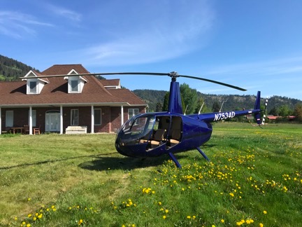
Here’s Mr. Bleu on a photography client’s front lawn not long after my FAA inspection. The front seat photographer did still photos while the guy behind him did video. (By Chelan County’s definition, this is a heliport. Go figure.)

Now you might wonder why this mattered to me. First, understand why I might need to take one or more doors off. It’s mostly for aerial photo work — no serious photographer is interested in shooting images through a curved, possibly dusty Plexiglas window. I have worked with photographers who have chosen me because other operators refused to remove a door for them. Doors off is required and, coincidentally, I had booked a photo flight for the following Monday.

Second, if the doors could only be removed and installed by a mechanic, that meant I’d have to schedule a flight to the airport when a mechanic was present (9-5, M-F), wait while he removed the doors and made the logbook entry, do my doors-off flight, return to the airport when the mechanic was present (9-5, M-F) to have the mechanic install the doors and make another logbook entry, pay the mechanic for his time, and fly back to my off-airport landing zone.

The level of inconvenience this interpretation of some obscure rule was causing me was astounding. Consider my Monday flight, when I was scheduled to meet my client in Leavenworth — the opposite direction of the airport — at 7 AM — two hours before my mechanic gets to work. That meant I’d have to fly to the airport the day before — well, no because that was Sunday so I really needed to be there three days before, on Friday — to have the doors removed, then return to my landing zone, leave the doors off while parked for several days, fly to meet my client on Monday, and then return to the airport before returning to base. I figure 4/10 hour on the hobbs meter just to add in all the flight time for the mechanic.

And in a helicopter, time is real money.

And what happens if I pick up a tour flight after the doors have been taken off? Do I just apologize to the folks paying me nearly $600/hour for the drafty in-flight conditions? Or just say no to them, thus taking a pass on an hour’s worth of revenue, and hope the photographer doesn’t cancel, leaving me with a net loss for the doors off adventure?

According to the Spokane Gang of Four, there was no way around this for me. Not at all. No waivers or anything else.

And that’s when I got seriously pissed off.

“Breathe”

After covering the helicopter back up and watching the FAA guys drive away in their little car — and wondering how comfortable they could possibly be crammed in there for the 3-hour ride back to Spokane — I got back into my Jeep and headed into town to run some errands. On the way, I called another Part 135 operator friend and vented to him about the doors, knowing that he was in the same boat as me.

“Breathe,” he told me. And then he told me a few other things that I won’t repeat here, including how he planned to deal with it.

I relaxed a little, but I knew his solution would not work for me. I’m too fucking honest.

And that’s really what it all comes down to: honesty. The FAA makes these rules that are nearly impossible to comply with, knowing damn well that some operators just won’t follow the rules because they can’t. It’s like they’re setting a trap. And one day, when they decide they just don’t want to deal with you anymore, they spring that trap and pull your ticket.

I have to say that I never thought this way about the FAA until I moved my operation to the management of the Spokane FSDO. I’m not sure if its a timing thing — maybe the whole FAA has changed? — or it’s just a higher level of unreasonableness. I thought the goal was to ensure safety. These days, it seems as if the goal is to see how many hoops an operator will jump through — how much money they’ll throw away on useless equipment and “maintenance” — before they throw in the towel and quit flying.

Another Part 135 operator friend of mine had enough when they zapped him for doing a photo flight at a train yard — long story there — and decided to punish him by suspending his license during cherry season, which is when he made 90% of his flying income. His “you can’t fire me I quit” response was to sell his helicopter and get out of the business entirely. I suspect that’s exactly what they wanted. I’ve also come to suspect that this FSDO sees small operators as nuisances. That would surely explain the failure to give waivers for a useless piece of equipment in a VFR-only aircraft — the radar altimeter — and this new rule about removing and installing doors.

The Safety Wire, Revisited

Of course, I also had to deal with the safety wire to satisfy the FAA guys. That meant getting my mechanic out to the helicopter to do the job, taking photos of the finished work, and scanning the logbook entry. I’d send all that evidence to them as soon as possible, knowing how long it takes them to process requests. All this had to be done before my photo flight on Monday. (Oddly, I wouldn’t need to have the mechanic remove the doors then because the helicopter was not yet on my Part 135 certificate so it was still legal for me to do it, as long as I made a logbook entry. I’m still trying to wrap my head around that convoluted piece of logic.)

But I wanted to rib the maintenance shop about missing the safety wires so I shot off a text to Paul, the Director of Maintenance where I bought the helicopter:

Spokane sent FOUR inspectors today. Just a few minor problems to resolve, the most embarrassing of which is the fact that there was no safety wire on the tail rotor gearbox and oil filter. (Oops!) I’m hoping to get a mechanic out to my LZ to fix that tomorrow. There was also some question on whether I need a radio altimeter supplement in my POH on board. Do you know?

Then they told me that I’m not allowed to remove or reinstall my doors because I’m not a mechanic.

His response came moments later:

Safety wire is not required.

There was more, mostly from me, but I’d prefer not to repeat it here. A while later, when I got home, I got his brief email:

Safety wire SL-45 link.
https://robinsonheli.com/wp-content/uploads/2015/12/r44_sl45.pdf

Sure enough, Robinson Helicopter Company had issued a Safety Letter dated July 3, 2013 titled “Deleted Safety Wire.” The Background section stated:

Safety wire and safety wire provisions have been deleted from various installations and parts. Deleting safety wire reduces maintenance cost and decreases the potential for safety wire-related FOD. This letter provides guidance for installing parts with or without safety wire provisions.

You can bet I wasted no time forwarding that document to my PMI. I’m sure it got to his office in Spokane before he did. Of course, he never said a word about it. I had to email him the following week to ask if he’d gotten it and whether it was still an issue. His response was brief:

I got it thank you. It takes care of the question raised about the safety wire.

There are three lessons to learn here:

  • The FAA is not all-knowing. In their defense, how could they be? There are hundreds of makes and models of aircraft. How could they be expected to know about every maintenance procedure or service letter for every one. While it bugs me that they automatically assumed there was a problem, it felt really good to educate them.
  • An experienced mechanic knows stuff the FAA doesn’t. I had already suspected this — which is why I prefer taking my aircraft for repairs and maintenance to a shop that sees Robinson Helicopters all the time — but my safety wire experience proved it.
  • Questioning authority can save you money. In this case, I saved at least $100 — the cost of getting a mechanic out to my LZ, which is a good 40-minute drive from the airport, for a 15 minute job that actually would have had me in non-compliance with Robinson’s Safety Notice.

But this got me thinking about the doors-off issue. If Robinson said safety wire wasn’t necessary in a place where the FAA thought it was, perhaps Robinson could weigh in on the door removal issue?

But haven’t you read enough here? (I’m surprised you made it this far.) I think I’ll save the door issue for another blog post. As you’ll see, it’s not a simple matter.

A Day in the Life of a Part 135 Charter Pilot

An illustrated journal for Friday, December 10, 2010.

On December 10, 2010, I took two passengers on a flight from Prescott, AZ to Las Vegas, NV in my 2005 Robinson R44 Raven II helicopter. This is a journal of that day’s events.

4:45 AM
Awake, thinking about the asshole doctor I visited yesterday. I’m angry — too angry to get back to sleep. I decide to blog my anger and frustration.

6:12 AM
Blog entry done, published, proof-read, and corrected. I make a very large cup of half-caf coffee, add 3/4 teaspoon of sugar and about an ounce of 2% milk. I go back to my computer to catch up on Twitter and Facebook.

6:31 AM
Mike (my husband) is awake, doing things in bathroom. Shower starts running. I turn to the computer to check weather for the day’s flights from Phoenix (DVT) to Prescott (PRC) and then on to Las Vegas (LAS) with two paying passengers for the weekend. But instead of checking the weather, i get distracted by e-mail and waste some time with that. I finish packing and hop into the shower when Mike is done.

7:03 AM
Although I only drank half of my first cup of coffee, I brew another cup. Mike is having breakfast at the dining room table with his laptop. He has a big meeting in the afternoon and is likely preparing. I give Alex the Bird (my parrot) his breakfast of scrambled eggs. Our roommate, Matt, takes care of his breakfast things and leaves for the day.

7:15 AM
I fix up my hair and face to the best of my limited abilities and stow a few final things in my weekend bag. I clean up Alex’s cage and give him fresh food and water for the day. Mike is still working on his computer when I fetch a few things from his truck to pack into the plastic trunk in the bedroom. He’ll bring the trunk back to our house in Wickenburg later in the day when he goes home for the weekend.

7:48 AM
iChartReady to go, I wait for Mike, who is only half dressed and still working on his laptop. I pull out my iPad and check the weather for Las Vegas. Later, when I’m waiting for my passengers at Prescott, I’ll check official weather with Duats and file a flight plan, which is required for my Part 135 operation. I waste some more time playing with iChart, a pilot chart app. The previous evening, I’d downloaded sectionals and terminal area charts for Phoenix, Los Angeles, Las Vegas, and more.

8:12 AM
Mike and I head out in Mike’s car. It’s a 25-minute drive in the HOV lane to Phoenix Deer Valley Airport where my helicopter is parked for the night. Mike drops me off and says goodbye.

8:37 AM
After dropping off a tray of holiday cookies at the Atlantic Aviation desk and chatting with Tiffany, who is on duty there, I wheel my weekend bag out to the helicopter in the big south hangar. It’s in good company, surrounded by Pilatus airplanes, a handful of small jets, another R44 helicopter, a Cessna, and the prettiest DeHaviland Beaver on wheels that I ever did see.

In the Hangar

I stow the bag on the seat behind mine and check my map pocket. Sure enough, my Las Vegas sectional chart is expired. I’ll need a new one, along with a Las Vegas TAC, to be legal for my Part 135 flight.

8:46 AM
I settle down for breakfast at the airport restaurant, where I order an iced tea and a gyro omelet with cottage cheese instead of potatoes. Around me, pilots and students come and go. The omelet is a bit greasy but delicious.

9:17 AM
I head into the pilot shop and buy Las Vegas sectional and terminal area charts to make me legal for my Part 135 flight to Las Vegas later in the day. Then I head back to the Atlantic FBO, say goodbye to Tiffany, and head out to the helicopter, which has been pulled out of the hangar for me. As I start my preflight, a fuel truck pulls up and tops off both fuel tanks.

9:52 AM
I finish prepping the helicopter for the flight, stowing my weekend bag under the seat behind mine. My passengers’ luggage will go atop that seat, secured with the seatbelt and bungee cords. I set up my GoPro Hero camera and iPod. I stow a bunch of gear I don’t need in a locker back in the hangar. I make a quick stop in the ladies room there before returning to the helicopter.

10:14 AM
After one last walk-around, I start the helicopter and begin warming up the engine. I turn on my SPOT personal tracker and enable the breadcrumb tracking feature. I listen to the ATIS; winds are calm. I tune the radio to the south tower frequency with the north tower frequency in standby. I complete the startup process, make my radio call to the tower, and on receiving my clearance, begin a steep climbing turn to the west and then south. I’ll climb in a 270 degree turn to 500 feet over the ground before crossing both runways and departing to the north.

Crossing Over DVT

10:25 AM
Anthem
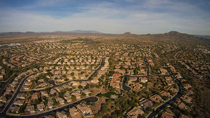
I make a radio call on the practice area frequency as I fly over Anthem, a master-planned community north of Phoenix, and then leave the urban sprawl behind me. Ahead of me are rolling hills climbing into the high desert. I fly over the freeway toward Prescott, passing over a handful of scattered homes and dirt roads. Somewhere along the way, I realize that changing the battery in my Garmin 420 GPS has erased my custom settings; I make some display changes on the map page. I tune my main radio to the Prescott tower frequency and tune the radio on my GPS to the Prescott ATIS frequency.

10:48 AM
I round the corner of some low mountains and Prescott Valley comes into view. I listen to the Prescott ATIS. Winds are calm, runways 21 in use. I hear several other helicopters in the area, all calling in to Prescott tower. I key my mike and make my radio call, requesting landing at Legend Aviation. I’m given a squawk code and told to make my approach to runway 30 and call 2 miles out.

10:51 AM
I pass the first of two herds of antelope. The second comes only moments later.

Antelope

I see the runway and line up. I’m 2-1/2 miles out when the tower asks where I am. I’m told to continue, then told to land and hold short on the numbers 30.

10:54 AM
The Numbers of 30
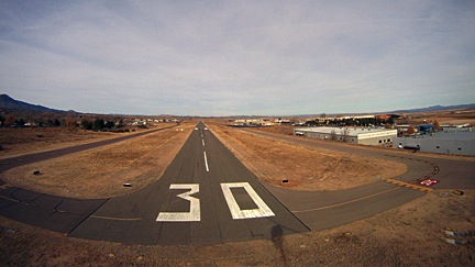
I come into a hover over the numbers 30 on runway 30. I’m told to switch to a ground frequency — something that very seldom happens — and I get sloppy with my 3-foot hover while using my left hand to tune in the frequency. I call in and get progressive taxi instructions to the Legend ramp. I land in a t-spot, glad that they use chains instead of ropes to tie down the planes. I shut down and send an OK signal from SPOT to Mike.

11:05 AM
After placing a fuel order, I take the FBO’s crew car (a Toyota Camry) to the mall where I have an eye doctor’s appointment.

12:30 PM
I return to the FBO and settle down in the pilot lounge. I copy the photos off my Hero camera to my laptop and put the camera on its charger. I use the Internet to check weather. I send a few photos from my flight to Twitter via Nambu client software — both Twitter and Facebook sites are blocked by the free wifi. I snack on some cookies from my purse. I use Duats to check the weather and file a flight plan, which is required by the FAA for my Part 135 flight. I have already completed my weight and balance calculations for the flight, which I am required to carry on board. I relax.

2:00 PM
I take the Hero camera off the charger and mount it on the helicopter again. I make a cheat sheet of frequencies for the flight. I relax.

2:45 PM
I pack up my laptop and power cords and stow my luggage under the seat again. I preflight the helicopter. I return to the FBO lounge to wait for my passengers.

2:50 PM
My client calls the FBO for directions.

3:03 PM
My clients arrive: two women with two very large — but not particularly heavy — wheelie bags. I immediately wonder whether the bags will fit in the helicopter. A few minutes later, I’m stuffing them onboard, atop the seat behind mine, while the two clients chatter nonstop about how cool the helicopter is and take pictures from every angle. The two bags barely fit. I strap the bigger one in with the seatbelt and use a bungee cord to secure the smaller one to it.

3:15 PM
Safety briefing completed, passengers loaded onboard and belted in. After a final walk-around, I climb onboard and start the engine. My passengers have already donned their headsets and are talking to each other. I turn on the SPOT unit and enable tracking. I listen to the ATIS. I finish the startup process and keynote mike to talk to ground. I’m told to taxi and hold short of taxiway Delta, then switch to tower. Tower tells me to hold, so I maintain a three foot hover over the entrance to the ramp. For five minutes. We’re facing into the sun and it’s getting hot in the cabin. Departing Prescott
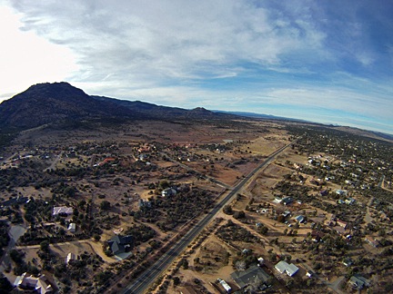
Tower finally tells me to depart along taxiway Delta (parallel to runway 21L) and maintain taxiway heading. Then switch to the other tower frequency. That controller finally clears me to turn on course. I turn right heading 295 degrees, which will take me directly to the Hoover Dam 160 miles away. Controller asks what altitude I want and I tell him 500 AGL.

3:30 PM
NW of PrescottClear of Prescott airspace, I turn into the FSS frequency and activate my flight plan. Passengers are happily chatting away about the places we’re flying over. I answer questions when asked. Terrain is high desert hills with piñon and juniper pine. Some evidence of lava flows along basalt cliffs. We climb to 6,500 feet to clear small mountain ranges. There are no paved roads, no buildings, no vehicles. Only scattered cattle ponds and the occasional handful of cows.

3:59 PM
I-40We cross I-40 just east of the junction of state route 93, far to the east of we cross a few more mountains, then drop into a Valley inexplicably marked on the charts as Cottonwood Cliffs. (What cliffs?) We’re still heading roughly 295 degrees. There are scattered homes beneath us now.

4:07 PM
We are just passing near Hackberry, AZ (northeast of Kingman) when the Aux Fuel warning light illuminates. The circuit breaker has popped. I attempt to reset the breaker but it pops again. I explain to my passengers what this means — am am very familiar with it, having replaced two fuel pumps in the five years I’ve owned the aircraft — the auxiliary fuel pump is a redundant system. It’s a problem that it has stopped working, but it does not require immediate landing. They’re not worried but I am. I have to figure out how to get the damn thing replaced before our return flight on Sunday afternoon. We are about 45 minutes from our destination.

4:21 PM
NothingWe near the area where the tour pilots fly between Boulder Airport and Grand Canyon West, so I tune into their frequency to monitor communications. Lots of chatter using landmarks and reporting points I don’t know. The only comforting information is their altitudes: higher than mine. The desert flattens out with scattered communities. We overfly two paved roads.

4:35 PM
Route 93We cross over the road to Temple Bar and pick up state route 93 as it snakes into the hills. The pair of two-lane roads looks freshly paved. At the turnoff to Willow Beach, I veer off the main road to the west. We catch a glimpse of the Colorado River as we head toward the dam.

4:43 PM
We overfly the new bridge just downstream from the Hoover Dam and the the dam itself.

Hoover Dam and Bridge

After making a radio call, tour pilots suggest we climb another 400 feet to avoid tour traffic; makes sense in rising terrain. Past the dam, we descend and fly up the west shore of Lake Mead toward Lake Las Vegas.

4:50 PM
Vegas Smog
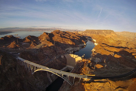
Listening to the Las Vegas ATIS, I learn that the helicopter frequency is in operation. I call the tower and request inbound heading to Stratosphere, then turn for landing at Atlantic ramp. I receive a squawk code and clearance to do as requested. Ahead of us, a thick blanket of white smog covers the Las Vegas skyline. The Stratosphere tower, rising 1,149 feet above the Strip, is barely visible in the haze.

4:57 PM
We cross the strip just south of the Stratosphere. Tourists on top of the tower are snapping photos at us as we pass below them; I see their cameras flash. The sun is low on the horizon. I turn south along I-15 toward the airport. I’m cleared to land — at my own risk — at the Atlantic ramp. I turn “base leg” between Luxor’s pyramid and Excalibur’s medieval castle.

Turning Base

I land on the ramp between two jets. A tug with two linemen wave me to follow them so I life off and return back down the ramp to the usual exile parking reserved for helicopters. I shut down and send Mike an OK signal with SPOT.

5:15 PM
We pull all the luggage out if the helicopter, I unmount the Hero camera, and I tie down the helicopter’s blades. I close my flight plan by phone. We let the two line guys drive us back to the FBO in a long golf car. Inside, my passengers use the ladies room while I arrange for overnight parking with the FBO desk. I tell them I’d likely be doing some repairs on the ramp. (This isn’t the first time I had mechanical problems in Las Vegas.) Then I call my Seattle mechanic and explain the fuel pump problem. He reminds me that the fuel pump, which was replaced less than a year ago, is still under warranty. I remind him that I have two passengers that I need to get back to Prescott, AZ on Sunday afternoon. He says he has a pump and agrees to fly it down to Las Vegas on Saturday or Sunday and will call me with details when he has them. I call Mike and leave a voicemail message. I call a friend I’m supposed to meet for dinner and she tells me she’ll meet me at her hotel after 5 PM.

4:20 PM PST
I realize that I’m in a different time zone and reset my watch. There’s a 40-minute wait for the hotel shuttle. I rent a car: a RAV 4 that will cost me $85/day — about the same as my hotel room. I figure that it will get my passengers to their hotel promptly and make it easier for me to transport my mechanic from the commercial aviation side of LAS to the general aviation side and back. I hope he’s done by Saturday afternoon so I can drop it off a day early and save some money.

4:32 PM PST
I drop my passengers and their luggage off at the Luxor Hotel, where they are staying. They tell me they’ll meet me at Atlantic Aviation at 1 PM on Sunday. The repair clock officially starts ticking.

4:47 PM PST
After many wrong turns on back roads, I find my way to the Rio, where I am staying. I leave the car with the valet and take my luggage inside. There’s a short line for registration. I check in, get my room key, and go to my room on the 23rd floor of the main tower. It’s the wrong kind of room. I call the desk and get reassigned to a room on the 26th floor. I wait 30 minutes for a bellman to bring the key, getting crankier every moment.

5:20 PM PST
I get into my hotel room, disappointed. The Rio’s idea of a “suite” does not match mine: it’s nothing more than a good-sized hotel room with a large dressing area. I unpack and set up my laptop. Internet access will cost $13.95 per day, so I use my cell phone to connect to the Internet to check mail. I begin looking at photos snapped by the Hero camera. Some of them are pretty good.

5:49 PM PST
My friend calls from downstairs. I leave to meet her and her husband. We wait on line for the “world famous” buffet for about 20 minutes, chatting about this and that. The buffet has over 300 items, but none of them are outstanding. I eat only a little more than I should.

7:14 PM PST
My friends come up to my room where I hand over a few things I’ve brought for them. They admire the view to the north that offers glimpses of the strip. We spend some more time socializing.

The View from my Room

7:51 PM PST
My friend leave. I call Mike and update him on the helicopter problem. I check e-mail, Twitter, and Facebook. I upload several photos. I start writing up this blog post, using the notes I’ve been taking all day.

10:21 PM PST
Exhausted from a long day, I turn off the lights, leaving the curtains wide open, and go to sleep.

Getting a Part 135 Certificate

Don’t expect free help from me.

Last night, I received yet another e-mail from a helicopter operator with questions about getting a Part 135 certificate. I thought that it was about time for me to explain why people who e-mail me for free help about this won’t get it.

But first, a bit of an explanation of what a Part 135 Certificate is.

What Is a Part 135 Certificate?

A Part 135 certificate is literally a piece of paper issued by the FAA that permits a commercial aircraft operator to perform air-taxi operations. The phrase air-taxi refers to the mission of picking up a passenger at Point A and transport him to Point B. A Part 135 Certificate also permits an operator to conduct aerial tours beyond the 25 statute mile limitation set by Part 91 or the relatively new Part 136. Part 135 gets its name from the Federal Aviation Regulations (FARs) Part 135, but a Part 135 operator must also comply with all other applicable FARs, including Parts 61, 91, and 119.

Zero Mike Lima at Monument Valley

Zero-Mike-Lima at Monument Valley during one of my multi-day excursions.

A Part 135 certificate is worth more than its weight in gold for an operator that has one and can use it properly. For example, if I didn’t have one, I’d be limiting my operations to short tours within 25 miles of my starting point and aerial photo/survey flights. With a Part 135, however, I can also take my tours as far as I like, transport passengers between two points, and even offer day trips and multi-day excursions. In the highly competitive area I live in — Arizona is just swarming with helicopter operators — a Part 135 Certificate gives me the competitive edge I need to stay in business. (With less local competition, I might even become profitable. Wouldn’t that be special?)

There are three types of Part 135 certificates: Single Pilot, Single Pilot in Command, and Basic. I have a single Pilot Part 135 certificate. That means that under my company’s certificate, only one pilot is allowed to fly the aircraft under Part 135: me. (Hint to jobseekers: that’s one reason why I don’t ever hire other pilots.) A Single Pilot in Command certificate is similar, but is used mostly in organizations with aircraft that require more than one pilot; just one of those pilots is allowed to fly as pilot in command, but any other pilot can be second in command. The Basic Part 135 certificate — and I may have its name wrong — allows multiple pilots to act as pilot in command on multiple aircraft. The Grand Canyon tour operator I worked for had a Basic Part 135.

At a recent meeting at my local Flight Standards District Office (FSDO; pronounced fizz-doe), I learned that there are only 4,800 Part 135 certificates in the entire country. If you take a moment to consider what percentage of those could possibly be helicopter operators, you’ll realize that I’m part of a very small club.

The penalty for conducting a Part 135 operation without a Part 135 certificate? Well, I know of at least one pilot who had his license permanently suspended. Ouch. When you consider the amount of time and money a commercial pilot — especially a helicopter pilot — might have invested in a career, that’s a very costly penalty.

Airline operations, by the way, are Part 121, which has tighter regulations.

How to Get a Part 135 Certificate

You work with your local FSDO to get a Part 135 Certificate. It requires multiple meetings at the FSDO to work your way through a flow chart of activities. Although I’ve heard of people getting their Single Pilot Part 135 as quickly as three months — it took me four months — it takes other people years. In fact, more than a few operators have gone out of business while working through the process.

Want Help Writing a Statement of Compliance?

When I wrote this blog post back in 2010, I was firmly against helping operators create their Statement of Compliance. At time time, I was based in Arizona with a lot of competition making it damn near impossible to turn a profit. Things are different now. It’s 2017 and I’m comfortably settled in Washington State with a small market but little competition for Part 135 work. In addition, I have found more lucrative sources of flying revenue that don’t require a Part 135 certificate at all. Add to that the FAA’s recent requirement for all Part 135 helicopter operators to have a radio altimeter and the cost to obtain that and I’m a bit softer about helping others — for a fee. Let’s just say that the FAA has motivated me to sell my experience and possibly increase its workload.

So here’s the deal. If you’re interested in getting help writing a Statement of Compliance for a Part 135 certificate, use the form on the Contact page of this site to get in touch with me. Tell me a little about your business and the aircraft you fly, the kind of Part 135 certificate you’re seeking, and where you are in the process with your FSDO. If I think I can help you, I’ll let you know what kind of compensation I need to write a Statement of Compliance for you.

Keep in mind that although this will make the process easier, it’s still time-consuming and you’ll still have a lot of work to do on your own.

There’s a lot of paperwork. The biggest challenge to most people is the creation of a Statement of Compliance. That’s where you list all the applicable FARs and state exactly how you will comply. My Statement of Compliance, written in 2005, was 54 pages long. It wasn’t difficult for me to create because, after all, I am a writer. But I’d say that 90% of the people who try to get their Part 135 certificate stumble on this component, which occurs about halfway through that flow chart.

You’ll also need to get on a drug testing program, create a training manual for carrying (or not carrying) HazMat, and obtain a secure location for basing your aircraft. You’ll need to create forms for pilots to log time flown, aircraft flight time, and squawks. You’ll need to have perfect maintenance records. If you’re going for a Basic Part 135, you’ll need all kinds of other manuals and documents, as well as staff in predetermined positions, such as Director of Operations, Director of Maintenance, etc.

The FAA did not make the process easy. If it were easy, everyone would have a Part 135. Instead, they made it a challenge.

I am extremely fortunate to be working with an excellent FSDO full of people who are reasonable and helpful. Yes, I’m required to jump through the same hoops as everyone else, but my contacts at the local FSDO help me make those jumps. In turn, I comply with their requests promptly, without question. After all, their mission is to keep me safe. Why wouldn’t I want to be safe?

Why I’d Rather Not Help You Get Your Part 135 Certificate

I’ve already given you several hints on why I’d rather not help you get your Part 135 Certificate. Did you read between the lines to get the answer? If not, I’ll spell it out for you.

  • Rise to the challenge. I personally believe that the FAA makes it challenging to get a Part 135 Certificate as a test to see if applicants are worthy. Let’s face it: the FSDO folks spell out what you need to do — using a flowchart, for Pete’s sake! If you come into the application process with the right attitude, they’ll help you achieve your goal. But they won’t just give you a certificate for showing up. You have to earn it. By jumping through all the hoops and smiling the whole time, you’ll prove that you have the right stuff to be a safe and cooperative aircraft operator. If I — or anyone else — help you get your certificate, you won’t prove anything other than that you can’t do it alone.
  • Membership has its privileges. That old American Express slogan can easily be applied to the 4,800-member club of Part 135 certificate holders. We can do things that Part 91 operators can’t. This gives us far more flexibility in our operations. I can’t tell you what a joy it was to finally be able to say yes to a client request for an air-taxi flight. Saying yes means more business, more revenue.

I get e-mails and calls at least twice a month from helicopter operators hoping I’ll help them get their Part 135 certificate or make their business grow. Apparently, it isn’t enough for me to write about my own experiences here so they can use them as learning tools. Instead, they want me to take them by the hand and walk them through the process.

Why should I? What’s in it for me?

I did the hard work I needed to do to get my certificate and build my business. Isn’t it in my best interest to have other operators jump through the same hoops I did and prove they’re worthy of getting a Part 135 certificate? Wouldn’t I rather be sharing the skies with pilots who passed muster with the FAA? Wouldn’t I rather refer overflow business to an operator I know has the ability to do his own homework?

You want a Part 135 certificate? Take my advice: Call your local FSDO and set up a meeting to get started. Then put a smile on your face, roll up your sleeves, and get to work.

Check Ride Prep Time

I get ready for my sixth Part 135 check ride.

Some of you may know that I hold what’s called a “Single Pilot Part 135” certificate. This is an FAA certificate that allows me to perform operations that a regular Part 91 pilot can’t perform. For example, I can pick you up at Airport A and drop you off at Airport B. I can also take you for a sightseeing tour more than 25 miles from our starting point. This might not seem like a big deal, but it’s very difficult — if not downright impossible — to build a business in aviation without the capabilities offered by Part 135.

There are three kinds of Part 135 certificate: Single Pilot, Single PIC (I think that’s what it’s called), and Basic. Single Pilot means there’s just one pilot doing all the Part 135 work. I can have two pilots in my company, but only one of them — me — would be able to do Part 135 flying. The other would have Part 91 limitations. A Single PIC is for companies with aircraft that require two pilots; one is always the pilot in command, but the second officer could be any qualified pilot. A Basic Part 135 certificate is not very basic at all. It allows multiple pilots in a company to operate under Part 135. It also requires all kinds of paperwork, training programs, and personnel.

I was a Part 135 pilot when I worked at the Grand Canyon. The company I worked for did all operations under Part 135 and had a basic certificate. I took my first Part 135 check ride with their check pilot. It wasn’t a huge deal.

When I ordered my R44, I applied for a Single Pilot Part 135 certificate. In February 2005, I took my first check ride for that certificate. Since then, I’ve taken a check ride with an FAA inspector every February. My 2009 check ride is tomorrow.

The check ride is like any other commercial check ride. There’s an oral part that lasts 1-2 hours. Then there’s a flight part that lasts about an hour. I’m expected to get all the important questions right and to fly safely, to commercial helicopter pilot standards.

Every year, the flights get easier. I don’t think it’s because they’re going easy on me. I think it’s because I’m getting to be a better, more confident pilot.

In FlightI now have over 800 hours on my R44 and I’ve flown just about every one of them. There’s something magical about flying the same aircraft all the time. You get to know its little quirks. And you can fly it without thinking — it’s as if it’s an extension of my hands and feet. I climb in, strap myself in, start the engine, and fly. It does what I tell it to do without me laboring over it. That’s a really great feeling.

Anyway, one of the reasons I haven’t been blogging as regularly as I usually do lately is because I’m prepping for my check ride. Cramming. I can never remember weather minimums — we don’t have much weather here in AZ — and I have to try again to remember them for tomorrow. Not that it matters much. The rules for airplanes don’t apply the same way for helicopters. But I’ll try to remember and hopefully get it right when I’m asked.

The rest should be pretty easy.

I’ll let you know how I did tomorrow afternoon.

Weather Flying

Two trips to Sedona in challenging weather.

One of the best things about being a pilot in Arizona is the weather. It’s darn near perfect just about every day. What else could a pilot ask for?

So when weather moves in, it’s a big deal. Especially when you need to fly in it.

Wickenburg to Sedona

Saturday’s flight had been booked a month in advance. Three friends from Phoenix wanted a day trip up to Sedona. To save money, they drove up to Wickenburg — which was on the way to their weekend place in Yarnell anyway — to start the flight at my home base.

I’d spent Friday night in Phoenix for Mike’s company Christmas party. When I woke at 6 AM, it was dark and rainy. But I had my laptop with me and wasted no time checking the weather. I’d told my client that I’d call him by 8 AM if we needed to cancel. If he didn’t hear from me, it was a go.

The forecast called for chance of showers before 11 AM, then partly cloudy. More showers after 11 PM. Sounded good to me. OUr flight would depart Wickenburg at 10 AM and we’d arrive in Sedona around 11, when any weather in the area would be moving out.

The drive home to Wickenburg was long but the weather was definitely clearing. There was some flooding on State Route 74 (Carefree Highway) not far from I-17. Nothing I couldn’t drive through, though.

At 9:30, when I pulled the helicopter out of the hangar and fueled it, there was still a layer of clouds sitting atop the Weaver Mountains. That wasn’t good.

Let me explain my usual route from Wickenburg to Sedona by air. I depart to the northeast, crossing the Weaver Mountains just east of Yarnell. Then I continue northeast, following the path of Route 89 through the Bradshaw Mountains and over the town of Prescott. Then I head skirt along the southern edge of Prescott Airport’s airspace and cross over the top of Mingus Mountain at the pass so I can descend right past Jerome. Then it’s north until I reach the red rocks and east until I reach Sedona Airport. I chose the route because it’s relatively direct, it shows downtown Prescott and Jerome from the air, and it completes a “red rock tour” outside of Sedona’s noise-sensitve areas and away from other helicopter traffic. The return flight is much more direct. I fly southeast over Oak Creek, then head southwest to Wickenburg, crossing the southern end of Mingus Mountain and the Bradshaws at Crown King or Towers Mountain, and passing east of the Weaver Mountains. You can see this usual route on the chart below; it’s the blue route.

Wickenburg to Sedona

You may have noticed that the word “mountain” is used extensively in the above paragraph. That’s because there are a lot of mountains here. The ones I have to cross range in elevation from 5000 to 8000 feet. While that’s not a big deal on a typical Arizona day, it is a big deal when the clouds are sitting at 6000 feet. All pilots know about mountain obscuration — mountains hidden by clouds. And smart pilots avoid it.

So one look at the Weaver Mountains made me wonder how much detouring I’d have to do that day and what the clouds looked like in the valley beyond the mountains.

But there was plenty of detour space. I could avoid the mountains entirely by flying around the west end. That would add time to the flight, which was billed at a flat rate. Not in my best interest, but neither is hitting a “granite cloud.”

By the time my passengers arrived, however, the clouds had lifted a bit. And since they really wanted to see Yarnell from the air, I headed that way. When we got close, I saw a clear path beneath the clouds and a clear valley beyond it. I popped over the ridge and even circled their weekend home once so they could get photos of it from the air. Then we continued on our way.

In the valley between the Weaver and Bradshaw Mountains, I’d estimate the cloud bottoms at 6,000 feet. I was flying at 5,400 feet, 600 to 800 feet off the ground, so I had plenty of space. But I decided to file a pilot report, since the weather forecast had nothing about the low clouds.

A pilot report — for those readers who are not pilots — is a report of observed conditions where a pilot is flying. Normally, pilots file pilot reports when they encounter unexpected conditions, like low ceilings, turbulence, or icing. These were low ceilings and they were low enough to get an airplane pilot in trouble. They were worth reporting. It’s unfortunate that more pilots don’t file pilot reports since, once filed, they appear on weather briefings for the area and they’re a valuable source of information for other pilots.

I think that hearing me talk to the Prescott Flight Service Station on the radio about the weather scared my passengers a bit. When I was finished, my client said, “If the weather is too bad, we can do this another day.”

I assured him that the weather did not pose any danger to flight. I then told him how interesting to me it was since I’m so accustomed to flying in perfect weather.

Meanwhile the tops of the Bradshaws were socked in pretty good, so I decided to go around the west side of Granite Mountain. That took us over the Williamson Valley Road area of Prescott and Chino Valley. From there, it was a straight shot past the northwest end of Mingus Mountain (which was also cloud-covered) to the red rocks. I did my usual tour, listening to my passengers ooh and aah. (It really is beautiful out there, even when the weather is overcast and otherwise ugly.) Then I landed at the Sedona Airport.

It was cold and windy there. We walked to the terminal and my passengers left me to have lunch at the airport restaurant, which overlooks the rock formations around Airport Mesa. I chatted with the FBO folks, placed a fuel order, and settled down with the IFR training material I’m reading in preparation for getting my instrument rating.

I got a call from one of the Phoenix-area resorts I occasionally do business with. They had a couple who wanted to do a Sedona Tour the next day. We agreed on times and my contact said she’d fax me the reservation form. As I hung up, I was glad I hadn’t delayed this flight for a day, making me unavailable for the next day’s flight.

I read about IFR flight instruments. It wasn’t terribly exciting. After about 20 minutes, I happened to look out a window. It was snowing outside, just southeast of the airport. One of the low clouds was dumping a flurry of flakes. While snow didn’t bother me, the fact that I couldn’t see through the snowfall did.

When I flew at the Grand Canyon, the pilots had a saying: if you can see through it, you can fly through it. I couldn’t fly through this little snowstorm.

Of course, I didn’t have to go that direction, either. So went outside and had a good look. There were little snow squalls here and there in every direction.

I went over to the computer they’ve got set up for flight planning and got on the National Weather Service Web site. The forecast had changed. There was now a 50% chance of snow showers. Duh.

Things looked good to the west. Although there was falling snow out that way, I could see sunshine beyond it near Mingus Mountain. That meant the snow was localized. It would probably blow through.

And it did. But other snow blew in to take its place.

Still, when my passengers returned, I didn’t want to wait around. I’d seen a good clearing to the west and I wanted to be through it before the situation at Sedona worsened. So we loaded up, started up, warmed up, and took off.

We were in snow showers almost immediately. Visibility wasn’t bad, though, and the air was still smooth. It was safe. It was just…well…different.

We got clear of Sedona’s weather and popped into the sun. But there was still a cloud atop Mingus Mountain, so crossing over the top on the way back wasn’t an option. And the weather radar I’d looked at showed me that conditions were better to the west than to the east, so I should avoid my usual return route. So after taking a low-level pass alongside the ghost town of Jerome, I headed northwest to retrace our route back the way we’d come.

We hit a bunch of snow along the west end of Mingus Mountain. I must have been flying in it for close to 10 minutes. My passengers were very quiet. But I kept chatting — as I usually do — to keep them at ease. Then the snow cleared out and we were flying with the clouds at least 1,000 feet above us. I looked for and found the indian ruins on top of one of the mesas in the area and pointed it out to them. A sort of consolation prize for taking the same route each way. When we got closer to Prescott, I thought I might be able to overfly it and follow Route 89 back to the Yarnell area. But by this time the wind had picked up and flying along the foothills of Granite Mountain was tossing us around a bunch. And since I couldn’t see the pass south of Prescott that I needed to slip through, I didn’t know it’s conditions. I didn’t want to look and see — I’d already done too much detouring on this flight and it was quickly losing profitability. If conditions were bad at the pass, I’d just have to come back, thus adding at least 20 minutes to the flight time. So I steered us around the west side of Granite Mountain again.

Ahead of me, in the Yarnell area, the clouds looked low again. So I detoured to the west some more, around the west end of the Weaver Mountains. That put us in the valley near Hillside. The clouds seemed to move up as we descended down to 4000 feet. I followed Hillside Road to Congress Mine, then detoured once again to the Hassayampa River just so see how it was flowing. From there, we made a quick pass over the town of Wickenburg before landing.

It was mostly cloudy but cold when we got out of the helicopter. It had been an interesting flight for me, but not one I was anxious to repeat. It had taken 30 minutes longer than the round trip flight usually takes and about 15 minutes longer than my budget for it. I hadn’t lost money, but it hadn’t been a very profitable flight, either.

But my passengers really enjoyed it and maybe I’ll see them again.

Scottsdale to Sedona

The next day is a good example of how quickly weather can change. I was scheduled to fly from Scottsdale to Sedona with two passengers at 2 PM.

I checked the weather shortly after getting up that morning. Partly cloudy, 10% chance of showers, high 46°F. Not bad at all.

I checked the weather again at 10 AM. It was the same. My passenger called right after that. I told him about the weather and that we were good to go. He promised to meet me at the airport at 2 PM.

At noon, I prepared my flight plans and manifests. I checked the weather again. Now it was mostly cloudy with a 50% chance of show showers. Dang!

I dug deeper into my weather resources. Flagstaff looked bad, with low visibility forecast right around the time we’d get to Sedona. Flagstaff is only 20 miles from there, but its up on a higher plateau. Was the altitude part of the problem? Would it be clear in Sedona? I called the FBO and asked what the weather was like. He said it was cloudy and that a small storm had passed through, but it was okay then. I got back online and looked for Webcams. I found a few in Sedona and they all showed good visibility. One of them even looked as if there was a little sunshine.

I called my passenger and left a message on his cell phone. Then I called the concierge who had booked the flight and told her the situation. I said I didn’t think it was a safety issue, but I thought the weather might make the views a bit less appealing. (Wow, did that turn out to be an understatement!) She wanted to cancel. She tried to reach the passengers, but couldn’t. I told her I needed to leave Wickenburg by 1 PM to get to Scottsdale on time.

I was warming up the helicopter on the ramp at Wickenburg when my cell phone rang. I answered it. It was the Concierge. She’s spoken to the passengers and they were still good to go.

So I went.

It was cloudy in Wickenburg but there were very low clouds atop the Weaver Mountains. I didn’t have to go that way. I had to go to Scottsdale, which is southeast. I passed through heavy rain in North Phoenix. I was sunny in Scottsdale when I landed, but it soon started to pour. I was wet when I got into the terminal.

Scottdsale to SedonaLet me take a moment to review my flight route from Scottsdale to Sedona. I fly northwest to Lake Pleasant and follow the shoreline up past the Agua Fria River to Black Canyon. Then I follow I-17 (mostly) to the southeast end of Mingus Mountain. I follow the mountain’s northeast slope to Jerome, then head north to the red rocks. I do my red rocks tour and land. The return trip takes us through Oak Creek and Camp Verde before climbing up along I-17 and following that back all the way to Phoenix. Again, it’s the blue line in this illustration.

I met my passengers, gave them a briefing, and loaded them up. One of them looked startled that the helicopter was so small. I talked to the tower and we took off to the north.

I could immediately see that the weather in the vicinity of Lake Pleasant would be anything but pleasant. So I headed north up into the mountains. The area was remote and undeveloped. All the little runoff channels were full of water, with waterfalls everywhere. It would have been kind of cool to fly lower and really see them, but I needed to climb to clear mountains ahead of us and I definitely didn’t want to get caught in the area if weather moved in.

It rained on us. It was mostly a light rain. The drops were pushed off the helicopter’s bubble by the force of the wind.

I couldn’t get much speed because my passengers (and I) were heavy and I’d topped both tanks off in Scottsdale. (You can never have too much fuel when weather is questionable.) We were not far from max gross weight.

We hooked up with I-17 just south of Cordes Junction. The freeway was covered with water — you could tell by the splashing of the car and truck tires. The clouds were low. North, along I-17, they seemed even lower. I couldn’t see the Bradshaws at all. I flew to Arcosante and circled it, telling them what it was all about. I also told them that I didn’t think I could go any farther toward Sedona. I was actually heading back along I-17 when I decided to take another look. I swung the helicopter around and, sure enough, the clouds had lifted enough for me to see the pass down into the Verde Valley. “Let’s give it a try,” I said.

Conditions improved a bit as I reached the pass. The clouds were much higher over the valley — primarily because the valley is much lower. I descended through the pass right over I-17. I skirted along the foothills of Mingus Mountain as I normally would, but lower. The top of the mountain was completely obscured. We reached Cottonwood and I still couldn’t see Jerome. It was in the clouds.

So I altered my course and headed northeast toward the first red rocks I could see. I’d start the tour there.

I should mention here that my passengers didn’t seem the least bit concerned about the weather. They were from British Columbia in Canada and they live, as one passenger told me, “in a rain forest.” Sadly, they’d come to Arizona for sunshine and it had been cloudy and/or raining since they arrived. They commented on all the terrain we passed over, asking me a lot of questions. Apparently he wants to buy a place here and she’s not convinced it’s a good idea. They did appreciate the views, especially when we got right up to the red rocks. I did a modified tour, going into a canyon I usually avoid, mostly because it was clearer than some of the other areas I do go.

It was snowing hard at the airport, and since they hadn’t been very interested in landing anyway, I decided to recommend against it. By big worry was that the weather would worsen while we were on the ground and that we’d be stuck there when the sun set in less than 2 hours. Then I’d have to pay a car service to take them back and I’d have to spend the night in Sedona. None of this would impress the Concierge that had booked the flight. My passengers understood the situation and agreed that it was best to continue. So we flew around Airport Mesa, getting a few last good looks of Sedona, and headed toward Oak Creek. We were only in snow for about 5 minutes.

The return trip was relatively uneventful, After crossing over Camp Verde, we climbed along the path of I-17. I’d been tempted to follow the Verde River south — it looked pretty clear that way — but did not want to get trapped in that canyon by weather, especially since my flight plan had me going a different way. When we came out atop the mesa north of Cordes Junction, I was surprised to see that the ceilings had risen by at least 500 feet. In the distance, toward Lake Pleasant, the sky was bright. Whatever had been there had cleared out. I headed toward the light.

A while later, we flew along the northwest side of the Agua Fria River. I showed them the ruins atop Indian Mesa and flew down the west side of the lake. We caught sight of a rainbow about 10 minutes out from Scottsdale.

My flight home was quick and easy. By 5 PM, the helicopter was tucked way in its hangar, clean from the rain.