Snowbirding 2017: Two Days at the Dunes

With a note about why loneliness doesn’t exist for people who don’t need the company of others.

On Friday afternoon, I took a right turn off a two-lane road in San Bernardino County, California. A historical marker indicated that I’d found the “Harry Wade Exit Route,” a route a man and his family had taken to escape a particularly deadly desert valley in 1849.

Thus I began a long trek down a series of washboarded single-lane roads into the Mohave Desert. I was on a quest to visit some sand dunes in the farthest reaches of a National Park that gets nearly a million visitors a year but there wasn’t a single vehicle on the road with me. After bumping along on one road and then making a right turn onto another, the only indication I had that I’d entered the park was a weathered sign with the park name followed by a similarly weathered sign warning that off-road travel was prohibited.

Map
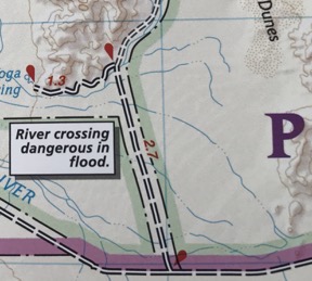
My map of the area was very detailed.

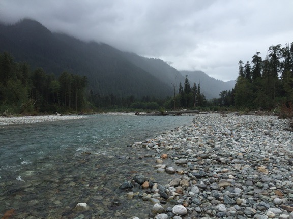
I crossed a few dry washes, recalling quite clearly that my detailed map warned “River crossing dangerous in flood.” I had seen water flowing earlier in the day and suspected the meandering river might enter the valley, but it certainly didn’t seem as if the water had made it this far. Until a healthy stream trickled across the road a few hundred yards ahead. Surely my big pickup with its beefy tires could cross this sandy stream? Even with my big camper on back? I knew that a slow crossing was not advised, so I gave it a bit more gas and surged forward. The tires started to bog down on the far side of the stream, but by then momentum had carried us through. On the way back, I’d use 4WD.

Saratoga Springs
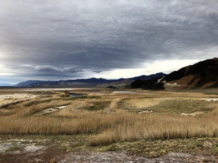
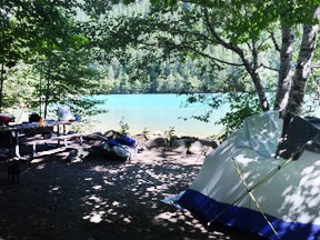
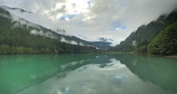
This was supposed to be a photo of the ponds by the springs but it’s a better picture of the dreary weather. Apparently, it was pouring in the main park area.

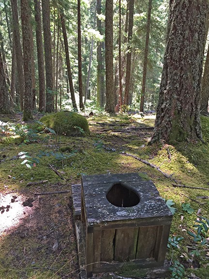
I followed signs to a spring where another sign that I suspected might be there said “No Camping.” There were no people in the parking area, although there was a weather station that I later found on Weather Underground. I never saw the source of the spring, but I did see the huge reed-fringed ponds that had formed in a desert well-known for its lack of water. I heard water fowl and frogs and, after retrieving my binoculars from the camper, saw a few dark colored birds floating on one of the ponds. I also saw what I think was burro (AKA donkey) dung along the trail.

I was tempted to park there for the night despite the sign, but didn’t want to get in trouble in the unlikely event of a park ranger stopping by this remote spot during the night. My camper is pretty much zero-impact; it’s fully equipped to haul what I need — fresh water, fuel for cooking, food — in and what I don’t need — waste water and garbage — out. A campfire isn’t necessary for cooking. All I need is a relatively level place to park, preferably with a view. But rules are not meant to be broken and if this spot wasn’t protected by the “No Camping” rule, it would likely be overrun with motorhomes and people bathing in the springs as soon as word got out about what a great spot it was.

We are our own worst enemies.

The goal, I reminded myself, was the dunes. It would be better if I could find a place closer to them to park for the night. Although the weather was degrading and rain was in the forecast, a hike to the dunes from my campsite was a possibility, either that evening or in the morning. So I came away from the spring and turned left on the washboard road, continuing north and mindful of the sign that warned about deep sand 4 miles up the road. I didn’t plan on going that far.

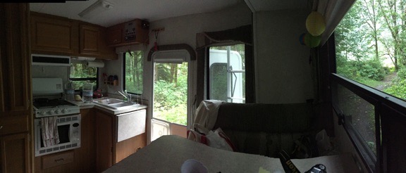
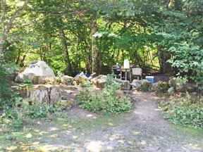
I found what I think was a parking area for the dunes about a mile up the road and turned in. There was a sign about it being a wilderness area that allowed foot and horse traffic only. There was space between the sign and the road for my rig, so I pulled out, turned around, and backed in with my camper’s back door facing the dunes. I killed the engine, fetched a few things from the truck, and opened up the camper. After spending about 10 minutes putting out the slide and picking up the things that had fallen during the bumpy ride, I was settled in.

The dunes, over a mile away without a clear trail to them, taunted me under a darkening sky.

Parking for the Dunes
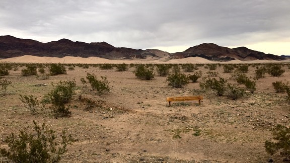
Parking for the dunes — the view out my camper’s back door.

I fed Penny.

I checked my cell phone, fully expecting to see No Service in the area where there are usually dots representing signal strength. I was shocked to see three dots and LTE. That had to be wrong. I ran SpeedTest and was even more shocked to see that not only did I have Internet service, but it was the fastest service I’d had since leaving home.

I checked in on social media. I admit that part of me wished I didn’t have an Internet connection so that I could fully disconnect. But, at the same time, I’m a realist and know that if anything goes wrong, it’s nice to be able to call for help — even if help would likely take hours to find me. (My dead starter was still fresh in my mind, which also explains why I always back into a campsite now.)

I found a classic rock station on the radio that actually played good music. I listened for about 15 minutes before realizing I preferred silence.

And it was silent. No sound of cars or trucks or planes. I could hear the wind coming through the greasewood (AKA creosote) bushes before it reached me. I occasionally heard a bird.

From my parking spot, I could see for miles in almost every direction; nothing moved.

I looked again with my binoculars. Nothing.

I sat at the table, writing a blog post on my laptop (that I might never publish), finishing the last of the ice tea from my late breakfast in Boulder City. Occasionally, I’d glance outside to see if Mother Nature would surprise me with a ray of sunshine highlighting the dunes or mountains behind them. I heard a few raindrops on the roof. It got dark out without the pleasure of a nice sunset.

Despite the full moon that had risen behind the clouds at around sunset, it got very dark.

I made some dinner and sat up in bed eating it while I did a crossword puzzle. I debated watching a movie but decided against it.

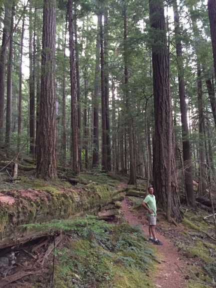
I realized I was exhausted. I’d started the day with a 4-1/2 mile hike on the Historic Railroad Trail near Hoover Dam, which would have been nothing if I was still in shape. But I’d been letting exercise opportunities pass me by and it was starting to really make a difference. Which is why I’d done the hike.

So I went to bed early.

As I slept, I was very aware of the persistent rain on the roof. I thought about that little stream I’d crossed and wondered whether it would be a bigger stream.

Later, I was also aware of the wind loudly snapping the ratchet tie-down strap holding my old rotor blades in place on the roof. There was no way to stop the sound without going outside and climbing a ladder, so I tried to ignore it. Eventually, the wind — and the noise — stopped.

I slept well after that, waking enough just a few times to notice that it wasn’t dark anymore. The clouds had thinned enough to bathe the desert around me in faint moonlight.

I’d slept until after 5:30 AM, which was actually quite late for me.

No surprise that it was dead quiet when I woke up. It was still cloudy. The sky was brightening from the coming sunrise. The dunes taunted me.

I had some coffee and breakfast, fed Penny again, and caught up on social media. The world is going nuts, but you don’t really feel it when you’re disconnected. Sadly, I was not disconnected and can feel it. It makes me sad.

I looked out at the dunes. It wasn’t worth the mile plus walk to get out there with bad light and I definitely didn’t want to spend the day out there waiting for the light to get good.

But I didn’t mind waiting in my camper for the light to get good. There was no place else I had to be. Heck, I had enough food, water, and fuel to last me at least a week and didn’t need to be at my next destination, which was only 536 miles away for six days.

And I really liked the solitude of this roadside campsite in the middle of nowhere.

So I pulled out my portable solar panels and set them up on the south side of the camper. There was enough blue sky that I knew they’d eventually generate some power. I certainly didn’t want to run my generator and break the silence.

And that’s how I spent the day: writing, relaxing, reading, and shooting the occasional photo.

A park ranger stopped by around 10 AM. We chatted for a while and he gave me some advice about road closures and campsites over the next few days of my stay in the park. A while later, two guys in a pickup stopped, wanting to know what the road was like up ahead. I told them I didn’t know, but mentioned the deep sand sign, which they’d also seen. I told them not to get stuck because I didn’t want to pull them out. We laughed.

Much later in the day, two SUVs parked near me and two men and a woman got out. By then the wind was really howling and visibility had dropped due to blowing dust. It was also cloudy and threatened rain. They told me they’d been much farther north in the park and it had poured on them all day. I asked them if they were going to hike to the dunes and they said that they’d come this far so they had to go all the way. I watched them bundle up against the wind — the temperature had dropped to the 60s — and head northeast. It rained while they were gone, but not enough to make anything wet. Around sunset, when they still hadn’t returned, I took out my binoculars and saw them at the base of one of the dunes. I guess they were doing some photography; it was too far away to really tell. I wondered if they’d taken camping gear with them; I hadn’t really paid attention to their departure.

A few other pickups and SUVs drove by but didn’t stop. It was actually a lot more activity than I expected.

The sun finally made an afternoon appearance about a half hour before sunset, illuminating the dunes and the mountains behind them and making deep shadows. It was too late to walk out there — and besides, the wind was still blowing pretty good — so I satisfied my urge to document the moment using my 70-300mm lens from the roof of the camper. The light was constantly changing and I took quite a few photos. The one below, which I obviously cropped, is one of my favorites.

Sunset at the Dunes
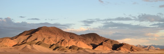
Sunset at the dunes.

When the sunset show was over, I started making dinner: chicken cordon bleu with fresh creamed spinach and chanterelle mushrooms (from the freezer). It got dark quickly. I kept checking out the back windows for the moonrise, which was expected just north of due west at about 6:30. There were clouds out there on the horizon and I wondered it they’d clear out enough for me the see the moon coming over the mountains. Overhead, stars started appearing one-by-one with Venus leading the way.

My dinner was almost ready and it was dark when the sand dune hikers returned. I turned on one of my outside lights for them. Soon their engines were running and I saw taillights down the road. I didn’t envy their drive back to pavement in the dark.

Moon Rise
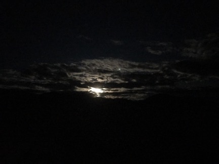
Moon rise through the clouds.

My friend Bob called and we chatted for a while. It had snowed quite a bit at home and he’d spent the weekend in his shop, working on a Moto Guzzi motorcycle he’d owned for more than 20 years, getting it back into pristine condition. Unfortunately, the work he needed to do on the engine required him to keep the door open to the cold so he wouldn’t be overcome with fumes. While we talked, the moon rose just where I expected it to, making the clouds around it glow. Overhead, the stars faded away, unable to compete with the moon’s brightness.

I went to bed with a book I’d downloaded from the library, Time and Again by Jack Finney. I originally read it not long after it was first published in 1970 and it seemed brand new to me. I recommend it.

I slept great until about midnight, then woke for a while, then slept again until after 6:30. The sound of rain that was nearly forecasted nor on radar got me out of bed. It was overcast (again).

Outside, the dunes taunted me.

The hourly forecast said it would clear up around 10 AM. It would be my last chance to hike to the dunes; I really did need to get on my way if I wanted to see other remote parts of the park. So, after coffee and breakfast, I did the dishes and dressed, getting the camper prepped as much as I could for departure. The sun finally made an appearance as the clouds fled west, faster than the sun could climb into the sky.

Two pickups drove by. I started wondering why vehicles nearly always came by in pairs.

It was just after 9 AM when I started my hike to the dunes. Although satellite images had shown the remnants of a road that went that way, I couldn’t find it. So I just cut as straight as I could through the desert. Halfway there, I stripped off my flannel shirt and faced the sun in a tank top. The shade temperature was below 60°F, but I was not in the shade. The sun felt amazing on my skin and the light breeze kept me cool.

I looked back every once in a while. Although I thought the route was pretty flat, we apparently descended into a dip; I couldn’t see the camper when we were about halfway to the dunes. I later saw it again and made a note of the knob on the mountaintop behind it so I could easily navigate back in the unlikely event that my phone’s GPS tracker failed and I couldn’t see my rig.

Desert Mushroom
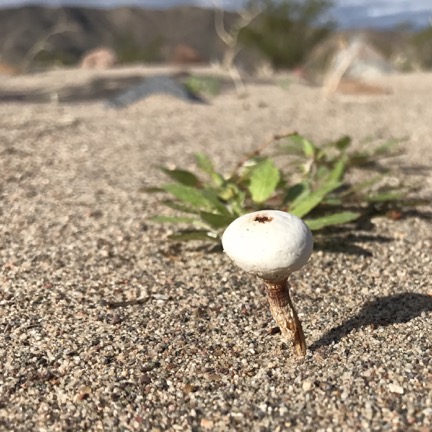
I saw three of these within a half mile radius of each other. They were about an inch and a half tall.

The walk took about a half hour, with stops along the way to look at interesting plants, including mushrooms (!), and rocks.

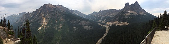
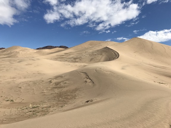
The dunes are large and I felt small beside them. Penny went nuts running up and down the sand. She loves the beach and I suspect that to her, there was nothing better than a beach without water.

Ibex Dunes
A closeup shot of part of the dunes.

Dune Ridge
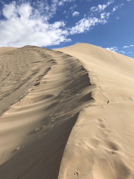
I didn’t get very far trying to climb up this ridge.

I took a bunch of photos. Unfortunately, although I might have been in the right place, I was definitely not there at the right time. The dunes were in full sun and the golden hour was long gone. Shadows were relatively small. The light was bright and harsh. A more serious photographer would have arrived at dawn — and gotten rained on along the way.

I tried to climb one of the ridges, but when I got to the point where every step forward slid me a half step back, I quit.

It was windy there — windy enough for my footprints to disappear within seconds of me laying them down.

We stayed about a half hour, then turned around and headed back. By this time, it was almost cloudless. The sun still felt good on my skin and I never really worked up a heavy sweat. Halfway back, my path intersected with the old road and I saw the footprints of the previous day’s visitors. I almost lost the trail when a wide wash ran through it, but I picked it up on the other side and was almost surprised to see that it delivered me almost right back to the door of my camper.

Behind me, the dunes smiled and winked.

After a bathroom break and something cold to drink, I finished up this blog post. I want to get back on the road before noon and I suspect I won’t have as good an Internet connection as I have here for a few days.

I know a lot of people will read this and be amazed that I spent two days alone in such a remote place. Wasn’t I scared? Wasn’t I lonely? How could I stand to be so completely alone for so long?

First of all, no, I wasn’t scared. I come to places like this very prepared. Why would I be scared when help is a phone call away, phone service is excellent, and I have everything I need on hand to survive for at least a week without skipping a meal?

Second, no, I wasn’t lonely. I don’t get lonely. Loneliness is a feeling suffered by people who need to be around other people to be happy. While I wouldn’t call myself anti-social, I’m also not dependent on other people to keep me — well, what? What is it that people need other people for? Conversation? Sex? Companionship while watching television? Am I that unusual in that I can go for more than two days without any of that?

I love my friends, but I don’t need to be with them all of the time.

And third, not only can I stand to be alone, but I rather like it. I’ve always needed a certain amount of alone time. Time to think and reflect without having to keep someone else entertained. Time to read and write and do photography without someone interrupting me, demanding my attention. Time to do whatever I want to do without someone else making judgements about how I spend that time.

When I was in a relationship, every year my future wasband used to ask me what I wanted for my birthday. In the later years, I told him that all I wanted was to have the day to do what I wanted to do. I wanted alone time.

I finally have as much of it as I want.

The Sticker on the Coffee Cup

Logic, U.S. government style.

Last week, I was in the North Cascades National Park. On a whim, I stopped by the Visitor Center at Newhalem. In addition to the usual interpretive displays, they have an excellent three-dimensional map of the area that identifies rivers and lakes and dams with lights; push a button and a red light appears on the map to show you where that thing is. They also had a ranger standing at a table with a bunch of reproduction animal skulls (wolverine, wolf, and bear) and corresponding paw castings and pelts. And a gift shop.

I went into the gift shop before leaving because … well, that’s what I do. I found some interesting kids’ stuff and picked out two gifts for my neighbor’s grandson, who has some learning disabilities. Then I saw a large coffee mug I liked — I like a big cup of coffee in the morning — and thought I’d buy it as a little gift for myself. But it had a paper sticker on it that had nothing to do with the mug. I reached for another, hoping to find one without a sticker and that’s when I realized that they all had stickers.

The sticker, which is shown below, says:

The North Cascades has an annual rainfall of over 200″ in some areas, which feeds the many cascading waterfalls of the region.

Sticker on Mug
This sticker was on every single coffee mug in the shop.

On a side note, I can definitely believe that rainfall figure because it rains every single time I go there. Although I like rain more than most people — probably because it rains so seldom where I live — I prefer getting rain at home instead of when I’m traveling. (Yeah, I know: whine, whine, whine.)

Of course, being the inquisitive person I am, I had to know why this sticker was on the mugs. So when I went to pay for my purchases, I asked the ranger at the check out counter.

He didn’t know. He said he’d never even noticed the stickers. He said he’d ask the guy who stocked the shop.

PFDs when flying across the Grand Canyon?

This brings to mind another side story that is related to this.

Years ago, the FAA changed its rules regarding personal flotation devices (PFDs or life jackets) on board flights conducted for tours. The new rule said that if any part of the flight crossed any body of water, a PDF was required for each passenger. This extended to Grand Canyon tours, which, of course, cross the Colorado River 5000 feet or more below the helicopter’s flight path. When I was a Grand Canyon tour pilot (which was before this rule came into play) the pilots often discussed that in the event of an engine failure, we should autorotate anywhere except to the water. The river was about 55°F, flowing at 10 mph or more, and full of rapids. When you’re doing an autorotation from 5000 feet, you have plenty of time to find and navigate to a more suitable landing zone; believe it or not, there are quite a few inside the canyon.

I spoke to the woman who created this rule — an aging FAA pencil pusher who had likely never flown across the Grand Canyon and reminded me of my sixth grade teacher, Miss Dumphy — and tried to tell her how silly (actually, idiotic, but I toned it down) her rule was. She didn’t care. Water was water; the way her rule was written, PFDs would be required when crossing a 3-foot-wide stream.

I didn’t have long to wait. That ranger walked by a moment later and the guy I’d asked called him over and asked him. He seemed almost embarrassed when he told me that they weren’t allowed to sell anything in the gift shop unless it provided some kind of interpretive or general information about the park.

Apparently, just having a logo on the mug wasn’t enough to satisfy some decision maker higher up on the food chain. The sticker was the solution.

I bought the mug as a practical memento of my visit to the park. I didn’t mind paying the price — which I honestly can’t remember — because I figured that it was another way to support the National Park Service. I didn’t need any additional information about the park to help me justify my purchase. And I definitely didn’t need a sticker that I had trouble scrubbing off once I got home.

But it makes me wonder … what other things are National Park Service employees being required to do to meet government guidelines established by someone in Washington who may have traveled to only a tiny fraction of the parks?

Summer 2016 Road Trip, Day 3: Colonial Creek to Baker Lake

A tale of two parks.

It began raining very early in the morning, maybe around 3:30. I was wakened by the first drops — my years as a cherry drying pilot have fine-tuned my senses to react to the sound of rain overnight. At first, I thought the sound was caused by tiny pine cones hitting the top of the Turtleback. Click, click, click. I could count the impacts if I wanted to. It was only when they were falling too frequently to count that I realized it might be rain. At first, I couldn’t believe it — after all, the day before had been perfectly cloudless day nearly all day. I looked up through the clear plastic sunroof over the bed, trying to see stars. When I couldn’t, I knew it was rain.

It might be my years of living in Arizona followed immediately by years of living on the desert side of the Cascade Mountains in Washington that make me forget that it sometimes rains when you don’t want it to. Yes, we had a rainy cherry season at home this summer: more than a dozen days with rain in the 10 weeks I was on call. But the weather for the week before my departure had been drier than dry — normal, in fact. The grass that had managed to stay green since spring was finally turning to gold, the wildflowers were withering, the blackcap raspberries I’d planted in the spring needed watering almost every day. Surely it wouldn’t be raining anytime soon. Especially not on my vacation.

But there it was: a heavy shower in the campground. The sound of the rain on my roof and in the trees almost drowned out the sound of the rushing water in nearby Colonial Creek. Almost.

Even after the rain stopped about fifteen minutes later, I couldn’t get back to sleep. I read for a while and did a crossword puzzle. Then I slipped out of bed, made a cup of coffee, and finished up the blog post I’d started the afternoon before. When it got light, I made myself a bowl of cereal with some of the blueberries I’d picked on Saturday morning and kept working. I pulled photos off my phone with a USB cable, not realizing that the cable was keeping the phone charged at the expense of my laptop’s battery. When I was done, my laptop’s battery was down to 24% power. That meant using the inverter to charge it so I could publish the post later when I was back in cell phone coverage later. The inverter has a noisy built-in fan and I only use it when I’m not around to listen to it.

Back on the bed, Penny got up out of her bed and stretched. I lifted her off the bed — it’s too high for her to jump down safely — and put her on the floor. It had drizzled a few times since I got up and it was raining then. She didn’t seem to mind too much when I let her out. She did her business under the truck — one of the benefits of being a tiny dog is that she can just walk under it. She came in when she was done and I gave her some breakfast while I got dressed.

It was a lazy morning, to be sure. None of my neighbors seemed to be awake. No noise from the RVers on either side of me. I could imagine the tent campers snug inside their nylon shelters, dreading breakfast on a wet picnic table. We’d had heavy rain one day on my last tent camping trip which, coincidentally, had been at the same campground the previous year. I’d been prepared with a tarp and ropes and we’d rigged up a good shelter over our table. So good, in fact, that we invited a family of four tent campers to join us under our shelter for dinner since they didn’t have a similar shelter at their site. But RV camping makes tarps and temporary shelters from the rain unnecessary. It makes the whole camping experience easier. Is it still camping, though? I guess that depends on how much of a purist you are.

I grabbed a nylon rain jacket and put it on over my long-sleeved shirt, just in case it started raining again. Then Penny and I took a walk to the garbage dumpster. I visited the very clean restroom I hadn’t noticed the day before and enjoyed the luxury of a real flush toilet. On the way back to our site, I noticed the family of tent campers at the creekside spot two spots down from us sitting dejectedly in folding chairs around a cold, wet fire pit. I hoped their day would get better.

After washing the dishes and stowing my loose belongings, I closed up the Turtleback and got into the truck with Penny. It was about 9 AM when we rolled out of the campground. We hadn’t used the picnic table or fire pit once.

On the Road Again

My plan had been to explore the area on the west side of Baker Lake, which was in the Baker-Snoqualmie National Forest. I was hoping for a lakeside campsite, possibly in one of the campgrounds I saw on my North Cascades area map. I wanted to get in a hike before the end of the day and thought I might find a good one along the way. Or possibly a good walk from my campsite once we’d parked. In any case, I was in no hurry to get there.

I did want to make at least one stop: the park Visitor Center in Newhalem, which was along the way. I knew from experience that my cell phone would work there. I wanted to check messages and texts, update my house-sitter and a friend with my current location, publish my blog post, and post my two hiking track logs with photos. And maybe check in on Facebook and Twitter. In other words, check in with the rest of the world.

I have to say this about being off the grid: On one hand, it’s wonderful to not have communication and social media distracting me and taking up so much of my time. But on the other hand, it sucks to not have access to basic information such as weather forecasts and maps. The weather had completely taken me by surprise, which would not have been the case if I’d had access to the Internet.

Along the way to Newhalem, I saw some of the damage wrought by the fires that had swept through the area after my camping trip last year. Thousands of tall fir trees standing dead, their needles burned off, skeletons of what they once were. There were dozens of patches like this along the mountainsides, climbing high into the low-hanging clouds. I wondered why I hadn’t noticed the extent of the damage the previous autumn when I was in the area for a mushroom course at the North Cascades Environmental Learning Center. Had I been too distracted by the autumn colors? Or had the weather that weekend been so much worse that I just couldn’t see the burned up trees? It had certainly rained very hard on our mushroom hunting day.

My phone pinged to life about a mile short of Newhalem. Text messages, social media notifications, missed call notifications. The usual. (My house-sitter texted to say that she couldn’t believe how many tomatoes and eggplants were in my garden.) Nothing pressing. But it did mean that I was back on the grid.

I parked in a regular spot near the Visitor’s Center in Newhalem. It was pretty much deserted at about 9:30 AM. I fiddled around with my devices, posting my track logs with photos from my phone first and then using my iPad as a hotspot for my laptop to publish my blog post. It sounds a lot more complex than it is. While the blog post and its photos were being uploaded, I used my phone to check Twitter and Facebook and reply to some comments there. Then I posted links to my track logs and new blog post. The whole chore took less than 15 minutes. When I was done, I closed up all my devices, put away my laptop and iPad, put my phone in my pocket, and went to see if I could find a decent map of British Columbia at the Visitor Center.

I was chatting with the ranger when my phone rang. Seriously: I would only be on the grid for about an hour but someone managed to catch me. It was a woman who wanted me to do helicopter rides at Quincy’s Farmer Appreciation Day in September. She needed details for an article in the newspaper. I answered her questions while I looked at the books offered for sale. When I hung up, I chose a small book about easy hikes in the North Cascades. (I later discovered that I had already done all or part of six of those hikes, including the two hikes I’d done the previous day.) I also bought a “2016 National Park Service Centennial” refrigerator magnet. And I got a free map of Washington State’s Scenic Byways. The ranger and I chatted briefly about the road to Baker Lake before I left.

I made a quick stop in the store across the street, looking for velcro, which they didn’t have. Then I was back in the truck with Penny, heading out of town.

Although Newhalem is still inside the park, it feels as if it’s outside. The road winds mostly down to the west from there, out of the mountains. I stopped briefly at the convenience store in Marblemount, still looking for velcro, and emerged with a small tube of Gorilla Glue, a pint of milk, and some Hostess Cupcakes. Then more winding, descending road. I was now farther west than I’d ever been on Route 20. But I hadn’t really missed much. Once I’d left the park, it was typical foothills driving on the west side of the Cascades: cloudy with rain showers through rural land with the occasional town. Seriously: does it ever not rain on that side of the mountains?

I took a detour off route 20 through the historic area of Concrete. This is a cute little town that might be (but probably isn’t) popular with tourists on weekends. I did find what I was looking for, though: a True Value hardware store. These small town hardware stores are really gems. They’re loaded to the gills with everything you might need to build, repair, or decorate your home. This one occupied two storefronts with an open area between them. Because my truck was protruding into the main road, I wasted no time getting someone to help me find what I needed: adhesive velcro and a outdoor folding chair. If I’d had more time, I would have wasted an hour in there and probably bought a lot more than I needed. There’s something about a good hardware store that I really like.

Back on the road, I almost missed the turn for Baker Lake. The narrow, winding road climbed up a steep hill with lots of 10 mph switchbacks. I had to take it slow and started wondering how long it would take to get to the lake. I hadn’t expected the road to be quite like that. But then it ended abruptly at the road I should have turned on: Baker Lake Road (Route 11). I’d unwittingly taken a “shortcut” that wasn’t very short.

On Baker Lake Road

Baker Lake Road was wider, better maintained, and straighter than the one I’d been on. It headed north, paralleling Lake Shannon and then Baker Lake. I passed the turnoff for Route 12, which led westward to the Mount Baker Recreation Area. Soon — very soon, it seemed to me — I was at the turnoff for the Upper Baker Dam, which created Baker Lake. I turned in to check it out.

About two miles down the road was a mostly vacant campground with parking lot like sites. Beyond that, a fork in the road with the right leading to the road over the dam and the left leading to the boat ramps. For reasons I still can’t determine, I went left. I wound up in a parking area full of boat trailers and fishermen taking their boats out of the water. It was busy; I guess Baker Lake is a real hit with fishermen. I noticed I had a cell signal there and consulted the map on my phone. I was exactly where thought I was. And I didn’t need to be there. So I turned around and retraced my route back to the main road.

Shadow of the Sentinals
The main features of the Shadow of the Sentinels Nature Trail were the old growth trees towering well over 100 feet into the sky.

Shadow of the Sentinels Nature Trail was my next stop — and not a moment too soon. Penny was eager to get out and run around. This is one of those stops built to help the casual tourist get in touch with nature — without much effort. It doesn’t matter if you’re young or old, fit or a couch potato, tuned in with the world or out of touch with reality. Who can’t take 20 minutes to walk on a boardwalk among old growth trees in a densely vegetated grove? The half-mile loop trail wound into the forest with plenty of interpretive signs along the way. The forest floor was absolutely carpeted with moss, fern, lichen, and countless kinds of shrubs. The trees grew straight up into the cloudy sky, draped with what looked like Spanish moss. If it weren’t for the boardwalk, the trail would likely get grown over weekly. And yes, a 680-year-old tree is very big. Think redwoods big.

There weren’t many people there, although one group was a family with two small, loud boys whose shouts seemed to echo throughout the forest, audible no matter how far away I was. Penny and I walked the trail quickly, more for the exercise and experience than to learn anything new from the interpretive signs. I would have stayed longer on a nicer day, especially if the loud kids weren’t around. As it was, I think I was more fascinated by that winding boardwalk than anything else.

Boardwalk Trail
To me, raised boardwalks like this one, forming a nearly a half mile long trail through the forest, are the real attractions of nature trails like Shadow of the Sentinels.

Back on the road, I skipped the turnoff for campgrounds at Horseshoe Cove and Bayview, preferring to go farther uptake. It wasn’t much of a drive. The map made everything look farther away than it was. I drove through Boulder Creek and Panorama Point campgrounds. They were similar: very small campsites nearly right on the road, some adjacent to the ones beside them. Very little privacy. Most had Reserved signs on them; it was a while before I realized that the dates were in the future and most of the empty sites were not reserved for that night.

It was around this time that I started getting a bad vibe about the area. I can’t really describe it. It kind of reminded me of old, off-season resorts in the Catskills: busy and popular at one time, but now neglected and decaying. This feeling would nag at me as I continued up the road, visiting one campground after another. It got especially strong when I drove through what my map referred to as Baker Lake Resort but the sign identified as Swift Creek Campground. It may have been a resort at one time, but now it was just a collection of campsites, a closed down store, and a boat ramp. In many of the campgrounds, there appeared to be squatters — people who had been living there for a long time with lots of junk spread out in their site. It was unclear whether these sites had a nightly fee or if a Northwest Forest Pass was sufficient. At one campground, a very nice site overlooking the water was being used as overflow parking with three cars in it — but no sign of camping. I felt almost as if I were intruding just by driving through.

I continued up the road. Past a certain point, people were camping alongside the road. They’d park in narrow turnouts and set up their tents between the road and the lake. Some of these sites were quite spacious — but they were still right next to the road.

Free Camping

Camping is pretty much legal anywhere in National Forest or BLM land where it isn’t prohibited. In other words, if you find a nice parking spot down a side road in a National Forest and there isn’t a No Camping sign around, you can camp there. Campfires may or may not be allowed depending on local burn bans. Firewood collection might not be allowed; again, it depends on local rules. There likely won’t be any facilities and you’ll have to pack out your trash. Although there’s often a 14-day limit, it’s usually free.

That’s how I camped for free on my first night of this trip. I also did it in for weeks on BLM land along the Colorado River in Arizona with some friends this past winter. There’s nothing nicer than free, private waterfront living.

I kept going past the Pavement Ends sign and continued on gravel. No big deal for me and my big 4WD high clearance truck, but I assumed it would weed out a lot of city dwellers who liked to keep their cars clean. (Although I suspect it’s hard to keep a car clean in a place where it seems to rain all the time.) There were still people camped along the road. In one place, there were two empty boat trailers parallel parked alongside the road; I still can’t figure out how they got their boats off, through the narrow stretch of woods, and into the water.

As I neared the top end of the lake and passed the Road Narrows sign, I realized that I was probably not going to find a campground site I liked. I started looking at options along the road. Near the end, I found a nice turnout that had obviously been used for camping. Although large rocks prevented me from driving all the way in, there was plenty of room to back in far enough off the road. Beyond the rocks was a trail leading down to the water. But it wasn’t the lake anymore; it was the rocky delta of Baker River. I got back into the truck and kept driving. A half mile farther, the road ended at a trailhead parking lot for the Baker River Trail — coincidentally one of the trails in the book I’d bought that morning. People were parked along the edge of the parking area and tents were set up in the woods nearby. A makeshift campground.

Night 3 Parking
Here’s where I parked for the third night of our trip. It was far enough off the road, surrounded by drippy trees with the river a few hundred feet away out back.

I backed the Turtleback in beside another truck camper, thinking I might spend the night right there. But when I got out to take a look around, I got those bad vibes again. This is not where I wanted to spend the night. Who knows what these people might be like? Would they be crazy drunks who get loud after dark? Would their dogs be barking on and off all night, triggering Penny to do the same? Did I really want to be parked right next to another RVer and have to lower my blinds for privacy? Suddenly, that spot back up the road looked really good. So I got into the truck, drove back to it, and backed the truck in as far as I could go.

Not what I’d envisioned for the night, but it would do.

Lunch and a Hike

By this time, it was after noon and I was hungry. I heated up some leftover steak and ate it with a salad that included the last of the tiny tomatoes from my garden. I drizzled the steak juices over some kibbles for Penny.

Then we headed out for our afternoon hike. I figured we’d follow the short of the river back up to the trailhead and then follow the trail for a mile or two. My goal was to make sure I got my 10,000 steps a day on this trip and I wasn’t even halfway there. Three or four miles would be enough.

The shore of the river was rocky, with smooth river stones carved by glaciers far upstream and carried down by spring floods. Huge, old growth trees, torn out by wind and water, lay scattered like so many matchsticks on the rocks. The river’s channels wound through the delta, its water rich with glacial flour that gave it a milky color. The sound of the rushing water competed with the sound of the drizzle on the hood of my nylon rain jacket.

Baker River
Looking down Baker River, from the shore right behind my campsite. Every once in a while, the sky would brighten, leading me to believe that it might clear up, but it never did.

It wasn’t an easy walk. The rocks were large and required carefully footing to navigate without mishap. The logs often blocked the most direct route, requiring me to go around or over them. Penny accompanied me, sometimes in front of me, sometimes lagging behind to sniff at a stump or clump of weeds.

We reached the trailhead parking lot/camp area a while later. I was surprised to see that we’d already walked almost three quarters of a mile.

We passed a few of the people there. None of them acknowledged us. One guy walked right past us without so much as a nod. Unfriendly. That vibe again. I was glad we weren’t camping among them.

We got on the trail and headed north. It was a very wide, very smooth, very level trail. Easy. I set a brisk pace. My goal was to walk a total of two miles — as measured by the Gaia GPS app on my phone — and then turn around and walk back, taking the road from the trailhead to our camp. A brisk pace would make it a good workout and hopefully get us back before the rain soaked us.

It was a nice walk through old grove forest. Every once in a while, I’d notice a particularly huge tree or interesting bit of vegetation. There were few wildflowers, but I think that’s mostly because the forest floor probably got very little sunlight.

Bridge Across Baker River
This sturdy wood and steel suspension bridge spans Baker River for hikers and horseback riders. This is our tax dollars and park fees at work, folks.

After a while, I caught sight of a bridge across the river. It was a wood and steel suspension bridge, designed for foot and horse traffic. The trail spilt here. The Baker River Trail continued north as a narrow path for hikers only. The Baker Lake Trail turned right over the bridge and continued south down the other side of the river back to the lake. I chose the wider trail, mostly because I wanted to be able to keep an eye on Penny, who is easily hidden by tall brush alongside narrow trails, and to keep my jeans dry.

The Bridge over Baker Lake
I really admire the structures like this, especially when they’re so well-built and out in the middle of nowhere.

As we walked over the bridge, I took a moment to look at the solar panels attached to it, wondering what they could be powering. The answer was on the other side: a USGS flood gauging system that likely broadcast information to a base somewhere.

Blum Creek
Blum Creek, near where it enters Baker River. You might think that all this flowing water is from the rain. It isn’t. This is glacial runoff.

We crossed another small footbridge, this one over Blum Creek, and continued through the woods. The rain started to pick up, but, at the same time, my quick pace was causing me to work up a sweat under my layers of clothing: long sleeved shirt, fleece hoodie, nylon rain jacket. I stopped to pull off the hoodie and leave the rain jacket draped over my shoulders. We’d walked just short of two miles when I’d had enough. We turned around and went back the way we came.

It was a good thing we did. The rain started coming down harder. Back on our side of the river, we passed a family hiking north; I figured they had to be from Seattle and used to the rain.

I put the leash back on Penny as we finished the hike along the road from the trailhead parking lot to our camp. Although she’s usually pretty good around cars, I didn’t know how people would be driving.

It was good to be back in the Turtleback.

Repairs

After stripping off my wet clothes and putting on some dry ones, I did a few repair chores.

The first was the velcro. Apparently one of the three pilots who had stayed in the Turtleback during cherry season had snapped off the plastic latch that holds the medicine cabinet door closed. The result: the door swings open and closed during travel, spilling medicine cabinet contents all over the bathroom. Not acceptable. I’d found a temporary remedy with a bungee cord, but it was a royal pain in the butt to deal with.

I decided to try velcro: one small piece in the top corner of the door. I prepped the areas by cleaning and drying them thoroughly and then sticking the stuff on. The instructions say maximum adhesive strength is in 24 hours, so I left the door open for now and will close it before moving on.

The second was the latch to the cabinet under the sink. All of the cabinets have push-latches that keep the doors closed until the button on the latch is pushed. But the one under the sink doesn’t catch properly. The result: the door swings open and closed during travel. Although nothing falls out, it bugged me that the door wouldn’t stay closed. Surely there was something I could do.

I compared the door latch on that door with another cabinet door and discovered that its position wasn’t quite right. I used a screwdriver to loosen the latch, shifted it back a bit, and tightened it back up. Voila! The door works perfectly.

The Turtleback needs one more repair that’ll require parts from Lance: the latches that hold sunroof over the bed in the full down position broke off. I think this is because they’re plastic and have spent a lot of time in the sun. I’ll have to order and install new latches. Until then, I’ve discovered that I can keep the sunroof in the slightly open position while driving; not locking it in that position causes it to swing wide open, which isn’t a good idea in rainy weather or at high speeds. When I’m parked, it’ll stay full down, even without the latches.

I’d like to make a few improvements, too. For example, there are key hooks over the door; the previous owner likely put them there. Trouble is, you need to be in the camper to reach them. In the Mobile Mansion, I’d mounted the key hooks near the floor at the door. This made them easy to reach from inside or outside with the door open. Instead of key hooks up there, I’d like to put a shelf. I already had a charging station for my phone installed on the side of the cabinet there, which is close to the stereo so I can plug in my phone for music while charging it. It would be nice to lay the phone and other things, like my sunglasses and wallet, on a shelf up there, out of the way.

And hooks. I need hooks in the bathroom to hang items I want to dry.

I’m still debating whether to remove the stove lid and use my big cutting board there as a lid and additional counter space. The stove lid in the Mobile Mansion broke off within a few months of buying it and I never missed it. The cutting board has feet that fit solidly over the stove grating. I can stand it up behind the stove when not in motion. I think it all depends on whether I can remove the stove lid neatly, without breaking it. I’ve already removed a cabinet door in the sleeping area because the mattress I added makes the bed too tall to get the door open.

These are all things that get hashed out when an RV is in use. I like to customize my space, especially when I know I might spend months traveling with it, as I hope to this winter.

R and R

When I was done with the repairs, I relaxed at the table with a crossword puzzle. I’m just starting to figure out how to get comfortable in the Turtleback and I admit that I sorely miss the Mobile Mansion’s La-Z-Boys. It it hadn’t been so nasty out, I probably would have tried out my new chair, possibly set up along the river bank.

Inside the Turtleback
A panoramic view of the back end of the Turtleback from my seat at the table. We were surrounded by lush, green forest, dripping from the rain. You can see the trail down to the river on the right side of this photo.

Penny wanted to nap, so I lifted her up onto the bed and she got into her bed. I thought she had the right idea and climbed up beside her. Soon, I was drifting off to sleep. When it got chilly, I went down to fetch a blanket. Then I was out like a light.

Until 8:30 PM.

Sheesh. I couldn’t even use a long hike as an excuse for such a long nap.

Miraculously, I wasn’t hungry when I woke up. That didn’t stop me from eating the pudding I’d made that morning and left in the fridge for dessert.

It was nearly dark when I let Penny out to do her business for the last time that evening. I gave her some dog food, which she turned her nose up at. Then I put her back on the bed and she went back to sleep.

I stayed up at the table for three hours writing this blog post. Outside, it rained hard for a while. I cracked one of the windows open so I could hear the sound of the river not far away.

I decided I wanted an early start in the morning. I’d be heading back into civilization, staying at a State Park campground on the coast after making stops at Trader Joe’s and a supermarket. I might even have a full hookup Wednesday night.

I just hope it stops raining.

It was nearly midnight when I went to bed. When I turned off the light, it was pitch black dark — darker than I’ve been in for a long time. And other than the faint sound of the river out back and the dripping of the trees, it was dead quiet.

Camping in the North Cascades

My first real camping trip in at least 15 years is an exhausting ton of fun.

Last week, Kirk and I went off-the-grid on a 5-day/4-night camping trip in Washington’s North Cascades National Park.

To many people, the North Cascades is a “drive-thru” park. That’s because one of the nation’s most scenic roads, the North Cascades Highway (SR 20) winds right through it. It’s also part of the Cascade Loop, a 400-mile driving tour through the Cascade Mountains. The loop runs right through Wenatchee, up Route 97 through Chelan, up the Methow Valley on Route 153, past Twisp and Winthrop on Route 20, and then through the North Cascades Mountains past Washington Pass and the Skagit River dams and their lakes: Ross, Diablo, and Gorge. It eventually dumps down into the Seattle area where it goes south, eventually hooking up with Route 2 for the eastbound leg up Highway 2 through Stevens Pass, Leavenworth, and Cashmere, back to Wenatchee.

Although I’ve spent eight summers in Washington and have been living full-time in the area for the past two years, I’d never driven any part of the North Cascades Highway. I was supposed to do a camping trip up there in September 2012, but more pressing matters brought me home to Arizona early that year. But this year, I planned two trips that way: a drive-thru trip on motorcycles with my friend Bob to Friday Harbor later this month and a camping trip with Kirk at the beginning of the month.

The Gear

I had all my camping gear from when I brought it to Washington in 2012. Back then, I had the silly notion that my wasband, who claimed to want to spend the summer with me, would go boat camping out on the Columbia River. So when I packed up my RV for my annual migration north, I packed up all the gear we’d need: the good tent, sleeping bags, cotton sleeping sacks, mess kit, lantern, etc. My wasband apparently had other ideas, so we never used the equipment together again. But it sure came in handy when I packed for this trip.

Although Kirk has an all-wheel-drive vehicle, I really wanted to take the Jeep. I thought there might be some back road opportunities. I’d already removed the back seat from the Jeep so there was plenty of open space back there. The trick was to stow the gear in boxes that would be organized and easy to pack.

Fortunately, I had a number of wheeled storage bins, including a very large, heavy duty Husky toolbox I’d bought to store tools before I had a building on my future homesite. That became the camping gear box and it held everything we’d need to set up camp: tent, sleeping bags, sleeping sacks, tarp, rope, bungee balls, queen sized air mattress, and three air pumps (two battery and one manual).

I used another smaller box for kitchen items: butane camp stove (which I’d bought in 2012 but had never used), two covered frying pans, a coffee pot, a small bin full of dinnerware and cups, and the vitally important equipment to make coffee. That box also took the items that didn’t need to be kept cold: coffee, scones I’d made the day before, bread, cookies, oil for cooking, etc.

I also have a wheeled cooler I bought for my boat. I filled that with frozen meats (burgers, chicken, and sausage) and a wide range of vegetables from our gardens (beans, peppers, and tomatoes from Kirk’s; eggplant, onions, garlic, and cherry tomatoes from mine). I added milk for my coffee, eggs from my chickens, cheese, and two pounds of cold cuts (turkey and ham) for lunch, Two solid ice half-gallon milk bottles would help keep everything cool for the five days we expected to be out.

I packed a bag with clothes and toiletries, Kirk packed two smaller bags with the same. He also brought along his two inflatable kayaks — mostly because I didn’t have a roof rack for mine — life jackets, and paddles. I brought my portable propane grill, which I bought years ago for travel with the RV — it folds up into its own little carry bag.

Packed Jeep
The Jeep was jam-packed for our camping trip.

Packing all this stuff into the Jeep was a bit of a challenge. When we were finished, the back of the Jeep was completely crammed with stuff. So crammed, in fact, that Penny had to ride on Kirk’s lap for the drive.

The Drive Up

We started out at about 10 AM on Monday, heading north on Route 2 to avoid having to drive through Chelan. We filled the Jeep with gas before we got too far, then settled in for the long drive to Twisp, our first stop, which was on Highway 20 not far from where the North Cascades Highway begins.

Twisp is a great place to stop at mealtime. There are two good places to eat there. Most folks like Cinnamon Twisp, which is where we stopped. It’s a great bakery that’s also open for breakfast and lunch. We sat outside with Penny, eating fresh-made sandwiches on whole grain bread. Of course, I bought an oat bar for dessert.

(In case you’re wondering, other place I like to eat in Twisp is the natural foods store next door, the Glover Street Market. Their Curry Stew and Forbidden Rice Bowl are great warmups for cold winter days. I usually pass through Twisp on my cross-country ski trip to Winthrop every Christmas.)

Kirk with Cider
Kirk posed with a taste of cider at the Methow Valley Ciderhouse.

We continued on our way, stopping briefly at Winthrop in search of a good map. We found several in the local visitor’s center. That’s also where we decided to make a quick stop at the Methow Valley Ciderhouse, just outside of town. This is a funky cool place that looks like it would be fun to visit with a bunch of friends. But that Monday morning, it was just us and the owner. We tasted a flight of ciders and I have to admit that I wasn’t terribly impressed. We left empty-handed and continued on our way.

Our next stop was quite a few miles up the road, at Washington Pass. There’s a big fancy overlook there with lots of parking and a short trail to a lookout point. We parked and made the climb. The view was spectacular, but smoke in the area from the Wolverine Fire on Lake Chelan had drifted into the area, muddying the sky. We’d been driving in the haze since leaving my home that morning and to see it this far up in the mountains was very disheartening. Fortunately, the smoke cleared out as we headed down from the pass, deeper into the Cascades.

Washington Pass Panorama
A panoramic view from the overlook at Washington Pass.

Somewhere along the ride, cell phone service completely dropped out. It would be like that for most of our stay in the area.

The First Camp and Hike

We continued on our way, stopping at just one more overlook. But that time, it was after 3 PM and I was starting to get worried about finding a decent campsite. We’d already decided to camp at Colonial Creek Campground on Diablo (pronounced “Die-ah-blow”) Lake. The campground map showed some tent sites right on the lake and I was hoping to get one of those. By the time we arrived, however, it didn’t seem like any of those sites were open. We wound up instead on a nice, private wooded site. We paid the fee for one night and set up camp.

I was very pleased to see that the tent and its poles were still in perfect condition. I’d bought the tent back in 1992 for motorcycle camping. We needed a good 3-man tent with poles that folded up short enough to be packed on a motorcycle. This was a great tent that had made several motorcycle trips with me and my wasband, including our epic Skyline Drive/Blue Ridge Parkway/Outerbank Islands adventure in 1992 or 1993. Its main drawback was that it wasn’t tall enough to stand up in. That wasn’t such a big deal when I was in my 30s, but 20 years later, it matters, especially when I try to dress. (I wound up changing my clothes outside the tent; our site had enough privacy to make modesty a non-issue.)

The air mattress was another story. Although we’d tested it at Kirk’s place and it had lost some air there, Kirk was convinced that the valves hadn’t been properly closed during our test. Unfortunately, it wasn’t the valves. The mattress, which was admittedly old, apparently had other leaks. It wouldn’t hold air. With no camp store in the area, we couldn’t replace it that first night. So Kirk spread out all our sleeping bags and blankets and towels as padding under where we would sleep.

The campground featured flush toilets in several well-kept buildings on the camp roads, water spigots, and a mix of RV and tent sites. There was a fishing pier and a boat launch. (Boats are limited to 14 feet in the lake, which is why I didn’t bring mine.) Each site had a large picnic table, a designated tent area that was level and smooth, a fire pit (which was useless with a fire ban in effect), and a bear box. A bear box is a secure place you can store anything that smells like it could be food; every night we had to pack up our kitchen box and cooler and stow them inside it.

Kirk and the Big Trees
Here’s Kirk along the Thunder Creek Nature Trail. There are some seriously big trees throughout the park.

We had burgers and green beans for dinner, then headed out on a trail that led from the campground up Thunder Creek. There was a nature trail off the main trail, a 0.9 mile loop that climbed steeply up the side of the mountain, past rock slides, fallen trees, moss, ferns, and old growth cedars and pines. Numbered sign posts corresponded with a guide we didn’t have so we amused ourselves by making up interpretive comments about what we saw at each sign post. Kirk was very good at this — way better than me.

Later that night, we crawled into the tent and settled down on the relatively hard ground. I thought I’d have trouble sleeping, but I must have been exhausted because I slept surprisingly well. Penny slept like a log, mostly because I’d brought along her bed and she was perfectly comfortable.

Day 2: Hiking, Shopping, Moving, Napping, and Hiking

I heated up the scones with butter in a frying pan the next morning for breakfast. The coffee was good and hot. Because the campground was down in a valley, it took a while for the sun to reach us. I think it may have been a bit overcast, too, and that burned off as we headed out on our morning hike.

Colonial Creek
Colonial Creek is full of the “glacial flour” that gives it and Diablo Lake their milky blue-green color.

The hike was on the Thunder Knob Trail. This was a 3.6 round-trip hike that climbed about 425 feet to the top of a heavily wooded hill on the lake. From our campsite, the trailhead was about 1/2 mile away, so we walked to it. The trail starts by crossing Colonial Creek, where glacial runoff flows down the mountain and into Diablo Lake. It then winds through the woods, climbing up on switchbacks. I was still fresh and full of coffee so I didn’t need more than a few short rests. Only one hiker passed us on the way up. At the top were two viewpoints looking down at Diablo Lake and across at the peaks it’s nestled in. It was mind-boggingly beautiful.

Diablo Lake from Thunder Knob
Diablo Lake from one of Thunder Knob’s lookout points.

On the way back, we took a walk along the lakeside campsites. Some of the previous day’s campers had departed. We found an excellent site right on the lake and wasted no time staking it out for ourselves. Then we spent about an hour packing up our original camp, moving everything over to the new one, and setting up the camp again. The old air mattress wound up in a dumpster.

Campsite Campsite
Two views of our campsite: from the lake looking in (left) and from the campsite looking out toward the lake (right). We were right on the lake.

After a good lunch of thick sandwiches and chips, we hopped into the Jeep and headed out to the nearest town, Newhalem, in search of a new air mattress. This was a nine or so mile drive farther down Route 20. Along the way, we passed the Diablo Dam and powerhouse, Gorge Lake, Gorge Falls, and the Gorge Dam.

Just as we got into town, my cell phone, which had been charging in a cradle, came to life with a handful of text messages — including a thank you note from the Realtor who had finally sold my old Arizona house. Let’s just say that I wasn’t the only one celebrating that sale with champagne.

Newhalem is a “company town” that was built by Seattle City Light, the publicly owned power company that owns and operates the three hydro-electric power plants on the Skagit River. It features a general store, a restaurant with odd hours, and a bunch of buildings for company use. Employees who work in the area live in town or in the small community of Diablo, just downstream from the Diablo Dam.

We beelined it to the General Store in search of a new air mattress. The store had a tiny bit of camping gear but no air mattresses. The clerk suggested Marblemount, 14 miles farther up the road.

We stopped for a few minutes at the Visitor Center, which had the usual collection of displays about the river, dams, lakes, salmon, and original native settlers. Kirk spotted a sign with information about a “Dam Good Chicken Dinner” and nighttime tour of Ladder Creek Falls that coming Thursday night. He signed us up. I bought a good trail map.

Then it was on to Marblemount, which isn’t much bigger than Newhalem. The store there had a bit more camping gear, much of it stowed away in a back room. There were some roll-up pads that would have helped us in a pinch. But we were ready to try our luck at Concrete, even farther up the road, when I spotted some twin sized Coleman air mattresses on a bottom shelf. We bought two, feeling very lucky to have found them.

Park Sign
Penny and I posed atop the fake snow at the park entrance sign.

We gassed up the Jeep at the only gas station I’d seen since leaving Winthrop the day before and headed back to the campsite, stopping for some super touristy photos at the park entrance sign, a visit to Gorge Falls, and a very short hike to what was supposed to be an overlook of the Gorge Dam but was blocked by trees.

Back at the campsite, we inflated the two air mattresses and stuffed them into the tent. They literally filled the tent’s floor. Then Kirk inflated his kayaks while Penny went on chipmunk patrol around our site. Sometime around mid afternoon, we found our way into the tent for a nap. The air mattresses were perfect! We woke up near dinner time. I cooked up a concoction of eggplant, garlic, olive oil, and polenta that came out pretty good. We had that with grilled sausages.

Kirk in a Tree
Another shot of Kirk, this time in a tree.

After cleaning up, it was time for our evening hike. We headed back up the Thunder Creek Trail which followed the lake shore up Thunder Creek. It was yet another heavily wooded trail, surrounded by tall, old growth trees but offering few views of either the lake or the creek. Although the trail went on for miles, the idea was to hike until 7:30 and turn back. 7:29 found us at a grove of old growth trees with a big hollow one that was obviously a spot for taking photos. So we took one.

I slept amazingly well that night.

Day 3: Ross Lake, Rain, and the Folks from Maryland

Eggs with tomatoes, onions, pepper, and cheese for breakfast. And coffee, of course.

After cleaning up, we headed out on a hike to Ross Lake Resort. This is one of only two lodging facilities inside the park and it isn’t easy to get to because there’s no road to it. There seems to be just a few ways of getting there. The easiest is to take a ferry from Diablo Dam up to the portage area near Ross Dam, get on the portage truck, and then take a water taxi across Ross Lake. If you’re on a kayak, you can launch it at the Colonial Creek campground, paddle 5 miles up Diablo Lake, catch the portage truck to Ross Lake, and then paddle across. Or you can do what we did: park at the Ross Dam Trail trailhead, hike down to the dam, cross the dam, and hike up the lake to Ross Lake Resort. Although I didn’t have my GPS app tracking us, I estimate the total mileage to be about 2 to 3 miles each way.

Ross Dam
Ross Dam was built with future expansion in mind.

It was a pleasant hike on narrow, well-worn trails. We crossed a creek on a nice wooden bridge early on, near the parking area — more glacial runoff. Then a descent down almost to lake level. Crossing the dam was interesting; I later found out that the reason the Dam has the stepped sides is so that it can be built up to enlarge it at a future date. (Apparently, the Canadians aren’t too happy with that plan.) On the other side, I was surprised to see the trail climb up the side of the hill — I hadn’t planned on two climbs on the return trip — but it eventually leveled out as it headed up lake. We met two hikers waiting for friends at a trail intersection and turned right, down the hill to Ross Lake Resort.

Ross Lake Resort consists of 12 cabins on floating platforms: house barges, in effect. They’re all moored against the shore. There’s an office, a boat rental facility, and not much else. No restaurant, no store beyond snacks. Anyone who stays there not only has to get there, but he has to bring in all his provisions. The cabins are various sizes and include everything you need to live comfortably for the length of your stay. Most folks likely spend most of their stay boating and fishing; most cabins had a boat tied up out front. And of course, the place was entirely off the communication grid. Talk about a comfortable remote getaway! Sign me up!

Ross Lake Resort
Ross Lake Resort consists of a string of floating cabins.

I let Penny off her leash to play with the other dogs, including a boxer named Maple. Kirk and I rested, snacked on nuts and energy bars we’d brought along, and prepared mentally for the walk back. By that time, it was starting to cloud up. We’d heard in Newhalem the day before that there was a 20% chance of rain on Wednesday and it seemed to be coming. The first small drops started falling on us as we crossed the dam. The drizzle continued, on and off, but we arrived back at the Jeep dry enough.

We drove back toward the campground and beyond. Kirk wanted to check out the town of Diablo. I directed him on a turn that took us over the Diablo Dam instead. That put us at the Seattle City Lights Ferry terminal instead. We saw a few young deer and followed a sign for the North Cascades Environmental Learning Center. I was hoping they had a restaurant where I could get something hot to eat, like soup or chili. I ran in to investigate and discovered the only other lodging place in the park: a learning center with weekend programs on a wide variety of topics. I took some literature to check it out later on.

We continued along Highway 20 and soon found ourselves back in Newhalem. (My phone alerted me when we were getting close by displaying a list of new text messages and missed calls.) I bought a can of chili in the General Store and we headed back.

Tarp over Table
We rigged up this great old ripstop nylon tarp over our table. (They don’t seem to make tarps like this anymore.)

By this time, it was raining lightly but steadily. It let up a bit when we reached camp and we had enough time to heat and eat the chili and some sandwiches before it started up again. I mentioned the tarp I’d brought along and we pulled it out, along with the rope and bungee balls I had. It took two tries, but soon we had it hanging nicely from four trees. We moved the table under it just before the rain started coming down in earnest.

We read and napped the afternoon away. The tent stayed remarkably dry, despite the fact that we hadn’t properly tied out the fly. The tarp completely covered the table. I propped a walking stick under its middle on top of the table to raise it and help the water find a way off.

Later, we ran to the bathroom, took care of business, and waited in the shelter of the building overhang for the run back. That’s when we met a family from Maryland who were camped near us and had just returned from a very long hike. They were disappointed that they didn’t have any shelter from the rain and would likely be eating cold food inside their tent. So we invited them to bring their food over and prepare it under our tarp with us. The tables were big enough for all six of us to eat outdoors and keep dry. I don’t think they thought we were serious, but a while later, when we were preparing to make our own dinner, Kirk ran over to their site and reminded them they had the option of joining us. I had just begun heating up the frying pan for a stir fry of green beans (of course), onions, tomatoes, and chicken when they arrived with two big ham steaks, the biggest yam I’d ever seen, two stoves, and two frying pans. Soon we were all cooking and chatting and then eating in the bright light of my old camping lantern, which had to be at least 25 years old.

It was dark when they left. We cleaned up, packed up the bear box for the night, and turned in. It was still raining. But by morning, the only rain sound was the dripping of water through the trees.

Day 4: Long Hike, Where I Sh*t in the Woods, Bear Sighting, Dam Good Chicken

Kirk in a Kayak
Kirk headed out for a pre-breakfast paddle on Thursday morning.

It was still cloudy when we woke up, but with low clouds that clung to the mountainsides offering glimpses of blue sky beyond. After coffee, Kirk took one of the kayaks out on the lake, which was as smooth as glass. I stayed behind and prepped to make breakfast. When he returned, we had the last of the eggs and onions. And the scones. The cooler was getting empty enough to start storing other food in it. The ice was nearly gone, but it was cool enough.

Soon I couldn’t resist the call of the smooth lake surface beyond our campsite. I changed into shorts and climbed into the kayak for a quick paddle up the lake toward Thunder Creek. There were geese feeding on grassy areas and a low ground fog hanging over the water surface here and there. I snapped a few photos with my camera before turning back. The wind was just beginning to pick up when I pulled into shore.

Diablow Lake
A view up the Thunder Creek arm of Diablo Lake from a kayak, early in the morning.

We debated two hikes from the same trailhead that morning: East Bank and Happy Panther. Both ran alongside the Ruby Arm of Ross Lake. Although it seemed to me that Happy Panther Trail might run closer to lakeside, Kirk opted for the East Bank Trail. So we headed that way, descending down to lake level where Panther Creek and Ruby Creek met. There was an interpretative sign there with information about mining operations that had been in the area, as well as a hermit who lived in a home across the creek. We crossed the bridge and started up the trail on the other side, which led downstream toward the lake as it climbed gradually up the hillside. Yet another densely forested trail, soon there was no sign of the creek, although we could hear it and the cars on the road we’d come in on. Soon even that faded away as we walked through the forest on what used to be a road, crossing small creeks along the way.

Open Air Privacy
With no one around, this beats a stinky outhouse any day.

My GPS app, which I’d preloaded with topo maps of the area, showed a barn and horse meadow and we tried unsuccessfully to find that. I think we may have found where it had been, though. We certainly found meadow areas, long overgrown. A little beyond that was the Ruby Pasture campsite, where someone had hung his covered hammock between two trees before heading out on a hike. There was a sign for a toilet and I followed it through the woods. It ended at a pit toilet out in the open with its seat facing the forest and lake. It was probably the nicest pit toilet I’ve ever used.

After a short rest, we headed back. Thats when my leg muscles started aching. I think the rest was the mistake — it seemed to flip a pain switch inside me. I joked that I’d reached my weekly hiking distance limit of 10 miles and now my body was shutting down. I kept a slow pace on the way back, despite the mostly level terrain for the first part. That was probably a good thing. Because I’d hung back, Kirk’s approach down the trail was quieter. So quiet, in fact, that the bear about 100 feet off the trail didn’t hear us until I joined him for a look. It was a young bear — maybe a year old — and it seemed to be alone. After taking a good look at us, it headed up the hillside away from us. I like to think that Penny’s tentative bark drove him off. I took two pictures, but I won’t waste your time or mine sharing them; the bear is nothing more than a black lump in the trees.

I’ll admit that it was great to get back to the Jeep. I was exhausted. We’d only hiked about six miles, but I’d done so much hiking during the week that I really was beginning to tire out.

We went back to the campsite for a quick bite to eat. It was late — about 3 PM — and we didn’t want to ruin our appetite for the dinner later that evening. Then we were back on the road, this time zeroing in on the tiny community of Diablo along the way. This is a collection of company housing for the folks who work at the dams. A bunch of houses that all look the same and a road that terminated at Diablo Dam.

Number 6
I felt a little like a kid climbing up on this nicely preserved steam engine.

From there, it was on to Newhalem. We bought a frozen burrito for the next day’s breakfast — we’d run out of breakfast food — climbed the old steam engine parked nearby, walked the 1/3 mile long Trail of the Cedars Nature Walk, and then checked out the Ladder Creek Falls trail, where we’d be walking later that evening. I was too pooped to make that climb before dinner, so I hung back and waited for Kirk, answering a few text messages and posting a photo or two on Facebook and Twitter while I had cell service.

We got to the Gorge Inn dining room just in time for dinner. It was cafeteria style dining with family style seating. I got to sit beside the ranger who would be leading the walk after dinner. Across from us were a pair of brothers who had grown up in the area and were revisiting it as adults. Dinner was fried chicken, using the same recipe that had been used when the dining hall first opened, with mashed potatoes, and gravy. And green beans, if you can believe that. Dessert was homemade apple pie and ice cream. We left feeling stuffed. I got a doggie bag of chicken skins and meat for Penny and left it for her in the Jeep before we started the walk.

Ladder Creek Falls
One of the ways that Seattle City Light got early support for their dam project was to offer nightly tours of these falls lit up much as they are now. Electricity was new back then so this was a real treat for visitors.

There was a group of about 40 of us for the evening walk. The ranger took his time getting from the Inn to the falls trail — he needed to wait for the lights to come on. Along the way, he talked about the natural and social history of the area, including the history of the dams along the Skagit River. Finally, we reached the start of the falls walk. The lights up the trail were turned on and the colored lights on the rushing creek and falls were doing their thing. We walked along the trail with our companions, stopping to look at the lights along the way. It was funky weird and thoroughly enjoyable.

It was nearly 10 PM by the time we got back to our campsite. We fell into the tent and got right to sleep.

Day 5: Views, a Hike, and a Walk around Winthrop

We heated up that burrito in a frying pan for breakfast. It was remarkably good. But then again, everything tastes good when you’re camping.

We packed up camp at a leisurely pace. Everything was dry. I didn’t bother washing the dishes since the next time they’d be out was home, with my dishwasher handy. We got everything back into the Jeep and even had room to put Penny’s bed up on top of one of the camp boxes, behind the driver’s seat.

We headed out, making just one stop in the park before leaving: Diablo Lake Overlook. We’d stopped there before, but the light and sky was much prettier that morning and I wanted a good photo.

Diablo Lake
I shot this using the pano feature of my iPhone; panoramas don’t have to be wide.

Rainy Lake
Rainy Lake. Can you see the waterfall just left of center in this shot? It was so quiet, we could hear it from the trail’s end.

Then it was back down the road toward Winthrop and home. But not before one more hike. We stopped at the trailhead for Rainy Lake. This was a “handicap accessible” trail, meaning that it was paved the entire way. It wound through forest, under a canopy of fresh-smelling foliage, with signs that pointed out the different vegetation along the way. At the end of the trail was the lake, nestled into a glacier-dug cavity. The entire lake is surrounded by mountains and a waterfall at the south end feeds it with a healthy flow from melting glaciers out of sight above it. Amazingly, there was no one there when we arrived. We climbed down to the water’s edge and watched fish swimming in the clear water. We also found some kind of water bugs in the shallow water that were strangely fascinating to watch.

Washington Pass View
Another view from Washington Pass.

Back in the Jeep, we continued toward home. We stopped again at Washington Pass. Although we’d started to notice smoke again, it wasn’t nearly as bad as it had been on Monday. I wondered if the Wolverine Fire had gotten some of the rain we did on Wednesday.

From there, it was downhill and eventually back in civilization. We passed the turn off for Mazama without stopping and headed into Winthrop, which was surprisingly busy for a Friday midday. We had lunch at a Mexican place — I felt like having a hot, hearty meal — and then walked around town. I bought a birthday present for my friend Bob who turns 65 later this week. After a few hours in town, we got into the Jeep and pointed it toward home again. We stopped for fuel in Twisp but skillfully avoided the bakery, which I longed to visit.

The final stop along the way was at the Orondo Cider Works, which I thought was a cidery. Instead, it’s more of a farmstand that also sells cider. I bought an 8-ounce bottle to drink immediately — I was parched — and Kirk bought a gallon to split with me at home.

It was nearly 5 PM when we pulled into my driveway. We unloaded the Jeep and unpacked the perishables. I checked the chickens — they’d laid nearly 2 dozen eggs! — and irrigation. Everything was fine. Nice to know that I can leave for 5 days without having to worry about anything at home.

Final Thoughts

The trip had been great — everything I wanted and more. Kirk is a good traveling companion who prevents me from being lazy when I might be. We stayed active most of the time and I really got a workout that I needed.

But what surprised me the most was how well we’d packed for this trip. We had everything we needed with some minor exceptions:

  • A second rope would have made hanging the tarp easier.
  • Duct tape would have made it possible to repair the storage box for my camp stove when it cracked.
  • Fresh batteries for the pumps would have made them work a bit faster.
  • Throw rug would have been nice to have outside the tent to keep the entranceway clean.
  • Some canned chili or soup would have been nice when the weather turned rainy.
  • More breakfast food. I honestly hadn’t expected us to stay four nights.

The camp boxes made bringing equipment down to the lakeside campsite — which was not near the car — very easy. And they also made it easy to keep things secure and dry when the wind kicked up or it rained.

There were only three casualties on the trip:

  • Kirk’s air mattress. Admittedly, it was past its prime.
  • One of my folding chairs. I carry two in the Jeep but broke one when we sat out by the lake one evening.
  • Ground cloth. This old piece of plastic, which had to be at least 20 years old, was stuffed in the tent bag. It had become brittle and although it worked for this trip, it would not be good for the next.

Would I do it again? Hell yes! But I think we’ll take Kirk’s big tent next time. I’m getting too old to crawl in and out of that old tent’s doorway.

Stirring Emotions with Misleading Headlines and Photos

I’m sick of people sharing misleading information on social media.

The other day, one of my Facebook friends posted a link to an online petition on a site called Sum of Us. I won’t share the link, but here’s the top of the page:

Petition
This petition’s page is over the top when it comes to using misleading information to stir emotions.

When I saw the image at the top of the page, my immediate reaction was, “The Havasupai are building a mall?”

You see, the photo shows Havasu Falls, which is just down Havasu Creek from Supai, a tiny village on the Havasupai reservation inside the Grand Canyon. Supai is so remote that you can only get there three ways: on foot, by horse/mule, or by helicopter. There are no roads leading down to Supai. Because of this, it gets relatively few visitors — perhaps a 100 a day during peak summer tourism months. It’s widely known for it beautiful blue waters, waterfalls, and travertine rock formations. I’ve been down there three times and feel very privileged.

The idea of Supai having a “super mall” is absurd, so I clicked through to see what it was all about.

Apparently, I’m the only one seeing this post on Facebook who doubted the veracity of the headline/photo combination. Most of the people who saw it shared comments voicing their outrage that such a beautiful place should be ruined and assured the rest of us that they’d signed the petition.

Of course, the real story didn’t have anything to do with the Havasupai land in the Grand Canyon — which, by the way, is outside park boundaries. It was about the Navajo land on the east side of the Grand Canyon and a proposal to build a tourist attraction near the confluence of the Little Colorado River and Colorado River. These two sites are a full 50 miles apart as the crow flies.

Locations
The beautiful waterfall in the photo is 50 miles away from the actual confluence of the two rivers. On this map, green represents actual park land.

The leading paragraph spread more misleading information; they added the emphasis, not me:

Property developers want to build a super-mall smack dab in the middle of one of America’s most breath-taking world heritage sites, the Grand Canyon. The mall would include an IMAX, shops, hotels and fast food cafes. The National Park Service has called the plans ‘a travesty’.

I don’t know about you, but “smack, dab in the middle” should be somewhere near the middle of something — not on the far east end of it. As the map above shows, this development won’t be anywhere near the middle of the Grand Canyon. The Grand Canyon is mind-bogglingly huge: 1.2 million acres or 1,904 square miles — that’s bigger than the entire state of Rhode Island. A development at the Confluence won’t be visible from the South Rim, which hosts at least 90% of the park’s visitors — many of whom spend less than an hour looking at the canyon — or the North Rim.

Grand Canyon Map
Here’s the big picture. Grand Canyon National Park is pink; Native American reservations are purple. You can download the whole map as a PDF. Note that there is a dispute over the exact location of the border between park and Navajo lands that would affect the ability of developers to move forward.

The truth about this story is that developers want to build a tourist attraction on the rim of the Grand Canyon inside the Navajo reservation. It would include shops, hotels, and a tram to the bottom of the canyon so people could actually access a part of the canyon that’s currently limited to hearty hikers, river runners, and mule riders — a tiny fraction of the park’s visitors. This isn’t too different from what the Hualapai have done on the west end with their Grand Canyon Skywalk or what the Navajo have done in Monument Valley with The View Hotel.

And maybe I should remind people that National Park Service concessionaires already manage six hotels (El Tovar Hotel, Bright Angel Lodge, Maswick Lodge, Yavapai Lodge, Katchina Lodge, and Grand Canyon Lodge) and well over a dozen gift shops on the rim of the Grand Canyon, inside the park. And a hotel at the bottom of the Grand Canyon (Phantom Ranch).

So what this petition page has done is used a photo of a beautiful waterfall that was shot 50 miles away, coupled it with a headline referring to a super mall, and led with an untrue statement regarding development in the middle of the Grand Canyon. Someone who doesn’t know the facts and relies on the information on this page might think there’s going to be a giant mall ruining the vistas at one of the world’s natural wonders.

So people sign. They provide their names and email addresses. Those addresses are likely harvested for use in other slactivism efforts. They’re likely followed up with pleas for donations to support the cause.

And people share the link to the misleading information, getting their friends to sign up, too.

And people talk about the “problem,” using the misleading information they read — if they bothered to get past the photo and first paragraph.

And this pisses me off to no end.

Now please don’t think that I’m in favor of more development at the Grand Canyon. I’m not. But I am in favor of Native American people being able to develop their land in ways that economically benefit them. I’m very familiar with the Navajo people, having spent quite a bit of time on and over the reservation. There are social problems including poverty, obesity (and related health issues), and alcohol abuse. Young people are leaving the reservation for better opportunities elsewhere. The native language — which was instrumental in our World War II communication efforts — and culture are being lost. If the Navajo people vote in favor of a project like this on their own land, I don’t see any reason why we should stop them. It would give them jobs, bring more tourists and tourism dollars to their part of the canyon, and help their economy.

Again, the Hualapai did this at Grand Canyon West and no one seemed to care. Why care about this now?

Oh, yeah. “Smack dab in the middle.”

My advice to people reading petitions like this: get informed before you let the authors manipulate your emotions to get the response they want. Don’t share misleading information.

We all know how difficult it is to find the truth on the Internet — and the problem is getting worse every day. Don’t be part of the problem. Don’t share information unless you know it’s accurate.