Business and pleasure.
I spent last weekend in Las Vegas. It was nice to get away.
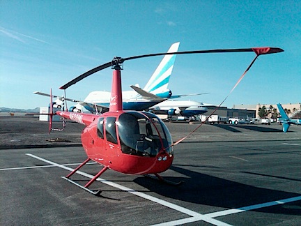
I went for business. (Really!) The FAA was sponsoring an annual helicopter safety seminar at the Rivera hotel conference center. I signed up a few weeks ago. I figured that while I was up there I’d look into the employment situation. A friend of mine who works for the FAA had recommended that I apply for a tour pilot job with two Boulder City-based operators; I figured I’d stop in and drop off resumés.
Although I was hoping to fly up with some paying passengers, no one stepped forward to take advantage of the smoking deal I offered. That didn’t surprise me. And it turned out to be for the best — by driving up, I had my little Honda S2000 up there. It was sweet to cruise The Strip with the top down.
Here’s a quick rundown of my weekend, for those who wonder how someone who doesn’t gamble can stay busy in the casino capital of the world.
Friday: A Long Drive, Casual Job Hunt, and Visit with Friends
After dropping Penny off at boarding for the weekend, I made the drive up in late morning. I made excellent time, arriving in Boulder City in only 3-1/2 hours.
I stopped by each of the two operators wanted to visit. At the first, the person I needed to speak to was out to lunch. I left a resumé. At the second, I met up with the General Manager. We sat down and he interviewed me. We had a nice chat. I interview well; I have nothing to hide, am proud of my achievements, and have a lot of self-confidence. I also don’t need a job. The GM seemed to like me. At the end, however, he admitted that they weren’t hiring because they only had one helicopter in their fleet. He invited me to contact him in March when he planned to expand the business. Then he encouraged me to visit all of the area tour operators to get my name and resumé out.
I drove the rest of the way into Vegas. Along the way, I called my friend Jim. I had tentative plans to stay over at his new house on the west side of Las Vegas. It was early — only around 1 PM — and I needed to hook up with him. He was busy running errands. I told him I’d keep busy and call later.
I hit the McCarren-based tour operators and dropped off resumés. I got the same story from several of them: they weren’t hiring now; the busy season started in March or April. Since I already have a good gig for the summer, I probably won’t be flying in Las Vegas anytime soon. But that’s okay.
I hit the Fashion Show Mall next. I needed a new pair of flat black shoes — I’m not wearing Keds anymore — and figured I’d track them down in Dillards. It only took about 20 minutes to find and buy a pair. Then I wandered upstairs. I needed a suit jacket to wear with my skirt for my upcoming court date. A really helpful saleswoman worked with me to find the perfect jacket. A double success!
I also hit the Apple Store where I got a look at the iPad Mini and bought a new power adapter for my 13-inch MacBook Pro. Penny the Tiny Dog had chewed through the connector on my old one.
I called Jim again and got directions to his house. By 4 PM, I was ringing the doorbell on a huge one-story house in a gated community. Jim opened the door and invited me in. We went out to the backyard, where he showed off the bridge he’d just finished building over his Koi pond. His wife, Judith, joined us. We chatted for a while and then I got the tour of the house.
Jim and Judith lived in Wickenburg for quite some time. Like so many of my friends there, they got fed up with the town and decided to move. Although they stopped in a few places along the way, they wound up in Vegas, where they set up their business. With property values in Vegas so low, they were able to buy a great home and a 30,000 square foot industrial space for manufacturing Start Pacs.
Their new Las Vegas home is very nice. They did some work to close up extra doors, tear out walls to enlarge rooms, and finish everything with a fresh coat of paint. Then they hung their huge collection of Navajo rugs, arrowheads, and other items. The place is like a comfy museum, with plenty of art to admire.
They had a guest room for me, but when I realized that Judith was feeling under the weather, I decided that it might be best to stay in a hotel instead of imposing on her. So I booked a room at the Riviera and, after dinner, checked in.
I didn’t do much that night — I’m not a bar-hopper. But I did sleep extraordinarily well.
Saturday: 6 AM Coffee, a Hike, Safety Seminar, and Dinner with Friends
Throughout this trip, I kept thinking back to my last trip to Vegas, which had been with my ex-husband and his mother.
I’d flown the three of us up in the helicopter, following the Colorado River from Lake Havasu to Lake Mead — my favorite route. After landing at McCarran Airport, we’d checked in the Bellagio hotel, which is actually quite pleasant (sure beats the Riviera, anyway). Then the fun began. My husband had rented a motorized wheelchair-type device for his mom. I got to watch her run into several people in the Bellagio lobby before we ventured out. The highlight of the trip? Seeing her ram the chair into a glass showcase filled with glass trinkets in a shop. I think we were at the Venetian. Nothing broke, but I swear that the shopkeeper was ready to kill us.
Needless to say, despite the comedy, that trip wasn’t my idea of fun. So very glad I’ll never have to do that again.
I may have slept well, but I was still up at the crack of dawn. I consulted the Starbucks app on my phone and learned that there was a 24-hour Starbucks at Treasure Island, which was about a mile down the strip. I dressed, put on my hiking shoes, and hit the pavement.
I like walking in Las Vegas early in the morning before the traffic and tourists get thick on the streets and sidewalks. There’s something magical about this fantasy place, something that makes it special and just a little more real. Like a made-up whore before the johns arrive.
I walked briskly, passing other strollers and the occasional jogger running the opposite direction. The weather was great — nice and cool. At Starbucks, I got my first eggnog latte for the season and a danish. Then I wandered outside onto Treasure Island’s boardwalk to enjoy it.
My Safety Meeting wasn’t until 3 PM, followed by a social hour. That meant I had the entire morning to kill. When I got back to the hotel, I researched the hikes scheduled for the Around the Bend Friends hiking group. I decided I’d go for a hike with them.
But first, I needed a sweatshirt. You see, I’d brought along my old Robinson jacket in case the weather got chilly. The jacket had two problems: (1) It’s black. Black is not a good color to wear in the desert when the sun is out. (2) The jacket no longer fit me. I had lost so much weight that it was far too big on me. I hadn’t worn it in so long that I just didn’t know. So I hit Walgreens on the way back and paid $25 for a light pink (!) sweatshirt with the words “Las Vegas” stitched across the front in white. Not my first choice, but beggars can’t be choosers. I now own exactly one pink item of clothing.
I blogged extensively about my hike with the Around the Bend Friends here. Read it and check out the photos from the hike.
After the hike, I had some lunch in one of the Riviera’s restaurants. Not recommended. Then I showered and dressed for the afternoon event. My brother, who lives in New Jersey and had just gotten his power back after Hurricane Sandy, called and we spent almost an hour chatting. Then my friend Don called to invite me out to dinner; I obviously had to decline since I was 300 miles away.
The safety seminar was informative but relied to heavily on PowerPoint presentations. (Seriously: are people still using PowerPoint to communicate?) A pilot friend of mine, Amanda, was there and sat with me for the second half of the seminar. I chatted with two of the speakers after their presentations to share my feedback with them. I was pleasantly surprised when one of them told me that he regularly reads my blog. Later, at the “social hour,” two other pilots introduced themselves and told me they read my blog. How cool is that?
When the social hour was over, I joined Amanda and four other people for dinner at the Peppermill, which is right next door to the Riviera. It’s a funky place with a real, old-style Las Vegas decor. It specializes in offering breakfast, lunch, and dinner 24 hours a day. I had breakfast — an egg concoction that could have fed the entire table. We talked about helicopters and safety, especially in EMS operations, which one of us had studied extensively.
The subject of my divorce also came up and when I reported everything I’d been through — finding out about his lies and infidelity, being locked out of my home and hangar, having to fight him in court to live in my own home — they all agreed that my husband was an asshole and that I was so much better off without him. No argument from me. During this past summer, he turned into an angry and hateful old man — I guess it rubbed off on him from the woman he’s sleeping with these days — and I can’t bear to see him anymore. (I can’t help but wonder what other maladies he caught from her.) So sad when a good man turns bad.
I was back in my room and ready for bed by 11 PM. Like I said — I’m not much for bar-hopping.
Sunday: A Long Walk and a Surprise Visit from a Friend
I woke up relatively late on Sunday, but since we had to set the clocks back, it was still early. I got my coffee in the hotel and wrote up the blog post about the previous day’s hike. Then I showered, dressed, and got on with my day.
Along the way, I’d checked in on Facebook. My friend Janet, who lives in Colorado, was on her way to Death Valley. She’d planned to spend the night in Mesquite, NV, which was about an hour from Vegas. We chatted on the phone and I convinced her to come all the way to Vegas and share my room. I had two beds. We’d go out that night and do something interesting.
This is what convinced me to spend the extra day in Vegas. I’d originally planned to come home on Monday, but was thinking that I was pretty much done with Vegas and would prefer to be home with my dog. But with Janet coming to see me, it made sense to stick around. The extra night in the room was certainly no financial burden. And it wasn’t as if I had anything vital to do at home.
But I still had the whole day to kill. I figured I’d kill it by doing a casino walk.
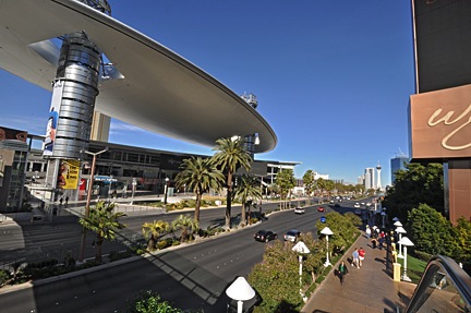
I’m not a gambler, but I like Las Vegas. I like the craziness of the casinos. The decor, the themes. The shops, the restaurants. My ex-husband seemed to share this interest with me — we’d often spend hours just walking from casino to casino, checking things out. It had been a long time since I did a casino walk and there were new casinos on the strip to explore. So I hopped in the car, drove it down to Luxor where parking was easy, and began my walk.
If you’re a friend of mine on Facebook, you’ve probably seen the photos. I checked in at almost every hotel/casino I walked through and included a photo. I’ll share a few of them here.
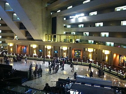
Inside Luxor.
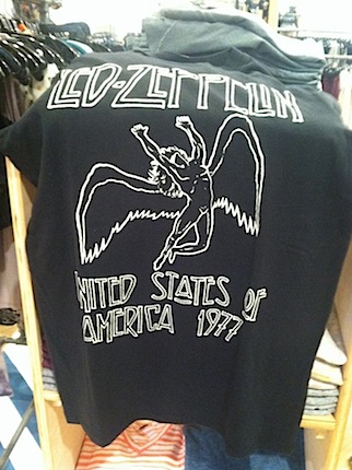
This shirt was for sale at Urban Outfitters. The sad part: I saw Led Zep on this tour at Madison Square Garden.
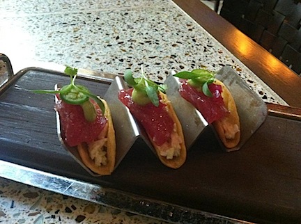
My lunch at Fleur: Ahi Tacos.
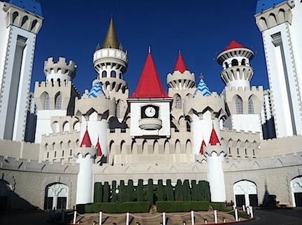
The absurdity of Excalibur is mind-boggling.
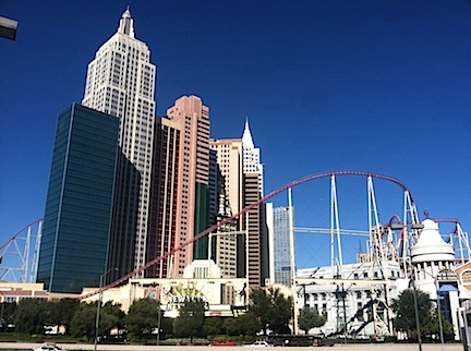 New York New York is a caricature of New York City, with a roller coaster just for kicks.
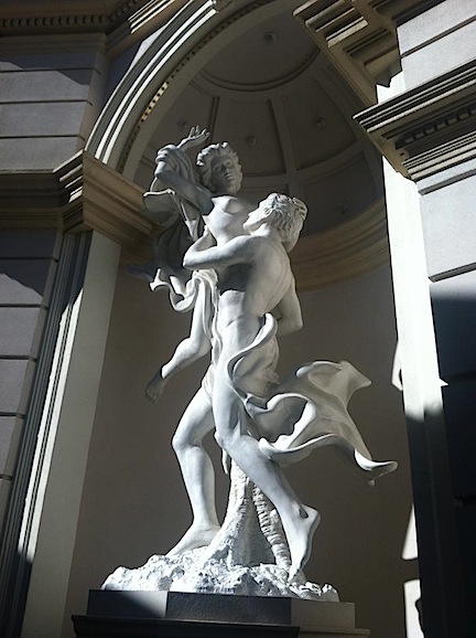
Monte Carlo, like some of the other nicer hotels, has reproductions of classic sculpture.
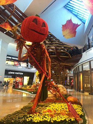
I loved the seasonal decor at the Crystals shopping center.
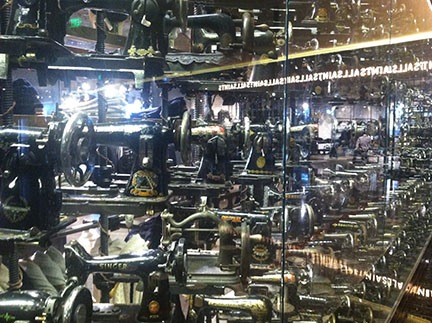
All exterior windows of this shop at the Cosmopolitan were lined with old sewing machines — hundreds of them!
Bellagio’s Conservatory is always decorated for the seasons.
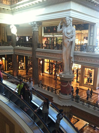
At the Forum Shops at Caesar’s Palace.
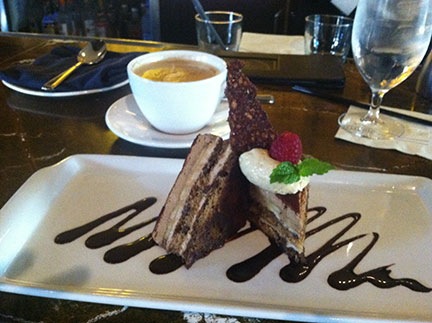
Banana tiramisu and latte at Olives.
In Luxor, I walked around the atrium level. I remember when the hotel was brand new. They had an arcade and several virtual reality rides. All that is gone now. There’s a Titanic exhibit which I would have seen if it weren’t $35. There’s also a great model of the Titanic down on the main lobby level, across from Registration.
I headed out toward Mandalay Bay. Along the way, I sopped at Urban Outfitters and bought a pair of shoes, two t-shirts, and a leather jacket. I restaurant-shopped at Mandalay Bay and settled on Fleur, where I enjoyed Ahi Tacos and a flatbread.
I hopped on the tram to Excalibur. I walked in only to refresh my memory. The place is as dark and sleazy on the inside as I remember it. I didn’t stay long. I wished I’d brought along some hand sanitizer.
From there, it was a short walk to New York New York. I’m not very fond of this place, either, although it sure beats Excalibur. I walked through to the other side, taking a short side trip to a magic shop to see what kinds of tricks they had for sale.
Then across the street to MGM Grand. They were doing some construction in there, so I didn’t stick around.
I crossed back to the west side of the Strip and visited the Monte Carlo. I’d stayed there once long ago — I can’t remember if it was with or without my ex-husband. (Really memorable trip, huh?) It’s a nice place — a lot classier than the ones I’d visited so far (except maybe Mandalay Bay), but not nearly as classy as others still to come on my walking tour. As I exited to the north, I stopped in at a cupcake shop and bought two cupcakes for later when Janet arrived.
From there, I hopped on another tram and took it one stop to City Center, which didn’t exist the last time I was in Vegas. This is an extremely upscale indoor mall fully occupied by shops that didn’t have a single customer in them. The same was true for the Crystals mall across the street. That one, at least, had interesting seasonal decor and lots of overweight midwesterners gawking. There was also some kinetic art, including lucite columns filled with whirlpools. Fascinating to look at closely.
The next stop was the Cosmopolitan, which is also new to me. I was impressed. It was trendy, but not ostentatious. Lots of young people staying there. Restaurants and shops that look approachable. I think I might stay there on my next visit, in March.
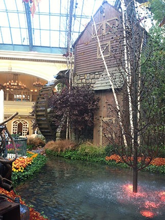
Bellagio, which I was familiar with from previous visits, was next. I visited the conservatory, which is decorated with plants and other items for each season. We were still in the autumn season, so there was an animatronic tree — very popular with the tourists — and a building with a watermill. I like that room — so festive and bright! Afterwards, I began my search for desert. I was hoping for Italian pastries and came up just a little short at the pastry/gelato shop near the Conservatory. So I kept moving.
Sometime around then, Facebook told me that a friend of mine, Tom, was nearby. Tom’s a pilot who works near Lake Havasu doing EMS. I posted a message to Tom. For the next two hours, we’d play message tag as I tried to zero in on his location for a possible meetup.
Next stop, Caesar’s Palace. This is an old hotel that they’ve managed to keep up-to-date and classy. I’m pretty sure it was the first hotel to be positioned back from Las Vegas Boulevard — although additions throughout the years have brought certain elements (such as the Forum Shops and a restaurant) right up to the street. I wandered through with my sights set on the Ferrara’s pastry shop I remembered in the Forum Shops. That’s where I’d get dessert. Unfortunately, it didn’t work out that way. The pastry shop was gone and the pastries in the nearby coffee shop looked like they were from the previous day. Ick.
By that point, I’d come a full two miles from my starting point, most of it on foot. With the added wandering through casinos and shops, I figured I’d walked about three miles. I wasn’t the least bit tired and, because I’d worn my hiking shoes, my feet felt fine. Still, it was getting late and I figured it was time to walk back. And I still needed to find dessert.
I walked back from the Forum Shops along the street, trying to keep in the shade. It was very warm out. I’d stowed the short-sleeved shirt I wore over my tank top and was fine as long as I didn’t spend much time in the sun. I was sad to see that the Imperial Palace hotel/casino had shut down. It was one of the old timers. (Sahara has also shut down.)
When I got to the northeast entrance to Bellagio, I went right in. And that’s where I found desert: at Todd English’s Olives restaurant. I sat at the bar and enjoyed an excellent banana tiramisu with a latte.
Another message from Tom said he was having pizza at New York New York. I decided to try to catch him there. I took the tram from Bellagio to Monte Carlo, then walked to New York New York. But I was too late. I later found out that he had moved on to a sports bar to watch the game with his friends.
I walked the rest of the way back to my car at Luxor. My phone was nearly dead — I’d been checking in on Facebook all day long. But it wasn’t too dead to get a phone call from Janet. She was within sight of the city. There was a chance that she’d get to the Riviera before I did. Good thing I hadn’t found Tom.
I figure I walked 5 to 6 miles, most of which was at a good, brisk pace. I felt great — not tired at all.
I took back roads to the Riviera to avoid traffic on The Strip, but Janet still beat me there. It was great to see her. We went back to the room where we could chat and she could rest after her 8-hour drive. I filled her in on the bullshit going on at home. Like me, she still can’t believe how my ex-husband had changed over the summer. But she’d been with me when I arrived home in September to find the locks on the house and hangar changed. And she saw the damage to the boxes of my belongings that he’d carelessly stowed in the hangar before the floodwaters came. She knew the truth of the matter and, like me, couldn’t deny what he’d become.
Later on, we headed back out in my car. I’d tried my new leather jacket on again and decided I’d rather have one size larger. So we headed for Urban Outfitters at Mandalay Bay with the idea of Asian food at Rice at Luxor. (Remember, I’d scoped out all the restaurants.) The jacket wasn’t available in a larger size, so I just returned it. And then I suggested martinis at Red Square, a vodka bar in Mandalay Bay.
We wound up spending the entire evening there. They had a special that included 1/2 ounce of caviar with all the fixings if you bought two drinks with a certain Russian vodka. I love caviar and was willing to try the vodka. Both were excellent. We drank and ate and drank. Two rounds. And then topped it off with a round of Remy Martin VSOP.
Amazingly, I was sober enough to drive us back. Unfortunately, something I ate or drank — or perhaps it was the mix of vodka and Remy — made me sick. I lost all that nice vodka and caviar before going to bed.
Sunday: Recovery, Factory Tour, and a Long Drive Home
I wasn’t feeling much better when I woke up. I figured a hot shower would fix me right up, so I jumped in. Wrong. It made me feel worse. In fact, I puked up the water I’d had since waking.
Not good. I got back into bed, feeling like crap. Janet did her morning stuff, then went down in search of some chamomile tea and plain bread. By the time she returned, I was feeling well enough to sip tea and nibble a bagel. Janet got packed up to move on — she was spending that night with a friend camped out in town before heading to Death Valley. I got out of bed, dressed, and put on my makeup. By the time she was back from loading her van, I was almost ready to go.
We said our goodbyes and I finished packing. By 9:30 AM, I was back in my car, heading for Jim’s Start Pac factory near the airport. I got a warm welcome and a good tour of the place. It’s a great building in a nice industrial area — much nicer than his last place in Vegas. Lots of room to expand. He showed me his whole product line, including a self-propelled APU that he has a patent on. Jim’s a real inventor who follows through on his ideas. (Unlike another man who called himself an “inventor” when I first met him 29 years ago.) We chatted some more about the divorce — everyone wants the details — and I left with even more encouraging words.
I made two more stops on the way home: Another try with meeting up with a potential employer (unsuccessful) and Vons to buy some lunch. Realizing that the time change was working against me if I wanted to pick up Penny at boarding by 5:30, I hit the road. I ate a half sandwich and drank some water along the way. I still felt a bit weak from my stomach problem, but at least I was keeping food down.
I made good time on the way back and arrived in Wickenburg just before 4 PM local time. Penny was thrilled to see me. Both of us were glad to be home.
One final note…although I ate very heartily while I was away and was convinced that I gained several pounds over the weekend, I was thrilled to see the scale registering exactly what it had before I left. (I don’t think it had anything to do with my stomach problem on Sunday night/Monday morning; I didn’t really puke up that much food.) I’m starting to think that my metabolism has actually changed — possibly because of the higher level of activity I have now that I’m single and have a real social life. Yet another way divorce has been good to me.
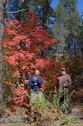
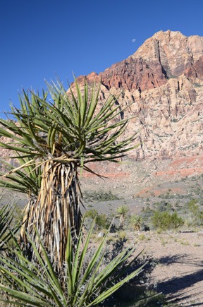
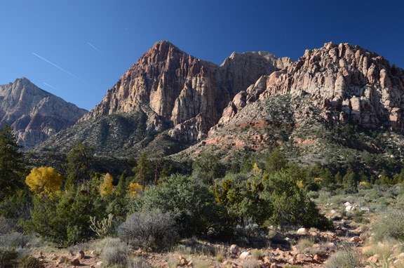
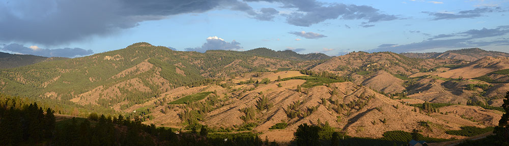
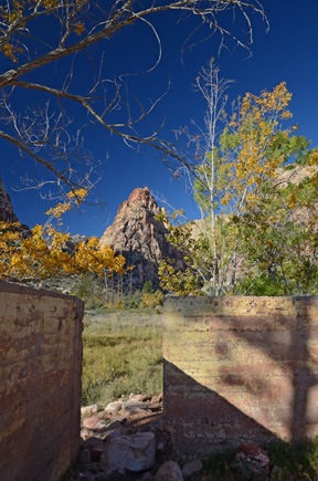 Mescalito Peak from the Wilson homestead ruins.
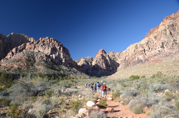


 Ready to go, I wait for Mike, who is only half dressed and still working on his laptop. I pull out my iPad and check the weather for Las Vegas. Later, when I’m waiting for my passengers at Prescott, I’ll check official weather with Duats and file a flight plan, which is required for my Part 135 operation. I waste some more time playing with

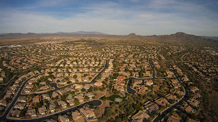 I make a radio call on the practice area frequency as I fly over Anthem, a master-planned community north of Phoenix, and then leave the urban sprawl behind me. Ahead of me are rolling hills climbing into the high desert. I fly over the freeway toward Prescott, passing over a handful of scattered homes and dirt roads. Somewhere along the way, I realize that changing the battery in my Garmin 420 GPS has erased my custom settings; I make some display changes on the map page. I tune my main radio to the Prescott tower frequency and tune the radio on my GPS to the Prescott ATIS frequency.
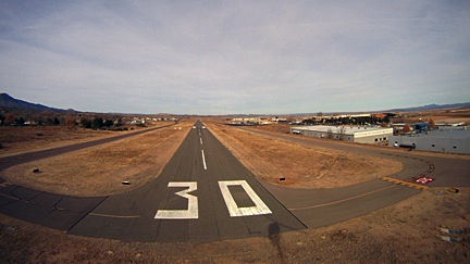 I come into a hover over the numbers 30 on runway 30. I’m told to switch to a ground frequency — something that very seldom happens — and I get sloppy with my 3-foot hover while using my left hand to tune in the frequency. I call in and get progressive taxi instructions to the Legend ramp. I land in a t-spot, glad that they use chains instead of ropes to tie down the planes. I shut down and send an OK signal from SPOT to Mike.
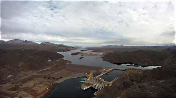
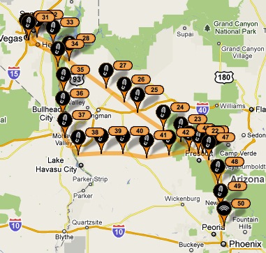
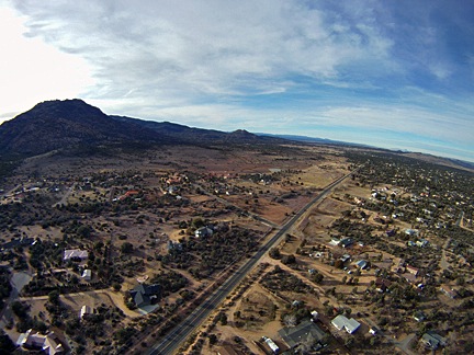 Tower finally tells me to depart along taxiway Delta (parallel to runway 21L) and maintain taxiway heading. Then switch to the other tower frequency. That controller finally clears me to turn on course. I turn right heading 295 degrees, which will take me directly to the Hoover Dam 160 miles away. Controller asks what altitude I want and I tell him 500 AGL.
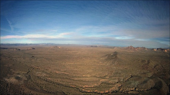
 Clear of Prescott airspace, I turn into the FSS frequency and activate my flight plan. Passengers are happily chatting away about the places we’re flying over. I answer questions when asked. Terrain is high desert hills with piñon and juniper pine. Some evidence of lava flows along basalt cliffs. We climb to 6,500 feet to clear small mountain ranges. There are no paved roads, no buildings, no vehicles. Only scattered cattle ponds and the occasional handful of cows.
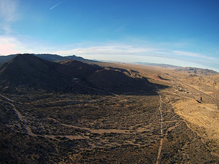
 We cross I-40 just east of the junction of state route 93, far to the east of we cross a few more mountains, then drop into a Valley inexplicably marked on the charts as Cottonwood Cliffs. (What cliffs?) We’re still heading roughly 295 degrees. There are scattered homes beneath us now.
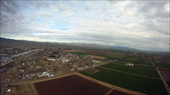
 We near the area where the tour pilots fly between Boulder Airport and Grand Canyon West, so I tune into their frequency to monitor communications. Lots of chatter using landmarks and reporting points I don’t know. The only comforting information is their altitudes: higher than mine. The desert flattens out with scattered communities. We overfly two paved roads.
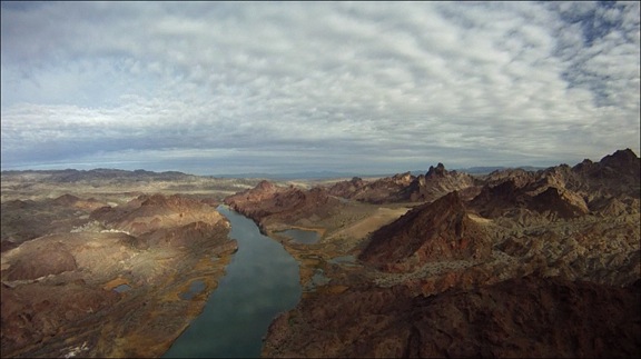
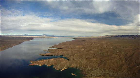
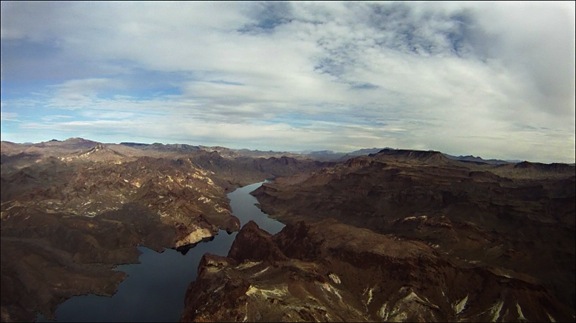
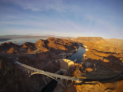
 We cross over the road to Temple Bar and pick up state route 93 as it snakes into the hills. The pair of two-lane roads looks freshly paved. At the turnoff to Willow Beach, I veer off the main road to the west. We catch a glimpse of the Colorado River as we head toward the dam.
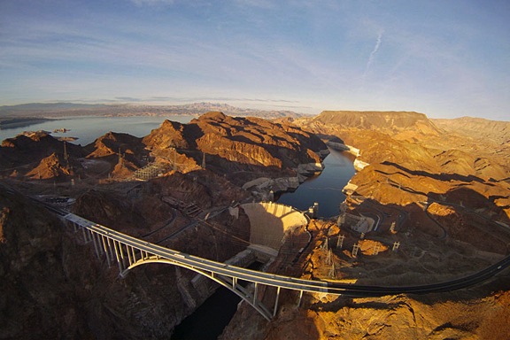
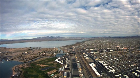
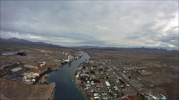
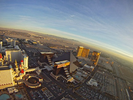
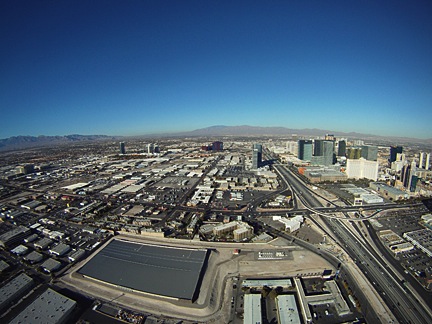
 Listening to the Las Vegas ATIS, I learn that the helicopter frequency is in operation. I call the tower and request inbound heading to Stratosphere, then turn for landing at Atlantic ramp. I receive a squawk code and clearance to do as requested. Ahead of us, a thick blanket of white smog covers the Las Vegas skyline. The Stratosphere tower, rising 1,149 feet above the Strip, is barely visible in the haze.
