A last minute gig turns out to be a fun little adventure — that pays.
I was sitting at my computer at 1:15 PM on Friday, scanning and shredding documents for my paperless filling system, when the phone rang. Caller ID said it was Barry. I couldn’t remember who Barry was, but knew we’d been in touch in the past — hence his number in my phone’s address book — so I answered it with my professional voice: “Flying M, Maria speaking.”
Barry had the foresight to remind me who he was when he identified himself. He’s another helicopter operator out of Falcon Field in Mesa. I’d done a video gig for one of his clients back in 2009. He was supposed to use his Bell 206B JetRanger to do a video flight with a regular client out at the Parker 250 off-road race the next morning. Unfortunately, the JetRanger was due for scheduled maintenance and his 206L LongRanger was just not right for the job. Was I available to go out there today for a shoot starting at dawn?
The first time I flew the Parker 425 was in 2008. All of the aerial footage in this video was shot from my helicopter.
I’d been to Parker to shoot the Parker 425 several times in the past. It’s a weird little town at the edge of the Colorado River Indian Tribes (CRIT) reservation that attracts mostly snowbirds. There isn’t much there beyond a Casino resort and a Walmart. The airport is owned and operated by CRIT. Hotel accommodations in the area are limited, especially when there’s a race in town.
Lodging was my first concern. I’d stayed in some pretty crappy places there. Places so bad, I told myself that a sleeping bag in the airport terminal would be better.
“It depends on if I can get a place to stay,” I told him.
He laughed almost nervously. “Well, the clients have rented a house. They were going to give me and the pilot our own room to share. You can have that room.” He hesitated and then added: “It would be private.”
“Ground transportation?”
“Call them when you get to the airport and they’ll pick you up. The only thing is, you need to get there by 5 PM because that’s when the airport closes for fuel.”
I consulted my watch and did some quick calculations. If I left my house at 3 PM, I’d have plenty of time to load and prep the helicopter and get to Parker before 5. I thought about what was going on at home: nothing. With my soon-to-be ex-husband out of the picture, I wouldn’t have to deal with his disapproving glare and whining complaints when I told him I had accepted an overnight flying gig. (Even if I invited him to come along, he’d use it as an example of how I always do what I want — ignoring the fact that flying for hire was how I earned my living and I needed to take jobs when they came up.) The only question was Penny the Tiny Dog, and I did have several options for dealing with her.
“Sure,” I told him. “I can do it.”
“Great,” he said, sounding relieved. “Let me get them on the phone and confirm that it’ll work for them. I’ll call you back as soon as I get a green light.”
Prepping for the Trip
I hung up and called Bar S Animal Hospital. They’re our local vet and they do animal boarding. Penny’s stayed there twice. Yes, no problem. They could take her. I told them I’d be there by 3.
Then I pulled out my overnight bag and packed a change of clothes, including warm layers for the dawn flight. It would be around 31°F in Parker at dawn and although I planned to have just the door behind me off, I knew it would get cold in the helicopter. I didn’t want to repeat the previous week’s shivering cold flights.
I gathered together Penny’s stuff: her bed, a toy, and a bone. She knew something was up, but I played it cool and she lost interest.
Barry called again. He said he’d left messages for the clients. We talked money. He told me what to charge; it was slightly more than my regular rate. He didn’t want a cut. He was just glad I could do the work. He didn’t want to let the client down. I told him I was going to jump in the shower but I’d be expecting the launch call.
The call came after I was showered and dressed. It was one of the clients. He told me to come on out and give him a call when I got to the airport. As easy as that.
The Flight to Parker
A while later, around 3 PM, I was at Wickenburg Airport, prepping the helicopter. I’d dropped Penny off and prepaid for her stay. I preflighted the helicopter in the hangar, out of the cold wind that was blowing across the airport. I loaded my Bruce’s Custom Covers door storage bag and the rock climbing harness I offer photographers who want better range of motion than a seat belt allows. Then I tossed in my overnight bag and leather jacket, closed everything up, and dragged the helicopter out to the ramp.
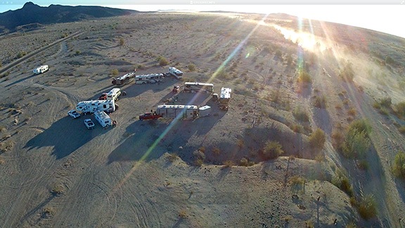
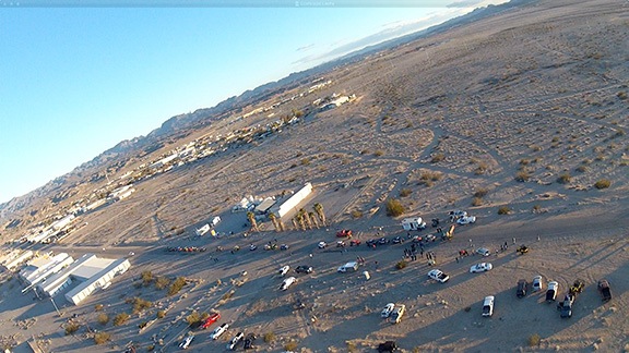
By 3:35, the hangar was locked up and I was airborne, heading due west. Despite the wind, the flight was quite smooth. I headed toward Cunningham Pass, which cut through the Harcuvar Mountains, and then made a beeline to Parker. There was a whole lot of empty desert along the way — I flew over only 2 paved roads on the 74 NM flight. My only detour was to drop into the dry wash along the race route where folks had set up RVs to observe the race. I flew low level past them, returning their waves and smelling the burning wood of their campfires.

A typical Parker 250 campsite out in the desert. This was shot on raceday; the track is on the right, down in the wash.
There was a plane turning final as I crossed the runway at Parker and set down on the ramp. I shut down and pulled out my step stool and blade tie-downs. It was about 4:30 PM. I figured it would probably be a good idea to place a fuel order before I settled down.
Fuel Woes

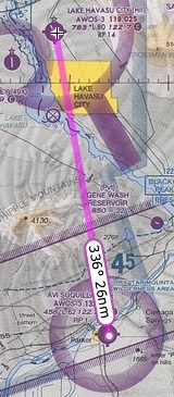
Although it’s tempting to follow the river, the fastest route between Parker and Lake Havasu City is over the mountains.
And that’s when I was reminded how badly the FBO at Parker airport is managed. There was just one person in the office: a woman who claimed to be a secretary. She told me that everyone else had gone home with the flu. There was no one to drive the fuel truck. No, I couldn’t drive it for her. And no, I couldn’t use the self-serve island. If I wanted fuel, I’d have to go to Lake Havasu City.
Lake Havasu City was a 26NM flight that would take me about 15 minutes. Each way. I called my client and told him what was up. I needed fuel for the next day; there was no doubt about that. I told him I’d be back in 45 minutes. Then I re-stowed all my gear, started up, and headed north.

A shot of the mountains I had to cross on a direct path between Parker and Lake Havasu City. I shot this with my iPhone from inside the helicopter; pardon the glare.

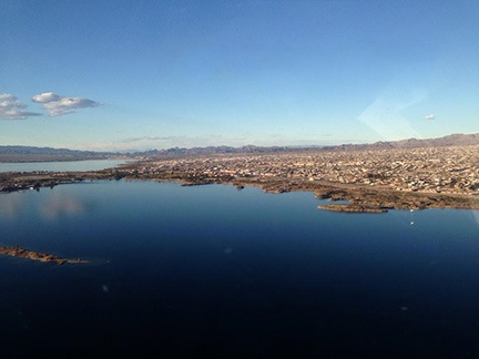
Lake Havasu City, shot from the air south of town; pardon the glare.
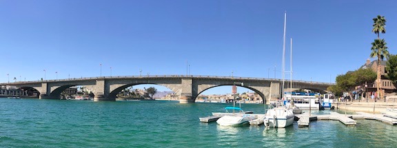
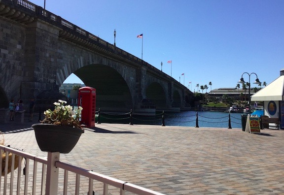
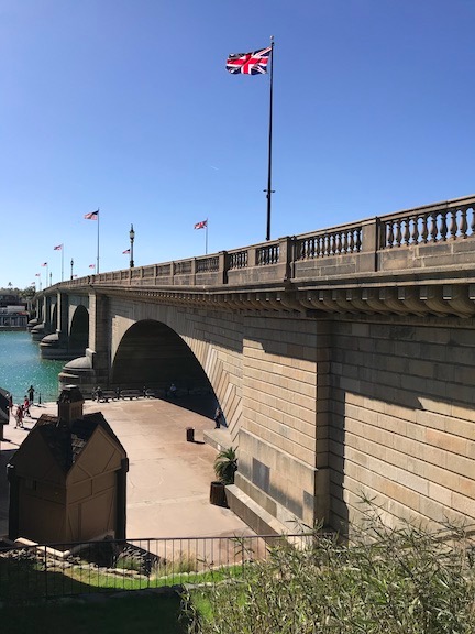
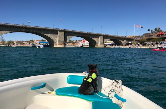
My route took me over some pretty rugged mountain terrain that was beautifully lit in the late afternoon sun. Once over the mountains, I had a clear view of Lake Havasu and the city beyond it. Compared to Parker, it was a thriving metropolis. I sped past London Bridge and covered the distance between town and the airport quickly. Since it was getting close to 5 PM, I called ahead to make sure a fuel truck would be available. Desert Skies, the excellent FBO there, told me to look for the truck. When I got close to the ramp, I saw it and landed nearby.
The fuel guy must have sensed my urgency, because he pulled into position as soon as my blades stopped. I helped him by grounding the aircraft and moving his stepladder for him. He gave me a ride back to the terminal to pay and I took the opportunity to use the ladies room. Then I was done, heading back to the helicopter, winding it back up, and heading south to Parker again.

This sign was on the Pilot Lounge door when I returned to Parker from Havasu.
I touched down exactly 45 minutes after talking to my client. The sun would set in about 10 minutes.
I figured I had 2-1/2 hours of fuel on board before I’d have to go back to Havasu for more. And when I saw the sign on the pilot lounge door, I realized that CRIT would not be providing fuel the next day.
The Frat House

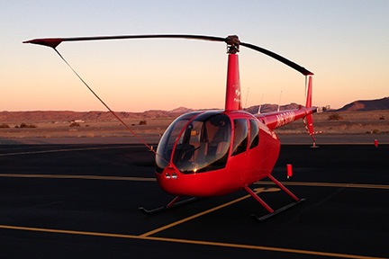
Here’s my helicopter parked on the ramp at Parker just as the sun was setting.
I had the blades tied down and was waiting outside the airport fence with my overnight bag, leather jacket, and bottle of oil (to keep warm overnight for easier pouring in the morning) when my client pulled up in a big, black van with vanity plates. I climbed in back with three members of the video crew, including the videographer I’d be flying with the next day. They all introduced themselves and I almost immediately forgot their names. (I am so bad with names and faces.) We drove to the house they’d rented in a small gated community on the Colorado River upriver from Parker, making one stop along the way.
The house was on a little canal with access to the river. It had four bedrooms, one bathroom, and a great room. A patio out back on the canal had a barbecue grill, table, chairs, and stairs down to the water. I asked where I’d be sleeping and was offered a small bedroom with a large — maybe California King? — bed, large closet, and television. There were teddy bears on the night tables. The bed was rumbled and I suspected someone else had slept in it the night before.
Turns out the house was owned by snowbirds who, for $2100/weekend, would vacate and rent to groups. Apparently most of the homes in the neighborhood were handled the same way; at least five of the race crews were camped out in nearby homes. Although the owners cleaned out most of their personal possessions, possibly locking them up in the garage and behind one locked door, there were still a few weird items around — like the teddy bears.
The group quickly expanded to eight guys ranging in age from around 20 to 50. They all wore black shirts, most of which had the company logo on it. They were nice guys and all introduced themselves to me. After a quick discussion about dinner, four of them took off in the van to pick up groceries. The rest of us sat around drinking beer or bottled water and eating Fritos and Ruffles chips.
No need to go into details on the evening, but I do recall thinking that this was the closest I’d ever get to living in a frat house. Somehow groceries got organized and beer got put away in the fridge. Burgers and brats got cooked, buns got toasted, and tubs of macaroni and potato salad got served out. My contribution was slicing the tomatoes and a red onion. I had a bratwurst with lots of mustard and some macaroni salad. I also polished off half a bottle of wine.
More guys showed up — this time from my client’s client — and I could tell they were trying to figure out where the only woman fit into the puzzle. When I introduced myself to one of the race team guys as the pilot, he nodded thoughtfully and looked around for the pilot, obviously thinking I said that I was with the pilot. Then his eyebrows rose and he looked at me. “You’re the pilot?” he asked. “The helicopter pilot?” I nodded and admitted that I was.

Here’s an iPhone 5 panorama of the “frat house” with most of the folks who showed up for dinner.
There was a lot of chatter about the next day’s plan. I’d be working with the videographer, who worked with a handheld RED camera, and a still photographer. When I told them I preferred the videographer to sit behind me so that I could see the car we were chasing, they agreed it was the best way to go. The photographer would sit on the opposite side of the helicopter and get his shots after the videographer was satisfied. We agreed to leave the house at 6:30 so we could be in the air by the race start time of 7:15 AM.
Somewhere along the line, they let me know that they might need me on Sunday, too. It all depended on whether their main target vehicle survived Saturday’s race. Was that okay with me? Although I was hoping to get home on Saturday early enough to rescue Penny from boarding, I was certainly not opposed to making a few extra bucks on a second day of flying. (Again, it was great not to have to call a hostile spouse to get approval.) So I told them it was fine with me.
I disappeared into my bedroom at around 10 PM. The guys were still talking loudly and the walls were paper thin. I was lying in bed, reading before shutting off the light when the crowd started thinning out. The house was quiet when I went to sleep.
The bed was comfortable and I slept well.
In the middle of the night, I woke to hear someone snoring next door. The walls were very thin.
Rise and Shine
I was up at 5 AM and figured I’d take the opportunity to use the bathroom before it became in high demand. It was weird to see an empty beer bottle on the vanity.
Frat house.
By 5:30 AM everyone was awake and stirring. About half of the guys had slept in the living room, sprawled out on sofas and an inflatable bed. Without blankets. But they were in remarkably good spirits. I suspect they’d dealt with worse conditions in the past.
I spent about 10 minutes cleaning up beer bottles, plates, and other garbage from the day before. I filled two trash bags. I considered loading the dishwasher but decided that would be too much like being a den mother. Let them deal with that.
They had excellent instant oatmeal cups with nuts and fruit and a coffee maker that I couldn’t get to work. I used the coffee maker that came with the house to brew a pot of Folgers. Only three of us drank it. There was no milk. By 6:10 AM, everyone was out of the house except the three of us who’d be in the helicopter.
I packed up all my things. I wasn’t sure whether they’d need me Sunday and I didn’t want to leave anything behind in case they didn’t. After all, while the race was going on, there was no way for me to get back to the house. Best to have my overnight bag with me.
It was dark when we stepped out of the house at 6:30 AM. Sunrise wasn’t until about 7:45. We weren’t sure why they expected us to be in the air when the race started a full half hour before sunrise. Although the RED camera could handle low light, our six target UTVs wouldn’t be starting until after all the motorcycles and ATVs had left. Still, we went to the airport and I prepped the helicopter for flight.
It was also cold. About 30°F.
I took care of the oil first, worried that it would get cold and thicken back up. Then removed the blade tie-downs. Then did a preflight inspection with a flashlight. Then removed two doors and put them away. And finally set up my GoPro nosecam.
I was disappointed about having to use the nosecam instead of the skidcam, but that was my fault. Although I put the RAM mount piece on the skid, I left the remaining mount components, including the GoPro housing, at home. So I couldn’t assemble the skidcam, which would have given me the same view as the videographer. Instead, I hooked up the nosecam with the remote back and set it up to turn it on/off with my iPhone in the cockpit. I’d shoot 1080p video until the SD card filled or the battery died.
The Flights
We were airborne by 7:15, with the videographer behind me and the still photographer beside me. The starting line was less than a mile from the airport, so we were there within seconds. I circled and we looked down at the action. The motorcycles were leaving, 30 seconds apart. It would be at least 15 minutes before our target vehicles left. We went back to the airport and sat idling on the ramp for a while.
When we took off to check again, the motorcycles were almost done starting, but the ATVs were behind them. We went back to the airport and shut down. No sense burning fuel we’d need later.
Barry called. We chatted about the job. I told him about the fuel situation and the possibility of a second day. He was as bugged as I was about the fuel and apologetic about the second day. “No worries,” I told him. Everything was under control.
One of the video crew members advised us that the target vehicles would likely be off the line in 30 minutes. We all got out to stretch our legs. The local medevac guy showed up and chatted with us. The King Air they fly turned up a while later and he got busy. By that time, we figured it was worth another try so I started back up and we launched again.
We spent about 10 minutes circling the starting line, waiting for them to launch the UTVs. They apparently waited more than just 30 seconds between the last ATV and the first UTV. The two camera guys got shots of the non-action.

The starting line with the UTVs lined up and waiting to go.
Our main target was about 10 cars back, but another target was first in line. When they released him, we took off after them. It was finally showtime.
Chasing desert racers is my absolute favorite kind of flying. I’m out over the mostly empty desert so I don’t have to worry about low flying causing a hazard to people or property on the ground. Although there are wires in the area, I quickly learn where they are. I focus on the vehicle and the instructions from my client. My goal is to get the helicopter into position for whatever kind of shot the videographer needs — without doing anything that could get us killed.
And when the vehicles are moving fast, I can get a pretty good rush.
We began in a 200-foot hover beside the starting line with the car on the videographer’s side of the aircraft and his camera focused on it. Then, when it was released, I pivoted while it made the first turn and then pushed the cyclic forward gently to get some forward movement. Without adjusting the collective, we began a descent, gathering speed along the way. When we were about 100 feet off the ground, I pulled pitch to arrest the descent while maintaining speed. And then I just chased the car, matching its speed, pulling in front of it or behind it as instructed and crabbing, if necessary, to give the videographer the best shot.
My focus was absolute; I was the autopilot. I wasn’t thinking about all the divorce crap that has been fucking up my brain for the past eight months. I was just thinking about the vehicle I was chasing, the instructions from the videographer, and the wires I knew were up ahead. The helicopter was an extension of my mind and body. It did exactly what I needed it to, without me having to give it much thought at all.
I was in the zone.
We chased that car for a while with it on our right side. Then, when the videographer was done, I popped over the top of the track and put the car on our left side for the still photographer. He got a bunch of shots. When he was done, I pulled up and around to go back for the next target.

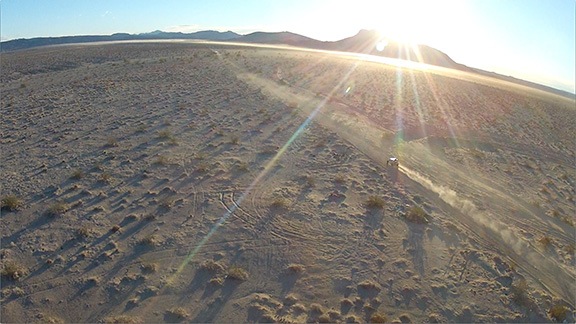
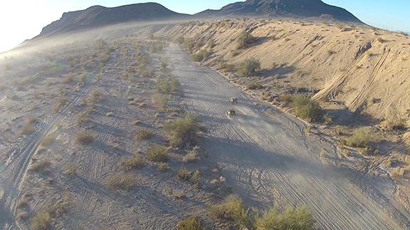
We’re chasing the car behind the one in this nosecam image. You can see the dust kicked up by the motorcycles and ATVs ahead of us on the track hanging low over the desert.

It’s not unusual to bank 45° to 60° at 50 knots or more while turning to pick up the next target. This is really aggressive flying, but done with smooth control inputs, the R44 handles it admirably. In this shot, we were probably 50 to 100 feet off the desert floor.
We did this repeatedly, one target after another. We found the first four targets without trouble and spent most of the time with the main target, shooting it from all kinds of angles. My clients really liked the look of the shots toward the sun where the dust was really illuminated. I did a lot of crabbing, hovering, and pivoting. The wind was calm and the air was cool so performance was not an issue at all — even with three of us on board and nearly full tanks of fuel. The same flying on a 90° day would have been impossible with our load.

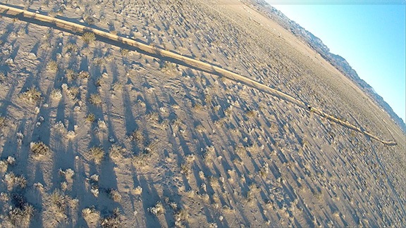
Again, we’re chasing the car behind these. A good portion of the track runs in dry washes like this one.
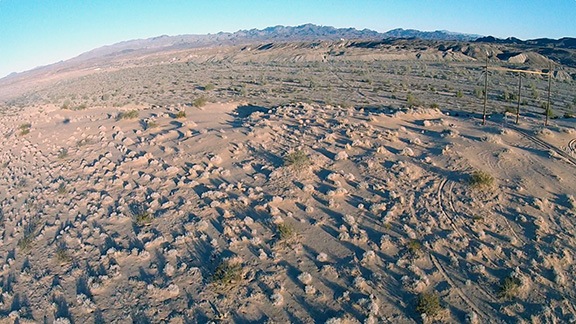
Little by little, we made our way down the 80-miles of the track: flat desert, dry wash, more flat desert, powerline road, more flat desert, deep canyon, and more flat desert. The GoPro battery died less than an hour into the flight — I think that remote backpack drains the main battery because I know it was fully charged when I put it on the helicopter — so I don’t have any footage from the more interesting segments of the track.

I did mention the wires, right? The track follows these powerlines to the edge of a wash and then dives down into the wash. It’s tempting to follow the vehicles down, but the wires don’t go down at the same angle, so you need to stay high to clear them when making the right hand turn.
We hopped from one vehicle to the next, back and forth on the track. Our main target vehicle broke an axle or something while we were videoing it; we got footage of the team getting out to check the damage. Another one of our targets got a flat tire; we captured one team member changing it. We picked up the last two targets on the return side of the track. We followed one of our targets — which turned out to be the leader — all the way into “the python,” a segment of track that winds around a sandy area near the airport, complete with banked curves and jumps.
And then we were done. The Hobbs meter showed I’d flown exactly 2.5 hours.
Warming Up, Heading Out
I flew back to the airport, which was only about a mile away, and landed. We fetched the doors and my overnight bag from my clients’ car and they prepped to move on to their ground base somewhere along the track. I locked up the helicopter and they dropped me off at McDonalds on their way out.
I got the last breakfast order in and took my food and orange juice to a booth in a sunny window to warm up. I made a few phone calls. I relaxed. Then I went back to the helicopter, which was parked facing south, and relaxed in the pilot seat, reading on my iPad. The cockpit was warm and cozy.
I realized how nice it was to just take it easy without having to be anywhere or answer to anyone.
A jet came in. The jet pilots came by to chat with me. Their passengers arrived at 1 PM — the same time I got a text from the client decision maker. They would not need me on Sunday. I was released.
I didn’t waste any time getting the helicopter started. A few minutes later, I was heading northeast along the Colorado River to Lake Havasu City. I’d have to refuel before heading back to Wickenburg.
While I waited for the line guy to fuel, I went into the BBQ place next to the FBO and got some ribs to go. I settled my bill at the FBO and walked back to the helicopter, swinging my take out bag beside me.
It was then that I suddenly realized that I really love my life. That’s something I need to blog about soon.
I checked the oil and the fuel caps, then climbed into the helicopter and started up. I was munching fried okra and sipping iced tea when I pointed the nose east for the 86NM flight back to Wickenburg. It was a long flight over remote terrain — I’d only cross two paved roads and one tiny settlement (the Wayside Inn) along the way. I’d be there 50 minutes later.
I put the helicopter away and pulled all my gear out of it. I totaled the billable flight time: 5.2 hours. Not bad for an unexpected, spur-of-the-moment gig.
I stopped at a friends hangar and spent some time chatting with a few people there. Then I fetched Penny and we went home. It felt good to get a hot shower and relax with a glass of wine in front of the fire.
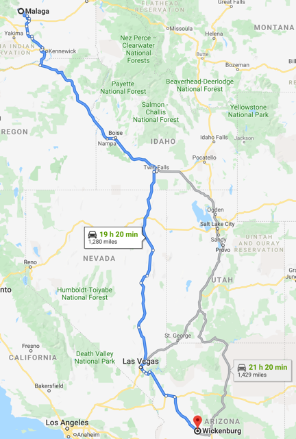


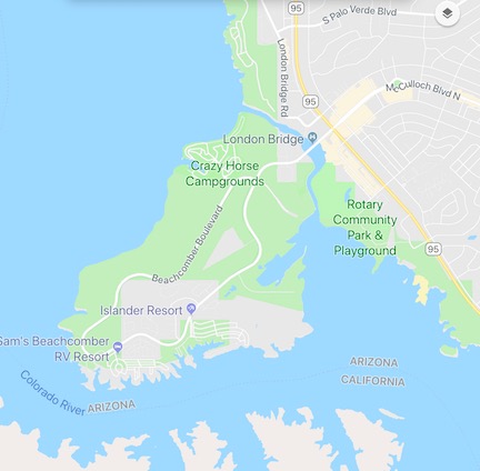
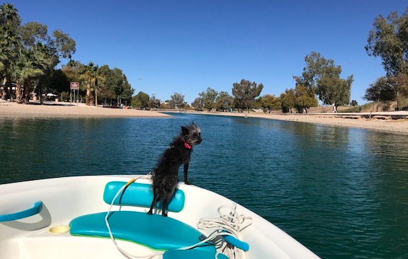






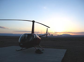 I dropped off the van at the airport, leaving the keys tucked inside the van’s logbook under the seat with a $10 contribution for fuel. It took five tries to get the combination right on the locked gate to the ramp. There was no one around. I walked out to the helicopter just as the sun was rising over Tower Butte and Navajo Mountain to the east. The air, which had been completely still, now stirred to life with a gentle breeze. There was enough light for a good preflight and I took some time stowing my bags and the life jackets so I’d be organized when I arrived at Havasu.
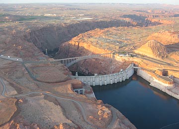 I started the engine and warmed it up, giving the engine plenty of time to get to temperature. (Take care of your engine and it’ll take care of you.) At exactly 6 AM — right on schedule — I raised the collective, made a radio call, and took off toward the lake. I swung over the dam for a look and a photo before heading down the Colorado River, over Glen Canyon.
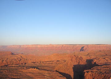 My flight path would take me south along the eastern edge of the restricted Grand Canyon airspace. In a way, it was ironic — less than two years ago, I’d earned part of my living as a pilot flying over the canyon every day, but now I can’t fly past the imaginary line that separates that sacred space from the not-so-sacred space I was allowed to fly. That didn’t mean I didn’t have anything to see. As I flew past Horseshoe Bend and over the narrow canyon, I could see reflections of the canyon wall on the slow moving river below. To the west were the Vermilion Cliffs with Marble Canyon at their base.
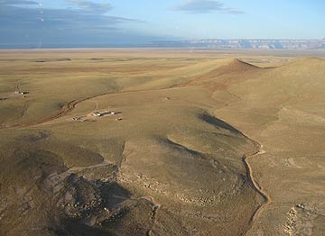 I detoured slightly to the east, keeping to the left of the green line on my GPS that marked Grand Canyon’s airspace. The red rock terrain gave way to rolling hills studded with rock outcroppings and remote Navajo homesteads. I flew low — only a few hundred feet up — enjoying the view and the feeling of speed as I zipped over the ground, steering clear of homes so as not to disturb residents. I saw cattle and horses and the remains of older homesteads that were not much more than rock foundations on the high desert landscape.
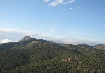 Then there were more homes beneath me and pinon and juniper pines. Wisps of low clouds clung to the mountains at my altitude. Past the mountain I’d been aiming for was the town of Seligman on Route 66 and I-40. I crossed over with a quick radio call to the airport and kept going.