Bringing back — and adding — memories.
The house I own with my soon-to-be ex-husband in Wickenburg, AZ sits on 2-1/2 acres of horse property on the very edge of town. The area is hilly and the house, which sits on the side of a hill, has plenty of privacy — indeed, there’s no real reason to close curtains or blinds. Beyond our neighbor’s 10-acre lot are more rolling hills in state and BLM (Bureau of Land Management) public land. The land is crisscrossed with dozens of horse trails that are in regular use during winter months by Rancho de los Caballeros wranglers and trail riders, as well as local horse owners.
When we first moved there, I distinctly remember hitting the trails with my dog, Spot. We hiked up the road to the trailhead just beyond my neighbor’s driveway, followed the trail to the fence, opened the gate, and slipped through. Then we hiked through the wash and up and down the hillsides past tall saguaro cacti and other desert vegetation planted and cared for by Mother Nature.
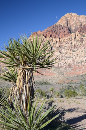
I remember climbing a trail out of the wash to a hilltop where a tall saguaro stood. Sometime in the distant past, its top had been broken off, possibly from strong wind or a lightning strike, about 3 to 4 feet off the ground. Three big cactus arms had grown up just below the break point, rising another 15 to 20 feet into the air. To me, the cactus looked like a hand reaching up with a thumb and two fingers pointing up to the sky. I have a picture of me there with my dog — I suppose my soon-to-be ex-husband must have taken it — with that big cactus behind us.
At that point, I got an idea of how vast the desert was and how many miles of trails there were to cover. And that’s when I realized I needed a horse.
The Horse Trails
I’d been riding with a friend on the other side of town, on the horse trails she rode from her house. The horse I always rode was a retired barrel racer named Misty. Misty had navicular disease, a malady caused by the constant pounding on her front feet as she raced. My friend eased her pain before and during rides with a dose of Phenylbutazone (“bute”). She was fine for trail riding and seemed to love getting out. I bought her from my friend for $500.
(I should mention here that within a year, I took Misty to a Scottsdale equine surgeon for a Palmar Digital Neurectomy, which pretty much ended the pain. Unfortunately, a few years later she suffered a bowed tendon in one front leg and an abscess in the opposite front foot. The combination of these two problems at the same time eventually led to her death. I replaced her with a beautiful paint horse named Cherokee.)
We set up a horse corral with a shade on our property and brought Misty over. We had a shed built to store hay and other feed and her saddle and other tack. And I started riding on those trails.
My soon-to-be ex-husband also wanted to ride. For a while, we took turns taking Misty out. But I wanted us to be able to ride together, so I bought him a horse, too. His name was Jake and he was a retired ranch horse. We added a fenced in area down in the wash below our house so the two horses would have more room to move around. During the rainy season, we’d bring them back up to the original corral just in case heavy rain caused the wash to flood.
In the years that followed, we’d take Misty and Jake out to explore the miles of trails, saddling up at the house and then just riding out. When my dog, Spot, died and was subsequently replaced with a Border Collie/Australian Shepherd mix named Jack, we’d all go out together, with Jack and sometimes even my neighbor’s dogs in tow.
We’d do this a few times a week just about every week. In the warm months, we’d do it early in the morning, before it got hot out. In the cooler months, we do it in the afternoon. My soon-to-be ex-husband said our life was like “living on vacation.” I couldn’t argue.
We did this for years and learned just about every trail within 5 air miles of the house.
 We gave the trails names. The Golf Course Trail was the one that went from the gate to Rancho de los Caballeros’ golf course. Deer Valley Trail was the one that rode through a valley where we almost always saw deer on a morning ride. Danny’s Trail was the one our neighbor, Danny, showed us on the only time he went riding with us. The Ridge Ride was the one that stretched along a high ridge overlooking the golf course and points north on one side and the big, empty desert and points south on the other side. Yucca Valley was the strip of sandy wash filled with an unusually large number of yucca plants.
Places had names, too. The Ball Field, for example, was a flat area of mostly cleared desert roughly the shape of a baseball diamond. For a week or two in the spring, it would be carpeted with California poppies.
We’d plan a ride using these names — for example, “let’s take the Golf Course Trail to Yucca Valley and up to the Ridge Ride and come back through the Ball Field.” We both knew exactly where we were going to go.
The horses knew the trails, too. Every time we came to an intersection, they’d try to get us to turn in the direction of home. But if we wanted to keep riding out, we’d stubbornly pull them the other way. At the next intersection, the same thing would happen.
We’d gauge the length of our rides by the number of gates we had to pass through. An average ride was two gates: the first gate and a second one about two trail miles away. A long ride was three gates.
As the years went by, however, we began riding less and less frequently. I developed an interest in flying and began building a business around it. My soon-to-be ex-husband took a job in Phoenix and, after buying a condo down there, was gone most of the week. Jake eventually got too old to ride, got sick, and had to be put down. With me gone all summer and my soon-to-be ex gone all week, it seemed silly to replace him. So we found a home for Cherokee (Misty’s replacement), gave away the remaining horse feed, and closed up the tack shed.
In all, we’d been horse owners for about 10 years.
Hiking the Horse Trails
Although our horses were gone, the horse trails remained, maintained by the wranglers at Rancho de los Caballeros. I just didn’t get any opportunity to see them.
Time passed. I went away this past summer and lost 45 pounds. Hiking became an important part of my life, a way to get exercise and enjoy the outdoors with my dog and friends. I began hiking regularly with a Meetup group (and others). When the hiking host of the Meetup group mentioned that he wanted to do a hike in Wickenburg, I volunteered to lead a hike on the horse trails behind my house.
Of course, to do that, I had to make sure I remembered the horse trails. And I had to make sure I could put together an interesting route 3 to 4 miles in length, something we could cover at a slow to medium pace in a few hours. That means I had to hike the trails myself in advance.
I called my friend, Alta, and invited her to join me on a hike. We went out at 9 AM on a Thursday morning — just me, Alta, and Penny the Tiny Dog. I wanted to take the group through the slot canyon accessible from about a half mile down the wash from our house, so that’s the way we went. I soon realized that a half mile in sandy wash followed by a mile snaking up a narrow, rocky canyon didn’t make for a good hike. So after climbing out of the canyon, I extended the hike to familiarize myself with the trails I had once known so well.
And that’s when the memories started kicking in. You see, the only times I’d been on all those trails were with my horse and usually with my soon-to-be ex-husband and long-gone dog. Although the memories of all those trail rides were good ones, they were tainted by the events of the past six months — namely, my husband’s lies and betrayals. I remembered the rides, I remembered the great times we’d had out there on horseback. But none of that jived with the way my husband had discarded me, after 29 years together, for a woman he’d met only weeks before on the Internet. All those good memories became painful. More than a few times, hiking with Alta that day, I found myself in tears.
 As we reached the highest point on the Ridge Ride trail and stopped to look out over the desert, I remembered toasting the new year with my husband and friends on New Year’s Day rides. I began to regret volunteering to take my new friends on these trails. Would I be able to keep it together that day? Would the pain I felt so intensely be noticed by my companions?
I didn’t have much time to think about it. The day after our trial hike, I was caught up in more divorce bullshit. First, returning the truck that my soon-to-be ex had assured me several times I’d be able to keep in the settlement. Then, the next day, going to our Phoenix condo to beg him to allow me to take home my things so I could pack them. Later the same day, watching him retrieve random belongings from our Wickenburg house during an “inspection” he’d demanded by using lies to convince the court that his possessions were in danger of damage or theft. By the woman he’d lived with for 29 years. He apparently trusted me even less than I now trusted him. The difference: I’d done nothing to earn that mistrust. He’d been lying to me for months, if not years.
More pain, more tears.
I spent Sunday hiking with my Meetup friends again and flying Santa Claus to an appearance at Deer Valley Airport Restaurant. It did a world of good to help keep my mind off my divorce ordeal.
On Sunday, the hike host reminded me that he needed a description and photos of the hike. When I emailed the description and two photos to him on Monday, he said he’d try to get them online quickly. They appeared Tuesday and folks started signing up for the hike.
In the end, on Sunday morning, we had just eight hikers and seven (!) dogs.
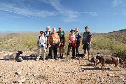 I led the group out onto the trail, feeling a weird mix of emotions. But as we hiked and as I talked about the things we were seeing, the ghosts from the past stayed away. Although I thought about those long ago horseback rides, I was more focused on sharing the trails — my trails — with my friends, pointing out plants and rocks and other items of interest. I realized, as we made the final ascent to the highest point on the Ridge Ride trail, that bringing my friends along helped me make new memories of the trails, fresh memories that helped the old ones — and the pain they conjured — fade away.
 The only time I got teary-eyed is when I stopped at that “three-finger cactus” and asked one of my friends to take a picture of me with my dog. Even then, I don’t think anyone noticed the tears behind my sunglasses.
My companions enjoyed the hike. It was the right difficulty (relatively easy) and right length (4-1/2 miles) for the group. And the pot luck lunch at my house afterward really completed the day.
But what I got out of the hike is something far more valuable than a day out with friends: I got a chance to reclaim the horse trails with new memories.
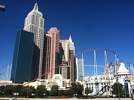 New York New York is a caricature of New York City, with a roller coaster just for kicks.
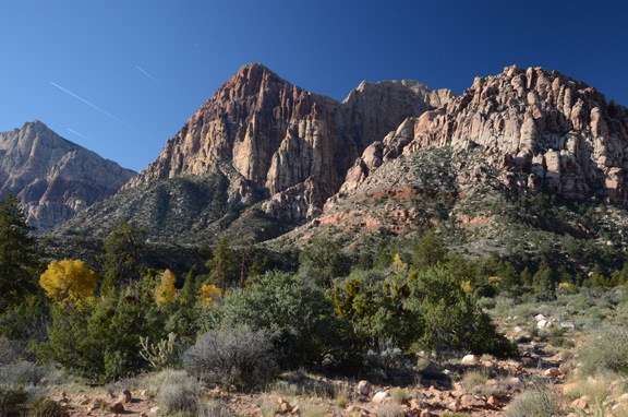
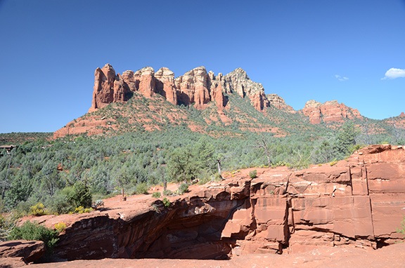
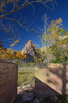 Mescalito Peak from the Wilson homestead ruins.


 The road to Lockett Meadow is not paved. I was driving my Honda S2000, which probably has about 6 inches of clearance on the bottom. (At least it seems that way.) I was a little concerned when I saw the sign that said “Road Not Maintained for Passenger Vehicles,” but when you consider that the road to my house is not maintained at all and is currently in deplorable condition and I drive it every day with the Honda, I was willing to give it a try.
 Lockett Meadow Campground was at the end of the road. So were the aspen groves. I stopped and snapped a few photos, including this shot of my car parked alongside the road.
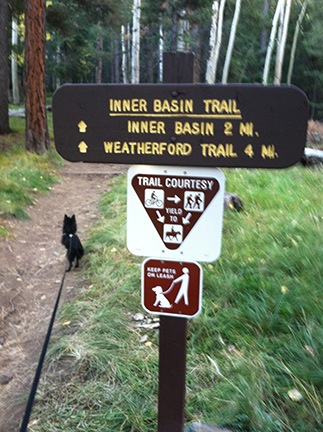 In the back of the campground was the trailhead for the Inner Basin trail. I parked the car among the SUVs in the small lot and got out with Penny to take a look. The trail looked dark and wound into the forest. It didn’t look very inviting. Although Penny was ready to go, it didn’t look like the kind of hike I wanted to take early in the morning. I was more interested in photographing the aspens; there were plenty of subjects back out in the meadow.
 I love including reflections in my photographs. This location did not disappoint me. I was able to make a number of photographs that really showed off the view with perfect reflections.
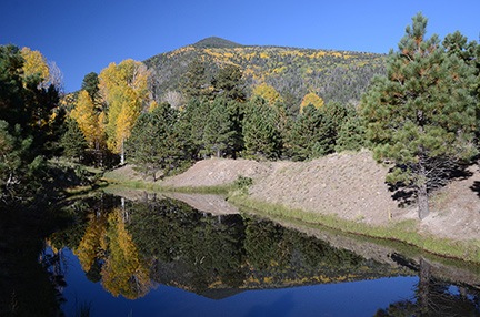 I got back into the car again, now ready to leave. But again, as I was driving off, I caught sight of another place where still water was surrounded by trees. Leaving Penny in the car, I went to investigate and made a few more reflection photos. It was really much more than I had hoped for.
 When Rod and I finished talking, I felt better. Penny and I got back into the car and continued to the Snowbowl. We followed the winding road all the way up to the entrance to the ski area. Just to the right was the parking area for the trailhead.
 Like the other trail, the Kachina trail led into the woods. But whether it was the time of day — after 10 AM — or just the kind of trail, it seemed a lot brighter and more inviting. But what really surprised me was the elevation — the GPS in my phone reported nearly 9,300 feet. Whoa.
 The trail was relatively narrow and wound up and down through the forest, between trees and around large rocks. Penny, on her leash, led the way, stopping occasionally to sniff at something. We met a young family with children walking the other way. I kept up a good pace without getting winded, despite the elevation, and was glad again for the health benefits of my recent weight loss.
 On the way up to the Kachina Trail, I’d passed a place called Aspen Corner. There was a parking area there with paths through an aspen grove. Those trees were at near peak color. I decided to wander around there for a while.
 Penny and I wandered around for a while. I asked another photographer to take a photo of usy, but the exposure was so bad you can barely see us. I also tried a self-portrait using the camera’s timer and did a little better — although I’m squinting into the sun so badly that I don’t really look very appealing. Oh, and do you know how difficult it is to prop up a DSLR vertically on a log?
 I can’t really express the joy I feel driving a tight-steering sports car with plenty of performance at high speed on otherwise empty mountain roads. Two weeks ago Sunday was the first time I’d driven my car since leaving Arizona in early May. A few trips to Phoenix helped reacquaint me to its feel. But this Sunday, as I sped toward Sedona, we were fully reacquainted. I especially enjoyed the stretch of Highway 89 in the Prescott National Forest between Wilhoit and Prescott. The stretch of Highway 89A between The Yavapai Country Fairgrounds and Jerome would have been even better if I weren’t stuck behind a slow Prius for most of the trip.
 The
The