Phoenix to Lake Powell by Helicopter

Again, but this time with video.

The initial call about the January photo gig at Lake Powell came in December through one of my Russian connections. Apparently, two Russian businessmen who were attending the Consumer Electronics Show (CES) in Las Vegas wanted to photograph the Lake Powell area from the air. They were willing to pay me to fly up to Lake Powell from Phoenix and make at least two flights totaling 3 to 5 hours.

Trips like this are extremely costly — after all, the client has to pay for 4 hours of flight time just to get me up there and back — and I honestly didn’t expect it to happen. But a week before the chosen dates — January 12-13 — I got the green light and the all-important credit card number I needed to get paid for that 4 hour repositioning flight plus a standard overnight fee to cover my expenses and compensate me for my time away from home.

The Gig

Weight and BalanceI admit I wasn’t looking forward to the gig. The two photographers claimed to weigh 242 pounds (converted from kilos) and I knew they likely weighed more fully dressed and carrying camera equipment. I calculated the weight and balance as soon as I had this information and discovered that I’d have to strip all non-essential equipment out of the helicopter to lighten it up so we could take enough fuel for 2 hour flight segments (plus FAA-required reserves). Anything that was left on board would have to be shifted from under my seat to under the seat behind me, just to shift weight backwards. Having two fatties — yes, including me — up front would make us front-heavy. Having two fatties on the left side would make us heavy on that side. But even after adding 15 pounds of weight for each of them, I confirmed that’d be in balance with 2/3 fuel or less on board.

The other thing that bothered me was weather. Page, AZ was having unseasonably cold weather with daytime highs barely getting above freezing. Flying a helicopter with two doors off guarantees plenty of outside air inside the cabin and no amount of heat is going to win against 30°F outside air. So not only did I have a bit of a challenge ahead of me with a listing (but still within acceptable CG) aircraft to fly, I’d likely be freezing my ass off.

As far as the helicopter goes, I wasn’t worried about the cold weather affecting operations. My R44 Raven II is fuel injected, so carburetor ice is not an issue. I’d flown it in cold weather before and it was always peppy — once I got it started. In fact, that was my only real concern: Lake Powell photographers usually want to get off the ground at dawn for morning flights and with overnight temperatures under 20°F, I worried a bit about getting the helicopter started for its morning flight.

But the gig did have one big thing going for it: at least 4 hours of revenue time. And if there’s one thing I’m interested in, it’s getting paid to fly.

The Flight Up

Lake Powell is about 200 nautical miles north of the Phoenix area. Since my clients were paying for a 2-hour flight, my goal was to make it there in two hours. That meant flying as close to a straight line as I could.

CourseUsing Sky Vector, I plotted a course from Phoenix Deer Valley Airport (KDVT) to Page Municipal Airport (KPGA) with only one waypoint in between: the Little Colorado River Gorge (LCRG) on the east side of Grand Canyon’s Special Use Airspace. I wrote down the coordinates for the LCRG to punch them into my GPS — a recent GPS battery change had wiped my user waypoint list clean. The flight path would take me north along the east side of I-17, crossing it just before it dips down to Camp Verde. I’d cut across the Verde Valley between Sedona and Cottonwood, then climb the Mogollon Rim west of Sedona, pass east of the restricted area for the Navajo Army Depot, west of Flagstaff, and west of the San Francisco Peaks, the tallest mountain in Arizona. From there, I’d drop back down into the Navajo Reservation, flying over its western edge, hop the Echo Cliffs, and drop back down to Page, AZ.

And that’s mostly how it all came off.

I departed Deer Valley at about 8:45 AM under partly cloudy skies with little or no wind. It was a cool morning, with temperatures just climbing through the 50s. I crossed Deer Valley’s runways at 2000 feet MSL as required by the Tower there and got right on course, aiming for the LCRG waypoint I’d added to my GPS.

It was interesting and different to fly a straight line route through an area I knew so well. After all, I’ve been flying from the Phoenix area to Sedona, the Grand Canyon, Flagstaff, and Lake Powell for years, so it’s not as if the area I’d be flying over was new to me. But I usually fly with passengers on board and, to make the flight more interesting, I fly over or past various points of interest, such as towns, highways, mine sites, and canyons. On this flight, speed was the goal — I wasn’t interested in scenery. But I got scenery anyway — how can you fly a helicopter through Arizona without seeing something spectacular every mile?

As I flew, my GoPro Hero camera recorded a 720p widescreen video of the flight. Mounted up front, it offered an unobstructed view of everything ahead of me. The wide angle lens brought in details of what was close while pushing back distant points. Later that night, I’d watch much of the 2 hours of video and remember the various points of the flight.

Mountains north of Phoenix
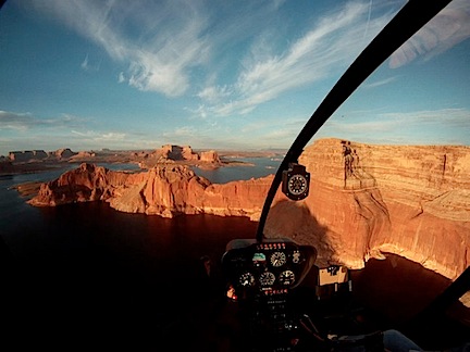
What fascinated me was the way the light changed throughout the flight. At first, it was partly cloudy. Then the sun slipped behind the clouds and it was cloudy. Then the sun began to break through, speckling the mountainsides with light. This still image, captured from the video, gives you an idea of what I mean. The light changed numerous times over the two-hour period of the flight — at one point, clouding over completely only 1,000 feet above me — giving the illusion that the flight was conducted over multiple days.

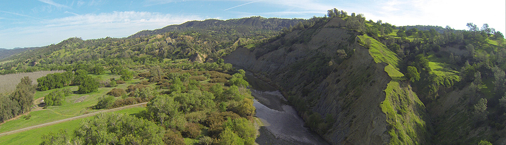
It wasn’t just the light that changed, of course. It was also the terrain. Flat desert in the Phoenix area, soft mountains studded with saguaro cacti as I headed north, flat mesas with steep basalt sides, deeply carved canyons, wide valleys, red rock cliffs and hoodoos, alpine forests blanketed with snow, tall mountains, ancient cinder cones, flat “painted” desert, deep gorges, buttes, uplifted cliff faces, slot canyons. I saw it all over the course of my two hour flight — all without trying to see it. My nearly straight line course simply put me over the top of all these things. I sat comfortable and warm in my seat, admiring the view as I glided over it.

Glided is definitely a good word. There was hardly a breath of wind during the entire flight so it was amazingly smooth. A pilot’s dream. And although outside temperatures dipped as low as -5°C, I was cosy and warm with the heat up only about halfway.

SedonaOne of the highlights of the flight was crossing the red rock cliffs west of Sedona and climbing up over the Mogollon Rim. The light was absolutely perfect, breaking through light scattered clouds to illuminate the rocks with a soft golden light. Absolutely breathtaking and the GoPro camera captured the whole thing.

Beyond that was a surprising amount of snow and a light overcast layer that shrouded the top of the San Francisco Peaks. The temperature there was around 0°C, but the Flagstaff ATIS reported -5°C — a real thermal inversion only 10 miles east. The low cloud layer and dimly lighted snowfields made me feel claustrophobic. Ahead of me, it looked as if some precipitation could be falling from the clouds. That got me a bit worried about icing, but I continued on. By the time I got to the point I thought I’d seen rain or snow falling, it had stopped — and so did my worries.

The only surprise on my flight was upon reaching the GPS coordinates for the LCRG. Simply said: it wasn’t there. It was about 10 miles northwest of where I’d plotted it to be. I can only assume that I’d punched in a wrong digit when I entered the waypoint into my helicopter’s GPS. So rather than fly over its most dramatic point, I crossed a bit to the east and kept going. I deleted that waypoint so I wouldn’t depend on it again. Oddly if I’d made a serious mistake in the entry, I would have noticed it a lot sooner. But because it was only off by a little bit, it wasn’t until I passed the waypoint that I realized the error. I’ll definitely be more careful in the future.

Over the RezWhen I got to the empty expanse of the Navajo Reservation, I dropped down and flew low over the ground. There were few homes in the hundreds of square miles and only a handful showed signs of life. In the video, my helicopter’s shadow is clearly visible: small when I’m flying higher and larger when I’m flying lower. The video makes it seem as if I’m going much faster during this portion of the flight, but I’m not. I managed to keep a steady 100-110 ground speed for most of the flight. It’s just an illusion: the closer the camera is to the ground, the faster I seem to be flying.

I crossed over the Echo Cliffs at Cedar Ridge — at least I think that’s where I was — and sped across more of the Navajo Reservation north. In all, I think about 45 minutes of the flight was spent over the Rez. It’s an amazing land of stark beauty, sprinkled with traditional homesteads, more modern yet simple homes, and, on its far western reaches, the ruins of abandoned homesites clearly visible as rock rings and corrals. The traditional Navajo home is a round or octagonal building called a hogan and they are clearly visible from the air. Also visible on most days are livestock such as cattle and sheep and wild horses.

I descended down toward the lake, flying at a low enough level that I didn’t actually see its clear blue water until I was about 15 miles out. Of course, I could see other landmarks — notably the bulk of Navajo Mountain about 50 miles to the east of Page and the Navajo Power Plant, with tall stacks belching ugly smoke into the air just outside of town. The radio frequency was silent as I descended toward the airport. I lined up with the taxiway and set down on one of the helipads.

The Video

Later, after doing 3.4 hours of photo flying around the lake and points east, I watched the video shot by my GoPro Hero. It was probably some of the best footage I’d ever captured with the camera. My only regret was that I hadn’t shot in in 1080p.

Over the course of two days, I assembled a movie from seven-second clips shot during that two hour flight. Last night I added titles and music. I exported it for my iPad and uploaded it to YouTube. Here it is. Enjoy.

2010: My Year in Flights

I was all over the place.

I thought I’d take a moment to blog about some of the flying I did this past year. LogTen Pro, the software I blogged about yesterday, makes keeping track of my flying activities a lot easier to summarize.

The Big Picture

I flew a total of 207.3 hours in 2010 with exactly 300 takeoffs and landings. Nine takeoffs were at night while 13 landings were at night — this inequality occurs, in part, because of long flights that begin just before dawn or just before dusk. But I only flew 5.1 hours at night.

Flights by MonthMy flights are spread out over the entire year, with February, March, September, and October my busiest months. LogTen Pro created this graph for me so I could visualize it.

Some Details

I broke my flight time down into different types that I want to track:

  • 71.5 hours Solo. Solo flight time is the time I was on board all alone. Much of this time was spent repositioning the aircraft for a flight. I often offer this time at low rates on Flying M Air’s Web site, but seldom have people take advantage of it. Their loss. I don’t mind flying alone. I suspect I have an unusually high percentage of solo flight time for a helicopter pilot.
  • 89.4 hours Cross Country. For helicopters, cross-country flight time is considered anything over 25 miles. This number includes only flights that landed at least 25 miles from the starting point. It does not include flights where I flew at least 25 miles away and then came back to the same airport or another one nearby. I did make several very long cross-country flights last year, including flights between Phoenix and Seattle and flights from the Phoenix area to Lake Powell, Monument Valley, Las Vegas, and Blythe, CA.
  • 30.2 hours High DA/Mountain. I track high density altitude/mountain flying because it’s important to some employers. The definition I use is flights that begin or end at an airport at 5000 feet density altitude or higher and the part of that flight spent over that DA. So if I flew from Wickenburg (2400 feet elevation) to Prescott (5000 feet elevation) and was over 5,000 feet for about half of that 30-minute flight, I’d log .2 or .3 for High DA/Mountain flying. All of the flights I did when I flew at the Grand Canyon were High DA/Mountain flights because I started and ended at 6300 feet and never got any lower. If I started at a low elevation and landed at a low elevation, however, I probably wouldn’t log any high flying in between unless it was either very high flying or involved crossing mountains, etc. I know this is subjective and not perfect, but I’m really not required to log this at all, so I do it my own way just to get a ballpark idea.

Landing Zones
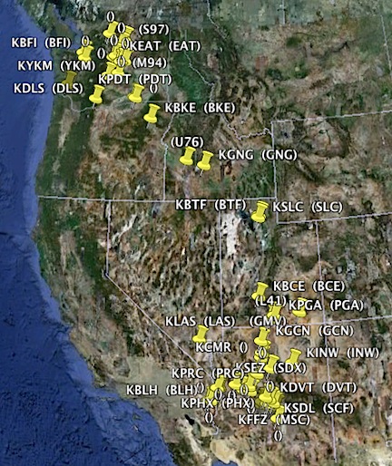
I landed at 52 different places in Arizona, California, Nevada, Utah, Idaho, Oregon, and Washington. 16 of these landing zones were off-airport, although two of them were official helipads registered with the FAA. These numbers do not include about a dozen off-airport landing zones I used during one mine survey job in March; it just wasn’t worth logging them all. This Google Earth map shows where they were, using data from LogTen Pro. (Seriously: isn’t this cool?)

I only flew one aircraft: my R44 Raven II.

The Flights

A look at my logbook reveals a wide variety of flight types:

  • Day Trips to Grand Canyon, Sedona, and Meteor Crater/La Posada. This is something Flying M Air offers and I’m pretty sure we’re the only operator in the Phoenix area that does so at a reasonable price. Truth is, I’ll take you anywhere I’m allowed to — which is almost anywhere in the 48 contiguous states — for the day if you pay me to. These are the trips I offers, so these are the trips I sell. Sure do wish someone would ask for something different once in a while. If I spent any more time at the Grand Canyon, I could probably get a part time job as a tour guide there.
  • Phoenix Tours. This is Flying M Air’s “cheap flight.” Frankly, it isn’t worth going to the airport for less than an hour of flight time, so this is the lowest price tour I sell. It’s a great flight around the city and I customize it for clients, partially to make them happy and partially to make it more interesting for me. One of these custom flights required me to visit several specific GPS locations, four of which were inside class Bravo (PHX) or class delta (CHD) airspace. That was a challenging flight.
  • Moonlight Dinner Tours. I only did one of these last year, but it was a biggie: the guy popped the question and the gal said yes. What’s especially memorable about this flight is that I picked them up and dropped them off at the Sky Harbor helipad, which is between the runways and always a fun challenge.
  • Monument ValleySouthwest Circle Helicopter Adventure. I only did one of these last year, with a nice couple from Tucson. (In 2009, I did four of them and I have one scheduled (so far) for 2011.) This is a six-day excursion with overnight stops at Sedona, Grand Canyon, Lake Powell (at Page), Monument Valley, and, on this particular trip, Winslow (which I actually prefer over Flagstaff, the usual stop). This was the first trip where I actually had to alter my course and change tour reservations due to weather — the second day had low clouds and rain that cleared out later in the day. You can find photos from this trip here.
  • Las Vegas Weekend. I took two women up to Las Vegas for the weekend. It was a nice flight and a relatively nice weekend away, despite some mechanical problems.
  • Video flights at the Best in the Desert (BITD) Parker 425 race. Last year was my third year at the race. It’s my favorite annual gig and I’m only sorry that it’s just one day a year. I flew three videographers last year, chasing race trucks through the desert. (The aerial shots in the video here were made from my helicopter.) Of course, the last videographer let his seatbelt hang out the door, causing damage that cost $2K to repair. I won’t let that happen again.

  • Wine Shopping. I took some regular clients on a wine shopping trip from Wickenburg to Scottsdale. They bought four cases of wine and we managed to fit them all in back under and on the third passenger seat. We named our “passenger” Bacchus.
  • Mine Survey. I took five different people (on multiple flights) to test soil samples on various mine sites not far from Blythe, CA. Although the logged time didn’t add up very much — each flight segment was less than 10 minutes — the waiting time sure did. I was satisfactorily compensated, so that’s not an issue. Now I bring my iPad on all flights so I have something to keep me occupied while clients are out doing their thing.
  • Equipment Testing. I actually did two of these gigs, each over multiple days, out in the desert west of Wickenburg. It required the client to hook up some communications equipment on the helicopter and me to fly as specified so they could test range, etc. There was a lot of flying, a lot of landing, and a lot of waiting. On the first gig, we brought our truck and new fifth wheel trailer out into the desert and camped. The truck had my fuel transfer system on board, which made it unnecessary to go back to Wickenburg for fuel. It gave us a good opportunity to test out the trailer before I used it that summer.
  • Over Lake PowellPhoto and video flights. I did a bunch of photo flights in the Phoenix area, north of Phoenix, south of Phoenix, and all the way up at Lake Powell. In fact, I spent a total of 45.4 hours (according to LogTen Pro’s summary of my remarks field) doing photo and video flights last year. I even got to do one flight with my new Moitek Gyro-stabilized Video Camera Mount.
  • Cherry DryingCherry Drying. I spent more time drying cherries this year than I did in the previous two years combined — but it still only added up to 20 hours over 11 weeks. Anyone who thinks drying cherries is a good way to build time is very wrong. (If you’re a pilot interested in cherry drying, read this.)
  • Rides. I did rides at one public event and one private one last year. I also did a few odd rides here and there, mostly for folks I owed favors to. I figure I took about 40 helicopter “virgins” up for their first ride, along with at least 30 others who had already been in a helicopter.
  • Golf Ball Drops. I did two drops in 2010 and I’m starting to get good at it. On the last drop, I got one ball in the cup and another right on the cup rim.
  • Ash Scattering. I did only one of these in 2010, but that’s okay. Although I don’t mind doing them, I don’t particularly like them. Good part: family happy to have complied with wishes of deceased. Bad part: Climbing to altitude and worrying about packet of ashes breaking open and getting into my air intake (again). This flight went well and the folks were happy. For two of them, it was their first ever helicopter flight.
  • Fun. I did some flights just for fun, mostly in Washington state. I sure do love flying up and down the Columbia River. I also enjoy low-level flight over the empty desert.

Not a Bad Year

I’ve been averaging 200 hours a year — except for the year I flew at the Grand Canyon, which was considerably higher — since I began flying. I have the huge chore ahead of me of entering all that flight time into LogTen Pro. I figure I’ll do a few months a week. I’ll likely finish up over the summer when I’m back in Washington waiting for it to rain.

When I’m done, I’m sure I’ll show off my stats here.

LogTen Pro

A mini software review for pilots.

LogTen Pro
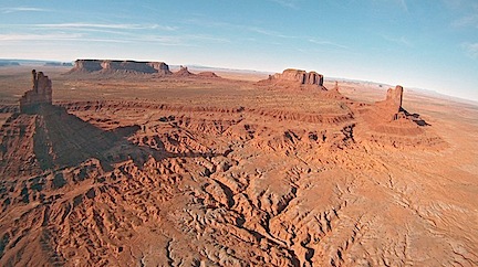
At the end of 2010, nudged by the availability of a coupon code for 30% (I think) off, I purchased the Mac and iPad versions of LogTen Pro. This program, published by Coradine Aviation Systems, is designed primarily for airline pilots to log their flight time, trips, duty time, expenses, and other data. It can then generate any number of reports, including FAA-approved logbook pages and duty sheets. Of course, pilots with Macs don’t only live in the US, so LogTen Pro supports multiple countries and the reports needed to satisfy their own FAA-equivalent organizations.

Although, on the surface, LogTen Pro seems like overkill for logging pilot hours, its true power lies in the fact that you don’t need to log everything it lets you. For example, LogTen Pro enables you to log flight date, aircraft N-number, duty time in, hobbs out, time out, from airport, to airport, time in, hobbs in, and duty time out. That’s the kind of information an airline pilot might need or want to log. But, in reality, how many people really track that much information about their flights? LogTen Pro is perfectly satisfied just taking the flight date, N-number, from airport, to airport, and total time flown. And of course, you can log day vs. night time, VFR vs. IFR time, etc.

In other words, you can log as little or as much information as you like.

iPad version of LogTen ProOf course, the iPad version (shown here with a screen shot of all my 2010 activity) syncs with the Mac version, so I can log time on the go and sync it all up when I get back to my office. Or I can pull old log entries out of my paper logbook and enter them in my Mac and then sync it all to my iPad.

While LogTen Pro is a bit weak on logging helicopter flight time — for example, it supports the Rotorcraft category but did not include a Helicopter class (although, for some reason, it did have gyroplane; go figure) — it is highly customizable. I simply used one of the undefined Class fields to create a Helicopter class in my copy of the software. Although this is calculated properly in the logbook reports as is, I can also create custom log book pages that eliminate columns I don’t need and expand on ones I’m interested in tracking, such as High DA/Mountain (another custom field I created) or Turbine helicopter.

I could go on for thousands of words about this software — there’s a lot to it. But it would be better to let you view the Guided Tour and just try the software for yourself. If you’re a pilot with a Mac, iPhone, or iPad, download the demo version of the software and see what you think. If you’re geeky and love stats like I do, I think you’ll be sold.

Pilot Flying Fears?

Education is the best way to deal with safety concerns — especially if you’re a pilot.

I recently took part in a forum discussion that revolved around safety issues. The person who started the discussion, a helicopter pilot training to be a CFI, was concerned about the possibility of flight schools emphasizing the fun part of flying without adequately addressing the dangers. It wasn’t a failure to teach emergency procedures that bothered him. It was the attitude of flight schools and CFIs. He worried that flight schools, in an attempt to keep enrollment high, were failing to make students understand just how dangerous flying helicopters can be.

While I’ll agree that flying helicopters is dangerous, I also agree that driving a car or or crossing the street is dangerous. In fact, you stand a far more likely chance of being injured or killed in a motor vehicle than in an aircraft. The pilot who started this discussion knows this, but he still wonders whether flight schools should be making student pilots more cognizant of the dangers, especially early on in training.

I understood his point of view, but I really don’t know firsthand how much his flight school is downplaying the dangers. The general feeling I came away from after reading his comments was that he had a fear of flying. (This turned out not to be the case.) While it’s always good for a pilot to be afraid of what could happen, there comes a point where the level of fear becomes unhealthy. Yes, it’s true that pilots need to be mentally prepared to react to an emergency within seconds. But no, we don’t need to spend every moment of every flight actively thinking about all the emergencies that could ruin our day — or end our life.

Experiences Teach

I flew with a 300-hour pilot a few years ago. He’d gone through training and was a CFI looking for a job. (I have flown with quite a few CFIs looking for jobs, but that’s another story.) We were on a cross-country, time-building flight in my R44. I would eventually fly a total of 20 hours with him.

Early on in our first flight, I learned that his CFI, who was the flight school’s Chief Flight Instructor, had been killed in a rather disturbing fiery crash. Although she had over 2,000 hours of flight time, she had only 24 hours in the helicopter make and model. On that fateful day, the NTSB concluded that the accident was caused by:

The pilot’s improper planning/decision in attempting a downwind takeoff under high density altitude conditions that resulted in a loss of control and impact with terrain. Contributing to the accident were the helicopter’s gross weight in excess of the maximum hover out of ground effect limit, a high density altitude, and the gusty tailwind.

(I don’t really want to discuss this accident here; I think deserves a discussion of its own elsewhere in this blog and hope to address it in the months to come.)

Near GormanIt soon became apparent to me that the pilot was unusually fearful of flying in the mountains. Our route required us to fly west from Wickenburg, AZ to the California coast near San Luis Obispo. He started fretting about the mountains ahead of us while we were still in the flat deserts of Southern California. The mountains he was worried about showed elevations of 5,000 to 8,000 feet on the chart; we’d be flying over a road that ran in a relatively straight and wide canyon. That part of the flight turned out to be uneventful and he seemed genuinely relieved when it was finished.

Monterey BayOddly, later in the flight, when the Monterey tower instructed us to cut across Monterey Bay at an altitude of only 700 feet, I was pretty freaked out. Here we were, in a single-engine helicopter flying far from gliding distance of land, without pop-out floats or personal floatation devices. My companion, on the other hand, was perfectly at ease. In fact, I think he thought me cowardly when I asked Monterey tower for clearance to fly closer to shore.

This is a great example of how experience teaches. My companion was a “sea level pilot,” who did all of his training — and flying — in the watery areas around Seattle. He was comfortable with water and low-lying lands, but he was fearful of the conditions that had taken the life of someone he knew very well. I was a desert pilot with most of my experience flying over dry land, much it in high density altitude situations, including more than 350 hours flying tours over the Grand Canyon at 7500 feet or higher. I was comfortable flying over most kinds of terrain at just about any altitude but very fearful of flying over water.

(Nowadays, I wear a PFD when doing any extended flying over water and require my passengers to do the same.)

Learn from Other People’s Mistakes

Back in the forum, I began wondering if the pilot who had started the thread was concerned because he’d lost someone close to him in a crash — much like my cross-country companion had. (That turned out not to be the case.) I said:

If a person thinks too much about the danger of ANYTHING, they won’t be comfortable doing it. I admit that I don’t concern myself with it. I do everything I can to fly safely and maintain a safe aircraft. I’m confident in my abilities and never push the envelope of comfort more than I absolutely need to. I don’t fly around thinking that at any moment, something bad could happen. If I did, I’d hate flying and I’d likely be a horrible pilot.

Later, in the same post, I said:

You might also consider reading NTSB reports for helicopter accidents. What you’ll find is that most accidents are caused by pilot errors. REALLY. Reading those reports will help you learn what mistakes others have made so you’ll avoid them in the future.

He saw these two comments as conflicting and replied that I couldn’t really say that I wasn’t concerned with danger if I was reading accident reports.

My response was:

You need to understand that it’s BECAUSE I read the NTSB reports that I’m NOT overly concerned with the dangers of flying. The NTSB reports educate me about what can happen when you do something dumb: fly too heavy for your type of operation, perform maneuvers beyond the capabilities of your aircraft, fly into clouds or wires, etc. Each time I read a report and understand the chain of events that caused the accident, I file that info into my head and know to avoid the same situation.

I went on to say a lot more about what I’ve learned from NTSB reports. I read them for helicopter accidents at least once a month. Another pilot in the forum said he does the same thing — in fact, he even has a browser bookmark that’ll pull up the reports by month! I cannot say enough about the usefulness of these accident reports for training and awareness.

Unanswered Questions Can Fuel Fear

As I look back now on the flights I took with that mountain-fearful CFI — with the forum discussion in mind — I’m wondering whether the flight school had properly debriefed its students after the loss of the Chief Flight Instructor.

What had the flight school told him and the other pilots? Had they told him what caused the crash? I know that back then, before the NTSB report was issued, the flight school was in denial about the aircraft being overweight for the operation. Had they told their students anything at all? Were my companion and the other pilots and student pilots at that flight school left to wonder how such a great, experienced pilot could have been involved in a crash in the mountains?

Were his unanswered questions fueling his fear?

Another thing I suggested in the forum is that flight schools might want to conduct monthly seminars that students are required to attend as part of ground school training. Get all the students and CFIs into a classroom or meeting room with a few knowledgable, experienced pilots at the front of the room. Pick 3 to 5 recent helicopter accidents for which the cause is known. Talk them out. Explain what went wrong and what could have prevented the accident. Don’t point fingers; present facts.

Why don’t flight schools do this? Could it be because of what this forum pilot originally said: flight schools don’t want to scare off students by discussing dangers? If so, they’re doing their students — and the rest of the aviation community — a serious disservice.

Education and Experience are the Answers

Nowadays, if you want a job as a pilot carrying passengers for hire, you’ll need at least 1,000 hours of experience as a pilot in command. (Yes, I know some companies will take less, but those are few and far between.) There’s a reason for this: they want pilots who have experience flying. Experience leads to skills, knowledge, and confidence.

Some people think 1,000 hours is an arbitrary number and frankly, I have to agree. My first 500 hours were very different from the average CFI’s first 500 hours — in some respects, my experiences are “better,” while in other respects, a CFI’s experiences are “better.” But I also can’t see any other easy way to gauge a job applicant’s level of experience.

But it isn’t just experience that makes a pilot a good pilot. It’s also knowledge and attitude. Both of these things could be the end product of a flight school’s training program.

Many flight schools seem satisfied getting students and putting them through a “program” with just enough skills and knowledge to pass a check ride. Many students, who don’t know any better, are more interested in the cheapest way to get their ratings than the quality of the training.

I believe that with better quality training and better quality experience, less hours of experience should be necessary to have and prove good piloting skills. I also believe that pilots with better quality training and experience will have a better, safer attitude toward their responsibilities as a pilot.

It’s not a matter of teaching new pilots to be fearful of what could happen by stressing the dangers of flying. It’s a matter of educating about dangers — and how to avoid them.

What do you think?

The Real Cost of Helicopter Ownership

Don’t believe what they tell you.

Looking for more up-to-date information?

Check out the livestream video I did on YouTube in July 2020 on this topic:

Twenty years ago, if someone told me I’d own a helicopter before my 40th birthday, I would have told them they were nuts. Yet on October 3, 2000, I took delivery of my first helicopter, a 1999 Robinson R22 Beta II. Four years later, on January 8, 2005, I’d traded it in for a brand-spanking-new, designed to my specifications, 2005 Robinson R44 Raven II.

N7139L
My first helicopter, a Robinson R22.

N630ML
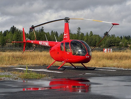
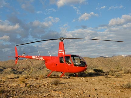
My R44, parked out in the desert at a rides event.

I was making a lot of money as a writer back then. A handful of bestselling computer how-to books — yes, they do exist — and a few good real estate investments left me with an excess of cash. I live rather modestly in a home I can afford and although I own more than my fair share of motor vehicles, none of them are new, flashy, or expensive. In other words, I don’t live beyond my means. Although my income fluctuates wildly — especially these days — I could foresee the ability to own and operate an R44 into the future, especially with added income from a small Part 135 on-demand charter operation.

Fueling my opinion on this matter was a document published by Robinson Helicopter Company on its Web site. Titled “R44 Raven II Estimated Operating Costs,” it painted a rosy picture of an “affordable” helicopter (if there is such a thing). The conclusion at the end of the “Operating Cost-Per-Road Mile” section stated that the calculated 98¢ per road mile “…compares favorably with some expensive automobiles, and will usually be lower when the value of time saved is considered.”

The Underestimated Costs

I knew from the start that the document was overly optimistic for my situation. Some of the numbers just didn’t seem right.

  • Back then, Robinson was calculating labor at $55/hour. At the same time, I had one mechanic charging me $95/hour and another charging me $105/hour. Later, I had a mechanic who charged me $75/hour. The local airplane fix-it guy, who I sent to the Robinson maintenance course, was the least expensive, charging me $45/hour at first but then bumping it up to $55/hour. He didn’t have the experience or specialized tools for the helicopter-specific inspections and maintenance I sometimes needed. So Robinson’s labor estimate was understated by 30-40%. (Nowadays, Robinson estimates $70/hour, which is still very low.)
  • Robinson’s estimated fuel and oil costs were consistently lower than what I was paying. That baffled me. Robinson is based in California, which has some of the highest taxes on fuel around. Just crossing the border from Arizona to California, you can expect to spend 50¢ more per gallon on auto fuel. Yet even today, they’re estimating $4.50/gallon for fuel. Tell that to the folks at Grand Canyon, who hit me up for $6/gallon early this month. And 14 gallons per hour? Realistically, its more like 15-17 gallons per hour. And oil: Robinson estimates 50¢/hour. Where did that come from? The W100+ oil I use costs about $6/quart and I seem to be adding a quart every 5 hours or so. Do the math.
  • Robinson’s insurance costs are based on Pathfinder rates. Pathfinder has a special relationship with Robinson that keeps its rates low. The annual premium in the current estimated operating costs — around $11,000 — aren’t too far off from what I paid when I insured with them for my commercial operation. Unfortunately, however, Robinson prorates this fixed annual amount over 500 hours of flight time per year. How many private owners — the same guys buying the expensive cars Robinson is comparing its helicopters to — fly 500 hours per year? I run a business with my helicopter and still don’t fly more than 200 hours a year on average. (Most private pilots fly less than 100 hours a year.) Take that $11,000 and divide it by 200 and the hourly cost for insurance alone is $55 — not the $22 figure Robinson uses.

Still, when I made my purchase/ownership decision, I plugged in whatever known numbers I had and relied on Robinson’s numbers for the unknown — especially the cost of periodic inspections and unscheduled maintenance. The result was within my budget, so I became an owner.

The Hidden Costs

I started getting slammed with unexpected costs not long after purchase. The first major component to need replacement was the starter and ring gear. My personal opinion on the matter is that the starter was defective and did not fully engage with the ring gear on every start. It began breaking teeth off the ring gear. The situation got so bad that it all needed replacement.

The clutch down limit switch, an $8 part, cracked. Of course, to replace it, you have to pull the tail cone, then put it back on and rebalance the fan scroll. That’s about an 8-hour job.

The auxiliary fuel pump went after about 500 hours. And then again another 500 hours later. And then again about 100 hours after that. The pump costs $1,600 new and $800 overhauled. I know because I’ve bought them both ways. Fortunately, a good mechanic can replace it in less than an hour.

I suppose the magneto overhaul is included in Robinson’s calculations. After all, they are required to be rebuilt every 500 hours. At a cost of $1,600 each time.

The upper bearing began leaking brown fluid at about 850 hours. The overhaul was $3,000 plus installation (which requires removal of the tail cone). The following year, it was still leaking and now overheating. I was lucky that the factory applied the overhaul cost to the price of a new one: $9,000.

I’ve also replaced the battery twice (at $400 a pop) and my oil pressure gauge once. I’ve had repairs done to my primary radio and GPS. The muffler cost another $2,200 this year.

These are just the things I’m remembering off the top of my head. If I pulled out my Engine and Aircraft log books, I’m sure I could list a lot more of the same: items that are supposed to last the life of the aircraft (okay, well maybe not the battery) simply not lasting.

But Wait! There’s More!

And then there are the Airworthiness Directives, Service Bulletins, and Service Letters. Because I operate under Part 135, these are not optional. So yes, I changed the orientation of the fuel control because some idiot who likely left his helicopter out in the rain all the time was getting water in his fuel — even though my helicopter was based in the desert, where it rarely rained, and was kept in a hangar. And I replaced the seat belt attachment points and changed the throttle link and swapped out the frame tube clamp and fiddled with the throttle linkage and changed the fuel hose supports and replaced the hard fuel lines and replaced the gascolator assembly and did something to the clutch actuator fuse holder wiring. Each one of these required maintenance items cost money — sometimes thousands of dollars. And none of them were included in Robinson’s estimate of costs.

A service bulletin that became an airworthiness directive required inspection and then repainting (or replacement) of the main rotor blades. To stay in compliance in my extremely corrosive (think dust) operating environment, I’ve had the blades removed and repainted twice in six years. It costs about $1,500 each time.

But the real kicker — the service bulletin that prompted this blog post — is the bladder tank retrofit for my fuel tanks. The kit for the retrofit will cost about $6,000 and there’s 40 hours of labor on top of that plus the cost to repaint the fuel tanks. By my calculations, this should cost me between $12,000 and $14,000. This is not one of the estimated costs on Robinson’s fairy tale cost estimate marketing document.

Limiting Robinson’s Liability

And why? I’ve discussed this at some length with two other owners and here’s what we think.

An operator — or possibly multiple operators — experience a problem. Water in the fuel tank, seat belt buckle attachment points cracking, stuck throttle link, cracked fuel lines, chaffed wiring. They whined and complained to Robinson and may have even threatened legal action. Or maybe they sued. Robinson is privately owned and self-insured. They examine the problem area and come up with a new design to fix it in the future. Then, to prevent other owners from giving them grief about it, they put out a service bulletin to address it. If you don’t comply with the service bulletin, you can’t come crying to Robinson with your problems.

The fuel line and fuel tank bladder situation is taking things to the extreme. There have been instances of post-crash fires on Robinson helicopters. (News flash: Most serious aircraft accidents involve post-crash fires.) To prevent legal action against the company, Robinson started issuing documents. First, in July 2006, came Safety Notice 40, which states:

There have been a number of cases where helicopter or light plane occupants have survived an accident only to be severely burned by fire following the accident. To reduce the risk of injury in a postcrash fire, it is strongly recommended that a fire-retardant Nomex flight suit, gloves, and hood or helmet be worn by all occupants.

Are they kidding us? Do they honestly expect me to put all my passengers in flight suits with helmets for tours around Phoenix? Or day trips to Sedona? And how do you think my passengers would feel if their pilot showed up wearing a pickle suit and helmet for their tour or charter flight?

But when that wasn’t enough to counter liability, Robinson followed up with three service bulletins: SB-67 (R44 II Fuel Hose Supports), SB-68 (Rigid Fuel Line Replacement), and now SB-78 (Fuel Tank Bladder Retrofit). They’re attempting to minimize the possibility of a post crash fire by making modifications to the fuel system to help prevent line and tank ruptures. So I’m basically required to modify my aircraft to reduce Robinson’s liability in the event that I crash and my helicopter catches fire?

That’s like requiring older car owners to add airbags and ABS brakes just to reduce the liability of the automakers.

Puddle
Good thing I complied with SB-55. I knew that 5 years later, I might park out in the rain.

Now if I were a private owner and not required by the FAA to comply with all these service bulletins, there’s no way I’d waste money complying with the ones that didn’t benefit me. For example why change the fuel control to avoid that water in the fuel problem? I live in the desert and my helicopter is hangared. There’s no rain falling on it. And even in the rare instance that it does get rained on, sumping the fuel tanks — which I should be doing before every flight anyway — would drain the water out. If I started finding water in the fuel tank, I’d reconsider my position and possibly get it done.

Similarly, this fuel system retrofit is beyond reason. It doesn’t make my flight any safer. It just makes crashing safer — as if that makes any sense. To get any benefit from it, I’d have to crash with enough impact and fuel on board to cause a fire. And guess what? There’s no proof that this retrofit would prevent a fire anyway.

But I don’t have the luxury of choice in these matters. When you operate commercially, you answer to a higher authority than common sense. But that doesn’t mean I won’t try to get an exemption. After all, they’ve given us until December 31, 2014 to comply. If it can wait four years, why can’t it wait indefinitely?

The Bottom Line

When you look at the cost of acquisition, the fixed cost of ownership, and operating costs, a helicopter like mine costs a heck of a lot more than the $185.10 per hour Robinson estimates. I can tell you exactly how much I spent on insurance, fuel, oil, maintenance, and repairs over the past 6 years: $208,000. Divide that by the 1100 hours I flew during that period and you get $200 per hour. Now add in the reserve for the overhaul that is required at 2,200 hours — roughly $100 per hour. So, after 6 years of operations, I’m seeing an average hourly cost of $300 per hour — not Robinson’s rosy $185.

Of course, that calculation doesn’t include my other costs to operate a business: advertising, supplies, travel, hangar rent, automobiles, taxes, fees, etc., etc. It doesn’t include depreciation, either. It also doesn’t include the $2,100 per month I pay on my aircraft loan or my initial $160,000 cash downpayment. Ouch.

Yet the Robinson document is never seriously questioned by anyone.

Here’s an example. Last spring, I flew from Salt Lake City to Seattle with another pilot who was building time, waiting for a CFI job to open up at his flight school. He told me about his plans to lease an R44 helicopter to start a business in a small Wyoming city. He had some specific ideas (which I won’t share here) that might or might not generate revenue. He’d run the numbers using Robinson’s estimates of operating costs plus the cost of the dry lease. The numbers he came up with — including his estimated dry lease payment — were about equal to my actual costs per hour. That told me his estimates were low. There’s no way someone leasing an aircraft could operate as cheaply as an owner; if there was, we’d all lease instead of buy.

Watch My Helicopter Videos on YouTube

Time for a shameless plug…

Flying M Air Logo

If you like helicopters, you’ll love the FlyingMAir YouTube Channel. Check it out for everything from time-lapse annual inspections to cockpit POV autorotation practice to a flight home from a taco dinner at a friend’s house — and more.

Like Robinson, he based his proration of fixed costs such as insurance on a 500-hour flight year. That’s an average of about 10 hours a week flight time in a place that has a very definite and rather short flying season. And he didn’t consider the cost of service bulletins and airworthiness directives and unscheduled maintenance beyond what Robinson estimates. And I don’t think he considered getting a hangar and an office and all the things that go with running a business. So his numbers were very low and I knew it. I tried to tell him, but I don’t think he believed me. Maybe he thought I was trying to discourage him, to minimize my competition. That’s not the case. I was trying to help him avoid disappointment and possibly bankruptcy.

But hey, why believe me? Do my ten years of experience as a helicopter owner give me any more insight than a marketing document cooked up by the company manufacturing and selling the helicopters?

My pockets are not as deep as they once were. As print publishing continues its death spiral, it takes my books along with it. My six-figure income years are gone. I can’t afford to fly for fun anymore. I have to fly for hire. I have to earn money on every flight I conduct.

After all, I have to support my mechanics and the Robinson Helicopter Company.