Some Good Charters

Flying M Air keeps me busy.

As anyone who runs a service business can tell you, work comes in spurts. You can go days or weeks without any customers, then wham! You’re busy with paying work several days or weeks in a row.

That’s how it is with Flying M Air. The months of January and February were a bit disappointing after a very busy December. But suddenly the phone started ringing again. And in less than 10 days, I had four good charter flights.

Sedona

The first, last week, was to Sedona. I like my Sedona flights. The scenery on the way up there and back (I take two different routes to keep it interesting for myself and my passengers) is beautiful and interesting. My passengers always enjoy the flight, especially if they’re not from Arizona and they’ve never seen its varied terrain. I cruise past the red rocks just enough to satisfy their needs to see them but without straying into the flight path of the helicopter tour company based up there.

At the airport, there’s a restaurant (or at least there is now; it’ll be closing soon) where I can grab a bite to eat while waiting for my passengers to do their thing down in the town. Then I hang out in thec terminal and read or write or chat with the FBO guys or helicopter tour guys or airplane charter guys.

My passengers, in the meantime, go down into the town of Sedona for a Jeep tour or shopping or lunch or any combination of those. They’re usually down there for about 3 hours and I include that waiting time in my price. When they return, I’m ready to go and we head back to our starting point. That’s usually Wickenburg, like it was last week, but I can do the tour from any airport in the Phoenix area. The great thing for the passengers is that they get a wonderful scenic flight lasting 90 to 120 minutes total (depending on where they started from) and they get to “do” Sedona in less than a day. When you’re on vacation based in Phoenix or Scottsdale or Wickenburg, that’s a big deal. My flight saves them the 2-3 hours each way it would take to drive and they still get back to their hotels in time for dinner.

My passengers last week were from Maryland, on vacation in Wickenburg. I set them up with a Jeep tour with the Pink Jeep Tour Company, the big outfit based in Sedona. They had lunch at the airport restaurant before returning to the helicopter for the flight back. They were a nice couple — heck, all my passengers are nice people — and they really enjoyed their day. That’s a bonus for me. And when we landed, they even gave me a tip. Woo-hoo!

Photo Shoot at the Proving Grounds

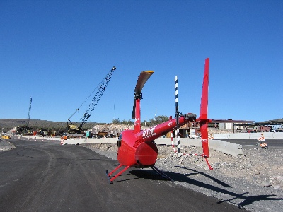
I’d just left the airport on Wednesday morning, ready to dig into a full day of work at my office, when my cell phone rang. A local contractor was looking for a helicopter to fly a photographer over a job he’d just finished at a local car manufacturer’s proving grounds. Was I available?

I wanted the work, but I wanted to get something done on the WordPress book I’m writing with Miraz. So I told him I was busy until 2 PM and could go then. He said he’d call me back. He did, a while later, and we scheduled the flight for 2.

Keep in mind here that I don’t keep my helicopter out on the ramp, all pre-flighted and ready to go. I keep it in the hangar and normally do most of my preflight work in the hangar (out of the wind or sun) before I drag it out, fuel it up, and park it on the ramp for departure. If everything goes well, I can do all this in about 30 minutes. But I like to allow 45-60 minutes, just in case something doesn’t go smoothly. That meant I needed to be at the airport at 1 PM.

I finished up early and waited for my passengers. They were two men, neither of which had been in a helicopter before. I gave the one with the camera the big option: door on or door off?

“What do most photographers do?” he asked.

“If they’re serious about the photos coming out good, they take the door off. Otherwise, they leave the door on and there’s some reflective glare in some of the photos.”

Door off.

I gave them their preflight briefing and loaded them onboard. Even though they were both pretty good sized men, I put them on the same side of the helicopter. This way, they’d have the same view, which I’d put on their side. It’s nearly impossible to load an R44 out of CG (center of gravity), so I wasn’t worried about that.

One of the passengers had drawn a map of where the proving grounds were. Trouble is, he drew it upside-down, so south was up, and I had to hold it upside down to make sense of it. I thought they wanted the proving grounds just south of Vulture Peak, but it turns out the place they wanted was farther east, near Grand Avenue. We found the place pretty quickly and I settled in for some slow circles around the area at about 500 feet.

There were three objects of the photography shoot. One was a huge skid pad — a big rectangular area, paved smoothly with asphalt. The pad would be filled with water and the cars would skid around on it. Another was a water line that ran from the skid pad to a well. The line was underground, so we expected to just see the disturbed earth over it. We had some trouble finding it because we were told it rand east-west when in fact it ran northeast-southwest right alongside an existing drag strip-like road. The final target was a dirt “hauling road” that ran alongside the edge of the property.

The photographer had a digital camera with 200 shots available and he took dozens of photos. It’s amazing what digital cameras can do. You can take anyone capable of pressing a shutter button, bring him to a place where he needs to take pictures, and let him take 200 shots. Some of them have to be good and a few have to be perfect. It’s just a matter of playing the percentages.

While we flew around and around, the cars below us were taking interest. A lot of the proving grounds in the area have cars that aren’t in production yet. Car magazines use helicopters to get spy photos. (Hey, Motor Trend, I’m available!) So when there are new cars out there, they tend to get under cover when a helicopter flies over. This is taken to a science at some proving grounds.

I pretty much ignored what was going on below me, being more interested in the F-16s that occasionally flew by. I was at the edge of the Luke Air Force Base jet training area and glad those guys had me on radar. But we were the only things flying that day — winds were gusting to 25 knots and all the other pilots were staying on the ground.

When we finished up at the proving grounds, we headed back to Wickenburg to take some photos of various houses and other things in town. We landed and I shut down. The whole job had taken less than an hour.

Grand Canyon

I also do Grand Canyon flights out of Wickenburg and the Phoenix area and I did one on Thursday. Like the Sedona flights, they save the passengers lots of driving time — at least 3 hours each way. But unlike the Sedona flights, the terrain we fly over each way is pretty boring, consisting mostly of high desert, open range with dry grass, stubby trees, and the occaisional group of cows.

I’d flown these passengers before. They were a couple from the Toronto, Canada area and they were very pleasant and well-traveled. The husband was in love with helicopter flight and used helicopters for all kinds of things. The wife was a bit nervous about flying, although not too nervous to let it spoil her trip. I’d taken them to Sedona a few months before and I’m already booked to fly them from Wickenburg to Sky Harbor Airport in Phoenix on Tuesday.

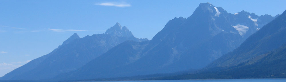
When we got up to the Grand Canyon Airport, the wind was howling and there was snow on the ground. It was cold. I called Papillon, who I’d booked a flight with for my passengers, to get a shuttle to take us from the main terminal to their terminal. It was walking distance, but not exactly close. It turned out that they’d lost my reservation and the long flight I’d booked them for wasn’t being done anymore because of weather on east side of the canyon. The only thing left was the short flight.

I looked across the street at Grand Canyon Helicopters, which is owned by Papillon but flies newer, nicer equipment, and asked the guy to book them on a flight over there. Then we walked over and I waited around until they got on board. I was happy to see them both get front seats next to Ron, a pilot I knew from my Papillon days.

Then, while they took their tour, I went back to Zero-Mike-Lima to retrieve my purse and place a fuel order. I called for a shuttle into the park when I got back to Grand Canyon Helicopters’ terminal. I chatted with the folks there — it’s true, I’ll talk to anyone — and was waiting when their flight returned. They’d enjoyed it and only wished it was longer. I wish it was, too — I know they would have enjoyed the other flight more. But what could we do?

In case you’re wondering why I didn’t take them over the canyon, it’s easy: I can’t. The Grand Canyon airspace is heavily controlled and I’d have to fly over at 10,500 and 11,500 feet (depending on direction). Although my helicopter can fly at 12,000 feet, anything over 9,000 sets up nasty vibrations that I just don’t like. The helicopter tour operators there — Papillon, Grand Canyon Helicopters, and Maverick — have special permits for conducting flights at 7,500 feet. That’s the altitude to fly the canyon. (And if you’re ever at the canyon, take a helicopter tour. It’s costly, but it’s an experience you’re not likely to ever forget.)

The shuttle arrived not long after they returned and it took us into the park. I had him drop us off at El Tovar Hotel, right on the rim. I told my passengers what they could do and see in a few hours. They invited me to join them for lunch and I agreed. We had a nice lunch at El Tovar, then split up. They walked down the rim path toward Bright Angel Lodge. I hung around El Tovar’s lobby for a while, then went out for a short walk. I was back in the lobby when they returned.

Grand Canyon in March

The Grand Canyon right after a snowfall.

They’d had a nice walk and had stopped into a few shops, including Hopi House, and the Fred Harvey museum in Bright Angel Lodge. We took the shuttle back to the airport. It took a long time to warm up the helicopter in the wind, which was now gusting to 22 knots, but we finally had the engine warmed up enough to depart. I was the only pilot on the radio. We took off to the south. I showed them our Howard Mesa property on the way, skirted around a controlled burn in Williams, and flew directly back to Wickenburg. It wasn’t an exciting flight but we were lucky that the wind was mostly out of the west, so it didn’t slow us down too much. We were back at the airport by 4:30 PM.

Golf Course Photo Shoot

The call came as Mike and I were preparing to go out to dinner on Thursday night. The woman was uncertain, as if she thought she was on a mission she’d never accomplish. Did I have a helicopter available to take a photographer around a golf course in Peoria the next day?

I saw another day of WordPress book work slipping away. “What time?” I asked.

“About ten?”

I told her I could do it and she gave me her contact information. She said the photographer might call to finalize the pick up location. She wanted me to land on the golf course, but didn’t have GPS coordinates for the landing zone and I’d never seen the golf course from the air — I usually don’t fly over there.

The photographer called a while later. She asked if we could do it earlier, like around 9:30. I told her we could. We talked some more. She said she wanted to get an early start, like maybe around 9 AM. I told her that was fine. We talked some more. She said she liked working early in the morning. Could I come earlier?

“What time do you want me?” I asked. I had already crossed out the time twice on the calendar and it was beginning to look pretty messy.

“Well how about around 8 AM? Or maybe a quarter to eight?”

“Seven forty-five?” I asked.

“Well, yes,” she said almost uncertainly. “Around a quarter to eight.” She made it sound as if that was a different time than seven forty-five.

We agreed to meet at Turf Soaring School, a small private airport that caters to gliders and ultralights. It should be easy for her to find and it should be near the golf course.

I got to the airport at 6:30 AM the next morning and pulled my helicopter out just as it was getting light. There was a big cloud on the horizon and the sun poked through it long enough to turn its edges golden. I wondered if the cloud would ruin her photos.

I fueled up, started up, warmed up, and took off. It was a quick flight, less than 20 minutes. I flew under that cloud I’d seen — evidently, it was a lot lower and smaller than it looked — and there was nothing but clear skies ahead. I landed at Turf, shut down, listened to a voicemail message on my cell phone from the photographer, and got out. I was just removing the front passenger door when the photographer drove up on the cross runway. I don’t think she realized it was a runway. It was dirt and not very well maintained.

We introduced ourselves and I told her where to park. Then I walked over and waited while she reformatted some cards for her digital camera. She had a huge bag of photographic equipment, almost all Nikon stuff. She told me how she’d gotten it cheap (or maybe for free) and dropped a few names of celebrities. Name dropping normally turns me off, but I wasn’t bothered too much. It was probably standard procedure in the circles she moved in. Not having other names to drop back, I kept quiet. (Really.)

We took off. The golf course was literally 5 minutes away. What followed was about a half hour of out of ground effect (OGE) hovering all over the golf course. Fortunately, houses hadn’t been built there yet, so I wasn’t endangering anyone on the ground. At one point, however, we moved close to the neighboring development of Trilogy and I saw people coming out of their homes to watch. I wondered whether the FAA would be calling later with complaints. I had nothing to worry about — I wasn’t hovering over anyone’s house — but people tend to exaggerate things to make their cases stronger when complaining.

It was a challenging flight for me. Lots of OGE hovering with a tail wind. But Zero-Mike-Lima and I were up to the challenge. That helicopter has all the power in the world with just two people on board. A few times, right after getting into a hover in the right spot, the wind would kick us from behind. I’d kick back with the pedals and get us stablized quickly.

The photograher, at one point, said, “You’re a great pilot.” At first, I thought she was just saying that to make me feel good. After all, who was I? Some Wickenburg-based pilot who didn’t even have any names to drop in a name-dropping conversation. But when she said it again and again, I started to think she might mean it. She did this kind of work with helicopter pilots all over the world. Although I don’t think I was the best, it was good to know I wasn’t the worst. In other words, I didn’t stink.

The golf course, by the way, was beautiful. Although I hate the idea of tearing up the natural desert to plant grass that soaks up our most precious resource here — water — I do admit that these desert golf course designers make glorious landscapes. This was one of the nicest I’d ever seen.

We finished up and flew back to Turf. The photographer told me that from now on, when she did aerial photography in Arizona, she’d use me. Of course, she lives in Monterey, CA, so I don’t know how often that would be. Better not quit my day job.

The Feast

That was the recent feast in my feast or famine cycle. With another two flights already scheduled for Tuesday, it has the potential to continue for a while. I hope so. Summer is dead time here and I’m not sure if that cherry drying gig will work out.

Southwest Circle Helicopter Adventure

I offer, for your perusal, the first draft of a 9-day helicopter charter I plan to offer passengers.

Yesterday, I spent the day in Sedona, AZ. I had a charter there that morning, and while my passengers were doing a Jeep tour, shopping, and having lunch, I spent the time planning a trip I’d been thinking about for a long time.

I’m interested in getting feedback. Take a few moments and read up. Use the Comments link to let me know what you think. Don’t balk at the price; it’s actually an incredible deal for about 9 hours of helicopter flight time over one of the most scenic areas of the U.S., plus lodging, other tours, and some meals.

Keep in mind that this posting is not an actual offer. Once I fine-tune the details, I’ll be offering the tour on the Flying M Air Web site. I’ll add photos and a table that lays out exactly what’s included each day. If you’re interested in actually taking this tour, contact me through that site and let me know. It would be great to do the first tour with someone who learned about it here.

Day 1
Your southwest circle adventure begins at Phoenix Sky Harbor Airport, where you’ll meet your helicopter pilot and climb aboard a 2005 Robinson R44 Raven II helicopter. This helicopter includes many luxury features, including leather seats, bubble observation windows, noise canceling headsets, voice activated intercom system, iPod-compatible stereo audio system, and state of the art GPS navigation system.

You’ll make the 60-minute flight to Sedona, AZ via the Verde River and beautiful Oak Creek for your first stop at “America’s most scenic airport.” You’ll take a 10-minute shuttle ride to Uptown Sedona for a 2-hour Jeep tour among Sedona’s famous red rocks, shopping, and lunch or dinner on your own. Then its back up to Airport Mesa where you’ll check into your red rock view room at Sedona Sky Ranch. Sit on your room’s deck and watch the sun set over the town.

Day 2
In the morning, return to the helicopter for the 45-minute flight to Grand Canyon Airport. You’ll start your visit to the Grand Canyon’s South Rim with a 25-minute helicopter tour over the Grand Canyon with one of the park’s licensed tour operators. At the end of the tour, board a shuttle bus for the 15-minute ride into Grand Canyon National Park. Enjoy a walk along the Rim, browse through the gift shops and museum displays, have lunch, take a bus along West Rim Drive for a variety of canyon views. You can even take a short hike into the canyon itself. In the afternoon, you’ll check into your room at one of the park’s South Rim accommodations, walking distance to the Rim and its incredible views.

Day 3
After breakfast at historic El Tovar hotel, courtesy of your pilot, return to the airport where the helicopter waits. From Grand Canyon Airport, it’s a 45-minute flight to Page on Lake Powell. Possible activities in Page include a Navajo-led tour of Antelope Canyon, (an incredible slot canyon carved through the sandstone), a tour of the Glen Canyon Dam, and a boat tour on Lake Powell. Ground transportation is available via the free shuttle provided by the park service concessionaire. You’ll spend the night at the Wahweap Lodge, where you can stroll along the water’s edge at sunset.

Day 4
In the morning, return to the airport and your helicopter for the next leg of your trip, a 45-minute flight along the southern edge of Lake Powell to Monument Valley. You’ll land at the airstrip at Goulding’s Lodge, a historic trading post with restaurant and motel. From there, you’ll take a 3-1/2 hour tour of Monument Valley, driving among the famous sandstone buttes with Navajo guides. Then it’s back to your room at Gouldings, with its private balcony overlooking the valley.

Day 5
The next day, you’re off to Bryce Canyon. The 1-hour flight will cross Lake Powell and miles of high desert landscape, passing by the east side of Bryce for a glimpse of the famous hoodoo formations before landing at the Bryce Canyon Airport. You’ll go into the park where you can walk along the rim, taking in the sights as you go, or descend on well-maintained trails among the rock formations. Hotel accommodations are in the park, at the Bryce Canyon Hotel.

Day 6
Start the day with an hour-long flight to a remote ranch on the north rim of the Grand Canyon: Bar 10. This unique destination is a waypoint for Colorado River runners starting or ending their adventures. If we arrive early enough, you’ll see helicopters taking passengers in and out of the canyon. When things calm down, enjoy horseback riding, skeet shooting, and a cowboy show. All meals are included for this part of the trip — the ranch is so remote, there’s no where else to eat! Even the sleeping accommodations are something special: you’ll share a covered wagon for the night after seeing more stars than you thought existed.

Day 7
The next morning, it’s off to bright lights in the big city. After an hour-long flight over high desert and Lake Mead, we’ll touch down at North Las Vegas Airport and take a taxi to a hotel along the Famous Las Vegas Strip. You’ll be on your own to explore casinos and shopping opportunities. But make sure you’re available that evening for a Neon Lights tour along the strip with Papillon Helicopters.

Day 8
The adventure continues when we leave Las Vegas for Grand Canyon West on the Hualapai Indian Reservation. You may catch a glimpse of the Hoover Dam as we cross Lake Mead and head east on the 45-minute flight. After a coach tour out to Guano Point for sweeping views of the canyon and a buffet lunch, you’ll board a helicopter for a trip down into the canyon and a boat ride on the smooth waters of the Colorado River. Afterwards, relax in the helicopter for the 90-minute flight to Wickenburg, a western town perfect for unwinding on the last night of your adventure. Unwind at a downtown motel, near shops, restaurants, and the historic area.

Day 9
Spend the last day of your trip in Wickenburg, strolling through the historic area, browsing shops, visiting through the museum, or just taking it easy. When you’re ready to return to Phoenix for the return trip home, your pilot will take you to the airport.

Package Price:
$8,995 double occupancy for two people; add $1,995 for separate rooms. Prices includes taxes and other fees.

Reservations are required at least 30 days in advance. A 50% deposit is required at the time of reservation. Cancellations within 30 days of departure date are subject to a $200 cancellation fee. Deposits are forfeited for cancellations within 14 days of departure date. (Trip insurance is recommended if you think your travel plans may change.) Flying M Air reserves the right to change hotel accommodations and some services from what may be listed here in the event of unavailability. In all instances, substituted accommodations and services will meet or exceed those offered here.

Package price includes air transportation, tours, and lodging (double occupancy) as described, some ground transportation, and some meals for up to two people. Passengers are responsible for all incidental costs not specifically included in the description, including most meals, some ground transportation, and the cost of personal items purchased on the trip.

Total passenger and luggage weight is limited to 500 lbs. Luggage size is limited by stowage space constraints; details will be provided at booking. Walking distances up to 1/4 mile is required at several stops. Some accommodations have limited facilities due primarily to their locations in remote areas. This trip is not recommended for people with health problems or special dietary needs, or people who have difficulty getting around. Trip starts and ends at Phoenix Sky Harbor Airport (or another Phoenix area airport of the passenger’s choosing).

Important Note:
This trip is not being offered as a tour. Instead, it is a series of charter helicopter flights, for transportation purposes only, packaged with lodging, some meals, and tours offered by licensed tour operators at destination locations. Although the helicopter flights pass over and through some of the most incredible scenery the southwest has to offer, Flying M Air is not a tour operator in these areas and is not conducting the flights as tours.

Jack the Dog Earns His Wings

We go flying in the helicopter and take Jack with us.

The phone call came last night at about 7 pm. It was Robin from Prescott, another R44 owner.

“We finally have a day off tomorrow,” he told me. “Want to go flying?”

Of course I did. I always want to go flying. I suggested Red Creek, a dirt strip along the Verde River. He’d never been there and was interested in seeing the place.

I told him I’d fly up to Prescott and meet him and his wife Linda at around 11 AM. We’d fly down to Red Creek and have a picnic lunch and a short hike.

Mike and I debated asking various friends to come along. My helicopter has four seats; it seemed a shame to waste two of them with such a fun destination. But we couldn’t decide who to ask.

In the morning, I made an outrageous suggestion: “How about if we take Jack?”

Jack is our dog. He’s part Border Collie and part Australian Shepherd. We call him a Border Shepherd and, if we say it with a straight face, people think its a real breed. He’d been in a small plane once, but he’d never been in a helicopter. He’s a pretty smart dog, although he tends to get excited easily. He loves roaming around in the desert and this destination would be perfect for him.

A while later, Jack was wearing the harness we’d bought for him months ago and sitting on a blanket in the back of my helicopter. Mike used a piece of rope and a carabiner to fasten the harness to the seat belt. The idea was for him to sit in the seat behind me so Mike could reach around back or take a look at him easily if he had to. But he’s so squirmy, he managed to sit in either seat.

I fired up the helicopter and took off. Jack was calm. It was like he was in the car, going for a ride. But the view out the window was…well, somewhat distant.

We flew up to Prescott and eventually got clearance to land at the bottleneck. I saw Robin and Linda in front of their hangar with their helicopter parked nearby. There were two planes on the ramp there. I flew in between them. One wasn’t tied down and its wings rocked, but not dangerously. (Why a pilot would park an airplane with its wings lined up right over the tie-down chains yet not tie it down is beyond me.) I set down on the ramp. Mike got out to talk to Robin and Linda. When he came back, they got into their helicopter and started up. Robin made the call for a flight of two helicopters departing to the northeast, low level. That would keep us from having to cross the runways. We got clearance and took off.

Once clear of the Class D airspace, we switched to the helicopter air-to-air frequency, which is 123.025. Robin told me to lead. He fell in behind me, a comfortable distance away and slightly higher than me. It was a real pleasure to fly with a pilot who knew how to give me some space.

We flew southeast, eventually intersecting with I-17 where it comes down off the plateau into Camp Verde. Then we followed the Verde River south. We didn’t fly down in the canyon, hugging the twisting river. Instead, we kept up a bit, overflying the goosenecks. The river was flowing swiftly beneath us, but after leaving the vicinity of Camp Verde, we didn’t see a soul. Well, there were a few cars by the Childs Power Plant. But after that, no one.

I pointed out the canyon that led to Payson. Then I pointed out an odd-shaped butte that was near our destination. I flew in first, checking the windsock at the east end of the strip. The wind was blowing from upriver. I made my approach from the south, crossed the strip, and landed in the tie-down area near the picnic table.

Robin Lands his R44 Beside MineMike already had Jack out of the helicopter as I was cooling the engine down when Robin came in for a landing. Although I thought there was enough space beside me, Robin didn’t think the spot looked level enough. He wound up parking a few dozen yards east, on the same side of the strip.

We met over at the picnic table. Oddly enough, we’d both brought along fried chicken. Ours was from Safeway, theirs was from Fry’s. And chocolate chip cookes. And soda and water.

A plane flew over and we thought it might land. I’d parked with my helicopter’s tail a little close to the runway. After guessing at a few frequencies, I finally reached the pilot on my handheld radio and asked him if he was landing. He told us he wasn’t; the runway was too short. And sandy and bumpy, I could have added. If he was in doubt, he definitely would have messed up a landing in his Cessna 172.

In case another airplane came by, we used Robin’s wheels to move my helicopter a bit farther away from the strip.

A little history of this place: if I got the story right, the airstrip was carved in by Jason Rovey’s grandfather, who used to run cattle on that land. Back then, he flew in and out in the Citabria Jason still flies out of Wickenburg. I happened to stumble across the place while flying in the area in my R22 years ago, but later met Jason and learned more about it. We flew in a few years back with four helicopters (my R22, two Bell 47s, and an R44).

The strip is maintained by the people who use it. They take care of the runway manually, with rakes and shovels that they leave at the site. I’ve been told that a lot of people from the airpark at Carefree use the place. In addition to the maintenance tools, there’s a picnic table, an ammo box with a sign-in book, some lawn chairs, a horseshoe pit with horseshoes, a barbeque pit, and water bottles. The one thing the place could really use is some shade–it’s mighty sunny there with very few trees taller than a person. There are plenty of cacti, though, including tall saguaro and lots of prickly pear.

Mike and Jack at the Verde RiverAfter lunch, we took a short hike down to the river. It was rushing pretty good and the sound of the flowing water was great. There’s plenty of space down there to camp and we hope to come back in the spring, when it’s warmer at night, to camp out. I’m hoping Jason and his fiance, Becky, can join us. Jason still flies in with the Citabria that’s older than he is. But somehow, I don’t think we’ll camp by the river. I think we’ll be up by the runway, by that picnic table.

And I know we won’t come in the summer because it’s too darn hot and Jason says the place is full of rattlesnakes.

The ShackAfter scouting around down by the river, we followed an old road up to a shack built high above the river. There were some cattle pens there and the place was pretty beat up. Supports for the porch roof had collapsed and the metal roof panels hung down against the side of the building. The concrete pad the place was built on had 1964 scratched into the cement. Inside, the building showed signs of recent use, including a new set of steps leading up to one of the bunks and a sleeping bag in decent condition.

We made our way back to the picnic table and spent some time drinking water and soda and chatting. Jack sniffed around the prickly pear cacti, looking for rodents (likely) or lizards (unlikely this time of year). He’d had a lot of fun wading in Red Creek and the river and was just dirty enough for Robin and Linda to tease me about the mess he’d make in the helicopter.

We left a short while later. It was almost 3 PM. Mike wanted to follow Red Creek back toward I-17 to see how close you could get to the airstrip with a truck. He had ideas about bringing the horses in. There was a ranch about 3 miles up the creek and a good road ran to it. The rest was rugged and would require a quad or hearty Jeep. Or horses — they are the best ground-based, off-road vehicles, after all.

Robin followed us for a while, then we went southwest and he split off to the northwest, toward Prescott.

The ride got bumpy as we flew over one mountain or canyon after another. We crossed I-17 right near Black Canyon City, then continued almost due west to Wickenburg.

Jack Enjoys the ViewJack spent most of the ride back lounging in the back of the helicopter, stretched out on both seats. He was tired after all his running around. Mike shot this photo of him looking out the window as we neared the airport. That’s Wickenburg down below — one of the motels and Denny’s, with the newly built apartments and condos below them. It almost looks as if Jack was enjoying the view. Almost.

Will we take Jack flying again? Of course! He passed the test and has earned his wings.

Helicopter Safe Flight Altitudes

How some people try to make up — and enforce — FAA regulations.

Yesterday, Mike and I flew out to Wenden to give helicopter rides to our friend, Celia, and her family. Wenden is a farming community primarily inhabited by Mexican farm workers. Its a tiny desert town in what must be a fertile valley. Wells pump water into irrigation canals and the entire area is surrounded by a patchwork of farm fields. This time of year, the cotton harvest is over and big square bins of cotton line one field after another. Most of the fields are already plowed and readied for their next harvest; a few are even planted.

A straight-line route between Wickenburg and Wenden takes me right over the top of an airpark called Eagle Roost. Eagle Roost was the brainchild of a man with vision. He bought a section of land — that’s a mile square — in Aguila, another Mexican farming community. He laid in a north-south runway, paved it, and sold 5-acre lots all around it. Back when I first started coming to this area about 10-12 years ago, the lots were going for $8,000 each and the place wasn’t very impressive. They’re now worth considerably more, and most lots have been built up.

Eagle Roost is the home of mostly retired people who are (or were) pilots. Like Wickenburg, half the population disappears during the hot summer months. Although the development isn’t bad, the town of Aguila has nothing much to offer. There are one or two small convenience stores, three restaurants, and a motel. Most people speak Spanish. On weekday mornings men gather in predetermined places, waiting to be picked for work crews. On Tuesdays (I think), there’s a farmers market. The place has terrible flies during cantaloupe harvest. There’s nothing much to do, so most Eagle Roost residents seem to do a lot of internal socializing, gossiping, and drinking. When they need something, they drive 25 miles east to Wickenburg or about 75 southeast to Phoenix’s west valley.

We used to have friends out there, but after a disagreement with one of them, another one told me he didn’t want to be friends with me anymore. (And no, he isn’t a third-grader.) No loss, as far as I’m concerned.

Anyway, whenever I fly from Wickenburg to points west, like Wenden, Salome, Vicksburg Junction, or Quartzsite, I usually fly right over the top of Eagle Roost. I’ve been doing it since I got my first helicopter, back in October 2000. More than five years now.

Don’t get me wrong — I don’t fly out there often. I don’t have reason to. There’s not much west of Wickenburg to fly to. As I mentioned elsewhere, Wickenburg is on the edge of nowhere. West of there is nowhere. But I definitely do it at least a few times a year. In fact, I did it a few weeks ago when I flew out to Quartzsite to research possible landing zones for a gig there.

Now in case you don’t know, helicopters fly lower than airplanes. In fact, there’s no set minimum altitude for helicopter flight. When I’m in Wickenburg, in or around town, I normally fly at 500-700 feet above the ground, but when I’m out in the desert, I sometimes fly lower. This is so for two reasons. The main reason is so I can see the stuff I’m flying over — range cattle, people off-roading out in the desert, the trickles of water in a spring-fed canyon creek. If I wanted to get from point A to point B without seeing what I was flying over, I’d fly an airplane. And that brings up the second reason I fly low: to avoid airplane traffic.

It’s a common joke among helicopter pilots. You mention that you flew at a certain higher-than-usual altitude someplace and a fellow helicopter pilot says, “Why the hell were you all the way up there? That’s where the planes are.”

We also joke about nosebleeds.

If you’ve been following along, you’ve probably guessed by now that I fly over Eagle Roost — and most other places I fly over — at less than 500 feet above the ground. I did it yesterday, on the way out to Wenden.

Now although very few of Eagle Roost’s residents are active pilots, there are a few who do actually own planes and fly them. So I treat Eagle Roost about the same as I treat Wickenburg. It’s a Class G, uncontrolled airport. Common courtesy — but not FAA regulations — dictates that you listen in on the airport frequency as you approach and depart the area and make one or more radio calls to announce your intentions and solicit responses from other pilots in the area. So, on the way west, I tuned into Eagle Roost’s frequency about six miles west of Wickenburg. I made a radio call as I passed south of Forepaugh, a historic airport that seems to have had its name wiped from aeronautical charts.

A minute or two later, I heard a call from someone at Eagle Roost departing runway 17 with a downwind departure. I had to translate that into direction. Helicopter pilots don’t have much use for runways so we don’t pay much attention to runway numbers and directions. It takes thought to decipher what the pilot had said. Since runway numbers correspond with compass directions, the pilot was taking off on the runway that pointed roughly south. Downwind was the direction parallel to the runway, but going in the opposite direction he’d taken off. That meant he was departing to the north. We were east and still pretty far out, so we were no factor. Mike and I actually discussed this thought process yesterday, comparing notes about how airplane and helicopter pilots think.

There were no more calls from Eagle Roost and no more traffic. I made a call three miles east, giving my altitude and intentions: transitioning to the west. Then I made another call when I was over the airpark. Then we were west, speeding along at a healthy 110 knots to our destination, still 25 or 30 miles west.

I circled the town of Wenden to find Celia’s street. She lives in a house between two farm fields, off Alamo Lake Road. I followed Alamo Lake Road with my eyes, saw her house, judged the wind from a flag, and decided to come in from the west. I lined up with an east-west road that ran right past her house. It was a farm road, made to give access to the fields. But it was Christmas Eve day and a Saturday, so the fields were empty. No one was using the road. I landed in a huge cloud of dust about 50 yards from her front door, where she and her family had gathered when they first heard us coming. The breeze from the east was pretty stiff, so the dust cloud swept past me when I idled down, so it didn’t actually reach where everyone was standing.

Celia Takes a Helicopter RideI gave four rides, each with three people on board. It was Celia and her daughters and their husbands and kids. Mike handled the ground crew work. I gave short rides — there’s not much in Wenden to see — and everyone really seemed to enjoy it. I gave helicopter toys to the little kids. The dust was incredible on my takeoffs and landings and my fears were confirmed when I shut down in Wickenburg later on: a little more paint had been sanded off the blades.

When we were finished, Celia invited us in for burritos. But I had another charter at noon and wanted to get back to Wickenburg. So Celia gave Mike a package of burritos and he climbed on board. Soon we were on our way back to Wickenburg.

Of course, we flew over Eagle Roost again. We’d been on the same frequency since we’d left Wickenburg and there was no one talking on the radio. Mike and I kept an eye out for planes, as we usually do, and didn’t see any. I made my first radio call about 3 miles to the west and didn’t hear a thing from anyone in the area. But when I made my second call when I was overhead, the radio suddenly came to life.

“When you fly over the airport, fly above traffic pattern altitude,” came a man’s voice.

“Zero-Mike-Lima is a helicopter,” I told the person who’d called. “Helicopters fly below traffic pattern altitude.” No lie there.

“Helicopters have to follow the rules, too,” the voice said. If there hadn’t been an edge to it before, there was now.

“I’ll have to look that one up,” I replied.

“You do that.” Now definitely nasty. “The FAA would be interested.”

“Then I’ll ask the FAA,” I replied, thinking I might send my Part 135 contact at the Scottsdale FSDO an e-mail if I couldn’t find the rule. (Some people are afraid of the FAA. I’m not. All of my dealings with the FAA have been very fair and everyone I’ve worked with at the local FSDO has been very helpful and informative. So if this guy was trying to scare me, he wasn’t succeeding.)

By this time, I was about a mile or two to the east. The man, who Mike and I figured was on the ground because he didn’t provide an N-number, didn’t say anything else.

I looked at Mike. “Is there a rule like that?” I asked him.

“I don’t think so,” he replied.

“I’ll look it up,” I repeated. I have the 2006 FAR/AIM in my hangar. And we continued east, with the episode tucked in the back of our minds.

Unfortunately, that wasn’t the end of it. I was sitting with Mike and a few other pilots at a picnic table at Wickenburg airport, waiting for my noon charter and eating burritos when my cell phone rang. I looked down and saw a familiar phone number. When I answered it, I heard the voice of the Eagle Roost idiot who said he couldn’t be my friend all those years ago.

“I have absolutely no desire to talk to you,” I said. And I snapped the phone shut.

It started ringing again almost immediately. I pushed the button that would silence it. Then again. Sheesh! Some people just don’t get it. I turned the phone off.

We talked to the pilots we were with about the “rule” we’d been told about while over Eagle Roost. Mind you, we were sitting with three other active pilots — the kind that actually fly — and none of them had ever heard of such a rule for an airport in Class G airspace, let alone a private airpark that doesn’t even appear on current GPS maps.

I turned the phone on a while later and there were three messages on it. I let Mike listen to them. Two were from potential customers. The other was from the idiot at Eagle Roost. For some reason, this guy has become the “Godfather” of the airpark and everyone goes to him with their problems. And although the original cause of the breakup of our friendship years ago was because I hadn’t “minded my business” when his buddy was sleeping around behind my friend’s back, this guy has no problem minding other people’s business. He’d called to talk to me about flying over Eagle Roost. Supposedly, the guy who’d talked to me on the radio swore that there was another plane in the pattern. He claimed I was being dangerous and I’d been belligerent. And this former friend of mine had been assigned to talk to me about it. The hell with that.

One thing was already pretty obvious: the guy was lying about the plane, probably to cover up the fact that he didn’t know what he was talking about. I have four pieces of evidence to prove it:

  1. Neither Mike nor I, experienced, active pilots who were sitting in the front seat of an aircraft with virtually unlimited forward and side visibility, did not see another aircraft, even though we were both looking.
  2. No other pilot made a radio call. And yes, I do realize that the pilot could have been operating without a radio, but then who’s being safer: me with two radio calls or him with none?
  3. If the guy on the ground was so concerned about our altitude because of other traffic, why didn’t he mention the other traffic?
  4. How did the guy on the ground know there was other traffic if he was inside listening to his radio and the phantom pilot hadn’t made a call?

My charter passengers arrived right about the time Stan had the espresso machine fired up. I did two charters while everyone else went to Stan’s for a latte. By the time I was done an hour and a half later, Stan had closed up shop and most of the other pilots had gone home. I settled up with my passengers and locked up the helicopter on the ramp. I was schedule to fly Santa to a remote ranch at dawn on Christmas morning.

Mike said that the pilots gathered at Stan’s had discussed the “rule” at length. They all agreed that there was no such rule and that I hadn’t done anything wrong.

We had some repairs to make on our airport golf cart and Mike left to get the parts. While I was waiting, I washed the chicken dust off my car and spent about 20 minutes going through the FAR/AIM for the “rule.”

I found the helicopter altitude rule I’d already committed to memory: Helicopters may operate at an altitude lower than airplane minimum requirements as long as operations do not pose a danger to persons or property on the ground. This is paraphrased, of course — I don’t have the FARs in front of me right now. But this is the rule we’re taught and we discuss it at length. Although it seems like it’s a free pass to fly wherever you want, if something does happen and you have an emergency landing and someone on the ground gets hurt, the FAA could always say that you were not operating at a safe altitude. So safety is always the primary concern when choosing a minimum altitude. For a helicopter, that means operating within the safe area of the height-velocity diagram, a document that establishes safe altitude and airspeed combinations to make a power-off landing. Of course, terrain has a lot to do with it, too. There needs to be a flat open space within range to land. Like a farm field? Or a runway at an airpark? So as far as that rule was concerned, I was operating at a safe altitude.

I also found another helicopter rule that was pounded into my head when training: helicopters are to avoid the flow of fixed wing traffic. This is the rule that keeps helicopters low. In fact, whenever I operate in a Class D airspace — that’s an airport with a control tower —-and I want to approach my landing zone or cross over the top, I’m directed to stay below the traffic pattern altitude. Even when crossing over the top — and I can’t tell you how many times I crossed over the top of Scottsdale while working on on my private helicopter rating. Just the other day, when leaving Scottsdale Airport, the tower cleared me to depart and directed me to remain below 2,000 feet — or below the traffic pattern altitude. I come and go at Prescott below the TPA and, when I was training at Grand Canyon Airport to work for Papillon, I was constantly reminded by my instructor to stay below 7,000 feet MSL — below the traffic pattern altitude. (Of course, that put me right over the treetops, which wasn’t a comfortable place to be, at first.) As a result of all this work in Class D airspace, it’s become natural for me to cross airports below the traffic pattern altitude. I never expected to be told that there was a rule to the contrary.

I looked for, but did not find, any rule stating required — or even recommended — altitudes for any kind of aircraft operating in the vicinity of a Class G airport. So what the hell was this guy talking about?

I reported my findings to Mike as he worked on the golf cart. We went home, stopping at Safeway for some wine to take to Christmas dinner at a friend’s house the next day.

Belligerent. That word bothered me. I asked Mike if I’d been belligerent on the radio. He said I hadn’t but the guy who’d talked to me had definitely been belligerent. So I asked Mike to call the idiot at Eagle Roost and tell him I wasn’t belligerent.

Mistake. The guy talked poor Mike’s ear off. And, as usual, he didn’t believe anything Mike had to say. Talk about a trap door mind. One of his neighbors had sworn something to him, and the idiot, our former friend, was willing to believe him instead of us. Radio man said that a plane had been in the pattern and I had been belligerent. Period, end of story, trap door swings shut. Poor Mike listened to the idiot far longer than I would have. I felt bad for him when he finally hung up.

Like I said, no loss.

Tomorrow, I’ll give my FAA contact a call and ask him about this “rule.” He’s a helicopter guy, so he’ll know. And if there is no rule, I’ll just pretend the whole thing never happened.

PostScript

I called my POI at the Scottsdale FSDO and talked to him. Twice. He confirmed what I suspected: there is no rule in the FARs specifying an altitude for untowered airport overflights. That applies to both airplanes and helicopters. However, he added in his best FAA voice, a “prudent pilot” would overfly above the traffic pattern altitude. He went on to provide some examples of how overflight at a lower altitude could cause problems.

So I was right but I was wrong. And so was the guy on the ground.

In my opinion, if something happens while you’re flying in Class G airspace — like a midair collision or even a near miss or a forced go-around — then one of the pilots (at least) is not being prudent. It doesn’t matter what the situtation was: if a rule wasn’t broken but someone did something dumb that caused a problem, that someone wasn’t being prudent. But if nothing happens? Then is there a question of what’s prudent? I don’t know. But I do think that if the FAA felt strongly about altitudes at Class G airports, it should amend the regulations to specify an altitude. That would turn a gray area into black and white. What good are regulations if you can’t use them to guide you in your actions?

I also spoke to a fellow helicopter pilot who lives in the area. “Do you ever fly over Eagle Roost?” I asked.

“Once in a while,” he replied.

“What altitude?”

“Usually about 400 feet.”

So I wasn’t the only one. “Do you talk on the radio?” I asked.

“No.”

He didn’t add what we both knew: The regulations do not require communication in Class G airspace. But who’s being more safe? The pilot who attempts communication or the one who just buzzes through without a peep?

What is the lesson to be learned from this? It isn’t one the FAA would like.

The lesson is that when you overfly an airport without a published radio frequency, don’t talk on the radio. Eagle Roost’s frequency does not appear on any chart and the airport is not listed in the Airport/Facilities Directory, the only two documents a pilot is required to have onboard (and I’m not even sure the A/FD is required for all pilots, although it is required for Part 135 operations). If I hadn’t responsibly made my radio calls, the guy on the ground wouldn’t have even known I was flying over. He’d have nothing to get his blood pressure up. He wouldn’t have called the idiot to harass me. None of this would have happened. Heck, you wouldn’t even be reading a blog entry about it.

Fortunately, that’s not the lesson I learned. I learned that residents at private airparks are a bunch of whiners who like to boss around anyone within radio range. They like to make up stories about possible accidents and share them with anyone who will listen and take their words as gospel truth. And some of them even like to take it beyond the radio, with harassment by phone and in person.

As for me, I won’t overfly Eagle Roost again. It just isn’t worth the headaches that go with it.

Two Interesting Charters

I find that there’s more to flying helicopters than giving tours.

Lately, I’ve been getting calls from folks who want to use my helicopter for more than just transportation or tourism.

The first good assignment I got came a few months ago, when I flew a camera crew around the a carmaker’s test track in Arizona. I wrote about it in another blog entry. This past week, I did two more.

The first, on Tuesday, was for a professional photographer hired to take aerial and ground photographs of the new bridge being built over Burro Creek on state route 93. There’s already a beautiful bridge there and the construction crew is building a twin on the north side of it (the road runs pretty much east-west there). Burro Creek runs in a deep canyon there and the Sonoran desert landscape is breathtaking. The site is also far from civilization — about 55 miles north of Wickenburg and perhaps 20 miles south of Wickiup.

It was a cold morning when we left Wickenburg, so I left the helicopter’s doors on. It took us about 30 minutes at my top cruise speed (110-115 knots with two on board and full fuel) to reach the site. I set down in a fenced-in area where the construction folks were storing cactus to be replanted after work was done. I took the passenger door off while my client got his camera equipment out — a pair of Hasselblad medium format cameras with three different lenses. A construction truck pulled up and my client got out to talk to the driver. He came back and told me that the next time I landed, I could land on the new road right near the bridge. It was closed to traffic and was smoothly paved. We took off and began circling the bridges from various altitudes. My client snapped away, cranking the camera’s advance do-dad after each shot. He was perfectly at ease leaning out the door; he’d flown in many helicopters before. After about ten of fifteen minutes of that, I set down on the road near the bridge and shut down. (I had to set down on the edge of the road, as shown in the photo below, because the road was banked for a curve and the only real level spot I could find was at the very edge of the road.) My client climbed out, filled a smaller camera bag with equipment, and walked off to take his ground shots.

I pulled out my iPod and a book and settled down on the side of the road to read. Cars and trucks drove by and I wondered how many of them were headed to or from Wickenburg.

He was gone about 90 minutes. When he returned and finished fiddling around with his equipment, we climbed back on board and I fired the helicopter back up. The light had changed, so we did another 10 or 15 minutes of circles around the bridge at all different altitudes. Then he told me to head back and I broke off circling and headed back.He took some more photos on the way back — using up extra film on shots he thought he might be able to sell the construction folks. Then we set down on Eric Barnes’s dirt strip, on route 93 near the Santa Maria River, so I could put the door back on. With the door off, it was loud and my speed was limited to 100 knots. With it on, it was quieter and I could get it up to 120 knots. When we got back to Wickenburg, I’d put 1.4 hours on the Hobbs. My client paid for that, as well as for some waiting time.

Two days later, I was in Aguila, doing a job for the maker of a “breadcrumb” communications system. Breadcrumb systems, as they were explained to me, create a wireless network that can be used for voice, data, or video communications. The folks who hired me had an impressive system they wanted to mount in the helicopter. The idea was to have me fly around with the system and a few techs on board to see how well the system stayed connected to other breadcrumbs on the ground and how well video that one of my passengers shot could be seen at ground-based stations.

As the photo here shows, I had to remove both doors on the pilot side so they could mount the unit’s antenna. The breadcrumb box itself was positioned at the feet of the passenger behind me; you can barely see it in this photo because it’s just a flat box standing on one end. Although the unit can be powered by batteries, my helicopter has a 28 volt DC port that looks like a cigarette lighter port. The breadcrumb had a cable that could take this voltage, filter it, and step it down to the 12 volts it needed. So they just plugged it into my DC port. The boss of the operation wasn’t happy about the positioning of the antenna — he wanted to dangle it somehow under the helicopter’s body — but we soon proved that it was fine.

One of the techs also had a GPS and, at first, they wanted to mount it on my tailcone. They claimed that in the work they’d done with RC helicopters, they’d found that there was too much interference from the main rotor disk for the GPS to get a good signal. When I told them that my handheld GPS worked in the cockpit cabin, they decided (to my relief) to give it a try. (For the record, I would not have let them mount it on my tailcone. That’s much too close to the tail rotor! We might have mounted it on a skid if we had to.)

My passengers climbed aboard and we took off, flying circles around their base of operations at Robson’s Mining World. One guy in the back did the video while the guy beside him kept reporting on the status of the breadcrumb: green, blinking green, green, green, etc. We kept in touch with other breadcrumbs on the system at all altitudes and even when we flew behind a mountain. We only lost touch once, and that was for only a few seconds. The video went down to the guys on the ground, who clustered around a laptop set up on the hood of a car in the parking area. We did this for about 20 minutes, then landed.

I didn’t realize it then, but I was done with my assignment. What followed was about an hour spent giving everyone there a ride. I took them three at a time and did a 4-minute ride around the base, climbing up the mountain behind Robson’s and descending back into the desert for landing in my designated landing zone. When everyone had their ride, they told me to shut down and have lunch with them. Some other folks would be taking photos of the setup while I was eating.

I ate outside, with the guys from Rotomotion. They build RC helicopter systems to be used for surveillance and unmanned observation. The company founder started the company when he got frustrated that he couldn’t fly an RC helicopter. (Having owned one for a while, I know exactly how he feels; I couldn’t fly mine, either.) He wrote a computer program that would fly the helicopter for him. His company now builds helicopters that work with his Linux-based software system. They had three helicopters with them: a small electric model (on the table in this photo), a medium diesel model, and a large model powered by a chain saw engine.

The software is extremely cool. Once the helicopter is airborne, the software takes over and can hold it in an absolutely perfect out of ground effect hover. You can also tell it to go to certain coordinates at a certain altitude and it’ll go. It uses wireless communications to control an onboard camera or other equipment. If it loses its radio control signal, it’s programmed to return to its home base. Although they have a routine for software-controlled take off, they need a reliable but small altimeter to judge distance from the ground before a good landing program can be written. I have no doubt that they’ll add this feature soon. These guys definitely know what they’re doing.

While the rest of the group went off to go shooting out in the desert, a small group of us remained to watch the RC helicopters fly. A police officer from Chandler had come up to get a demonstration and we just watched. He said that the system has many applications in law enforcement and he seemed excited about it.

I went home a while later and put my dusty helicopter away. I’d logged 1.6 hours for the assignment — not much, but enough to make it worthwhile. And the technology I’d seen while I was out there was well worth the time spent.