Great Loop 2021: Doing My Homework

I research my part of the route.

The Girl Scout motto is “be prepared,” and it’s something I’ve taken to heart ever since I was a scout. The best way to ensure a smooth endeavor is to be prepared for what may come up along the way. While I wanted my two-month boat trip to be smooth, I also wanted to make sure I didn’t miss anything.

Of course, I am limited in what I can see and do on the trip. After all, I am not the captain of the boat and the captain — like an aircraft pilot in command — makes all the decisions. I assumed I’d have some kind of input, but I couldn’t be sure. Still, I wanted to know all of the options — or as many as I could discover through research — so I could share an educated opinion when one was requested.

That meant hitting the books.

What I’d Already Done

If you haven’t read the previous posts in this series, let me recap my early research.

AGLCA
I had discovered and explored the American Great Loop Cruisers’ Association (AGLCA) website where there is lots of basic information for non-members. I wound up joining the association and ponying up even more money to attend a web-based Rendezvous which was very informative. (I blogged my thoughts about the AGLCA and Rendezvous here.) I’ve been back to the website, which has since been revised, to see if I could learn more, but stopped short at paying to watch narrated slide shows, wading through forum questions and answers, and participating in the new social networking features. I have a budget and limited time; I need to spend both time and money wisely. While I believe that the forums can be a valuable resource to get specific questions answered, I don’t see them being very helpful until I have a specific question. As for social networking — well, until I actually start my cruise, I really don’t have anything to network about.
Crossing The Wake
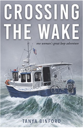
Here’s the book I read first about motoring the Great Loop. I keep looking at that photo and imagining all the salt water corrosion on that poor bicycle.

Crossing the Wake
I read Crossing the Wake: One Woman’s Great Loop Adventure by Tanya Binford, which I reviewed briefly in the first blog post of this series. The only thing I learned from the book was that a barely prepared middle-aged woman could do the trip “solo” in a 25-foot boat. (I put “solo” in quotes because apparently there are so many people doing this trip that it’s common to join up with one or more boats and do lengths of it together.) The book was more of a personal memoir than a useful travelogue because it lacked most of the details a cruiser would need to plan and execute this trip.

Needing — or maybe just wanting? — more detailed information about the trip from Jersey City, where Captain Paul, first mate Dianne, and the Motor Vessel Nano would pick me up, to Chicago, where I’d leave them, I started digging deeper

Waterway Guide

I learned about Waterway Guide at one of the “Lunch and Learn” sessions at AGLCA’s Rendezvous. Lunch and Learn sessions basically give an AGLCA sponsor time in front of members to sell their product. They are informative and can be helpful, especially if they’re selling something you’re interested in. Waterway Guide was definitely something that interested me. It’s an online service that provides a wealth of navigation, marina, anchorage, service center, and points of interest information for east coast waterways, including the entire length of the Great Loop. (They do have a database of west coast marinas and some other services, but it is not maintained anywhere to the level of the east coast information; they apparently focus on the east coast, leaving me to wonder if another organization fills the void out west.) Of course, membership is required to get access to all of the information they have online and, of course, I joined to get that information. (My AGLCA membership got me a discount, which was nice.)
Waterway Guide Online
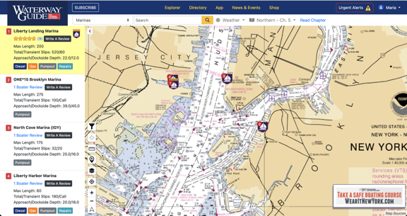
Waterway Guide’s website showing New York Harbor. I love the fact that it displays charts and plots various features on it. Zooming in provides more detail. If I turned on location tracking in my browser, it would put an icon near my position.
Waterway Guide Cover
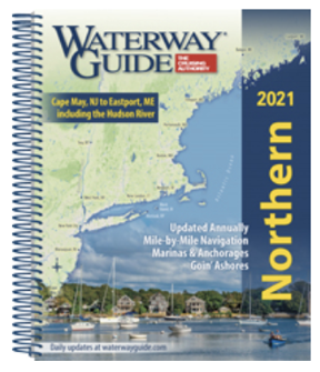
The printed Waterway Guides offer detailed information about various east coast waterways.

The membership level I chose also came with two of their printed guides. I chose Northern, which would take me up the Hudson River, and Great Lakes Volume 1, which would take me through the Erie Canal and into Lake Erie. These books, which are revised annually, include all of the information that’s on the website in a handy spiral bound format that’s easy to leave open and consult while traveling. (Sadly, they are not small so I won’t be bringing them with me on the trip; there’s limited space on the Nano. I hope Captain Paul will have his copies with him.)

I have a love-hate relationship with these books. First, I love the amount of detail that’s included. Reading through them makes me want to go ashore and explore every place they talk about. But what drives me nuts is the way the book is organized. Each section is broken down into segments that can be 5 to 25 miles in length. Within each segment are subsections:

  • An overview or notes section discusses the segment of waterway in terms of geography, geology, and points of interest.
  • Navigation tells you more about navigating each part of the segment, including which chart(s) to use. This has some more points of interest information.
  • Dockage/Moorings tells you where you can find marinas or other places to tie up. This information is repeated in chart format for the section.
  • Anchorage suggests places to drop anchor and provides useful information about each place such as how it is protected and whether there is noise.

Sounds great, right? Well, it is and isn’t. The information is great but the presentation isn’t presented logically. For example, in the “Tappan Zee Bridge to Bear Mountain — Mile 27 to Mile 46.7” segment of the Northern guide, the overview takes you through that roughly 20 miles of Hudson River with a separate heading at the end for the Bear Mountain Bridge. Then Dockage/Moorings takes you back from the beginning of that stretch to the end. Then Anchorage takes you back again from the beginning to the end. So there’s a lot of back and forth in a 20-mile stretch of river. What I found, especially in the segments covering the Erie Canal, is that I couldn’t keep track of where a marina or anchorage was without trying to follow along on the online guide, which included charts and icons for many of the things they were talking about.

I think the guide would be a lot easier to follow if the Dockage/Moorings and Anchorage sections were combined and that information was presented together. Or, better yet, combine all information with a much shorter overview. Just take me up the river and tell me what I’ll find along the way without forcing me to go back and forth on a map to see where points of interest, navigation details, marinas/moorings, and anchorages are when moving forward.

I guess what I’m trying to say is that the books could probably use a deep edit to remove repetition and better organize the data. Having more charts/maps and possibly fewer photos would be helpful. As for the photos, I can’t tell you how frustrating it is to see a photo of an interesting or beautiful place that has neither caption nor label to identify where it is.

(Please keep in mind that I spent 20+ years in publishing where I wrote and laid out dozens of books. One of the series I wrote for — Peachpit Press’s Visual QuickStart Guide series — made extensive use of “spreads” where everything you needed to see for a task was either on one page or two facing pages (a spread). I laid out these books, so I know it’s possible to present information in a format that doesn’t require a lot of paging back and forth. It drives me nuts when information could be presented more logically for the reader and isn’t.)

But overall, the books are worth the money — about $50 each — if you need printed detailed information for a trip.

But wait! There’s more! Waterway Guide also has an app, which I downloaded for my iPad.
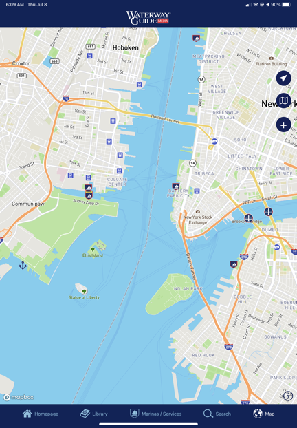
Waterway Guide App
The Waterway Guide app doesn’t even use nautical charts as the base map layer.

So far, I’m not impressed. In order to get the kind of detailed information the printed guide has, you have to subscribe to each chapter — even if you’re a member, logged in, and have already obtained the printed version of the book containing that chapter. I subscribed to the New York Harbor & the East River chapter for $2.99/year to give it a try. The content is the same as what you’d find in the book, including the organizational shortcomings I mentioned above. It’s basically an ebook that you pay for each chapter you want to read using a subscription format that hits you up for another fee every year. (I can only assume the old information becomes inaccessible if you cancel the subscription.) And yes, it does include ads — although I admit I didn’t see many (yet). I’m bummed out because I was hoping it would be an offline version of the website and it falls far short of that. It doesn’t even have real charts. I’d much rather use the web browser in my iPad to access the website, where I have all the information without having to pay more subscription fees.

Skipper Bob’s Guide
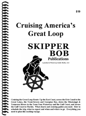
Skipper Bob's Guide
Skipper Bob’s guide, Cruising America’s Great Loop, is an excellent overview of the entire trip.

If you want the “Cliff’s Notes” version of Waterway Guide specifically for the Great Loop, try Cruising America’s Great Loop, a Skipper Bob publication. This $19 book provides 108 pages of information about cruising the Great Loop. It’s a good overview that tells you which charts to use, what you’ll see along the way, and things to watch out for.

My opinion: If you’re considering the Great Loop and want to learn more, start with this book. It really is a good overview to help you decide whether cruising the Great Loop is something you really want to do. It’s also a great visual aide when you’re trying to explain to friends and family members what the Great Loop is all about.

New York State Canal System Cruising Guide
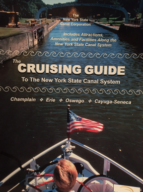
Cruising Guide
I got my copy of the Cruising Guide for free from the New York State Canal Corporation, but I’m not sure how.

I think it was the Skipper Bob book that recommended getting a copy of The Cruising Guide to The New York State Canal System from the New York State Canal Corporation. I tracked it down online where I found a printable (!) order form. I filled it in, sent a check for $29.95, and waited. About two weeks later, I got a thick envelope with a spiral bound book, a bunch of other informative pamphlets and maps, a letter, and my check. The letter informed me that they were no longer accepting payment for the guide; it was free. For the life of me, now I can’t find a link on their website to order the book, but there’s some good navigation info here. I did find the same book on a website that is charging $29.95 for it.

The book breaks down the canal from west to east — the opposite direction I’ll be traveling in August — with charts, photos, and descriptions on full-page sections along the way. (This is the format I wished Waterway Guides would use.) It’s got a LOT of information specific to the canal, inlcuding the amount of time between points and the expected time to lock through each specific lock. It’s easy to see why the book is now free: there are ads throughout. But the ads don’t distract from the content and are strategically placed near where they apply. For example, an ad for a marina will be on the same or facing page as the map where it can be found.

This is a great book that I would definitely bring with me if Captain Paul hadn’t already assured me that he also had a copy and it would be on board.

Quimby’s Guides

The one book I bought that I really regret buying is Quimby’s Cruising Guide. This well-known resource for eastern U.S. boaters is nothing more than a listing of commercial establishments and locks on various inland waterways. While it might have a lot of value for folks doing the entire Great Loop, it didn’t provide any coverage for the area I’d be cruising: the Hudson River, the Erie Canal, and three of the five Great Lakes. I don’t know what made me think it would provide coverage; it’s my own damn fault that I didn’t read the description thoroughly. At $42, it was a costly lesson.

I should mention here that although the information it provides is extremely limited and the book has quite a few ads, I do like the way the information is presented: in order of river mile. There’s no bouncing back and forth in the text to get the big picture. Instead, it’s just a list, by river mile, of the facilities and related contact information.

Summing Up

I think one of the things that has me so excited about my trip is that there’s so much that I can learn along the way. I’m familiar with just a tiny stretch of this trip — from Jersey City to just beyond West Point, where my family took our small motorboat on outings when I was a kid. The rest is new and full of challenges and history. How can that not be exciting?

Preparing for the trip by researching it as much as possible can help me make the most of the journey. I’ll keep reading right up to the day I head east.

My Thoughts on the American Great Loop Cruisers’ Association

Some thoughts after about a month of membership.

I’m writing this blog post mostly because I said I would elsewhere. I’ll try to keep it brief.

Great Loop Logo
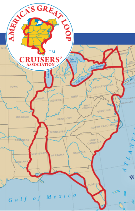
The AGLCA logo and a map of the route(s) on the home page of the organization’s website.

If you’ve been following my blog, you know I’m interested in completing the Great Loop. In an effort to learn all I can about it in preparation for the year-long journey, I began looking for resources online. The American Great Loop Cruisers’ Association was one of the resources I found.

At first, there were just two organizational resources that interested me: videos about the Loop and the Rendezvous.

The Videos

There are a lot of videos and most were tagged $25 each, which really put me off. I honestly couldn’t imagine them charging members a fee to watch existing content, many of which appeared to be narrated PowerPoint slide shows. I assumed that the videos were free to members and it was one of the reasons I joined up.

I was wrong. The $25 per video fee was on top of annual membership. Yes, there are a handful of videos that I could watch for free and my registration to the Rendezvous (see below) included credits I could apply to two (I think) more. So simply joining the organization wasn’t going to get me much closer to seeing educational video content unless I was willing to dish out more money.

Video for a Fee
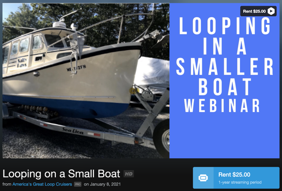
Is it worth paying another $25 to watch this webinar? I don’t know.

Understand this: I don’t mind paying for content I can learn from. But the price has to be related to the actual quality of the content. $25 to watch a 45-minute narrated PowerPoint slide show seems excessive to me. I understand that videos cost money to produce and host, but I also believe that they’d get a lot more views and likely take in a lot more money if they made the price more reasonable — maybe $5 or $10 each. At this point, I’m not terribly interested in spending $25 on a video that might or might not provide information I can benefit from.

The Rendezvous

The Rendezvous is an event held twice (or maybe three times?) a year. Normally, it’s held live at a location along the loop. For example, they’re planning an autumn rendezvous in Alabama and a new (I think) winter rendezvous in Florida. It’s designed for folks getting ready to start the journey, but it also seems like a good way to just pack in a lot of information.

Because of COVID, this spring’s rendezvous was held as webinars. That was actually good for me because it meant that I could attend without having to travel.

The Rendezvous includes social and educational activities: “docktail” parties, seminars, a vendor expo, etc. It seems like a good opportunity to network with other cruisers, learn about new products, get route briefings, and build a base of information about the trip.

I signed up for the spring rendezvous. It was conducted over a three week period with sessions on Tuesdays and Thursdays. There was a midday (EDT) “Lunch and Learn” which was basically a vendor talking about his/her products. I learned about Waterway Guide, which I wound up subscribing to. In the evening (afternoon for me), there were route briefings, each segment focusing on a different part of the loop. The presenters were actual loopers who narrated their slide decks either in a recording or live. Some were excellent — the couple who talked about the Chesapeake Bay and the guy who covered the Erie Canal were very good. Others were good but could have been better. (These were not professional speakers.) At the end of each presentation, they answered questions we’d ask either live or via text.

There were also two “small group” sessions, which were handled like Zoom meetings. Those were nice because you got a chance to chat with a small handful of other loopers. In person social events would (of course) be better, but this was a good substitute.

There was an online Expo and Q&A sessions concentrating on specific topics. Unfortunately, they were held at the same time. I chose the Q&A session for the Erie Canal so I missed other sessions I might of benefited from, as well as the Expo.

I did learn a lot and the good presentations really fed my desire to do the trip. Unfortunately, I missed or arrived late for some presentations. I didn’t get the links I needed a few times and had to scramble to contact the office to get them. Other times, I simply couldn’t take time off to attend — after all, this was in the morning or afternoon for me because of the time difference. What’s good is that I can apparently watch (or rewatch) any of the presentations as videos without having to pay for them again.

Overall, I think it was worth the cost to attend: $165 (on top of the $89 AGLCA membership fee; you must be a member to attend).

Other Benefits

Of course, the annual membership fee includes other benefits that are listed on the website. The funny thing about membership benefits is that they’re really not worth much if you don’t need/want/use them.

But one of the benefits is discounts at certain sponsor locations. Waterway Guide is one of those sponsors and I used my AGLCA discount to buy my Waterway Guide membership, thus getting two very detailed guides about parts of the loop. I also used the discount to buy another book about the loop. If I use enough discounts, it should (theoretically) cover the cost of membership.

Another benefit is access to a member forum where members ask and answer questions. This is a typical forum like you’d find for any group, but these folks are mature adults who don’t troll and act like assholes. So if you have a question — no matter how basic — you can be assured that someone will give you a good answer for it without humiliating you. They also share information about problems along the route — for example, lock closures or fuel unavailability. They even share opinions about marina service and anchorages. There’s lots there and it can be found on the website or delivered to you via daily emails.

Full access to classified ads is also a benefit, and it’s one I took advantage of to get on the crew of a boat doing part of the loop starting later this summer.

There are Looper Lifestyle seminars held a few times a year at various locations along the loop. I suspect that these have been put on hold during COVID, but they do appear on the calendar for the future, so they might actually happen. Keeping in mind that a lot of folks live full-time on their boats, this is probably pretty informative for them.

Worth It?

I’m pretty leery of “associations.” I’ve been conned into joining more than a few that weren’t what I expected them to be.

Helicopter Association International (HAI) is a perfect example. This organization seems to cater to big helicopter operators while pretty much ignoring the needs of the little guy. I honestly believe that it was started by a bunch of guys who saw a way to make a living traveling around the country to host events while occasionally acting as spokespeople for the helicopter community. I got sucked into joining twice and let my membership lapse with a very bad taste in my mouth both times.

I’ve also had an unsatisfactory experience with Whirly Girls, an organization of female helicopter pilots. I blogged about my experience here, so I won’t cover it again.

So while I like being part of groups of people who share similar backgrounds or interests, I’m not the kind of person who will just pay up to be a member. I need the organization to satisfy my needs.

In this case, my need is for information. The AGLCA does satisfy my need, but there’s a lot of pay-as-you-go along the way. I’m starting out, my knowledge base was nearly blank. They’re helping me fill it in and I believe the forums will be very useful for getting questions answered.

The fee is $89/year with discounts for longer terms or a lifetime membership. Is it worth it? I think it might be, at least right now. If those videos were free to members, it would definitely be worth it.

Footnote:

Last night, I watched one of the webinars that normally costs $25 but was free for AGLCA members. To watch it, I had to follow a link to get a promo code, then log into Vimeo, click to Rent the video, and enter the promo code. It took about 10 minutes for the video to appear in the Vimeo app on my television, but when it did, was able to watch it on the big screen.

It was an Aqua Map app demonstration by the developers. Although the video quality started out pretty bad (on a 4K TV), either I got used to it or it improved because it didn’t seem so bothersome after the initial shock. The developers had recorded and edited a tutorial style video that showed finger tapping on a smaller screen and results on a bigger screen. That was pretty effective, despite the strong Italian accents of the presenters. They gave a good tour of the app, but spent (in my opinion) too much time on the “Master” features that I don’t think will appeal to average users. I still don’t know how they got river mileage to display; they showed the feature but not how to enable it. When the tutorial video was over, they answered questions that had been posted live during the webinar. This didn’t go as smoothly as it could have, but they were definitely trying hard.

On a scale of 1 to 5, I’d give the webinar a 3. That score reflects the length of time they spent on Master features and the difficulty they had answering questions quickly and effectively. It wasn’t a waste of my time, but I sure wish it hadn’t been 90 minutes long.

Was it worth $25? I say no. I hope the other ones I get a chance to view are better.

Great Loop 2021: My (First) Great Loop Adventure

How I found a chance to cruise the Hudson River, Erie Canal, and Great Lakes from New York City to Chicago — without my own boat.

A while back, I blogged about The Great Loop, a boat trip I wanted to take before I turned 65 — which is still a way off. With thousands of miles of river, canal, and even ocean to navigate over the course of about a year, it isn’t a trip to be taken lightly. Not only would I need a boat capable of making the trip — and yes, I’ve been shopping for one — but I’d also need to build a knowledge base and skills to be able to do the trip safely. Although my self-imposed deadline was still years away, I’ve learned that the older I get, the faster the years go. I can’t waste time dreaming about it. I need to get my rear in gear and get to work.

It Started with a Crew Wanted Ad

I started building my knowledge base by joining an organization that provides support for “Loopers,” as Great Loop cruisers are known: America’s Great Loop Cruisers’ Association. (I blogged more about that organization here.) The AGLCA’s website has a number of features, many of which require membership to fully access. While browsing through it, I saw that they had a classified ads section. And while browsing through that, I saw that there were listings for Crew Wanted.

I’d never really thought about doing any of the trip as a member of someone else’s crew. I’m a hands-on person and I guess I kind of like being in control of things I get involved with. But I definitely lacked many of the skills and much of the knowledge I’d need to take command of a boat on a cruise like this. Perhaps being part of someone else’s crew could give me the hands-on experience I’d need to learn a lot of what I’d need to know a lot more quickly than I would without access to a boat.

The Nano
Capt Paul’s boat, the Nano.

There were two ads and I answered one of them. It was posted by Capt Paul, an experienced boat captain who had a 27 foot Ranger Tug — coincidentally the same boat I was interested in buying (although he has the older inboard engine model). He set up a FaceTime call, which I soon realized was one of many interviews he’d be doing to find crew members.

The Interview

The interview lasted about an hour. We discussed what he was looking for and my qualifications for the position.

He was looking for two crew members to accompany him from his home in the Portland area of Maine to the Stuart area of Florida. I originally thought he just planned to go down the coast, moving into the Intracoastal Waterway around Chesapeake Bay. But no! He wanted to enter the Hudson River at New York City, take that to the current incarnation of the Erie Canal, and cruise various Great Lakes to Chicago before heading south of the Illinois, Mississippi, and other rivers to get to the Gulf of Mexico and then cross central Florida in the canal system there. In other words, he wanted to do about 2/3 (or more?) of the Great Loop.

Wow. That was a bit more than my mind could take in. It would be a long trip — maybe longer than I was willing to commit to? I wasn’t sure.

The arrangement would be cost sharing. I think he wanted two crew members not only to deal with the locks on the canals — which are notoriously difficult for solo boaters — but to keep the cost of the trip down. I thought immediately of my friend Bill as another crew member, but family obligations currently have him tied up.

We spent a lot of time talking about my boating experience. I didn’t realize I had so much until I had to brag about it:

  • I grew up in northern New Jersey where my family had a series of small — think around 20 feet? — boats. We’d put in at the boat ramp under the George Washington Bridge and cruise on the Hudson. A common trip would go around Manhattan, but we also went as far north as just past West Point.
  • I’ve been houseboating on Lake Powell twice: a 7-day trip and a 4-day trip. I did a lot of the driving.
  • I’ve rented powerboats on Lake Powell, Lake Mead, and various other lakes and rivers throughout my adult life.
  • I’ve owned a pair of Waverunners, which I used on various Arizona lakes and in the Colorado River on an epic overnight trip from Lake Havasu to Laughlin, NV.
  • I’ve owned a small jet boat for the past 10 years, which I’ve taken on various rivers and lakes in Washington state and Arizona.
  • I took a 12-day “Learn to Navigate the Inside Passage” cruise a few years go where I was one of just four passengers learning about cruising.
  • I’ve been an active passenger numerous times on other people’s boats in various waterways, from inland lakes and rivers to the San Juan Islands.

I also have a huge interest and tons of experience in navigation, on land, on sea, and in the air. Maps have always interested me and I have good map skills, even in this age of Googled driving directions. Hell, I’m nutty enough to put nautical charts on my iPad while on big ship cruises so I can track where we’re going.

Anyway, we hit it off well enough. Capt Paul seemed like a no-nonsense guy and I’m all for that. I apparently didn’t come off as (too) flaky and my experience seemed to score some points. I probably scored more on enthusiasm and apparent financial stability. He mentioned other interviews and we said our goodbyes.

The Plan

A few days went by. I had a chance to wrap my head around the trip. Capt Paul sent a planned itinerary with dates. I had some time constraints — I couldn’t leave Washington until after cherry drying season ended, which was at least two weeks into Capt Paul’s trip.

In the meantime, he found another crew member willing to do the whole trip with him and another willing to join him in Chicago. I had to hustle or I’d miss out.

We started emailing back and forth about me going from New York City to Chicago with them. I really wanted to do the Hudson River — the cruising grounds from my childhood — and the Erie Canal. In fact, I pretty much decided that if I couldn’t do those parts of the trip, I’d skip it. After all, I was facing a big expense just getting out there and back and a lot of work finding someone to take care of my pups while I was away. I may as well do the trip I wanted to do.

We played with dates a little. I found a pilot willing to take over for me in my helicopter if cherry season went long. Capt Paul agreed to wait until August 10 to depart New York City. I could arrive the night before and meet up with him and the other crew member (Dianne) at Liberty Landing Marina. I bought plane tickets to get out there.

And then, when he sent out an email to all the folks who had applied for the crew positions to tell them he’d made his selections, I double-checked to make sure that I was one of them.

I was.

The trip is a go.

Some Closing Thoughts

I have a lot more to share about this adventure now and will have a ton more to share in the future. But I do want to share a few thoughts as I finish up this blog post.

I guess the main point I want to make is this: if you want something badly enough, you need to make it happen. This is something my wasband used to say to me when I was a twenty-something on a career path I hated in corporate America. I took his advice to heart and have been doing so ever since. If you know me and my history, you know that I’ve been making things happen for myself for the past 35+ years.

I was in a Zoom meeting with other Loopers recently — blog post to come about the AGLCA Rendezvous — and mentioned my upcoming crew duties. One of the attendees who was also shopping (with his wife) for a boat wanted to know how I’d managed to get the chance to do it. He sounded — dare I say it? — jealous.

I answered a classified ad, I told him.

You can’t just wait around for opportunities to present themselves. You have to look for them. And then you have to take action to make it happen.

If I hadn’t needed time to think about the possibility — and difficulties — of doing the whole trip, I could have had Diane’s slot — or maybe we could have both been crew members for the whole thing. That’s okay because I’ve bit off exactly what I wanted to chew this time around, but it also brings home the point that if I’d delayed at all, someone else would have had my slot.

If you want something badly enough, you have to make it happen. I’m making this trip happen and I can’t wait for it to start.