My Thoughts on the American Great Loop Cruisers’ Association

Some thoughts after about a month of membership.

I’m writing this blog post mostly because I said I would elsewhere. I’ll try to keep it brief.

Great Loop Logo
The AGLCA logo and a map of the route(s) on the home page of the organization’s website.

If you’ve been following my blog, you know I’m interested in completing the Great Loop. In an effort to learn all I can about it in preparation for the year-long journey, I began looking for resources online. The American Great Loop Cruisers’ Association was one of the resources I found.

At first, there were just two organizational resources that interested me: videos about the Loop and the Rendezvous.

The Videos

There are a lot of videos and most were tagged $25 each, which really put me off. I honestly couldn’t imagine them charging members a fee to watch existing content, many of which appeared to be narrated PowerPoint slide shows. I assumed that the videos were free to members and it was one of the reasons I joined up.

I was wrong. The $25 per video fee was on top of annual membership. Yes, there are a handful of videos that I could watch for free and my registration to the Rendezvous (see below) included credits I could apply to two (I think) more. So simply joining the organization wasn’t going to get me much closer to seeing educational video content unless I was willing to dish out more money.

Video for a Fee
Is it worth paying another $25 to watch this webinar? I don’t know.

Understand this: I don’t mind paying for content I can learn from. But the price has to be related to the actual quality of the content. $25 to watch a 45-minute narrated PowerPoint slide show seems excessive to me. I understand that videos cost money to produce and host, but I also believe that they’d get a lot more views and likely take in a lot more money if they made the price more reasonable — maybe $5 or $10 each. At this point, I’m not terribly interested in spending $25 on a video that might or might not provide information I can benefit from.

The Rendezvous

The Rendezvous is an event held twice (or maybe three times?) a year. Normally, it’s held live at a location along the loop. For example, they’re planning an autumn rendezvous in Alabama and a new (I think) winter rendezvous in Florida. It’s designed for folks getting ready to start the journey, but it also seems like a good way to just pack in a lot of information.

Because of COVID, this spring’s rendezvous was held as webinars. That was actually good for me because it meant that I could attend without having to travel.

The Rendezvous includes social and educational activities: “docktail” parties, seminars, a vendor expo, etc. It seems like a good opportunity to network with other cruisers, learn about new products, get route briefings, and build a base of information about the trip.

I signed up for the spring rendezvous. It was conducted over a three week period with sessions on Tuesdays and Thursdays. There was a midday (EDT) “Lunch and Learn” which was basically a vendor talking about his/her products. I learned about Waterway Guide, which I wound up subscribing to. In the evening (afternoon for me), there were route briefings, each segment focusing on a different part of the loop. The presenters were actual loopers who narrated their slide decks either in a recording or live. Some were excellent — the couple who talked about the Chesapeake Bay and the guy who covered the Erie Canal were very good. Others were good but could have been better. (These were not professional speakers.) At the end of each presentation, they answered questions we’d ask either live or via text.

There were also two “small group” sessions, which were handled like Zoom meetings. Those were nice because you got a chance to chat with a small handful of other loopers. In person social events would (of course) be better, but this was a good substitute.

There was an online Expo and Q&A sessions concentrating on specific topics. Unfortunately, they were held at the same time. I chose the Q&A session for the Erie Canal so I missed other sessions I might of benefited from, as well as the Expo.

I did learn a lot and the good presentations really fed my desire to do the trip. Unfortunately, I missed or arrived late for some presentations. I didn’t get the links I needed a few times and had to scramble to contact the office to get them. Other times, I simply couldn’t take time off to attend — after all, this was in the morning or afternoon for me because of the time difference. What’s good is that I can apparently watch (or rewatch) any of the presentations as videos without having to pay for them again.

Overall, I think it was worth the cost to attend: $165 (on top of the $89 AGLCA membership fee; you must be a member to attend).

Other Benefits

Of course, the annual membership fee includes other benefits that are listed on the website. The funny thing about membership benefits is that they’re really not worth much if you don’t need/want/use them.

But one of the benefits is discounts at certain sponsor locations. Waterway Guide is one of those sponsors and I used my AGLCA discount to buy my Waterway Guide membership, thus getting two very detailed guides about parts of the loop. I also used the discount to buy another book about the loop. If I use enough discounts, it should (theoretically) cover the cost of membership.

Another benefit is access to a member forum where members ask and answer questions. This is a typical forum like you’d find for any group, but these folks are mature adults who don’t troll and act like assholes. So if you have a question — no matter how basic — you can be assured that someone will give you a good answer for it without humiliating you. They also share information about problems along the route — for example, lock closures or fuel unavailability. They even share opinions about marina service and anchorages. There’s lots there and it can be found on the website or delivered to you via daily emails.

Full access to classified ads is also a benefit, and it’s one I took advantage of to get on the crew of a boat doing part of the loop starting later this summer.

There are Looper Lifestyle seminars held a few times a year at various locations along the loop. I suspect that these have been put on hold during COVID, but they do appear on the calendar for the future, so they might actually happen. Keeping in mind that a lot of folks live full-time on their boats, this is probably pretty informative for them.

Worth It?

I’m pretty leery of “associations.” I’ve been conned into joining more than a few that weren’t what I expected them to be.

Helicopter Association International (HAI) is a perfect example. This organization seems to cater to big helicopter operators while pretty much ignoring the needs of the little guy. I honestly believe that it was started by a bunch of guys who saw a way to make a living traveling around the country to host events while occasionally acting as spokespeople for the helicopter community. I got sucked into joining twice and let my membership lapse with a very bad taste in my mouth both times.

I’ve also had an unsatisfactory experience with Whirly Girls, an organization of female helicopter pilots. I blogged about my experience here, so I won’t cover it again.

So while I like being part of groups of people who share similar backgrounds or interests, I’m not the kind of person who will just pay up to be a member. I need the organization to satisfy my needs.

In this case, my need is for information. The AGLCA does satisfy my need, but there’s a lot of pay-as-you-go along the way. I’m starting out, my knowledge base was nearly blank. They’re helping me fill it in and I believe the forums will be very useful for getting questions answered.

The fee is $89/year with discounts for longer terms or a lifetime membership. Is it worth it? I think it might be, at least right now. If those videos were free to members, it would definitely be worth it.

Footnote:

Last night, I watched one of the webinars that normally costs $25 but was free for AGLCA members. To watch it, I had to follow a link to get a promo code, then log into Vimeo, click to Rent the video, and enter the promo code. It took about 10 minutes for the video to appear in the Vimeo app on my television, but when it did, was able to watch it on the big screen.

It was an Aqua Map app demonstration by the developers. Although the video quality started out pretty bad (on a 4K TV), either I got used to it or it improved because it didn’t seem so bothersome after the initial shock. The developers had recorded and edited a tutorial style video that showed finger tapping on a smaller screen and results on a bigger screen. That was pretty effective, despite the strong Italian accents of the presenters. They gave a good tour of the app, but spent (in my opinion) too much time on the “Master” features that I don’t think will appeal to average users. I still don’t know how they got river mileage to display; they showed the feature but not how to enable it. When the tutorial video was over, they answered questions that had been posted live during the webinar. This didn’t go as smoothly as it could have, but they were definitely trying hard.

On a scale of 1 to 5, I’d give the webinar a 3. That score reflects the length of time they spent on Master features and the difficulty they had answering questions quickly and effectively. It wasn’t a waste of my time, but I sure wish it hadn’t been 90 minutes long.

Was it worth $25? I say no. I hope the other ones I get a chance to view are better.

Great Loop 2021: My (First) Great Loop Adventure

How I found a chance to cruise the Hudson River, Erie Canal, and Great Lakes from New York City to Chicago — without my own boat.

A while back, I blogged about The Great Loop, a boat trip I wanted to take before I turned 65 — which is still a way off. With thousands of miles of river, canal, and even ocean to navigate over the course of about a year, it isn’t a trip to be taken lightly. Not only would I need a boat capable of making the trip — and yes, I’ve been shopping for one — but I’d also need to build a knowledge base and skills to be able to do the trip safely. Although my self-imposed deadline was still years away, I’ve learned that the older I get, the faster the years go. I can’t waste time dreaming about it. I need to get my rear in gear and get to work.

It Started with a Crew Wanted Ad

I started building my knowledge base by joining an organization that provides support for “Loopers,” as Great Loop cruisers are known: America’s Great Loop Cruisers’ Association. (I blogged more about that organization here.) The AGLCA’s website has a number of features, many of which require membership to fully access. While browsing through it, I saw that they had a classified ads section. And while browsing through that, I saw that there were listings for Crew Wanted.

I’d never really thought about doing any of the trip as a member of someone else’s crew. I’m a hands-on person and I guess I kind of like being in control of things I get involved with. But I definitely lacked many of the skills and much of the knowledge I’d need to take command of a boat on a cruise like this. Perhaps being part of someone else’s crew could give me the hands-on experience I’d need to learn a lot of what I’d need to know a lot more quickly than I would without access to a boat.

The Nano
Capt Paul’s boat, the Nano.

There were two ads and I answered one of them. It was posted by Capt Paul, an experienced boat captain who had a 27 foot Ranger Tug — coincidentally the same boat I was interested in buying (although he has the older inboard engine model). He set up a FaceTime call, which I soon realized was one of many interviews he’d be doing to find crew members.

The Interview

The interview lasted about an hour. We discussed what he was looking for and my qualifications for the position.

He was looking for two crew members to accompany him from his home in the Portland area of Maine to the Stuart area of Florida. I originally thought he just planned to go down the coast, moving into the Intracoastal Waterway around Chesapeake Bay. But no! He wanted to enter the Hudson River at New York City, take that to the current incarnation of the Erie Canal, and cruise various Great Lakes to Chicago before heading south of the Illinois, Mississippi, and other rivers to get to the Gulf of Mexico and then cross central Florida in the canal system there. In other words, he wanted to do about 2/3 (or more?) of the Great Loop.

Wow. That was a bit more than my mind could take in. It would be a long trip — maybe longer than I was willing to commit to? I wasn’t sure.

The arrangement would be cost sharing. I think he wanted two crew members not only to deal with the locks on the canals — which are notoriously difficult for solo boaters — but to keep the cost of the trip down. I thought immediately of my friend Bill as another crew member, but family obligations currently have him tied up.

We spent a lot of time talking about my boating experience. I didn’t realize I had so much until I had to brag about it:

  • I grew up in northern New Jersey where my family had a series of small — think around 20 feet? — boats. We’d put in at the boat ramp under the George Washington Bridge and cruise on the Hudson. A common trip would go around Manhattan, but we also went as far north as just past West Point.
  • I’ve been houseboating on Lake Powell twice: a 7-day trip and a 4-day trip. I did a lot of the driving.
  • I’ve rented powerboats on Lake Powell, Lake Mead, and various other lakes and rivers throughout my adult life.
  • I’ve owned a pair of Waverunners, which I used on various Arizona lakes and in the Colorado River on an epic overnight trip from Lake Havasu to Laughlin, NV.
  • I’ve owned a small jet boat for the past 10 years, which I’ve taken on various rivers and lakes in Washington state and Arizona.
  • I took a 12-day “Learn to Navigate the Inside Passage” cruise a few years go where I was one of just four passengers learning about cruising.
  • I’ve been an active passenger numerous times on other people’s boats in various waterways, from inland lakes and rivers to the San Juan Islands.

I also have a huge interest and tons of experience in navigation, on land, on sea, and in the air. Maps have always interested me and I have good map skills, even in this age of Googled driving directions. Hell, I’m nutty enough to put nautical charts on my iPad while on big ship cruises so I can track where we’re going.

Anyway, we hit it off well enough. Capt Paul seemed like a no-nonsense guy and I’m all for that. I apparently didn’t come off as (too) flaky and my experience seemed to score some points. I probably scored more on enthusiasm and apparent financial stability. He mentioned other interviews and we said our goodbyes.

The Plan

A few days went by. I had a chance to wrap my head around the trip. Capt Paul sent a planned itinerary with dates. I had some time constraints — I couldn’t leave Washington until after cherry drying season ended, which was at least two weeks into Capt Paul’s trip.

In the meantime, he found another crew member willing to do the whole trip with him and another willing to join him in Chicago. I had to hustle or I’d miss out.

We started emailing back and forth about me going from New York City to Chicago with them. I really wanted to do the Hudson River — the cruising grounds from my childhood — and the Erie Canal. In fact, I pretty much decided that if I couldn’t do those parts of the trip, I’d skip it. After all, I was facing a big expense just getting out there and back and a lot of work finding someone to take care of my pups while I was away. I may as well do the trip I wanted to do.

We played with dates a little. I found a pilot willing to take over for me in my helicopter if cherry season went long. Capt Paul agreed to wait until August 10 to depart New York City. I could arrive the night before and meet up with him and the other crew member (Dianne) at Liberty Landing Marina. I bought plane tickets to get out there.

And then, when he sent out an email to all the folks who had applied for the crew positions to tell them he’d made his selections, I double-checked to make sure that I was one of them.

I was.

The trip is a go.

Some Closing Thoughts

I have a lot more to share about this adventure now and will have a ton more to share in the future. But I do want to share a few thoughts as I finish up this blog post.

I guess the main point I want to make is this: if you want something badly enough, you need to make it happen. This is something my wasband used to say to me when I was a twenty-something on a career path I hated in corporate America. I took his advice to heart and have been doing so ever since. If you know me and my history, you know that I’ve been making things happen for myself for the past 35+ years.

I was in a Zoom meeting with other Loopers recently — blog post to come about the AGLCA Rendezvous — and mentioned my upcoming crew duties. One of the attendees who was also shopping (with his wife) for a boat wanted to know how I’d managed to get the chance to do it. He sounded — dare I say it? — jealous.

I answered a classified ad, I told him.

You can’t just wait around for opportunities to present themselves. You have to look for them. And then you have to take action to make it happen.

If I hadn’t needed time to think about the possibility — and difficulties — of doing the whole trip, I could have had Diane’s slot — or maybe we could have both been crew members for the whole thing. That’s okay because I’ve bit off exactly what I wanted to chew this time around, but it also brings home the point that if I’d delayed at all, someone else would have had my slot.

If you want something badly enough, you have to make it happen. I’m making this trip happen and I can’t wait for it to start.

The San Juan Islands Photography Cruise

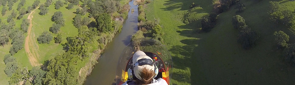
Another cruise on the Motor Vessel David B.

Twitter is my social media platform of choice and I follow so few people there because I actually try to read everything they tweet. That’s how I learned about the four-day photography cruise in the San Juan Islands on the Motor Vessel David B and the 50% discount they were offering to fill empty cabins.

David B
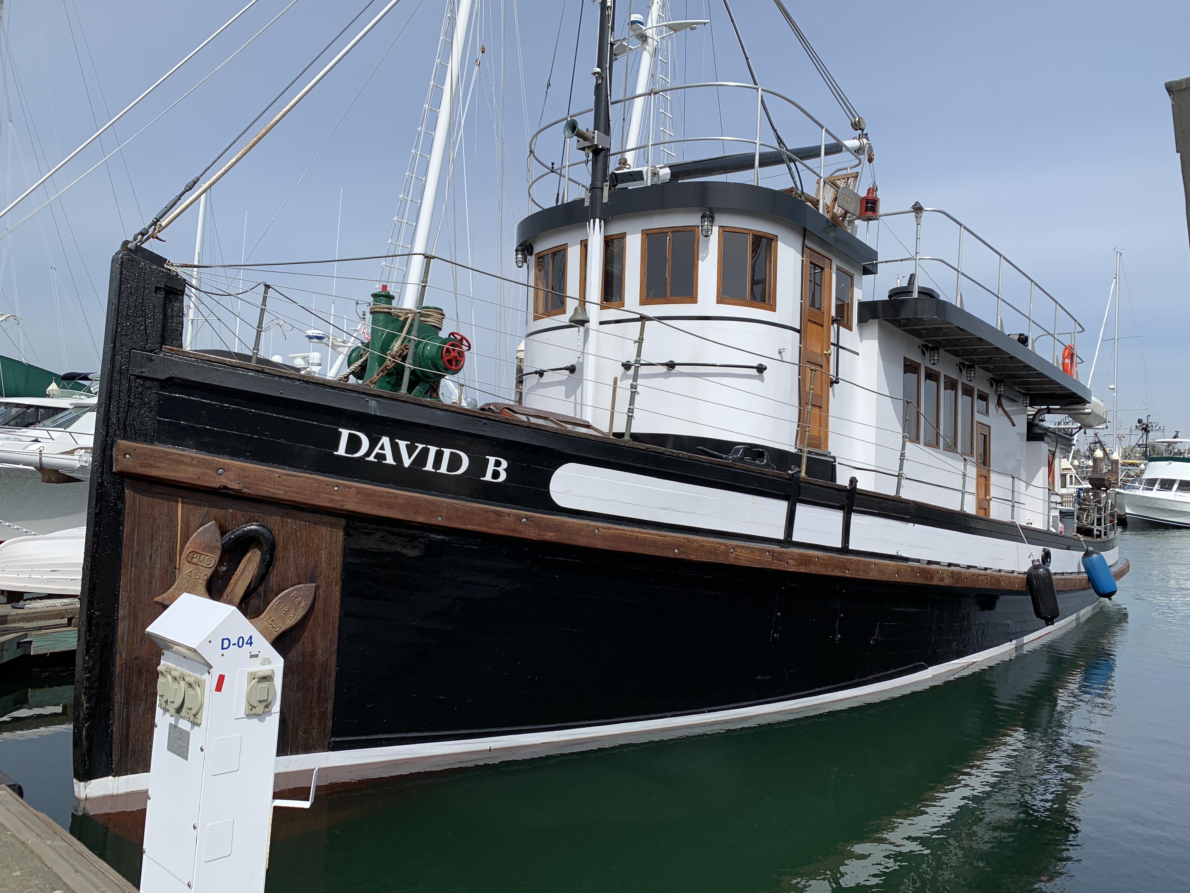
Here’s a photo of the David B at anchor on the last day of our trip.

I’d taken a 12-day cruise on the David B from Bellingham, WA to Ketchikan, AK back in April/May of this year. (I started to blog about it in some detail and put that aside. Sorry.) I knew all about the boat and what I could expect on board. Cruising on a small ship isn’t cheap and I honestly didn’t expect to be on the David B again. But 50% off made the four-day trip quite a deal. I put it to my Twitter friends — should I or shouldn’t I? — and was overwhelmingly told to go for it.

So I juggled some other responsibilities that weekend, booked my spot, arranged for my usual house sitter (who, on arrival, seemed a little too excited about my new TV), charged up the battery in my 2003 Honda S2000 (long story there), and packed for the trip. At 5 AM on Thursday morning, I loaded two carryon sized wheelie bags — one with clothes and the bigger one with camera equipment — into the trunk of the Honda and started on my way.

Getting There

The David B lives in Bellingham when it isn’t summering in Alaska. Bellingham is about four hours from my home. Boarding time was at 9 AM and I wanted to maximize my time on board. That’s the only reason I set off in the dark — I absolutely detest driving on unfamiliar roads at night.

After a quick stop at a Starbucks drive thru for one of their bacon and egg sandwiches (I had my own coffee in a travel mug) and another stop for gas in Leavenworth, I began the climb up into the mountains on Route 2. That’s right about the time the rain started. Great. Not only was I driving in the dark, but I was doing it in the rain.

Fortunately, I seemed to be one of very few people on the road. As the rain came down, cleaning all the garage and road dust off my car and reminding me again that I needed new wiper blades, I made the best pace I could without scaring myself. The car performed admirably — it always does — but it was still a relief to be on the other side of Stevens Pass in the valley beyond.

I stopped at the Sultan Bakery primarily to use their bathroom, but I also bought a nice cinnamon bun with no icing. I ate that in the car and kept driving. It was light by this point, but a dreary day with a heavy overcast. I wondered whether the whole weekend would be like that.

I arrived at Gate 5 of Bellingham’s Squalicum Harbor at about 9:05 AM. A short while later, I was wheeling my two bags up to the David B. On board, it was hugs for Christine and Jeffrey, the boat’s owners/captains. Jeffrey led me downstairs and, surprisingly, put me in the same cabin I’d had that spring. It felt like coming home.

My Cabin
My cabin on the David B consisted of a comfy queen sized bed, space to stand/dress, and a tiny head (bathroom) with toilet and sink. I had the luxury of two portholes: one in the sleeping area and one in the head. There was only one shower on board and that was in a spacious shared head at the forward end of the cabin area.

My Fellow Passengers

Back upstairs, the other passengers had arrived and were settling in. There was Betsy from Port Townsend, who had also taken advantage of the last minute half-price offer. Then there were Jeffrey and Jane, from Oregon; Jeffrey — I’ll call him Jeff from this point on so we don’t confuse him with Captain Jeffrey — was the photographer. Al and John were the photographers leading the trip; Ilene was Al’s wife. The David B only has four passenger cabins so that meant John would be sleeping upstairs in the saloon.

Interestingly, we were all about the same age — mid 50s to mid 60s. We immediately hit it off. Our first lunch together, after getting underway, was a parry among passengers quoting lines from The Princess Bride. Lots of laughter. I soon realized that I was among brainy people who, for the most part, were up on current events. I was also very pleased when I realized that we were all on the same page politically. Conversations at meals got deep, especially on the last night when we talked a little about climate change and what to do about it.

Day 1

The weather cleared while we were settling in, with blue sky peeking out behind low, drifting clouds. The forecast called for a gale warning, but we saw no sign of that. The wind was relatively calm and the sea was smooth.

Bellingham Harbor
I shot this off the stern of the David B while we were still in the slip. It was turning into a beautiful day.

We started out between 10 and 11 AM on that first day. It was great to hear that old 3-cylinder engine’s familiar rhythmic beat! After squeezing out of the slip — a feat I was amazed by — Jeffrey took us out across Bellingham Bay and around the south end of Lummi Island. I had my nautical charting app running on my iPad with the tracking feature turned on, but it soon failed to track — I had neglected to delete tracks from my previous cruise and the app’s memory was full. Further confusing the matter was that Al and John did a little lecture enroute. That required them to darken the salon so they could use a projector and screen. With the windows curtained, it was impossible to track our progress through the islands.

The lecture was an introduction to photography with a concentration on themes, composition, and what makes a photo work. John showed some of his photos — mostly landscapes from Alaska and the American southwest — and Al showed some of his — mostly black and white images that showcased textures and patterns.

Somewhere along the way — it might not have been that first lecture — Al introduced Adobe Lightroom, which we were required to have installed on our laptops — and explained the benefits of shooting in RAW format (as opposed to JPEG). We all made sure we had RAW format enabled on our cameras; I set up mine to save RAW on one SD card and JPEG on the other.

Sucia Island Chart
The nautical chart for the Sucia Islands. The yellow dot marks where we dropped anchor.

We reached our destination early afternoon: Sucia Islands. Jeffrey steered us into Echo Bay and then into the narrow channel between Sucia Island and Justice Island, right near the gap between Justice and South Finger Island. Christine dropped the anchor. There were a few other boats in the area — mostly in Echo Bay — and a small cruise ship was parked just on the other side of the gap between Justice and South Finger. Jeffrey told us it was on the last day of its cruise from Alaska to Seattle and would likely leave during the night.

We gathered our gear together while Christine and Jeffrey lowered the skiff. Laden with camera bags and tripods, we climbed on board and donned life jackets for the short ride. Jeffrey took us over to the little bay on the northeast end of Sucia Island, right where Ewing Island and some other tiny islands make a shallow, sheltered bay. He landed us there and we all climbed out onto the gravel beach.

We started off as a group, but soon split up to wander on our own. Sucia is a park and is covered with trails that wind through dense forest of conifers and madrone trees. The madrone were fascinating, reminding me a lot of the manzanita I knew from northern Arizona. Their red peeling bark was very photogenic and I got more than a few shots.

Madrone Bark
The bark peeling off a madrone limb, which was growing at an odd angle on Sucia Island.

I got into a little bit of trouble for not using my tripod on every shot, but when Al and John realized that I’d prefer to make my own mistakes and learn from them (if I was making a mistake at all), they didn’t bother me about it. I did drag my tripod along on every shoot that weekend except the last and I used it for about a third of the photos I took when we were on land. (I plan to blog a bit more about tripods soon.)

Great Blue Heron
A great blue heron perched in a conifer.

One of the oddest things I saw (and photographed) was a great blue heron perched on a conifer near the beach where we’d landed. He stayed almost perfectly still for at least 30 minutes and all of us got photos of him. I think Christine’s came out the best; she had a lens able to get in really close and capture a lot more feather detail than I could with mine.

After 90 minutes or more, we gathered together on the gravel beach for Jeffrey’s return on the skiff. From there, we cruised along the south shore of Ewing Island, which is just covered with amazing tafoni formations. The water was relatively smooth and Jeffrey was able to get quite close. With my 75mm to 300mm zoom lens and a 1/1000 shutter speed, I had no trouble capturing full frame shots of the rock formations. Best of all, the late afternoon light deepened shadows and enhanced colors. Since texture is one of the themes I like to explore in my photography, I was in heaven. So were Al and John, who apparently had never had the opportunity to spend so much time in this area. For close to an hour, the skiff was full of the sound of shutter clicks and photographer oohs and aahs.

Tafoni and Sandstone
Contrast was one of the themes suggested by Al and John. This is sandstone with tafoni formations in the lower right corner.

Tafoni Closeup
Here’s a closeup shot of some tafoni. I’m pretty sure I shot this one at my feet while I was still on Sucia Island.

Lone Gull
What struck me about this was the back lighting and silhouette. Lightroom brought out a lot of detail in the bird, but also put a halo around its body which required more work to remove.

I didn’t just shoot rocks as we inched along the shoreline. There were also birds — mostly gulls — and distant views of Mount Baker’s snow-covered top. My shutter clicked.

Birds on Tafoni
These birds seemed to pose for a photo. Although I think the composition and mechanics are fine, I’m disappointed by the lack of contrast. I wish the birds were white so they’d stand out more.

Birds with Mount Baker
The view in this shot was stunning, but it took a lot of work in Lightroom to get it to look this good. Even so, I wish I could do better.

Back on the boat, we got our first Lightroom lesson. The goal was to get the raw images off our SD cards and into our laptops in a Lightroom catalog. I also took the opportunity to back up all of my photos onto one of my photo hard disks, which I’d brought along just for that purpose. Al and John then showed us how to use a lot of the controls in the Basic panel of the Develop module. (Pardon me if I’m getting these terms wrong, but it’s not like I’m writing a book about them.) They encouraged us to ask them for help making any fixes we needed as we worked on images. The goal was to have three images to share for a critique after dinner.

Of course, none of us followed the three image rule. Jeff was the worst, with 11. I submitted the seven you see above plus the other one below for a total of eight, and Betsy submitted five. Oops. Al and John projected them onto the screen and critiqued them, suggesting things like bringing out detail in one spot or toning down the brightness in another or changing the crop. All helpful bits of feedback.

Weathered Log
Here’s the eighth photo I submitted. I really do like capturing textures. This was a log lying along the beach.

Dinner was amazing (as usual on the David B). We had pork tenderloin with mashed potatoes and veggies. I’d brought along a pint sized jar of either homemade mango or cherry chutney — I can’t tell the difference because I made the cherry chutney with yellow rainiers — to go with the pork and it got raves. We ate almost all of it. After chatting for a while in the saloon, we all retired for the night.

I slept like the dead, likely exhausted from a combination of my early start, the stressful drive, and the activity on shore.

Day 2

In the morning, the little cruise ship was gone. It was a beautiful morning.

I tried to launch my drone but it wouldn’t fly. Apparently I was in some sort of restricted area — possibly the park? I was disappointed and didn’t try again.

We had breakfast: spinach frittata, yogurt, granola, sausage, and blueberry muffins. (The David B is not a boat for dieters.) Then we had another Lightroom lesson and planned our next photo outing.

The plan was to stay right where we were for the day. We’d go onshore at Echo Bay and could walk anywhere on the island. Christine wanted to show us what she called the sunken forest — a place where trees that had grown in a low-lying area had been killed off, likely from the invasion of salt water. There was also Fossil Bay (where there were fossils) and China Caves (which were cavelike formations). The entire island was heavily wooded, but there were plenty of trails, some of which were wide enough for the ranger who lived there to get around on a six-wheeled Gator.

By the time we got onshore, the weather had changed. Clouds were moving in and it looked like we might get rain. The group stayed together for a while, crossing the island at the narrow point we’d landed at and then following a trail to the sunken forest. There was a very large school group on the island and we must have passed about 30 kids ranging in age from 5 to 12 going the other way. There were adults, too; one of them was a woman carrying two babies. I took some photos around the sunken forest and didn’t like anything I shot. Betsy wanted to check out the fossils so I went with her.

It started to rain just as we began walking. At first, I thought the thick forest canopy would keep us dry, but soon it was obvious that it wouldn’t. I was glad I’d had the foresight to bring my rain jacket instead of my cotton sweatshirt as my outer layer. Although my jeans were getting wet, I was staying warm and dry up top. The rain became a downpour just as we reached a trail intersection where there were some signs and maps covered by an overhang. Al and Ilene were already in there. We joined them.

Hail
Hail outside the shelter I waited in with Al and Ilene.

Betsy didn’t stay long. She wanted to find fossils and took off in the direction of the area where they could be found. The ranger eventually found the rest of us and told us there was a more comfortable shelter a little farther down the trail. We made our way there. It was a big wooden shelter with windows all around and a concrete floor, filled with picnic tables. We’d just gotten inside when the downpour became a torrential downpour and it began to drop pea-sized hail all around us.

Oddly, I didn’t mind the rain. It wasn’t cold and even though my legs were damp, my upper body was warm and dry. I took off my rain jacket and draped it over a table to dry a little and watched the rain come down. Being a desert dweller, I really do enjoy a good rainstorm now and then.

It eventually let up and I headed out in search of Betsy and the fossils. I found her at the head of Fossil Bay, stowing loose day packs and jackets under a picnic table. The school group we’d passed had left everything out to get completely soaked by the rainstorm.

She showed me two fossils she found and together we headed back to where Jeffrey would be picking us up with the skiff. We made only two wrong turns before getting on the right trail. I found a single chanterelle mushroom along the way.

On the way back to the boat I realized that I’d taken very few pictures. Instead, I’d really enjoyed the hike in the dense woods, despite the rain.

We had another Lightroom lesson and then worked on our images for a while. I was really starting to like using Lightroom. I had never really understood the point of it since I’d been using Photoshop for so long. But now I could see that when working with RAW images, it was an excellent non-destructive tool for fine-tuning photographs.

Day 3

We headed away from the Sucia Islands just after breakfast on Saturday. Our destination was Garrison Bay on San Juan Island. Keep in mind that none of these islands were very far from each other, but when you’re cruising at a whopping 6 knots, it takes a while.

Spieden Island to Garrison Bay
Here’s the chart and some of our track (in red) for the trip to Garrison Bay.

One of the highlights of the day’s cruise was a trip up the south shore of Spieden Island. This privately owned island was once the site of a hunting preserve. The original owners had brought in a bunch of miniature deer, bighorn sheep, and other animals and let them loose on the island. When the hunting preserve business failed, the owners abandoned the place, leaving the animals behind. They quickly reproduced with their limited gene pool resulting in some unusual animals. Jeffrey got close enough to see lots of these animals grazing on the grassy slopes of the island or climbing around on the rocks near the shore. I didn’t take any photos but regret it; Betsy got at least a few nice ones.

We saw a pair of bald eagles perched atop Sentinel Rock just as we made the turn inbound toward San Juan Island. We were all out there snapping away. I got a few nice shots, but none of them were good enough to make the cut for the next critique.

Bald Eagles
Bald eagles on Sentinel Rock. I manipulated this in Lightroom, but never got it as good as I’d like. I eventually gave up.

We were in the middle of another Lightroom lesson with the windows curtained and the screen separating the saloon from the wheelhouse when Jeffrey appeared suddenly and lifted the screen. “There’s a whale outside,” he announced.

You never saw so many middle aged people jump to their feet, grab their cameras, and head outside so quickly.

The whale was a humpback and it was only a few hundred yards away. Two whale watching boats were already with it — at least they were as close as they’re allowed to go. The smaller boat was listing to one side as all of its passengers gathered there.

I soon realized there was a pattern to the whale’s appearances. First there would be a burst of spray as its blowhole reached the surface and it took a breath. Then we’d see its long back and top fin. Then it would disappear for about 10 to 30 seconds. That whole routine happened five to eight times in a row before the dive. That’s when you’d see the whale’s tail emerge from the water as its body headed down to the depths. Once it dove, it would be five to 10 minutes before it appeared again, usually somewhere else.

After shooting too many disappointing pictures of the whale’s back, I decided to focus on getting a shot of the tail. Each time it came back to surface, Jeffrey would try to get closer and we’d all move into position to photograph it. For one round, I put my camera in continuous mode, which enables you to hold down the shutter button and just keep shooting. I soon realized that the size of the RAW image files the camera was creating limited me to about ten shots like that. Every time the whale would reappear after a dive I’d try something else. Once, when Jeffrey just let the boat idle in position on the water, the whale came up right next to us, not even 100 yards away. That’s when I got my best shot: a beautiful view of a barnacled tail dripping with seawater.

Humpback Whale Tail
Shot with a 300mm lens from the boat, this image is not cropped. In fact, I didn’t need to make many improvements in Lightroom at all.

We watched the whale for about an hour. You can see our track — the red line — in the chart image above. Finally, when it surfaced quite a distance ahead of us back east on the Spieden Channel, we broke off and headed south into Roche Harbor and beyond it to Garrison Bay. The Lightroom lesson finished in the darkened saloon with a discussion of the HDR and panoramic tools.

This was my second time in Garrison Bay, which is right off shore at English Camp on San Juan Island. We’d stopped there on our way from Bellingham to Ketchikan back in April. It was a sheltered cove, which was a good thing because the wind had definitely picked up.

After lunch, we went to shore at English Camp. I’d been there a few years before during a motorcycle trip to Friday Harbor that I’d made with a friend. It looked different from the water side. The history of the place involves a border dispute and a pig. There are a number of surviving buildings, a formal garden fading for winter, and paths leading up to a small cemetery and the top of 650-foot Young Hill.

Dalia
I got this closeup shot in the formal garden down near the buildings. This is exactly the way the photo came out of my camera — I didn’t make a single adjustment in Lightroom.

Trees
This is my favorite photo from the trip. I used my 10mm-28mm zoom lens set to 10mm and mounted the camera on a tripod for a good exposure in the dark forest.

The group started together but soon split up with the most athletic taking the mile-long path all the way up the hill. I lingered in the dense forest and eventually made it up to the cemetery, shooting photos along the way. I had dutifully brought along my tripod but soon got tired of using it. On the way back down to the dock, I took my time and shot a lot of photos of mushrooms, using my iPhone for most of them.

Mushrooms
Nothing beats my iPhone for taking shots of tiny mushrooms on the forest floor from only inches away.

I saw Jeffrey coming back for us while I was still quite a way from the dock. I hurried without running. He said he’d check in every half hour, but I was hoping I wouldn’t have to wait. I didn’t. When I got there, Jeff and Ilene were already on board. The others — Betsy, Al, and John — had gone all the way up to the top of the hill and would catch the next ride. (Christine and Joan had stayed behind.)

The water had gotten choppy and although it wasn’t rough enough to rock the David B, it was enough to have it swinging back and forth at anchor. I sat at the table in the Galley with Ilene to work on my photos while Christine worked on making croissant dough. Betsy soon joined us. We’d have a new show and tell the next day on our way back to Bellingham and I was hoping to have something more interesting to show.

Dinner was halibut cheeks with a cream sauce and veggies. Yum.

John mentioned that it might be possible to see the aurora that night. He’d gotten a text from a friend. But it was cloudy and rain was in the forecast. It was agreed that if either Jeffrey or Christine saw the aurora on their overnight watches — they walk the ship several times a night — they’d wake us up.

I slept badly. The swinging of the ship made weird noises when the anchor chain hit the forward port side of the ship. I heard footsteps overhead and thought I heard voices. I kept waiting for someone to come to the door to tell me the aurora was visible. Finally, at about 4 AM, I gave up trying to sleep and spent time reading instead.

Day 4

As usual, I was the first passenger in the galley that morning, making my appearance at about a quarter past 6. As usual, the coffee was ready. If there had been an aurora event to see, the clouds had hidden it. As someone said later in the day, the trip had been so perfect that the aurora was the only thing that could have made it better.

We were working on images in the saloon when Christine brought out a tray of her croissants. Plain, chocolate, cinnamon, and pepper jelly. Fortunately, they were small. I tried one of each and then had seconds of the ones I really liked.

Breakfast came a little later: cheesy grits with thick bacon, yogurt, granola, and fruit. I ate too much grits.

By that time, Christine and Jeffrey had pulled up the anchor and we were under way, headed to our next stop, Jones Island. The island, which is just off the southwest corner of Orcas Island, is a state park with several small bays, campsites, shelters, and pit toilets. I bet it’s packed on summer weekends. But that day it was nearly deserted, with no one in sight where Jeffrey parked on the south side. We all went ashore for a final photo outing. I purposely left my tripod behind, tired of lugging it around.

We split up quickly. I chose a trail that wound around the west side of the island, hugging the top of a bluff for much of the way. I spotted (and photographed) three deer in three separate spots. I eventually wound up at another camping area that I mistakenly thought was on the north side of the island. It wasn’t until I took the trail that I thought would take me back to my starting place and wound up someplace completely different that I realized I’d only gone one quarter of the way around the island before taking the new trail.

Gnarly Log
Did I mention that I like to photograph textures? This was part of a tree that leaned over the trail. John later said he must have spent an hour at that same tree.

Leaves
Al had suggested contrast as a theme and I thought this was a good example. It’s also a reminder that autumn is on its way.

I found Al and Ilene at the camping area on the north side of the island. I walked back with them for a while, pointing out some of the more attractive mushrooms I spotted along the way. I’m not sure if Al was just being polite but he seemed genuinely interested in some of the ones I pointed out.

We crossed from north to south on the main ADA-compliant gravel trail. Back at the starting point, we started to regroup. A while later, we were on our way back to the David B in the skiff.

Back on the boat, we had enough time to edit images and have lunch before our final critique. My new photos were the ones above: whale tail, flower, trees, gnarly wood, contrasting leaves. They didn’t have many comments to improve any of them.

They had a Canon photo printer with them and offered to print one enlargement for each of us. I chose the trees. The print came out great but with all my wall space filled at home — I have a lot of windows — I’m not sure where I’ll hang it.

Another Goodbye

It was slow going back to Bellingham. We were fighting wind and a 2 knot current — a big deal when you cruise at just 6 knots. But we arrived right on time at 5 PM. By that time, we’d all packed and exchanged cards. I suggested that Jeffrey and Christine borrow my home for a week or so during the winter while I was gone; they could get some skiing in while my house sitter took a break. John was interested in a photo houseboat excursion on Lake Powell and I hoped he’d contact me for tips and advice.

There was a round of hugs as Jeffrey helped us get our luggage off the boat. Then I was headed back up the dock to my car, pulling my wheelie bags behind me, amazed that the weekend had gone so fast.

My Inside Passage Cruise, Part 1: Bellingham to Nanaimo

A summary, with photos, of my spring vacation.

Greetings, Cruisers!

If you’ve found this blog post while Googling for information about big cruise ships in the inside passage, I’m sorry to disappoint you. My cruise was on a 65-foot historic wooden boat. But don’t click away! Read a little more about it or at least look at the photos. And then consider a trip on the David B or another small ship like it instead of an impersonal floating city. It’ll be a trip you remember for the rest of your life.

The past nine or so months has been a crazy travel time for me. A 4-day trip to the Washington coast and Tacoma for a jewelry class in September. An 18-day trip to New York, Washington DC, and Vermont in September and October to visit family and friends and see the sights. A 3+-month trip to Arizona and California in December through March. And then a real vacation: 12 days aboard a small, historic ship called the David B as it cruised slowly up the Inside Passage from Bellingham, WA to Ketchikan, AK at the end of April and into May.

(A side note here: all this travel would not be possible if I were still married. Once again, I have to thank my wasband for freeing me from a boring life in his rut, waiting for him to get his shit together and start enjoying life. Thanks, honey!)

I’ve mentioned elsewhere why I booked Northwest Navigation‘s “Learn to Cruise – The Canadian Inside Passage to Alaska” trip late last year for this spring. It would be a learning experience, and I’ve come to realize that learning experiences are the best experiences because they stay with you the longest and can change your life.

And this trip did not disappoint me in the least. I learned a ton about navigation, small boat cruising, tidal impacts, salt water boat maintenance, customs requirements, and “camping” on the water — which is basically what we did. I see small boats like the David B and the Ranger Tug R-27 I’m considering for my own use to be seaworthy RVs — recreational vehicles for use on the water. Like a motorhome, a boat with living space is a vehicle you can use to travel from place to place with a degree of flexibility, privacy, and comfort. What makes the boat I want different from the David B (other than size: 65 feet vs. 27 feet) is that mine can be easily trailered from place to place giving it almost unlimited options for exploration in fresh and salt water. What I learned on the David B can easily be applied to any serious boating I do in the future.

Anyway, although I brought my old laptop with me on that trip with the idea of blogging daily, that didn’t happen. Who wants to bury their head in a computer when there’s so much going on outside and around you? So I’ll try to share some of my experiences now, along with photos and charts of where we went.

And don’t worry; I’ve split this into multiple parts. I hope you read them all. Lots of photos!

Getting to Bellingham

I won’t bore you with details of my pre-trip travel. The short version is that it involved a flight from Wenatchee to Seattle to Bellingham. I saw no reason to make the 4-hour drive to Bellingham when the trip wasn’t going to finish there. Instead, I bought plane tickets from Wenatchee to my starting point in Bellingham with return flights from my ending point in Ketchikan to Wenatchee.

I spent the night in an AirBnB room that was cheap and walking distance (barely) from the marina where I’d get the boat the next day. It was also the smallest room I’d ever slept in (which turned out to be good preparation for my cabin on the David B). I did a lot of walking on that Tuesday, making the trek down to Anthony’s restaurant where I ate oysters two ways and had wine and dessert — entirely too much food. I then walked along the marina until I found where the David B was parked before walking back to my lodging.

Bellingham Marina
Bellingham’s marina was absolutely gorgeous that late April day.

Day 1: Bellingham to San Juan Island

David B at the Dock
The David B when I arrived on Wednesday morning.

The next day, I took a Lyft to Bellingham’s art district with my giant rolling bag, had coffee in one restaurant, and breakfast in another. I then took a short walk, dragging the bag behind me, visiting a few antique stores to buy old sterling silver and silver plate tableware that I thought might be turned into nice rings. Finally, as the time to board got closer, I called another Lyft to take me the mile or so to the pier. If my bag wasn’t so damn big, I probably would have walked.

I was a half hour early but they let me board anyway. I wasn’t the first passenger to arrive. I met Sarah, who is in charge of reservations and other office stuff in Bellingham briefly before she left. Captain Jeffrey introduced himself and helped me wrestle my bag down the stairs to where the cabins were. There were five of them, including a crew cabin, and they were tiny. Mine had a queen sized bed, a head with toilet and sink, two portholes (one of which was in the head), and enough space for me to stand next to the bed. There was space under the bed for my bag, but about a third of it was occupied with manufactured logs, which I later learned were for the wood burning stove in the galley. They bring up a whole summer’s supply of logs and one of the other cabins was full of them. I had enough space, but it would have been challenging if I was a very large person or was traveling with a friend. Other cabins had different configurations and were better suited to couples. Mine was fine for me.

My Cabin
My cabin on the David B, as seen from the doorway with a panoramic photo. It was cosy!

Stairs The Head
The stairs were steep and winding. The first door at the bottom was a spacious bathroom (head) with shower that we shared. My tiny head was so small that when I sat on the toilet seat, I had to put my left arm on the sink counter.

I went back upstairs to the saloon (not salon, as we later learned) and met co-captain/cook Christine, who was Jeffrey’s wife. We chatted for a while in the saloon and I told them about the boat I wanted to buy and what I hoped to learn. (They must have thought I was nuts.) Then I learned about the David B and a little about our trip.

The Saloon
The saloon was our central gathering and lounging place on the David B. The snacks set out on that first afternoon should have warned me of the food to come.

Before long, I met my fellow passengers: Graeme from Australia and David and Leslie from Kettle Falls. Graeme was a wooden boat fan who had made the trip the centerpiece of a visit to the American northwest and Alaska. David and Leslie had just purchased a C-Dory 22 — coincidentally, the same boat my ex-friend at Lopez Island had that got me interested in small boat cruising two years before — and David was very interested in learning more about navigation since they’d just bought a home in Bellingham and I suspect he planned to move the boat there.

And that was it: only four passengers and two crew. I expected to be one of seven passengers, so this was a pleasant surprise.

We left port that afternoon.

I followed Captain Jeffrey down a ladder to the engine room and stood out of the way while he squirted oil into more places than I could count before doing a bunch of other things and then finally bringing the engine to life. I had questions but didn’t want to ask. He reminded me of a pilot preflighting an aircraft and if there’s one thing a serious pilot hates, it’s being interrupted doing a preflight. Then we both climbed back up and I told him I’d watch again, which I did the next morning.

Engine
The David B’s three-cylinder engine.

Backing the David B out of its slip was probably the most challenging job; those of us who wanted to help were given big bumpers to separate the boat from other boats or dock parts if we drifted too close to something. But Captain Jeffrey had it covered. Backwards and forwards and backwards and forwards, he inched the 65 feet of wooden boat out and into the space between the slips. Then we were on our way while various friends and family members waved us off from the dock.

Smoke Stack
The Washington Iron Works logo adorns the David B’s smokestack atop the ship. The boat was built in 1929 and had just celebrated its 90th birthday.

The day had started to cloud over and get a bit chilly, but there wasn’t much wind and the San Juan Islands area we wound through was only a bit choppy. (I had my Sea Bands on for a while, just in case.) We were all excited about starting off and, after a lunch of hearty chicken soup and salad, spent a lot of time out on the deck or in the pilot house watching the San Juan Islands drift by and chatting about the homes we saw on shore. The David B literally chugged along under the power of its 90-year-old 3 cylinder engine, averaging about 6 to 7 knots of speed. We saw a few other boats, including some large tankers and freighters when we crossed the Rosario Strait. And there were ferry boats, of course.

Pilot House
The pilot house is a neat compilation of early 20th century and 21st century technology. For example, the computer ran a navigation application that actually turned the big wooden steering wheel. We all spent a lot of time in this room, which had enough seating for all four passengers.

I’d prepared for the trip by downloading, installing, and subscribing to an iPad app called Time Zero (TZ) iBoat. Throughout the trip, I had tracking turned on so it kept track of our exact route. (Yes, I know I’m a geek.) Looking back at that track now, I can tell you that we passed south of Eliza, Lummi, and Sinclair Islands; between Obstruction and Cypress Island through Peavine Pass; between Orcas and Shaw Islands in Harney Channel; north of Crane Island; south of Jones Island; and then into Roche Harbor on San Juan Island. We passed the main harbor and wound through some channels before finally settling for the night at the mouth of Garrison Bay, which was named for nearby English Camp.

Day 1 on a Chart
Here’s the view of our first day’s track as it appeared zoom-to-view on my iPad.

Captain Jeffrey slowed the boat until it was almost stopped and Christine worked some equipment on the bow to drop one of the two large anchors with enough chain to hold us in place. Then he shut down the engine and the sound we’d been listening to for the past few hours stopped.

The Stove
A fully-functional replica wood-burning stove was the centerpiece of Christine’s galley.

By this time, Christine was cooking dinner in the amazing galley. I say “amazing” because she was using a wood-fired stove and I personally can’t imagine dealing with the intricacies of such a device after a lifetime of gas, electric, and microwave cooking power. Because the boat had a generator and inverter, she had all the usual appliances — mixer, blender, ice cream maker. There were several refrigerators and freezers. The only thing she didn’t have was a dishwasher, but we all took turns washing the dishes after meals.

Galley
David B’s galley.

Dining Area
Here’s where we sat for meals. Although Christine plated dinners, breakfast and lunch was usually family style.

We had baked salmon, asparagus, and black rice for dinner. The “bread course” — which became a sort of running joke because every meal had some kind of freshly baked bread — was sourdough. I ate more bread on that trip than I had eaten in the previous year but I simply couldn’t resist.

After dinner, we spent some time discussing the next day’s cruise, which would take us into Canada. Part of the trip was a passage through Dodd Narrows, a narrow space between Mudge and Vancouver Islands that was well known for dangerous eddies during tidal flows. We had to plan our arrival at slack tide, a narrow window when the eddies were minimized. If we arrived too early or late, we’d have to wait on the south side of the narrows. An early arrival wasn’t a big deal but a late one would have us waiting for hours until the next safe time to pass through. This was my first introduction to the concept of tidal currents and it came with a lesson on how to use various reference guides to calculate when slack tide would occur.

Not long afterward, we all turned in for the night. I quickly realized that the walls were paper thin and I could hear everything Leslie and David said to each other. They didn’t say anything embarrassing, but I made some noise so they knew how thin the walls were. I suspect they figured it out — probably from hearing me snore! — because they didn’t talk much on subsequent nights.

Day 2: Bellingham to Nanaimo

I woke up early, as I usually do, but with a very sore throat that got me very worried. I’ve been on two vacations where I was sick with a cold and it really sucks. If I was taken down with a cold on this trip, I’d be very upset.

I spent some time lounging in bed with my iPad, which is what I do at home, too. I still had Internet access — heck, we were in the San Juan Islands. Around 5:30, I heard movement upstairs and went up in my pajamas to see what was going on. Christine had stoked up the stove and made coffee. I hung around in the kitchen for a while with my coffee, then went down to put real clothes on. The other passengers appeared one by one. Christine made us a frittata with asparagus (leftover from the previous night), fruit, granola, and yogurt. (The last three would be at every breakfast.) She didn’t have any orange juice, but I did have an orange to start pumping Vitamin C into my system.

The day was beautiful and the water was glassy smooth. I launched my drone for the first time to get some aerial views of the boat. I was a little skittish about flying it over water after my Lopez Island crash, but I faced my fears. There was a big clear area on the roof of the saloon and that’s where I launched from. I did not rely on auto-land to bring it back.

David B at Garrison Bay
The David B at anchor in Garrison Bay.

Afterwards, I went back down into the engine room to get a narrated view of the engine start. I tweeted it.

Captain Jeffrey engaged the windlass and Christine started pulling up the anchor. Once it was stowed, we were ready to go. It was about 9 AM.

We left San Juan Island behind and headed out into Haro Strait. Somewhere northwest of Stuart Island, we crossed into Canada. I spent some time trying to find a good place to sit outside while cruising. The two lounge chairs above the pilot house were windy and chilly. I finally settled — at least for a while — into one of the back facing seats on the stern which was sheltered and in the sun.

It wasn’t long before I realized that the David B was cruising slowly because the David B cruises slow. The engine, which required oiling and other attention every two hours while it was running, was set to a six knot cruise speed. We were going to cruise over 700 nautical miles at 6 knots.

No wonder the trip took 12 days.

My notes for the second day mention a lot of boats on the water in Canada, including a Canadian Coast Guard boat, tug boats, and a tug boat pulling a barge of oddly loaded logs. I took some pictures, but not many. Everything was big and far away and didn’t look very impressive in photos.

Log Barge
I guess this is one way to load logs on a barge. What’s interesting to me is that in the Pacific Northwest they use chain to attach the tug to the barge and the chain dips way down into the water. This is very different from the barges I remember on the Hudson River when I was a kid; they used cables that were taught when the barge was being towed.

Dodd Narrows
The chart for Dodd Narrows. The red line is our path through it.

We arrived at Dodd Narrows about 30 minutes early. During our slow approach, we could see several boats waiting to enter the narrows, including a tugboat towing a bunch of floating logs tied together. Captain Jeffrey liked the way it looked so he didn’t wait and kept going. A sailboat under engine power pulled in behind us. There was current in there, but it wasn’t bad enough to cause any problems for us. I was glad there weren’t any boats coming through from the opposite direction.

We got into Nanaimo, a port city that’s commonly used by American on private boats to clear Customs into Canada, at about 4 PM. Captain Jeffrey went to shore to deal with the paperwork for himself, Christine, and their four passengers.

Day 2
Day 2’s track from San Juan Island to Nanaimo in British Columbia.

Canadian Club
When in Canada, drink Canadian Club.

I was told that there was a supermarket nearby, so I set off alone in search of orange juice and vitamin C tablets. I had $40 in Canadian money with me and the goal of not being identified as an American. I found the supermarket and accomplished my mission with a credit card so I could save the cash for someplace that didn’t take credit cards, also returning to the boat with a bottle of Canadian Club whiskey and a reusable shopping bag.

Christine made us another amazing dinner with fresh bread. She was feeding us very well. Too well, I think. I’d brought along some snacks in case I got hungry between meals but (1) I didn’t get hungry and (2) there were always snacks available (which is probably why I didn’t get hungry).

Nanaimo Sunset
Mother nature treated us to an amazing sunset.

Day 3: Nanaimo

The wind kicked up overnight and was blowing hard by 8 AM. Captain Jeffrey decided to delay departure by 2 hours. When that time had gone by, he delayed departure again. After lunch, he announced another delay.

I really couldn’t blame him. The wind was howling and the seas that we could see through a gap in the islands nearby was full of whitecaps. A big cargo ship anchored there drifted 90° or more at anchor. Even the seaplanes based near us at the harbor weren’t flying most of the day.

I spent most of the day reading and wasting time on Twitter. I wanted to go see Avengers Endgame at a theater in town, but the only showing I could see was at 3 PM and we might leave.

In the afternoon there was some excitement when a kayaker capsized about 30 feet from the boat. He couldn’t right the boat and he was hanging on in water that had to be icy cold. We got a line to throw to him while Christine called the coast guard. One of his companions paddled back and helped him to the dock in front of the boat. Fortunately, he’d been wearing a wet suit so he wasn’t that cold. But they went into a panic when they realized another kayaker was missing. They later found him back at their starting point at a nearby island; he’d turned around when he realized the seas were too rough for him.

At 4 PM, Captain Jeffrey announced that we’d be spending another night. He went ashore to pay for our space on the dock.

I walked into town with Leslie. We stopped at a tea shop where she had him make a custom blend of Earl Grey and lavender. We also went into a very nice gift shop. I would have visited more shops — including a chart shop Jeffrey had told us about — but I think Leslie was done so I walked back with her.

Back at the boat, we did more waiting. Then dinner. I think all of us were ready to move on.

The wind started to let up before bedtime.

(More to come…)

A Helicopter Trip to the Anacortes Boat & Yacht Show, Part 1

The backstory on why I flew my helicopter out to Anacortes on Sunday.

Those of you who know me well in person, by reading between the lines on this blog, or by following me on Twitter, have probably come to realize that I have been lusting for a boat for the past few years.

Boating with my friend Jim
Here I am boating with my friend Jim on the Columbia River back in 2012.

Yes, I know that I already have a boat — a little 1995 Sea Ray Sea Rayder F-16 that I bought back in 2011 for about $2,000, including the trailer — but although it’s a nice little toy to get me out on the water, it just doesn’t meet the needs of someone with a yen for exploring new waterways on extended length trips. Someone who has always wanted to live on the water but can’t decide exactly where that might be.

What Planted the Seed — and How It Grew in my Brain

I got this desire for a more substantial boat after a few outings with an (ex)friend at Lopez Island. He’d bought a 22-foot C-Dory Cruiser, which is an ocean worthy power boat in a sort of tugboat style. I loved the bright roominess of the cabin and the features, which included a usable galley (kitchen) and sleeping area. It was lacking one thing I needed in a boat: a head (toilet). But I poked around a bit and discovered that the C-Dory made a larger boat, the 25 foot Cruiser, which had everything I needed. I started thinking about that.

After a while, I started exploring other options — heck, even when I dream about something big like this, I do some research. I knew I wanted an ocean worthy boat that could be towed and stored in my big garage when I wasn’t using it. I knew I wanted the tug style, which had lots of big windows and stand-up cabin space throughout. I knew I needed a decent sized galley and a head, as well as full-time sleeping space. That weeded out a lot of possibilities.

Possible brand names included C-Dory, Nordic Tug, Cutwater, and Ranger Tugs. I eventually zeroed in on the 27′ Ranger Tug — specifically, the 2018 or later model. Not only did it meet all of my criteria, but it was fully loaded with all of the features I needed and wanted, from the Garmin navigation system with autopilot to the solar panels and inverter system.

Trying to Get Over It

R-27 Ranger Tug
Photo of the 2018 (or later) R-27 Ranger Tug from Ranger Tug’s website.

As time went on, I lusted after this boat. I carried photos of it from the Ranger Tugs website on my phone. I thought about it when I was camping out in the desert or driving/flying past a waterway. I figured I’d better do something to get it off of my mind.

My first step was to see the boat in person. So far, all I’d seen were photos and videos online. I kind of hoped that seeing it in person would disappoint me and get it off my mind.

So I made an appointment with the General Manager of Ranger Tugs in Kent, WA, where the R-27 model is made. I had to take my helicopter to Hillsboro, OR and fly back through Seattle, so I scheduled my return flights with a long layover in Seattle and took a Lyft to the boat factory. It was very nondescript and certainly didn’t look as if they built $200K boats inside. I met with Andrew and boarded one of the two boats being built in a metal building behind their offices.

It was amazing. Better than the website. Shit. Now I really wanted one.

R-27 Interior
The interior of the 2018 R-27 Ranger Tug. If you took a comfortable little RV and stuck it into a boat, this is what you’d get.

The next step had already been set up. Last fall, I’d booked a 12-day “Learn to Cruise the Canadian Inside Passage to Alaska” cruise with Northwest Navigation on a small ship called the David B. I figured it would be a good way to learn new skills — marine navigation — and experience a long trip on a relatively small boat. (The David B is 65 feet.) So only a week after I visited the Ranger Tug factory, I was one of just four passengers on a 12 day trip that might be very similar to one I’d be able to do in the boat I lusted after. I hoped I wouldn’t like it.


Shot of the David B at its slip in Bellingham. I need to blog at least a little about that trip.

Of course, I loved it. How could I not? Exploring sheltered, glacier-carved channels along the coast of Canada? Enjoying the solitude of secluded anchorages where the only sound comes from birds or waterfalls? Getting daily sightings of wildlife that included bears, eagles, seals, porpoises, dolphins, whales, and countless water birds? Navigating from point to point with the challenges of tidal currents in narrow passageways? Jeez! I could spend a lifetime doing that.

I’m not saying the trip was perfect. There were a few times we had to cross open water that was a bit rough and my landlubber head and stomach weren’t happy. (As I told Captain Jeffrey and Co-Captain/Cook Christine, my wasband, who would have really enjoyed the trip, would have been puking his brains out.) But even the weather cooperated with very few overcast or rainy days. (Whodathunkit?) As for the open water crossings, the David B chugged along at 5-7 knots; the boat I had in mind was capable of planing and could cruise a lot faster. So even though I wouldn’t take rough water at high speed, I could probably comfortably cruise at double the David B’s speed and cut the crossing times in half.

I also learned a ton about marine navigation and cruising — everything from reading details in charts to how much chain/rode (anchor rope) to set when anchoring. It filled me with new questions to ask Andrew at Ranger Tugs.

I also got advice from Captain Jeffrey: check out other boats. There might be one you like better that might even be less expensive. He was right, of course. I needed to do more homework.

Planning a Trip to the Boat Show

I was still on the David B when the invitation to the Anacortes Boat & Yacht Show arrived via email from Andrew. Seemed like a perfect opportunity to see a lot of boats at once.

The trouble was, it was in Anacortes and I live in Malaga. It’s a 3-3/4 hour drive. Each way.

It was a four-day show: Thursday through Sunday. I was helping my neighbors at Malaga Springs Winery bottle wine on Friday. I was supposed to be at Pybus Public Market selling jewelry on Saturday and Sunday. I had done very well at Pybus the previous weekend and was looking forward to a repeat performance. That left Thursday.

But did I really want to drive a total of nearly 8 hours in one day just to see some boats? Maybe in my S2000 with the top down. But there was rain in the forecast for Anacortes, so not only would I be driving in the rain, but I’d probably be walking around the boats in the rain. It wasn’t very appealing.

Thursday came and went; I did things at home. I bottled wine on Friday. I went to Pybus on Saturday — and had a crappy sales day.

I’d started looking at the forecast for Sunday. Earlier in the week, it had been bad, with clouds and rain on both sides of the mountains. But as time went on, the forecast changed. By Saturday evening, it looked like Sunday would be a good day.

Good enough to take the helicopter over. Instead of a dull 3-3/4 hour drive, I could have a 1-1/4 hour flight.

So I whipped out ForeFlight on my iPad, created a flight plan, got a weather briefing, and filed my plan for the next day.

()