I thoroughly enjoy a flight from Wickenburg to Chandler on a beautiful Arizona winter day.
Direct flight = boring flight.
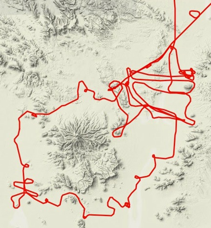
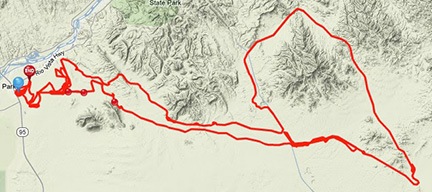
I recently had to reposition my helicopter from Wickenburg (E25) to Chandler (CHD) to get some maintenance done. That meant a cross-country flight which, if flown directly, would take about 40 minutes and fly right over the top of Sky Harbor Airport (PHX).
But the helicopter was going in for a 100-hour maintenance and had 6 hours left before it was due. It seemed to me that I should try to use up as much of that time as I could.
Unfortunately, I did have a time constraint. I was meeting a friend at Chandler Airport at 1 PM. I had plans to spend some time with him and then another friend afterwards. And I even had a dinner date down in Tempe.
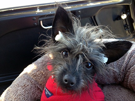
But as I loaded Penny and an overnight bag into the helicopter, I figured I had about an hour and a half to kill along the way. Why not take the scenic route?
I didn’t realize then that I’d be treating myself to a four-river tour.
The Hassayampa River
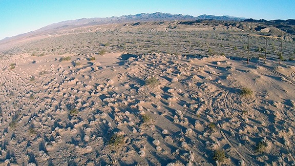
The Hassayampa River flows through Wickenburg, AZ, the town I’ve been living in for the past 15 years. Its name supposedly means “river that flows upside down” or something like that. That’s because although water flows year-round, it doesn’t always flow on the surface of the river bed where it can be seen. Instead, it flows mostly under several feet of sand in the river bed. So, when you drive over the bridge in town — usually on your way to or from Las Vegas, which is how most people know Wickenburg — you won’t see any water down there. Just sand. And tire tracks. And occasionally, some cattle.
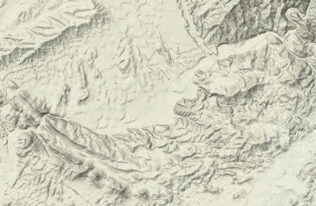
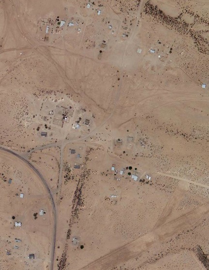
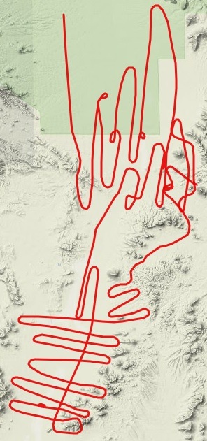
If you know Wickenburg and the Hassayampa River well enough, you should be able to see where it “flows” on this Google Maps terrain view from the canyons near Box Canyon to just past Constellation Road.
Indeed, the Hassayampa River is so un-riverlike that it doesn’t even appear on Google Maps’ terrain view.
But it had rained a few days before — a constant, steady rain that had lasted for hours. Although it hadn’t been enough rain to get the wash that flows through my property flowing, it apparently accumulated in streams upriver from town. When I flew over the river two days later, I could see a small but steady stream of water.
But I’m getting ahead of myself here.
For some reason, I headed south from the airport — not east toward the river. I think my initial idea was to fly south to Buckeye and slip between the Estrella Mountains and South Mountain, approaching Chandler from the west. I also wanted to glimpse the roads I’d been on a few days before with a local Jeep group.
When I got to Vulture Peak, I decided to see if anyone was on top. So I started a steep 1500-foot-per minute climb, reaching the top in about 10 seconds. No one up there. I dropped down on the other side and followed some wash beds east past Wickenburg Mountain. And then I found myself at the Hassayampa with the water flowing by beneath me.
And I stopped thinking about Buckeye.
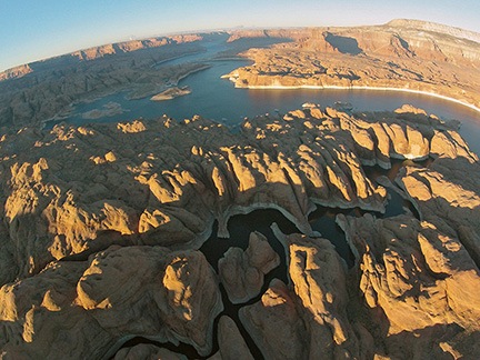
Instead, I turned north, passing to the east of Wickenburg and joining up with the Hassayampa River just past the bridges. The river’s flow wasn’t much to brag about, but it was something — a lot more than I’d seen there in a long time. I followed the flow, flying a lot lower than I usually do with passengers on board, gently coaxing the helicopter left and right as I followed its winding course. In the narrows past Box Canyon, in the place I usually refer to as “the slot,” the water filled the canyon, wall to wall. Beyond that, where the riverbed was wide and sandy again, the water returned to an ambitious trickle.
I flew past the nearly abandoned ranch formerly operated by the Gatehouse Academy as part of their treatment center for young people with addiction problems. I remembered flying by and seeing my husband’s old suburban parked in the lot the house. I remembered all the times I’d flown the owners out there with various VIPs. I remembered the time a cowboy and his dogs had chased off a herd of cattle closing in on me and my helicopter as it sat parked in a field. I remembered the Christmas day I’d flown Santa and a bag of toys out to the ranch and had wound up giving rides to about a dozen young men who had taken a detour from their lives into drugs or alcohol. Gatehouse was gone, closed up over the summer while I was away. Their properties in town were for sale and there was no sign of life down on the ranch.
Beyond the ranch, the river flowed in a twisting canyon. I stayed low, about 200 feet up, following the river on a less twisting path. I saw that the old mobile home at the edge of Jesus Canyon had collapsed into a million pieces and that someone was using heavy equipment on a patch of old farmland across the river. I flew over most of the goosenecks that the river had carved through the rock, admiring the tall saquaro cacti that covered the hillsides and marveling at how all that rain had washed the dust off everything below me.
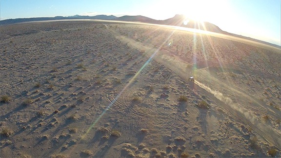
Did I mention that the flying conditions were perfect? On the ground at Wickenburg Airport, there had been a bit of a breeze, but a few hundred feet up, any breeze was completely unnoticeable. It was smooth flying at any altitude I chose. And the cool air made the helicopter’s performance better than I was accustomed to. I had great speed, great climb rates when I wanted them, and great response to all my control inputs. Flying was effortless, leaving me to enjoy the scenery and the freedom to be able to move in any direction I wanted.
Although I could follow the Hassayampa all the way up to its source in the Bradshaw Mountains — which is something I’ve done in the past — I left it where the Williams Family Ranch sits on the side of a hill at the mouth of a tributary wash. It takes at least an hour to drive from the ranch into town on unpaved Constellation Road, but I could cover the same path in less than 3 minutes in the helicopter.
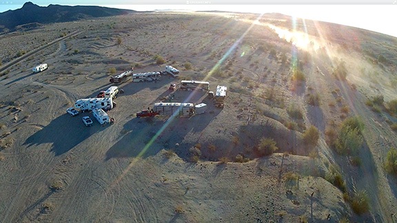
From there, I slipped between two rocky hillsides, following a canyon southeast, roughly toward Chandler. The terrain here was rough and unforgiving; an engine failure would have been a huge problem with absolutely no suitable landing zone. I followed wash beds and dirt roads, climbing with the terrain the whole time. Then the land dropped off in front of me and I descended down into the canyon where Buckhorn Creek flows. Although it was still wet from recent water flowing, nothing wast flowing that day. I followed the creek bed downstream, past where it met with Castle Hot Springs Creek. I began to see homes and then Castle Hot Springs with its green lawn and tall palm trees. A fifth wheel RV was parked on its ruined tennis courts.
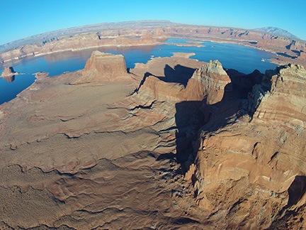
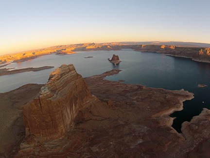
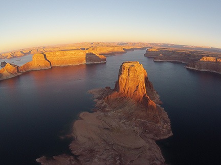
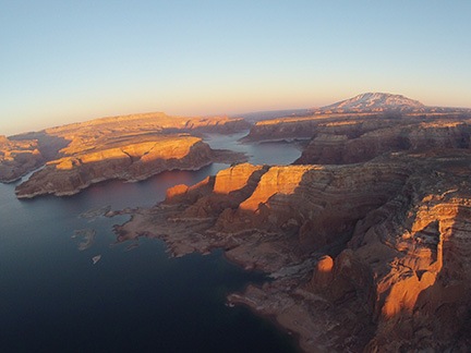
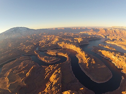
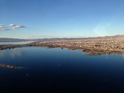
And then I was at the shining blue waters of Lake Pleasant.
The Agua Fria River
Decision time. Which way to go? If I headed south, I could still do a route to Chandler that would take me between the Estrellas and South Mountain. But after passing the lake, I’d be spending much of the flight time over suburbia — subdivisions of houses on postage stamp sized lots, surrounded by tall walls to keep out the world. I hated seeing homes like that. I hated knowing that people lived like that when there was so much open land so closely. I hated thinking that people actually liked that way of life.
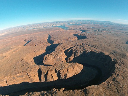
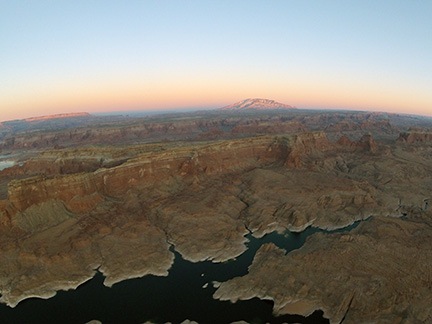
Without thinking nearly that much about it, I turned east. I flew low across the northern arms of the lake, mildly surprised that the water level was so low after all that rain. There were a few fishing boats on the water, but not many. I made a half-hearted attempt to spot some wild burros (donkeys), but knew I was probably going too fast — 110 knots — to see them.
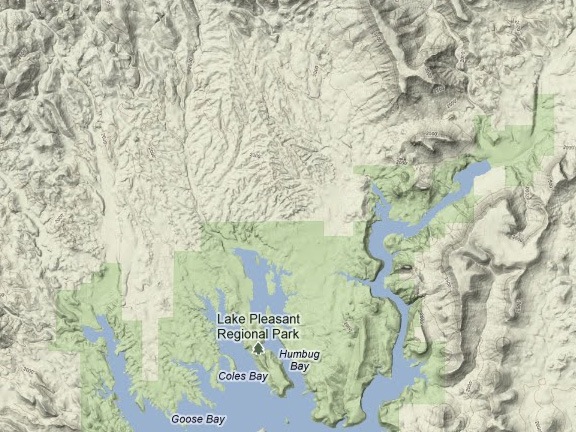
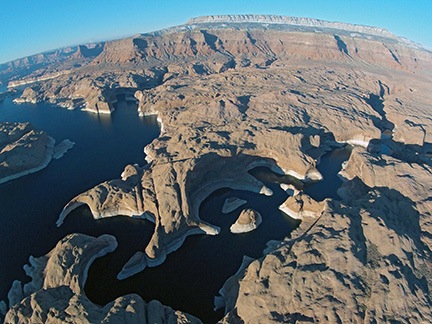
The northern half of Lake Pleasant is a series of “arms” where tributary streams and washes enter the lake.
A pair of C-130 cargo planes flew over the lake in loose formation about 3000 feet above me, heading northwest. The only reason I know their altitude is because a flight instructor on the practice area’s radio frequency announced them. The pilots didn’t say a word and were soon just a pair of specks in the distance, climbing over the mountains to the east.
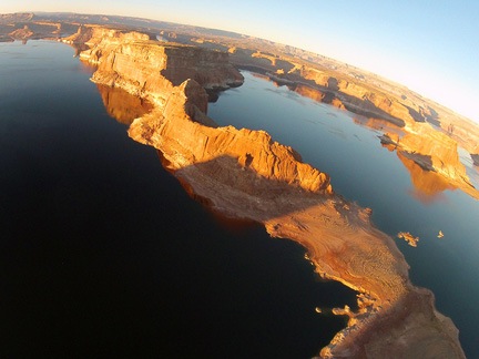
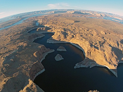
The Agua Fria River where it enters Lake Pleasant. Indian Mesa is near the lake.
I headed toward the Agua Fria River arm and climbed steeply to take a really good look at the prehistoric Native American ruins atop Indian Mesa. I even slowed enough to considered a few possible landing zones. Then I pointed the helicopter’s nose up the river and continued on my way.
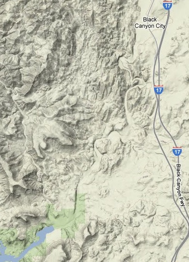
Agua Fria is Spanish for cold water. The river flows much of the year, but often not more than a serious trickle. That day, it was flowing much more than usual. It drains the mountains up I-17, past Black Canyon City. I didn’t want to follow it that far. I didn’t want to go that far out of my way. So I struck out to the east again, crossing over I-17.
New River
I picked up New River almost immediately, on the other side of the freeway. I realized that I although it was only a 20-minute flight from my home, I had never followed it upstream. Never. It was time to remedy that situation.
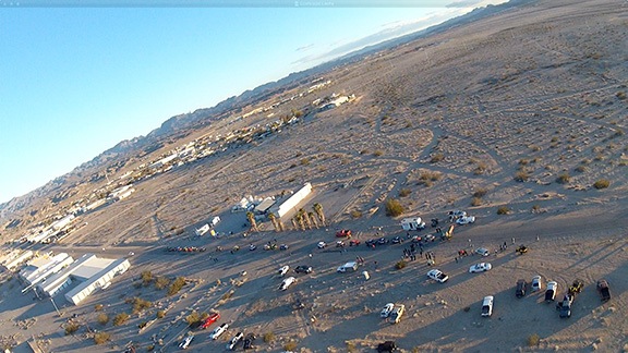
The river had a good, strong flow as it came through the canyon from the northeast. I saw a parking area with a bunch of trucks and empty flat-bed trailers. Although it was midweek, there were ATVers out and about. I saw a dirt road that generally followed the river — Table Mesa Road, according to the map — and wondered whether I’d see the riders along it.
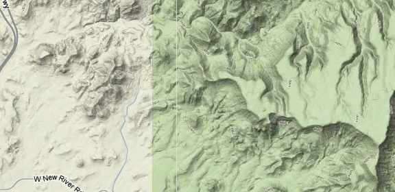
New River winds mostly east through a canyon.
I followed the river upstream, keeping a sharp eye out for wires. I wasn’t very low, but low enough that wires stretched high across the canyon could be a problem. The water rushed by below me. I looked for waterfalls, but didn’t find any.
I climbed with the canyon. The road meandered alongside the river, sometimes disappearing from view to the south before coming back. It climbed to a high point overlooking the river and there were the ATVers — about eight of them, parked at the overlook. One of them waved up at me. I waved back.
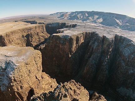
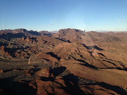
Other streams fed into the river as the main channel turned to the northeast. I needed to go south, so I chose a tributary canyon and followed it toward the south. It climbed steeply and widened, with a flat-topped mesa on either side. The water disappeared. The rock was volcanic — dark basalt. I started noticing rock walls alongside the east wall of the canyon. There were quite a few of them, hundreds of feet long, parallel with the top of the mesa at different heights. Fortifications from ancient indians who had likely made their homes atop the mesas. As I got level with the mesa tops, I started looking for rock foundations. But with all the jumbled rocks and yellowed weeds and cactus up there, it was hard to see any patterns at all.
I was surprised when I found myself at the broken mesa that I had dropped off two passengers for a camping trip years before. I had climbed to over 4,000 feet; when I reached the edge of the mesa, there was a 1,000 foot drop to the valley floor. I lowered the collective and began a steep descent, heading northeast again.
And that’s when my sister called. My new Bose headsets have Bluetooth, so I’m able to take phone calls while I’m flying. The music I was listening to stopped, the phone rang, and I touched a button on the headset cord to answer. We chatted. I brought her up to date with the bullshit being flung at me by the lying, cheating bastard I was still married to, the man who’d told me to my face less than two months before that he still cared about me. But I was descending down into a small canyon area northeast of Scottsdale. As I expected, my cell phone dropped the signal. The music from my iPhone resumed. My mood immediately lightened as I descended to follow one of the many canyons cut through the sedimentary rock that had been deposited into the valley millions of years ago.
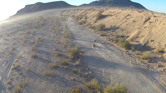
I flew over an ATV speeding down the sandy canyon floor with two people on board. I wondered if they heard me coming before I flew over.
Then the canyon opened wide to the last river on my trip.
The Verde River
The Verde River shows up as a blue line on the map, likely because it flows year-round.
The Verde (green, in Spanish) River flows year-round. Its source is up near Ash Fork. It winds through a narrow canyon into the Verde Valley, flows past Camp Verde, and then enters another long, narrow canyon. Beyond that, two dams create two lakes: Horseshoe and Bartlett. I reached the river just downstream from Bartlett Lake; I could see the dam off to my left.
I turned right, dropped down low over the river, and sped south. The river was wide here — about 50 to 100 feet across — and shallow. It was about ten past noon and the sun shined into the cockpit warming me and penny asleep on the passenger seat beside me. I followed its course downstream, gently banking right and left. At one point, I saw three wild horses standing in a row in the middle of the stream, drinking. The sun reflected off the water all around them, displaying them as silhouettes. One of them looked up at me as I flew over.
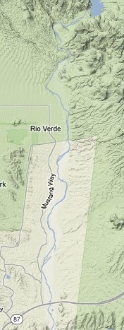
By then, I was getting back into civilization. The community of Rio Verde was to the west and the McDowell Indian Reservation was all around me. I crossed the Beeline Highway. I knew there were wires up ahead and I knew I’d have to talk to a few airport towers soon. The fun part of my flight was over. I was at the confluence of the Verde and Salt Rivers, on the eastern edge of Phoenix’s sprawl.
I climbed to 500 feet above the ground, tuned in the frequency for Falcon Field, and got ready to finish my flight.
Finishing Up
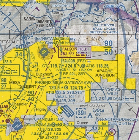
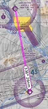
The last part of my flight required me to navigate through Falcon Field’s airspace, avoid Gateway’s airspace, and slip into Chandler’s airspace to land at the heliport.
I made my radio call to Falcon Field’s tower, requesting a transition through the east side of their airspace. When I released the mic button, all I heard was static and two men having a conversation.
It sounded like a flight instructor with a student.
Falcon Field is a class Delta airspace. That means I can’t enter until the tower responds to me, including my aircraft N-number. But the only sound on the frequency I was tuned into was the sound of a flight instructor and a student.
I checked the frequency with my cheat sheet and with the chart on my iPad. I was tuned into the right frequency. I banked to the left, beginning a circle just outside the airspace until I could figure out what to do.
It was pretty simple to me. If I couldn’t communicate with the tower, I could detour south, on the east side of Falcon’s airspace. I could then use my GPS to navigate the narrow space between Falcon and Gateway. Or I could call Gateway and get permission to transition through the north side of their airspace.
As I was thinking about this, the two men on the radio were musing on why no one was answering their call. “Stuck mic!” I wanted to scream into the radio.
And suddenly the static ended and the controller came on. He sounded annoyed. He identified the aircraft by number and told him to make a full stop landing because his mic had been stuck. Again.
The flight instructor responded. The mic got stuck again, but only for a moment. I seized my chance and made my call.
The controller’s voice clearly indicated his frustration when he gave me my clearance. He then started issuing instructions to everyone else who needed guidance.
I was glad I wasn’t the guy with the stuck mic. I knew that the ground controller would be giving him a phone number when he landed.
I headed southwest, giving Falcon’s runway plenty of space. Then I banked right. I pushed Go To, Enter, Enter on my GPS to get a solid pink line from my current position to Chandler, which had been programmed in since before I took off. I flew over roads and golf courses and canals and wires. And houses. Thousands of houses. No wild horses here.
Falcon cut me loose and I switched to Chandler’s frequency. I’d already listened to the ATIS recording on my second radio, so I knew the airport conditions. I asked for landing on the Quantum ramp. The controller cleared me for a straight in approach. There were no planes in the pattern. Just helicopters.
A while later I was setting down on one of the big circles in front of Quantum Helicopters’ hangar. R22 helicopters were coming in and spinning down all around me. As I was shutting down, my phone rang again. It was my editor, Cliff. He said he’d had a dream about me the night before and wanted to check in. Weird, because I’d been thinking about him earlier in the day.
I put Penny’s leash on and dropped her onto the pavement outside my door while I finished shutting down. My friend walked out to the helicopter just as I hung up.
I was done flying for the day.


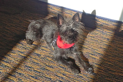 Penny lounges in the sun under the desk in our hotel room.