Cherry Drying: A Narrated Video

Experience the glamour of being a helicopter pilot!

Drying Cherries
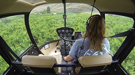
The camera position offers a clear view out the windscreen, as well as the instrument panel, and my hand on the collective. It also offers partial views out the side windows.

I’ve been fiddling around with my GoPro camera setup. A few years back, I positioned a mount between the two back seats. A few weeks ago, I put my Hero 3 Black in there and played around with various video options. I was satisfied with — I can’t say I really like — the results. Other people who saw stills and videos seem to like it a lot.

I think adding audio really made it better, though. Through the use of a cable I bought online, I can get audio right from the helicopter’s intercom system. That means you can hear anyone talking in a headset as well as radio communication. I think this can be an excellent teaching tool.

Cherry Drying?

I’ve been drying cherries in Washington state since 2008. As I write this, I’m starting my ninth season.

If you have no idea what this is all about, here’s the short version: In the last few weeks before harvest, cherries are susceptible to damage when it rains. When the cherries get wet, they absorb water though the skin and they split. They can also get mold or mildew growth. It’s bad; if 50% or more of a grower’s crop is damaged, he won’t pick at all. So growers hire helicopters with pilots to stand by in the area. When it rains, they call us out to hover low over the trees. This shakes the branches, thus shaking off most of the water.

Want more info? Here’s a post I wrote about this years ago.

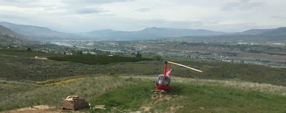
I gave it a try on Saturday when I dried a new (to me) cherry orchard in East Wenatchee. The resulting video was about 45 minutes long. But when I edited out the flight to the orchard and the flight home, it shortened up to 25 minutes.

So if you’d like a good, long look at what it’s like to fly a helicopter low and slow over 16 acres of cherry trees in a wire-rich environment, here’s your chance. I warn you now: it isn’t riveting stuff. In fact, it’s downright tedious. The only thing that makes it remotely sharable is the narration, where I chatter away about what I’m doing and thinking. See for yourself:

I warned you!

And yes, I should be wearing a flight suit. I promise to wear it for the rest of the season.

And while I should also be wearing my helmet, there’s a limit to how much discomfort I’m willing to endure these days while doing this work.

My Helicopter’s Annual Migration from California

I take a few days off and fly from California to Washington solo.

Last week, I flew my helicopter home from a frost contract in California. I took the opportunity to treat myself to two nights in a bed and breakfast I’d been wanting to stay in for some time. Then I made the solo trip home, taking a coastal route for part of the way. I thought I’d share some information about why I go to California every winter and the highlights of this particular trip.

My Annual Frost Migration

In 2013, I got my first contract as a frost control pilot in California’s north Central Valley. That year, my helicopter was still living in the winter in Arizona and, as I flew it westward with my dog, I realized with a bit of sadness that it would likely never be back in Arizona. When that contract ended, I flew it north to Washington for cherry season. I left my home in Arizona in May 2013 and bought the land for my new home in Washington before the ink on my divorce papers was dry in July 2013.

The helicopter spent that winter in a hangar in Wenatchee. In February, I flew it south again for my second season on frost. That contract required me to stay in the area, so I migrated down in the mobile mansion and stayed there for two months. I came back in April.

My helicopter moved to its new home on my property in Malaga in May 2014, at the start of cherry drying season. By October, it was tucked away inside my building, which I designed primarily to house it, the mobile mansion, and my collection of vehicles. When I got busy with construction on my place in December and needed to shift the RV into the helicopter’s parking space, I moved it back out and into a hangar at Wenatchee Airport. (Thanks, Tyson!) Then, in February, it was back to California for my third frost season. Like my first frost contract in 2013, I didn’t have to live there with it — I wanted to stay home to continue construction and enjoy the spring blooming season. But in late April, it was time to bring it home again.

A lot of folks ask me why I fly the helicopter to and from these agricultural contracts instead of putting it on a trailer. There are three reasons:

  • I don’t have a trailer that would accommodate the helicopter and I don’t want to buy one. A trailer that can support the helicopter and its blades/tailcone properly would cost about $30,000. I could fly a lot of hours for that amount of money. And I’d still have to cover the cost of the drive, although it wouldn’t be nearly as much.
  • I don’t know about you, but the thought of driving down the highway with a $350K investment towed behind me is pretty scary. All it takes is one asshole cutting me off to turn that shiny red machine into a heap of junk on the side of the road. Simply stated: I think flying is safer for it.
  • I like to fly. ‘Nuff said.

I factor in the cost of transporting the helicopter when I decide whether a contract is worth my while. I don’t take contracts that would put me in the red if I didn’t actually fly on contract. That would be dumb.

But with that said, I do often take either passengers for hire or pilots wanting to build time with me on those long repositioning flights. I’ve been doing this since 2008, when I started migrating between Arizona and Washington for cherry season. I cut various deals with various people, depending on what the market will bear. Sometimes passengers or pilots just pay for gas. Other times, they pay a rate that covers all my costs. Most of the time, I collect something in between. This helps make the contract a tiny bit more profitable, often while giving a new pilot a chance to build some flight time in an R44 and gain some valuable cross-country flight experience.

I know I flew solo from Arizona to California that first season (2013) and I’m pretty sure I flew solo from California back to Washington. But in 2014, I had pilots do the flying with me as a passenger on both flights. And on the way down in 2015, another pilot flew while I just sat in my seat, trying not to be bored.

I decided that for the return flight, I’d be be pilot and I’d treat myself to a flight up the coast.

After all, I really do like to fly.

Potential Passengers

I asked a bunch of people who I like if they’d like to join me on that return flight. I got a bunch of interesting responses.

Four people could not go because of work they simply couldn’t get out of. I’d planned my trip for mid-week, so that really shouldn’t have been much of a surprise.

One person, who is also a helicopter pilot, wanted to go but had to work. I think he would have gotten out of work if I’d let him share the flying duties with me. But I made it clear up front that I would be doing most of the flying. In fact, I didn’t even want the dual controls in because I didn’t want that counterweight. (I would have put them in for him.) Without the bonus of stick time, it wasn’t worth taking time off from work.

One person couldn’t come because his wife’s mom is seriously ill and they expect her to pass away soon. We agreed that it would be better if he didn’t come. (She hasn’t died yet, but she’s close.) And yes, I did tell him he could bring his wife.

One person couldn’t come because he didn’t want to spend $300 on a one-way plane ticket to Sacramento. He had that money earmarked for other things. “Next time,” he said. I’m not sure if he realizes that there probably won’t be a next time.

And there were the usual collection of pilots wanting to build time. When I told the ones who contacted me that I’d be doing the flying, they all passed on the opportunity to come along as a passenger.

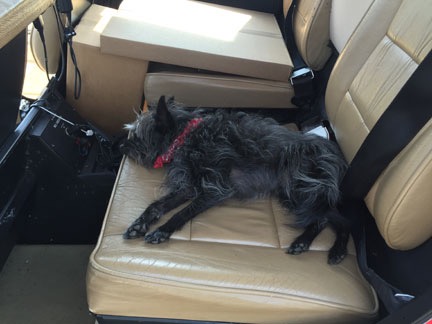
So as Penny and I boarded the flight to Sacramento on Tuesday morning, we knew it would be just the two of us in the helicopter on the way home. I’d fly and drink up all the sights along the way. Penny would do what she always does on the helicopter: sleep.

Prepping for the Return Flight

My flight down to Sacramento didn’t go as smoothly as I would have liked. I was supposed to get into Sacramento at 11 AM, but the 6 AM flight out of Wenatchee was cancelled due to a bird strike on the starboard engine the night before. The morning pilot had seen some of the damage during his preflight walk-around and a mechanic confirmed that the bird — likely an owl — had been ingested into the turboprop engine. That plane wasn’t going anywhere soon.

Through some miracle, I managed to get on the next flight out later that morning. Then an afternoon connection to Sacramento. I stepped off the plane there at around 4 PM and was driving away in a rental car by 4:30.

My whole day in the area was shot to hell. I managed to do some errands before heading out to Rumsey where I was booked at a bed and breakfast for the night. I’ll blog about that in another post.

Wednesday’s forecast called for strong winds from the north. That would cause two problems:

  • Strong, gusty winds make turbulence. I really hate long, bouncy flights, especially when I’m trying to take a scenic route.
  • Strong winds from the north when I’m flying north meant longer flight times and more fuel stops. If I cruise at 110 knots and there’s a 40 knot headwind, that means I’m only doing 70 knots. Hell, I could drive faster than that.

Penny in the Helicopter
Penny lounges in the back seat of the helicopter while I prepped it for the flight home.

So I decided to spend another night in the area and leave early the next morning. In the meantime, I went to the airport, preflighted, wiped down the windows, and prepped it for flight. I’d be taking off as early as possible the next morning.

Locally, the wind was maddeningly calm all day.

The Flight Home

Penny and I were back at the airport at 6:10 AM on Thursday morning. Although the sun hadn’t peeked up over the horizon yet, as far as I was concerned, it was daytime.

I put Penny in the front seat beside me with a cooler full of drinks and snacks in the footwell there, within reach. The back was packed with some luggage and the equipment I’d left with the helicopter over the previous two months: blade tie-downs, cockpit cover, spare fuel pump, and miscellaneous equipment. My GoPro was mounted on the nose with the WiFi turned on. My iPad and iPhone were mounted within reach; I’d use Foreflight on my iPad to navigate and listen to podcasts and music on my iPhone.

The helicopter started right up and I gave it plenty of time to warm up. Then I took off to the west along Cache Creek and opened my flight plan by tapping a button in Foreflight.

Although I didn’t often file a flight plan when flying solo, I’d forgotten to bring along my SPOT Messenger and I wanted some way of being found in the event of a mishap. My flight plan had me heading west along Cache Creek all the way to Clear Lake, then hitting the California Coast at Fort Bragg. But because it was so early and the California Coast is notorious for morning fog and I’d already passed some low clouds near Willits, I took a more northerly route.

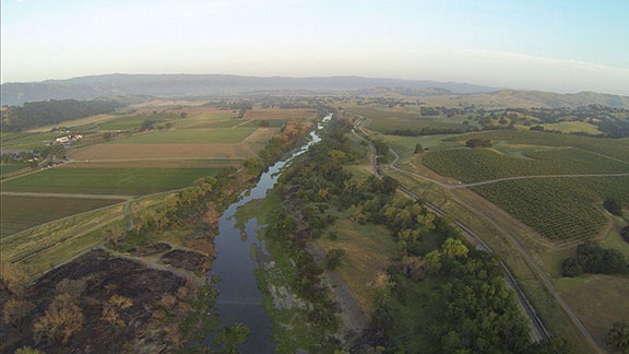
Cache Creek at Dawn
Flying up Cache Creek just after dawn.

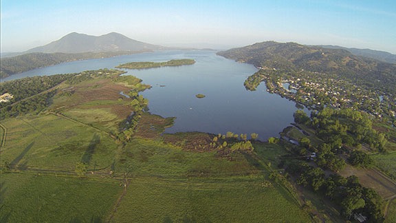
Clear Lake
The lower end of Clear Lake.

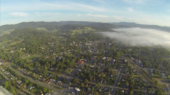
Willits, CA
Low clouds over Willits, CA.

Along the way, I played around with Periscope. This is a Twitter-owned video broadcast service that makes it possible for anyone to broadcast anything to the world in real time. My iPad was mounted in such a way that its camera looked right through the front of the helicopter’s bubble, so the picture wasn’t bad at all. Unfortunately, the rotor sound made it impossible to hear any narration from me, so although I saw viewers’ questions, I couldn’t answer them.

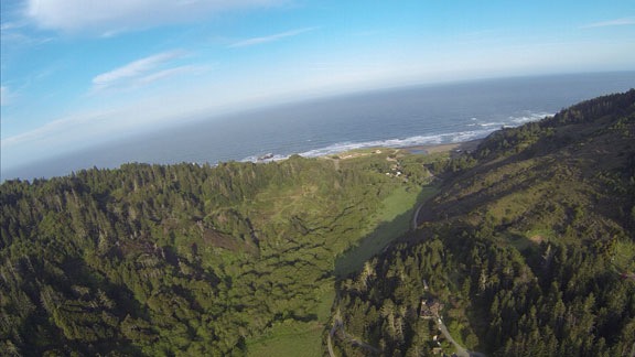
Faced with a choice of following a valley north or striking out across the hills to the coast and following that, I finally headed for the coast. I came down a little green canyon between Westport and DeHaven and banked to the right to start my flight up the coast. (I was broadcasting during this time, so my Periscope followers got to watch it live.)

California Coast
My first sight of the Pacific Ocean from the Helicopter since my trip to Lopez Island last August.

Flying Up the Coast
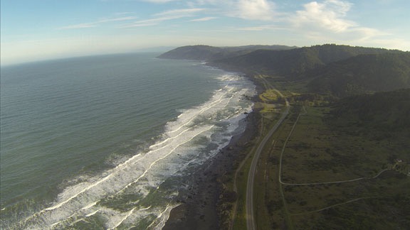
I flew up the coast at my usual altitude of 500 to 700 feet AGL.

I was surprised, at first, how smooth the flying was. I had been expecting some wind and, with it, turbulence. But just when I started enjoying the smooth air, the turbulence hit. With a vengeance. Within 20 minutes of arriving at the coast, I was bouncing all over my area of the sky.

I headed inland. For another 20 minutes, the bouncing continued. I tried higher elevations to avoid the effect of the wind over the hills — mechanical turbulence. This is the kind of turbulence that most often affects my flights, mostly because I fly so low to the ground. But climbing didn’t help. The only way out of it was going to be to fly somewhere where there was less wind.

Of course, while all this was going on, I was burning fuel at a higher rate than expected. That meant I wasn’t going to make my first fuel stop as far north as Crescent City. I used Foreflight to find a closer alternative. I could make Eureka or Arcata, both of which were on the coast. I checked weather there using the Aeroweather app and saw the wind was much calmer. By that time, the bouncing had stopped anyway and flight was smooth again. So I hooked up with the South Fork of the Eel River at Myers Flat, followed that down to the Eel River, and followed that down to Fortuna.

At the coast, a marine layer had moved in but was burning off quickly. I flew just below the clouds, north from Fortuna to Eureka, where I landed for fuel at Murray (EKA) and closed my flight plan. Their pumps are ancient and attendant-run, which didn’t bother me in the least. When I do long cross-country flights, I don’t mind paying more for someone else to do the pumping. I let Penny out and we went into the FBO for a bathroom break. They had a surprisingly large pilot shop there with lots of goodies. But I wasn’t in the mood to shop so I didn’t linger.

I chatted with the attendant about the weather. I really wanted to fly up the coast but I really didn’t want to do scud-running along the way. He thought it would clear up. I figured I’d head north along the coast as long as I could see, then strike out to the west. I whipped up and filed another flight plan, then added a quart of oil and fired up the helicopter. Minutes later, Penny and I were airborne again, heading north on the east side of Arcata Bay.

We stayed on the coast for quite a while. I turned on my helicopter’s nosecam as we flew up the coast past the Redwood National Forest and various other places. The views were amazing. There were sandy stretches of beaches, sheer cliffs, and rocky islands. I saw sea lions and sea birds. But I think it was the sheer number of waterfalls tumbling off the cliffs into the Pacific Ocean that really stood out for me. It was just the kind of trip I’d hoped for. It was only after I thought I’d shot at least a half hour of spectacular video that I reached down to shut off nosecam — and realized that it hadn’t been turned on. Duh-oh! I did manage to get some good shots and video later on, but not until after a fine mist started moving in.

Waterfall
There’s nothing quite as awe-inspiring as a waterfall tumbling off rugged cliffs into the ocean.

The mist turned to rain around Gold Beach, OR and I decided to move inland in search of clearer weather. Unfortunately, there was no joy. I took an incoming call from a pilot friend based in California who’d just gotten some bad news about an engine overspeed on his R44. We chatted for a while as I flew between green hills and low clouds while a light rain pelted the cockpit bubble. Then the call dropped and I continued through the muck in silence.

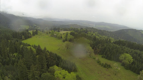
Green Hills Near Umpqua
There was no way to keep the rain off the nosecam’s lens cover. This was the view as we headed northeast near Umpqua, OR.

I hooked up with I-5 near Yoncalla, OR. From that point, it was a bit of IFR — I follow roads — flying. It wasn’t that I had to follow the road — I could see fine. It’s just that there was no reason to fly further east because mountain obscuration made it impossible to cross the mountains anyway.

I stopped for fuel at Creswell. I’d stopped there before. I pumped my own fuel, used the restroom, and checked the oil. It was still raining lightly. One of the interesting things there is a vending machine that sells aviation oil. I didn’t need to use it — I learned long ago to always carry at least two spare quarts and actually had six on board for this flight — and I wish I’d taken a photo of it.

We were there less than 15 minutes. I continued north along I-5, now in Oregon’s “central valley.” I broadcast another Periscope video just past Eugene, then peeled away abeam Harrisburg to the northeast. Although I couldn’t see the mountains at all, I still had high hopes of crossing the Cascades at the foot of Mount Hood’s north side. After all, how big could this weather system be?

Apparently, it could be pretty big. I got within 40 miles of Mount Hood and still couldn’t see it. If anything, the clouds were lower and thicker. I heard some helicopter pilots chatting on one of the frequencies about low ceilings. One was doing training and the other was doing powerline survey work. They shared information about holes in the weather but since I didn’t know any of the places they talked about, none of it helped me.

Near Mt. Hood
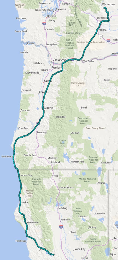
My track took me pretty close to Mount Hood. I never saw it. My track is the teal dots in this map capture; the red dots represent geotagged photos.

So the scud running began. I wasn’t in the mood for it at all, so I didn’t put much effort into it. Instead of following valleys to the northeast that might have got me closer to my destination, I just headed north, hopping over hills and ducking under clouds along the way. I knew that eventually I’d reach the Columbia River, my old standby for crossing the Cascades. And sure enough, just when I thought the ceilings couldn’t get any lower, I found myself at the edge of a drop down to the water. There were clouds below me, but a big enough hole to dive right through. I descended at about 1500 feet per minute and leveled out about 400 feet over the river’s surface.

Columbia River
Leveled off over the Columbia River not far from Multnomah Falls.

My reward: an amazing view of Multnomah Falls, off to my right. (Sorry — no photos. My nosecam faces forward, not sideways.)

I followed the river northeast, flying in a sort of tunnel created by the walls of the gorge and the low clouds. I overflew the Bonneville Dam and Cascade Locks and the town of Hood River, which I really liked before it got so upscale. At Lyle, one of my least favorite places on earth, I turned to a more northward direction. That eventually put me over the Yakima Indian Reservation. I don’t know if it’s pretty. By this time — more than 7 hours of travel, including stops — I was tired and just wanted to be home. But the sky gods were going to make me work for it. They threw just enough headwind and turbulence in my way to make me ready for another fuel stop at Yakima.

The FBO’s fuel guy did all the work. I got something to drink and relaxed a while in a comfy chair while Penny looked around for dropped popcorn. We’ve spent entirely too much time at McCormick at Yakima.

Fueled up and feeling refreshed, we headed out again, continuing north. Although I could have gone direct to my home from Yakima, I had a small task to do along the way — I needed to check out a possible landing zone for an anniversary flight in June. The location was off I-90 across the river from Vantage.

That done, and feeling great to be back in very familiar territory, I dropped down and raced up the Columbia River, only 100 or 200 feet from the surface. Wanapum Reservoir was full again — it had been drained for dam repairs all last year — and it was great to do one of my favorite flights. I passed Sunland, where the folks who sold me my property live in the summer months, Cave B and the Gorge Amphitheater, and Crescent Bar. I saw a huge herd of elk down on West Bar before beginning my climb to clear the wires that crossed the river between the mouth of Lower Moses Coulee and Rock Island.

Then I was climbing up toward my home and my old landing zone was in sight. I set the helicopter down on the grass and let Penny out while I cooled down the engine and shut everything down.

Old Landing Zone
I shot this from my deck while having a very late lunch.

It was almost 3 PM.

I left the helicopter outside while I went in to make myself a good meal and relax. The wind kicked up and, for a while, I thought it would have to spend the night outside. But the wind died down after 6 and I got my ATV hooked up to the platform and repositioned it on my driveway’s landing zone. Then I started up the helicopter and moved it onto the platform. When the blades stopped spinning, I locked them in place and used the ATV to pull everything into the garage beside my RV.

RVs
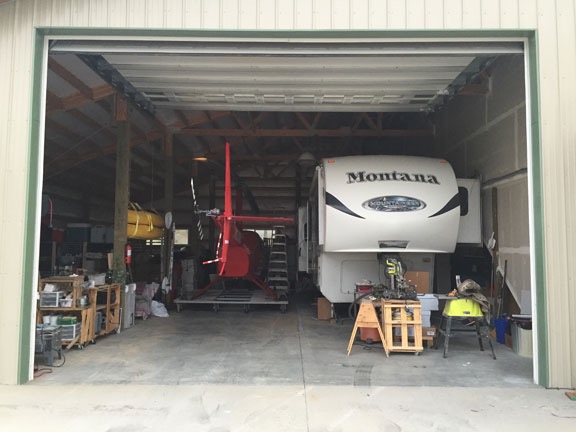
Recreational vehicles? Must be. It’s an RV garage, after all.

Track Log
Here’s my track log for the entire flight. I was about 20-30 minutes into the flight when I remembered to turn it on, so it doesn’t accurately show my starting point.

According to my GPS tracklog, I’d traveled about 750 miles in 6-1/2 hours of moving time. It had been a great flight with lots of different flying conditions and things to see to keep it interesting. I’d enjoyed it, despite the moments of turbulence. It’s a shame that I had to do the flight alone. I’m sure every single person I invited would have loved it.

Next time? Maybe — if there is a next time.
About the Wind Machines

An important part of crop protection.

The economy of this area of Washington State is based primarily on tree fruit production: apples, cherries, pears, and apricots. Indeed, Columbia River Valley around Wenatchee is one of the biggest apple producing regions in the world.

Fruit trees bloom in the spring, are pollinated by migratory bees, and form fruit. Throughout the summer, the fruit develops and grows. Months later, when the fruit ripens, it’s picked, sent to processing plants, and either shipped out immediately, as in the case of cherries, or stored for later shipment, as in the case of apples.

The timing of all this is determined by the weather and can fluctuate by several weeks every year. The trees get a cue from temperature to start budding and once the buds are formed, there isn’t much that can stop the seasonal progression.

Except frost.

Frost can kill flowers and developing fruit. A bad enough deep freeze over the winter months can even kill trees.

And that’s where frost protection comes in. Growers are deeply concerned about frost destroying a crop so they take steps to protect the crop from frost. In this area, they rely on wind machines to circulate the air in parts of an orchard prone to pockets of cold air.


This video shows wind machines in action at a pear orchard in Cashmere, which is near here. It looks to me as if the trees are in bloom. Unfortunately, the sound is turned off so you can’t get the full effect.

Wind machines look like large, two-bladed fans on a tall pole. Usually powered by propane, they’re often thermostatically controlled — in other words, they are set to turn on in the spring when the temperature drops down to a certain point. The blades spin like any other fan and the fan head rotates, sending wind 360° around the machine’s base.

The idea, of course, is that the cold air has settled down into pockets and that warmer air can be found around it and above it. By circulating the air, the warm air is brought around the trees and frost is prevented.

In California, they use helicopters to protect the almond crop from frost. (As a matter of fact, as I type this my helicopter is in California for a frost contract for the third year in a row.) The principle is the same, but the orchards tend to be much larger and I can only assume that it isn’t financially feasible to install and run wind machines in that area. (Hard to believe it’s cheaper to use helicopters, though.)

This year, some unseasonably warm weather has triggered a very early bloom. My clients tell me that their cherry crop is running 2 to 3 weeks early. Right now, cherries are in various stages of bloom throughout the area; apricots are pretty much done with their bloom. (Apples and pears will come next.) And since winter has not let go of its tenuous grip on us, the temperature has been dropping down into the low to mid 30s each night this week.

Well, not at night. It actually starts getting cold around 4 or 5 AM, as you can see in this weather graph:

Weather Graph
The National Weather Service weather graph page for this area shows the forecasted highs and lows over time.

The result: the wind machines kick on automatically when it starts getting cold: around 4 or 5 AM.

Want to hear what a wind machine sounds like close up? This video has full sound as a field man starts and runs up a wind machine. He’s wearing ear protection for a reason. Stick with it to see the spinning head on top.

Wind machines are not quiet. In fact, from a distance, they sound exactly like helicopters. And as they spin, they sound like moving helicopters — so much so that when I first heard them in action back in Quincy in 2009 or 2010, I thought they were helicopters and actually got up to see what was going on. I suspect that to someone on the ground, they sound exactly like a helicopter drying cherries would sound.

Although there aren’t any orchards on my end of the road, my property does look out at quite a few orchards, some of which have wind machines. There are at least 5 within a mile of me — I can see 4 of them from my side deck. I can also see others much farther out into the distance. And when the close ones are running, I know it. It’s not loud enough to wake me up in my snugly insulated home, but it sure did wake me up when I was living in my thin-walled RV outside. And it’s definitely not something you can pretend you don’t hear.

Fortunately, wind machines are a seasonal nuisance — much like other orchards noises: sprayers, tractors, helicopters, and pickers. Although frost season runs through May in this area, the machines only kick on during cold weather. Looking at the forecast, I can expect to hear them tomorrow morning and probably Wednesday morning, but not likely on Monday or Tuesday morning.

Weather ForecastNWS Wenatchee forecast for this week.

In the meantime, I’ve already gotten the heads up from my California client who might need me down there on Monday. After all, they don’t have wind machines.

For a helicopter pilot working in this area, wind machines are one of the obstacles that can be a hazard when drying cherries. They tower higher than the trees and their blades can be “parked” at any angle or direction. Although some growers will try to use wind machines to dry trees while waiting for pilots, my contract states I won’t fly in an orchard with wind machines spinning so they’re usually turned off when I arrive — or right afterwards. But if the blades aren’t parked, they can move. And one pilot I know learned the hard way about what happens when a helicopter’s main rotor blade hits a wind machine. (He’s okay; the helicopter is not.)

To sum up, wind machines are an important crop protection device that can be a bit of a nuisance with predawn operation in the spring. But I don’t mind listening to them. Like so many orchard owners in the area, my livelihood depends on a healthy cherry crop. If that means tolerating some noise 10-20 mornings out of the year, so be it.

On Spur-of-the-Moment Travel

It’s amazing where you can be in just a few hours.

I’m on my third consecutive year as a frost control pilot. I haven’t written much about this, mostly because I haven’t actually had to fly a mission. But for the third year in a row I’m being paid to have my helicopter ready, with relatively short notice, to fly slowly over almond trees on cold California mornings.

The Back Story

My first year’s contract, back in the winter/spring of 2013, had a relatively low standby pay for 60 days, along with compensation to move the helicopter from its base — in Arizona, in those days — to California’s Central Valley. Because I wasn’t sure about my living situation that winter — after all, my future ex-husband could get his head out of his ass and accept the very generous settlement offer I made and I’d have to move — I moved my truck and RV to California as well, thus guaranteeing a cheap and comfortable place to live near my work. (After all, that’s why I bought the RV; as a place to live when I was on the road with the helicopter.) I spent about two months traveling with Penny the Tiny Dog between Phoenix, Sacramento, and Las Vegas, getting called out just once for two days. I happened to be in Vegas at the time, so it wasn’t a big deal to change my plane ticket and spend a few days in California instead of returning to Arizona.

Last year I took a very different contract. It paid a generous standby rate for six weeks but I had to live near the fields. This turned out to be very convenient for me since I was out of my Arizona home for good and didn’t have a home in Washington yet. I brought the RV and helicopter down in mid-February and stayed until the middle of April. I really got to know the area, made new friends, went hiking and kayaking several times, got comped on a balloon ride, and even learned to fly a gyroplane. It was like being on a paid vacation in a pleasant place, with warm days and lots to do and see. If I did have to work, it would likely be between 3 AM and 7 AM, so days were free to do as I pleased.

Although the money was great, the drawback to that contract was the simple fact that I couldn’t get back to Washington until April. I wanted to be back earlier. I wanted to experience the spring: seeing orchards in bloom and leafing out, hiking along streams full of snow-melt runoff, starting a garden. So when December 2014 rolled along, I decided to try to get a frost control contract like the first year.

And I did.

I brought the helicopter down to California on February 22. The RV would stay home — with me — as I finished work on my home and enjoyed the spring.

That’s the back story.

Call Out

Frost control is not like cherry drying. In cherry drying, I’m required to be ready to fly at a moment’s notice. I can monitor the weather closely and vary my daily routine based on the likelihood of rain. When my clients call, they expect me to be airborne in minutes.

In my frost contract, the client monitors the weather closely and, if there’s a possibility of frost, he initiates a callout. My contract requires him to do this by at least 12 hours before he expects me to fly. This gives me the time I need to get to California from Washington. I’m paid for the callout — the fee covers my transportation with a bit to spare. And then I’m paid a generous hourly pilot standby fee from the moment I get to my California base until I’m released the next morning. If I fly, I’m paid a flying rate for that. The next time I’m called out, the process starts all over again

When I brought the helicopter down to California this year, I built in a few extra days to spend some time with friends in the area. When those plans fell through, I kept myself busy by reacquainting myself with the area and visiting other friends. But I couldn’t have timed it better. I was put on standby two of the three nights I was already down here. I was able to earn the callout and standby fees without incurring the related travel expenses. Although it did require a minor flight change for my return home with a $25 fee, that’s still pretty sweet. Really made it worth the trip.

I went home last Wednesday and got back to work on my home. The cabinets were installed on Thursday and Friday and the appliances were delivered on Saturday. Timing was everything and I lucked out.

My client called on Friday to make sure he understood how much lead time I needed to get back to California. Cold temperatures were forecast for Sunday through Wednesday nights. He wasn’t calling me out — yet. But he wanted to make sure he knew how much time would be needed to get me in position. I told him that if he called me by 3 PM, I’d be able to make it to the helicopter by 10 PM and be on standby overnight.

Of course, I watched the temperatures, too. Unfortunately, the forecasts of my various weather sources aren’t nearly as accurate as those available to almond growers, by subscription, from an agricultural weather resource. I had to rely on them to call me and didn’t want to fly down unless I had to.

So each day the forecasted low was 40°F or lower, I’d be a nervous wreck, wondering whether I’d get a call. Once 4 PM rolled along, I’d relax. I did this on Sunday and Monday and got a lot of work done at my place. But I did pack an overnight bag on Monday afternoon, just in case.

On Very Short Notice…

On Tuesday, at 3:22 PM, my phone rang. It was my client. He’d been sitting on the fence about calling me down. Forecasted lows were 32° to 39° in the area. He told me that he knew from experience that if the forecast said 32°, it could go lower. Better safe than sorry. He was calling me out.

Fortunately, I was sitting at my desk answering an email message when he called. When I hung up, I got on the Alaska Air website. There was a flight out of Wenatchee at 5:20 PM — less than two hours from then — and I needed to be on it. I booked the flight from Wenatchee to Seattle to Sacramento. I’d arrive at 9:28 PM.

While I was at the computer, I searched for car rentals in Sacramento. Thrifty had one for $22/day. Rather than book online, I called directly. With my bluetooth earpiece in my ear, I made car reservations as I changed my clothes and put a few more things into that suitcase.

I decided to board Penny. She’d been with me on the last trip and I thought I’d keep things a lot simpler by leaving her behind this time. So I packed an overnight bag for her with enough food for 2 days — just in case I needed to stay over an extra night. Club Pet is on my way to the airport, so dropping her off only took 5 minutes, especially since the paperwork was already waiting for me. As I type this, she’s likely playing out in the yard with the other dogs.

I checked into my flight and chose my seats using the Alaska Air app on my phone while stopped at a traffic light. I only had one bag — a carry-on — so I didn’t need to stop at the counter.

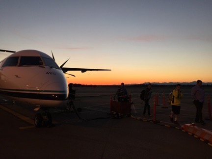
Seattle Sunset
I got off the plane in Seattle just after sunset.

I was at the airport, through security, and sitting in the waiting area by 4:45. That’s less than 90 minutes after getting the call. At 6:07 PM, I stepped off the plane from Wenatchee onto the tarmac at SeaTac. This is one of the best things about living in a small town with airline service: it’s so damn quick and easy to catch a flight out of town when you need to.

I grabbed dinner at SeaTac’s Terminal C before catching my flight to Sacramento.

It was an amazing flight. The moon had risen and was almost full. The land beneath us was illuminated with moonlight. I sat at the window on the A side of the plane and watched as we passed Mt. Rainier and Mt. Hood. Our flight path took us down the Cascade range in Oregon, over the Three Sisters and other mountains there. I could clearly identify the towns I knew on Route 97 from the location of their airport beacons in relation to the town’s lights. The moon’s bright orb reflected back up at me from streams, marshes, and lakes. The flight couldn’t have been any smoother, either.

We touched down in Sacramento fifteen minutes early. I was out of the terminal waiting for the rental car shuttle bus by 9:30 PM. Later, I’d settle down in a Best Western for the night. I slept like a log until 5 AM.

Although a call to fly never came, I don’t mind making the trip. I will be well compensated for my time and the inconvenience of dropping everything to spend a few days in California. My client is satisfied, glad he can count on me to come when called. It’s all good.

I’ll kill some time here today and catch a flight home either tonight or tomorrow morning. I’m flexible and it’s a beautiful day.

About the Header Images

A quick summary of where the current images were taken and who I was with.

You may not realize it, but I shot all of the photos that appear in the header on this site. There are currently more than 90 of them and they’re set up to appear randomly. Each time you visit this site or click a link to another page here, the image up top should change.

I noticed just the other day that although all images were shot within the past 10 years, the vast majority were shot when I was alone. That made me realize how much I traveled by myself, even when I was married, and how the places and things I saw were beautiful or interesting enough to capture an image of.

Anyway, here are the images, with summaries.

Alfalfa

Alfalfa

This was an alfalfa field near where I spent my summer in Quincy, WA. I think I shot this in 2008. Alone.

American Coot Family 1 & 2

American Coot Family

American Coot Family 2

I shot these two images at Quincy Lakes in Quincy, WA in 2008. Alone.

Bark

Bark

Birch Bark 2

I like photos that show texture. These close up photos of bark were shot at Quincy, WA in 2008. Alone.

Barn Roof, Wagon, and Waterville Farmland

Barn Roof

Barn Wagon

Waterville Farmland

These three images were shot on the Waterville Plateau near Douglas, WA, probably in 2009. I was with my wasband.

Basalt Cliffs

Basalt Cliff

I’m pretty sure this photo was shot while repositioning my RV from Washington to Arizona by way of Glacier National Park with my wasband — one of the last “vacations” we had together — in 2009. I think it’s at Palouse Falls.

BC Mountains Pano

BC Mountains Pano

This was shot from a cruise ship on an Alaska Cruise with my wasband in 2007. Our last day on board took us between Vancouver Island and the mainland.

BHCB

BHCB

This was shot at Quincy Lakes in 2008 or 2009. I assume BHCB is an abbreviation for the type of bird. Alone.

Birch Leaves

Birch Leaves

I liked the way the sun shined through these leaves in the late afternoon. Shot at Quincy near the golf course in 2008. Alone.

Blue Heron & White Heron

Blue Heron

White Heron

I was kayaking with my dog at Lake Solano in Central California in 2014 when I shot these photos of herons.

Bowman Lake

Bowman Lake

This was shot at Glacier National Park in 2009 while traveling from Washington to Arizona with my wasband.

Bryce and Bryce Dawn

Bryce

Bryce Dawn

These two photos were shot at Bryce Canyon in 2011. I’d gone there with a client in January on a photo flight for this 360 interactive panorama: Bryce Canyon in Winter, Utah, USA.

Cache Creek

Cache Creek 1

Cache Creek 2

Cache Creek 3

Cache Creek 4

These four images of Cache Creek were taken from my helicopter’s nosecam on an early morning flight up Cache Creek in Central California in 2014. I was alone.

Cascades

Cascades

This image of a ridge and cloud-filled valleys was taken from my helicopter’s nosecam on a flight between Wenatchee, WA and Hillsboro, OR in 2012. I blogged about the flight here and shared video from the flight here. It’s notable not only for the perfect weather and amazing scenery, but because it was my dog Penny’s first helicopter flight — 90 minutes long! And yes, that is Mt. St. Helens in the background.

Cherry Drying Cockpit

Cherry Drying Cockpit

This is a shot from a GoPro camera mounted in the back of my helicopter during a cherry drying flight. It was probably taken in 2011.

Close Up Wheat

Close Up Wheat

This closeup of wheat growing in a field in Quincy, WA was shot in 2009. I was alone.

Combine

Combine

This aerial shot of a wheat combine at harvest on the Waterville Plateau in North Central Washington was shot in 2011 during a flight between Wenatchee and Coeur d’Alene, ID. My friend Jim was flying his helicopter; I was on board with a camera.

Corn

Corn

I like patterns. This field of young corn plants in Quincy, WA was capture in 2009. I was alone.

Cows in the Road

Cows in the Road

I was on my way up to my old Howard Mesa, AZ place one bright winter day when I came upon these cows following tire tracks in the road. When I approached, they just stopped and stared. I took a photo before continuing, herding them along with my Jeep. I can’t be sure of the date, but I expect it was around 2003 or 2004. I was probably with my friend Jeremy.

Cracked Mud

Cracked Mud

I shot this alongside the road to Alstrom Point on the northwest end of Lake Powell in Utah. It was probably shot in 2008. I was alone.

Crescent Bar View, Yellow Flowers

Crescent Bar View

Yellow Flowers

I shot these photo of Crescent Bar in Quincy, WA in 2009 not long after drying a cherry orchard down by the river there. I was alone.

Dandelion

Dandelion

I shot this photo of a dandelion seed puff in Quincy, WA in 2008. I was alone.

Desert Still Life & Desert Wildflowers

Desert Still Life

Desert Wildflowers

I shot these photo of hedgehog cacti blooms and California poppies near Wickenburg, AZ between 2009 and 2011. It was probably on one or two Jeep outings and I was probably with either my wasband or my friend Janet.

Fern

Fern

Patterns and textures again. This was shot in Alaska sometime during a cruise with my wasband in 2007.

Float Plane

Float Plane

I shot this image of a float plane taking off at an Alaska port while on a cruise with my wasband in 2007. It was shot from the balcony of our stateroom.

Golden Gate Bridge

Golden Gate Bridge

This image of the Golden Gate Bridge was shot during a trip to San Francisco in 2011. Not sure if I was alone — isn’t that odd? — but I was probably there for a Macworld Expo speaking gig.

Glacial River Rocks

Glacial River Rocks

I shot this closeup of rocks in a river bed while on a trip to Denali National Park in 2007 with my wasband.

Golf Balls

Golf Balls

Attach a GoPro to the bottom of a helicopter with the lens pointing down. Then hover over a golf course green and drop hundreds of golf balls. This is what it might look like. Shot in late 2011 or early 2012. My client was dropping the balls.

Grand Canyon Sunset

Grand Canyon Sunset

I’ve been to the Grand Canyon countless times so I don’t know exactly when this was taken or whether I was alone. I know it was shot before the summer of 2011.

Gyro Cache Creek & Gyro Pattern

Gyro Cache Creek

Gyro Pattern

I learned how to fly a gyroplane in the spring of 2014. These two shots were made with a GoPro mounted on the mast. In the first shot, I’m flying up Cache Creek; in the second, I’m doing a traffic pattern at Woodland Airport. Both were shot in Central California.

Hay Bales

Hay Bales

I’m pretty sure this was shot on the road between Upper Moses Coulee and Waterville in North Central Washington in 2009. I was alone.

Helicopter

Heli Header

This is a photo of my helicopter right after sunrise parked out near my new home in Malaga, WA. I shot this in 2014; I was alone.

High Tension

High Tension

This was shot in 2008 near the Chief Joseph Dam near Bridgeport, WA. I was on a daytrip with my wasband.

Hopi House

Hopi House

Another trip to the Grand Canyon. I suspect I was alone when I shot this one, possibly on a day trip by helicopter with clients from Phoenix. Sometime between 2009 and 2011.

Houses

Houses

Here’s another straight down image shot with a GoPro from my helicopter. This was Peoria, AZ in 2011 or 2012. I was alone.

Inspecting Bees

Inspecting Bees

I set up a GoPro on a tripod to record a beehive inspection in 2013. That’s me in the picture; I was alone.

International

International

This is a closeup of an old International truck parked outside the bakery at Stehekin, WA. I was there with my wasband and another couple on a helicopter trip in 2011.

Juvenile Robin

Juvenile Robin

Shot in 2008 at Quincy, WA. I was alone.

Ladders, Side

Ladders Side

Patterns again. These are orchard ladders neatly stacked at an Orchard in Quincy, WA. Shot in 2008.

Lake Berryessa

Lake Berryessa

An aerial view of Lake Berryessa in Central California, shot with my helicopter’s nosecam in 2014. I was alone.

Lake McDonald Sunset

Lake McDonald Sunset

This was shot on a trip to Glacier National Park with my wasband in 2009.

Lake Pleasant

Lake Pleasant

Another nosecam image from my helicopter. This is a dawn flight over Lake Pleasant near Phoenix, AZ. I was alone.

Maine Coastal Town & Main Fog

Main Coastal Town

Maine Fog

I shot these during a trip to Maine to visit some former friends with my wasband back in 2008 or 2009.

Marble Canyon

Marble Canyon

Another nosecam image from my helicopter. I’m pretty sure I shot this one on my way back from a Bryce Canyon photo shoot with a client in 2011.

Mini-Stack

Mini-Stack

An aerial view of the so-called “mini-stack” of at I-17 and Route 101 in north Phoenix, AZ. Probably shot in 2011 or 2012.

Mission Ridge Pano

Mission Ridge Pano

I shot this photo from Wenatchee Mountain near Wenatchee, WA during a jeep ride to Mission Ridge with my friend Don in 2014. What an amazing day!

Monument Valley

Monument Valley

I’ve flown over Monument Valley dozens of times. Once in a while, there’s a camera on the helicopter’s nose. This was probably shot in 2011. I was either alone or with aerial photo clients.

Monument Valley Wide

Monument Valley Wide

I used to do multi-day excursions by helicopter to Arizona destinations that included Monument Valley. While my clients took tours, I’d explore on my own. This is Monument Valley from the overlook, shot in 2010 or 2011.

Moonset Sunrise

Moonset Sunrise

I used to camp out at a friend’s place overlooking Squilchuck Valley near Wenatchee, WA. This was one of the early morning views from my doorstep. I was alone.

North to the Future

North to the Future

I shot this in Girdwood, AK in 2008. I’d gone up there alone for a job interview. I got an offer but turned it down. Beautiful place.

No Wake

No Wake

I shot this with my 10.5mm fisheye lens at Lake Pateros, WA in 2008. I was with my wasband.

Orchard Still Life

Orchard Still Life

These are apples culled from the trees in Quincy, WA. Shot in 2008; I was alone.

Peacock

Peacock

This is one of the dozens of peacocks strolling around at the Lake Solano campground in central California. I shot this in 2014; I was alone.

Penny Kayak

Penny Kayak

This is one of the few images I didn’t shoot. I was on a kayak trip in the American River near Sacramento with a Meetup group and one of the other members shot this and sent it to me.

Petrified Wood

Petrified Wood

I’m not sure, but I think this was shot in Vantage, WA in 2008 or 2009. I was probably alone.

Phoenix

Phoenix

Another nosecam image, this time of downtown Phoenix. Shot in 2011 or early 2012; I was likely on a tour with passengers.

Poppies and Chicory

Poppies and Chicory

Another desert jeep trip near Wickenburg, AZ. I could have been alone, with my wasband, or with my friend Janet.

Poppies Plus

Poppies Plus

This wildflower closeup was shot on a trip to the Seattle area, possibly in 2007 with my wasband and his cousin.

Quail Mom

Quail Mom

A Gambols quail hen and her chicks, shot from my doorstep in Wenatchee Heights, WA in 2012. I was alone.

Rafting

Rafting

Put a GoPro in a head mount, get in a raft, and head down the Wenatchee River and this is the result. I was rafting with a bunch of friends in 2013.

Red Wing Blackbird

Red Wing BlackBird

Red Wing Blackbird 1

Red Wing Blackbird 2

I shot these at Quincy Lakes in Quincy, WA in 2008. I was alone.

Rocks Under Water

Rocks Under Water

I’m pretty sure I shot this in 2009 at Glacier National Park on a trip with my wasband.

Saguaro Boulders

Saguar Boulders Big

I shot this photo of saguaro cacti among sandstone boulders near Congress, AZ on a Jeep trip in 2009 or 2010. I was probably with my wasband.

Sand Dunes

Sand Dunes

This is an aerial shot of the sand dunes west of Yuma, AZ. This was probably shot in 2008 on a flight to the San Diego area with my wasband.

San Francisco

San Francisco

What a memorable flight! This was on a ferry flight from the Phoenix area to Seattle in 2008. Another pilot was flying my helicopter so I got to take photos. Low clouds over the coast forced us high over San Fransisco. Amazing views!

Sedona

Sedona

The red rocks of Sedona at Oak Creek. Shot in 2010 or 2011 while on a multi-day excursion with passengers.

Squilchuck View

Squilchuck View

The view from where I spent several late summers at Wenatchee Heights. This was probably shot in 2012.

Steam Train

Steam Train

This is an aerial shot of the old Grand Canyon Railroad steam train. I used to buzz that train with my helicopter any time I saw it from the air. This was probably shot in 2007. I was alone.

Stucco Scroll

Stucco Scroll

I shot this on a photo walk at the San Xavier Mission in Arizona with my wasband and a group of photographers.

Sunset

Sunset

I can’t be sure, but I think I shot this from Howard Mesa in 2006 or 2007.

Surprise Valley Drugs

Surprise Valley Drugs

I shot this in California during my 2005 “midlife crisis road trip.” I was alone. It was one of the best vacations in my life.

Helicopter Tail

Tail Header

An early morning shot of my helicopter parked out near my new home in Malaga, WA. Shot in 2014; I was alone.

Tetons

Tetons

Another shot from my 2005 “midlife crisis road trip.” This was at the Grand Tetons.

Turtle

Turtle

Shot while I was kayaking with my dog at Lake Solano in 2014.

Two Hillers

Two Hillers

I shot this at Brewster Airport in Brewster, WA on a day trip with my wasband in 2008.

Wheat Irrigation

Wheat Irrigation

Textures and patterns. What’s not to love about them? Shot in Quincy, WA in 2008. I was alone.

Yellow Headed Blackbird

Yellow Headed Blackbird

Yellow Headed Blackbird 2

I shot both of these photos at Quincy Lakes in Quincy, WA in 2008. I was alone.

Yellow Flower

Yellow Flower

A yellow flower. Probably shot somewhere in Washington state in 2011 or 2012. I’m sure I was alone.

Yellow Kayak

Yellow Kayak

Although my kayaks are yellow, this isn’t one of them. This was shot at Glacier National Park on a trip there with my wasband in 2009.