Two flying jobs in one day.
I spent most of yesterday flying — and that’s not an exaggeration. I was in the cockpit almost nonstop from 8 AM through 5 PM. During that time, the helicopter was on the ground waiting for less than two hours — and most of that time was for either fueling or waiting for passengers.
The Plan
I’d been booked to fly a series of 30-minute tours for a bunch of lawyers in Phoenix for a conference. The woman who made the arrangements started a dialog with me about it at least four months ago, and I admit I didn’t think the job would happen. But about a month and a half ago, she finalized. There would be 21 passengers — that meant 7 individual flights of 30 minutes each. Three and a half hours of flight time. That’s the kind of job you just don’t want to turn down. Best of all, I received payment by check a week before the flight. So I was booked for 12 noon out of Deer Valley Airport in Phoenix.
The day before that flight, I got a phone call from a local video producer. He needed a helicopter to fly a job on the same day. (Why does this always happen? Nothing major for a week or two and then two job possibilities at the same date and time?) I explained that I was only available before 11:30 AM or after 5 PM. He said he’d call back. When he did, he said the morning slot would work best, since the home he needed to video from the air faced east. After a few more phone conversations with him and his camera guy, I was booked for 8:45 AM out of Falcon Field airport in Mesa.
The Photo Shoot
 Early yesterday morning, Mike and I were at the airport, pulling the helicopter out and fueling it up for the flight down to Falcon Field.* Mike was coming with me for the Phoenix Tour portion of the day; I needed someone reliable to safely “hot” load and unload my passengers, since shutting down after each flight would be far too time consuming. He wanted to fly with me on the photo shoot, but I would have a cameraman and director onboard and the added weight of a fourth person would have severely restricted my performance. As it turned out, we didn’t have room for him — the cameraman brought all kinds of stuff with him that took up the other seat.
 The flight down to Falcon Field was relatively uneventful. We took a route that scouted around the south sides of Deer Valley’s and Scottsdale’s airspace. Normally, I’d fly between Squaw Peak and Camelback, but I wanted to preview the area I’d be flying for the photo shoot. I’d found it on Google Maps; as you can see here in a Google Maps satellite view, it’s on the side of a mountain at the end of a canyon. (I don’t want to identify the house in question or even provide details on where it is. Even though it’s in a gated community, I know there are people who read this blog and have nothing better to do than track down the places I write about.) From there, we continued on to Falcon Field, where I landed on a helipad at the base of the tower and shut down.
The film’s director, Anthony, was already there. He’d been told to meet us at 8:30. We’d been told 8:45. Evidently, the cameraman had been told 9:00. He arrived at 9:15. He’d had some trouble with the camera mount and his gyro. Mike, Anthony, and I chatted while we waited. He told us that the house in question was a rental and the video was for promotional purposes.
The cameraman, Will, arrived with all kinds of equipment. We brought it all out to the helicopter and helped him prepare it. He climbed into a very serious harness with the thickest web straps I’d ever seen. That turned out to be a good thing, since he depended on that to keep him from falling out and he did most of his work with both feet on the skids. (I’m glad he was sitting behind me where I couldn’t see him.) He also had a helicopter pilot helmet, which he said made it possible for him to get his head closer to the camera. The camera was quite large and he put additional equipment on the back seat beside him, as well as on the floor in front of that seat. Anthony sat up front next to me, with a video monitor he could use to see and direct Will’s camera work. Will’s door was off, of course.
Both of them had spent extensive time in a helicopter doing this kind of work, but Mike gave them the safety briefing anyway. Then I started up, warmed up, and took off.
To say the shoot was tricky is an understatement. The house in question was the highest one on the hill, but it was still below the ridge lines nearby. It was also at the end of a canyon. I couldn’t hover for long abeam it because (1) if I got into settling with power, there was no place to escape to, (2) hovering that low would put me too close to neighboring homes, and (3) 10-15 mph winds from the south over the nearest ridge set up nasty turbulence at that level in the canyon. So although I was able to give them plenty of low, slow passes, I had to keep moving, keeping my speed above 20-25 knots so I wouldn’t slip below ETL. I also couldn’t get as low as they wanted.
I should mention the effect they were trying to achieve: Zoom in on a guy on the balcony who is talking to the camera. Make it look as if the camera guy is standing with him — not on a helicopter hovering 200 yards away. Then pull back to reveal the home and mountainside from the helicopter. They called it a “snap.” It sounds like a great shot, but it was nearly impossible to achieve. I don’t know if they expected me to hover out of ground effect 100 feet away from the house in a canyon with neighboring homes nearby in 10-15 mph winds, but I’m not an idiot. While it might be possible for a 10,000 hour pilot who didn’t worry about safety or noise flying a twin-engine turbine, it wasn’t possible for me to do it safely in a loaded R44.
There was some confusion with the actors, too. Anthony did all of his communication by cell phone and text messaging, but apparently there were a lot of lost instructions. I won’t go into details, but some of it would have been funny if they weren’t paying me to watch it from the air. So it didn’t come off exactly as planned. But they assured me that they got plenty to work with. I hope so. We were on point for more than 90 minutes — and I’m sure I’m going to get phone calls on Monday morning.
From there, Anthony wanted to shoot his office, which was near Scottsdale Airport. I asked where it was in relation to the tower. About a half mile northeast. I got permission from the tower to enter their airspace and move into permission. I had to stay low-level to keep away from other traffic, so we were about 300-400 feet up. It turns out, his office is a block away from the taxiway at Scottsdale airport. I reported on point to the the tower and did two circles while Will shot video.
Then we peeled off to shoot someone else’s house just inside Scottsdale’s space. By this time, Scottsdale Tower had cut me loose with a “Frequency change approved,” and I was pretty much free to do what I wanted. Unfortunately, this required some low (300-400 feet), slow flight over a golf course and the folks on the fairway stopped to give us some dirty looks. More phone calls on Monday, I suppose.
We were back at Falcon Field at 11:20, just 10 minutes before I wanted to be out of there. I’d flown 2.2 hobbs hours — more than twice the time we’d originally estimated for the flight. I had to cool down and shut down. Mike put the door back on and we all helped Will get his camera stuff out while he disconnected his harness. There was a lot of hand shaking all around before they left. I got a fuel truck over to top off both tanks, settled my fuel bill, and started up for the flight to Deer Valley.
The Phoenix Tours
We were supposed to be at Deer Valley by 12 noon. We were late, arriving at about 12:10 PM. I hate to be late. Being late tells the person waiting for you that he’s not important. Nothing could be further from the truth, especially in this case. So I sent Mike in while I was shutting down on the east helipad. Fortunately, the client was very understanding. Since I was already fueled, we were ready to go. Our first flight departed Deer Valley at 12:20 PM.
They wanted a tour of Phoenix that would last 30 minutes. Frankly, it would have been easier to come up with a tour that lasted only 15 minutes. Deer Valley is due north of downtown and I could have done a loop down to McDowell, back over their hotel — they were staying at the Biltmore — and back to Deer Valley. But they wanted 30 minutes and I wanted to deliver it. So I came up with a route that included quite a bit of the west side of Phoenix. The highlight out there was Cardinals Stadium, where they played the Super Bowl this past February. Although the roof was closed, the grass field was outside and I was able to explain how they moved it in and out as needed for games. On one flight, the sprinklers were even on. The grass looked perfect from 500 feet up.
Here’s a Google Maps image of the exact route. You can follow this link for an interactive version.

The flight was challenging because I had to pass through three different towered airport airspaces: Deer Valley (Class D), Glendale (Class D), and Phoenix Sky Harbor (Class B). To make things a little easier, on one of the first flights, I told the towers at Glendale and Phoenix that I’d be doing the same thing six more times.
The tower at Sky Harbor was especially friendly. After the third flight through, the controller could no longer hold back his curiosity. “What are you doing, anyway?” he asked as I exited to the north.
“Half-hour tours of Phoenix from Deer Valley Airport,” I replied.
“Sounds like fun. See you later.”
“Ill be back in 35 minutes,” I told him.
Glendale tower’s controller asked me if I was on traffic watch, probably because I was following the Loop-101 south to I-10. The question surprised me, so I just told him no, but didn’t say what I was doing.
My passengers were very nice and very friendly. They’d come from all over the world: New York, Seattle, Portland, San Diego, Sidney, and Shanghai, to name a few cities. I pointed out sights. They asked questions about what we were seeing and how the helicopter works. They all seemed to enjoy the flight. I estimate that about a third of them had never been on a helicopter before. About a third had never been to Phoenix before, either.
On the last flight, I took some video of the entire flight with my POV.1, from departure to landing. Because the sun was low — it was about 4 PM when I took off — the westbound video isn’t very good. And by the time I got faced the other way, there were bugs on the lens. I probably have a few good clips from the video, though. I decided that I want to try repositioning the camera to the front of the helicopter, pointing straight out. Although the video from my side isn’t bad, I usually make a conscious effort to put the best view on the other side, where two people are sitting. So my view isn’t as good as what the passengers see and the video doesn’t represent their flight as well. Need to work on that.
The Flight Home
After the last tour, I didn’t even bother shutting down. We had enough fuel for the flight home — I’d refueled after the fourth flight. Mike escorted the last group to safety and they made their way back into the terminal. He climbed on board and we took off.
We landed at Wickenburg just after 5 PM. When I shut down and checked the Hobbs meter, I realized that I’d flown 7-1/2 hours that day. I was exhausted.
*Flying M Air stock photo by Jon Davison.
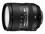 The lens is a Nikon 16-85mm f/3.5-5.6G AF-S DX ED VR Nikkor Wide Angle Telephoto Zoom Lens. It’ll replace the 18-55mm lens I bought on eBay last year — the same lens that crapped out on me about two months ago. (Another reason not to buy used camera equipment on eBay.) That lens was cheap and it felt cheap — lightweight and plasticky. This lens was costly and it has a weighty, quality feel to it.
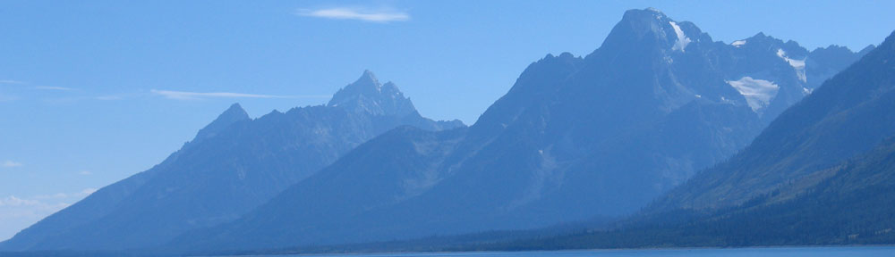
 When we flew to Seattle on Friday, the new lens was in my camera bag with the rest of the camera equipment I take on the road. But with the back problems that have been slowing me down, I didn’t have time to do anything fun in Seattle, despite the fact that we had the whole day there. (I spent much of it sleeping off some painkillers.) The next morning, we began our helicopter flight from Seattle to Page. I was sitting up front, handling navigation while Louis flew. I had my hands full with directions for our scud-run south. I didn’t realize it at first, but Mike was sitting in back, snapping photos with the new lens. He continued to do so on both days of the flight and got quite a few good shots from the air. This photo, taken just outside of the Bryce Canyon area, is especially attractive to me because of the shadow created by the big, puffy, low clouds.
 My photography was limited to shots taken on the ground, like this photo of my helicopter at the Spanish Fork, UT airport. Although the photo doesn’t seem too interesting in this low-res shot, it’s really impressive in full-resolution, with clear detail of the clouds — enhanced with the use of a circular polarizing filter on the camera (not in Photoshop) — and dramatic mountains in the background. I think it’s my new favorite picture of my helicopter.
 The Height-Velocity diagram in the pilot operating handbook (POH) shows the combinations of airspeed and altitude at which an experienced pilot (or test pilot) should be able to make a safe autorotation in the event of an engine failure.
 Early yesterday morning, Mike and I were at the airport, pulling the helicopter out and fueling it up for the flight down to Falcon Field.* Mike was coming with me for the Phoenix Tour portion of the day; I needed someone reliable to safely “hot” load and unload my passengers, since shutting down after each flight would be far too time consuming. He wanted to fly with me on the photo shoot, but I would have a cameraman and director onboard and the added weight of a fourth person would have severely restricted my performance. As it turned out, we didn’t have room for him — the cameraman brought all kinds of stuff with him that took up the other seat.
 The flight down to Falcon Field was relatively uneventful. We took a route that scouted around the south sides of Deer Valley’s and Scottsdale’s airspace. Normally, I’d fly between Squaw Peak and Camelback, but I wanted to preview the area I’d be flying for the photo shoot. I’d found it on Google Maps; as you can see here in a Google Maps satellite view, it’s on the side of a mountain at the end of a canyon. (I don’t want to identify the house in question or even provide details on where it is. Even though it’s in a gated community,
 So yes — I know what a subdivision looks like from the air. And a school with ball fields. And a park and a town pool. I’ve seen all kinds of backyards, from perfectly trimmed, walled-in plots of grass or decorative rock to sprawling, weed- and junk-filled patches of desert. I’ve seen small downtowns, both dead and alive. I’ve seen where the pavement turns to dirt and what lies five miles beyond. Or ten. Or fifty.
 I’ve seen desert lakes and rivers winding through canyons. I’ve seen dams along the Colorado and canals stretching as far as the eye can see. I’ve seen, from the air, natural wonders, like the Grand Canyon, Meteor Crater, the Little Colorado River Gorge, the Grand Falls of the Little Colorado River, and Rainbow Bridge. I’ve flown beside red rocks in Sedona and Monument Valley buttes. I’ve peeked into open pit mines from above and have felt as small as a speck flying down the emptiness of Death Valley. Recently, I’ve flown over Alaskan glaciers blanketed with fresh, pristine snow that went on for twenty, thirty, or forty miles without so much as a footprint to disturb it.
 That doesn’t mean I’m bored with the view. While I’ll admit that spending 20 minutes to cross an empty valley in some of the more remote areas of Nevada and California can get pretty dull, there’s always something interesting to notice along the way. Perhaps it’s a deserted homestead, half blown away by wind or covered by sand. Or some ATVs speeding along a transmission line road, sending up a cloud of dust that reveals their position. Or maybe it’s just an odd rock formation, jutting out of the otherwise flat terrain like the ruins of a half-sunken ship.