Again.
I couldn’t have asked for better weather. That’s what I was thinking as I preflighted my helicopter early on Wednesday morning.
I’d been hired to take three people from Wickenburg to the Las Vegas area with the primary objective of viewing the new bridge near the Hoover Dam from the air. My client, who had flown with me several times before, was willing to make the four-hour round-trip flight by helicopter — and pay for it — just for a look. To make the trip more worth his while, we’d also land at Boulder City Municipal Airport, where they’d rent a car and drive over to the dam for a tour. After lunch, they’d come back to the airport, climb back on board, and I’d take them for a Vegas Strip tour before returning to Wickenburg.
I’d mounted my GoPro Hero camera on the helicopter’s nose and set it up to shoot 720p video of the flight. I expected the flight up there to yield some good images and, if the camera was mounted properly, some smooth video footage. The camera seems to work best with the light behind the helicopter. On the way back, we’d by flying with the sun in front of us, so I didn’t have high expectations. Still, I brought along a pair of 16GB SD cards and the camera’s charger so I could capture it all. The images throughout this narrative are stills taken from that video.
The Flight Up
A thin, almost lacy layer of high clouds veiled the sky as we headed northwest from Wickenburg just after 8:30 AM. There wasn’t a breath of wind. The helicopter glided over the desert, 500 feet off the ground passing over cacti and other desert vegetation, open range cattle, and the occasional manmade water “tanks,” half of which were dry. Our departure from “civilization” to empty desert was almost immediate. As I often tell people, Wickenburg is on the edge of nowhere; I could just as easily say it’s a five minute flight from nowhere. We passed over a lonely ranch alongside the railroad tracks leading to Parker and beyond, then Route 71, which runs between Aguila and Congress, AZ. Then not a single building for thirty miles, when we reached the Wayside Inn and Alamo Lake.

Alamo Lake, at the confluence of the Big Sandy River, Santa Maria River, and Date Creek. The trickle of water released from the dam is the Bill Williams River, which eventually joins the Colorado River north of Parker, AZ.
I climbed not only to cross the lake within gliding distance of shore but to clear the mountains on the far side. As we crossed the lake, I was surprised by the number of campers parked alongside its shore and the boats tied up nearby. I suspected that a fishing tournament might be either starting or finishing up. The lake is popular with fisherman, which is probably a good thing. It’s so remote — heck, it’s a 90-minute drive from Wickenburg — that it simply doesn’t appeal to the typical powerboat/jetski crowd. They usually prefer Lake Pleasant, only 30 minutes from Phoenix (or Wickenburg), which is larger and far more interesting for boating.
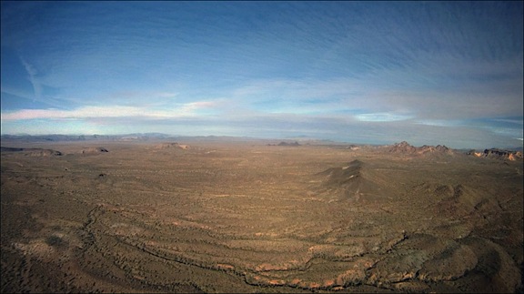
Beyond the lake and the rugged mountains on its opposite shore was yet another stretch of empty desert. But rather than being just a flat expanse, this one was peppered with rock formations left behind by ancient volcanos. There were areas of broken basalt, including flat-topped mesas. In the distance, to our left, we could catch glimpses of the Colorado River. If we’d been in a plane, flying 3,000 feet higher, we’d have a better view of the river and mountains in the distance; at our cruise altitude of 500 to 1000 feet above the desert floor, we could clearly see the details of the rock formations, dry stream beds, and scant vegetation as we flew.

The desert northwest of Alamo Lake is vast and empty.
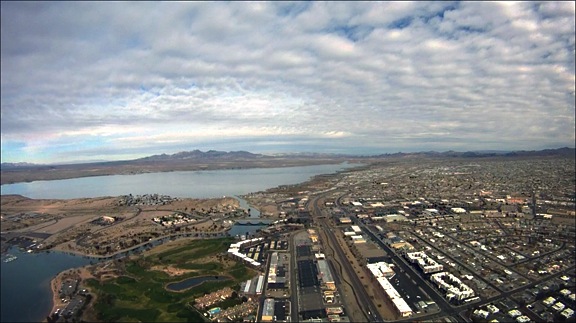
Forty-five miles from Alamo Lake, we reached Lake Havasu, one of the Colorado River’s many lakes. Formed by Parker Dam far to the south, the lake widens in a broad valley. The founders of Lake Havasu City bought the London Bridge — the real London Bridge from England — and had it installed across a manmade canal as a tourist draw. The town formed nearby. It’s popular for water sports and has a huge influx of visitors during boat races and Spring Break. A friend of mine who lives there complains that the temperatures top 100°F six months out of the year.

Lake Havasu’s surface was mirror calm as we flew over, reflecting not only the graceful arches of London Bridge, but the clouds high above.
I’d chosen our route carefully. Two hours is a long time to spend in a helicopter, especially out over the desert where the terrain can be — and, up to that point had been — very monotonous. I planned the trip to follow the Colorado River, which was quite scenic. From that point on, we’d be over one shore or another or at least nearby. It would give my passengers something interesting to see for the second hour of the flight.
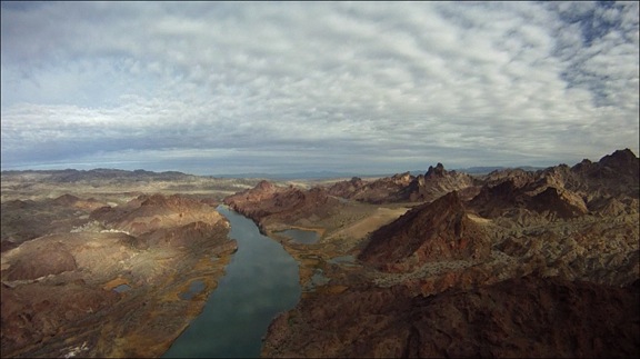
Indeed, the scenery along the river can be breathtaking — especially where the river narrows and passes through mountainous terrain. Topock Gorge is one of those places. Although it’s a short stretch of river and takes only five minutes or so to overfly, it’s dramatic and rugged. During the summer season, when the lake busy, speedboats roar through this area all day long. But that day, the lake was calm and quiet and we were treated to beautiful reflections of the sky and canyon walls.

Topock Gorge is one of the more scenic areas along the Colorado River between Lake Havasu City and Bullhead City.
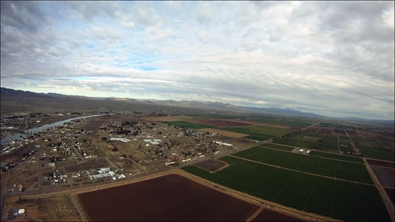
Past the gorge, the river twists and turns in big arcs to the east and west. Rather than follow its course exactly, we headed almost due north. We passed over I-40 where it crosses the Colorado and the farms and communities built up in the Mohave Valley. This was also desert, but desert made habitable by the river that passed through it. Make no mistake: we were still miles from anything remotely resembling a real city — but at least there were people living here.

The Mohave Valley, near Needles, CA, is full of farms and small communities clustered up near the Colorado River.
A while later, we were within range of Bullhead City Airport and I called the controller for permission to transition the area along the river. Bullhead City Airport is a real oddity. It was built on the Arizona side of the river to support the casinos in Laughlin, NV. Although it’s well over 100 miles from any international border, it’s an International airport, meaning that you can fly into it from other countries and pass through customs and immigration. It even gets airline traffic; as we flew through the area, a Sun Country 737 was coming in to land. But the airport itself gets very little traffic. This might be because of the natural “wind tunnel” that funnels air up or down the river, resulting in winds that often top 20 knots. But that day, the wind was calm — the first time ever that I’d been there — and other than the jet, we were the only other traffic in the area.

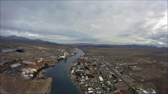
The tall casinos of Laughlin, NV across the river from Bullhead City, AZ. You can see the Bullhead City airport on the far right.
Beyond Laughlin and Bullhead City was the Davis Dam, which forms Lake Mohave. Lake Mohave is another one of the oddities of the desert. Although there are a few marinas and campgrounds along its southern shores, most of the lake is deserted and I seldom see any boat traffic on it. Again, this is likely because of its remote location — although access is easy from the Laughlin area. It seems to me that Lake Mohave would be a great place to become a houseboat hermit.

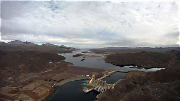
The Davis Dam is just upriver from Laughlin and Bullhead City.

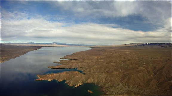
Lake Mohave seems like the perfect place to get away from it all on a clear, blue lake.
We flew up the eastern shore of the lake and I kept a sharp eye out for wild burros (donkeys). I’d seen them there before. While their trails were easily visible from the air, I didn’t see any animals — or people — at all.
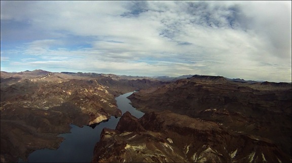
The north end of the lake narrows considerably where the Colorado River winds through a gorge. The rock formations are rugged and starkly beautiful. This isn’t the place you’d want an engine failure — there aren’t many places for an emergency landing. But the landscape draws me to this area each time I fly up the river.

The Colorado River on the north end of Lake Mohave passes through a rugged gorge.
I tuned into the Lake Mead/Hoover Dam tour helicopter frequency and began monitoring communications. I knew that the area around the dam would be full of traffic and wasn’t sure what altitude pilots would be flying at. Routes and procedures are not published; my attempt to get this information from a tour operator failed miserably. (These operators apparently think they own the places they fly over and do what they can to keep everyone else out.)
I reached Willow Beach and made my first call. “Helicopter Six-Three-Zero-Mike-Lima at Willow Beach, heading for the bridge at 2500 feet.”
Some wise-ass tour pilot came on the radio and said “Which bridge? Hoover?”
What an idiotic question. There was only one bridge within 60 air miles. Which bridge did he think? What kind of morons are those tour companies hiring?
“Hoover,” I replied.
“Be advised that there will be four Maverick helicopters over the dam in about two minutes,” he replied. No indication of altitude or any other useful information.
Other pilots were more generous. Although the Papillon Pilots seemed to be crossing the river farther south at 3500 feet, the Maverick pilots were operating near the dam at 3000 feet. I planned to say at 2500 feet, which would keep me out of their way.
The bridge came into view around the same time the Maverick helicopters started appearing overhead. They were flying an odd S-shaped pattern that was obviously designed to give all their passengers a view. I did a three-quarter circle from the right to the left as my passengers leaned forward and then left to see. They got a good look — I was not prepared to loiter and they didn’t seem as if they needed me to. Then I was exiting the area along the road to Boulder City.

The Hoover Dam and its new bridge are a popular tourist attraction for Las Vegas visitors. They’re amazing from the air.
I wasn’t finished yet, though. Another tour operator does very short tours of the dam and bridge from the Hacienda Hotel just up the road. He was preparing to launch as I flew over. He kindly said he’d wait until I’d passed by, then thanked me for talking on the radio. (Apparently, some pilots don’t — that’s a scary thought.) I thanked him for listening.
Not knowing the approach procedures for Boulder City Airport and anxious to stay out of the way of any other tour traffic, I stayed low as I crossed over the city and headed for the airport. (I was later told I’d likely get in trouble for that, but no one ever called. I guess I lucked out.) There were skydivers falling from the sky near the airport so, to stay clear, I circled around to the east and landed along one of the runways. I was still on edge from mixing with so much other traffic when I set down on one of the helicopter parking spots for the FBO.

Boulder City was built 90 years ago to provide a home for dam construction crews. It’s since grown to a vibrant community — the only one in Nevada that does not allow gambling.
We’d been in the air for 2.2 hours and I was ready for a break.
More about this trip in another post…
 191 pages is a lot to scan and I admit I never would have attempted it with my old flatbed scanner. But last week I bought a ScanSnap S1100 portable scanner. Although it only takes a page at a time, its feeder considerably speeds up the scanning process. I was able to get the whole book scanned in about 20 minutes. (Yes, it would have gone quicker with a duplex model, but that’s not what I bought.) I saved the resulting PDF to Evernote, which performed optical character recognition (OCR) on the document to make it searchable on Evernote. And I copied the PDF file created during the process to my DropBox so it would sync to my iPad.
 Through the use of some new


 While I realize that