Pressure Cooker Mongolian Beef

Another recipe for my Instant Pot.

Back in December I took delivery of 1/4 cow: about 100 pounds of local grass-fed beef. The meat was butchered and packaged and frozen and most of it is still in the freezer I bought primarily to store it.

Mongolian Beef
Here’s what my first try looked like. I cut the green onions too long. (Not sure what I was thinking there.) And yes, I know I can benefit from a course on food photography.

Among the cuts of meat I got in my package was a lot of stew meat. I’ve been using it to make a variety of things, including beef barley soup, in my Instant Pot pressure cooker. The other day, while looking for something different to make with an Asian flair, I found this recipe for Mongolian Beef.

I made it today, tweaked to the beef I had on hand. I wasn’t thrilled with the results. In general, it was too sweet and not flavorful enough. I made some minor changes to the recipe that I think make it better — at least for me. Here’s my version.

Ingredients

  • 2 pounds beef stew meat, cut into 1-1/2-inch cubes. The original recipe called for sliced flank steak.
  • 1/2 teaspoon salt
  • 1/4 teaspoon pepper
  • 1/2 teaspoon Chinese five spice. This was not in the original recipe, but I think it adds flavor.
  • 1 tablespoon sesame oil. Vegetable oil may be substituted.
  • 6 cloves garlic, minced or pressed
  • 1/2 cup soy sauce. Low sodium would probably be best, since this recipe can be quite salty. I might even consider cutting the soy sauce in half the next time I make it.
  • 1/2 cup water
  • 1/3 cup brown sugar. The original recipe called for 2/3 cup dark brown sugar, but I think it comes out way too sweet so I cut it in half. I use light brown sugar.
  • 1 teaspoon minced fresh ginger. The original recipe called for 1/2 teaspoon.
  • 2 tablespoons cornstarch
  • 3 tablespoons cold water
  • 4 green onions, sliced into 1-inch pieces. The original recipe called for only 3 green onions.

Instructions

These instructions assume you’re using an Instant Pot or a similar electric pressure cooker.

  1. Mix salt, pepper, and five spice in a medium bowl. Add beef and toss to coat as evenly as possible.
  2. Add oil to the pot and press Saute.
  3. When oil begins to sizzle, add meat and brown on all sides. You may have to do this in multiple batches so as not to crowd the meat. When browned, transfer meat back to the bowl.
  4. Add the garlic to the pot and sauté for one minute.
  5. Add the soy sauce, 1/2 cup water, brown sugar, and ginger. Stir to combine.
  6. Add browned beef and any accumulated juices.
  7. Press Keep Warm and then press Manual. Set the timer for 20 minutes. Make sure High pressure is selected.
  8. When pressure cooking cycle is done and beep sounds, press Keep Warm. Then release the pressure (carefully) by turning the release knob. When all the pressure has been released, carefully remove the lid.
  9. Combine the cornstarch and 3 tablespoons water, stirring until smooth.
  10. Stir the cornstarch mixture into the beef mixture in the pot.
  11. Press Saute and bring to a boil, stirring constantly until sauce thickens.
  12. Stir in the green onions.

Serve with rice and steamed vegetables or a salad with a ginger dressing.

This is not spicy at all, although I think it could use some heat. If anyone has any suggestions on what kind of chili or pepper I should add, please leave your suggestion in the comments for this post.

A Flight to Salinas

Any excuse to fly, eh?

I’m currently based in the Sacramento area of California for my late winter/early spring job as a frost control pilot. I live part-time in a nice farm town I’ve grown to know and like over the past four years, waiting for the weather to turn cold and a phone call telling me to get ready to fly. At that point, “passive standby,” when I get paid by the day to have my helicopter on-site, turns into “active standby,” when I get paid by the hour to wait. When the fly call comes, I theoretically spring into action, firing up the helicopter and heading out over my almond orchards to circulate air and keep the frost from damaging the developing nuts.

I say “theoretically” because although this is my fourth year as a frost pilot, that fly call has never come. Instead, each season I wind up being paid by the flight to fly to California, being paid by the day to hang around in very pleasant weather doing whatever I like while it’s still kind of dreary at home, occasionally being paid by the hour to sit in my truck at the airport at night waiting for a fly call, and eventually being paid by the flight to fly the helicopter home. I earn enough in two months to carry me financially until cherry season starts in May — and beyond. Along the way, I have a grand old time in Northern California’s Central Valley. I’ve made some friends, done a ton of hiking, gone wine tasting, kayaked the American River and Lake Solano, learned to fly a gyro, gone ballooning, and even given my bees an early start to the spring season. In general, it’s just an extension of my winter travels, with lots of flexibility to go where I like and do what I want — as long as I can get back to base by midnight when I’m put on active standby.

Anyway, my point is that I don’t have a lot of flying to do for this job. So instead, I take the helicopter out on “maintenance flights.” This is where I start up the helicopter to make sure it’ll start when I need it and since I’ve got the engine running, I may as well take off and since I’m taking off, I may as well go somewhere interesting like up Cache Creek or into Napa Valley or around Sutter Butte.

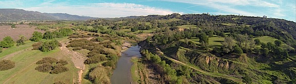
Cache Creek 2
My favorite “maintenance flight”? Low-level up Cache Creek, especially just after dawn.

Yesterday’s Excuse for Flying

My helicopter is coming up for overhaul soon and I’ve begun interviewing service centers to find one that’ll do the job the way I want it done at a price I’m willing to pay. I’ve already visited a shop in St. Augustine, FL, and have talked to the folks in Hillsboro, OR, who sold me my helicopter nearly twelve years ago. (Hard to believe it’s been that long, eh?) I’ve recently gotten more motivated to learn my overhaul options; one of the magazines I write for has agreed to a 1000-word article about my search for a shop. So I obviously need to visit more shops.

So the other day, I checked the Dealer/Service Center page on Robinson Helicopter’s Website. And I made a list of the centers in Northern California. And I started making calls. By the end of the day, I’d made plans to visit the folks at Airmotive Specialties, the service center in Salinas.

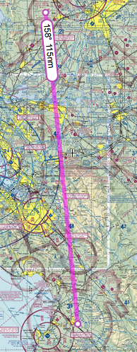
DWA to SNS
The direct route to Salinas was easy enough.

I was not interested in driving to Salinas. The 170-mile drive would take at least 3 hours each way. Obviously, I’d fly. Foreflight told me it would take about an hour and 20 minutes and that was fine with me. (I have 200 hour to burn off on the helicopter before November.) A review of the direct route showed that it was pretty easy, with no serious concerns about airspace or mountain terrain. Weather was forecasted to be good on Wednesday, although rain was moving in north and east of San Francisco (where I’m based) later in the week. It was a no-brainer. I made tentative plans to fly on Wednesday afternoon.

The Flight Down

I spent Wednesday morning taking care of odds and ends: writing a blog post, updating a friend’s website, answering email messages, scanning receipts, walking to the closest RedBox to drop off a video and pick up another one. The man I needed to meet at Airmotive would be at the office all day, so there was no rush. I had lunch just after noon, then climbed into the truck with Penny and headed out to the airport. A while later, after setting up my GoPro “nosecam,” iPad with Foreflight, and phone for music, I fired up the engine. I was heading south by 1:30 PM with Penny lounging on her bed in the front passenger seat beside me.

It was an uneventful flight. Well, mostly.

Why I Tend to Avoid Towered Airspace

I think a sidebar is in order to explain why I didn’t fly right through Livermore’s airspace and talk to the tower.

First of all, my direct route would have put me less than 1/2 mile into Livermore’s airspace — nowhere near the runway or tower. It wasn’t a big deal to adjust course a tiny bit to the left (east) to avoid it.

Second, my experience with towered airports has been a real mixed bag over the 15+ years I’ve been flying. If an airspace is directly on my flight path, I’ll ask the controller to transition. I might make a request like “Helicopter six-three-zero-mike-lima, 10 miles northeast, would like to transition southbound on the east side of your airspace.” (That’s what I might have said on Wednesday to Livermore.)

About half the time, the tower will allow me to “proceed as requested,” sometimes asking me to “ident” (push a button on my transponder which momentarily makes me more visible on his radar) or even assigning me a squawk code (an unique 4-digit code for my aircraft on radar). All that’s quite reasonable and fine with me.

But other times, the tower will require me to follow a certain route through the airspace — for example, over the top of the airport, midfield at a specified altitude. This can waste time and fuel. And still other times, the tower will instruct me to climb to an altitude above the airspace — usually 2500 feet AGL or higher — to “transition.” (Technically, this is not transitioning the airspace because I’m technically not in it when I’m flying that high over it.) This is nosebleed territory for helicopter pilots who typically fly 500-1000 feet AGL, not to mention a real waste of time and fuel. And other times — admittedly rarely — the tower will simply deny the request and tell me to stay clear. (Scottsdale liked to do this.)

So the solution I’ve come up with is this: if my direct route doesn’t take me within two miles of the runways or tower, I adjust my path to fly around the airspace and monitor the tower frequency to listen for traffic. At my altitude, airplane traffic — other than crop-dusters — is seldom an issue.

There was a close call with a biplane crop duster who apparently didn’t see me where I was cruising at about 1000 feet AGL (Above Ground Level) just to avoid crop-dusters. I guess he was going back to base. I dumped the collective and dropped down to about 300 AGL quickly while taking other evasive actions. He passed above and behind me and I continued on my way, climbing back up to at least 700 AGL and keeping a sharp eye out for others.

And then near Livermore, another traffic situation. I’d tuned into Livermore’s tower to monitor the frequency as I flew southbound just east of the tower-controlled airspace. I heard the controller warn another pilot about traffic that sounded just like me. I stayed quiet until the controller came back on the radio about a minute later, sounding a bit alarmed that the traffic (me) was only a half-mile away. I looked up and left and saw the Cessna flying at least 500 feet above me, westbound. I keyed the mic button and said: “Livermore Tower, helicopter six-three-zero-mike-lima, just east of your airspace, has that airplane traffic in sight. I’m passing below him, no factor.” The controller sounded more than a little relieved when he responded with thanks.

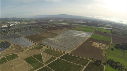
Marine Layer Moving In
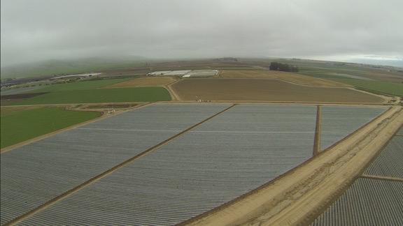
You can see the marine layer moving in on the right side of this shot. I was about 5 miles from Salinas Airport here.

I was in the mountains, abeam San Jose Airport, when I started noticing the marine layer moving in from the west. I fiddled with Foreflight’s settings to get visibility information for the nearby airports. All of the ones in my vicinity — including Watsonville and Salinas up ahead — were reporting 10 miles or more. But I didn’t like the way those low clouds look. I know from experience that the marine layer can turn an airport from VFR to IFR in fifteen minutes when it’s moving just right.

I landed at Salinas and followed the controller’s directions to “the biggest hangar on the field.” I parked in an empty airplane tie-down spot nearby. As I shut down, I looked at the windsock and the low clouds. The wind was clearly pushing the marine layer in from the west. I might not have much time if I wanted to get back that day.

At Salinas

My meeting went extraordinarily well. I met the boss, had a quick tour of their facility, and chatted with him about my options. He and his crew have done more than a few Robinson overhauls, including one for a helicopter that was parked right outside his hangar door. He’d learned a few things that would save me money while keeping me safe and in full compliance with FAA requirements. He had local sources for aircraft painting, upholstery, and parts inspections. Best of all, he could get the work done within my stated time restraints — I would need it back by mid February for next year’s frost season.

He and his helicopter guy came out and looked at my ship. They said it looked good — I have to wonder if they say that to everyone or if so many other ships don’t look good that they feel compelled to say something when they see one that looks better than usual. I have to agree that it doesn’t look 11+ years old. I’ve taken very good care of it over the years, getting quality maintenance done by good shops and keeping it in a hangar (or garage) for most of its life.

My visit ended by giving him my complete contact information so he could work up a quote. I’d have to order the overhaul “kit” from Robinson at least six months in advance to get it in time. Clearly, I’d need to choose a shop a lot sooner than I expected to, possibly as early as May 1.

By the time I got outside, it was overcast and downright cold. The marine layer had indeed moved in, with clouds just 1200 feet above the field (according to the ATIS recording) and mountain obscuration to the north, where I needed to go. It looked as if the only clear routes were to the south. I’d need to fly around the weather to move north.

But first I needed fuel. I’d burned half of what was on board on my trip down and did not want to go into any weather situation without full tanks. A call on the unicom frequency got me nowhere, so I walked over to the general aviation terminal and found someone in the Airport Manager’s office who gave me a phone number to call for fuel. While I waited for the truck, I fiddled with Foreflight to get additional weather information. But I didn’t need a computer or weather report to see that I wasn’t going to be taking the direct route back.

Around this time, I realized that I’d forgotten to text a Facebook friend who worked at the airport. She’s a medevac pilot who was on duty that evening. I was supposed to text her when I arrived so she could drop by. But the incoming marine layer had distracted me and I’d forgotten. Now, with the weather getting worse by the minute, I couldn’t wait around. I texted her my apologies. Another time? Chances are, I’d be back in November; I’d very much liked what I’d seen and heard at Airmotive.

The Flight Back

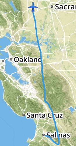
SNS to DWA
My actual track, as logged by Foreflight, on my return flight from Salinas. Talk about circumventing weather!

Once the fuel was on board and I’d added some oil, I climbed back on board and started up. The ATIS mentioned ILS approaches but the airport was still VFR. I asked for a departure to the east, got clearance, and took off.

I had my GoPro “nosecam” running for the whole flight. With the sun behind me — if it made an appearance — I knew the light would be much better than it had been on the way down. (I don’t record every minute of every flight. I already have too much mediocre footage; now I just try to get good footage.) The camera captured the situation well: very low clouds for quite a distance. I aimed for some brightness on the horizon, stayed at an altitude that kept me below the cloud layer, kept a sharp eye out for towers, and flew southeast.

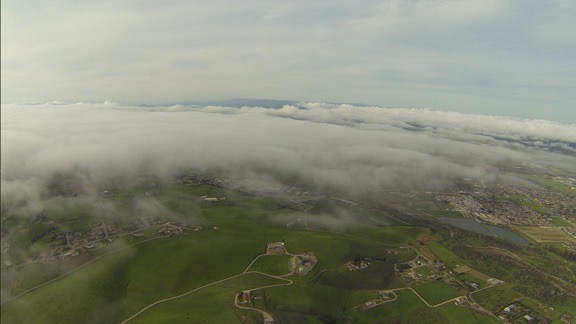
Marine Layer
I really wanted to steer left in this shot, taken less than a mile from the airport. But instead I aimed for that bright spot in the far right — southeast bound.

Don’t get me wrong. I could have tried scud running a path up the valley to the north. And I might have found a comfortable way to get where I wanted to go. But I’ve run scud enough times and have found my way blocked enough times that I’ve learned not to even bother trying if there’s an easy way around it. I know marine layers well enough to know that they don’t usually cross mountains. If I could get to the far side of the mountains east of the airport, I’d find a clear way north.

And that’s exactly what happened. I aimed for the brightness, which got bigger and brighter the farther I went. Suddenly, I was in sunlight, climbing the bright green foothills of the mountains on a northeast heading. Soon I was at cloud level just to the east of the clouds heading due north. Before long, I was above the marine layer, looking out at islands of mountaintops in the clouds to the west.

Out of the Marine Layer
Only six minutes passed from the time the previous photo was snapped to the time this one was snapped. At this point, I was banking to the northeast, climbing above the marine layer just east of where it got “stuck” in the mountains.

I adjusted my course on both my helicopter’s Garmin 430 GPS and Foreflight and attempted to fly direct back to my base. The lush green hills were amazingly beautiful and the shadows from the sun shining through the marine layer gave them an extra depth. It was hard not to detour in a few places to get some better views. I let the camera run, figuring I’d get a few good shots along the way.

Green Hills
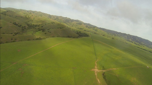
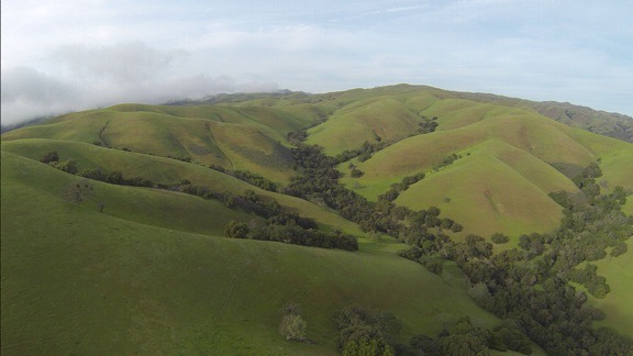
California’s hillsides are gorgeous in the spring. You can see the marine layer trying — but not succeeding — to climb over the hills on the left.

I flew for a while to the east of the marine layer, but as I crossed the valley near Hollister, the marine layer moved in beneath me. I was already about 2500 feet up, having just crossed some mountains, and knew I’d have to cross more mountains on the other side of the valley, so I stayed at altitude and crossed above them, with glimpses of the farm town beneath me. The air up above the clouds was a bit rough and we got bounced around a bit. So the next time I had the option of flying above or below the marine layer — near Livermore — I elected to fly below it. That had me flying just below the clouds along a hillside east of the airport there, almost on my original flight path down.

Over Hollister
I flew above the marine layer clouds at Hollister and was rewarded with a bumpy ride.

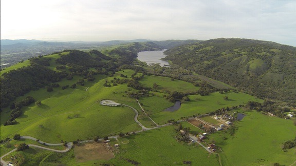
Lake Valley
I couldn’t resist flying down this lake-filled valley east of San Martin.

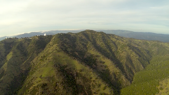
Lick Observatory
While I didn’t overfly any of the buildings at Lick Observatory, I did fly close enough to get a good look. (Hope I didn’t wake anyone!)

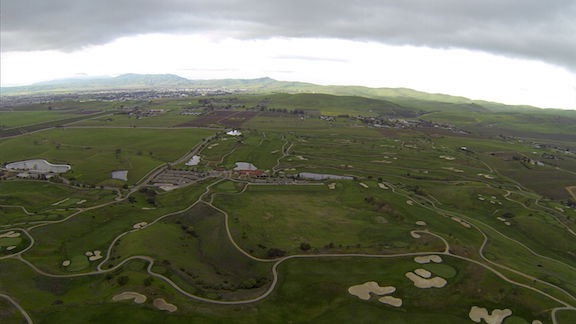
Golf Course
I was over this Livermore area golf course at 4:39 PM when one of my Twitter friends saw me fly by.

The rest of the flight was pretty uneventful. I made a straight line back to my base, over two wind farms, a handful of small cities, the Sacramento River, wetlands, and lots of farmland. It was just after 5 PM when I set down on my grassy parking spot at the airport.

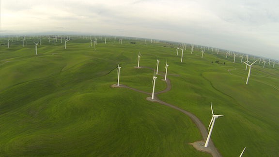
Wind Farm
Windmills that had been still on my way south were turning by the time I flew back north.

Birds
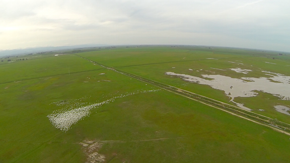
All of the wetlands in northern California are full of these large white birds that take flight as soon as they hear a helicopter approaching. This was a big flock — yes, every white dot here is a bird. Fortunately, they stay very close to the ground.

Final Approach
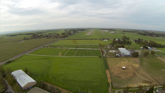
On final approach to this year’s base of operations west of Sacramento.

I gathered together my things, let Penny out to run on the grass, and locked up the helicopter. I chatted for a while with one of the line guys about the upcoming rainy weather and placed a fuel order. (The helicopter must always be topped off with fuel when I’m on call.) Then Penny and I headed back to the truck and our temporary home.

I’d logged a total of 2.7 hours of flight time.

Later, after I drove back to where I’m staying and relaxed for a while, I checked in with Twitter. I found a tweet from one of my twitter friends who had apparently seen me from the ground while he was golfing in Livermore. How’s that for small world syndrome?

It had been a good flight and a nice day out and about. Although I could have done without the detour — which probably added 20 minutes of flight time to my return trip — I certainly couldn’t complain about the views along the way.
Snowbirding 2016: Valley of Fire

A short overnight visit to a geologically interesting place.

Posts in the Snowbirding 2016 Series:
– Introduction
– The Colorado River Backwaters
– Quartzsite
– Wickenburg
– Phoenix
– Home
– Back to the Backwaters
– Return to Wickenburg
– Valley of Fire
– Death Valley
– Back to Work

When I left Wickenburg that Sunday morning, I was technically on my way to my late winter job in the Sacramento area of California. Indeed, I had to be in Sacramento to catch a 6:40 AM flight home on Friday to fetch my helicopter. But I’d planned the drive with enough time to make two stops along the way. The first was Valley of Fire State Park near Overton, NV.
Valley of Fire gets its name from the vibrant red rocks that jut out of the desert floor in this area of Nevada. It’s full of scenic overlooks, easy to difficult hiking trails, and plenty of interesting sandstone formations. In the right light, it’s quite photogenic. It’s also easy to visit. Only 50 miles from Las Vegas, it gets quite a few visitors on weekends — as I soon found out.

Camping with the Mobile Mansion

When I planned the trip, I didn’t realize it was a holiday weekend — since when is President’s Day right after Valentine’s Day? — and had half expected to be able to slide into a campsite inside the park that Sunday afternoon when weekenders left. I’d also been assured by a friend who’d been there weeks before that if all the campsites were taken, I could park my rig in “overflow parking.”

Wrong on both counts.

When I arrived in early afternoon after a long but pleasant drive up Route 93 from Wickenburg, the weekenders weren’t quite through with their weekends and the first come, first served campgrounds were marked “Full.” I managed to park my rig along the curb in a completely full Visitor Center parking lot and went in to talk to a ranger. She confirmed what I’d already learned on the Self-Pay Station signs: camping in designated sites only. But she was extremely helpful, offering suggestions for camping on Bureau of Land Management (BLM) land west of the park or Bureau of Reclamation land east of the park.

Since the Reclamation land was closer, I soon found myself backtracking out the park entrance I’d come in and then turning north along the main road there. In a few miles, I found the gravel road I thought she’d referred to and made a right onto it. I could see a few other campers out there, quite far from the road. Since I wasn’t interested in exploring with the mobile mansion behind me — it’s seriously difficult to turn that sucker around in a narrow space — I opted for the first “pull through” spot I could find: a narrow road that climbed up a hill with a relatively level spot on top. I approached it from the east after turning around in a wide area and parked with the Mobile Mansion’s big back window facing out toward the lake. When I got it level enough that I didn’t have to worry about it rolling back down the hill, I dropped the landing gear and disconnected it from my truck. Then I put out the slides, gave Penny some food and water, locked it back up with Penny inside, and headed back into the park.

Another free campsite, courtesy of our government.

I later discovered that the location the ranger had referred to was about a half mile farther down the road where there were literally dozens of RVs, some of which were even bigger than mine, parked. I was glad that I wasn’t among them, though — I know half of them would be running generators past dark; likely watching satellite TV instead of the stars. There was no one within a quarter mile of my site and the closest campers were in tents. I had no intention of ruining their quiet evening with my generator so it was all good.

Afternoon Photo Shoot

Closer Look at Valley of Fire
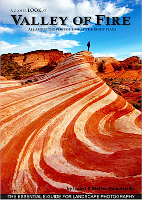
Want to learn more about what’s photogenic in the park? Start with this €4 ebook.

It was nearly 4 PM and the sun was low in the west when I got back into the park. I took the road north from the Visitor Center. I was very interested in hiking out to a formation called the Fire Wave, which was best viewed in the afternoon. My photographer friend Rebecca, who had been to the park recently, had recommended an ebook about the park: A Closer Look at Valley of Fire by Isabel & Steffen Synnatschke. That’s where I learned about the Fire Wave, which is pictured on the cover, and it was exactly the kind of scenery I like to shoot.

Of course, what had been described in the book as something off the beaten path had since gotten its own marked path. The parking lot there was completely full and there were people all over the place. Even if I could have parked, I doubted I could get the kind of scenery-only photos I wanted. On top of that was the authors’ note that the scene was best shot just after sunset and numerous signs that warned that anyone out on the trails after sunset was trespassing. So it seemed to me that a walk down to the Fire Wave that afternoon would be a frustrating waste of time.

I continued out to the end of the road, finding every single parking area completely full with day trippers who were out of their cars and climbing all over the rocks. While it’s nice to see families enjoying the outdoors together, I really wish I’d come on a weekday when it would likely be a lot less crowded. I turned around at the end of the road and headed back.

Red Rocks
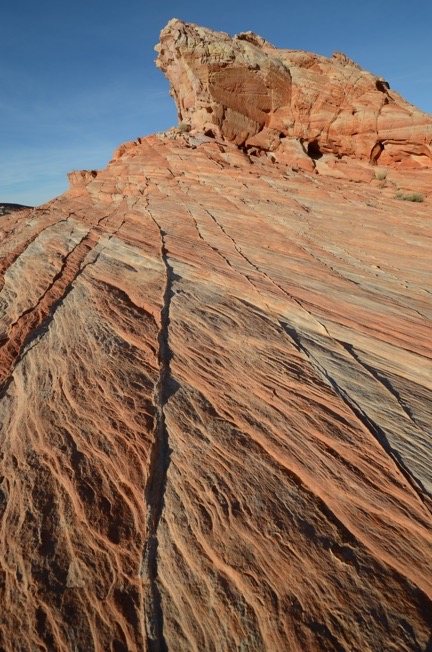
I spent an hour shooting various rock outcroppings with various lenses from various positions. It was nice working alone, unrushed with plenty of time to experiment.

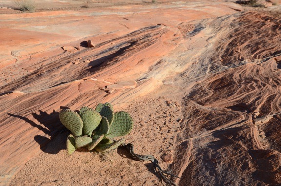
I wound up parking at an almost empty parking lot beyond the Fire Wave’s lot on the way back. From there, I struck out into the desert to the northeast with the thought of maybe coming up on the Fire Wave or an area like it from the other side. That didn’t pan out, but I did find some interesting rock outcroppings to photograph. I walked about a mile with Gaia GPS turned on in my phone to record my track. In addition to my phone, which I used to take a few photos for my Gaia track, I had my Nikon with me, along with three lenses. I got a chance to use my 10-24mm lens, which I rarely use, to take some really wide angle shots. As the sun got lower and lower, the shadows grew, giving the rocks a three-dimensionality they wouldn’t have when the sun was higher in the sky. The tricky part was keeping my shadow out of some of the shots. And I tried to tread carefully among the sometimes delicate rock formations to keep from crushing thin rock ridges beneath my feet.

Cactus with Red Rocks
Another wide angle shot, this one featuring a type of prickly pear cactus that would likely be in full bloom with large pink flowers within two months.

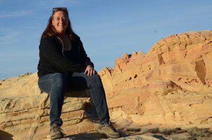
Selfie
I seldom share selfies — I usually don’t like the way they turn out — but was very pleased with this one.

On the way back to the truck, I stopped for a selfie with the park behind me. The battery in my camera’s remote was apparently dead — no real surprise there — so I did it the old fashioned way, with the camera’s self-timer. I was very pleased to get a good shot on the first try.

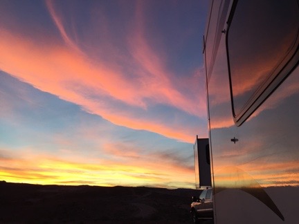
Sunset
Another beautiful desert sunset, reflected on the side of the Mobile Mansion.

I explored a bit more of the park before the sun set, trying to find a good place for a morning shoot the next day. Then I headed back to the Mobile Mansion. Penny, as usual, was glad to see me. We went for a walk and I watched the sun set. Later, while I was having dinner, I watched the flickering dots of nearby campfires through my big back window, marveling at how bright the moonlight was.

Morning Photo Shoot

I was up, as usual, before sunrise. My closest neighbors had started a campfire, likely to keep warm. I could see it flickering off in the distance. It reminded me of my days at the backwaters in January and early February.

I made a cup of coffee to go and grabbed a snack bar for breakfast. Then, as the sky brightened to the east, Penny and I were in the truck, headed into the park.

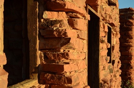
Stone Walls
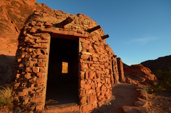
I love the textures of the wood window frames and stone walls at the Cabins.

Although I’d read through the Valley of Fire book looking for ideas of where to go for that morning shoot, I decided, in the end, to keep it simple: I’d go to the Cabins, a trio of stone cabins built by the Civilian Conservation Corps (CCC) to house workers years ago. The book panned the Cabins as a photographic destination, claiming it wasn’t interesting unless they were lit from inside. I disagree. I was there before sunrise — trespassing? — and began shooting almost immediately. The first light on the cabins was extraordinary and I got more than a few interesting shots. I was the only one around and, again, it was a real pleasure to shoot on my own without having to deal with other photographers or tourists. (Honestly, I don’t understand why people go on photo excursions where they have to jockey with other photographers for a good spot to take a shot.) My only challenge was keeping an eye on Penny — and keeping her out of my shots.

Cabins in First Light
The Cabins at Valley of Fire, shot with a 10mm lens at first light. No, I didn’t retouch this (or any other image) here. It really was that red.

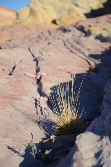
Grass and Rock
Yet another wide-angle close up. The light had already become too harsh by the time I shot this.

Afterwards, I drove farther into the park, retracing my route from the afternoon before. It was around 7 AM, the Visitor Center was still closed, and there wasn’t another soul in sight. I parked alongside the road in one of the numbered dips where the road crosses a wash, got out alone, and began hiking down a slot canyon. The sun hadn’t climbed high enough to illuminate the canyon walls and there were deep shadows. According to the book, the canyon would eventually end up by the Fire Wave. I didn’t get that far, however — the canyon was full of water about a quarter mile in.

I turned around and went back to the truck, then crossed the road and headed off to the west. By that time, however, the light had become bright and harsh — not good for photographing desert landscapes. It was time to go.

Hooking Up and Heading Out

After taking a drive through the west side of the park, Penny and I headed back to the Mobile Mansion. It was around 9 AM. People were just starting to come into the park.

After a quick drive farther down the road where I’d parked — mostly to scout it out for better sites for a future stay — I returned to my rig and began the relatively quick task of hooking it up to the truck and getting ready to move on. Although it’s big, I’ve learned over the years that if I don’t take a lot of stuff out of storage while I’m parked, it’s pretty quick to close up for travel.

By 10 AM, we were rolling back down the gravel hill and onto the pavement. We’d have to drive through the park again — it was the shortest route to I-15. I had to show my pay stub at the ranger station on the west side to exit. Then we were on our way to our next destination: Death Valley.

You Can’t Go Back

A note in response to a bulk email from an old colleague.

It may be hard for some blog readers to believe, but for a while in the late 1990s and early 2000s, I was “famous.”

My fame was limited to a group of people who bought my books and read my articles about using computers. I started writing in 1991 — as a ghostwriter for a John Dvorak book — and was soon writing my own titles. I learned early on that if you couldn’t write a bestseller, you had to write a lot of books. So I did. And then, in the late 1990s, two of my books became best sellers. Subsequent editions of the same book continued to be best sellers. For a while, I was making a very good living as a writer. At the computer shows where I was a regular speaker, people actually asked for my autograph.

I’m not an idiot. I knew that my good fortune could not last forever. So as I continued to write, turning out book after book and becoming well known in my field, I invested my money in my retirement, assets that could help extend (or at least securely bank) my wealth, and something that I thought would be a great hobby: flying helicopters. I learned to fly, I got hooked on it, and I bought helicopter. I started my helicopter charter business in 2001 — it was easy to fit flights in with my flexible schedule as a writer — and bought a larger helicopter in 2005. Building the business was such a struggle that I honestly didn’t think I would succeed. But fortunately, I did.

Mountain Lion VQS
My most recent book was published back in 2012. I don’t call it my “last book” because I expect to write more. They likely won’t be about computers, though.

And it was a good thing, because around 2008, my income from writing began declining. By 2010, that income began going into freefall. Most of my existing titles were not revised for new versions of software. Book contracts for new titles were difficult to get and, when they were published, simply didn’t sell well.

Around the same time, my income from flying started to climb. Not only did it cover all the costs of owning a helicopter — and I can assure you those costs are quite high — but it began covering my modest cost of living. By 2012, when I wrote my last computer book, I was doing almost as well as a helicopter charter business owner as I’d done 10 years before as a writer. And things continued to get better.

I was one of the lucky ones. Most of my peers in the world of computer how-to publishing hadn’t prepared themselves for the changes in our market. (In their defense, I admit that it came about quite quickly.) Many of these people are now struggling to make a living writing about computers. But the writing is on the wall in big, neon-colored letters as publishers continue to downsize and more and more of my former editors are finding themselves unemployed. Freelance writers like me, once valued for their skill, professionalism, and know-how, are a dime a dozen, easily replaced by those willing to write for next to nothing or even free. Books and magazine articles are replaced by Internet content of variable quality available 24/7 with a simple Google search.

So imagine my surprise today when one of my former colleagues from the old days sent me — and likely countless others — a bulk email message announcing a newsletter, website, and book about the same old stuff we wrote about in the heydays of computer book publishing. To me, his plea came across as the last gasp of a man who doesn’t realize he’s about to drown in the flood of free, competing information that has been growing exponentially since Internet became a household word.

I admit that I was a bit offended by being included on his bulk email list simply because he had my email address in his contacts database. But more than that, I was sad that he had sunk so low to try to scrape up interest in his work by using such an approach. Hadn’t he seen the light? Read the writing on the wall? Didn’t he understand that we have to change or die?

So after unsubscribing from his bulk mail list, I sent him the following note. And no, his name is not “Joe.”

The world’s a different place now, Joe.

After writing 85 books and countless articles about using computers, I haven’t written anything new about computers since 2012. I’m fortunate in that my third career took off just before that. Others in our formerly enviable position weren’t so lucky.

Not enough people need us as a source of computer information anymore. All the information they could ever want or need is available immediately and for free with a Google search. There are few novices around these days and only the geekiest are still interested in “tips.” Hell, even I don’t care anymore. I haven’t bought a new computer since 2011 and haven’t even bothered updating any of my computers to the latest version of Mac OS. My computer has become a tool to get work done — as it is for most people — a tool I don’t even turn on most days.

Anyway, I hope you’re managing to make things work for yourself in this new age. I’m surprised you think a newsletter will help. Best of luck with it.

And if you ever find yourself in Washington state, I hope you’ll stop by for a visit and a helicopter ride. I can’t begin to tell you how glad I am that I invested in my third career while I was at the height of my second.

Maria

Is it still possible to make a living writing about computers? For some of us, yes. But we’ll never be able to achieve the same level of fame and fortune we once achieved. Those days are over.

Snowbirding 2016: Return to Wickenburg

I return for a few more days with friends — and make some new friends.

Posts in the Snowbirding 2016 Series:
– Introduction
– The Colorado River Backwaters
– Quartzsite
– Wickenburg
– Phoenix
– Home
– Back to the Backwaters
– Return to Wickenburg
– Valley of Fire
– Death Valley
– Back to Work

I left my Colorado River backwaters campsite and was on I-10 heading east by 11 AM on Tuesday morning — a full two days earlier than I originally expected. But that was okay — I was heading back to Wickenburg, the the comparable luxury of my friends’ guest house.

Getting There

It was about 100 miles or so of driving without much traffic. By noon, I was hungry. I wound up stopping for lunch at a place in Salome that turned out to be a biker bar. Whatever. I ordered a burger and sweet potato fries and ate it out in the shade on the patio. My friend Jim texted me with a lunch invitation just as I was taking delivery of my food. I felt bad having to turn him down.

The rest of the drive was completely uneventful. I drove into the outskirts of town a little after one.

Unfortunately, although Jim and Cyndi have 10+ acres of land, their driveway is narrow and twisty and likely not navigable by my truck pulling the Mobile Mansion. I had to park my rig somewhere relatively close by that would also be safe and free. I came up with what I like to think is an ingenious solution: a piece of unused pavement inside a locked fence. Sadly, I don’t feel at liberty to say more — I think I’d get into some serious hot water if lots of people started parking RVs there. Let’s just say that it falls under the “ask for forgiveness, not for permission” rule of life. When I finally told the property manager that the RV parked there for two days was mine, he was cool about it, but if I’d asked in advance, he probably would have said no.

At Jim and Cyndi’s

After parking the Mobile Mansion and offloading the things I needed with me for the next five days, I drove over to Jim and Cyndi’s house. I let myself in through the garage — neither of them were home — and let their dogs out into the yard to play with Penny. Then I settled into the same room in the guest house I’d stayed a few weeks before.

Jim and Cyndi cooked dinner for us that night: spaghetti with a thick and meaty sauce. Wickenburg treated us to an amazing sunset. I retired early to the guest house to do laundry and relax. I was asleep very early.

Wickenburg Sunset
Sunset at Wickenburg.

On Wednesday, Jim and I went down to Phoenix to get the speakers on one of his cars fixed. We went to Fry’s Electronics on Thunderbird, which is one of the few stores in the Phoenix area that I really miss. I bought a CD head cleaner and a new battery operated vacuum for the Mobile Mansion. We sat around in the cafe, waiting for the repair to be done. Afterwards, he took me to a burger place on Bell Road that he really likes. Then another stop in Wickenburg for some errands while I did some shopping and met up with some old friends. Along the way, I passed by where my old neighbor works and had to introduce myself — he didn’t recognize me after the nearly three years since I’d moved out of town.

I made dinner that night. I had some pork tenderloin and salad and bought some macaroni and cheese to go with it. I’d invited my friends, Janet and Steve, to join us — they were also staying in town and had brought their horses by earlier in the day to stay at Jim’s place — but they’d had a late lunch. They did join us after dinner, where we all sat around Jim’s gas fire pit talking and drinking wine or beer. Steve’s dad, Archie, was also visiting. I love Archie and hadn’t seen him in at least 10 years so it was really good to give him a hug and catch up with him.

On Thursday, I took Jim out to Wickenburg airport and another friend’s house to introduce him to some of the local area pilots. Jim is a retired airline captain and I think he’s having trouble keeping himself busy. Two of my airport friends are also retired airline pilots; the others are simply involved with aviation. Three of them are building planes. We spent a few hours meeting and greeting folks. Hopefully, Jim forms some good friendships with guys he has a lot of common with.

That afternoon, the other guesthouse guest arrived. Ron is a photographer based in Cottonwood, AZ. Jim and Cyndi had purchased one of his works months before and had suggested that he get a booth to sell at Gold Rush Days, Wickenburg’s big annual event. My friend Janet, who is an artist, was also selling her work there; that’s why she and Steve were in town. Ron turned out to be a really friendly, down-to-earth guy who was a pleasure to hang out with. Jim and Cyndi took us to dinner at our favorite Wickenburg restaurant that’s not in Wickenburg, Nichols West.

On Friday morning, I helped Jim and Cyndi set up a booth in town for Cyndi to sell the jewelry she makes. Then, while Jim headed down to Phoenix on an errand, I hit the art show around the library in town. It was surprisingly busy; I didn’t expect the Gold Rush kickoff to begin until Saturday after the big parade. I visited Janet’s booth and Ron’s booth; both looked great. (Janet later won first prize for Best Booth.) I saw two metal sculptures I thought would look great hanging on the front wall of my home: different versions of a sun face over four feet in diameter. The one I liked better had a hefty price tag and I decided to give it some more thought before splurging.

Afterwards, I headed back to the house. I was tired — I hadn’t been sleeping well — and although I wanted to get my truck washed, I decided to put it off until I got to California and took the kayaks off the roof. (Yes, I drove around with the kayaks up there for five days.) I spent the afternoon napping and reading and being lazy. I’d begun reading a Robert Galbraith book and found it difficult to put down. I need that kind of reading to keep my attention.

That evening, two of Jim and Cyndi’s friends joined us for a trip up to the T-Bird Cafe in Peeples Valley for pizza. Ron didn’t come. He’d begun feeling under the weather earlier in the day and just wanted to rest. I had a great pizza topped with all kinds of meat — I love meat on my pizza; you can keep the veggies — and we all brought back some for Ron. But he was asleep, knocked out by the cold medicine.

English Breakfast
English breakfast at Nichols West. Yum.

On Saturday, I went up to Nichols West for breakfast. Simon, the owner, is British and there’s an item called English Breakfast on the menu. I’d had it before and liked it, so I went back for more. I highly recommend it.

Penny on the Trail
Penny, the tiny trail dog.

Afterwards, I headed up to Granite Lake with Penny for a hike. It was early — not even 10 AM when we arrived — and still cool. We parked on the back side of the lake and, after walking along the lake’s edge for a few minutes, struck out along a trail heading northwest. That soon joined up with another trail that climbed into the saddle between Granite Mountain and the smaller hills to the west. There were horse tracks along the trail, along with patches of ice, snow, and mud. The trees were a mix of evergreens, manzanita, and other high desert varieties. Granite boulders were everywhere. A trickle of snowmelt formed a tiny stream that wound down the hillside, sometimes across the trail, to the lake.

Cat tails
I did a bit of photography around Granite Lake.

I was on the trail for at least 30 minutes when I realized that I’d hiked it before. I tried to remember when I was last there and who I was with. I know I wasn’t there alone. I started wondering whether I’d hiked it with my wasband years before. I remembered that we hadn’t gone far on the trail — I certainly went a lot farther that Saturday — and recall being winded by the climb. That put it before my big 2012 weight loss, when I was really out of shape. I was still married; had we hiked the trail together? Was a hike with my wasband that unmemorable? Unless I find photos or a blog post, I’ll likely never know. It’s probably better that way.

Penny and I hiked for a little more than a mile and half before taking a break and then turning around to go back. Although only two people had passed us on the way up, we passed quite a few people on the way back. It was much later in the day and I’d taken my time on the way out, stopping many times to take photos. Back at the truck, the lot was full of cars.

Sonic Squeeze
Sonic drive-ins apparently aren’t designed for full-size trucks.

I did a little shopping in Prescott before heading back to Wickenburg. On the way, I stopped at the Sonic drive-in for a shake and wasn’t surprised to discover that my truck didn’t fit into the drive-in parking space, even with the mirrors folded in. Sheesh.

Back in Wickenburg, I stopped at the art show in town. I’d decided to pick up one of the two sun faces I’d seen the previous day. But I was spared the expense: they’d both been sold.

Firepit
The fire pit at Jim and Cyndi’s house.

I spent a lot of the evening getting ready for my departure the next day. That meant doing laundry, organizing my stuff, and packing the truck. Jim and Cyndi made spaghetti with Jim’s excellent meat sauce for dinner. Ron, feeling better even after a full day at the show, joined us. Afterwards, we sat around the fire pit and talked. It was a nice, restful evening.

Coffee and Donuts

The next morning, I finished packing and doing laundry and cleaned up the guest house. By 8 AM, I was ready to go. I said goodbye to Cyndi — who was still in her robe — and headed out to pick up the Mobile Mansion. It took a few tries to get it hooked up — I can’t understand why sometimes I line it up just right on the first try and other times it takes a dozen tries — but then it was securely connected and I was ready to move out.

The Birth of Coffee and Donuts at Wickenburg Municipal Airport

There’s a back story for this and I’ll try to make it quick. My company, Flying M Air, LLC, took over the fuel manager contract at Wickenburg Airport in January 2003. It was a sweet deal that included full access to the terminal building and the ability to sell refreshments and pilot supplies. All I had to do was provide a warm body to pump fuel. I split the profits on all fuel sales with the city, which actually bought the fuel. Under this contract, I netted about $60K a year — with employees working 12 hours a day 365 days a year. The contract made a ton of money in the winter when the jets came in and lost some money every summer when it was too hot to fly.

(Around this time, my future wasband was between jobs and wanted to start a consulting business. I set him up in the terminal and paid him $20/hour — which was double what I paid my other employees — to be the warm body, leaving him free to do office work for his consulting business while he was there. He lasted less than a week, claiming there were too many distractions. Needless to say, that consulting business never got off the ground.)

Anyway, when I first got the contract, I naively thought that if I brought more planes to the airport, I’d sell more fuel. So I started providing donuts and coffee every Sunday morning. Donations covered all costs — which is a good thing, because the pilots who came seldom bought fuel. By the time I sold the contract in the summer of 2004, sick of dealing with the town and disappointed that my future wasband wasn’t interested in working there, it had become a tradition.

I had one more stop to make: Wickenburg Airport. I’d promised Jim that I’d introduce him to “the gang” at the weekly coffee and donuts event.

I rolled into the parking lot in my truck with the Mobile Mansion in tow. There was a crowd of people behind the terminal building, where a keypad-operated door let them into the lounge and kitchen. I was amazed by the number of people who had gathered. I knew some of them, but most of them seemed to know me — after they recognized me! (I look a bit different from the old days: considerably slimmer with long hair.) I got lots of hugs. One of my friends asked how long coffee and donuts had been a thing at the airport and was very surprised to learn it had been 13 years.

Jim showed up in his Jeep and I introduced him around. He already knew a few of the people. I’m hoping he makes socializing with the airport’s pilots a regular part of his retirement routine. I know he misses flying — despite his denials — and there are a few pilots who would welcome a companion on a trip for a $100 hamburger.

Heading Out

By 9:30 AM, I was ready to get on the road. I wanted to be at my next stop by early afternoon and it would be a four-hour drive. I said my goodbyes and after a tight squeeze getting out of the parking lot, hit the road, northbound.

I have to say that the best thing about this trip to Wickenburg was running into so many people I know, getting so many big hugs, and having so many people tell me how great and happy I look.

“Divorce suits you well,” one of my real estate friends said.

I laughed. “No shit.”