May Morel Mushrooms

I find and bag my first morel mushrooms.

Science Friday, an NPR radio show (also available as a podcast), did a show last Friday about mushroom hunting. It got me interested in mushrooms all over again.

Last October, I attended a weekend-long seminar at the North Cascades Environmental Learning Center about mushrooms. We learned about mushrooms, hunted for mushrooms, identified mushrooms, and ate mushrooms. It was a fun weekend.

About a week later, I went mushroom hunting in the Leavenworth area with one of the other seminar attendees. We didn’t do too well, but didn’t come back empty handed, either: two chanterelles, some oyster mushrooms, and something else I can’t remember. I took home the chanterelles; my companion took the rest. I returned to the area several times since then but haven’t had any success.

I’d pretty much given up on doing any serious mushroom hunting.

And then Science Friday did their story, “Mushrooms: On the Hunt for Edibles.” And I started thinking about foraging for mushrooms all over again. After all, it was the right season for them and I knew places where the conditions might be right. So I emailed my hiking buddy Susan, who also has some mushroom foraging experience, and asked her if she was interested. Of course she was! We went out around 9 AM Monday morning.

We took the Jeep up into the mountains. That’s about as specific as I’ll get for the location. As any serious mushroom hunter will tell you, locations are never divulged. Morel mushroom hunting is serious business in Washington state; hordes of hunters cross the Cascades every weekend this time of year. Some are commercial hunters; Susan says morels are worth about $30/pound. Others are hobbyists like us who use a mushroom hunt as an excuse to get outdoors and walk around in the woods.

Although we were unable to take the Jeep as far as I’d hoped, we parked at a familiar parking area, grabbed our bags, and headed into the woods. Penny ran ahead. For the next three hours, we wandered around the underbrush on either side of trails or roads, looking for just the right environmental conditions.

Trouble was, I didn’t know the right environmental conditions. I’d never hunted for morels. The only thing I’d every heard was that they grew in areas damaged by forest fires. The Science Friday story said they grew under oak and apple trees, but we don’t have oak trees here and there aren’t any apple trees other than in orchards.

After wandering around the woods off to one side of the road, Susan climbed back down to the road. “I think there’s an easier way down over here,” she called back from up ahead.

Morel Mushrooms
From my first find. Aren’t they gorgeous?

Morel Mushrooms
Can you see all five mushrooms here? Hint: two of them are together.

Morel Mushroom
Here’s a closeup of one of the last morels I found. As you might imagine, from a distance, pinecones look similar.

I made my way through the underbrush. I was about halfway down the steep slope when I looked down and saw it: a very large morel mushroom. Within seconds, I’d seen three more.

They were beautiful — I mean, really beautiful. Perfectly shaped, popping up through the dirt looking clean and brown and exactly the way a morel should. I took photos. I marked GPS coordinates on my phone. And then I cut them and put them into my canvas bag.

Susan found the next batch not far away and packed them away in a paper bag she’d brought for the purpose.

We talked about the conditions they were growing in. Plants growing nearby. Moistness. Amount of sunlight. We found things in common between the two patches. We began getting a real idea of what to look for.

We continued wandering around, on and off the road, for the next two hours. We took turns finding mushrooms. At one point, Susan found a huge one about three inches from my foot and I spotted a smaller one nearby. At another point, I found five of them within a square foot of space. Much later, the two of us, working within 15 feet of each other, found several patches of them.

Now I don’t want you to think that the mushrooms were all over the place. Well, mushrooms were all over the place — mostly shiny brown round ones — but the morels were elusive. One of us would find a patch and then twenty minutes might go by before the other found a patch. We were out there for three hours and we each brought back maybe enough for a meal. I weighed mine when I got home: 9 ounces.

It was fun and, because we weren’t getting skunked, it never got frustrating.

It was nearly 1 PM when we called it quits. We’d only walked a little more than a mile according to my GPS tracker.

I drove us back to Susan’s place and took a quick tour of her backyard rose bushes and gardens. We talked about the mushrooms we’d found and how we each planned to double-check that we’d found morels and not false morels, which were not recommended for consumption. Then I headed home.

Later, I laid out the mushrooms I’d brought home to take a photo. I also weighted them on my postal scale: 9 ounces even. Good thing we weren’t hunting mushrooms for a living.

Morel Mushrooms
Not bad for a first time out, eh?

Dinner tonight or tomorrow: Pizza with Ramps, Morels, and Eggs. I might also try one of the recipes I found for fried morels.

And since mushrooms grow so quickly, there’s a pretty good chance there will be more to pick later this week in the same places we found them today. I’m game for another outing on Friday. I hope Susan is, too.

Cross Country Flight: Sacramento to Seattle and Wenatchee

A look back at a memorable flight.

Since the winter/spring of 2013, my helicopter has spent two months each year in the Sacramento area of California on a frost control contract. I fly the helicopter down in late February and fly back in late April. I usually take along a fellow pilot who does most of the flying to build R44 time and shares the cost of the flight. Most of these people are relative strangers and although they’re usually nice guys or gals that I stay friends with after the flight, I admit that I prefer flying with people I already know pretty well. So this spring, when it came time to start thinking about that return flight, I started thinking about who I could invite to join me.

The answer hit me like a lightning bolt: of course I should invite my friend Don.

Don’s been a pilot for much of his life and has flown airplanes and helicopters. I don’t know how much time he’s logged, but I’m certain it’s more than my 3,300 hours. I also know he has tons of cross-country experience, including helicopter flights between the Seattle area and Alaska.

Why Don?

You might be wondering why I’d invite such an experienced pilot when there were so many low-time pilots who’d likely jump at the chance to fly with me on a six to eight hour cross-country flight. There are three reasons.

First, Don is a good friend I’ve known for years. He and his wife were very supportive during my crazy divorce, and you know what they say about a friend in need. He’s easy going and has a good sense of humor. I knew I’d enjoy spending time with him.

Don't Helicopter at PHX
Don’s helicopter on the T3 Helistop at Sky Harbor Airport in Phoenix in 2009. After I shared my experience approaching and landing at the helistop, he often picked up and dropped off visitors there. Later, in October 2012, he dropped me off there when I was off on one of my many trips.

Second, Don had owned a helicopter very much like mine — in fact, it was only six months newer — which he’d kept in his garage at his Seattle area home. About two years ago, he sold it. I knew he hadn’t flown much since and probably missed it. He would appreciate the flight; surprisingly, not everyone I’ve invited to fly with me on a long flight has.

Third, because Don already had so much flight time, he’d actually share the flight with me. After all, I like to fly. When I fly with other pilots, they’re paying for the privilege of every minute of stick time they can get. They don’t want to share the stick with me and I don’t feel comfortable asking them to.

So I texted Don to see if he was interested. The response came almost immediately. Hell, yes!

Getting to the Helicopter

Don has two homes, one in the Phoenix area and one in the Seattle area. He made arrangements to be in the Seattle area on the day we’d go south to fetch the helicopter.

I booked my flight from Wenatchee to Sacramento, which included a plane change in Seattle. Don booked his flight from Seattle to Sacramento on the same flight. Since Don always flies First Class, I bought a First Class ticket, too. When he booked his flight, he got the seat right next to mine.

We met at the gate for the Seattle to Sacramento flight. I’d been at the airport for two hours and had treated myself to a breakfast of trout and eggs at Anthony’s. Don had also been at the airport for a while and had breakfast.

I had Penny with me, of course. She’s always excited when she sees me take out her airline travel bag. She’d gotten back into the bag at the gate before Don arrived and he didn’t even realize I had her with me until we boarded.

There wasn’t supposed to be breakfast on our flight, but there was; a nice yogurt and granola bowl with fresh fruit that would have gone nicely with the Bloody Mary I couldn’t have. (First Class on Alaska Air really is worth the extra cost. Can’t say the same for all airlines.)

On the flight, we chatted, ate, read. Time passed quickly. We were on the ground by 10:45 AM. With no bags checked and a quick exit from the plane, we were at the curb waiting for our Uber driver by 11 AM. Penny seemed happy enough to be out of the bag, sniffing around someplace she was pretty familiar with. After all, we’d flown to Sacramento quite a few times over the past four years.

It was about a 30 minute ride to the airport where my helicopter had been parked on the grass for two months. I settled up my bill for parking and said goodbye to the staff there. Don preflighted and installed the dual controls while I folded up the cockpit cover and tie downs and went to work setting up my GoPro. That’s when I realized that I’d left the Mini SD card for the camera at home. Duh-oh! There would be no video from the flight.

California to Washington

We’d discussed our route briefly on the flight down. Neither of us was in a hurry and both of us leaned toward a flight up the coast, which would add about an hour to the flight time.

Marine Layer
Here’s a shot of the marine layer on the coast of Oregon that forced us inland during a flight from Seattle to Wickenburg with my wasband in 2009.

My experience with flying the coast was varied. What I’d learned was that if I could get to the coast, I probably wouldn’t be able to follow it all the way up. The California and Oregon coasts are well known for their “marine layer” clouds. Although I’d flown the coast many times in the past, from Los Angeles to the Columbia River between Oregon and Washington, those damn clouds always made an appearance, forcing me inland so I’d never covered more than one or two hundred miles at a stretch. Last year, when I’d flown north by myself, planning on a coastal route, clouds with rain moved in not long after I hit the coast, forcing me inland for a dreary flight with more scud running than I like to do.

But nothing ventured, nothing gained, eh?

We followed Cache Creek west into the hills. I did the flying. I’d been wanting to fly Cache Creek all winter, but truck troubles had messed up my March plans and I wound up spending most of the month home instead of with the helicopter. I hadn’t flown nearly as much as I wanted to. This was my chance to get flying out of my system, flying a familiar and loved route. Somewhere in the hills, I turned the controls over to Don and he steered us over Clear Lake. Although the weather was clear where we were, there were clouds to the west (of course) and neither of us were sure whether they came into the coast or were off over the Pacific.

After flying up Highway 101 for a while, we decided to try heading west to see if we could make the coast. So we followed one of the canyons — I’m not sure, but I suspect it was the one the Noyo River flows in — concentrating on the path ahead of us. As expected, we were moving right in toward the clouds, which forced us lower and lower. But ahead of us, to the northwest, the sky was bright. Maybe it was clearing up?

We were flying about 300 feet over the road, stretching our necks to peer ahead of us and ready to turn around as the road went around a bend at a high point in the hills. We followed the bend and the road dropped away. We kept going.

Low clouds kept us flying low in the hillsides near Fort Bragg. We turned north, heading for our first fuel stop at Eureka. The coast was to our left and we occasionally caught glimpses of it as we flew over tree-covered hills with the clouds only a few hundred feet above us. I don’t think either of us wanted a trip up the coast in such conditions — I know I didn’t. But I also didn’t want to fly the I-5 corridor, which is painfully boring, especially once you get north of Eugene. We’d make a decision at Eureka.

The ceilings were much higher when we stopped for fuel at Eureka. We gassed up; Don bought the first tank. Then we went inside for a potty break. There wasn’t much else to do there — although the airport has a nice little pilot shop, there was no restaurant and nothing was within walking distance. So we climbed back on board and continued on our way, this time following the coast.

Cloudy Coast
Despite the clouds, it was beautiful on the coast.

Brookings Bridge
If you’ve driven on the Pacific Coast Highway — Route 101 — through Brookings, CA, you’ve driven over this bridge.

Near Newport
The coast near Newport, OR. I love the way the breakers line up when you see them at just the right angle.

Lincoln City, OR
A look down into Lincoln City, OR.

By this time, the scenery around us was interesting enough to take some pictures while Don flew. The doors were on, of course, so most of my photos have reflections and glare and even window dirt. But they give you a feel for what the weather was like and show a little of how beautiful the California and Oregon coasts can be from about 500 to 1000 feet up.

The coast was very rugged at the beginning, where the Redwoods National and State Parks come right up to the rocky shoreline. There were no roads in many places — just trees right up to the cliffs with lots of small waterfalls dropping down into the ocean. This is a view few people see, a view that can only be seen from the air off the coast. Don steered us along its left, over the ocean, just within gliding distance of land.

In some places, we saw sea lions stretched out on rocky beaches. I took pictures, but they didn’t come out good enough to share.

The Pacific Coast Highway hit the coast and then went inland several times. Finally, just before we hit the Oregon state line, it came out to the coast and stayed there for quite a while.

The weather got a little worse at first, with light rain pelting the cockpit bubble in more than a few places, then started to get better. By the time we got into Oregon, we saw patches of blue sky. The sun was shifting ever lower toward the horizon to the west and the light started getting kind of good.

Good Light on the Coast
Light is 90% of photography.

Waterfall
Waterfall near Otis, OR. Yes, I cropped this image; we weren’t that close.

Cloverdale
Cloverdale, OR looks like a pleasant place to live, eh?

Tillamook, OR
Don fueling up at Tillamook. The huge hangar behind him was used for airships years ago. I think there’s a chance it might be an air museum now.

We made our second fuel stop at Tillamook, OR. Don pumped while I paid. It was just after 5 PM and the airport office (and restrooms) were closed. It was also chilly. I let Penny loose to do her business, then called her back to get back on board. We didn’t hang around.

Oregon Coast at Seaside
The Oregon Coast near Seaside.

By now, we were hungry. Two breakfasts had filled us before noon, but skipping lunch hadn’t gone unnoticed. Don had been texting back and forth with his wife who would have a hot dinner waiting when we arrived at their Seattle area home.

We continued up the coast a bit more before heading inland not far from Astoria, where the Columbia River meets the Pacific Ocean. This was, by far, the longest stretch of the Pacific Coast I’d flown in one day: more than 400 miles.

Don navigated northeast toward his house. It was all familiar territory to him — I didn’t fly much west of the Cascades. We flew east of Olympia and right over the top of the airport at Puyallup. From there, it was only a few minutes to Don’s place.

My iPad, with Periscope running, broadcast the approach in typical low-def quality.

Don let me take the controls and guided me in. I’d flown to his house before a few times but honestly couldn’t remember much about the approach. He had to keep pointing out landmarks and reminding me to slow down. It is tight — that’s for sure — with a steep approach between tall trees into a clearing beside his garage. I had Periscope running on my iPad in its cradle and recorded the whole thing.

And then we were on the ground, the long part of my journey over.

Resting Up

We went in and had something to drink while Don’s wife, Johnie, finished making dinner. Penny played with their new dog and ran around their grassy yard occasionally taking a detour to terrorize their chickens through the fence.

After dinner and a nice dessert, I went out to the barn with Don to see the two cows they’d “rescued.” They were huge. I really wish I’d had the presence of mind to take a photo, but I was so shocked by what I was looking at that I simply didn’t think of it.

I hit the sack in the guest room pretty early. I was still fighting a cold I’d had for at least three weeks and was exhausted. I slept well with Penny at the foot of the bed.

Seattle Area to Wenatchee

In the morning, after letting Penny out and then taking a quick shower, I dressed and met my hosts for breakfast. It was overcast and questionable (as usual) as to whether I’d make it across Snoqualmie or Stampede Pass. The automated weather station at Stampede was reporting half-mile visibility, which was enough to get through legally. But what about the rest of the flight? There was no accurate weather reporting in other places in the mountains. The only way to find out whether I’d make it was to give it a try. If I couldn’t get through, it was a long flight around the Washington Cascades to the Columbia River Gorge. I was hoping I wouldn’t have to go that way.

Don's Heliport
Another cloudy morning at Don’s place.

After thanking my guests and saying goodbye, I did a quick preflight, added some oil, and climbed on board with Penny. Then I started up and warmed the engine, setting up my iPad and iPhone with weather resources and Firelight maps to guide me while I waited. When the helicopter was ready to go, I picked up into a hover, turned 180 degrees over the driveway, and climbed out through the trees the way I’d come.

I had ForeFlight’s track log feature enabled during the flight, so I know exactly how I went. Originally, I thought I’d hook up with I-90 and follow that through the mountains at Snoqualmie Pass, which is at 3004 feet. But that would require me to head north quite a bit before heading southeast. It didn’t make sense to go out of my way. So instead, I followed the course of the Green River up into the mountains, aiming for Stampede Pass, which is higher at 3800 feet, but had that handy ASOS weather station. The weather there was reported at 1/4 mile visibility with mist, but I knew that could change at any time.

My Route
An overview of my route from the Seattle area to Wenatchee. Not exactly a straight line.

In the meantime, the flight was pleasant, even under the clouds, taking me over the Howard A Hanson Reservoir and a few communities that were no more than named points on the map. The area below me was thick forest, for the most part, with a road following the river for part of the way. I wish I could have taken pictures, but I’m a terrible photographer when I’m flying. I really missed my GoPro on that flight.

I steered up another canyon to the left just past Lester, heading for Stampede. The only roads were forest roads now as I climbed with the hills, getting ever closer to the cloud bottoms. Soon, I could see Stampede Pass ahead of me. I’d forgotten all about the wires that crossed through the lowest (and clearest) spot. I’d have to cross at a higher point a bit east where the clouds seemed to touch the ridge line. I could tune into the ASOS by that point; it was still reporting 1/4 mile visibility with mist.

My route over the pass
Here’s a closeup of my route (the blue line) through the Stampede Pass area on a Sectional Chart. I crossed the mountains just southeast of the pass, not at all interested in crossing over all those wires.

I slowed to 40 knots and creeped up to the ridge. I knew the rules I’d set for myself, rules that had never failed me when dealing with weather flying: if I could peek over the ridge and see the ground and my path ahead, I’d cross the ridge. Otherwise, I’d have to backtrack or find another place to cross.

I peeked, I saw. The ground dropped away ahead of me as I crossed the ridge near the pass and descended down into the valley beyond. Soon I was flying over I-90, past the lakes near Roslyn and Cle Elum. I steered east northeast, then due east, then northeast, direct toward home.

I crossed the mountains south of Wenatchee at Mission Ridge and made a slight detour to check out the slide damage areas at Whispering Ridge and Joe Miller Road. Then I made a beeline for the airport to get some fuel and take care of some paperwork with my mechanic.

A short while later, I was landing on my platform, which I’d left outside before heading down to Sacramento the previous day. It was good to get the helicopter put away.

Maximum Performance Takeoffs and Judgement Calls

Just because you can perform a maneuver, doesn’t mean you should.

Note: A version of this post originally appeared in AOPA’s Hover Power blog. If you’re a helicopter pilot, you owe it to yourself to check in there regularly to read great articles written by experienced helicopter pilots.

In the summer of 2014, I was part of a helicopter rides gig at an airport event. There were three of us in Robinson R44 helicopters, working out of the same rather small landing zone, surrounded on three sides by parked planes and spectators. We timed our rides so that only one of us was on the ground at a time, sharing a 3-person ground crew consisting of a money person and two loaders. Yes, we did hot loading. (Techniques for doing that safely is fodder for an entirely different blog post.) The landing zone was secure so we didn’t need to worry about people wandering into our flight path or behind an idling helicopter.

The landing zone opened out into the airport taxiway, so there was a perfect departure path for textbook takeoffs: 5-10 feet off the ground to 45 knots, pitch to 60, and climb out. It was an almost ideal setup for rides and we did quite a few.

One of the pilots, however, was consulting a different page of the textbook: the one for maximum performance takeoffs. Rather than turning back to the taxiway and departing over it, he pulled pitch right over the landing zone, climbed straight up, and then took off toward the taxiway, over parked planes and some spectators. Each time he did it, he climbed straight up a little higher before moving out.

I was on my way in each time he departed and I witnessed him do this at least four times before I told him to stop. (I was the point of contact for the gig so I was in charge.) His immediate response on the radio was a simple “Okay.” But then he came back and asked why he couldn’t do a maximum performance takeoff.

It boggled my mind that he didn’t understand why what he was doing was not a good idea. The radio was busy and I kept it brief: “Because there’s no reason to.”

The Purpose

The Advanced Flight Maneuvers chapter of the FAA’s Helicopter Flying Handbook (FAA-H-8083-21A; download for free from the FAA) describes a maximum performance takeoff as follows:

A maximum performance takeoff is used to climb at a steep angle to clear barriers in the flightpath. It can be used when taking off from small areas surrounded by high obstacles. Allow for a vertical takeoff, although not preferred, if obstruction clearance could be in doubt. Before attempting a maximum performance takeoff, know thoroughly the capabilities and limitations of the equipment. Also consider the wind velocity, temperature, density altitude, gross weight, center of gravity (CG) location, and other factors affecting pilot technique and the performance of the helicopter.

This type of takeoff has a specific purpose: to clear barriers in the flight path. A pilot might use it when departing from a confined landing zone or if tailwind and load conditions make a departure away from obstacles unsafe.

The Risks

This is an “advanced” maneuver not only because it requires more skill than a normal takeoff but because it has additional risks. The Helicopter Flying Handbook goes on to say:

In light or no wind conditions, it might be necessary to operate in the crosshatched or shaded areas of the height/velocity diagram during the beginning of this maneuver. Therefore, be aware of the calculated risk when operating in these areas. An engine failure at a low altitude and airspeed could place the helicopter in a dangerous position, requiring a high degree of skill in making a safe autorotative landing.

Deadman's Curve
Height Velocity diagram for a Robinson R44 Raven II. Flying straight up puts you right in the “Deadman’s Curve.”

And this is what my problem was. The pilot had purposely and unnecessarily decided to operate in the shaded area of the height velocity diagram with passengers on board over an airport ramp area filled with other aircraft and spectators.

Seeing what he was doing automatically put my brain into “what if” mode. If the engine failed when the helicopter was 50-75 feet off the ground with virtually no forward airspeed, that helicopter would come straight down, likely killing everyone on board. As moving parts came loose, they’d go flying through the air, striking aircraft and people. There were easily over 1,000 people, including many children, at the event. My imagination painted a very ugly picture of the aftermath.

What were the chances of such a thing happening? Admittedly very low. Engine failures in Robinson helicopters are rare.

But the risks inherent in this type of takeoff outweigh the risks associated with a normal takeoff that keeps the helicopter outside the shaded area of the height velocity diagram. Why take the risk?

Just Because You Can Do Something Doesn’t Mean You Should

This all comes back to one of the most important things we need to consider when flying: judgment.

I know why the pilot was doing the maximum performance takeoffs: he was putting on a show for the spectators. Everyone thinks helicopters are cool and everyone wants to see helicopters do something that airplanes can’t. Flying straight up is a good example. This pilot had decided to give the spectators a show.

While there’s nothing wrong with an experienced pilot showing off the capabilities of a helicopter, should that be done with passengers on board? In a crowded area? While performing a maneuver that puts the helicopter in a flight regime we’re taught to avoid?

A responsible pilot would say no.

A September 1999 article in AOPA’s Flight Training magazine by Robert N. Rossier discusses “Hazardous Attitudes.” In it, he describes the macho attitude. He says:

At the extreme end of the spectrum, people with a hazardous macho attitude will feel a need to continually prove that they are better pilots than others and will take foolish chances to demonstrate their superior ability.

Could this pilot’s desire to show off in front of spectators be a symptom of a macho attitude? Could it have affected his judgment? I think it is and it did.

Helicopters can perform a wide range of maneuvers that are simply impossible for other aircraft. As helicopter pilots, we’re often tempted to show off to others. But a responsible pilot knows how to ignore temptation and use good judgment when he flies. That’s the best way to stay safe.

The Bathroom Debate

Are you kidding me?

Let me start with a story.

About four years ago, I met a fellow helicopter pilot who had just finished up her training. I’ll call her Alice. Alice was slender, kind of pretty, and friendly, with an upbeat personality and a positive outlook — the kind of person I like to help when I can. Like most new pilots, she needed to build flight time. When it came time for me to fly my helicopter from my old home in Wickenburg, AZ to my new home in the Wenatchee area of Washington, I invited her to come along for the 8-10 hour flight. Although she wanted to come, a logistical misunderstanding prevented it and I made the flight alone.

Not long afterwards, Alice and I became friends on Facebook. That’s when I noticed that she shared a lot of links to LGBT-related articles. I assumed she was a lesbian — I know quite a few! — and was very surprised when I realized from her Facebook posts that she had been born male.

We had a conversation going in Facebook Messaging and even though that was back in 2013, it’s still there for me to consult. Here’s a pared down part of that conversation:

Me: Honestly, I didn’t even know you were transgender until you started mentioning it on Facebook. While I know it’s important to you that everyone accept transgender people as just regular people, I had already accepted you as a regular person — a woman.

Alice: First let me say thank you! You have just given me an amazing compliment (probably without realizing it). To be recognized and accepted as a woman is really a huge compliment to me and means so much that it’s really hard to explain. I have worked incredibly hard towards the goal of being accepted as a woman and the journey has been the most difficult and challenged thing I’ve ever encountered.

There’s more to the conversation, including me urging her to just be a woman and not identify as transgender and her concerns about bathroom use. I guess I was displaying my naivety when I said:

Me: In your public persona, be the woman you are. I can’t imagine anyone challenging you if you use a ladies restroom. Why worry about it?

Her response was chilling:

Alice: It’s been a problem for me in the past, and being arrested as a sex offender for using a restroom is very high on my list of nightmares. Especially in Maricopa County where Sheriff Joe’s reputation for treating Trans* people in his jails is abysmal. I’ve been told by an employer that I have to leave their property to find a unisex bathroom. I’ve been asked to leave the bathroom in a restaurant. I’ve been physically blocked from using a bathroom in a restaurant with the owner threatening to call the police on me if I entered the women’s room. To this day, even though I feel that I generally ‘pass’ as a woman, I’m still scared to use a public restroom without first having a friend ‘check it out’ to see if it’s empty. The ‘bathroom’ issue is actually one of the most prominent in my everyday life. Statistically speaking, it’s also one of the most dangerous activities a trans* person does in any given day. Again, I ‘pass’ pretty well so it’s not that much of a safety concern for me, but the anxiety from when I didn’t ‘pass’ is still very much present in my mind.

I have the entire conversation saved and if I thought it wouldn’t be violating her privacy, I’d share it here to help people understand more about what transgender people are dealing with. But I’ll stick to the issue at hand: bathrooms.

First let me sum this up. Here’s a person who looks like a woman, talks like a woman, acts like a woman, and is thrilled when she’s recognized as a woman. (I honestly had no idea she wasn’t born a woman.) Clearly, she identifies as a woman. Why on earth wouldn’t she use a woman’s bathroom?

I can’t even imagine her using a men’s room.

The Conservative Sex Problem

The problem is this: Conservatives in America have a problem with sex.

They’re completely hung up on it. They think they’re supposed to believe that sex is for one purpose: making babies. They think they’re supposed to believe that sex for enjoyment or to feel closer to their mate or because it’s a natural part of being alive is bad and dirty.

So it follows that any kind of sex that isn’t to make a baby is bad.

Premarital sex? Can’t have a baby without being married. Bad! (This also explains why they rely so heavily on abstinence sex education rather than teaching kids about condoms and safe sex. Shouldn’t be doing it at all because it’s bad!)

Gays or lesbians having sex with someone of the same gender? No way to make a baby there so it’s bad!

Boy feeling more like a girl than a boy? How can he make babies if he turns into a girl? Bad!

Girl feeling more like a boy than a girl? How can she make babies he she turns into a boy? Bad!

So rather than try to understand these things and recognize the fact that there are all kinds of natural differences in sexuality, conservatives fall back on what they think they’re supposed to believe and they act (or react) accordingly.

It’s ironic to me that the political party that whines the most about government interference in our lives is the same party that unceasingly tries to enact laws governing sex and gender related issues. But I digress.

Not Everyone is as Creepy as Mike Huckabee

Back in February 2015, then presidential candidate Mike Huckabee, in a speech to fellow conservatives, made the following comment:

Now I wish that someone told me that when I was in high school that I could have felt like a woman when it came time to take showers in PE,” Huckabee continued. “I’m pretty sure that I would have found my feminine side and said, ‘Coach, I think I’d rather shower with the girls today.’

Apparently, he made a similar comment back in 2013.

You see, in the small, closed minds of conservatives, the only reason a male might want to go into a woman’s bathroom or locker room is to peep at (or do worse to) a woman. They can’t imagine a person who honestly identifies as a member of the opposite gender just wanting to do what’s natural: use the restroom for the gender he or she identifies with.

Conservatives hung up on this issue seem to think that gender identity is something that a person can switch on or off based on convenience or motives. Teenage Mike Huckabee wants to peep at girls so he finds his feminine side for the day. (I guess looking at porn isn’t enough.)

To them, it’s all about sex and ulterior motives and creepy guys wanting to do something nasty in a ladies room.

Funny how they’re never worried about women who identify as men wanting to use the men’s room, huh?

I don’t profess to know all the answers, but I do know this: I’m a woman who identifies as a woman and can use a women’s restroom. If Alice walked in, I probably wouldn’t look twice at her. If someone who was not quite as feminine looking as Alice but who clearly identified as a woman walked in, I would try not to stare and would certainly not challenge her. She has enough crap to deal with; why add more?

But if Mike Huckabee walked in, I’d scream “Rape!” at the top of my lungs. You have to keep creeps like that out of the ladies room.

What’s the Solution?

The solution is to do away with gender-specific restrooms.

Ladies

I heard a great story on an NPR program, PRI’s The World, yesterday that explains how gender-specific bathrooms came into being in the United States. Called “Why a 1920s legal move is responsible for the gender-segregated bathrooms we have today,” it discussed the cultural ideology of women’s place in the home and, later, in the workforce.

Terry S. Kogan, a University of Utah law professor explains it this way:

“American regulators began figuring out ways of trying to, in effect, protect women in the public, since they could not be forced back into the home,” Kogan says. “So you find a range of architectural solutions, all of which was, in a way, an attempt to create a private haven and protective space for women in the public realm.”

But the idea of protecting women has often been used as an excuse to advance other agendas. For example, many lawmakers argue that strict abortion laws will help keep women safe, but advocates point out that putting barriers in front of reproductive services actually make things more dangerous for women. Additionally, those that favored bathroom segregation laws that discriminated against black Americans during the Jim Crow era also claimed such laws were designed to protect white women and children.

Nevertheless, gender-segregated bathrooms were written into the fabric of American society in the 1920s with the rise the uniform building code.

“It was a movement aimed at various building officials — engineers, architects, contractors, building material dealers,” Kogan says. “[They were] coming together, trying to adopt a code that could be enacted hook, line, and sinker by cities around the country and ensure adequate public safety, health, and welfare in new construction. Hidden in the midsts of the first uniform building code from 1927 is a provision that says, ‘Where there are public restrooms in buildings, they shall be separated by sex.’”

With those words, Kogan says, the “Separate Spheres Ideology” was written into law and carried into the 20th century. Today, many advocates of HB2 argue that women and children must be “protected” from transgender people in public bathrooms.

Listen to the story. There’s a lot more.

Another thing I heard on NPR yesterday — although I can’t seem to track down a link to it — is a discussion of possible alternatives. For example, why not have a urinal room that would obviously be used by people capable of using a urinal? And then have a restroom for every other bathroom use by either gender? If privacy is a concern, make the bathroom stalls fully enclosed with lockable doors — like they already are in many high-end hotels and conference centers. (And apparently in the U.K., according to one friend who was appalled by the metal bathroom stalls to be found in U.S. restrooms.)

It seems to me that multi-person restrooms have two parts: the toilet part where you do the business you likely came in for and probably want privacy for and the sink/mirror part where you’re hopefully washing your hands and possibly fixing your face or hair or maybe adjusting your slip (do people still wear those?) or bra strap. I’ve never seen a woman expose herself in the sink/mirror part of a ladies room. So who cares if there are men in there?

Oh, that’s right. Conservatives. So worried about creepy men.

I’ve got news for conservatives: I’ve seen more creepy men out in the open — including a guy in a business suit masturbating on 40th Street near the corner of 6th Avenue in Manhattan at 4:30 in the afternoon — than I ever will in a ladies room. And I’m not even counting the last time I saw Mike Huckabee on television.

But I guess this problem won’t be resolved until the close-minded sex-obsessed conservatives lose this battle, too. Like the one for gay marriage.

If only they’d learn to mind their own fucking business. (No pun intended.)

A Weekstart Trip with the Turtleback

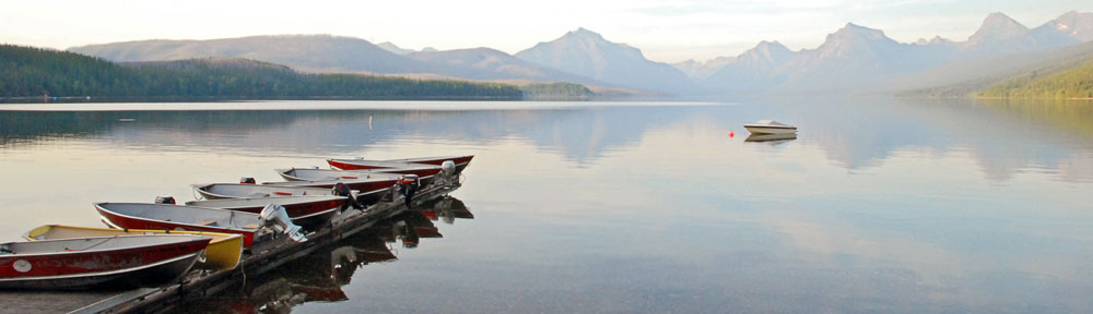
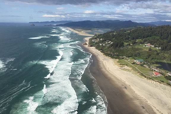
Or 28 hours off-the-grid.

I brought the Turtleback home on Wednesday and left it on my truck on purpose. I wanted to take it out for a short trip before I put it away.

I wanted to test it out in real off-the-grid conditions. I wanted to see how comfortable it was, how well I slept in it, how hot the water got, how loud the heater was. I wanted to cook a meal in it, wash dishes in its kitchen sink, and use the toilet in the middle of the night. I wanted to take it on a narrow gravel road and squeeze into a parking space I couldn’t dream of fitting into with its predecessor.

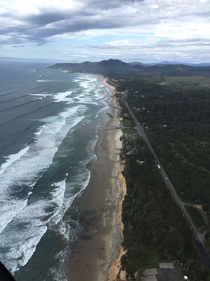
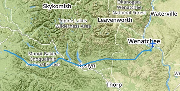
I’d do it locally — or relatively so. There’s a campground called Rock Island about 17 miles up Icicle Creek near Leavenworth Washington. The total driving distance is about 75 miles. One of my favorite trails, the Icicle Gorge Loop Trail, runs right past it. I thought I’d get a campsite, set up camp, and do the loop trail.

The campground page on the USFS website said Rock Island Campground got “heavy use.” I hate crowds so I didn’t want to do the trip on a weekend. I figured I’d do it on a “weekstart.” (If Friday through Sunday is the weekend, then Sunday through Tuesday should be the weekstart, no?) The way I saw it, most people left the campground on Sunday; I’d pull in on Sunday evening, get a good site, and avoid the crowds.

Heading Out

Of course, things don’t always turn out the way you want them to. I lost about two hours of my Sunday to a bee swarm call that was a total bust. (Don’t ask.) Then I spend another 30 minutes looking at new grills. By the time I got back home to pack, it was well after 4 PM. There was no way I’d have time to shower, pack, and head out before the friendly propane suppliers closed. I’d leave the first thing in the morning instead.

I was ready to go by 7:30 AM with the refrigerator packed, clothes and dog supplies loaded, and water tank topped off. I got a mile from my home before I remembered that I needed to harvest some broccoli that would flower if I didn’t and that I’d forgotten my Nikon. Twenty minutes later, I was headed out again.

I stopped at Ag Supply on North Wenatchee Avenue for propane. I asked for a “strong guy” to help me. Lots of places won’t load full propane bottles back into your truck. They’re not required to. But friendly places do. And the main drawback to the Turtleback is that the two 7-gallon propane tanks are in a cabinet about level with my head. Getting them down when they’re empty will be easy. Getting them back up there, not so much. And I had no idea how much propane was in them. I didn’t want to run out on my maiden voyage.

The kid who helped me used my stepladder to get them down and put them back. They were each about 1/2 full. I like to run one tank empty before switching to the other and refilling the empty so I always know I’ve got a full tank. These tanks have fancy gauges that I didn’t think worked. They do. They just read a little low.

The next stop was in Leavenworth: Safeway. I needed a gallon bottle of water — I don’t drink what comes out of an RV’s tank. (Ick.) And some orange juice. And an almond croissant. And a veggie platter to snack on. And bacon (which I forgot).

Once the groceries were loaded, Penny and I continued on our way with me munching a croissant. And then a donut. We drove through town and turned left onto Icicle Road. Soon we were winding up the canyon beside Icicle Creek, which was rushing madly with spring snow melt. Few cars were on the road — it wasn’t even 10 AM on that Monday morning. Pavement turned to gravel and we kept going, passing one campground after another. It was when we got to Chatter Creek Campground’s turn that I saw a pickup truck at the campground entrance. A woman was out of the truck moving a ribbon that stretched across the entrance drive. I stopped my rig and called out to her: “Is the campground closed?”

She came over and we chatted. All the Campgrounds past Johnny Creek were closed. Some biologists were checking out trees. Bark beetle was an issue. Was Rock Island closed? Yes. I pointed out that the website didn’t say the campground was closed. She had nothing to say about that. I asked her if the ranger station up the road had more information and she told me that was closed, too. But there’s some distributed camping, she said in a sort of wink-wink-nod-nod-say-no-more kind of way.

“Yeah, I’ll just find one of those sites,” I said. “This is set up for off-the-grid camping.” I thanked her and shifted into gear.

She took a step back and said, “Nice rig.”

I laughed and thanked her.

I kept driving. I took it slow. The truck handles a bit differently with the Turtleback on it. Higher center of gravity, exaggerated bumps, lots of squeaking. One of the things I’ve learned over the past few years is patience. I’m seldom in a hurry to do anything. I think it’s got to do with my relaxed lifestyle. So when I want to drive slowly, I can.

I passed one of the Icicle Gorge Loop Trail trailheads and kept going. Then I reached Rock Island Campground. It had the same red ribbons tied across its access roads with signs that said, “Closed to Public Use.” I kept going.

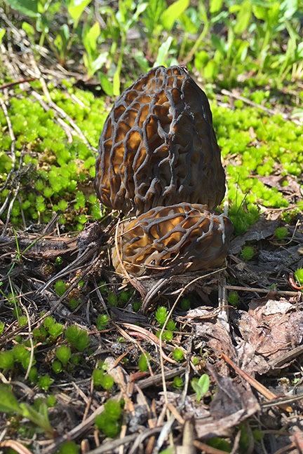
I stopped for a while in a parking area where I’d gone mushrooming with a friend the previous fall. Penny and I got out for a short walk in the woods. It was wet — I think it had rained that morning — and there was some flooding down on the trail. We didn’t stay long. We didn’t see any mushrooms either. Seriously: what was I thinking? It was way too early in the season for chanterelles.

We continued down the gravel road. The only thing left was a horse loading area, a horse campground, and the Icicle Creek Trail Trailhead at the very end of the road. The horse campground was closed (of course) and a pretty good water flow crossed the road just past it. Although the ford had a concrete bottom, I didn’t see any reason to drive through. I couldn’t camp at the trailhead. So I turned around and started looking at some of the side roads I’d passed.

One of them about halfway back to Rock Island Campground looked pretty good — but narrow. I parked the truck on the side of the road and got out with Penny to scout it out. I’d lost my cell signal before the pavement ended and the last thing I wanted was to get stuck on some dirt road in the middle of nowhere. Better to look on foot than explore with the truck and Turtleback.

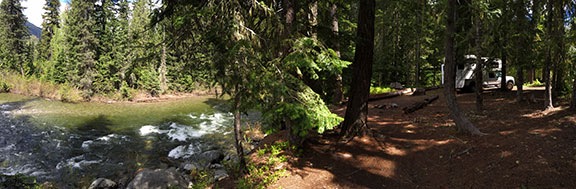
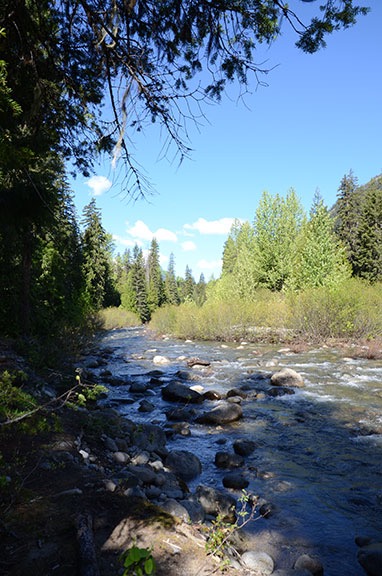
The road was narrow with scattered potholes, many of which were deep and full of running water. Branches came low over the road. The Turtleback is at least 12 feet tall and more than 8 feet wide — it would be pushing these branches aside as I drove. But there didn’t seem to be anyplace to drive to. One by one, we passed right turns that we either short or extremely narrow paths unsuitable for my rig. We kept walking. We’d gone about 1/3 mile when I saw it: the most amazing campsite I’d ever seen. Nearly level with a mix of sun and shade, a fire pit, logs to sit on, and Icicle Creek rushing past.

Not the best video in the world, but it gives you an idea of what the road was like. If you can, watch it fullscreen.

We went back to the truck and climbed on board. I used my phone to video our 4-minute drive back to the site. You can hear the truck and camper pushing through the branches. It sounds like I’m beating the crap out of my rig, but there wasn’t any damage.

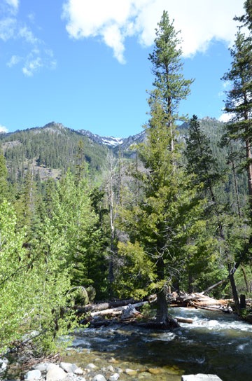
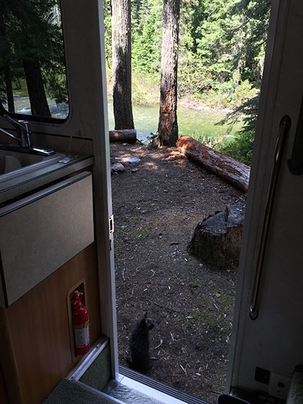
I backed into the campsite and killed the engine. Icicle Creek was about 50 feet from the camper door. I could hear the water rushing — it was about the only thing I could hear. It sounded wonderful.

My Campsite
Here’s a panoramic view of the campsite with the Turtleback parked in it.

And, of course, we were the only ones around — possibly for miles.

Setting Up Camp

There wasn’t much to setting up camp. That’s the beauty of traveling with an RV. You park it, open a slide (if you have one), and you’re good to go.

In my case, there was a bit more work. Although I’d brought linens with me, I hadn’t made the bed. So I did that. I also stowed the few items of clothing I’d brought. And the medicine cabinet items I planned to leave in there.

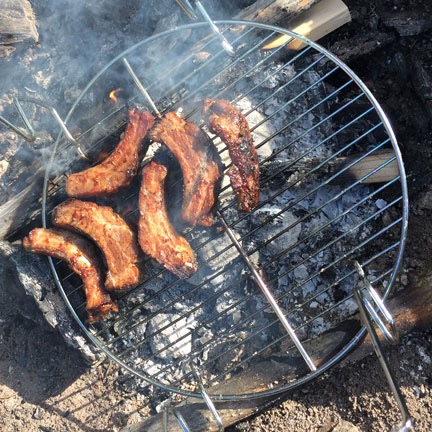
I’d also brought along some MatchLight charcoal, scrap lumber, and newspaper, all in a box. I put those outside beside the fire pit, along with a new grill I’d bought for cooking over the fire. I wasn’t going to “cook” — I had some smoked ribs that needed sauce and grilling to finish up before they were ready to eat. I was going to reheat them there. The only other alternative for reheating them was the convection microwave and I had no desire to run the generator.

Penny on Guard
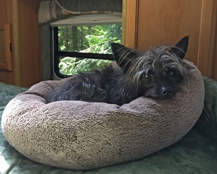
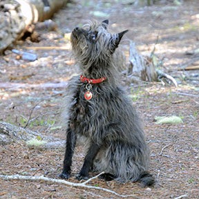
Penny on guard duty.

I should mention that while I was doing all this, Penny was sitting outside the camper door on high alert, shivering a bit in the cool air, watching the forest around us. She’s pretty funny sometimes. She’s incredibly brave for a small dog, always running far ahead on hikes and challenging other dogs that give her the weird eye. But there in the forest, in a place completely unfamiliar to her, she stuck close to home. I suspect it was because she couldn’t hear much above the sound of the rushing creek and she was likely smelling all kinds of wildlife that could include something as exotic as bears.

As I was finishing up, I started thinking about all the things I needed to set up a good camp. Some of the things were things I already had and could leave in the camper but had neglected to pack them: folding chairs, lantern, BBQ tongs, Dutch oven, steamer basket. Other things would have to be bought or otherwise acquired: battery monitor, stiff broom, outside door mat. Of course, I didn’t have a pen and paper to write these things down. So I fetched a pen from the truck and made lists on the back of the cardboard insert that had come with the BBQ grill. I added notebook w/pen to the bottom of the list. Duh.

I’d periodically add items to this list over the next 24 hours. And two more lists: things to fix/add (outdoor shower, DC outlet near stereo) and things to modify (bedroom closet, key hooks, mattress top).

The Hike

Penny and I went for a hike right from the campsite. There were narrow trails leading up and down Icicle Creek. I picked the one heading up and we started out.

Stream
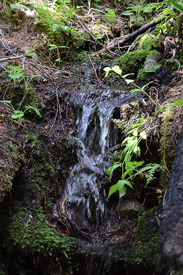
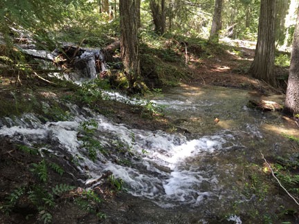
Spring runoff had streams running all over the place.

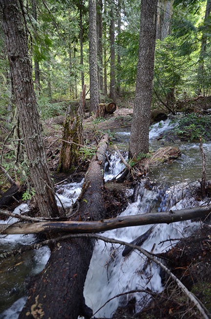
We didn’t get far before our path was blocked by a rushing stream. I didn’t want to get my feet wet and there didn’t seem to be a way to cross. But Penny was already finding another trail. I followed her up the little creek into the woods. After a while, the path turned back toward the creek and another chance at crossing. It was wider there, with strategically placed logs that looked crossable. But there was a lot of water flowing and falling in would not be good for either one of us.

Log
Penny and I crossed the stream on this log. Her way was blocked by the log and branch lying across the larger log.

Still, before I could make a decision, Penny had already started across, jumping from one stone or patch of earth to another and pausing on a center island. I knew I could get at least that far so I followed. Before I could stop her, she began trotting down the log that went to the other side. Trouble was, there were other logs on top of that log and her way was blocked. So she tried to find another way. Worried that she’d misstep and fall into the rushing water, I inched my way across the log, stopping near where she’d found another island to stand on. I coaxed her into my grasp, picked her up, and tossed her the final four feet to the opposite shore. Then I followed, hoping we wouldn’t have to go back the same way.

Seriously, though: my dog is very brave.

Or maybe not. The trail was narrow as it wound through the woods. For a while, there were signs of horse traffic — after all, the horse trailer parking area was just up the main road. Then that disappeared as the trail got really narrow and the brush seemed to close in. Penny ran ahead, as she usually does. At one point, she stopped along the trail, sniffing the air. She growled and then barked. I looked and saw nothing.

But although my sense of smell is better than most people’s, it’s no match for a dog’s. She was smelling something I couldn’t and it was getting her riled up. What was it? Could it be a bear?

Yes, there are bears in the area. No, I’ve never seen one there. But one of the signs I’d seen earlier in the day was all about keeping a bear-safe campsite. And here we were, in a thick forest, and Penny was barking at something I couldn’t seen.

Talk about creeping me out.

I hustled her along the trail, eager to keep moving, trying to remember if I was supposed to be quiet or make a lot of noise if I encountered a bear.

Pacific Trillium, White Pacific Trillium, Pink
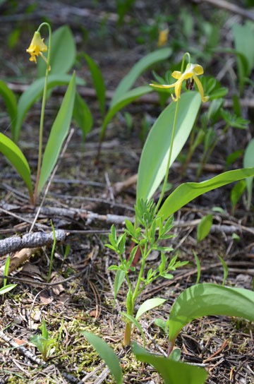
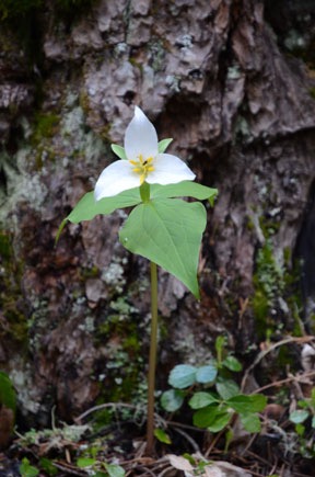
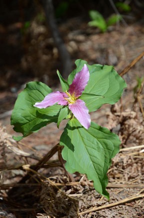
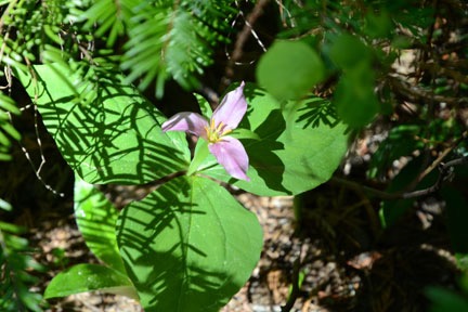
I did stay focused on the walk enough to take some photos of some of the flowers we saw along the way. These two look like two different colored versions of the same thing: Pacific Trillium. (Correct me if I’m wrong, please.)

After a while, the trail turned toward the road and dumped us in the horse trailer parking lot. We walked down the road as far as the ford, then turned around and followed it all the way back to the side road we’d turned down to camp. I’d had enough of the dense woods and Penny barking at things I couldn’t see.

Camp Trail
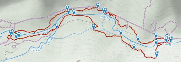
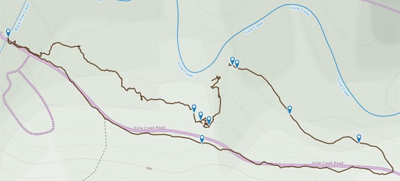
Here’s my track for the hike we took from camp. It was only 1.7 miles. You can find the stats and photos for this hike on the Gaia GPS website.

Relaxing

Penny in Bed
Of course I brought Penny’s bed with us.

I had a lunch of sardines with scallions on crackers — don’t knock it until you’ve tried it — and then stretched out on my bed with a book to relax. Penny couldn’t jump up on the bed so I had to lift her into place. She settled right down in her bed for a nap. Soon I was dozing off. (I’m still fighting a bit of a cold that I’ve had for over a month now and I get sleepy in the afternoon if I exert myself too much early in the day.) I found the sound of the creek soothing.

I dozed and read most of the afternoon. Outside, the sky changed from sunny to cloudy to sunny to cloudy more times than I could count. I was glad for the sun; the solar panels on the roof would keep the batteries charged. I was very eager to see whether they’d hold enough power to run the heater as necessary overnight. (The Mobile Mansion had failed me on a few nights on the previous winter’s snowbirding trip.) It was very windy, as it had been at home, but the wind was mostly up in the trees.

By 6 PM, I thought it was time to get dinner ready. The sun would sink behind the hills to the west long before the 8:30 PM sunset. So I built a fire, which took just one match on the dry paper and wood and MatchLight I’d brought along. While that burned down to coals, I got the broccoli I’d brought along ready to steam on the stove and opened a bottle of wine. I sat on the steps in the doorway, sipping wine and watching the creek rush past while Penny went on patrol, at one point barking at an invisible foe safely across the creek.

Ribs on the Grill
In hindsight, I don’t think it was worth building a fire just to heat up these ribs. Next time, I’ll bring my portable propane grill.

My new grill didn’t work as well as I’d hoped, but I made some modifications and got it to perform. That got the ribs sizzling enough to bring inside. I would have eaten outside if it had been a bit warmer, but with the sun gone behind the mountains, it chilled down quickly. I went inside and sat at the table facing the creek where I could see and hear it through the open door. Penny got two rib bones.

We didn’t stay up late. I crawled into bed before nine with my iPad and an ebook. I’d put Penny up there long before that. I killed the lights and read for a while in the dark. When my iPad fell out of my hands, I took off my reading glasses and went to sleep.

Morning in Camp

I slept pretty well. I’d set the heater to 60°F and it came on a few times during the night. It was remarkably quiet, especially compared to the one in the Mobile Mansion. I think it’s because it had a smaller blower since it had a much smaller space to heat. I was warm enough under the sheet, blanket, and comforter I’d put on the bed. But that didn’t stop me from waking between 4 and 5 AM, as I usually do.

I spent some time looking out at the stars through the big skylight over the bed.

I did a crossword puzzle on my iPad and was reading again at 5 AM when I began hearing a weird, rhythmic beeping sound. Three tones, repeated the same way, over and over. They were soft and got progressively louder and then got softer again. At 5:07, they stopped completely. Weird doesn’t begin to describe it. Eerie. I still don’t know what the sound was.

Up Icicle Creek
A morning look up Icicle Creek from my campsite.

I got out of bed around 6 AM and made coffee. I sat at the table to drink it and read some more. It was weird not being able to access the Internet to check the weather and read the news. The sun was up, touching the tops of the snow-capped peaks across the creek. But the campsite was still in shadows and would be until nearly 8 AM.

By that time, I was starting to pack up. Although there wasn’t anything preventing me from spending another day away from home, I didn’t see any reason to. The purpose of the trip had been to test out the Turtleback by actually living it in for a day. It had passed all tests with flying colors, surprising me with features I didn’t even know it had. For example, I discovered that the skylight over the bed opens and that it has two shades: one for dimming the light and one for blocking it. I discovered that the stereo has an audio in port. I discovered that the television mount enables it to pivot all the way around so it can be watched from the dining area. (Not that I could watch TV; I was really off the grid and don’t have a satellite subscription.) I discovered that the refrigerator door shelf dividers break very easily. (Oops.) I discovered that the water heater makes the water very hot. (Ouch.) I discovered that the bathroom is indeed smaller than one on an airliner and that if I was still as heavy as I was in my late married days, I might not be able to close the door. I discovered that one of the cabinet doors just doesn’t want to stay closed in transit.

I also discovered that the previous owner had left a can of Monkey Butt Powder in one of the bathroom cabinets.

So the plan was to drive around a bit to see if there were any more really good campsites and then do the Icicle Creek Gorge Trail.

Packing Up

Another nice thing about camping in an RV: packing up is very easy. I left the scrap lumber for the next camper and put the box with the MatchLight in it back into the camper. I turned off the water heater and water pump. I secured all the cabinet doors. And then I pushed the button to move the slide back in.

Done.

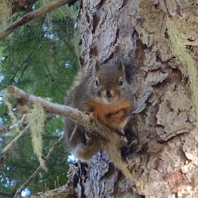
While I was doing this, Penny had caught sight of a squirrel and had chased it up a tree. I swear that she’d still be watching that damn rodent if I hadn’t called her away to get into the truck.

Squirrel Penny Looking at Squirrel
Penny chased this squirrel up a tree and then stared at it, trembling with anger and frustration as it taunted her with squirrel noises.

Icicle Gorge Loop Trail

Purple Trillium
More trillium, hiding beneath the fir trees.

Fairy Slipper
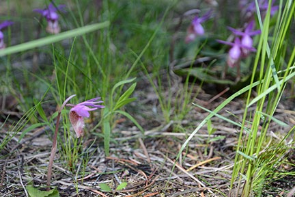
A patch of fairy slipper.

The Icicle Gorge Loop Trail is my favorite area trail. It’s got everything going for it: sun, shade, forest, meadow, rushing streams, small waterfalls, wildflowers. The 3- 4.2-mile well-worn trail is narrow and winding, climbing up and down gentle slopes all the way. Strategically placed benches give hikers places to rest in comfort. I’ve done the trail at least three times before yesterday — once alone and twice with friends.

There was only one car in the trailhead parking lot when Penny and I arrived with the truck and Turtleback. I slipped inside without opening the slide and raided the fridge and cabinets for something to drink, some cheese packets, and an energy bar. With my fanny pack filled and secured and my camera slung over my shoulder, Penny and I started down the trail.

Yellow Flower
I have no idea what these are. They grew in a relatively clear area not far from the creek. Anyone know? Tell me in the comments for this post.

Harsh Indian Paintbrush
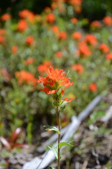
Harsh Indian paintbrush. I played around with bokeh — keeping a foreground item in focus while throwing the background out of focus — as much as I could.

Woodland Beardtongue
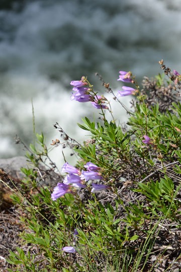
I’m pretty sure these are woodland beardtongue. They grew in patches near the creek.

Lupine
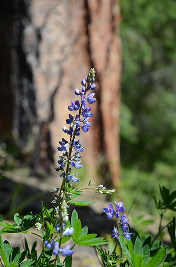
Lupine were all over the place. The trick was making an interesting composition.

Mountains and Creek
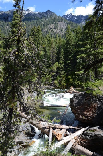
Snow-capped granite peaks were visible in many places towering above Icicle Creek.

Little Waterfall
Little waterfalls like this one were visible all along the trail.

Rushing Water
In many places, giant logs in the streambed attested to the power of rushing water.

I always hike the trail clockwise. I don’t know why, but I do. Yesterday was no different.

Everything was cool and lush and green. It was early May and although it’s been warmer than usual at home, it’s still nice and cool up in the mountains. And it was just after 9 AM — a good time to take advantage of a hike like this.

Penny ran ahead, as she does, and I took my time. Although I walked briskly when I was walking, I made lots of stops to take pictures both for my Gaia track and myself. I like to photograph wildflowers and flowing water and this hike gave me plenty of opportunities. There were lots of places were tiny streams crossed the trail. I suspected that much later in the day, after the sun had done its work on the snow-capped peaks around us, there would be even more water flowing.

And it was sunny. An absolutely perfect day. Hardly any wind, blue skies with puffy white clouds.

I took a lot of pictures.

The far side of the trail showed some serious winter damage with fallen trees across the trail and one that had even crushed one side of a bridge. It would take the efforts of many workers — I assume volunteers — to get the trail back in shape for the easy-to-moderate hike audience it is intended for. I found myself doing a lot of climbing over tree trunks and picking my way around blocked area of trails. I’d look into volunteering to help on the trail, but I suspect the work is done during cherry season when I have to be near my base and reachable by phone. (I’ll make some calls later today.)

I had the Gaia GPS app running on my phone and it counted off the miles one by one in Siri’s voice. I thought the hike was three miles long and was very surprised when Siri announced “Three Miles” when we reached the Rock Island Campground at the far west end of the loop.

“It can’t be three miles,” I argued. “The whole loop is only three miles.”

“Three miles,” she repeated. Which was weird because she never counts off a mile marker more than once.

Siri was right, of course. It was 4.2 miles. I don’t know where I got the idea it was only 3 miles.

It was only 1.2 miles back to the truck. During the hike, we’d passed a pair of older women once and three young women twice — they were all walking in the opposite direction. We exchanged cheerful greetings with each meeting and everyone had something to say about Penny, who darted around in front of them as if she wanted to play. For a while on the return leg of the loop, there was a single male hiker behind me. He stopped by the river for a while and then caught up again. I stopped to let him pass. He pointedly ignored me so I said loudly, “Good morning!” He grunted a response. I honestly can’t believe how unfriendly some people can be.

I was starting to stumble about a half mile before the end of the hike. Stumbling is my body’s way of telling me I’ve hiked long enough. In the old days, when I was a very big girl, the stumbling would start after about a mile. Later, when I was very thin, I could go eight miles before the stumbling started. Now that I’m somewhere in the middle, I start stumbling after three miles. I really need to get back in shape.

Back at the trailhead, I consulted the hike information sign, still not believing the hike was more than 3 miles. But it was there on the sign: 4.2 miles. According to Gaia GPS, I’d gone 4.6 miles.

Icicle Creek Gorge Trail
Here’s my track for the Icicle Creek Gorge Trail. You can find the stats and photos for this hike on the Gaia GPS website.

Heading Home

We headed home a while later, making a stop in Leavenworth for a bratwurst sandwich and some smoked meats at Cured. (Love their buckboard bacon.) My cell phone went nuts with missed calls and text messages once it picked up a cell signal. I answered one or two but decided to wait until I got home to get to the rest. If they waited that long, they could wait a few more hours.

It was about 1:30 when I pulled into the driveway and backed the Turtleback onto the concrete pad in front of my big RV garage door.

It had been a short but important trip. It showed me just how perfect my new rig would be for travel during my off season. Whether I wanted to go away for a single night or months, the Turtleback will give me a comfortable, affordable, and convenient place to stay. It also got me fired up for future travel with the Turtleback. I’m already planning a trip to the North Cascades in August, when cherry season is over. And there’s a very good chance that it’ll be my home away from home next winter for work and play. I can’t wait!