Grand Canyon Airport Tower

I make a visit to the FAA tower without any loss of life.

Grand Canyon Airport has two control towers. (Well, three, if you count the vacant one.)

One is at Papillon’s heliport. Attached to the building and accessible by its own staircase, it rises four stories above the heliport. It’s a small, simple room with enough space for two “controllers” and two or three visitors. New pilots are encouraged to visit the tower, to get a good idea of how traffic is controlled by Papillon’s tower staff. It’s amazing, really. Not only do the tower folks keep track of all us pilots as we’re flying in and out of the airport, but they manage aircraft loading, arrange flight (and break) schedules, and open and close flight plans with Prescott Flight Service Station. It’s safe to say that Papillon’s tower is the nerve center for the whole operation.

The other tower is the big, FAA tower. It’s an impressive structure, brand new and very tall. I’ve seen lot of control towers, both as a pilot and as a passenger on an airline, and this tower ranks high in the tower hierarchy. It’s at least as big as the one in Phoenix and possibly as tall, a slim white structure with a glassed-in octagon on top.

(The old, vacant tower is one of those four-story structures that were built on many Class Delta airports. Chandler has one just like it. I’ve been in Chandler’s tower and it wasn’t much more impressive than Papillon’s. Grand Canyon Tower’s staff moved out of that building to the new one a few years ago. Now they look at it across the runway and remember the roaches that infested it.)

I’d been wanting to visit the “big tower” — as I call it — for a while. Since starting at Papillon a month ago, I’ve spent at least three hours in Papillon’s tower. I go up there when I’m not schedule to fly so I can watch the wind readings and listen to the other pilots coming and going. But the big tower was different. It was the official air traffic control center for the airport, the final word, authorized by the FAA. And it was so impressive looking from the outside. What was it like inside?

Today, I finished flying early. Most of us did, in fact — the afternoon was pretty dead. Although Papillon doesn’t like to let pilots go home early, I figured I’d ask if I could visit the big tower. After all, I could be back in minutes; all it took was a call. Permission granted from Papillon’s powers-that-be, I called the big tower to see if I could visit.

After 9/11, tower security is generally very tight. In fact, I seriously doubt whether just anyone could get in. But I introduced myself by name and told them I was a Papillon pilot. I asked if I could visit, but only if they weren’t too busy. Gary, the guy on duty, put me on hold, then came back and said yes. “Drive up to the gate and we’ll buzz you in,” he advised me.

I was out in the Jeep in a flash, zipping out of Papillon’s parking lot and driving past the terminal building. I went straight where signs advised that “All Traffic Must Turn Left” and passed a sign that said “FAA Control Tower. Authorized Vehicles Only.” Gary had authorized me. The road turned to gravel and I continued along it. Then, through the trees, I could see the tower before me, looming up out of the forest. I noticed for the first time that a low building was attached to it. And the whole thing was surrounded by a very serious looking fence with a electric gate.

A sign on the fence said something like “FAA Control Tower. Accidents or loss of life can result from loss of operations.” Something like that. I can’t remember exactly, but I do remember the phrase “loss of life.” I started wondering if my visit could distract the controllers enough to result in loss of life. I hoped not.

There were three boxes on the driver’s side of the entryway before the gate. One was a mystery box; I have no clue what it was for. Another had a camera that looked right at me, kind of like the robot in Short Circuit. The other was a speaking box with a button on it. I pushed the button and waited. Nothing happened.

I started thinking about making radio calls to the tower that weren’t answered. You know, “Copter 28 would like a Southwest departure with Zulu” followed by a lot of silence. The tower just not noticing your call. You hesitating to repeat it, not wanting to piss off the controller, who had probably heard you but was chewing his lunch or swallowing a mouthful of coffee.

I hesitated, then began to wonder whether the button was more like a mike button. I pushed it again and said, “Hello?”

The gate began to open. I waited until it was open enough for my Jeep to squeeze through, then drove through. I waited on the other side. That’s something you’re supposed to do at those kinds of gates. So that other cars didn’t piggyback in with you. It didn’t matter that I’d just driven a half mile down a dirt road and there was no one behind me. The controller could be watching from up above. And then, the next time I needed a clearance, he’d make me wait, even if he wasn’t having lunch or coffee.

I moved on when the gate closed. I noticed that there was a similar arrangement of boxes at the exit gate and wondered whether that was so that they could lock people in. I reminded myself to be on my best behavior as I drove up the concrete drive to the base of the tower.

The parking lot was paved in concrete and had at least ten parking spots. There was one car there. I parked next to it and got out.

I passed a bicycle leaning up against the side of the building as I walked to the front door. I guess you don’t have to worry about getting your bike stolen when you have a security fence with barbed wire and cameras around your place of business.

At the door was another voice box. I tried the door and found it locked. Then I pushed the button on the voice box. Nothing happened. I wondered again whether the button was a mike button, but before I could try my greeting, the door opened from the inside. Danni, one of the controllers, was there to greet me.

I’d met Danni at breakfast one morning about three weeks before. I’d gotten to Tusayan a half hour early and decided to check out the local Internet café to see if they had a wireless network I could tap into. (They didn’t.) As I ordered my latte, I noticed Marty, who’d been one of my flight instructors in Long Beach, sitting at a table with a woman. Marty had taken a job with Papillon the previous year and had come back for the season. Danni was his friend from the tower.

Danni is a really nice person. The first time she hears your voice on the radio in the morning, she says, “Good morning!” and expects a suitable response. And the last flight of the day will always get a “Have a good night!” Not very FAAish, but very nice. Kind of reminds me that we’re all in it together. We’re tourist babysitters. She helps us with our tourists while dealing with the occasionally Sunday pilot’s adventure of landing at GCN.

Danni gave me a tour of the low building. Lot of office space, a full kitchen, and equipment rooms. Everything brand spanking new and totally underutilized. We rode the elevator up to a floor marked 6 (the elevator can stop at 1, 2, and 6; there are no other numbers), then took a flight of stairs to the top level.

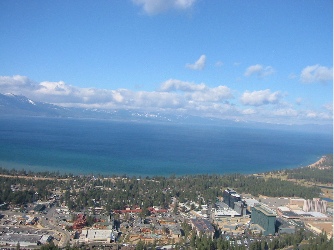
Ever wonder why you can’t take an elevator to the top floor in a control tower? It’s because the elevator shaft would block the view. A control tower is a big open room with windows on all sides. And this one had the best view of the Grand Canyon airport area. You could see for miles in every direction.

The room was surrounded with counter space. There were at least ten chairs, but only one had an occupant. Gary sat in the corner, in front of a laptop. A telephone receiver lay on the counter beside him. It turns out that the telephone receiver was actually a microphone, with a push to talk button between the earpiece and mouthpiece. It was on a very long curly cord, and as we chatted, he carried it around with him, talking into it now and then with his ATC voice.

Danni showed me around. I saw the radar screen, which tends to pick up ghost echoes and isn’t certified for use, but showed several aircraft in the area. I saw the wind reporting screen, which showed different winds for each of the three wind measuring locations on the airport, along with an average wind. The average was necessary because all three readings were different. I saw all kinds of screens that we didn’t really talk much about. I saw a device that printed out strips of paper with NOTAM and flight plan information on them. Danni showed me one for an incoming pilot’s flight plan. We looked at the time the pilot was expected in and realized he was due soon. He called in, got clearance, and landed during my visit.

My technical visit turned into a social call before I could stop it. Gary grew up in Wickenburg and wanted to know if I knew the people he’d grown up with. I didn’t. I’ve only been in Wickenburg since 1997; he left town in the early 80s. But that didn’t stop him from naming everyone he knew and making me come up with names of people I knew. Before long, my planned 15-minute visit to the tower had turned into 30 minutes. I told them I had to go.

Danni escorted me downstairs and outside. She told me to visit again. I promised I would.

Placerville, CA to Wickenburg, AZ – Day 1

Foiled by wind…again.

After sorting out my insurance problems (which required Mike to FedEx a check to the Bahamas) and spending a few pleasant days with Liz and Rod, it was time to head home. It was Friday, November 21 and I’d been away from home for four nights.

The weather was a mystery for quite a while. I used my laptop to connect to the Internet and check weather and flight planning info via Duats. The forecast called for clear skies and light winds. There was some mention of a storm coming in from the northwest later that afternoon, but I was pretty sure I could beat it out. So things looked good, at first. Of course, I did check all this at 5 AM, before it got light. When it got light, I found that the clouds were so low, we were in fog. Not a good thing.

Liz’s house is at 4800 feet. The airport is at 3600 feet. That meant that I’d have to fly through a layer of fog to climb above it. Not an option.

I said goodbye to Rod and he left for work at 6:30. I told Liz I wanted to be at the airport to fuel up and preflight by 8 AM. She got me there just as I requested. Three-Niner-Lima was completely covered with…well, I guess it must have been dew. But it was the dewiest dew I’d ever seen. It took six shop towels (you know, the blue paper ones on a roll?) to get the bubble dry. At least I’d been smart enough to leave the door vents closed so I didn’t have to dry the inside, too. And, of course, fog drifted across the runway as I worked. The mountains were completely obscured. Things didn’t look promising.

I fueled up anyway. We waited around the terminal for a while. I’d already decided that if I couldn’t leave by 9:30, I’d stay. I think Liz was hoping I’d stay. She talked me into going down into town to pick up a muffin for breakfast. That killed about 20 minutes. It was 9:30 when we got back. I called the flight service station (FSS) and the briefer told me he didn’t see any clouds at all. According to him, he could see snow covered mountains in our area on the satellite images. The fog broke up enough for me to give it a try. I said goodbye to Liz, started up Three-Niner-Lima, warmed it up, and took off.

I was glad I did. The fog was definitely burning off and most of it was below me. Once I got up a few hundred feet, I could clearly see the snowcapped Sierras. My route would take me along Route 50, through Echo Pass, where I would descend down into the Lake Tahoe area. Once I realized that I’d be able to give it a good shot, I found Route 50 and followed it closely, keeping about 500 feet off the road.

Liz and I had driven the road the day before, so I knew what to expect. Although I missed Bridal Veil Falls (I must have flown right over it), I did see Horsetail Falls. I also saw where a landslide had taken a huge chunk out of the mountain years before. I followed the road and the creek alongside it. I was surprised to see some kind of narrow canal running along the edge of the mountains on my right — I still need to check a map to see what that was.

All the time I flew, I climbed, getting higher and higher. I don’t remember what the elevation of Echo Pass is — I don’t have my charts in front of me right now — but it must have been about 7500 feet. Really not that high. Unfortunately, the clouds weren’t that high either. There were puffy clouds, like the fog down in Placerville, and they drifted about 100-200 feet above me. Going higher was not an option. Fortunately, I was high enough and the path in front of me was clear enough that I didn’t have to worry about terrain. And I was moving along at a good clip; with a 10-20 knot tailwind, my ground speed was about 100 knots.

For a few minutes as I neared the pass, things got a little tense. The clouds were close, the canyon was narrow. But then the canyon opened up to the valley beyond. The road veered off to the left, where it hugged the cliff for part of the way down. I could see Lake Tahoe airport ahead of me and, to my right, more of the Sierras. I started my descent to the Lake Tahoe area, a drop of about 2000 feet.

Photo
This photo taken just beyond Echo Pass, from the road the day before I flew though. Lake Tahoe Airport is dead center and you can see the lake beyond it, to the left.

Photo
Another photo taken just beyond Echo Pass, this time through my helicopter window as I cleared the pass.

I called in to Lake Tahoe Airport, requesting permission to transition to the east over the airport. Nothing was going on. The controller told me to proceed as requested. I crossed about 500 feet above the airport, to the south. I was quickly approaching the casinos of Stateline, NV. Liz and I had had lunch at Harrah’s the day before. The wind was howling that day, making it tough to walk across the parking lot. That morning, as I flew just south of the Casinos, the wind was calmer. Lake Tahoe tower called me again, asking where I was. I told him and he told me to have a nice flight.

Photo
South Lake Tahoe, CA and Stateline, NV. The two towns sit side by side. The highrises on the right are the casinos in Stateline; the green one is Harrah’s where we had lunch the day before.

I punched my next waypoint — Alpine, CA — into the GPS, then had to figure out the best way to get there. In all honesty, I didn’t want to go there. I wanted to go to the east of that point. I wanted to follow another highway, 395. But I wasn’t sure which of the roads leaving Lake Tahoe was the right road. And I didn’t want to go north, out of my way. I finally found a promising looking pass and headed for it, climbing with the terrain. There was a town there — I don’t know what it’s called — that has great views of the lake. As I flew over the lowest point, I saw another broad valley open up far below me. It had to be at least 3,000 feet down. I started my descent.

And that’s when the turbulence started. Gusts of wind slammed my ship repeatedly, knocking it all over the sky. Although I’d pushed the collective almost all the way to the floor to descend, at times I was climbing, carried up by updrafts. Three-Niner-Lima shook and rocked. For the first time in a long time, I felt a tang of fear. All I wanted was to descend to the valley floor. But the updrafts were making things very difficult. And against the huge backdrop of the Sierra Nevada Mountains, I felt like a tiny speck, an insignificant fly almost invisible to the world. It was scary.

It took about 10 minutes, but I eventually cleared the mountains and reached my cruise altitude of about 500 feet AGL. The turbulence were still with me, but greatly decreased. I continued on my way, feeling the fear subside.

After a few moments of confusion, I finally found the road I’d planned to follow. It would take me south, through a number of valleys along the east side of the Sierras. The view was stunning, with snowcapped peaks to my right and, in some cases, more to my left. I followed the road over small towns, through small mountain passes, past lakes, like Mono Lake. For the most part, I flew at about 7000 feet, but in some instances, I had to climb to 8000 or more.

Photo
Mono Lake, in the distance. I took this shot through the front of the bubble as I was flying; you can see my reflection (white shirt, black scarf).

Unfortunately, I couldn’t fully appreciate the view. The wind had kicked up and it was kicking me around. I don’t think I had more than 5 consecutive minutes of calm air at any one time. The turbulence definitely reached “moderate” levels. Although that doesn’t sound bad, believe me, it is. I was bobbing around like a cork on the ocean in a North Atlantic storm. I was having trouble keeping Three-Niner-Lima pointed in the right direction. I was starting to get airsick again. And I was not having fun.(And although I didn’t know it at the time, my Hobbs meter, which tracks engine running time, quit during this leg of my journey. I guess something got loose with all the shaking. I didn’t realize the Hobbs was dead until I got home, although the 1.3 hours it registered from Placerville certainly seemed low.)

Every time I reached one of my waypoints, I’d look down and see that there was nothing there for me. The airports I passed over were nothing more than paved strips. Some didn’t even have buildings. I didn’t bother making any radio calls; I would have been talking to myself. And the towns were never near the airports. They were always several miles away and very discouraging. I didn’t want to spend the night at another Rosamond.

So I’d set my GPS for the next waypoint and hope there was something better there. There wasn’t. But by the time I reached Mammoth, CA, I’d had enough. Mammoth, at least, had fuel. Supposedly, it had a restaurant. It would be a good place to take a rest.

Mammoth also had an AWOS. The recording reported winds of 18 gusting to 34 knots. Right across the runway. Nice. Good thing my wings weren’t bolted on. I made my radio call, then flew over the airport, planning a right crosswind toward the runway. I didn’t notice the hill in my path until it was close; I switched to the other side of the runway to make a left crosswind. My crosswind turn was more like a 180, so I was heading back the way I’d come. And that’s when I saw it: the storm that had been on my tail for the past hour and a half. All I could see was bright gray clouds and blowing snow. It didn’t look good.

I did my best to land along the taxiway. By that time, a golf cart had driven out to the ramp area. I used the radio to ask where I should park. He said something about a box that I didn’t see. The wind was making hover-taxiing very difficult. I had to move sideways, keeping my nose into the wind. I parked on a T-spot not far from the golf cart and told the driver it would take me a few minutes to cool down and shut down. Three-Niner-Lima was ready for shutdown in less than a minute. The outside air temperature was about 40Ôø? and the wind was howling.

The golf cart guy told me he was surprised to hear me coming in. He reported that a twin had tried twice to land and had given up and gone to Bishop (30 miles south) instead.

The golf cart guy took me to the terminal, which was beautifully appointed and warm. Two women sat at a desk. I hit the ladies room, then went to them for help. It was obvious that I wouldn’t be going any further that day. They helped me find a room at the Holiday Inn in town (7 miles away) and told me they’d call a taxi for me. They also told me that they were expecting snow that night and that there could be a lot of it. I asked about hangars and was told that they had one. A few minutes later, the two line men and I were dragging my helicopter across the ramp, tied to the back of a golf cart. I was never so glad that I’d brought along my ground handling wheels. When Three-Niner-Lima was tucked in for the night, I took my luggage back to the terminal and waited for a cab. It was about 1 PM local time.

The taxi driver took me to town, chatting the whole time. He recommended the restaurant across the street from the hotel. he saw me inside and drove away.

I got a room on the second floor at the front of the hotel, with a great view of the parking lot, a gas station, and Mammoth Mountain. But I couldn’t see much of the mountain because of the descending clouds. I relaxed for a while in my room, then went out to get lunch. It was cold outside, mostly because of the wind chill. I ate at a place across the street (not the one the taxi driver recommended), then went in search of warm clothes. Although I had my leather bomber jacket with me, I was wearing lace-up keds and didn’t have a hat or gloves. There was a row of “outlet” shops nearby and I hit a few stores, where I bought socks. (I’d buy winter shoes there the following day.) I then went to a ski outfitter shop where I picked up fleece headband, gloves, and a turtleneck. (For some idiotic reason, I’d left my scarf in the helicopter.)I spent the rest of the day back in my motel room, watching television. It wasn’t Rosamond, but I was beginning to wish I was home already.

Wickenburg, AZ to Placerville, CA – Day 2

What starts off as a bad day gets better, then worse, but ends up pretty good.

I was up by 4 AM. The only unusual thing about that was that I was in Rosamond, CA.

I killed time by working on the previous day’s blog and watching the news and weather. Arnold Schwartzenegger had been inaugurated as governor the day before. The weather north of Rosamond would be calm and relatively clear. When the sky brightened enough to see, I found a beautiful day waiting for me. Unfortunately, I still couldn’t get the cab company on the phone and didn’t know how I would get to the airport.

By 6:15 AM I was packed and ready to go. I woke the desk clerk, who came to the desk in her pajamas, with a sweater wrapped tightly around her. Together, we studied bus pamphlets and found another phone number. I finally spoke to the cab company. The woman who answered said they could pick me up at 2:15 PM that day. I hung up on her.

I spent the next 30 minutes trying to hire someone to take me to the airport. I failed. So I walked. I guess I was lucky. I thought it was 5 miles, but it turned out to be about 3. So I walked 2 miles less than I expected to. My bag was heavy and I worked up a sweat in the cool, early morning air. And as I walked, I made two resolutions: 1) I would never again stop for the night at an unattended airport and 2) I would trade in my Samsonite shoulder bag for a more practical backpack.

I reached Three-Niner-Lima at about 7:45 AM, did a good preflight, and spent about 10 minutes wiping the morning dew off the bubble so I could see through it. Then I climbed in, buckled up, and started up. I had to give it four hits of the primer to get it going. Three-Niner-Lima does not like cold, damp weather. The engine seemed to groan as it sucked cold oil. The blades didn’t start spinning right away. But ten minutes later, it was all warmed up, I had Tehatchapi programmed into the GPS, and native American flute music was coming through my headset. I picked up into a hover, announced my intentions to the Cessna doing touch and goes in the pattern, and took off to the north. It was about 8 AM.

Tehachapi was easy to find. Just head for the windmills. There had to be hundreds of them on the hills. I climbed and they got closer and closer. Some of them were spinning, but not many. They’d probably all been spinning hard the day before.

Photo
The windmills at Tehachapi Pass.

I cleared the windmills at about 6,000 feet MSL, listening to a Cherokee landing at Tehachapi airport. At the top of the mountain was a sort of bowl with two small airports and a mountain town. It looked like a much nicer town than Rosamond. But then again, any town looked much nicer than Rosamond. The more I thought about where I’d spent the night, the angrier I got about it.

Beyond the bowl, the mountains dropped away into the huge valley I’d be flying through. But from the air, it looked as if it were filled with water. Smog, fog, clouds? Who could say? Rod had recommended that I follow the foothills all the way to Placerville, heading northwest. The first waypoint on that side of the mountains would be Porterville. I punched it into the GPS, dropped to about 5,000 feet MSL, and flew along the west side of the Sierra Nevada Mountains. The air was smooth and the view was incredible. I could clearly see for dozens of miles along the foothills and beyond them to the snow-covered Sierra peaks. Below me were scattered ranches, cows, microwave antennas, and other signs of man. But mostly, there were the rolling hills, covered with grass and scrubby trees. The foothills in this area were high desert, similar to the area north of Malibu on the California coast. Drought was keeping the grass from getting really green, but it was still beautiful — much more pleasant than the barren desert I’d flown across the day before. My Rosamond experience was beginning to fade away to a dull lesson learned.

According to my GPS, I had a 10- to 15-knot tailwind. I was cruising along at about 100 knots ground speed, keeping my airspeed a bit low because of my altitude. At the Kern River canyon, that tailwind turned into a crosswind and tossed me around a little. I started thinking of the day before and how I’d started feeling sick. I realized that Porterville was at only 442 MSL and wondered why I was flying so high. I started a descent. At about 4000 feet MSL, I could see the smog layer in front of me. Above it, the sky was clear and blue and you could see for miles and miles. Below it, things were blanketed in a brownish haze. I could still see the ground there, so I continued to descend. By the time I was at 3000 feet MSL, the snow-capped peaks I’d been admiring for a while were hidden from view.

Photo
I begin my descent below the smog/haze level.

Once out of the foothills, I entered farmland. The land was filled with a patchwork of orange groves, dairy farms, cotton fields (already stripped of cotton) and fields of unidentifiable crops. I estimated visibility at about 8 miles. I passed over Porterville and set my GPS for the next waypoint, Hanford.

At this point, I was deviating from Rod’s suggestion to hug the foothills. This was the route I’d planned and it would keep me clear of the busy Fresno Class C airspace. There were more small airports along the way, more places to stop for rest and fuel. The visibility didn’t seem so bad so there was no reason to change my plan.

Of course, I was wrong. The farther west I flew, the worse the visibility became. By the time I reached Hanford, visibility had dropped to less than 3 miles and clouds formed a ceiling at 3000 feet MSL. It got chilly in the cockpit and looked like it might rain. I plugged in the next waypoint, Madera, and continued on my way. I was flying at about 800 feet MSL now, about 500 AGL. The ground was a flat quiltwork of farmland. That meant one thing: if there were any towers, they’d be tall. So I peered into the haze, searching for the flashing light that would reveal the presence of a tower before I hit it or its guy wires.

By the time I passed the Fresno Class C airspace, I’d had enough. I decided to head back to the foothills, taking a direct route to the fueling stop Rod had recommended: Columbia. I punched in the designator and saw that it was still over 70 miles away. I checked my fuel gauges. I did some quick math. It looked as if I could make it. I changed course and accelerated to 95 knots airspeed.

The farmland gave way to rolling hills and cattle ranches. The air cleared and I began to climb. As I climbed, I picked up a slight tailwind. My ground speed hit and exceeded 100 knots.

The next hour or so was tense, primarily because I wasn’t sure whether I had enough fuel to make it to Columbia. I steered the straightest course I could and kept my airspeed over 90 knots. As the ship lightened up, my collective began creeping up whenever I released it. Soon, I was making a conscious effort to hold it at 21 inches of manifold pressure. The farther into the foothills I flew, the fewer fueling alternatives there were. When the auxiliary fuel gauge slipped down to E and the main tank showed about 1/4, the GPS said I still had over 20 miles and 15 minutes to go. By that time, Columbia was the closest fuel stop and I was flying through an area filled with rugged hills and lakes. A low fuel light would really ruin my day.

But as I closed in on Columbia, I realized I’d make it. I overflew the field to get an idea of the lay of the land, then came in on Runway 17. I hover-taxied into a T-spot marked “Twins Only,” despite the fact that there was a helicopter parking area on the other end of the field. (Frankly, I’m getting a little sick of long walks just because my wings aren’t bolted on.) It was about 10:45 and I’d been flying for close to three hours straight.

One of the local airport bums walked out to check out my ship as I shut down. He told me about the helicopter parking area when I stepped out and I hold him I was too tired to walk. Besides, the airport was pretty quiet and it didn’t seem as if too many twins would be coming in during the next few hours. I asked him about restaurants and he told me about the closest one and then about the historic downtown area. I grabbed my purse, locked up the ship, and followed him into the terminal to order fuel and hit the ladies’ room. A bunch of airport bums were sitting in there, drinking coffee and eating donuts.

A while later, I was walking on the “nature trail” that wound from the airport toward the town’s historic area. Historic Columbia is quite a pleasant place, although at 11:30 AM on a Tuesday morning, things are pretty dead. Most of the quaint little shops were closed. A docent at the visitor’s center, dressed in a long black coat and black hat, recommended one of the saloons for a pastrami sandwich. I went in, had a seat at the bar, and ordered. I had to be very precise about how I wanted my sandwich; the bartender even asked if I want my bread heated. He served it with potato chips and a pickle. The bar was one of those high-ceilinged places that looked just the way you’d expect a saloon to look — if you think saloons should have bright, white walls and a spotlessly clean interior.

After lunch, I walked around the town a bit, peeked into stores, and bought some candy. The town’s architecture was interesting; many of the buildings dated back to the 1860s. Of course, the town had been destroyed by five two or three times during that decade, making you wonder why they continued to build with wood when so much stone was around. There were some brick buildings, too, as well as a brand new one that was being built with the same old architecture. I could imagine it housing a mini-mall of tourist shops.

Photo Photo
Two photos of Columbia, CA’s historic area. As you can see, it wasn’t too busy on that November Tuesday morning.

There were two separate fire stations in the town, and I’m not quite sure if it was always like that — they were within three blocks of each other. They were both open to the public, although the equipment they housed was safely behind bars. The first building had two or three old pumping wagons looking every bit as old as 150 years. The second one, however, had a fully restored pumping wagon dating from the 1850s. It was a beautiful old machine that was supposedly in full working order. I wished I could see and hear it in action.

I walked back to the airport, calculating that I’d probably walked a total of five miles so far that day. My helicopter had been fueled and the receipt was stuck in the passenger door. I did a preflight, added oil, and hopped in. As I took off over the airport’s grass runway (yes, I did say grass), I buzzed three deer that were grazing there. It was about 12:45 PM.

Calavaras County airport was my next waypoint. Calavaras was made famous, in part, by a short story by Mark Twain about a frog jumping contest. According to Rod, they did the contests annually until recently, when the animal cruelty people put a stop to it. Nothing like a bunch of frog huggers to ruin a 100+-year-old tradition.

I plugged Placerville into my GPS and closed the last bunch of miles quickly. I was flying at 3000 feet MSL now; Placerville’s runway was at 2600. Soon I saw it ahead in the distance, on a flat arm of of mountain, with canyons on both sides. I flew overhead, then made right traffic for runway 23. I touched down in a T-spot near the fuel island and shut down. It was about 1:30.

As I shut down, I thought about the flight. It had been long but relatively uneventful. If it weren’t for the wind the day before, I could have made it in one day. My total flying time had been about 7-1/2 hours. If the headwinds had been tailwinds, I could have shortened that time by about an hour.

I made a startling discovery when I tried to use my cell phone. Although I had a strong signal, I could not place a call. The system insisted on roaming and required a credit card number. This was the first time Verizon Wireless had failed me and I was angry. But the folks in the FBO were friendly and let me use their phone to call Liz and Mike. I left a message for Liz and spoke to Mike. Mike had bad news. He’d gotten a fax from Pathfinder, Three-Niner-Lima’s insurance company, that said my insurance had been cancelled two days before. Although I’d written the check to send them at least two weeks ago, I’d forgotten to mail it.

Liz showed up with her niece moments later. Our first order of business was to visit Bank of America and send a wire transfer. But it was after 2 PM, the cutoff time, and it would have to wait until the next day. Liz took her niece home, then took me on a quick tour of Placerville, pointing out good places to get coffee and eat. We stopped by the place where Rod worked and left him a message. Then we drove down twelve miles of twisty mountain roads to her house. Although most of the trees were tall pines, there were also a few oaks and other types showing off fall colors. It reminded me of the mountains of northern New York state, where we used to go to see the fall colors. The whole time we rode, I thought about how great it would be to go motorcycling there.

I spent the evening with my friends Liz and Rod and Rod’s mom, who was visiting with them. We went out to dinner, then came back to their house to relax in front of the television. Michael Jackson was all over the news. When I went to bed at 11 PM, it was in a comfortable bed, under a warm down blanket. Rosamond was a dim memory.

Wickenburg, AZ to Placerville, CA – Day 1

Foiled by wind.

I planned the trip for hours. That’s the truth. I knew I was going to go on a helicopter trip, but I didn’t know where I was going. It wasn’t until Friday, when I met Rod’s friend Nick, that I decided. I’d go to Placerville, to visit Liz and Rod. But it wasn’t until Sunday that I started planning a route.

The trouble with getting to Placerville from Wickenburg is the Sierra Nevada mountain range. There aren’t many places to cross it without climbing to altitudes that would cause Three-Niner-Lima to vibrate to pieces. (Three-Niner-Lima starts vibrating at 8500 feet.) I finally decided on the Tehachapi Pass, northwest of Palmdale. I then listed all the airports along the way, noting which ones had fuel (all of them) and restaurants (few of them). I marked up a WAC. And then I packed.

I got off to a late start on Monday morning. I’d hoped to leave by 8 AM; I took off at 9. I’d filed a flight plan to Apple Valley via Twentynine Palms. It was an ambitious flight plan. I’d have to fly direct at an average about 90 knots ground speed.

Flying direct was new for me. I have a tendency to follow roads when I fly and to look for mountain passes when I have to cross mountain ranges. Things worked out well for me at the start of this trip. I headed almost due west, over Forepaugh, and north of Eagle Roost. Then through Cunningham Pass, and over the Cactus Plains to the Colorado River, south of Parker. The terrain was boring, water-scarred desert, broken by mountains thrust out of the desert floor. To someone from the east or north or midwest, the terrain would be fascinating. But when you’ve flown over it as many times as I have, it loses its charm.

The Colorado River wound through the desert, a dark blue ribbon cutting across the dust and rock. Beyond it, the desert floor was flat, sloping gently back toward the river, scarred with thousands of tiny washes. I imagined the scene before me during a rainstorm, when water flowed in every single channel. I crossed over a VOR and followed a road and a line of train tracks. The track ballast consisted of light and dark colored stones. I caught sight of a name written alongside the tracks in carefully arranged stones. Then another and another. I soon realized that there were hundreds of names, all neatly written in stone in the middle of nowhere. I circled to take a picture. At least this was something interesting.

Photo
This photo doesn’t do the site justice; the names in stone went on for at least a mile.

Monitoring my progress on the Los Angeles Sectional chart now, I crossed over what had once been the town of Rice. It was a railroad junction where a few train cars waited on a siding. There were building ruins, including a stone building that still had one full wall standing. Lots of debris and trash. I continued on my course, almost due west, and passed south of Iron Mountain, with it single north/south runway. Nothing going on there.

Rocky hills and mountains rose from the desert floor. My path took me beside several of them. I joined up again with the road I’d left at Rice. It formed the northern border of Joshua Tree National Park. I stayed north of the road, flying about 300 feet AGL, admiring the stark rocks of the Coxcomb Mountains to the south. I climbed with the terrain, reaching an altitude of almost 3000 feet.

Joshua Tree
The landscape just northeast of the northern edge of Joshua Tree National Park.

Throughout the flight, I’d managed to maintain an airspeed that varied from 85 knots to 95 knots, with a similar ground speed. Still, flying at nearly full power with carb heat on, I was burning fuel at a higher rate than I’d expected. As Dale Lake (mostly dry) and the Twentynine Palms VOR came into view, I realized that I would not make it to Apple Valley. I made my first call to Twentynine Palms while I was ten miles out. No response. An airplane called in when I was about five miles out. He didn’t get any response either. He said he was heading toward Hi Desert, the next airport on my path, about 15 miles further along. I asked if there was fuel at Hi Desert — the chart said there was, but you never know — and he told me there was. I decided to go there instead. At least I knew there would be someone there.

Dale Lake
Dale Lake did have some water in it. But not much.

I passed Twentynine Palms airport just to the north of its runways. The field looked to be in good condition and I could see a big Chevron sign by the fuel pumps. About a half dozen planes were parked on the ramp. But there was no sign of life. I kept flying.

I overflew the rather large town of Twentynine Palms. Between Hi Desert and me was a mesa; I decided to fly around it, to the south. Meanwhile, the plane, a Cherokee, was getting closer to Hi Desert. Although I expected him to beat me in, he was still 5 miles out when I had the airport in sight. It wasn’t much to look at. I overflew it to check the wind, reported my findings to the Cherokee, and made a spiral landing down to the fuel pumps. It was about 11 AM.

Hi Desert is an airpark, something that isn’t obvious when you consult a sectional chart for information. It had one runway, which was in pretty good shape, and a handful of Mexican style adobe buildings on the southeast end of the runway. It looked as if it had once been a very nice place, but had since been neglected, probably because no one was around to admire it. I was shutting down when the Cherokee landed. The pilot appeared from behind some buildings when I was looking for a bathroom. Although the sign on the FBO door said it was open from 8 AM to 5 PM, everything was locked up tight.

The Cherokee pilot pointed out a bathroom that appeared to have been added as an afterthought to a shed. It was bright, but reminded me of the kind of rest room you’d find at a very old gas station. Not exactly dirty, but certainly not clean. There was toilet paper, but no paper towel. The Cherokee pilot helped me with the fuel hose, then spent some time looking at my helicopter while I fueled it. We chatted about the place. I told him that my husband and I were looking for a place like that. He told me it was for sale. I told him we weren’t interested in living in California. He told me he couldn’t blame us. Then a friend of his walked up and they started talking about other things. I finished up and put away the hose and static line, which was hopelessly tangled. I checked the oil, warned them to stand back, then climbed aboard and started up. It was about 11:20 AM. It wasn’t until the blades were spinning that I realized I’d forgotten to take a picture. It would have made an interesting shot.

I waved goodbye and climbed out, continuing toward Apple Valley. My course was now slightly northwest. Twentynine Palms and Hi Desert are just south of a bunch of restricted areas, which is why I had to remain so far south. Now I was flying across the high desert, with terrain roughly 2500 to 3500 feet. And the wind had kicked up. As I flew on the north side of the San Bernadino Mountains, I realized I was hitting headwinds of 20 to 30 knots. In the somewhat gusty conditions, it was tough to maintain an airspeed of 95 without getting dangerously close to my never exceed speed of 102 when the wind gusted, so I let it slip to 90. That gave me ground speeds in the 60s. As I flew along the road at Lucerne Valley, I realized that some of the cars were passing me. I dropped altitude in an attempt to stay out of the worst of the wind, but that didn’t seem to help at all. I was very glad I’d fueled at Hi Desert; I never would have made it to Apple Valley.

Meanwhile, the terrain wasn’t being as cooperative along my course. A mountain separated me from Apple Valley. Again, I skirted along the southern end of it, slipping through a pass about 5 miles southeast of the airport. There was a Decathalon in the pattern there; a Citation had landed when I was still 15 miles out. The airport was large and looked brand new, although there didn’t seem to be many planes on the ramp. I announced that I was transitioning but would remain east and then north of the runways. Someone with the Decathalon pilot — an instructor, perhaps? — thanked me. I continued on, heading into the wind, toward Victorville.

Victorville, or Southern California Logistics, is a controlled airport used primarily by the military. The AWOS was on a frequency that my radio couldn’t get. So I tuned into the tower while I was about 8 miles out and told them I wanted to transition westbound. “Transition approved,” was the reply I got. Simple as that. As I approached the airport, I realized that it was huge and full of parked airliners. Most of them wore United paint jobs, but I did notice one for Tower Air. An army helicopter was making excruciatingly slow approaches to the end of the runway. All around the airport were buildings and the ruins of buildings. I assume this had once been a big air force base that was no longer needed. The radio was quiet. When I was a mile out, I reminded the tower that I’d be flying over. He acknowledged my call with a simple, “Roger.” I punched L00 for Rosamond into my GPS. According to my research, Rosamond had fuel and a restaurant. It would make a good next stop, someplace where I could reassess my route over the mountains. I headed northwest, crossing more high desert. Below me were scattered ruins of stone walls and foundations. As I approached the southern edge of the restricted area around Edwards Air Force Base, I could clearly see Rogers Lake and the buildings of Edwards. I followed a paved road due west for a while, flying over a few homes, most of which were manufactured. My route took me far to the north of Palmdale and far enough to the north of General Fox, so I didn’t need to talk to either of these controlled airports.

Meanwhile, I realized that I was getting kind of sick. Like airsick. The problem was, the wind was gusty and the helicopter was doing a lot of bobbing around. Every time I consulted the chart to see exactly where I was — a GPS is nice, but situational awareness is important — I’d look up to find myself facing another direction. I’d correct my course, bounce up and down a few times, then check the map again. It was uncomfortable flying. And up ahead, I could see where the high valley I was in ended, with the windmills of Tehachapi pass. I’d been warned about the wind in the pass and had a feeling it would be worse than where I was now.

I crossed Rosamond Lake (mostly dry) and saw ripples on the water. Then I saw something that took me a while to figure out. It was a dark object, moving across the surface of the water, leaving dusty water behind it. At first, I thought it was a swimming animal. But the shape was all wrong. I realized then that it was a tumbleweed, being blown across the lake surface. We’re talking serious wind.

Rosamond Airport was beyond the town and it took a while to find it. I made a few calls in and didn’t hear any response. I overflew the field and saw windsocks flying straight out with a cross wind. I made right traffic to Runaway 25. As I was landing, I saw two people watching me. That’s when I realized that Rosamond was an airpark, too.

I set down by the pumps and shut down. There was nothing going on. The FBO office looked closed. The wind was howling.

A man stood by the FBO office. He told me he’d been listening on the radio and was very surprised to hear a helicopter coming in. He confirmed what I’d already suspected: that the restaurant was closed. He told me I could use his phone to call flight service about the weather. Feeling a bit dazed after almost two hours of bouncing around in the air, I followed him. He took me to his home, where his wife was waiting. They gave me the phone and waited while I called Flight Service. I was on hold a long time. When I got a briefer, he gave me the bad news. Winds of 30 gusting to 41 up in the mountain passes. Clouds building. The wind would calm by 7 PM, but there would be clouds in the valley in the morning.

One thing was clear: I wouldn’t be flying over the mountains that day.

I went back to the helicopter, filled it with fuel, and moved it into a parking spot. Moving it wasn’t easy; although I’d brought the ground handling wheels with me, they were underinflated. I tied down the blades and was removing my luggage when my new friend reappeared. He brought me back to his house, where his wife offered to let me stay there. That was weird, but what was weirder was that they were leaving, going back to their primary home in Los Angeles. They were offering to let me stay alone in their house. I thanked them, but said no.

So they brought me into town, where I starting to think I’d made a bad decision about staying at all. There was nothing going on in town — in fact, there wasn’t even much of a town. They drove me around for a while, then stopped at the Devonshire Motel, which one of their neighbors had recommended. I thanked them again, then climbed out with my luggage to get a room.

Inside the motel office, the desk clerk was struggling to get a fax machine working. She said the machine showed an empty paper message and kept trying to close the top of the machine without properly loading the paper. A man, who was waiting to receive a fax, was talking to someone on his cell phone. When it became obvious that it wasn’t going to work, he thanked her and left.

I got a room and the phone number for the local cab company, Dial-a-Ride. My room was on the second floor of the two-story building, just at the top of the stairs. It was clean, but otherwise unremarkable. I used my cell phone to call Mike and report where I was and why I’d stopped for the day. Then I called Liz and Rod and left a message with them.

I tried calling the cab company, but the phone was busy.

I walked to a Mexican place I’d seen nearby and had some lunch. It wasn’t bad, but it wasn’t anything to write home about. I walked back to my room. By this time, it was about 2 PM. I had an entire day to kill, but there wasn’t anything within walking distance of my motel to do. The town seemed to consist of a handful of schools, fast food joints, and a strip mall with a supermarket, pharmacy, and other necessities of life. There was no quaint town to walk through, no museum, no points of interest.

I spent the afternoon watching TV and starting this blog. And I called the cab company over and over. The phone was always busy.

Liz called to see where I was. She’d misheard me on the phone and thought I was near Santa Rosa, which she knew was pretty much impossible. I filled her in. Later, Mike called. I filled him in. Even later, Rod called. I filled him in, too.

At about 7 PM, I walked next door to the Fosters Freeze, an ice cream/burger chain in California. I bought a hot fudge sundae (so much for the diet). I tried to buy a souvenir tee shirt for Mike, but they didn’t have his size. I went back to the room, listened to the busy signal when I called the cab company, and watched Stargate reruns. By 9 PM, I was asleep.