A Trip to Tempe Camera

Or why I will not be buying a new camera this week.

Yesterday, while in the Phoenix area, I finally brought my camera in to Tempe Camera to get its sensor and related electronics inside the lens hole cleaned. I’ve owned my Nikon D80 since May 2007 and it had never been professionally cleaned.

(A side note here: New York City photographers may remember Nikon House in Rockefeller Center. One of the services offered there was a free camera cleaning to Nikon owners. You’d walk in with your camera, hand it over, and while you browsed the gallery, they’d professionally clean it for you. I didn’t have a Nikon in those days and those day are long gone.)

The D80 was my first digital SLR. It had been on the market about a year when I bought it and had gotten lots of good reviews. At the time, it was probably considered Nikon’s top of the line consumer model DSLR. The reviews and the fact that it would work with my Nikon 6006 AF lenses is what sold me on it.

AtlasSince buying the camera, I’ve put a lot of money into lenses. I buy Nikkor lenses and I learned early on to avoid the low-end models. My favorite lens is a super multi-purpose 16-85mm DX lens. Sure, there’s some distortion at the widest focal length, but I like the effect for some of my shots. I also have a 10-24mm, 18-85mm (from my film camera days), 10.5mm fisheye (what a bunch of funky photos that makes; see example here, coincidentally shot less than a block from where Nikon House was), 70-200mm (also from film days), and 105-300mm (I think). And an f1.2 50mm lens (also from film days; came with one of my 6006s. (I have two if anyone is interested in buying one.)

The point is, I have a lot invested in what can now be considered a mid (or possibly low) end, dated camera.

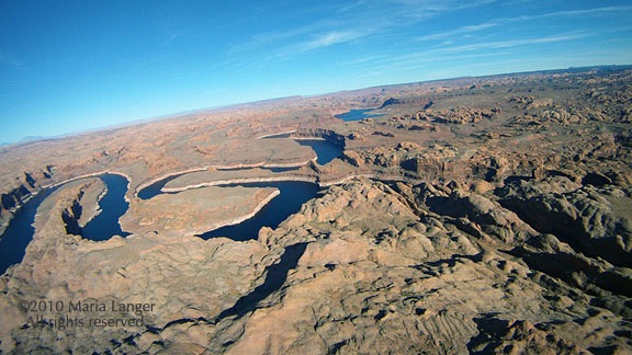
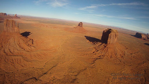
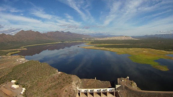
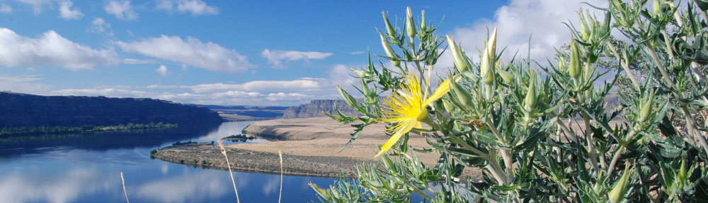
I’m not very happy with the quality of the camera’s photos lately. They seem to lack the clarity I’m looking for in photos. I bring them into Photoshop, zoom to 100% magnification, and check the details. No crispness. The situation seems to be getting worse, but in reality, when I compare them to photos to the first trip I took with the camera — Alaska in 2007 — I don’t see much of a quality difference.

Of course, it could be my eyesight, which is definitely worsening as I age.

Or it could be that I simply wasn’t as picky several years ago.

I’ve been trying hard lately to eliminate the possible causes of the problems. A photography seminar at the Desert Botanical Gardens last year with Arizona Highways editor Jeff Kida gave me a place to start. His advice was to always use a tripod. I’d always pooh-poohed photographers who used tripods in the bright Arizona sun — mostly at the Grand Canyon, where they gather like lint in a dryer screen along the walkways at certain viewpoints at sunrise and sunset. Even with plenty of light to get shutter speeds in excess of 1/500 of a second, they’re positioning their tripod legs, adding what looks like a lot of effort to each snapshot.

View from atop Doe Mountain in SedonaI have no shortage of tripods, so I started using them. The results were not much better, although just using the tripod forced me to think harder about every shot — mostly because of what a pain in the ass it is to set up a tripod. I actually bought a new ball head for my good Manfrotto tripod just to make setup easier.

Cleaning the sensors seemed like the next step. I’d done a dumb thing a year or two ago: I’d used canned air to try to blow dust out. I should have realized that propellant could also come out with the air and that propellent might stick like glue to the sensors. After thinking about this for a good six months, I finally had an opportunity to take the camera in to get it done professionally.

Hence my trip to Tempe Camera.

Tempe Camera LogoIf you’re a professional photographer in the Phoenix area, I don’t have to tell you about Tempe Camera. You probably know it very well. If you’re a serious amateur, you should get to know it. It’s a great resource.

The place is basically split into three departments:

  • Sales sells new and used camera equipment, including camera bodies, lenses, tripods, camera bags, lights, light stands, etc. They even sell darkroom equipment, film (remember that?), and photographic paper and chemicals. If it has anything to do with photography, chances are, you can find it on Tempe Camera’s second floor sales area.
  • Repairs does camera repairs. They’ll handle anything from my simple sensor cleaning job to more complex repairs on any kind of camera equipment. You’ll find them on the first floor.
  • Rentals rents camera equipment. Not only will you find a bunch of camera bodies and lenses, but they have a ton of video equipment, lights, light stands, audio equipments, etc. You’ll find them on the first floor, to the left of the Repairs desk.

After dropping off my camera at the Repairs desk and chatting with the folks at the rental desk about my Moitek Video Camera Mount, I climbed the stairs to start exploring the possibility of getting a new camera. Because of my huge lens investment, I didn’t want to upgrade to a camera that couldn’t use the lenses I already had, but I was ready for bad news if it would be delivered.

At the counter, I soon got the attention of a guy not much older than me who, fortunately for me, was a Nikon guy. (Anyone who does photography knows that there’s a Nikon vs. Canon rivalry that’s just plain silly. They’re both good cameras. Anyone who’s heavily invested in one is not likely to switch to the other, so just give it a rest, folks.) During the conversation, I discovered that he’d been doing serious photography and had had photos published for the past 38 years. (He wasn’t some college kid — Tempe is home of ASU — who doesn’t know jack shit about photography.)

Cactus FlowersI told him my situation: I’d owned a D80 for three years, had a lot of decent quality Nikon DX lenses, and was disappointed with the clarity of my photos. Was there a better camera model I could upgrade to without having to toss my lenses? He asked about the kinds of things I shoot. I told him I mostly shot landscapes, outdoors, in natural light.

The cameras were laid out on a shelf under the glass countertop in order of price/feature set with the low end cameras on my left and the higher end cameras on my right. He pointed out the D90 and D300S. He told me that stepping up to either one would make a big difference, since they both used CMOS sensors and had better software. Both would use the lenses I had. He then told me a personal story about stepping up from a D200 years ago to some other newer model (I forget which) and the mind-blowing difference in the quality of his photos. Camera software was very important.

We talked about my lenses. I told him about the 16-85mm and 10-24mm DX lenses. He said the 10-24mm lens I had was probably the second best lens Nikon made in that line. He said my problem was probably not due to the optics of my lenses.

I asked him about the full-frame sensors — and pardon me if I got the name of that wrong, but he did know what I was talking about. He said that they weren’t likely to improve the overall quality of the images. He said that what they would do is make it possible to create much larger prints. Cameras with full-frame sensors could not be used with my lenses, so I didn’t need to explore that avenue much farther.

We talked about a few things that could improve photo quality. The subject of shooting in raw and manipulating in Photoshop or some other image editing software package came up. He claimed that alone could improve image quality by 33%. (No, I don’t know where he got that number from.) I’d been told by others — Ann Torrence comes to mind — that shooting raw would help, but I know nothing about processing raw, so I hesitated to open what would likely be a tangled can of worms. Now I’m thinking about that can and have already started studying up with Camera Raw courses on Lynda.com.

Gunsite ButteI told him my husband already had a D90. He told me I should try it and see if I could notice a difference.

And this is what impressed me so much about my visit. I took at least 5 to 10 minutes of this guy’s time and picked his brain for information. Although I was ready to seriously consider buying a new camera, he didn’t try to sell me one. Instead, he offered some solutions that would take advantage of the relatively expensive equipment I already had. It was a “try this first” approach; not a “buy this first” approach.

So the next time I take a trip, I’ll bring my husband’s D90 along. I’ll use a tripod and I’ll shoot in jpeg+raw. I’ll experiment with raw file post-processing. And I’ll see if anything makes a difference.

One thing I know for sure: if I decide I’m ready to put my D80 aside, I’ll be gong to Tempe Camera to buy its replacement.

Bring the Right Lens

No, a telephoto lens is probably not the right one for aerial photography.

Slot Canyon

This is the slot canyon I needed to photograph from the air. The slot is actually wide enough for an ATV to drive through; there were tire tracks in the sand. (Nosecam photo.)

Yesterday, my husband and I took the helicopter out to get some aerial photos in the Alamo Lake area. I’ve been writing for Aircraft Owner Online magazine and have a bunch of stories that don’t have photos to go with them. This flight was a chance for me to do some fun flying while getting the pictures I needed.

I set up the helicopter’s “nosecam” to capture an overall view of the area. The camera has a wide angle lens which does add some distortion to the photos, but not enough to render the photos unusable. In fact, during my recent Southwest Circle Helicopter Adventure excursion last week, I captured hundreds of very usable shots, some of which you can find here. The camera has no controls; it’s set up to take a shot every 5 seconds.

My husband also brought along his Nikon D90. I didn’t pay much attention to the lens he’d bought along. He usually uses my old favorite, an 18-85 (I think) zoom, and that would be perfect for this mission. We took both front doors off and put in the dual controls so either of us could fly while the other took photos.

I took off and we headed west. Once I’d established us in level fight, I offered him the controls. He took them. I reached for the camera.

And that’s when I saw that he’d put on a 70-210 zoom lens.

I felt my heart sink as I looked through the lens. At our 500-foot cruising altitude, it was simply too zoomed in to be useful. Sure, I could take photos of the occasional grazing cow we flew past, but there was no way I’d be able to capture the “big picture” views I needed for my articles. For that, we’d have to gain another 2,000 feet in elevation.

Sorely disappointed, I put the camera down and just watched the desert scenery go by.

Bringing the wrong lens along on an aerial photo flight is something I see first-time aerial photographers do all the time. For some reason, they get the idea in their head that things will be far away and they need telephoto power to frame them properly. In a helicopter, this can’t be further from the truth. I routinely cruise at 500 feet AGL and am willing to go as low as 100 feet (depending on the circumstances) for a photographer to get the shot he needs. Some of the best photos taken from my helicopter have been taken with focal lengths less than 50mm.

Wayside Inn

The Wayside Inn is in the middle of nowhere. And yes, those are parked airplanes in the bottom-right corner of the photo. (Nosecam photo.)

A telephoto lens is a bad choice for another reason: the longer the lens, the faster the shutter speed required to prevent blur caused by a too-low shutter speed. The rule of thumb formula is generally 1/focal length for minimum speed. So a 70mm lens would require a 1/70 second minimum shutter speed. But since our digital cameras have a 1.5 focal conversion (meaning that a 70mm lens is equivalent to a 105mm lens), that ups the speed to 1/105 second minimum shutter speed. Not a big deal on a bright Arizona day, but remember: that’s a minimum rule of thumb and I don’t think it takes into account the increased vibrations of a helicopter. (I wouldn’t shoot anything from a helicopter at less than 1/500 second without gyro stabilization.)

Departing Plane

A bonus shot captured perfectly by the nosecam after we’d landed and shut down. That’s the main rotor blade parked dead center.

When I took back the controls a while later, Mike took the camera. I think he immediately saw what I meant. He was surprised. He did take some photos — among them, some bulls locking horns out in the desert — but not many. The camera simply wasn’t properly equipped for our mission.

Fortunately, the nosecam had us covered.

Lake Powell to Monument Valley by Helicopter

Part of my Southwest Circle Helicopter Adventure.

This article was originally written for Aircraft Owner Online magazine. I write their monthly “Adventure Flying” column. I normally pull old blog posts for publication, but this time, I wrote an original piece for them. You can find it in their November 2010 issue.

Although I’m based in the Phoenix, AZ area, I spend an unusual of time at Lake Powell doing aerial photo flights for amateur and professional photographers. In September of this year, I flew a total of 20 hours over the lake with at least 20 different photographers on board. I usually get as far uplake as the San Juan River confluence, which is halfway to Monument Valley. But due to the difficulty and expense of getting aerial photo permits for Monument Valley, I rarely fly there.

The one thing that does get me to Monument Valley is Flying M Air‘s Southwest Circle Helicopter Adventure. That’s a 6-day excursion by helicopter that starts in Phoenix and spends a night at Sedona, Grand Canyon, Lake Powell (at Page), Monument Valley, and Flagstaff before returning to Phoenix. I don’t do this trip often — frankly, it’s quite costly and there aren’t many folks who want to spring for it — but I happened to do one in October 2010. In fact, as I’m typing this on my laptop, I’m looking of the window of my room at Goulding’s Lodge at the first light striking the famous monuments of Monument Valley.

On this particular trip, I rigged up a GoPro Hero camera on my helicopter’s nose. Although I used this “nosecam” to shoot video on the first day of the trip, the mount introduced too much vibration to make the video usable. For the remaining days of the trip, I switched over to still photos. The camera automatically shoots a high resolution image every 5 seconds as I fly. With 720 photos per hour, I usually get a few good shots on each leg of the trip.

Wednesday was one of the most scenic legs of the trip. We flew from Page Airport (PGA) up Lake Powell to the San Juan confluence and then east to the airstrip at Goulding’s Lodge in Monument Valley (UT25). On board with me were my two excursion guests and all of our luggage for the 6-day trip. I pack the luggage on and under the seat behind me and sit my guests in the two right seats (front and back) so they get the same view. I then fly to put the best views on their side of the aircraft.

We lifted off from Page at about 2:30 PM. The ASOS reported wind at about 8 knots out of the north, but it sure didn’t feel that strong. I made my radio call and then departed right across the runway, heading uplake. A Citation jet called a downwind a few moments later; we caught sight of him high above us as we crossed the airport fence.

Departing PGA

Our shadow as we crossed the runway at Page Municipal Airport.

It was a beautiful day, with high, thin clouds tracing lazy lines across a clear blue sky. The October afternoon sun bathed the landscape with a soft light that illuminated the red rock cliffs and buttes, cast shadows in the canyons, and accentuated the blue of the water. Sure, the light was too harsh for the aerial photographers I usually take around there, but for my passengers and me, it was great for taking snapshots of our surroundings.

The first canyon we crossed was Antelope Canyon, which is just east of the airport. Normally, I just buzz across it, but the tour boat was inside the canyon, so I made a turn to the left so my passengers could get a photo of it. I didn’t circle, though. I’m extremely conservative with fuel on the fourth and fifth days of the excursion, since there’s no fuel between Page, Monument Valley, and Flagstaff (or, in this case, Winslow). I need every drop of fuel I have on board to get to my Day 5 destination on Thursday with required reserves on board.

Antelope Canyon

Most people see Antelope Canyon from the inside, where it’s a masterpiece of sandstone swirls carved by wind and water. But this is the view I see most often.

We continued uplake, passing Antelope Point Marina and the mouth of Navajo Canyon. I made a position call a mile north of iconic Tower Butte and changed from the Page airport frequency to the uplake frequency (122.75). I repeated the call on that frequency and got into a discussion with the returning tour pilots. They’d be coming my way at 5,000 feet; I’d stay out of their way by flying at 4,500 feet.

The tour traffic is a major concern for anyone flying at Lake Powell. It’s a very good idea to learn the tour routes, altitudes, and reporting points they use before exploring in your own aircraft. There’s nothing scarier than flying the lake and seeing a plane flying where you don’t expect it, especially if it’s not on frequency or doesn’t know where it is in relation to the usual reporting points. Ten minutes with a tour pilot and a chart at Page Airport is enough to get the basics.

We slipped between Dominguez and Boundary Buttes at the south end of Padre Bay and continued uplake. Winding canyons opened up on our right. I pointed out a cluster of kayaks near a powerboat in a canyon with water as smooth as glass. In the main channel, you could clearly see the wind on the water. Not enough to make whitecaps, but gusty enough to see round patterns of movement appear and disappear across the water surface.

Dominguez Butte

My usual uplake route takes me between Dominguez and Boundary Buttes. In the far left of this photo, you can see Padre Butte, referred to by local pilots as “submarine.” Navajo Mountain looms in the distance.

We passed the south side of Gregory Butte and Last Chance Bay as two tour planes flew by overhead. Last Chance is a long, wide canyon with steep sandstone walls. It’s a long boat ride to the end where there are a few sandy spots suitable for houseboat parking. Distance to parking and the cost of fuel are part of what keeps the canyon free of traffic, even during busy summer months. On this October day, however, the whole lake was quiet; I don’t think we saw more than 20 or 30 boats.

We flew over the main channel of the lake as the canyon narrowed. One of my passengers pointed out Dangling Rope Marina and asked me about it. I told her what I knew: it was a marina only accessible by water. There were no roads in or out. I then told her a story about our stop there 20 years before on a houseboating trip. How I miss cruising the lake in a houseboat!

Lake Powell from the Air

Over the main channel of Lake Powell just uplake from Last Chance Bay. The canyon walls rise about 800-1,000 feet off the water’s surface here.

We were nearing the mouth of the canyon that would take us to Rainbow Bridge. As I flew, I’d been listening to the radio and knew there was a female pilot in the area. I also knew there was another tour plane behind me, on its way to “the bridge.” It’s a tight squeeze in the canyon and my challenge is always to stay as low as possible to ensure my photography clients can get the shots they need. Over the years, I’ve perfected my approach.

The female pilot was just leaving the area when I reached the mouth of the canyon and turned in. I flew up the canyon at 5000 feet, telling my passengers what to look for as we flew: the dock, the trail, the giant stone arch of Rainbow Bridge. I was busy keeping an eye on the mesa to the right of the helicopter. On a day like that one, with occasional gusts of wind, I wouldn’t get any closer than 200 feet from it’s edge. I verbally pointed out Rainbow Bridge when I saw it, keeping both hands on the controls. We flew past and they snapped photos. I circled around the back, assuring the pilot behind me that I’d stay at or below 5000 feet until I was clear of the area. Then, when abeam the bridge a second time, I broke off to the left and climbed out toward the San Juan Confluence.

Rainbow Bridge

This wide-angle shot gives you an idea of how tricky the area around Rainbow Bridge is. I get very close to that mesa top. Can you see the bridge in the photo?

The trickiest bit of flying I’d have to do on the entire trip was behind me.

I climbed to 6500 feet to give my passengers a good view of the twists and turns of the San Juan River just upstream from the confluence. Then I punched in my user waypoint for Goulding’s Lodge, adjusted course, and headed east over the eroded desert terrain south of the San Juan River.

San Juan River

The San Juan River twists and turns dramatically before meeting the Colorado.

We were east of Navajo Mountain now and the area was riddled with water-carved canyons, windswept rocks, and stunted trees. Below us, here and there, were two-track roads leading back toward the river. One of the roads looked very well maintained, although there was no sign of any homesteads or other reason to use it.

We flew over the top of No Man Mesa, where two or three ranches are scattered. A pickup truck drove slowly along a two-track toward one of the ranches. We saw a herd of horses and a flock of sheep tended by a dog before crossing over the top of the mesa and beginning our descent toward Monument Valley. The famous monuments started coming into view as we rounded the edge of a cliff face.

Off No Man's Mesa

A wide canyon cuts across the desert just past No Man Mesa. While not as beautiful as the Grand Canyon, it offers a glimpse of what the Grand Canyon may have looked like before it became grand.

I switched to the Monument Valley frequency and heard several tour planes making calls. I leveled off at 5500 feet and flew directly over the first paved road we’d seen since leaving the airport. Ahead of us, at the airport, I could see three tour planes launch, one after the other. One crossed overhead in front of me, the others climbed out beside me and likely crossed behind me. All of them were returning to Page the quick way. They’d be back within 30 minutes; we’d taken 60.

Before landing at Gouldings, I always make a quick loop around the western part of the Monument Valley Tribal Park. That day was no different. I climbed to 6000 feet and followed the road into the park. Once I reached the visitor center area, I banked left toward the Mitten buttes. I flew between them, on a route the tour pilots refer to as “splitting the mittens.” Then I banked left again and headed back toward Goulding’s.

Splitting the Mittens

The two Mitten Buttes (East and West) are iconic Monument Valley images.

Monument Valley

I restrict my quick loop around Monument Valley to the west side of the park to minimize noise impact on the ground.

As we came in for a landing, a small herd of horses, spooked by the sound of my helicopter, galloped across the desert east of the airport, kicking up fine red dust.

Landing at Monument Valley

Monument Valley Airport has just one way in and out. Not the kind of airport where you want to overshoot the runway.

It had been a good flight with few bumps or unexpected challenges. Later, in my hotel room at Goulding’s Lodge, I was pleased with the quality of the images my Hero camera had captured. What a great way to document a flight.

Note to Pilots: If you do plan a trip to Goulding’s Lodge, remember that the airport there is private and for use by Goulding’s guests and tour clients only. Go to Goulding’s Web site at www.Gouldings.com to learn more about restrictions regarding airport use.

An Aerial View of the Verde River Lakes

A different perspective.

I flew up the Verde River today with my GoPro Hero camera on, shooting video. As I relax in my hotel room this evening, I’m reviewing the footage.

It’s amazing.

I’ll treat readers to two stills taken from the video. In both shots, I’ve included the dam at the bottom of the photo. It’s a view most folks don’t get to see. The quality of the images isn’t the best — it was taken from video, after all — but I still think they’re nice enough to share.

This is Bartlett Lake, the first lake you come to as you go up the Verde from its confluence with the Salt River. It’s about 10 feet down from full and they’re letting water out at the dam, as you can see in the lower left corner of the photo.

Barlett Lake

This is Horseshoe Lake, the Verde’s other lake. As you can see, the water surface was like glass and there were some really great reflections. This lake is fuller than I usually see it, but still not full enough to reach the dam.

Horseshoe Lake

It was a great day for flying, with smooth air, comfortable temperatures, and just enough clouds to make it interesting.

If I can get my act together tonight, I’ll try to put together a video from Day 1. Stay tuned.

And if you want to shoot real (not from video) photos of these places — or other places around Arizona — you owe it to yourself to look up Flying M Air.

Move Over, POV.1 — I’ve Got a Hero Now

Decision made.

The video just blows me away. Here’s a piece of the 1.1 hours of footage I shot today with my GoPro Hero fastened to the front of my helicopter:

This is unedited. I didn’t run it through any filters or stabilizers. All I did was find a 2-minute section of interesting footage, save it as a QuickTime movie, and upload it to YouTube.

I didn’t even have the camera set for full HD.

I didn’t even touch the camera during the flight. I turned it on before I got in and started up and turned it off after I landed and shut down. It saved roughly 4 GB of footage in a normal format easily read by my Mac without QuickTime plugins.

Add to this the incredible hi-res stills (and these, too) I can shoot just as effortlessly and you have a win-win situation for anyone interested in hands-free photography and video.

This completely blows the POV.1 out of the water. I’ll be selling my complete POV.1 camera setup on Craig’s List as soon as I get home. Why mess around with a second-rate extreme video camera system when you can have something so much better for less?