Look before you buy.
When I was a kid, when the harvest months rolled around in northern New Jersey and Upstate New York, my family would take Sunday drives to farm stands and apple orchards. The drive was the activity, the destination was the excuse. The destination also had the rewards: fresh-picked apples, fresh local corn, fresh-made donuts, cider, soft-serve ice cream. The smell of apples and cinnamon and donuts brings back memories of those days.
Just a Memory
A regular destination was Tice Farm, which was founded in 1808. It was torn down in the late 1980s so a mall could be built in its place. This article on NorthJersey.com offers a look back at two of the farms we visited when I was a kid.
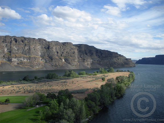
It’s this fond memory of farm stands that has always remained with me. It’s no wonder I began visiting a handful of farm stands in Washington State where I spent much of the summer. But I soon realized that today’s farm stands cannot be compared to the ones we visited 30+ years ago.
Today’s farm stands are mostly tourist attractions. Sure, they have some produce (more on that in a moment), but they also seem to sell an awful lot of non-food items that can’t easily be connected with a farm. Things like candles and scarves and t-shirts. Things like made-in-China “crafts.” Stocking and selling these items must be more satisfactory for the farm stand owner. After all, they’re cheap to buy, don’t need to be refrigerated, and don’t spoil. Sure, they’re usually the same kind of crap you can buy in any mall — even Tice’s Corner Mall — and probably even in a local Walmart. But tourists don’t care. They come, they buy, the farm stand owners keep them stocked.
Reject Fruit?
It’s the produce that upsets me, though. I visited a farm stand in Quincy, WA several times early this summer, attracted by its handmade signs for whatever “fresh” produce was currently available. What I found was often produce that was bruised or otherwise damaged, days old and, surprisingly, often not local.
I bought my first cherries of the season there and was disappointed to find that nearly half the bag’s contents had to be discarded because of splits and bird pecks. This is the fruit that the packing companies reject.
I suspect that the cherries I’d bought were from orchards in Mattawa that had lost 60% or more of their crop in heavy rains early in the season. (That’s what the helicopters are for, folks — to keep those cherries dry so they don’t split.) When the grower decides not to pick and take a loss for the season, the pickers will sometimes go into business for themselves, picking fruit and selling it directly to farm stands.

These organic Rainier cherries, although ripe and tasty, were flawed for two reasons: they’re slightly bruised by the wind and there’s not enough red on them.
I saw this first hand at one of my client’s orchards this season. He had several acres of Rainier cherries that didn’t get enough color. (50% of a Rainier cherry needs to be red to meet standards.) The fruit was good — I picked at least 15 pounds for my own consumption and they lasted two weeks in my fridge — but the packing companies wouldn’t take it. The grower didn’t pick but the pickers descended on the orchard anyway, taking away a lot more fruit than I did. Was it a coincidence that local Rainier cherries appeared in the supermarket for 99¢ a pound that week? I don’t think so. I’m sure that farm stand got their share, too.
Fresh, Quality, Local Produce? Not Always
And that’s the point: the farm stands don’t always get quality produce. It’s not always local. It’s not always fresh. It’s whatever they can get cheap and sell at premium prices. The tourists don’t know any better. They see farm stands and they think fresh, local, organic. They don’t realize that they’re often buying the produce that the packing houses don’t want.
Is all this produce bad? No. The cherries pictured above were sub-standard for the packing houses, but they were perfectly good to eat. (And it’s good to see that someone was picking them and making them available for consumption — I picked so much primarily because the idea of all those cherries going to waste was very upsetting to me.) Still, a farm stand might charge a premium for them just because they’re Rainiers and just because they’re at a farm stand. It’s the sucker tourist who doesn’t know any better who is paying a premium price at the farm stand when they might get better fruit at the local supermarket.
As for local…well, I’ve never seen an orange grove in Washington State. Lemons, limes, kiwis — these are all produce you might find at a farm stand. If you’re looking for local produce, think of what you’re buying and ask if it really is local.
And fresh? Here’s a secret: apples are picked in the late summer and early autumn. If you buy an apple anywhere in the U.S. in May, it’s either not fresh or it not local. Now I’m not saying you shouldn’t buy apples off season — apples are one of the few fruits that we’re able to preserve for up to a year and maintain in near-fresh condition. I’m just using apples as an example, since apples appear at nearly every farm stand you might visit.
Look before You Buy
My point: don’t automatically think that the best produce can be found at a farm stand. Not all farm stands are created equally. Look before you buy. Ask questions. Don’t buy pre-bagged items — remember my bag of bad cherries? Make sure you get what you’re paying for.
And support the good farm stands — the ones really delivering produce right from the local farms — by visiting them often.
 The first year,
 You want irony? Here’s the message I got in my Web browser only 10 minutes after posting this whine. These guys don’t even know how to configure the obsolete software they use.
 This photo shows the trailer parked in the spot next to mine. It’s been here longer than me and I suspect it isn’t going anywhere soon.