Day 13 brings me to the mountainous desert around Salt Lake.
Despite my less than perfect accommodations, I slept reasonably well. I think it’s because of the sound of flowing water that came in through the door to the back deck. I’d left the door open a few inches, trusting the lock on the screen door to keep out any hotel guests who might be wandering around on the deck. I was in the end room, so the chance of someone walking by my door on their way to another room was remote.
I showered. It was the first motel shower I’d encountered in a long time that couldn’t keep a steady water temperature. Every time one of my neighbors flushed the toilet, I’d come close to getting scalded. The third time this happened, I shut the water off and called it quits.
I packed up the car, checked out, and headed south on 89. I had a Doubleshot to meet my caffeine needs. (My friend Lorna, who has been reading these entries faithfully from her home in Maine, e-mailed me to ask what a Doubleshot is. In case you don’t know, here’s the scoop. A Doubleshot is a canned Starbucks coffee drink. It’s an easy way to get a caffeine fix when I’m on the road. I usually buy a couple of them when I’m in a supermarket and keep them in my cooler. When I can’t find decent coffee elsewhere, I drink a doubleshot. I don’t really like them — they’re too sweet for my taste — but they’re easy.)The road began by following the Snake River through a canyon. When it reached the town of Alpine, WY, the Snake River curved to the northwest while I headed south. Alpine was a nice little town with a lot of tasteful new construction and small businesses. The town was very quiet — it wasn’t even 8 AM yet. I almost passed a drive-up coffee stand. When I spotted it, I hit my brakes hard and pulled in for a latte.
The building was tall and it was quite a reach up to the woman inside it. My Clarkston reused coffee grinds experience had left me a little leery of coffee stands, but I had nothing to worry about here. The woman, who was very friendly, made me an excellent large triple latte. I asked her whether she owned the booth and she told me she didn’t. In fact, it was her last day at work. She was moving back to Spokane, WA. The woman who owned the booth was doing okay, but it was hard to do well in the town because of its heavy Mormon population. I later discovered that Mormons don’t drink coffee. I guess a coffee shop in a Mormon town would be like opening up a pork store in New York’s Lower East Side.
From Alpine, I headed due south on 89, which lies on the east side of the Wyoming/Idaho border. I was in farmland again, but at an elevation well over 5,000 feet. Wheat and alfalfa seemed to be the big crops. One alfalfa field had just been cut — probably the previous day — and the smell of the fresh alfalfa was rich and sweet.
I think I was in Afton when I saw the car wash and pulled in. I’d managed to call Megg on my cell phone and arrange to go to her house in North Salt Lake City that afternoon. My car was dirty and I didn’t want to make a bad impression. So I washed it for the third time on my trip. This time, it was the dirtiest it had been so far. The bug situation in Idaho, Montana, and Wyoming is bad and the front of the car was pretty much plastered with dead bugs of all shapes, sizes, and colors. It took six minutes worth of car wash time to get it all off. I dried it with my rags and dusted off the dashboard. Much better.
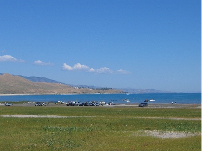
I crossed into Idaho at Geneva Summit, which was 6,938 feet. That put me into a long valley with a succession of towns: Montpelier, Ovid, Paris, St. Charles, Fish Haven, and Garden City. Every town I drove through was remarkably quiet — nothing seemed to be open. Except the church, of course. All the church parking lots were full and I saw more than a few well-dressed people out on the streets, walking to or from church. Things changed a bit when I got near Bear Lake. Lots of people were out and about at the lake, in boats and in public access areas. There was a lot of housing on the lake side of the road with plenty of Private and No Beach Access signs to keep people out.
Somewhere between Fish Haven and Garden City, I passed into Utah, the ninth state I’d visited on my trip. At Garden City, I got on route 30 and followed that around the south end of the lake. I climbed a hill and immediately realized that I had slipped into high desert terrain. The vegetation on both sides of the road consisted of tall grass, sage, and a variety of other desert plants. I was getting closer to home, leaving the water wonderland I’d enjoyed since entering Oregon more than a week before. I felt disappointed and did not look forward to what I’d drive through ahead: dry desert, hot sun, empty riverbeds. I realized that I’d fallen out of love with the desert.
I turned right on route 16 with a bunch of other cars, heading southbound. More farmland, but not much more. I passed the bunch of cars, tired of breathing their exhaust. Later, I turned right again onto route 39, heading west. The road climbed and climbed and climbed. I kept checking my GPS for elevation information and the number kept going up. I was certain that when I reached the top of the mountains, there would be a lookout where I could see Salt Lake. I crossed over the Monte Cristo Summit, at 9000 feet, and started down. There was no lookout. The road dropped into a canyon with a small stream on either side. It twisted and turned as it descended. I passed two pickup trucks and some kind of Volkswagen — a Jetta, maybe? — blew past me.
I spotted a restaurant on the left and made a harrowing turn into a parking space. I needed a bathroom and lunch, in that order. I asked for them in reverse order. It would be a 20 minute wait to eat outside on the patio, which looked like a good place to eat. I got directions to the ladies room and while I was doing my business, decided I didn’t feel like waiting. Instead, I’d find a shady spot in a park and eat some of the food in my cooler. So I left and continued on my way.
Trouble was, there was no shady spot in a park. All I passed were campgrounds, and since it was Sunday at midday, all of the campgrounds were full. So I kept driving.
The road dumped me down in Ogden. I got on a main avenue that was also labeled route 89 and headed south toward Salt Lake. I wasn’t in a hurry. I was supposed to meet Megg at around four and it was only 1:30. That meant I had time to kill.
I should have killed time up in Ogden, because when I got closer to North Salt Lake, all of the shops and businesses were closed again. It would not be a good place to kill time. I drove all the way down to the city, then came all the way back up to Bountiful, where I found a Barnes and Noble that was open. I killed over an hour in there, buying books for myself (as if I needed them) and for Megg’s son, Cooper. Then I hopped over to the Taco Bell for a bite to eat. Then I drove around some more. It was around four and I was in a Smith’s parking lot, after buying two pies for Megg and her family, when I finally connected with Megg. I was five minutes from her house. She gave me directions and I made my way over there.
Megg is one of my editors. She works with me on my Quicken Official Guide books, which I’ve been revising faithfully since the Quicken 99 edition back in 1998. Megg hasn’t been stuck with me that long. She inherited me from my first editor on that book, Joanne, about five years ago.
Megg has a lovely and very large house on a hill overlooking the North Salt Lake area. Excellent views, plenty of space. And a very comfy guest room. I met her son and her husband. I then proceeded to join her for a very relaxing afternoon and evening.
 I reached Ennis, which Lynn had told me was very touristy. I didn’t really notice that, but I made my turn there, so I may have missed that part of town. I was still on route 287, but it was heading southbound now. After a while, the road joined up with the Madison River, which I followed for quite some time. When I got to the turnoff for Quake Lake, I turned in. Lynn had told me a little about the place and said she’d wanted to see it when she and Ray had driven past. Ray hadn’t been interested at the time, so they’d gone past without stopping. The place was situated in a canyon where the Madison River flows. In the late 1950s, an earthquake had caused a landslide that dumped debris into the river bed. Twenty-eight people had been killed, although I don’t know how. Perhaps they were on the road there? In any case, the natural dam caused by the landslide had created Quake Lake. I read all this on the sign outside the visitor center. It was all I needed to know, so I didn’t go in. I took a picture of the little lake, then got back into the car and continued on the road as it wound alongside it. There were lots of dead trees sticking out of the water. I imagined a heavily forested canyon suddenly filled with water and the slow death of the trees that were submerged.
 I headed into the park, crossing over the border into Wyoming, the eighth state I’d visited so far. My National Parks pass got me in without a fee. (It works at Yellowstone but not Mt. St. Helens? What kind of bull is that?) I took the map and gave it a quick look. My objective was not to visit the park. My objective was to take a nice, scenic ride south toward Salt Lake City. The problem was, it was a Saturday in August. The park was full. And the tourists were of the most annoying variety: drive-through tourists who will stop their car anyplace someone else has stopped, just to take a picture of whatever that other person is taking a picture of. When I wanted to drive slowly, there was someone on my butt. When I wanted to drive faster, there was someone in front of me. When I wanted to stop in a place where no one else was stopped, two or three other cars immediately appeared, spewing occupants armed with cameras to take the same picture I was trying to take. At one point, I reached a traffic jam on a narrow, one-way road as at least 30 cars had stopped to photograph a grizzly bear on the other side of a creek. I was so wigged out by the crowd that I neither stopped nor saw the bear.
 I did see plenty of elk, though. The first herd was right inside the park, grazing along the Madison River. I guess seeing tourists have tamed them, to a certain extent, because some very gutsy tourists were approaching quite close and the elk didn’t seem to care. I also saw a few bison. Most of the bison, as I recall, are on the grassy east side of the park. I was on the west side. I saw four individual animals, each of which were the subject of many tourist photos. But the one that amazed me the most was the one walking alongside the road in a forested area. I think he was lost. But he was walking on the pavement, forcing vehicles to go around him. That, of course, caused a traffic jam because everyone wants the thrill of driving alongside a walking bison. When it was my turn to pass him, I didn’t stop. I just aimed my camera and pushed the button while I kept driving. He was so close that someone sitting in my passenger seat could have reached out and touched him. Although he didn’t seem interested in me (or anyone else), I could imagine what those horns would do to my car’s paint job if he decided he didn’t like the color red. I wondered what he thought of the long line of campers and SUVs and cars filing past him in slow motion. I also wondered where he was going. Probably to the administrative offices to complain about all the traffic and exhaust.
 I took the exit to the Old Faithful Inn, in search of a decent lunch. I got a great parking spot in the shade and got out with my camera. There was a huge crowd of people sitting on benches, facing the Old Faithful Geiser, which was spewing out various amounts of steam to keep them entertained. I tried two places and found a cafeteria and a buffet. I checked out the buffet and was surprised to find that the cafeteria food had looked better (although it didn’t smell better). As I was walking back to my car, Old Faithful let go and I managed to get a bunch of good photos. It was still bubbling water when I left.
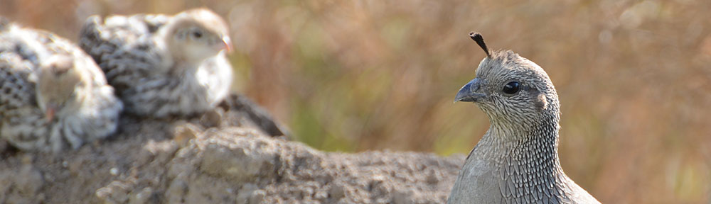
  I also managed to get a photo of this little fellow. It’s unfortunate, but people at national parks find it necessary to feed the wildlife. As a result, they become tame, like this guy probably was, and they forget how to forage for themselves. In the winter, when there are fewer tourists around, they starve. That is if they don’t get sick and die from the junk the tourists feed them.
 The road followed the Snake River down to Jackson Lake and Grand Teton National Park. The main feature of Grand Teton is the mountain with the same name, on the southwest side of the lake. It’s 13,770 feet tall, very rocky, and has a glacier not far from the top. In this photo, it’s the mountain that’s farthest away. It was after 3 PM and the sun was moving to the west, making it difficult to get a good photo of the mountains from the east. I followed the road, choosing the path that kept me close to the lake rather than the faster road that went direct to Jackson. A scenic drive.
 Tyler was very surprised when I climbed on board beside him. He fiddled with the intercom switches so I could hear the radios, which I really appreciated. It really helped bring back memories of all the flights I’d done. I discovered that I was booked on the shorter North Canyon flight, which goes over to the Dragon Corridor on the west side of the canyon. But since there was a lot of smoke on that side of the canyon due to a controlled burn, we’d be doing an East Canyon tour. Although Papillon doesn’t sell that tour, it is the best one. It starts off like an Imperial Tour, going out over the east side of the canyon, then turns west at the confluence of the Little Colorado River and makes a big loop back to the rim.
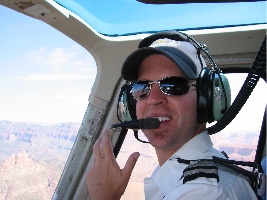 The canyon was hazy but beautiful. I had my camera with me and took a few pictures, including this one of Tyler in flight. (I always wished I’d asked one of my passengers to shoot a picture of me like this, at the controls with the canyon in the background. I’ll e-mail this to Tyler.) When we got back, I kept Tyler company while he shut down. Then I went inside to see if John was finished with his meeting. He wasn’t. I thanked Evelyn and Ilse for the flight and chatted a while with Ilse. Then, as it was getting late, I wrote a note for John on the back of a Flying M Air postcard and left it on his desk. It asked him to give me a call when he had time for a ride in my helicopter.
 One of the many things I don’t have on Howard Mesa is an Internet connection. Sure, I have my PowerBook and sure, the solar panel on the trailer roof provides enough power for me to keep it charged. So I can compose e-mail messages, write blog entries, play with my GPS’s connectivity features, and work on my novel. But I can’t surf the Web, send and receive e-mail messages, or publish those blog entries. Enter Java Cycle. This funky little coffee shop, which used to be a bicycle shop, offers a full range of coffee beverages and free wireless Internet connection. Conveniently located on the eastbound side of Route 66, west of Grand Canyon Boulevard, I can usually find a parking space right out front. So I can take my PowerBook down to Williams, order a latte, and sit at a comfortable table while taking care of my Internet needs.