A side note to my Digital vs. Film blog Post.
[I’d originally written this as part of my post titled “Digital vs. Film,” but pulled it out in an effort to shorten-up that post and keep it more focused on the topic. You might find it interesting if you think you might want to try your hand at commercial aerial photography.]
 I think it was in 2003 that Mike and I decided to try our hands at aerial photography. I bought a book about it (as I usually do, when I want to get a jump start on learning something) and the book said the best kind of camera for this kind of work was a Pentax 67. The camera was huge and heavy and took 126 film, which could not be processed locally. But that didn’t stop me from plunking down $1,500 for a used one. You gotta spend money to make money, right?
The Pentax 67 turned out to be a huge mistake. Although the camera had an internal meter, it did not have automatic exposure. So each exposure had to be set using its meter before snapping an image. Since I was doing the flying, Mike did the photography. He’s set the exposure on the first shot and use the same exposure for the entire shoot. You might think that would work, but it doesn’t. As the helicopter approaches the target from different angles, the sun hits the target differently. Some images were under exposed while others were overexposed. 2/3 of the images were not usable. And because we didn’t know this until nearly a week after the shoot — after the film had come back from the out-of-town processors — we didn’t know until then how bad the results were. We did two reshoots — at my cost — before I decided that camera was not for us. I sold it for $1,000, swallowing a $500 loss after owning it for about a year. Ouch.
I bought a Canon G5 camera. This was a regular digital camera that looked a bit like an SLR. But although it had all kinds of automatic, program, and manual settings, it did not have interchangeable lenses. It did offer 5 megapixel resolution, however, and that was a huge number in those days. We tried our hand at aerial photography with that. The results were better — at least the exposures were good and we could see them immediately — but my photographer was having trouble properly framing the subjects and our clients evidently had different ideas of what their property looked like from the air. I decided to give up on providing photography services. If a client wanted aerial photography, I’d be perfectly happy to do the flying for them, but they’d have to come up with their own photographer.
I’ve since purchased a Nikon D80 with multiple lenses. We’re playing with aerial photography again, but I’m still not interested in taking on any commercial assignments with either Mike or me snapping the pictures.
You can see some of our aerial photography efforts (with more to come) in the Flying M Photos gallery.
 I’m extremely pleased to spread the news that one of Flying M Air’s best clients,
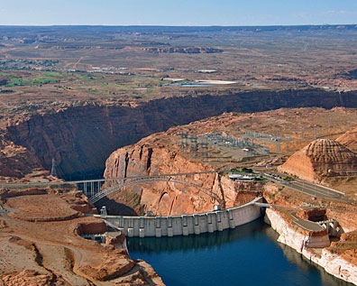
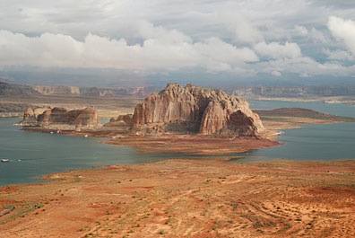 Lake Powell is outrageously beautiful. Its clear, blue water reflects the clear Arizona/Utah sky. Its red rock canyons, buttes, and other formations change throughout the day with the light. Deep, narrow canyons cut into the desert, making mysterious pathways for boaters to explore. When the wind and water is calm, the buttes and canyon walls cast their reflections down on the water. In the rare instances when weather moves in, low clouds add yet another dimension to the scenery.
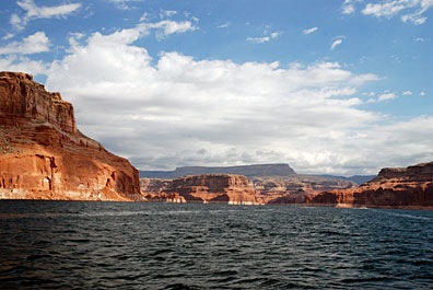 Sure, it’s wonderful by boat — especially by houseboat over 5 to 7 days with a bunch of good friends or family members — but views are limited from the ground and distances take a long time to cover. Let’s face it: the lake’s surface area is 266 square miles (at full pool) and it stretches 186 miles up the Colorado and San Juan Rivers. You could explore the lake by boat for a year and not get a chance to visit each of its 90 water-filled side canyons.

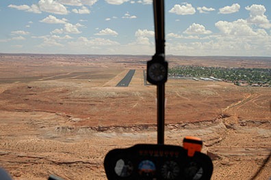 Most people fly into Page, since it’s the only airport near a town. If you come in from the northwest and land on Runway 15, as we are in this photo — well, we’re actually lined up for landing on the taxiway — you’ll make your descent right over the lake, west of Antelope Marina. (The town is all that green stuff to the right.) Taking off on Runway 33 has you shooting out over the edge of the mesa and lake. Pretty dramatic stuff. I have a lot of fun with it since I don’t really “climb out” after takeoff. The airport is at 4316 feet and the lake is currently at 3629 feet, so there’s no reason to gain altitude if I’m just cruising the lake.