Snowbirding 2017 Postcards: Colorado River Boat Ride

I’d only intended to spend one night at Willow Beach Campground, in preparation for about a week off the grid in the Turtleback as I make my way to Sacramento for my late winter/early spring work. Recharge batteries, dump wastewater tanks, fill fresh water tank, take a good, long shower. Normal prep stuff.

But when I saw the boat rentals and the smooth surface of the Colorado River at the upper end of Lake Mojave in Black Canyon, I thought it might be good to stick around for another day. And when I realized that the Arizona Hot Springs, which I blog about in another post, might be accessible from the river, I added a day to my campsite reservation. 

(That’s the beauty of traveling without a ball and chain; you can change your plans at any time and not have to listen to anyone whining about it.)

I rented the smallest boat they had for half a day and headed out at around 11 AM with Penny, my camera, a towel, and a packed lunch. I may have been the first power boat up that section of the river that morning — the water was completely smooth and glassy. The canyon started out wide, with lots of water fowl that scattered on my approach. But it soon got narrower and narrower, with canyon walls towering over the water. I had flown over this part of the river several times over the past 15 or so years and it’s beautiful from the air. But it might be even prettier from the water with the canyon walls reflecting on its surface.

Here are a few of the photos I took that morning. I’d hoped to do some exploring on the way back, but I spent too much time at the Hot Springs and had to get the boat back by three. Next year, I hope to bring my own boat on my snowbirding adventures.


Snowbirding 2017 Postcards: Arizona Hot Springs

I need to start off by saying that these hot springs were, by far, the absolute best hot springs I have ever visited in my life.

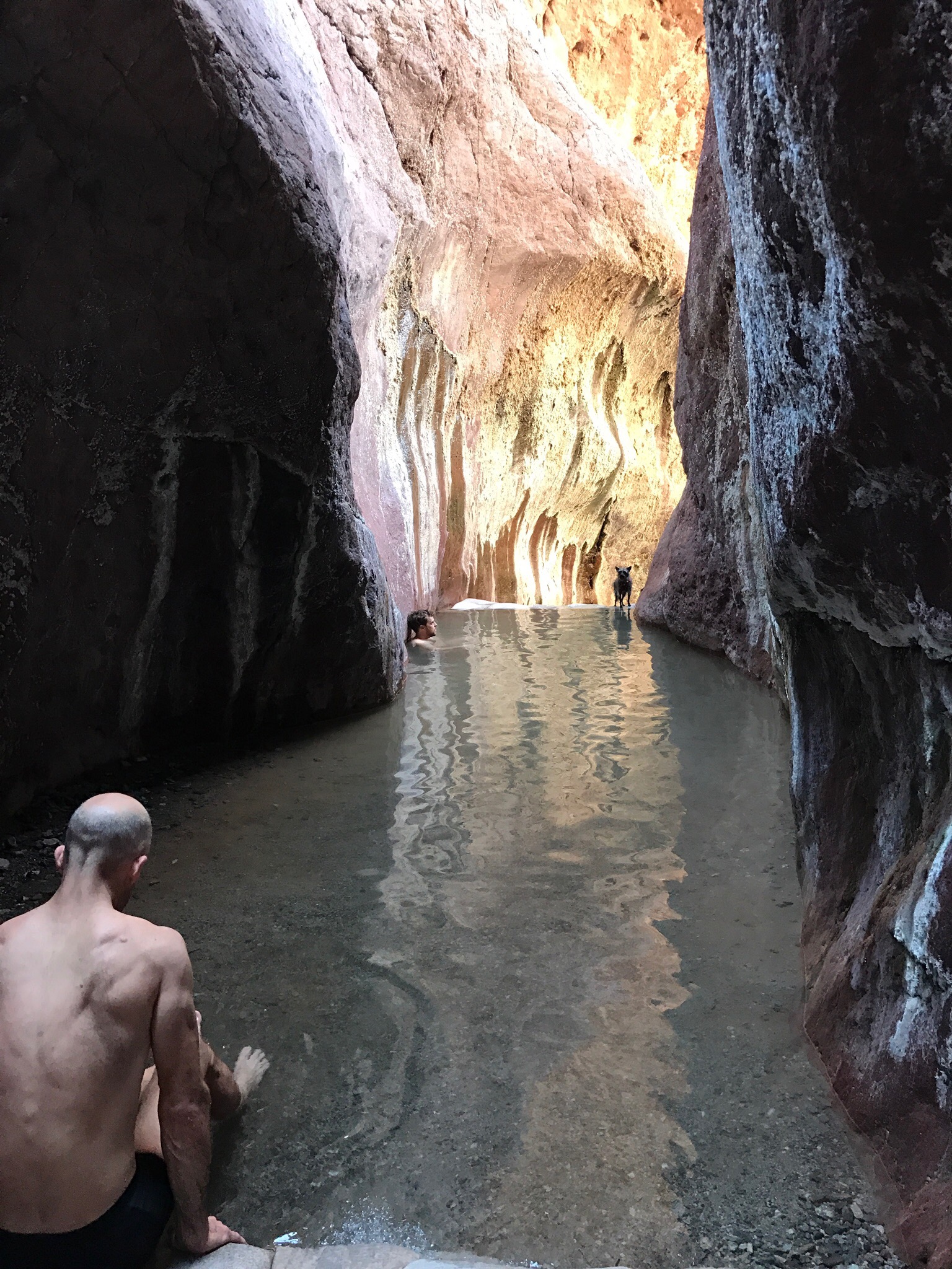
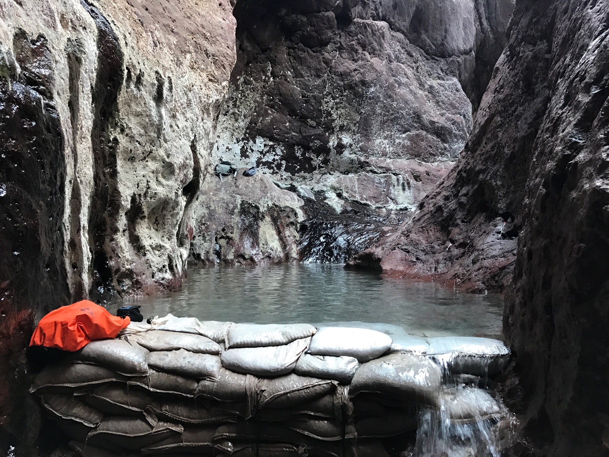
Tucked away in a slot canyon less than a half a mile from the Colorado River, Arizona — or, more properly, Ringbolt — Hot Springs consist of three “tubs” created by using sandbags as dams between the canyon walls. Hot water emerges from cracks in the walls to fill the first tub with very hot water — so hot I couldn’t sit in it. The water cascades over the sandbag dam to the next tub, which is cooler. The same happens to fill the third tub with even cooler water. (According to one regular, water temperatures are 102 to 115 degrees F.) Each tub had a gravelly sand floor and various depths, the deepest part being perfect for submerging up to your neck while sitting on the ground. The water was clean and algae free. There was no slime or nasty sulphuric smell. Although there may have been as many as a dozen people there at a time, it was never what I would call crowded.

This Hot Spring is accessible by a long, 2 mile hike down a trail from route 93 or by a much shorter hike up from the Colorado River. This physical limitation in access is likely what keeps it so pristine; there was absolutely no litter.  I choose the river route and rented a boat to make the 10 mile river trip up from Willow Beach. The boat trip was beautiful with many interesting spots along the way — I’ll save that for another set of postcards.

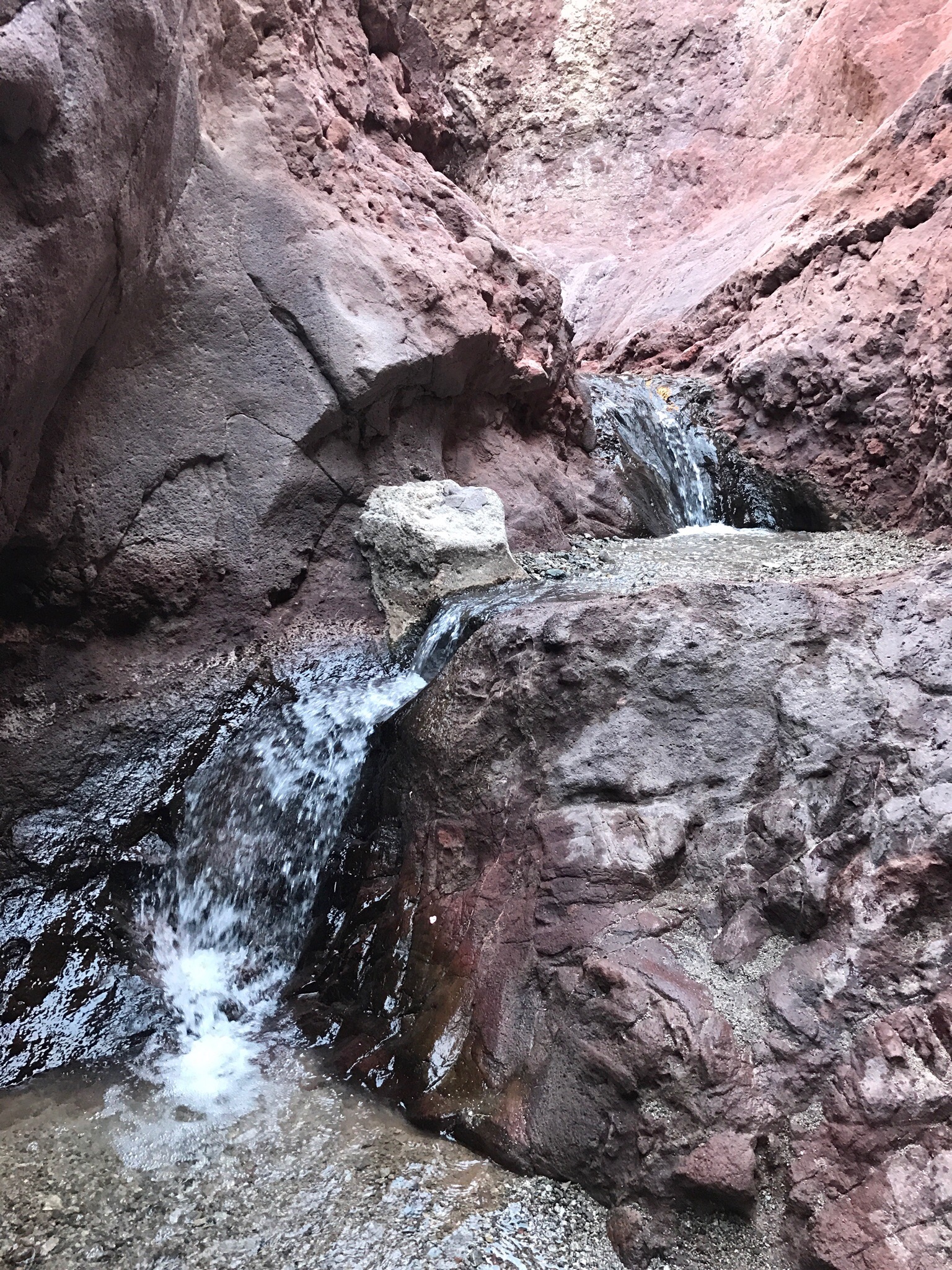
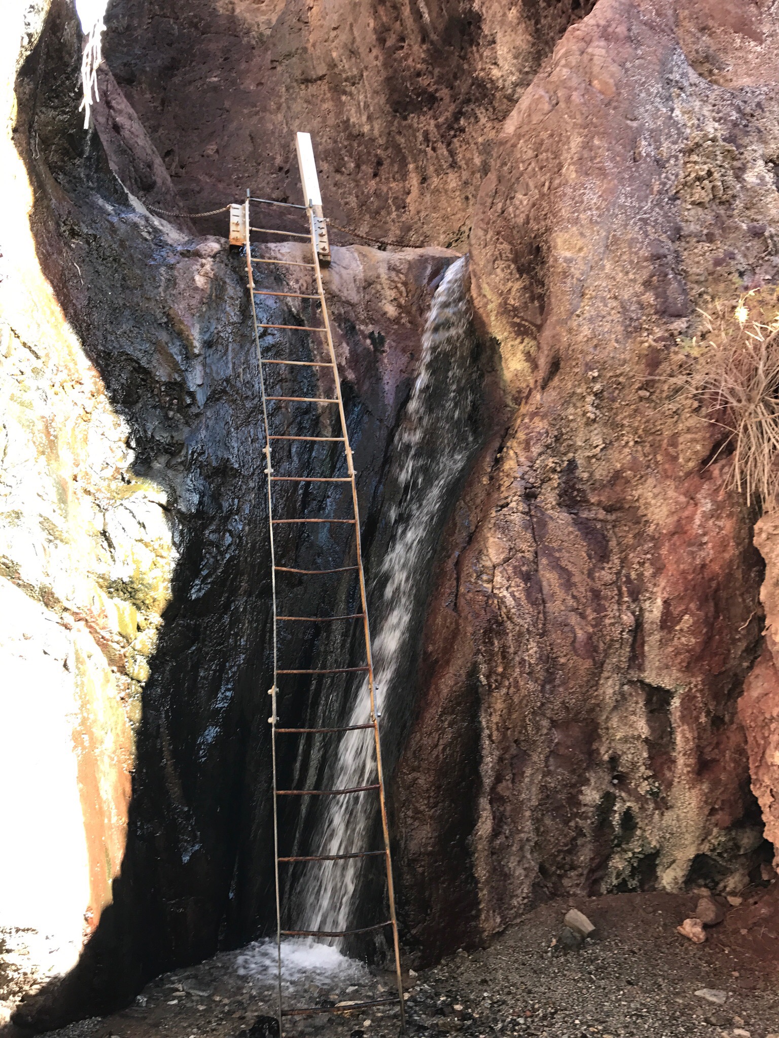
Here are a few pictures that I took along the hike to the hot spring and at the spring itself. The hike started on a dry beach and soon entered a narrow slot canyon with ever-growing trickles of warm water. There was a bit of scrambling up rocky cascades, some of which were slippery. The trickiest part of the whole trip was getting Penny up the 20 foot ladder to where the tubs were.

Along the trail to the hot spring.


There were a few places where we had to scramble up Cascades of warm water.


This 20-foot ladder was securely fastened to the canyon walls.


The third, coolest tub was the first one we reached.


The shallow end of the third tub had very warm water from the second tub.

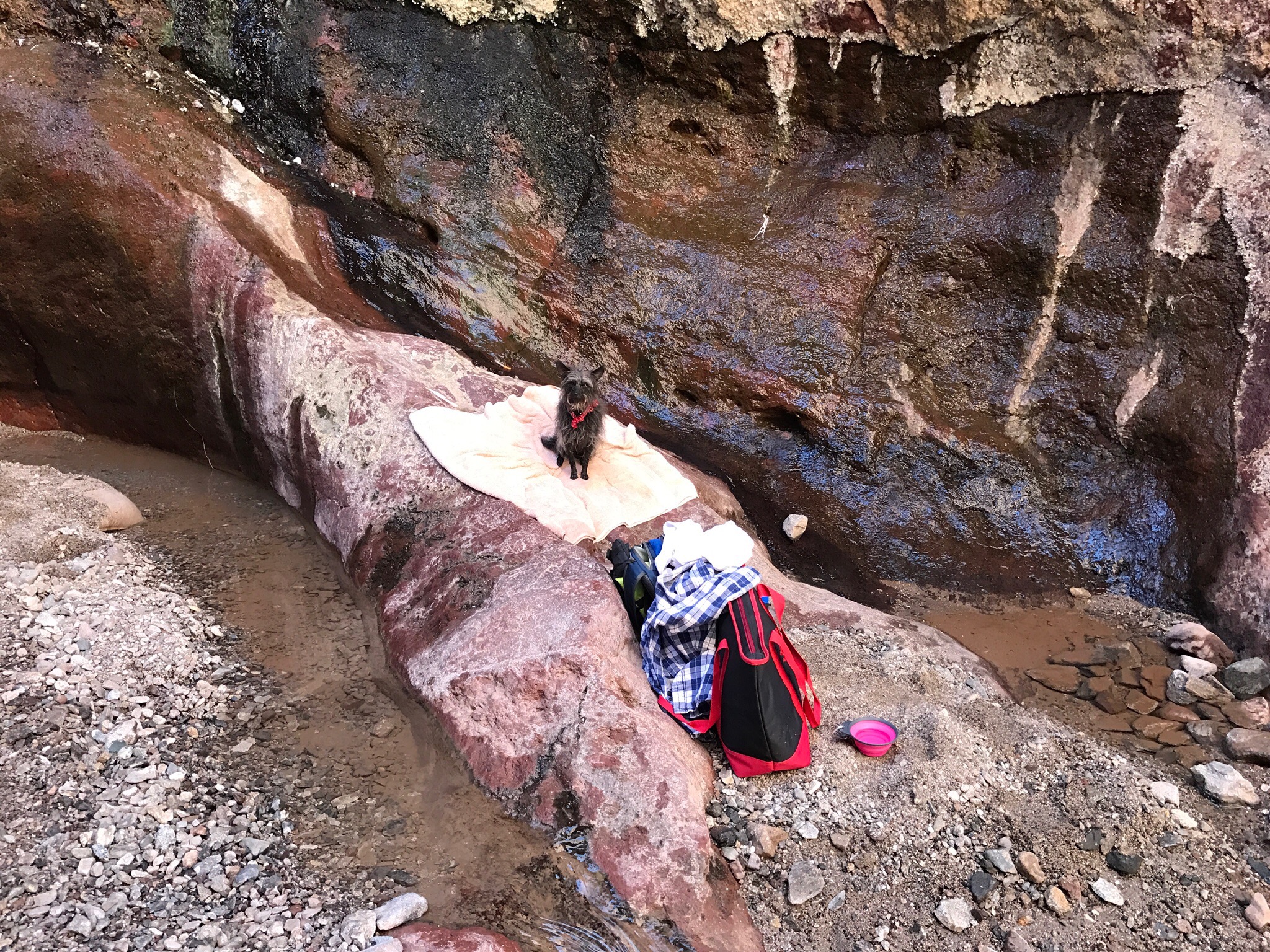
Penny watches from the dam at the end of the third tub. She did swim twice in that tub, although she didn’t like it.


The first and hottest of the tubs was the last one I reached. I didn’t soak in it at all.


Our lunch spot just downstream from the tubs.


We spent more than two hours at the springs. I soaked mostly in the deep ends of the second and third tubs. The first tub was simply too hot for me and just about everyone else. The people who were there were mostly young and outdoorsy — I might have been the oldest one there! I very much enjoyed the company of three medical students from Syracuse who were making the most of their trip to Vegas for a convention. I also had a great conversation with a local who told me about another hot spring I might pass near in my travels later this week.

Return to Burro Creek

And another [safer] flight under the bridge.

Back in November 2014, I blogged about the time I was in a helicopter that flew under the Burro Creek Bridge on Route 93 at Burro Creek. It was probably on my mind back then as I was reviewing log book entries for a book I’m working on about my flying experiences. I just re-read that post and I do recommend it. It’s short — for me, anyway — and tells an interesting story that gives you some insight into the minds of helicopter owners and pilots.

Burro Creek Bridge
Plenty of room to fly under, no?

Anyway, yesterday I drove north on Route 93, starting my annual migration from my snowbirding stay in Arizona to my late winter/early spring work site in the Sacramento area of California. (Yes, my seven-month “vacation” is nearly over.) I gave myself about 10 days to make the trip and planned stops along the Colorado River near the Hoover Dam, Death Valley, and possibly Lake Tahoe. Or the California Coast. I don’t really know yet. One of the things I like most about my life these days is my unfettered ability to make and change plans on the spur of the moment.

I’d been thinking about the drive for a while, wondering what stops I could make along the way. Burro Creek was a no-brainer. There’s a BLM campground down along the creek about a mile or so off Route 93. I’d considered stopping there for an overnight stay on my way south from Vegas in November but had ultimately chosen a different route that kept me on the Colorado River. The campground isn’t much — in fact, the water is turned off there so the bathrooms are closed up and I’m not even sure if you’re allowed to use the dump station — but it does have ramadas (shade structures) at each campsite, along with picnic tables and a nice desert garden. And plenty of hiking opportunities.

Burro Creek Bridge
A view back toward the campground, looking southwest. That’s Route 93 south of the bridge in the distance.

Burro Creek Campground is about an hour north of Wickenburg, which is where I’d spent the previous two nights. Perfect timing for a break on my estimated three hour drive to Willow Beach on the Colorado River near Hoover Dam. I pulled in, drove down the cracked asphalt road to the campground, and parked in the day use area so the campground host wouldn’t try to hit me up for camping fees.

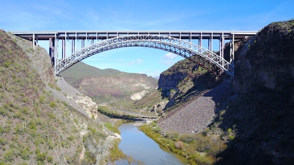
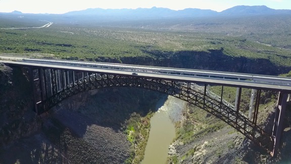
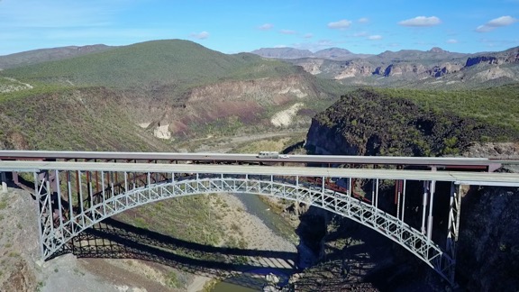
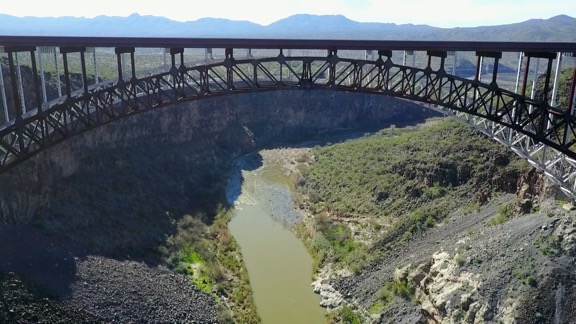
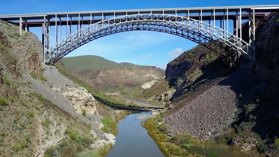
The Burro Creek Bridge — or should I say bridges? — is clearly visible from the campground. It’s a pair of two-lane truss arch bridges that are about 680 feet long about 390 feet over the floor of Burro Creek’s canyon. The first bridge was built back in 1966 and carried all northbound and southbound traffic. In 2005, as part of route 93’s widening project, they built a second almost identical span right beside it. The new bridge now handles northbound traffic while the old bridge handles southbound traffic. I’m glad they built a matching bridge. It really helps preserve the aesthetics.

Burro Creek Bridge
The two bridges are nearly identical, despite being built 40 years apart.

(A side note here: Route 93 between Wickenburg and I-40 near Kingman had the local nickname “Death Highway” because of the number of deadly accidents — often head-on collisions — that occurred there when it was just one lane in each direction. Widening it was long overdue since it handles nearly all auto and truck traffic between Phoenix and Las Vegas. Parts of it are still one lane in each direction. You can learn more about Route 93 in Arizona on Wikipedia.)

I had done a photo shoot of the new bridge back in 2005 with an aerial photography professional. It was a memorable flight, mostly because he did the shoot with a pair of Hassalblad medium format film cameras. These are extremely costly cameras and the reason he had two of them was so that when he finished shooting a roll of film, he could switch to the other camera instead of fumbling at an open aircraft door to reload film. I think each roll only had 12 shots. I distinctly recall hearing the mechanical sound of the shutter and his manual winding of the film though the intercom system since the microphone was so close to the camera. I orbited the bridges several times. I know he was disappointed with our timing; the second span wasn’t quite done but yet it wasn’t open enough to be dramatic. There was just a narrow gap maybe 50 feet wide in the middle of the roadway. We should have arrived about two weeks before for a more dramatic shot or two weeks afterward for a completed span.

I was thinking a lot about that photo shoot as I walked down to the creek with my Mavic Pro flying camera tucked away in my day pack. The construction company — or Arizona Department of Transportation? — had flown the photographer in to Phoenix from somewhere in the midwest for the shoot. He’d rented a car and drove to Wickenburg. I flew him up there with the doors on, then landed in the construction area to pull off his door and stow it in the back seat. We’d done the flight, circling around and and around. It was midday, but there were still shadows because of the angle of the sun in the deep canyon. I’d landed again to put the door back on and then we’d headed back to Wickenburg. The only reason we hadn’t done the whole flight with the door off was because I could get better speed in transit with the door on and it was at least a 30-minute flight. I’m thinking the whole job was about 1.5 hours of billable flight time, but without consulting my logbook, I can’t be sure. Total cost of those photos? Easily a few thousand dollars.

Burro Creek Bridges
Really. Nearly identical.

I walked as far as I could — at least a half mile — getting almost under the power lines that spanned the canyon just southwest of the bridge. I was hoping to be on the other side of them so I wouldn’t have to worry about them interfering with drone operations, but Burro Creek was running full and fast and I’d gone as far as I could without getting too close to the canyon wall. I spread out my collapsable landing pad in one of the few boulder-free areas, and got to work setting up the Mavic and its controller for flight. I have it down to a science at this point and it only takes me about five minutes from the moment I take it out of the bag to the moment everything is powered up and the Mavic is in GPS mode.

Mavic Operator
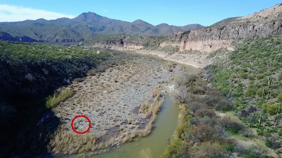
I grabbed this image of the video on the Mavic’s return flight. I circled where I’m standing with the landing pad. You can see the campground behind me.

I couldn’t tell how far above the canyon floor the power lines were. I knew they were lower than the bridge, but I also knew that we’d flown under them. They had to be at least 100 feet up. Still, when I launched the Mavic I kept it just 50 feet up until I knew it was on the other side of the wires. (I now estimate they’re at least 150 feet feet from the canyon floor, but likely more than 200.)

I spent the next half hour or so flying around near the bridge. I flew over it once and under it three times. I didn’t want it to distract drivers on the road, so didn’t fly anywhere where the average driver would see it. I had to bump up the maximum altitude for the flight over the bridge, but I figured that was okay because I was still within 400 feet of either the bridge roadway or canyon walls. Certainly nowhere where a manned aircraft should be flying — although I think I’ve already established that it was where a manned aircraft could be flying.

Burro Creek Bridge
This photo was shot from under the power lines.

I switched batteries after two flights and used up 20% of the second battery before finishing up. Penny had very patiently waited nearby. She doesn’t mind the drone or its bee-like buzzing but stays clear of the landing pad when it’s coming or going.

Part 107 Explained
Want to become a commercial drone pilot? Start by learning all about the FAA’s Part 107. This book will help. Buy the ebook edition on Amazon or from Apple. Or buy the paperback edition on Amazon.

When I was finished, I powered everything down, replaced the Mavic’s gyro lock and cover, and folded it up. Within a few minutes, I was ready for the return hike with everything stowed away in my day pack again.

I got a bunch of video shots, as well as some still shots. This blog post shows off mostly screen grabs from the video. Launching from the stream bed inside the canyon limited what I could do, keeping in mind that I had to keep the Mavic within sight during the flight (per FAA rules).

I think that if I’d launched from up alongside the roadway, level with the bridge, I could have gotten the same shots that Hassalblad photographer had captured twelve years before — for a lot less money. But there really wasn’t a good place to launch from that wouldn’t distract drivers. And it isn’t as if this was a real mission. It was just more practice.

I wonder what that Hassalblad photographer is doing these days. I seriously doubt he’s still using those cameras to take aerial photos.

Real News from Real Sources

Want to know where to get facts?

Forbes ArticleThe other day, one of my Facebook friends shared a link to an article on Forbes that discussed the difficulty of finding reliable news sources in a world where so many sources are labeled “fake.” The article listed, with objective descriptions, what the author considered honest and reliable news sources. I’ll run down the list quickly here; I urge you to read the article to get additional information about each source:
  1. The New York Times
  2. The Wall Street Journal
  3. The Washington Post
  4. BBC
  5. The Economist
  6. The New Yorker
  7. Wire Services: The Associated Press, Reuters, Bloomberg News
  8. Foreign Affairs
  9. The Atlantic
  10. Politico

There are runners up and financial resources, too. Again, I urge you to read the article to get those lists. (Spoiler alert: CNN is on a list; Fox News, Brietbart, Huffington Post, and Mother Jones are not.)

As I added on Facebook when I shared a link to the article, the real trick is convincing the people who already turn to less reliable news outlets that these news outlets are better and more truthful. Another challenge is getting people to understand the difference between fact-based articles produced by journalists and opinion pieces produced by pundits.

If you’re interested in doing the right thing during these difficult times — and don’t don’t fool yourself: these are difficult times — start by informing yourself about an issue by turning to reliable news sources. (Note the plural there; try to learn from at least two good sources.) Be careful to get information from journalists and not pundits. (In other words, skip the OpEd and political commentary pages/columns.) Go beyond the headlines! Think about what you’ve learned. Discuss it with other people you know and trust who have done the same thing. Then form your own opinions and act accordingly. Acting means calling your congressperson or senators when an issue comes up to vote. These days, it also means showing up for peaceful protests and doing what you can to help convince those sitting on the fence to see things your way and also act.

It’s sad to me that so many people are falling for “alternative facts” fed to them by unreliable news sources, many of which are playing political games for ratings or other gains. What’s even worse is that the “fake news” label is being applied to what are truly reliable news sources.

Stop the ignorance. Get your information from reliable sources and make your own decisions.

Drone Pilots: Beware of Bird Strikes!

Just a quick warning, with photos.

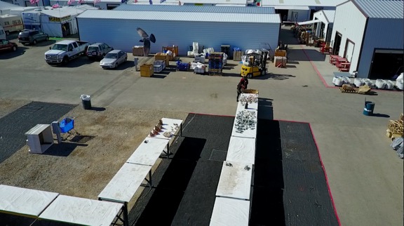
Last week, I did a few photo missions with my Mavic Pro flying camera. For two of the msisions, I launched from an open area at the far east side of the Tyson Wells complex in Quartzsite, just south of Keuhn Road.

I’m in the habit of using the Return-to-Home feature of my Mavic to get it back to its launch point quickly and efficiently. In all honesty, I’m awed by its ability to land exactly on its takeoff spot nearly every single time. I like to watch, with my finger poised over the pause button on the control (just in case), as it comes to the right coordinates far overhead, turns to the direction in which it took off, and descends to the spot.

On one of the three missions I flew from that spot, a small flock of pigeons flew right past the Mavic. I watched in shock and a bit of horror as the five or six birds swooped around my fragile aircraft. I felt relief as the Mavic continued its descent unharmed, but the whole thing repeated itself when another flock — or the same flock? — swooped past. Again, the Mavic was unharmed.

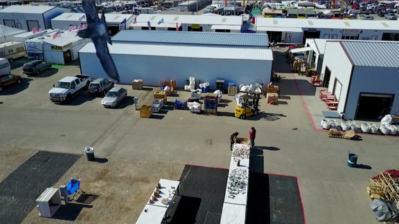
I happened to have the video camera going when this was happening. Here are two screen grabs, one from each flight, that show the closest encounter. The first one was definitely closer.

Near Miss
This reminds me of a scene from The Birds.

Near Miss
The bird is a bit farther off in this one. Can you see it?

Of course, the camera can’t capture action in a direction it isn’t pointing. For all I know they could have come closer behind the camera.

Part 107 Explained
Want to become a commercial drone pilot? Start by learning all about the FAA’s Part 107. This book will help. Buy the ebook edition on Amazon or from Apple. Or buy the paperback edition on Amazon.

While this is all kind of cool in a weird sort of way, it wouldn’t have been so cool if one of those birds clipped a rotor. The Mavic has four independently powered rotors. If any one of them was destroyed, I’d have to think the whole thing would immediately go out of balance and crash. This is one good reason why we don’t fly drones over crowds of people. Even though the Mavic weighs in at less than 2 pounds, having one crash onto your head from 150 feet would definitely cause some injuries.

Honestly, I’m surprised this hasn’t happened yet. A matter of time?