More about the Wind Machines

A few new videos.

Back in April 2015, I blogged about the wind machines commonly used for frost control in the Wenatchee Valley. Resembling tall fans, different versions of these machines can be found in agricultural areas throughout the west wherever frost — especially early spring frost — is an issue. Around here, they’re often in low areas subject to thermal inversions.

Wind Machine
The wind machines that were running this morning. That’s the Mission Ridge Ski resort in the background. Photo shot with my Mavic Pro.

The machines are fans that generate wind. The blades spin fast — faster than you might think watching the video below — to circulate the air. The fan heads rotate to constantly change the direction of the wind. The net result is that the air is circulated, bringing warm air from above down into the crops.

In the almond orchards of California, they use helicopters to do this. I think it’s because the orchards are so big that they simply can’t install and maintain as many wind machines as they need. The helicopters are likely a lot cheaper in the long run, especially when you have a few years in a row when they’re not needed. I’ve been on frost control contracts for the past five winters now and have yet to turn a rotor blade over an almond tree. (Global climate change?)

This winter was particularly long, setting the tree fruit back two to four weeks. The cherry trees are still blooming around here; last year, the cherries were already beginning to redden in the orchards closest to my home. Nighttime temperatures at my home have been in the low 40s. But in the orchards below me, pockets of colder air form. And this morning, they got cold enough to trigger the temperature-set auto start feature on the wind machines in the closest orchards.

I don’t know exactly when they started. I was up at 4:30, reading before getting out of bed, and I didn’t hear them. But by the time I made my coffee at 5 AM, I could hear them faintly through the walls and windows of my my home. I stepped out on the deck for a better look in the predawn light. The sound was louder and I could see two of the machines to the west spinning. My ears told me that one to the northeast, which I can only see from a handful of spots on my deck, was also spinning.

Here’s the zoomed in video I shot with my phone. When I shut up, you can hear the wind machines.

I did a Periscope — that’s a live Twitter video — of the wind machines. A handful of people tuned in and I answered questions as they came up. I was frustrated that I couldn’t zoom in. I signed off, used the video feature on my phone to capture a short zoomed-in clip, and posted it on Twitter. Then the sun rose and the light got good and I did another Periscope that was mostly to show off how beautiful the area was. The wind machines droned in the background of my voice as I described various things and answered questions.

I went inside, washed some pots from cheesemaking, and listened to the radio. I could hear the wind machines faintly through the walls and windows. I was sort of bummed out that I couldn’t give people a better view.

Part 107 Explained
Want to become a commercial drone pilot? Start by learning all about the FAA’s Part 107. This book will help. Buy the ebook edition on Amazon or from Apple. Or buy the paperback edition on Amazon.

And then I remembered my Mavic Pro.

It took only two or three minutes to set it up. I launched it from my deck, got the video camera going, and sent it to the wind machines, stopping before it got so close that the wind could affect it. The light was beautiful and the image the Mavic sent back to me was clear. I hovered for a while to capture a good clip and then flew around a little, just taking in the view with the camera running. I stopped the video camera, took some stills, and then flew home for some more video of my home and the area around it.

Back inside, I made a fresh cup of coffee and spent a few minutes editing the video and setting it to music. It’s unfortunate that the Mavic doesn’t capture sound, but I understand why: it would be capturing its own buzzing sound, which isn’t pleasant. So music will have to do.

A side note here: I’ve been thinking a lot lately about how much I like living here. I realized — and I think I mentioned in one of those Periscope videos — that I like it here more than anywhere else I’ve lived. I’m not sure if it’s because of the place itself or the fact that I have a home with an amazing view built to exactly meet my needs or because after a stifling relationship that went on a lot longer than it should have I finally have the freedom to do what I want to do with my life and time.

Whatever the reason, I just want to remind readers that we all have just one life and it will eventually end. Don’t waste it stuck in a rut or in a place you’re not happy.

Flying with Miss Veedol

My first photo flight of the year.

Early Tuesday morning, I lifted off from the ramp at Wenatchee Pangborn Memorial Airport in East Wenatchee, WA on an air-to-air photo flight with Miss Veedol for Voortex Productions and the Wenatchee Chamber of Commerce.

The Miss Veedol was the first airplane to fly non-stop across the Pacific ocean. A 1931 Bellanca J-300 Long Distance Special piloted by Clyde Pangborn and Hugh Herndon Jr., it took off in Japan with 915 gallons of fuel, jettisoned the landing gear to improve aerodynamics, and crash landed 41 hours later at Fancher Field in East Wenatchee, making history. You can learn more about it and its eventual demise on Wikipedia and the Spirit of Wenatchee website.

I recommend you watch this in full-screen mode.

The Miss Veedol I flew with on Tuesday is a replica of the original aircraft that is based at Wenatchee Airport. This isn’t the first time I flew with it — we did a video flight way back in January 2014. Footage from that flight (and a few others) was incorporated into the amazing We Are Wenatchee Part I video. (This video still brings tears to my eyes; I’m so glad I live here and so proud to be part of the team that made the video. I hope you’ll check out Part II and Part III, too.) It was a difficult flight, mostly because it was bitter cold and I was having trouble keeping up with the plane.

But Tuesday was a completely different story. It was a gorgeous morning when we gathered just before dawn. I parked near Miss Veedol’s hangar and discussed the flight plan with my clients from Voortex Productions and Miss Veedol’s pilots. Then we split up. I got the helicopter going while they started up Miss Veedol’s big radial engine. The two photographers climbed on board — I had already taken their doors off — I backed the helicopter away from where Miss Veedol would be taxiing, and then I followed her down the taxiway while the photographers shot photos. By that time the sun was up, illuminating the plane’s orange wings and fuselage and casting long shadows. We circled the plane in the run up area, then moved beside it as it taxied to the runway. We took off in formation, with the helicopter slightly above and behind the plane.

The conditions were nearly perfect for the flight. Light wind, blue sky, gorgeous early morning light. It was just after 6 AM when we reached the river and headed up on the East Wenatchee side. The plane would go up one side of the river and down the other while a photographer and videographer captured images and footage.

Miss Veedol Over Columbia River
Miss Veedol with the city of Wenatchee in the background. The snow-covered mountains are the Enchantments, west of Wenatchee in the foothills of the Cascades. Most of the snow will be gone by late June. (I can see the tops of these mountains from my home.) Photo by Charley Voohris.

One of the most frustrating things to me when I do photo flights is that I can’t take photos. I see the shot but I don’t have a camera handy and, even if I did, it would be impossible to work it properly with just one hand. I have to wonder if the photographers see the same shots I do. I like flying with Charley because he usually does see the same thing I do — or something even better — and gets the shot.

Miss Veedol Over Shadows
I distinctly recall when we were in position for this shot because the shadows beneath the plane made its orange color really pop in the early morning light. Photo by Charley Voorhis.

One of our target areas was a rock formation called Saddle Rock at the top of a hill overlooking Wenatchee. Every time we do an aerial photo flight, we spend time up and around Saddle Rock. (You can see it in the closing shot of We Are Wenatchee Part I above — seriously, you must watch that video.) Part of our mission was to get photos of Miss Veedol around Saddle Rock. Charley succeeded in getting several really good shots as we circled Saddle Rock twice.

Miss Veedol Flies up a Canyon
Spring time is always green here, but this year it’s especially green with all the rain we’ve had. I followed Miss Veedol up this canyon on our second pass for Saddle Rock. I love the textures and contrasts in this shot. Photo by Charley Voorhis.

Another target area was the Senator George Sellar Bridge — which I usually refer to as the South End Bridge. We circled twice at the end of the shoot.

Miss Veedol at the Columbia River Bridge
Charley managed to perfectly frame Miss Veedol between the Senator George Sellar Bridge and the historic Columbia River Bridge. Photo by Charley Voorhis.

Our Flight Path
Our flight path, captured by Foreflight.

After circling the bridges, Miss Veedol headed back to the airport for a few touch and goes before taxiing back to her hangar. We went back for a few more shots at Saddle Rock. By that time there was just enough tailwind to make hovering flight a tad difficult pointing in the direction we needed to point but I think they got the shots they needed. We did a quick run to the north end of Wenatchee and then back to the south, circling Pybus Public Market once. Then it was back to the airport.

Total flight time was 1.3 hours.

I want to thank Charley Voorhis at Voortex Productions and the Wenatchee Chamber of Commerce for allowing me to show these photos on social media and in my blog. It was a great flight and I look forward to our next one!

Helicopter Flight from Washington to Arizona, Day 1: Over the Mountains, IFR

A flexible flight plan, weather, and then smooth flying to someplace other than where I expected to be.

It was overcast with a handful of low-level clouds as we headed southeast from Wenatchee Airport at about 11 AM on Monday morning. Not very promising weather for the first day of our trip south.

Leg 1: Wenatchee to Baker City

Leaving Wenatchee
It looked pretty dreary when we left the airport heading southeast on Monday morning.

We left the Columbia River for the first time at the Gorge Amphitheater south of Quincy, WA. (We’d cross the twisting river two more times before leaving the area.) The air was really smooth and I found it difficult to believe that such high winds lay ahead on our planned route. But instead of taking that route, I headed toward Hermiston, which was closer to Pendleton than our original route would have taken us. I could always steer west again if I wanted to get back on that route.

The weather in Pendleton was moving northeast — per radar on my iPad — and it looked as if it might be gone by the time we got to Hermiston. I could check the weather at various points on my iPad as I flew and I did so, trying to decide what to do. But it wasn’t until we crossed over Benton City that I pretty much decided a more eastern route would be better; the winds at Benton City bounced us around in light turbulence that had Jeremy talking about the weather again. If a few bounces like that were bothering him, he’d either be sick or terrified when we hit the moderate turbulence forecast up ahead on our planned route. And although I was unlikely to be either, I still didn’t want a long day flying in turbulence. Been there, done that.

Fortunately, the weather that had been in Pendleton had moved off. I plotted a course for the airport there. We could clearly see rain in various places around us, but there was no lightning and the air was smooth. I talked to the tower at Pendleton and was cleared to cross over the field. The runways looked soaking wet. But what pleased me to no end was that I could clearly see the tops of the Green Mountains to the east. We’d have no trouble climbing them to follow the I-84 corridor.

Yes, IFR = I Follow Roads.

First Leg
Our first leg was from Wenatchee to Baker City. This is an actual track log from ForeFlight.

The next hour or so was a mix of sun and clouds and even some light rain as I plotted the straightest route I could that kept us within sight of the freeway. I turned the helicopter’s nosecam on and off depending on how nice it looked outside. When we were flying into the sun, the pictures are generally crappy with bad exposures so I didn’t have the camera on much. I had a GoPro 3 Black up there that I could control from my phone. It was set up to record HD video with still images every 10 seconds. With a 64 GB mini SD card and USB power source, it would last the entire length of the trip. The aerial photos throughout this post are from that camera.

Meanwhile, Jeremy was shooting pictures almost nonstop whenever there was something interesting to see. I felt kind of bad that he had to shoot through the plexiglas, which I knew could be very reflective. But taking a door off would be uncomfortable and slow us down. And because we had so much junk in the back, there was no place to store it on the flight anyway. The only good thing is that the occasional rain showers we passed through sometimes cleaned the bugs off the front windows.

Skeleton Crew
The folks at Baker Aircraft are serious about Halloween decorations. Photo by Jeremy.

FBO at Baker City
Yes, the fridge at the Baker City FBO is completely covered with airplane panels. How cool is that? I’ll let you fly in to discover what happens when you open the door.

We stopped for fuel at Baker City, OR. (I always stop at Baker City, whether I’m driving or flying.) I parked to one side of the pumps and the fuel guy came out and fueled me up while Jeremy and I made a beeline for the bathrooms. I asked about the courtesy car and they handed over the keys. After paying for fuel, we drove into town for lunch. I always eat at Sumpter Junction, a great little restaurant with a huge model train that passes by the booths at one side of the restaurant and that day was no different. They have a great breakfast all day; I had chicken fried steak and eggs. Back at the FBO, I bought some snacks — Pepperidge Farm Milano Cookies and some almond chocolate biscotti — for the flight.

Leg 2: Baker City to Burley

Before leaving, I texted my friend and former editor Megg, who lives in Salt Lake City, telling her that we might be overnighting in the area and asking if she was available for dinner. I knew Bountiful Skypark from having landed there several years before, and figured we could grab an Uber to a hotel for the night. It’s always good to have a plan, even if the plan changes.

Then it was back in the air, heading southeast through Oregon along the I-84 corridor again. More sun and clouds and light rain. Some snow around us (but not on us). Lots of green. Very few bumps. I was very happy I’d made the route change.

In Oregon
Along the I-84 corridor east of Baker City.

In Oregon
A bit further along the road. The weather was constantly changing but never became an issue for flight.

Leg 2
The second leg of our flight, as recorded by ForeFlight.

After about an hour or so, we finally dropped out of the mountains into the flatlands around Boise. We were back in civilization again, with lots of airports to monitor and traffic to see and avoid. (I didn’t have the nosecam running because we were pointing into the sun and the images would have been awful anyway.) I steered us through the Caldwell and Nampa airspaces, making calls along the way, then steered us eastbound, south of the Boise Class B airspace, partly because it was the most direct route, even though it took us away from I-84, and partly because I just didn’t feel like talking to a controller. We monitored the frequency, though, and heard the planes coming and going.

Then it was back out into the mostly flat lava fields east of Boise. The sky had cleared considerably and although there were still isolated rain showers in the area, it was very pretty and pleasant flying weather.

Over Idaho
We crossed over a few wind farms, including this one east of Boise. Jeremy got a great picture out the side window as we passed one of them. This is from the nosecam.

We fueled in Burley, ID. It’s another airport I’d stopped at before. I think it was back in 2008 when I was flying from Wenatchee, WA to Page, AZ with my wasband and another pilot. We’d overnighted there in a hotel not far from the airport. This time, we just fueled up as quickly as possible.

Leg 3: Burley to Salt Lake City

Megg had texted back with an invitation for us to spend the night at her house. I was eager to see her new home and spend more time with her so after conferring with Jeremy, I texted back that we’d try to get there before sunset. We were airborne minutes later.

East of Burley, ID
The nosecam picked up this image as we climbed out of the airport at Burley, ID.

By this time, it was nearly 5 PM local time and sunset at Salt Lake would be about 6:30. I did not want to fly in that area in the dark. So I put the pedal to the metal (so to speak) and cut some corners along the way to shave off a few minutes of flight time.

The light was magnificent for photography so I turned on the nosecam and left it on for the remainder of the flight. I picked up more than a few nice images along the way. The air was still smooth and we had a bit of a tailwind that hurried us along. We broke from the freeway corridor when we entered the Salt Lake basin, mostly to shorten up the route and avoid other airports along the way. There was fresh snow on the mountains and parts of the lake that we flew over were smooth enough to reflect the sky.

Heading toward Salt Lake
Heading south along on I-84 toward Salt Lake City in late afternoon.

North of Salt Lake
Although I cut some corners to save time, I was never very far from the freeway.

Salt Lake Basin
Dropping into the northeast corner of the Salt Lake Basin.

Reflections in Salt Lake
This is my favorite photo of the trip. I am such a sucker for reflections and will actually plan a route over water if it looks like the nosecam might get a few good shots.

I did have to talk to two towers along the way. The first was Ogden, which is north of Salt Lake City. To keep things simple, I asked for a transition along the I-15 freeway. The controller directed me to overfly one of the runways, basically cutting the corner and shortening up my flight path. He then handed me off to Hill Air Force Base tower, where I got clearance to continue my transition along I-15. Easy peasy.

Leg 3
Third leg of our trip, as recorded by ForeFlight.

We made remarkable time to Skypark. I tuned into the frequency, heard another plane in the pattern, and kept clear until I could see him. Although I probably could have darted across the runway to land on the ramp before he turned final, doing so would have had me looking right into the sun, making it difficult to see where I was going. So I joined the pattern in the downwind and followed him in to land.

Landing at Skypark
We landed at Skypark about 20 minutes before sunset. Can you see the plane landing in front of us? He’s about halfway down the runway.

I taxied over to self-serve fuel and topped off the tanks while Jeremy and Penny stretched their legs. I texted Megg to let her know we’d arrived; she said she’d be with us in 30 minutes. Then I fired up the helicopter and repositioned it over to an end parking space near the taxiway, leaving enough space between me and the next tied down aircraft to prevent complaints.

At Salt Lake City

Zero-Mike-Lima at Bountiful
Zero-Mike-Lima, parked at Bountiful Skypark at sunset after a long day of flying.

We unloaded the helicopter and I locked it up for the night, leaving the GoPro on the nose right where it was. We waited for Megg by the main terminal building. The light in the mountains to the east was spectacular.

Megg came and we exchanged hugs. I introduced her to Jeremy. She tried to pet Penny, but Penny danced around as usual. We loaded our luggage into Megg’s car and headed off to pick up her son at Boy Scouts. I could not believe how much he’d grown! He was 13 now — hell, I remember when he was born! — as tall as me, and had ditched the glasses in favor of contact lenses. We all went out to dinner at Cafe Rio. Then it was back to Megg’s wonderful little house, which was originally built in the 1890s and fully modernized. While Jeremy worked with his photos on his laptop and Penny dodged and teased Megg’s three big dogs, Megg and I chatted about things going on with both of us. It was really great to see her and I urged her to stop by my place for a day or two on her way to the Seattle area for a visit with her dad in July.

Then, with Megg needing a very early start in the morning for a meeting and me feeling pretty tired from a long day at the controls, we split up and hit the sack. I was asleep as soon as my head hit the pillows.

[read more]

Helicopter Flight from Washington to Arizona: Logistics and Flight Planning

Planning my last big cross-country flight before overhaul.

Last week, I flew my helicopter down to Chandler, AZ from Wenatchee, WA with Penny the Tiny Dog and my friend Jeremy. I needed to deliver it to Quantum Helicopters so they could get the helicopter’s first overhaul started by November 1. I’d need it back by mid-February at the latest and overhauls typically take 9 to 12 weeks.

Here’s the story of my two-day flight to Arizona, split into three parts for readability. It’s surprising how much I had to say about the flight — and how many photos I have to share. Enjoy.

Logistics and Flight Planning

With various activities scattered all over my October calendar — including a weekly wine tasting class on Wednesday nights and a weekend-long mushroom foray at Mount Rainier — I didn’t have many options to make the trip. I wound up letting Alaska Air pick the dates by searching for the best deal on a return flight to Wenatchee that would fit my schedule. That return flight was Wednesday, October 19, at 6 AM. Since I wanted one last oil change before I headed south and my mechanics usually don’t work weekends, that meant leaving late Monday morning and getting to Chandler before Quantum closed at 8 PM on Tuesday.

Some folks wonder why it was so important for me to get an oil change before making the long flight. After all, it was going in for overhaul. Surely it wouldn’t matter how dirty the oil was when it arrived. But only 8 flight hours before, on a 50-hour inspection, my mechanics had found more metal fragments in the oil filter than usual. (They had begun finding very small amounts of metal from the aging engine about six months before, but nothing to cause alarm. This was different.) Yes, the helicopter had gone a full 50-hours between changes so the amount of metal would likely be higher than usual. But was it critical? The only way to see how bad it was was to get one more oil change and take a look at the filter. They’d do this the morning before my departure and if things looked bad, I’d scrap the flight plans and arrange to trailer it down.

Fastest Route
The fastest route from Wenatchee to Phoenix. There aren’t many fuel options and there’s a lot of empty desert.

The fastest route between Wenatchee and Phoenix is a nearly straight line with fuel stops in Burns, OR; Elko, NV; and Mesquite, NV. I’ve taken this route several times and it can get me to Sky Harbor in eight hours with a light load and a nice tailwind. But at least 50% of this route is over empty desert, miles and miles from any road or town. There’s one stretch in particular where for 90 minutes all you’re flying over is grass and sagebrush, with herds of wild horses galloping away at the sound of your approach — no roads, no buildings, nothing else. If the engine got iffy, we might have to land someplace where getting help would be difficult. I honestly didn’t want to deal with it.

Planned Route
Our planned route was at least four hours longer with a handful more fuel stops along the way.

So I told my passenger, Jeremy, that he could pick the route. He got very creative. He suggested an overnight stop at Sacramento with friends of his on Monday night, then stops at the Hiller Museum at San Carlos Airport (south of San Francisco), and Santa Barbara for lunch with his daughter. That lengthened the route considerably, but kept us near roads, towns, or cities for much of the flight. I started working up a plan. Sacramento before sunset was doable — I’d done it in less than a day more than a few times — but we’d have to leave early and skip the San Carlos stop to make it to Santa Barbara with enough time for lunch before heading east. By that time, I’d also made early dinner arrangements with some friends in Wickenburg, AZ, and we needed to meet them by 4 PM to have an unhurried dinner and get to Chandler by 7 PM. (I had to chat with the mechanic and unload the helicopter before they closed and I certainly didn’t want to hold anyone up.) I plotted the new route, trying hard to find airports with decent fuel prices. Tuesday would be a long day, but I kind of looked forward to flying through the high desert north of the Los Angeles area, which I hadn’t done in several years.

Meanwhile, the weather wasn’t looking good. A pair of storm systems were due to arrive in the Pacific Northwest on the Thursday and Saturday before our trip. Cliff Mass, the Northwest weather guru, was predicting a storm equal to the famous Columbus Day Storm that had hit Seattle back in 1962. Jeremy, who lives on that side of the mountains, was getting nervous. While I was aware of the storm — heck, we were supposed to get a ton of rain in the Wenatchee area on both days — I also knew that storms come and go. The forecasts had it clearing up by Sunday and we weren’t due to leave until Monday. Monday’s forecast called for just 20% chance of rain and forecasts for our entire route, which I began tracking on Friday, looked pretty much the same. Worst case scenario was that we’d fly through some rain. And I’d done that enough times not to worry about it.

The storms came and went, pretty much as predicted. We got over an inch of rain here. Seattle and the coast got hit harder, but not nearly as hard as the weather folks expected. There were some scattered power outages and downed trees, but not the catastrophic storm damage expected.

Sunday was mostly cloudy here but there wasn’t any rain — at least not to notice. I picked up Jeremy at the bus station — he took a Greyhound (!) from Seattle — we had a late lunch, and headed home. I spent some time prepping the helicopter for the long trip, getting my GoPros hooked up and pulling out any equipment I wouldn’t need on the trip or after I picked up the helicopter in January or February. Jeremy made Manhattans and opened a bottle of wine he’d brought for dinner. My friend Alyse came for dinner — I cooked up some ribeye steaks and we had them with garden potatoes and carrots.

Eventually Alyse went home and, after chatting for a while, we turned in for the night.

A Change of Plans

I woke up early, as I usually do, and immediately used my iPad to check and file my flight plan. That’s when I got my first surprise: It would take more than three hours to reach our first fuel stop at Bend, OR. That wasn’t right. I woke up a bit more and took a closer look at the flight plan. The plan accounted for 25 knot headwinds.

Shit.

I checked the rest of the flight plan. High, gusty winds from the south were predicted for much of our route to Sacramento. Chances of rain had increased a bit, too. I started exploring other routes that would take us to Sacramento before nightfall. The high winds stretched far to the east, into the empty desert I’d been hoping to avoid. To the west, near the coast, rain was likely and, I knew from experience, visibility would be poor. The weather briefing backed this up, forecasting moderate turbulence inland and mountain obscuration along the coast.

So if we took the route I’d planned on, not only would we be bouncing all over the sky, but we’d be in the air an extra hour or more because of headwinds, with at least one additional fuel stop. I was looking at a miserable day of flying with a passenger who was already worried about the weather. It would not be a good day — certainly not the kind of pre-overhaul flight I was looking forward to.

At breakfast, I reported my findings to Jeremy. That only made him mention his previous weather concerns more. But it wasn’t as if I could call off the flight, or even postpone it. The flight was doable and I already had all my plans made for a return flight that would still get me back for my wine tasting class on Wednesday. (I do have my priorities straight.) I decided that we’d depart on schedule and see how things looked to the south.

So a while later, I was spinning up the helicopter while Jeremy watched from my front yard. I took off and headed to the airport for that oil change. Jeremy drove my truck to the airport so I’d have a way to get home from the airport on Wednesday.

I did treat myself to a nice tour of Wenatchee before heading into the airport. I needed to warm up the oil, after all. It was a beautiful morning with scattered low clouds. Through a gap in the clouds, I could see snow at the top of Mission Ridge. It was the second snowfall they’d gotten up there and I knew my ski-loving friends would be thrilled.

At the airport, the three mechanics of Alpine Aviation were waiting for me. I shut down and we pushed the helicopter into the hangar. They did the oil change while I chatted with the folks hanging out in the FBO lounge and consulted ForeFlight on my iPad for options. There was stormy weather to the east, near Pendleton and Walla Walla. One route I’d taken in the past climbed the Green Mountains near Pendleton and followed I-84 through the mountains and Boise beyond. It was a good route, but I’d also been stuck at the foot of those mountains, blocked by low clouds. It would be a time-wasting detour if that happened again.

The oil filter showed some more metal fragments, but not enough to cause serious concern. The engine was, after all, 2068 hours old. (And that’s based on the collective-based “maintenance” Hobbs — it likely had well over 2,200 hours of actual engine running time.) The engine would not cause a flight cancellation.

Penny on a Box
Here’s where Penny would sit for the entire duration of our trip south. She sleeps most of the time.

By 11, I was fueled up, paid up, packed up, and ready to go. I put Penny in her travel bed behind me on top of an empty wheeled box I’d brought along for storing helicopter equipment during overhaul. (I couldn’t bring all of that stuff home.) Jeremy’s wheelie bag and camera bag and tripod filled the space behind him. I shoved my day pack and jacket in the foot space behind my seat. Jeremy climbed into the passenger seat with his camera ready and buckled up. I got the front GoPro’s wifi fired up, climbed into my seat, buckled up, and started the engine.

We felt very heavy when I pulled pitch — was the engine really that tired? — but had no trouble lifting off. Soon we were heading southeast along the river. Our trip had begun.

[read more]

Prepping for Winter

I get started on my winter preparation chores.

Thought I’d write up a quick blog post to review a few of the things I did yesterday to prep for winter and maybe list a few that still need to be done.
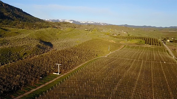
Winter in Wenatchee

I should start off by saying that winter in the Wenatchee area, where I live, isn’t as cold and nasty as you might think. Yes, Washington is in the northwestern corner of the country and I live at about 47.4° of latitude there. But as surprising as it might seem, our winters are just about the same as the ones I experienced in Northern New Jersey years ago, which sits at about 41° of latitude. Here’s some data from Sperling’s Best Places:

Climate Comparison

I’m finding it hard to believe that we have fewer sunny days than the New York Metro area, but that’s likely due to the winter when we get cloud cover 4 out of every 7 days (my estimate). In the rest of the year, it’s sunny most days. The rainfall numbers (8.8 annual inches in Wenatchee vs. 42.6 in Harrington Park) and precipitation days (64 vs. 113) tell the tale. We even get less snow.

One of the two main reasons I left New Jersey back in 1997 was to get away from the cold winters. (The other was financial; I can have a much better lifestyle out west for the same or less money.) So I think it surprised a lot of people when I made the move to Washington State. But there are a lot of things beside the weather to attract and keep me here — I’ve mentioned a lot of them elsewhere in this blog.

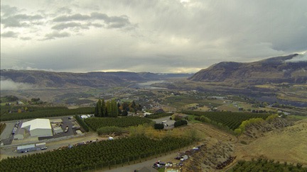
Still, the weather does dip below freezing in the winter here and, like in Arizona, it does it earlier than it did back east. It seems that the coldest days here are right around Christmas. (Back east, it started getting coldest around New Year’s day and didn’t let up until mid February.) I’ve experienced freezes here as early as November, which is why I start winterizing as soon as we get our first frost.

That was this past Tuesday morning.

Irrigation

Because of our “high desert” like environment, the only way to get a garden or leafy trees to grow is to put them on irrigation.

I’m a real pro at setting up drip irrigation — I did it at my Arizona home not long after we moved in and were able to do some sort of landscaping there. (Long story; not worth retelling.) The benefit of drip irrigation over sprinklers is that you can bring water directly to the plants that need it. That saves water and cuts down on weeds.

I have four irrigation systems at my Washington home:

  • My vegetable garden was the first one I set up. It runs from a battery-operated timer and provides water to the raised garden beds, a flower garden beside my shed, and the flower garden at the entrance to my driveway. I also ran the line under my driveway to deliver water to the first trees I planted on the south side of my driveway, including a handful of fruit trees (cherry and apple).
  • My front lawn was the next one. The only reason I have a lawn is because my dog likes grass. The lawn is small and is bordered by rocks and my driveway on three sides and a row of lilac trees I planted right in front of my home on the other. This system also runs on a battery-operated timer and it includes three pop-up sprinklers in the law and a bunch of drip lines for the lilac bushes and some marionberry bushes a friend gave me.
  • Two professionally installed irrigation lines on a programmable 4-zone timer provide water to the trees I’ve planted along the road and all the way down in my bee yard. I have over 1,000 feet of road frontage and the lines run almost that entire length. I add drip emitters every time I plant another tree.

The main thing to worry about with irrigation lines in the winter is that if you don’t drain them, they’ll freeze and possibly crack. That means tracking down leaks and doing a lot of repairs in the spring. I obviously want to avoid that.

Over the past couple of weeks, I’ve been cutting back on the water being delivered to my garden, lawn, and trees, mostly by adjusting settings in the irrigation systems. When the weather finally turned full autumn last week, I shut most of them off completely. A friend in the area suggested giving everything one final soaking before winterizing. Mother nature is doing that for me: there’s a double storm system coming through the area that should be delivering lots of rain. So I shut everything down yesterday and winterized it.

What does winterizing entail? Here’s what I do:

  1. Shut off the water source at the source. Three systems run from the “frost free” valve at my shed; the one from my lawn is a spigot at the front of my house. which has an internal shutoff valve.
  2. Disconnect the water lines. This makes it easier for them to drain. Or for water to expand if there’s any left in the water line and it freezes.
  3. Use an air compressor to blow out the lines. I bought all the equipment to do that last year: male and female hose fittings that can connect any hose fitting to my compressor. My compressor is a huge affair on wheels that my friend Bob gave me. I have it connected to a very long hose (also from Bob) on a reel I bought and installed my car garage. The hose is long enough — if you can believe this — to reach my shed about 100 feet away from my front door. So it took only minutes to run the compressor hose out there, hook it up to the various lines, and blow out each line. Then I cranked the compressor hose back in. Done.

Th only other thing I need to do is gather up and drain the hoses I’ve used around my yard, coil them back up, and store them in the shed until next spring. I’ll likely do that next week when the weather clears up again. They’re not at risk of freezing.

Water source
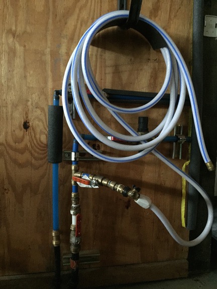
This Frankenstein’s monster is where the water comes into my building and goes all kinds of places — including a hose for the inside of my garage. I designed this crazy setup so I could actually drain all the water out of my pipes from one place.

Inside my garage, under the stairs where the water comes out of my slab and goes up into my home, my water lines also need a bit of prep. That’s easy. I have a ceramic heater that I place in front of the PEX pipes. I plug that into a Thermo Cube — a temperature sensitive outlet that turns on at 35°F and turns off at 45°F. So if temperatures get down to freezing inside my garage — which is possible once in a while — the heater will turn on and keep that area warm. No chance of pipes freezing.

The Garden

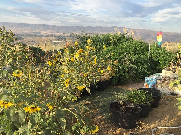
My vegetable garden this year was better than ever before. Until the tomatoes took over.

I planted and harvested sugar snap peas, beans, broccoli, brussels sprouts, peppers, onions, okra, eggplant, beets, corn, zucchini, yellow squash, cucumbers, various herbs, and potatoes. Everything except the brussels sprouts provided me with a good harvest. The sprouts were attacked by aphids and grasshoppers that I was simply unable to keep under control. The zucchini, yellow squash, and cucumbers were attacked by squash bugs, but I managed to get a good harvest before they came.

My Garden
Here’s my garden in the spring, before the tomatoes and sunflowers took over.

I also planted just four tomato plants. Unfortunately, some “volunteer” tomato plants also started growing. These were from seeds of tomatoes that had fallen to the ground, likely at the end of the previous season. At first, I pulled them out. Then I potted some and gave them to neighbors and friends. Then I pulled more out. Then I thought, well, what’s a few more tomato plants?

I went away for a week in the beginning of August. When I got back, those volunteer tomato plants had pretty much taken over one side of the garden, making it impossible for me to reach the second batch of corn that I wanted to harvest.

And then the spiders moved in. Big yellow and black ones that an entomologist friend assures my are not harmful. There were at least two that I saw. Who knows how many more lurked in the jungle of tomato plant leaves? I made sure I always wore gloves when picking tomatoes.

And then I started taking pruners with me when I picked tomatoes. Ever time I picked a basket full, I’d lop off huge branches of the plants. I eventually regained access to my eggplant plants, which began producing again. The peppers were a complete loss, as was the corn. If my chickens hadn’t met an untimely end, they’d likely be eating back the plants. But because they’re gone, the tomato plants soon invaded the fenced-in chicken yard.

Out of Control Garden
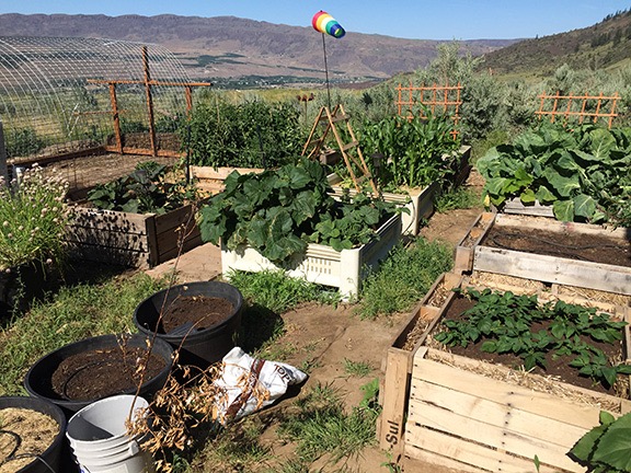
Out of control tomatoes and sunflowers in my garden. At this point, I’d already harvested much of my garden’s crops.

I should mention that there comes a point when your neighbors and friends stop taking tomatoes from you and you feel as if you eat another bowl of gazpacho, you’ll die of tomato poisoning (if there is such a thing).

When the frost set in the other day, I have to say that I was glad to see frost damage on some of those plants. I’d finally get rid of them.

But I will eventually have the task of cutting them all back and putting the plants in a compost pile. I’ve already been doing this a bit with grass clippings and other tomato plant cuttings. I put them in the raised planters I’ve already harvested from. When the snow falls, it’ll form a heavy blanket over each planter’s pile. Snowmelt will help break down the plants. In the spring, I’ll just use a rake to loosen up the previous year’s soil and new compost. Then I can add a half bag of fresh garden soil, work it in, and plant.

This year’s chore will be difficult. As soon as the frost kills the plants, I’ll get to it. I figure an hour or two a day through the rest of October will finish it up.

I almost forgot about the invading sunflowers. They grew all over my garden area and at the corner of my front walkway. They’ve been dying and I’ve been pulling them out for the past month or so. Still have a few to go. They go down to my big yard waste pile, which is a low area alongside the road just past my windsock. The quail are having a field day on the seeds that are dropping. I guess I’ll be fighting sunflowers next year, too.

Potatoes from my Garden
The last of the potatoes from my garden.

In the meantime, I harvested the rest of my potatoes yesterday. This was the first time I’d ever grown potatoes and I started with a few from my pantry that had grown “eyes.” I followed the instructions I found on the web and put them in their own pallet planter. I never put that planter on irrigation — I just watered it occasionally. Next year, I’ll irrigate; I think I’ll get more potatoes that way.

The Lawn

Bad Lawn
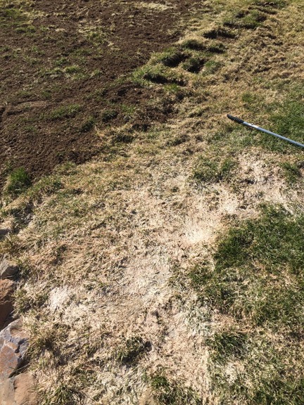
Here’s what part of my lawn looked like this spring. The top part of this photo shows the dead grass raked out; the bottom shows what long grass looks like if left under snow for months at a time. Lesson learned.

I learned my lesson about the lawn this spring: if you don’t cut the grass down short before the snow comes, you’ll start the season with an ugly brown patch that requires a ton of raking to prepare for spring growth.

Even though I’ve turned off the irrigation, my lawn continues to grow — although more slowly than it did in the summer. So I’ll keep cutting it.

It’s not a big deal because it’s a small lawn. I have an electric mower that works very well. The whole job takes about 15 minutes, including prepping the mower and then dumping the grass clippings and putting the mower away when I’m done. I suspect I’ll keep at it until either the first snow is forecast or I go away for the winter.

My Lawn
Here’s what my lawn looked like this summer. Not perfect, but I’m proud of it. It’s the first lawn I’ve ever planted, grown, and tended to in my life. (And yes, that is a pesky volunteer sunflower along the gravel area.)

My Cheat

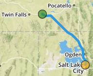
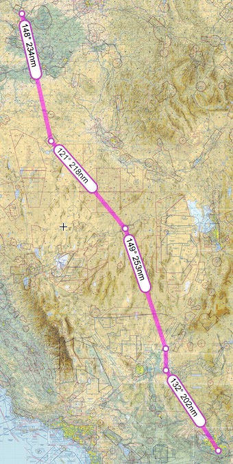
Oh, yeah — maybe I should have admitted that at the top of the post: I don’t stay here for the winter. I actually never intended to — even when I first saw this homesite and knew it was what I wanted. As far as I’m concerned, this is a three season place. When the temperatures begin to drop and that cloud cover moves in like a cold winter blanket, I’m out of here, headed to points south: Arizona and California.

I’m lucky to have a very good house-sitter who comes with her Doberman to keep an eye on things for me. She’ll be here for most of the time I’m gone and has family nearby to help her if anything goes wrong.

Still, I want to prepare my place so it’s easy for her to tend to — and worry-free for me. That’s why I winterize.