
We give Kingman residents and visitors helicopter rides.
I started planning for the Mohave County Fair at least a year ago. I exchanged phone calls and e-mails with the folks who handle the concessions for the fair, including Betty Watters and her son Phil Richardson. I flew up to Kingman in June to check out possible landing zones. That’s when I paid the fee for my “booth” in the north parking area. The dates September 15-18 went from pencil to ink on my calendar.
Mike and I went up to Kingman early Thursday morning. I flew, Mike drove. Mike brought our camper up there. It’s a 3-horse slant trailer with living quarters. I left about an hour after Mike and arrived at the fairgrounds the same time he did. I did a lap around Kingman, planning my route for rides, while Mike parked and secured my landing zone. Then I landed in a huge cloud of dust, cooled down the engine and shut down. We spent the next two hours setting up boundaries for the landing zone, putting up banners and signs, and doing housekeeping chores in the camper. The nice folks at the fairgrounds allowed us to park the camper at one end of the landing zone. On the other side of the fence were a few portable toilets (which we wouldn’t need) and the trailers and living quarters for the carnival folks. Beyond that were the carnival rides and attractions. And beyond that was the rest of the fair.

Mike made a trip to the local True Value hardware store to pick up a sprinkler and another hose. Phil had run his own hoses to the landing zone and we decided to use a sprinkler, which we’d move periodically throughout the day, to keep the landing zone damp. That would keep dust down. Mike also had to take a trip to town to fill the camper’s two gas bottles so we’d have refrigerator, hot water, and stove use. The camper also has a full bathroom with two holding tanks, so we could use our own clean toilet and shower daily.
We also had Jack the Dog and Alex the Bird with us. Jack had to stay on a leash. Alex stayed under the trailer’s awning in his cage. Neither of them were bothered by a helicopter taking off and landing about 150 feet away from them.
Betty had asked her neighbor, Tony, to give us a hand. Tony is on permanent disability after being hit by a truck years ago, but he was fully capable of helping us with the things we needed to do. He wound up working with us on Thursday and Friday and lending moral support on Saturday.
By 2 PM, we were ready to do rides. The only thing we needed were passengers. That was the problem. It was 2 PM on a weekday. Kids were in school, parents were at work. No one was interested in the carnival or our rides.
The ride took off from the north parking area. I had to make a crosswind departure, since heading into the wind would have taken me right over the carnival rides. From there, we flew up the east side of Centennial Park, north of Wal-Mart, just north of the I-40 pass through the mountains, down to the Beale Street exit on I-40, along the south side of Andy Devine Boulevard, across Hualapai Mountain Road, and up the east side of the fairgrounds. I made a 1807deg; turn at a cell tower north of I-40, then came straight in to the landing zone, landing right into the wind. Total time was about 6-8 minutes.
I’d priced the rides at $25 per person including tax. This was before fuel prices went up, so it was a real bargain. My usual ride prices are $30 to $35 per person for an 8-10 minute flight, but the fair folks practically begged me to keep the price down. So I did, depending on the cheaper price to attract more passengers and shorter ride length to make it profitable.
We managed to give 11 rides on Thursday. Very disappointing. We went to the Dambar restaurant for a good dinner, though.
On Friday, things weren’t much different. I walked over to the nearby junior high school around 10 AM, suggesting that a few of the teachers might want to walk students over to see the helicopter and get one of my presentations on aerodynamics or how helicopters fly. The school was very interested, but Fridays are half days so classes are shorter. There wouldn’t be enough time for any of the classes to walk over and back and get the presentation.
Things picked up late Friday afternoon. We did 10 rides, most of which were after sunset. The moon was big and full and beautiful and the carnival rides looked great from the sky.
By that time, our two helpers, Alex and his college buddy Ryan, had come to help out. There wasn’t much for them to do. They pitched their tent behind our camper, uncomfortably close to those portable toilets on the other side of the fence. We ate carnival food for dinner and walked around the fair.
We were pretty disappointed at the turnout so far.
Saturday changed everything. Although I wasn’t supposed to start flying until 10 AM, my first passenger arrived at 9, before the fair even opened. Heck, I didn’t care. I gave him a ride. For the next two hours, I did a few rides. Then the dam burst (so to speak) and I had a nonstop flow of passengers. Mike, Alex, and Ryan loaded 2 or 3 people on board for each flight. The only time I shut down was to get fuel at the local airport 5 miles away (three times!) and to take a 20-minute lunch/bathroom break. I put 5.5 hours on the helicopter’s hobbs meter that day — quite a bit when you consider that the hobbs only ticks when I’m in flight so my time spinning on the ground didn’t count. I figure I took about 100 passengers for rides that day. Most of them were in a helicopter for their very first time. I gave all the kids who flew with me helicopter toys (while they lasted). One guy liked it so much he went up twice.
We celebrated with four steak dinners at the Dambar.
Sunday looked as if it might be a repeat of Saturday, but the flow of passengers was starting later. The wind was stronger than the previous few days and it was warmer, so taking off with a crosswind (rather than a headwind) when I was heavy was tough. I did about 20 rides before we decided to call it quits. It was 1:30 PM. We packed up, said goodbye, and got ready to go.
I stopped off at the carnival office to leave a card for the carnival owner. I’d had a good event and was interested in working with carnivals to do it more often.
Mike left with the camper and I took off with Alex and Ryan. We took the scenic route home: to Bullhead City and down the Colorado River to Parker, where we refueled (at $4.54 per gallon!). From there, we hooked up with the Bill Williams River, overflew Swansea and the Alamo Dam, and returned to Wickenburg.
We’ll go back to the Mohave County Fair next year. But we’ll just spend all day Saturday and Sunday. I’m already looking forward to it.
My thanks to Betty and Phil for all their help.
 I reached Ennis, which Lynn had told me was very touristy. I didn’t really notice that, but I made my turn there, so I may have missed that part of town. I was still on route 287, but it was heading southbound now. After a while, the road joined up with the Madison River, which I followed for quite some time. When I got to the turnoff for Quake Lake, I turned in. Lynn had told me a little about the place and said she’d wanted to see it when she and Ray had driven past. Ray hadn’t been interested at the time, so they’d gone past without stopping. The place was situated in a canyon where the Madison River flows. In the late 1950s, an earthquake had caused a landslide that dumped debris into the river bed. Twenty-eight people had been killed, although I don’t know how. Perhaps they were on the road there? In any case, the natural dam caused by the landslide had created Quake Lake. I read all this on the sign outside the visitor center. It was all I needed to know, so I didn’t go in. I took a picture of the little lake, then got back into the car and continued on the road as it wound alongside it. There were lots of dead trees sticking out of the water. I imagined a heavily forested canyon suddenly filled with water and the slow death of the trees that were submerged.
 I headed into the park, crossing over the border into Wyoming, the eighth state I’d visited so far. My National Parks pass got me in without a fee. (It works at Yellowstone but not Mt. St. Helens? What kind of bull is that?) I took the map and gave it a quick look. My objective was not to visit the park. My objective was to take a nice, scenic ride south toward Salt Lake City. The problem was, it was a Saturday in August. The park was full. And the tourists were of the most annoying variety: drive-through tourists who will stop their car anyplace someone else has stopped, just to take a picture of whatever that other person is taking a picture of. When I wanted to drive slowly, there was someone on my butt. When I wanted to drive faster, there was someone in front of me. When I wanted to stop in a place where no one else was stopped, two or three other cars immediately appeared, spewing occupants armed with cameras to take the same picture I was trying to take. At one point, I reached a traffic jam on a narrow, one-way road as at least 30 cars had stopped to photograph a grizzly bear on the other side of a creek. I was so wigged out by the crowd that I neither stopped nor saw the bear.
 I did see plenty of elk, though. The first herd was right inside the park, grazing along the Madison River. I guess seeing tourists have tamed them, to a certain extent, because some very gutsy tourists were approaching quite close and the elk didn’t seem to care. I also saw a few bison. Most of the bison, as I recall, are on the grassy east side of the park. I was on the west side. I saw four individual animals, each of which were the subject of many tourist photos. But the one that amazed me the most was the one walking alongside the road in a forested area. I think he was lost. But he was walking on the pavement, forcing vehicles to go around him. That, of course, caused a traffic jam because everyone wants the thrill of driving alongside a walking bison. When it was my turn to pass him, I didn’t stop. I just aimed my camera and pushed the button while I kept driving. He was so close that someone sitting in my passenger seat could have reached out and touched him. Although he didn’t seem interested in me (or anyone else), I could imagine what those horns would do to my car’s paint job if he decided he didn’t like the color red. I wondered what he thought of the long line of campers and SUVs and cars filing past him in slow motion. I also wondered where he was going. Probably to the administrative offices to complain about all the traffic and exhaust.
 I took the exit to the Old Faithful Inn, in search of a decent lunch. I got a great parking spot in the shade and got out with my camera. There was a huge crowd of people sitting on benches, facing the Old Faithful Geiser, which was spewing out various amounts of steam to keep them entertained. I tried two places and found a cafeteria and a buffet. I checked out the buffet and was surprised to find that the cafeteria food had looked better (although it didn’t smell better). As I was walking back to my car, Old Faithful let go and I managed to get a bunch of good photos. It was still bubbling water when I left.
 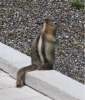 I also managed to get a photo of this little fellow. It’s unfortunate, but people at national parks find it necessary to feed the wildlife. As a result, they become tame, like this guy probably was, and they forget how to forage for themselves. In the winter, when there are fewer tourists around, they starve. That is if they don’t get sick and die from the junk the tourists feed them.
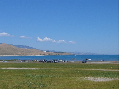
 The road followed the Snake River down to Jackson Lake and Grand Teton National Park. The main feature of Grand Teton is the mountain with the same name, on the southwest side of the lake. It’s 13,770 feet tall, very rocky, and has a glacier not far from the top. In this photo, it’s the mountain that’s farthest away. It was after 3 PM and the sun was moving to the west, making it difficult to get a good photo of the mountains from the east. I followed the road, choosing the path that kept me close to the lake rather than the faster road that went direct to Jackson. A scenic drive.
 I didn’t see or smell smoke all day yesterday. But in the evening, as the sun was setting, I saw the smoke on the northwestern horizon. Probably the fire out in the St. George area about 120 miles away. This morning, the smoke from Arizona’s big fire — the second biggest in its history — had drifted north, past the San Francisco Peaks, shrouding the eastern horizon. I almost missed the sunrise. The sun fought to be seen through the thick smoke, appearing as an orange globe poking out through the top of the thickest of it. There was little light from the sun at first. Then, when it broke clear of the cloud layer, I could feel its bright warmth. The smoke cloud faded back to a blue-gray blanket on the horizon.