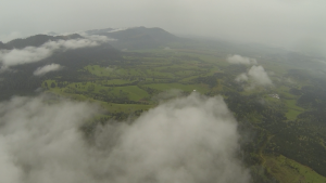
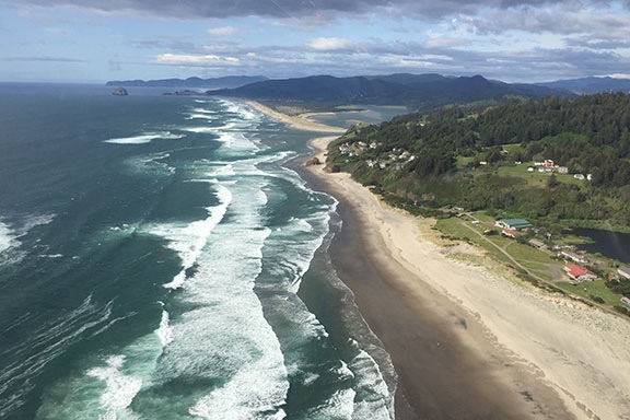
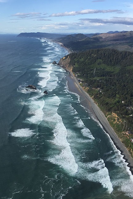
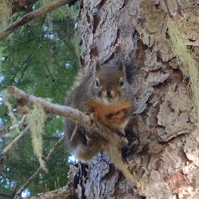
Day 2 is full of hiking, amazing mountain vistas, and the sound of running water.
– Day 1: The Road to Mazama
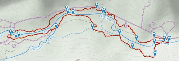
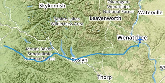
– Day 2: Mazama to Colonial Creek
– Day 3: Colonial Creek to Baker Lake
– Day 4: Baker Lake to Mount Baker
– Day 5: Mount Baker to Chilliwack Lake
– Day 6: Chilliwack Lake to Hozomeen
– Day 7: Hozomeen to Copper Creek
– Day 8: Winetasting My Way Home
I woke as the sky was getting lighter — just like I usually do at home. The difference is, because I was in deep valley, that didn’t happen until after 5 AM. By 5:30, I was done sleeping.
It was pleasantly cool. Cool enough to close the few windows I’d left open overnight.
I made a pancake and coffee for breakfast and settled down to write yesterday’s blog post. I didn’t really feel like writing — I’ve been like that a lot lately and it has me bothered. I’m working on a book — or trying to — and can’t seem to get and stay motivated. I was hoping that blogging each day of this trip would get me back in the mood, but yesterday morning, as I drank my coffee and our campsite brightened around me, I just couldn’t. It got worse when the first rays of the sun touched the tops of the hills nearby. It gave me a sense of urgency to start my day. Still, I forced myself to finish the task and then posted the result.
Penny and I took a short walk to that most excellent pit toilet building. Yes, the Turtleback does have a toilet in its microscopic bathroom. (Seriously: bathrooms are bigger on airliners.) But I didn’t see any reason to fill my blackwater tank. Besides, I was “practicing” for long term living in the Turtleback this coming winter. I hoped to park it out on the Colorado River again with friends and dumping wasn’t an option. The goal, then, was to use public facilities when needed if they were available. This was, as I mentioned yesterday, a very clean facility.
Then I broke camp. That was as easy as packing my portable grill back into its carrying case, stowing it in the truck, and turning the key that closed the Turtleback’s single slide. We were back on the road within 10 minutes.
On the Road
I stopped at the Mazama Store, which was on the way back to Route 20. I wanted to pick up a bottle of wine, some onions (I’d forgotten to pack the ones in my fridge at home), some seasonings, and some bug repellant (which I didn’t need yet but who knew when I would?). While I was in there, I looked at the selection of extremely overpriced, high quality clothing and household items they had for sale. No, I wasn’t going to spend $40 on an 600+ piece jigsaw puzzle or $60 on a sweatshirt that had Mazama written across its front. They do have the largest selection of Lodge cast iron cookware, including dutch ovens, that I’ve ever seen in one place. But I don’t even use the pieces I have. (I plan on changing that next time I head south for the winter.)
I also topped off the truck with diesel. I had a half tank, but I didn’t want to have to worry about it as I traveled.
As I drove out of town, I looked around at the big open field where I skied every winter. It looked completely different without the snow and snow banks. And, surprisingly, it was a lot less busy on that beautiful summer day than it is every Christmas Day. Go figure.
I hadn’t gone more than 5 miles when I started seeing National Forest campgrounds that I could have stayed in. I pulled into two of them to check them out. They were nice, with some level of privacy and enough space to be comfortable. But as I drove around mentally critiquing the sites, I began to realize that I didn’t really like camping in campgrounds anymore. It was like living in a subdivision. Why would I want to live somewhere with less peace and privacy than my own home? Sure, the first night’s site wasn’t anything special, but I was the only one there. It was dead quiet all night and completely private. The only thing that could have made it better was a stunning view or a lake or river out my door. Like the first campsite I’d taken the Turtleback to back in May.
But I do have this to say about National Forest campgrounds: they’re clean, they have good basic facilities, and they’re cheap. I’d rather pay $8 to $16 for a fire ring, picnic table, and nearby restroom facilities in the woods with some trees between me and my neighbors than pay a KOA $35-$55 for the basics plus a full hookup in something similar to a parking lot. When did “camping” turn into a parking lot activity?
I stopped at the Washington Pass Overlook, parked in the RV parking area, locked up, and walked with Penny up the path to the overlook area. There were only a few people there. The air was clear, the sky was cloudless, the low sun was illuminating the granite peaks around us. The view was spectacular — almost surreal — of forest crowned with pointy, snow-studded rocky outcroppings. The only sound was that of cars and trucks and motorcycles rushing by on the road far below.
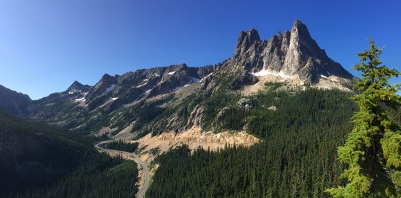
The view from Washington Pass overlook, looking southwest.
First Hike: Maple Pass Trail
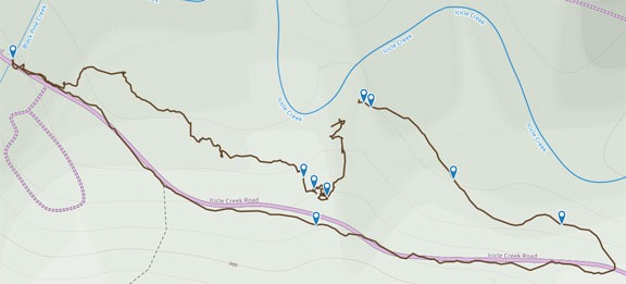
Back in the truck, I consulted my Methow Valley trail map. We were already almost off it. I wanted to do a morning hike. Rainy Lake was up ahead — it was an easy one-mile hike to a lake that no one other than me ever seemed interested in. The same trailhead had the much more popular Maple Pass loop trail with its side trail to Ann Lake. The Ann Lake hike looked doable — maybe a mile and a half each way. Worth a try.
I was pulling into the trailhead parking lot — which is almost exactly halfway between Winthrop and Newhalem — a short while later. It was already nearly full. On a Monday morning. Apparently I wasn’t the only person who thought a vacation in the North Cascades was a good idea for the first week in August.
Again, I parked in the RV parking area. I should mention that although my truck with the Turtleback on it will fit (snugly) in a standard parking space, it’s a bit wide and a bit long. Backing up out of a space in a crowded parking lot is often a problem. (Heck, it’s often a problem even without the Turtleback on; my truck is big.) It’s a lot easier to pull through a spot, so I park with the motorhomes when I can. I hung my Forest Pass from the rear view mirror, put Penny on her leash, and stepped down into the parking lot with her. After a bit of organizing to get my waist pack filled with water bottles, jerky, binoculars, and other necessities, I grabbed my camera bag and camera, locked everything up, and headed to the start of the trail.
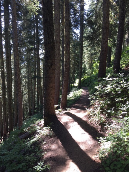
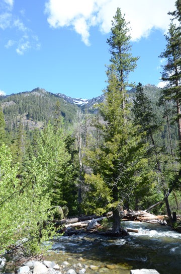
Along the trail to Maple Pass and Ann Lake.
The Maple Pass trail starts climbing immediately. It isn’t a steep climb, but it does begin with some switchbacks. I took my time — as I always do when climbing hills. I can hike all day at a good pace on level terrain or downhill, but put me at the bottom of a hill and you’ll need to be patient while I climb it.
Penny was freed from her leash when we reached the first fallen tree. She wanted to go under it and I couldn’t. So the leash came off and she hurried off up the trail, coming back when I called her and generally entertaining everyone who passed us. (That “he looks like Toto” thing is really getting old.) And lots of people did pass us, which was okay with me. I was in hill climb mode and not in a hurry.
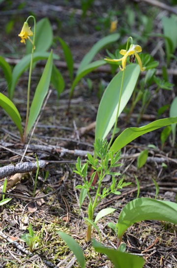
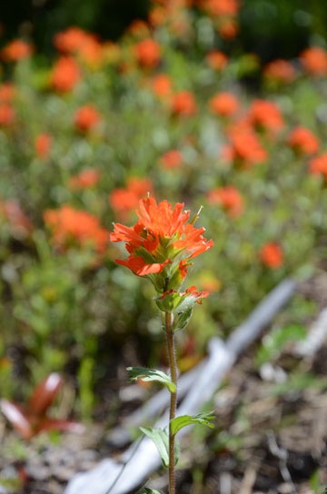
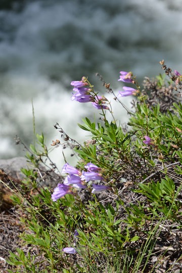
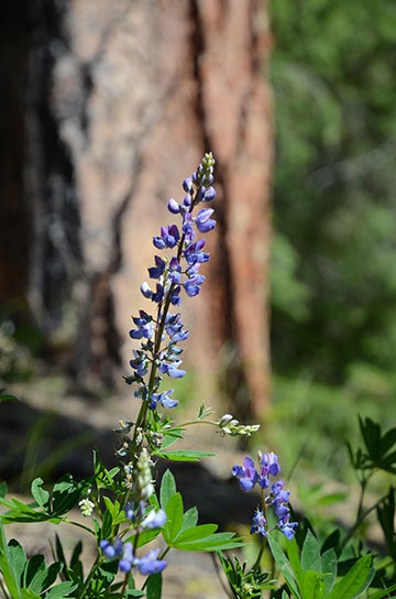
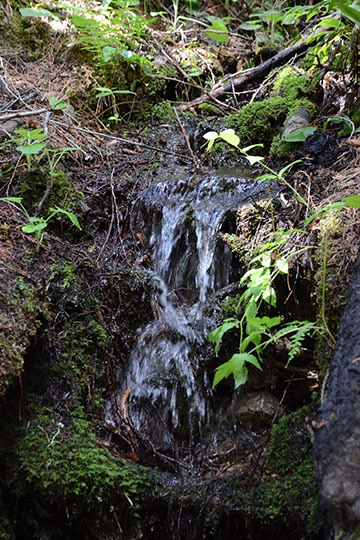
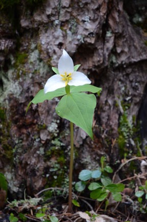
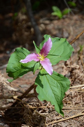
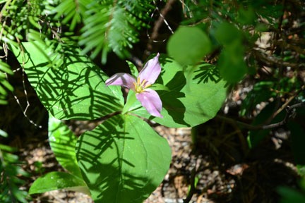
I stopped to take a lot of photos, mostly of wildflowers. The light and shadows made lots of opportunities for me to capture a bloom in the sun against a darker, out-of-focus background. This was a lot easier with my Nikon than with the camera on my iPhone, so I have few photos to share here. (I can’t get my Nikon photos onto my laptop without an SD card reader, which I neglected to bring along; maybe I’ll pick one up on the west side of the mountains, later this week.) The trail was mostly very shaded, but every once in a while it would open up to a hillside with spectacular mountain views. That’s also when it would get very hot — at least 20° hotter in the sun than the shade — and I regretted bringing along my sweatshirt.
The heat combined with the relentless hill climb was starting to get to me after an hour or so of hiking. At 10:30, I decided I’d hike until 11 AM and then turn back. But a short while later, when we emerged from the woods again, I saw a crowd of at least 50 hikers up on the trail ahead of me. I immediately assumed they were part of a tour group — they were dressed in brightly colored clothes with small day packs on their backs and seemed to be split into large groups led by a person with what looked, from a distance, like a map. I imagined some sort of nature outing of city folk from Seattle closely examining the plants and rocks as they walked. They hadn’t passed me, which meant they were hiking slower than I was. Which meant I’d be passing them. And, at my current rate of speed, I’d likely be among them for at least 20 minutes. Clearly, it was time to turn back.
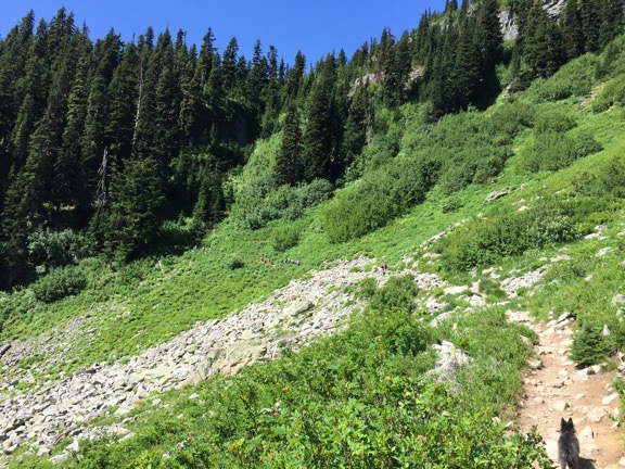
Here’s where I spotted that group of hikers. Can you see them? Only about 1/3 of them are in this shot; the rest had already entered the woods beyond them.
For the return hike, I activated the Gaia GPS app on my phone, mostly to get track stats. It already had the detailed maps loaded up; I’d done that last year. (Must remember to load maps for the rest of my trip when I’m back on the grid.) I snapped a few photos to include with the track and, with luck, will remember to upload it to the GaiaGPS site when I publish this later today. When I got back to the trailhead, I saw that I’d hiked just under a mile one way. That was just two miles total. Pitiful, even by my standards.
Colonial Creek Campground
After a pit stop in the Turtleback’s tiny bathroom — the toilets at the trailhead were too stinky — Penny and I continued in the truck on our way west. My plan was to camp one or two nights at the Colonial Creek Campground, where I’d stayed last year.
The road winds through the forest at a good clip and I did the best I could to stick to the speed limit so as not to slow up people behind me. The Turtleback raises the truck’s center of gravity considerably and, although it’s not in the least bit unstable, it feels very different when it’s so top-heavy. The drive was very pleasant, with views of at least a dozen small waterfalls along the way. I decided that, weather permitting, I’d take my motorcycle for the ride when I returned later that month for the photography class I’d booked at the North Cascades Environmental Learning Center on Diablo Lake. The road seemed made for motorcycling.
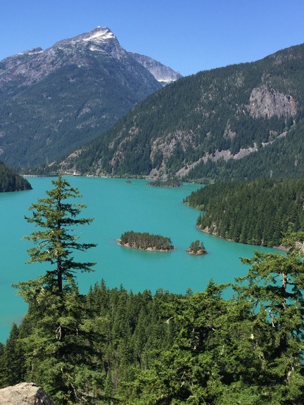
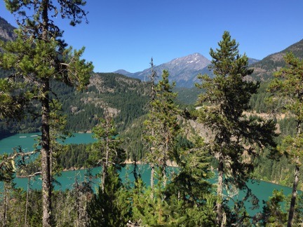
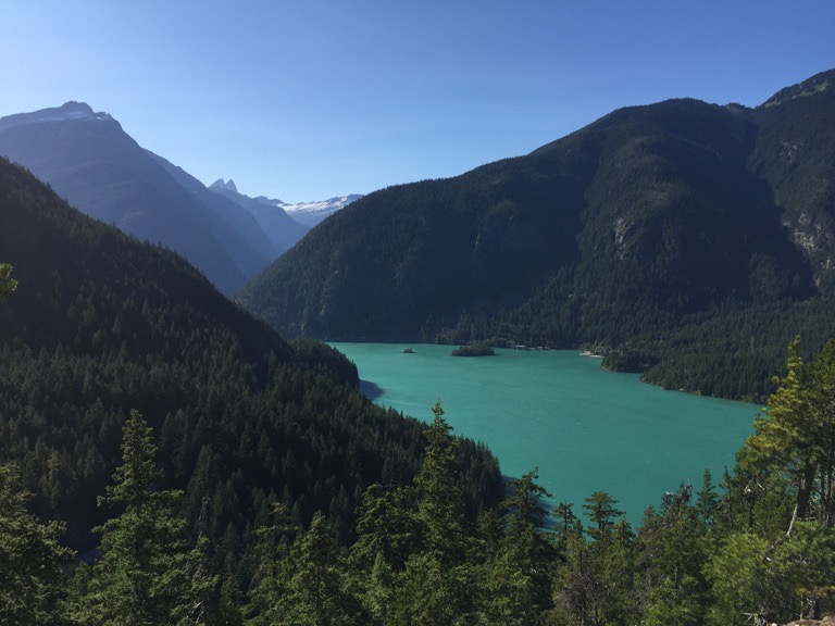
Diablo Lake, from the overlook on Route 20.
We passed the Ross Lake overlook without stopping, but stopped at the overlook for Diablo Lake. The incredible blue-green color of this lake’s water never ceases to amaze me. We took a nice walk along the rail on the edge of the drop-off and I shot photos with my phone’s camera along the way. Then it was back in the truck to finish the drive to Colonial Creek Campground.
I knew from last year that there were some sites right along Diablo Lake and I was hoping I could find one for the Turtleback. But as I drove through the campground, I also remembered that most of those sites — one of which we’d gotten the year before — were tent sites that you had to walk in to. A vehicle would be parked along the road, nowhere near the water. Great for tent campers but not great for RVers. I finished the loop, seeing one or two suitable sites on the west side that weren’t anywhere near the water but did have the privacy I prefer in campsites. Then I remembered the other part of the campground on the north side of Route 20. Colonial Creek ran along one edge. Maybe I could find a site along the creek?
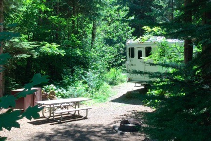
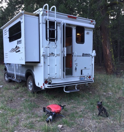
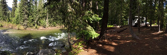
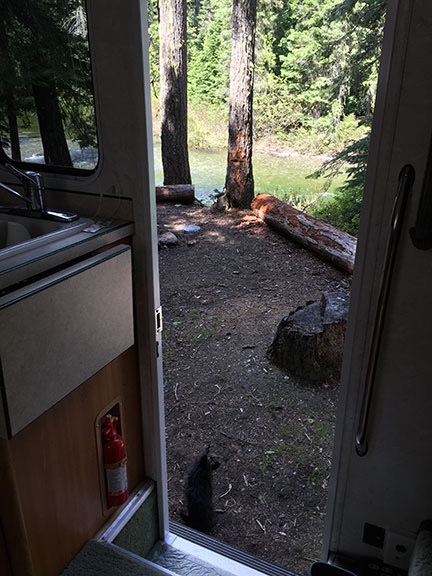
My campsite at Colonial Creek Campground was right on the creek.
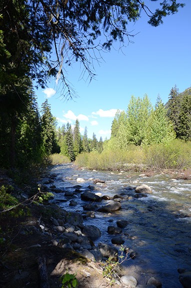
I drove in and found what I was looking for almost immediately: a creekside site I could back the truck into. Although the front end of the truck was within 5 feet of the road, the back end — with the Turtleback’s door — faced the campsite and creek. I maneuvered the truck so that a large flat stone set like a curb to prevent vehicles from driving any farther into the site was right beneath the Turtleback’s step, making it easy to climb up and down. Although I couldn’t see the creek from the Turtleback, I could certainly hear it rushing by beyond some fallen logs. And a trail led right from the site to the creek. With trees on both sides, I had plenty of privacy from the occupied sites on either side of me.
By this time, it was well after noon and I was starving. I had a fridge full of vegetables and ground beef I had to cook. I sautéed the beef with onion, peppers, eggplant, green beans, and tomatoes. I would have added zucchini and yellow squash, but the pan was already too full. A touch of Spike seasoning and some pepper and I had a nice hot lunch. Even Penny had some.
While I ate, I studied the North Cascades National Park Map I had. Although I’d tentatively planned my trip for two days at Colonial Creek, without my kayak along I wasn’t sure what I’d do the next day. Maybe I could move along and explore another location? Maybe the Mount Baker area? There were some campgrounds that seemed accessible from what might be paved roads — not that lack of pavement ever stopped me. If I wasn’t going to do any paddling on this trip, I’d do more hiking and photography. So far, I’d been in places I’d been before; it was time to strike out and explore something new.
So when I walked with Penny and my checkbook to the pay station to pay for the site, I filled out the form and wrote the check for just one night: $16. I also chatted with a uniformed volunteer about fire regulations. Campfires were still allowed in the fiercest provided for that purpose. I had a bunch of cedar trimmings from a windowsill project at home as well as some fruit wood I could burn. Maybe we’d have a campfire later that evening.
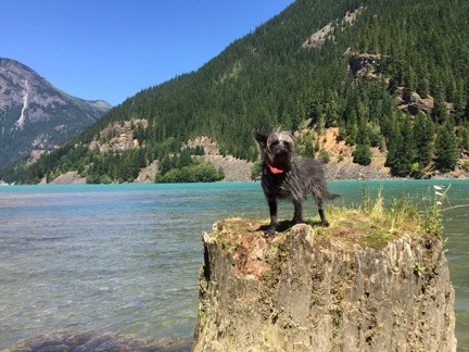
I took a picture of Penny on a stump in the lake. Why not?
We walked along the lake on the way back. I let Penny off her leash again. I stopped to chat with a man coming off the lake in a kayak. It looked sleek and light and a lot smaller than mine. He said it weighed 30 pounds but was 12 feet long. 12 feet! Mine was just under 10 and had to weigh at least 50 pounds. He’d bought it at REI. I figured I’d check them out if there was an REI near where I emerged from the Cascades on the west side later that week.
Back at the campsite, I spent a while starting this blog post. I had my phone plugged into the stereo system and was listening to old time vocals: Frank Sinatra, Tony Bennett, Dean Martin, Nat King Cole. Later, I climbed into bed for a nap with Penny stretched out napping nearby. It was a nice, relaxing afternoon, with no Internet distractions or phone calls or pressing tasks.
Vacation. Gotta love it.
Thunder Knob
I woke at about 4 PM. The campsite was in the shadows; although sunset was still more than 4 hours off, the campground is in a valley and the sun had already dipped behind the trees around us.
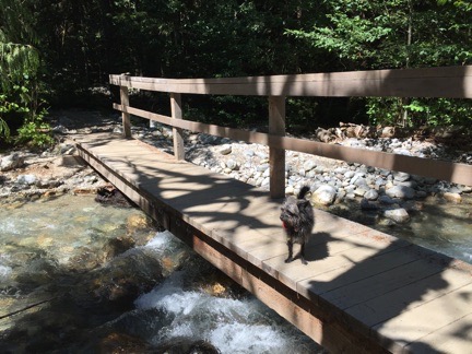
Here’s Penny on one of the bridges over Colonial Creek.
I put on my hiking shoes, grabbed my waist pack with a bottle of water and ice and my camera, and headed out with Penny. The Thunder Knob trailhead was just down the road two campsites away. It was a 1.7 mile hike that I’d done the previous year with my camping companion. I remembered it being a bit of a climb on the way out but all downhill on the way back. After my dismal performance that morning on the aborted hike to Ann Lake, I felt a real need to redeem myself with a good hike.
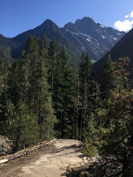
I’m not sure, but I think this is Colonial Peak.
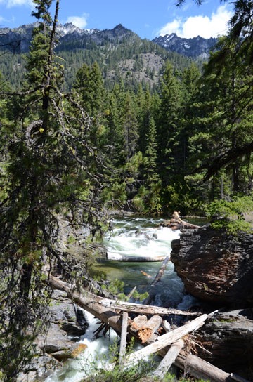
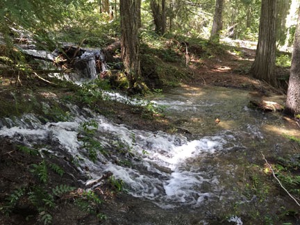
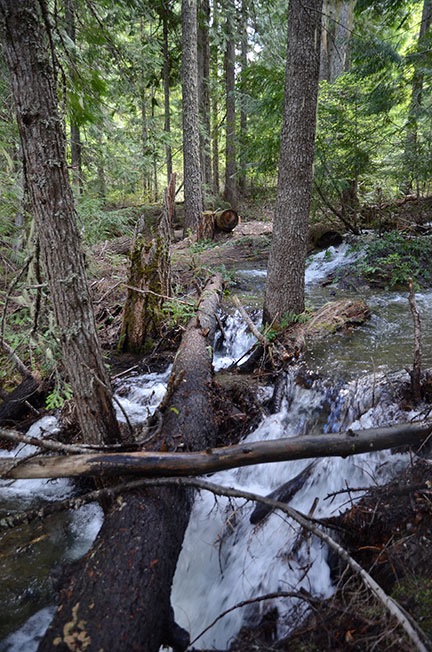
It was pretty much as I remembered it: cross Colonial Creek on some wooden bridges, walk through the cool woods, and then start a climb, mostly on switchbacks, up a hillside laid bare in places by high winds or past fires. Once the climb began, it was remarkably dry and even got hot in places. There were no wildflowers — just scattered fir trees and lower vegetation. Occasionally, there would be a view of Colonial Peak or Diablo Lake or some other snow-studded mountain or glacier off in the distance.
As I hiked, I kept pace with a couple around my age that were stopping for rests almost as much as I was. They offered to let me pass and I declined, the first time, telling them they’d just pass me on a steep portion of the hill. But the second time they offered, I did pass. I felt amazingly energized after my lunch and nap — much better than I had that morning on the first hike. They kept pace with me for a while, but when I announced (after consulting Gaia GPS) that we were half way there, one of them said, “Half way? Have fun!” They stopped for a break and I kept going. I never saw them again.
The view northeast from Thunder Knob.
The hike was worth it, though. The views of the lake from the top of Thunder Knob are nothing short of spectacular. It was cool and breezy up there and I could hear the wind in the trees and see the small whitecaps on the lake far below us. There were also very few people up there: just two couples. I think it was because it was the kind of hike that’s too long or strenuous for a casual hiker (like the folks I’d passed) and too short for a serious hiker. I’m apparently casually serious about hiking. When they left, Penny and I had the place to ourselves.
The view northwest from Thunder Knob.
It had taken us a little over an hour to get up there, but only forty five minutes to get back. I’m a gravity-assist hiker and get good speed when gravity is pulling me the same direction I want to go. The walk was, for the most part, in the shade or shadows and relatively cool. But humidity — especially near the bottom — got me working up a sweat anyway. By the time we got back to camp, I was hot and exhausted.
But I’d also broken my previous record for steps taken in a day: 18,095.
And yes, I have a trackless with photos from Gaia GPS. With luck, I’ll remember to upload it and link to it here.
Ending the Day
I opened the bottle of wine I’d bought in Mazama and poured a glass. Even though it was probably the worst Malbec to come out of Argentina, it still tasted good enough for a camping trip.
Although I felt as if I lacked the energy to take a shower, it definitely had to be done. It was my first shower in the Turtleback’s microscopic bathroom and it went surprisingly well. The water gets very hot and there was enough pressure to get the job done efficiently. Afterwards, I let the shower curtain hang open and draped the towel over the bathroom door to dry. It felt great to get into clean clothes, even though they were a night shirt and lounge pants.
I made a salad and gave Penny some leftovers from lunch. I did the dishes and briefly considered a campfire. But smelling smoke from the campfire next door reminded me that a campfire would just leave me smelling like smoke — a smell I didn’t want to take to bed. So I settled down at the dining table to read for a while, leaving the door open to let in the glorious sound of the rushing creek just 50 feet away.
When it started getting chilly, I closed up the door and whatever windows were still open and climbed up into bed. I managed to stay awake for about 30 minutes. I was dead asleep by 9.

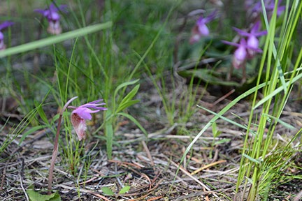 A patch of fairy slipper.