Jeeping in the Wenatchee National Forest

Exploring my world.

One of the things I love about this area of Washington is the variety of landscape and terrain so close by. I’m surrounded by farmland, orchards, desert, rivers, steams, lakes, forests, and mountains. All of these things are within a 30 minute drive from my home — it just depends on which direction I drive.

Beehive Reservoir
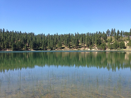
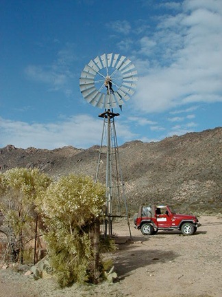
Behive Reservoir isn’t anything special, but it’s a short drive away, up in the mountains south of Wenatchee.

The other day, I briefly explored the area around Beehive Reservoir. I’d driven up there with the goal of checking it out as a possible kayaking destination. The lake I found was small and rather uninteresting. Penny and I walked around its one-mile circumference before continuing up the road. We found a far more interesting web of forest roads that I ached to explore. But without a decent map, I wasn’t comfortable going very far. I decided to return better prepared to explore.

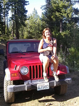
I had a 3-hour window of time on Monday. Penny and I, joined by a friend, climbed into the Jeep and headed out. This time, I had a Wenatchee/Leavenworth trail map with me that clearly identified all the forest roads. We drove up to Beehive Reservoir and kept going.

Our intended destination was Cashmere, on the other side of the mountains. A road numbered 7100 wound through the mountains and a canyon to Cashmere. I’d been on part of the road two years before, picking it up from Number 2 Canyon Road in Wenatchee. It was a relatively easy drive in the Jeep; I figured this would be the same.

But Road 7100 was closed to motor vehicle traffic. They were making improvements somewhere along the way.

Mountain View
I couldn’t ask for a better day — or better views.

So we followed Road 9712, which went west and then mostly south and east. It climbed pretty steadily into tall pine forest, often skirting the edge of a steep cliff. Every turn offered magnificent views. Although I tried to follow our progress on the map, using turns and trailheads as landmarks, I soon lost track of exactly where we were. That wasn’t a big deal — we could always get back because we didn’t make any turns.

We passed a family of three on mountain bikes: mom, dad, and a girl who couldn’t have been much older than about eight. A strap tied dad’s bike to the kid’s. I guess the logic there was that if the kid went over a cliff, her bike would be saved because it was tied to dad’s. The kid, of course, wasn’t tied to the bike so she’d be lost. Maybe that was the idea. We didn’t see them later on the way back, but their car was still there. Maybe they all went over a cliff. It was not the kind of road suitable for a family outing on bikes. I wonder, sometimes, whether people know how to use their brains.

It was after we made a turn down a steep hill that I got the idea to turn on tracking on my iPhone. I use an app called GPS Track that can keep a breadcrumb trail of where I’ve been. It can also display my position (and track) on a map — if I have a 3G or LTE connection. Since I wasn’t sure whether the road we’d turned down would offer other turns, I turned tracking on. Even if I couldn’t see where we were on a map — which I couldn’t — I’d still be able to follow the track back, even after making a bunch of turns.

At the top of the World
I used my phone to make a panoramic image; my friend used a phone to take a photo of me.

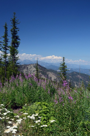
The road we were following descended steadily and then came to an abrupt end in a wide circle with a fire pit in the middle of it. A pickup truck was parked there, but there was no one in sight. We stopped the Jeep and got out to admire the view. We were at about 5,000 feet in elevation and the spot we were on offered a completely unobstructed view of the eastern side of the Cascade Mountains, still blanketed with snow. A variety of wildflowers grew in clumps along the edge of the cliff. It was beautiful and peaceful.

We got out of the Jeep to stretch our legs and take in the view. It was the kind of place that you find it hard to believe exists, a place you know you’re lucky to have stumbled into. I often find places like this when I go exploring in my Jeep. Maybe that’s one of the reasons I like doing it so much.

Panoramic View
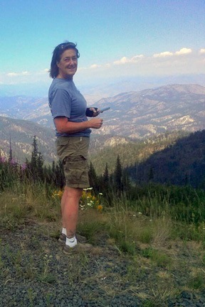
Not a bad photo for a phone. (Click it to see a larger version.)

Burned Forest
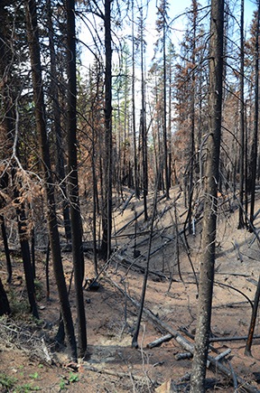
There was lots of evidence of last year’s fires.

We turned around and headed back up to the main road, then turned onto it and continued on our way. The road wound through more forest, up more hills, and over more loose patches of volcanic rock. In some places, the forest was burned out from the previous year’s fires.

The well-maintained road gave way to a narrower, less maintained track. I decided it might be a good idea to figure out where I was. I stopped the Jeep right in the middle of the road — after all, there was no one around — and pulled out my map. I lamented to my friend that I wished I could find a good GPS app for my phone that enabled me to download detailed topo maps so I wouldn’t need a cell signal to use them.

Motorcycle Guidance
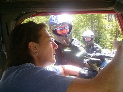
We ran into a pair of motorcyclists who helped us figure out where we were on my map and then recommended a great back road driving app.

I was rather absorbed in my map study when two motorcycles came into view in front of us. The riders were completely geared up and riding good bikes with camping gear fastened to them. I moved to the side to let them pass. They came up beside me and must have noticed I was looking at a map. They stopped and asked if we needed help.

I told them that we weren’t lost but we didn’t know exactly where we were. I know that sounds silly, but in my mind, “lost” means not knowing how to get where you need to go. I didn’t need to go anywhere in front of us and I knew how to get back, so I wasn’t lost. I just didn’t know exactly where I was. Makes sense, no?

One of the guys had a GPS and tried to point out on my map where he thought we were. I told them what I’d been telling my friend: that I wished I had an app that would download maps.

Gaia GPS,” one of the guys said immediately. “It’s $20 but worth every penny.”

They went on their way. I had a good LTE connection, so I downloaded Gaia GPS on the spot. (I figured that guys outfitted like that had to know what they were talking about.) I used it for the rest of the drive and even saved a track from it for the trip back from our farthest point.

Flower along Road
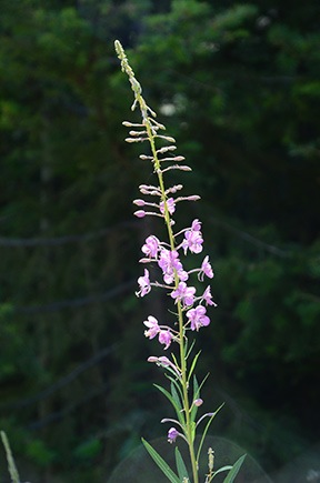
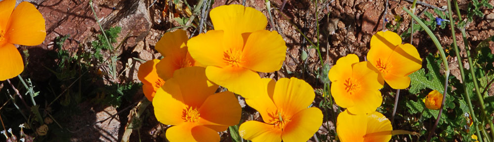
This flower caught my eye as we drove past; I stopped, got out, and took a photo. It’s nice not being rushed by an impatient companion when you’re out for a drive in the forest.

We continued on our way. Soon, however, I was watching the clock. I had a doctor’s appointment at 3:45 and needed to be home by about 3:00 to drop off my friend and make the trip down to Wenatchee. Not sure how long it would take to get back, I set a deadline of about 1:30 to return. It was about 1:00. That gave us just another 30 minutes to explore.

The road continued to wind through the forest, often with sheer cliffs on one side or the other. When we got a good look out to the southeast, I realized that we were on the far side of Mission Ridge, almost at the same altitude. The valley we looked out over was hazy from the smoke of the Colockup Tarps fire, which had started two days before.

I was looking forward to a particularly steep drop-off alongside a section of the road up ahead — that’s what the topo lines showed on the map, anyway — when I realized it was past 1:30. We had to head back. I’d have to make another trip to continue exploring. I marked a waypoint in Gaia GPS so I’d know where I left off and turned around.

Flowers and Burned Trees
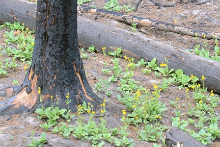
Less than a year after the fire that burned thousands of acres of this forest, flowers were blooming.

The trip back, of course, was much quicker. It always is. We stopped for a nature call and I got some mildly interesting photos of flowers blooming among the burned out trees in the area.

We were back at Beehive Reservoir before we knew it. And back on Squilchuck Road soon after that. In fact, we were back home well before 2:30. We could have stayed out longer after all.

It was a nice trip out — I say that all the time, probably because I enjoy exploring by Jeep so much. I’m looking forward to going out again, perhaps with a hearty picnic lunch, to follow that road to its end.

My Jeep Gets a Name

Courtesy of the State of Washington.

I’ve owned my 1999 Jeep Wrangler since June or August 1999. I bought it new from a Scottsdale dealership. The man who would become my wasband was away (again) at the time, so I made the purchase alone and picked it up with a friend.

The Black Junker

It wasn’t my first Jeep. I’d bought the first used, at my wasband’s recommendation. “Don’t buy a new one,” he’d told me. “It’ll just get all scratched up and you’ll be upset.”

So I bought a used black hardtop Jeep without air conditioning from one of his friends in New Jersey. We drove it across the country to Arizona together. I got sick along the way — it may have been altitude sickness from our drive through Colorado or dehydration because I simply don’t drink enough — and we wound up spending the night in Winslow, just four hours short of our final destination. (Or maybe I’m confusing that trip with the time we drove his old Mustang across the country?)

I sold the hard top and traded the full doors for half doors. We pulled out the boom box speakers — which I gave away to my neighbor’s kids years later. I may have replaced the stereo, which never worked quite right. I don’t remember. Frankly, I don’t want to remember that vehicle.

All I do remember is that damn thing absolutely refusing to start more than a few times when I drove it around town. If it wouldn’t start in front of the supermarket, it might not start 15 miles down a two-track, out of the cell phone service area. I wanted a Jeep for off-roading and it needed to be reliable. This one simply didn’t fit the bill.

Some advice is just plain bad. (I shudder to think of what my life would be like now if I’d taken all of my wasband’s advice over the years. After all, it hasn’t done much for him, either.)

I sold that black piece of junk before owning it even a full year.

The Red Jeep

Jeep and Windmill
When I “rediscovered” photography in the late 2000s, I used the Jeep extensively to explore the desert with my camera. Windmills were one of my favorite subjects.

I replaced it with a brand spanking new 6-cylinder, 5-speed manual 1999 Jeep Wrangler with a soft top and air conditioning. It was “loaded stock” meaning that I got the best transmission, suspension, tires, etc. that were still considered stock. Afterwards, I added door steps, installed by my wasband. (I’m surprised he didn’t submit a bill to the court for labor.) I also bought a bimini top, but I only used it one season.

Jeep in Snow
My Jeep had no trouble driving 5 miles to a mesa top on unplowed gravel roads in 20 inches of snow.

I gave that Jeep quite a workout over the following years, taking it as far as Moab for some slick-rock climbing. I beat the crap out of it regularly. It’s been on back roads around Wickenburg and near Prescott and at the Grand Canyon. It’s been in deep snow and across flooded creeks. It’s been places I probably should not have taken it. But then again, isn’t that what a Jeep is for?

Most of the year, the side and back windows were off of it. It got rained on and in a lot.

Jeep Roads
Jack the Dog was a frequent companion on my Jeep excursions.

Sometimes I took off the doors. In fact, I lost the bolts that hold the door hinges on. Every time I took the doors off before driving up to Prescott it would rain or hail.

Oh, yeah. I scratched it, too. But I haven’t shed a tear about that. Arizona pinstriping is what those off-road scratches are called and my Jeep wears them like a badge of honor.

When I went away to Washington in the summer starting in 2008, I missed it. After all, I was stuck driving a big diesel pickup for months on end. I’m a small vehicle person; I like a short car with a narrow wheelbase and tight turning radius. The Jeep was all that and more. It was always good to come home to it and get it back out into the desert. This past winter, in fact, I even joined a local Jeep club and joined them for a few desert drives.

Jeep Drive
My Jeep, with me and Penny the Tiny Dog aboard, was one of about two dozen 4WD vehicles on this rainy drive through the desert near Wickenburg’s Vulture Peak in January 2013.

The Jeep Moves North

Through Nevada
You don’t know straight, flat roads until you’ve driven north or south through Nevada.

I drove the Jeep from Wickenburg, AZ to Quincy, WA in May 2013. It was not a drive I was looking forward to and it was not a drive I enjoyed.

You see, a real Jeep is plenty of fun on dirt roads and two-tracks out in the desert or in the mountains, but it’s no fun at all on highways. My Jeep’s soft top tended to flap at highway speeds. The interior was loud. The ride was stiff.

I made it tolerable by wearing earbuds attached to my phone and listening to podcasts and music along the way. Penny just slept. I wondered whether the 1200 miles with noise like that would damage her hearing, but she seems to be okay.

Once I got the Jeep to Washington, I drove it almost all the time, leaving my big truck parked. It wasn’t a gas mileage thing — my truck gets way better mileage than the old Chevy I drove in previous years. It was just such a pleasure to drive something small and nimble. Something easy to park.

And, of course, once I got the Jeep to Washington, it made sense to register it there.

Alf the Jeep
Here I am with Penny just yesterday after a drive around the forest not far from my home in Washington.

And that’s how it got its name: Alf. See? It’s right on the license plate.

Yes, the State of Washington issued plates for the Jeep starting with ALF. That’s Alf. Obviously that has to be the Jeep’s name.

You see, unlike some other people I know, I don’t name my vehicles. How can I? No name jumps out at me so I simply don’t give them a name.

But this name did jump out at me. And it’s easy to remember. And, somehow, it’s suitable for an off-road vehicle that gets the crap beat out of it regularly.

My Jeep has 52,000 miles on it and it’s 14 years old. I think we’ll be sharing a lot of adventures — now up here in the Pacific Northwest — for many years to come.

Return of the Jeep

I bring my Jeep back from Howard Mesa.

On Saturday, Mike and I drove up to Howard Mesa to take care of “winterizing” our shed and property. That included things like spraying down the little building with Thompson’s Water Seal, covering the valves on our two water tanks with foam insulator cups, and securing loose items.

We were going to fly up, but for some reason, Mike wanted to drive. So we made several stops along the way in Prescott: the excellent True Value hardware store near the hospital, the Secondhand Man Furniture Shop, and an antique store near Courthouse Square. We almost bought a table and a drop-front desk (or secretary, as they’re sometimes called) but decided that the table was too big and the desk was too rickety. Then we got back on the road and, after stopping at Safeway in Chino Valley for fuel and KFC in Chino Valley for lunch on the go, we finally made it to Howard Mesa by about noon.

We did our chores. It took about two hours. I used Trade-a-Plane sheets to cover the windows of the shed and it’s a good thing I did — Mike has very little precision with the sprayer. He sprayed and I brushed the wet spots — mostly the building’s trim and “shutters.” Then we did our wooden bench and picnic table. Then we did the building again. We went through two gallons of Thompson’s. It was certainly worth the effort. The building will be protected for up to two years (although we’ll probably do this annually anyway) and, hopefully, it won’t turn black like the picnic table is.

Afterwards, we called our friends Elizabeth and Matt, who live full-time on the other side of the mesa. They were home so we decided to visit for a while on our way back home.

My JeepMy Jeep was at Howard Mesa — it had been there for about two months — and I wanted to bring it home. I’d been driving my little Honda S2000 for the whole time it was gone and the poor car was tired of eroded dirt roads and dust. And I was tired of washing it. Besides, as fun as the Honda is to drive, it’s not terribly practical for life in Wickenburg. I’d bought it for road trips and driving down to Phoenix — not for picking up feed for the horses and grocery shopping. And that’s what I’d been doing. (Do you know you can fit three 50-lb bags of horse and chicken feed in the trunk of a Honda S2000?)

So I loaded the garbage into the Jeep and let Mike take Jack the Dog in his truck. (He also took a very tall ladder that I’ll be using at the airport during my preflight to get just a little closer to my rotor hub.) We drove to Elizabeth and Matt’s place. We took what we call the Tank Road — a two-track that winds through state land from a big metal water tank to the edge of Elizabeth’s and Matt’s property. It’s a mile shorter that way, but the road is pretty rough. Didn’t stop me from bouncing along in the Jeep. I figured that the Jeep had had enough rest and it was time to get back to work.

We had a nice visit, then hit the road again in our two separate vehicles. I led the way. And that’s when I started to remember why I’d bought the S2000 in the first place.

On paved roads, the Jeep rides like crap.

First of all, the Jeep’s 6-cylinder, 4-liter engine cannot compare to the 4-cylinder, 2 liter engine in my Honda. The Jeep has terrible acceleration and could barely reach the speed limit on Route 64 (65 mph), I-40 (75 mph), or 89 (65 mph). My driver’s license would be safe: Speeding wasn’t much of an option. The whole thing shakes and rattles, feeling very unstable at any speed over 55. The Honda, on the other hand, feels rock solid and stable at any speed — and I’ve tried a bunch of them.

And the Jeep’s brakes — well they suck. I’m going to get them checked. They really can’t be that bad by design. The first time I used them at a stop sign, I nearly coasted right through the intersection.

Noise was a big issue. Although I had my iPod plugged into the stereo system with one of those cassette do-dads, I couldn’t get the volume loud enough to hear the podcasts I was trying to listen to. I had to resort to my ear buds, which are designed more like ear plugs than the standard iPod buds. That actually sounded good and cut out all the road noise.

You might say, well if you hate the Jeep so much, why don’t you just get rid of it?

First of all, I never said I hated the Jeep. I actually kind of like it. You know, the way you might like a stray dog who knows how to catch Frisbees. It can do a cool thing — drive just about anywhere my Honda can’t — and it really isn’t either troublesome or costly to gas up and insure. I hardly ever wash it — Jeeps are supposed to be dirty — and it does start right up every time I turn the key. And it is the perfect vehicle for driving around town in Wickenburg. After all, I have to cover nearly a mile of dirt road just to get to the supermarket from my house.

But I really don’t like driving it long distances on paved roads.

Especially after driving the Honda nearly every day for the past six or so weeks.

We stopped at the Iron Springs Cafe in Prescott on our way home. I wish Wickenburg had a little restaurant like that. The March Hare comes close — but it’s only open for dinner one day a week and you need reservations by noon the previous day, which is not always convenient. Good, interesting food, great taste combinations. But the Iron Springs Cafe is filled with trendy baby-boomers and young people, rather than retirees.

From there, I followed Mike home. I had a hard time keeping up with him on Iron Springs Road. The sun had set while we were in the restaurant and the sky glowed with that post-sunset color — red, orange, violet. The air was clear. I had my window open — mostly because I had a half full, open bottle of fuel injector cleaner wedged in beside my seat (long story) and the smell of it was screwing up my sinuses. (I think if I had the windows closed, I probably would have been asphyxiated.) The air was cool enough to have the heat on in the Jeep. We passed by the Kirkland Steakhouse, which was really hopping and had a bunch of antique cars parked out front, then made our way through Kirkland Junction, Peeples Valley, and Yarnell. We got behind a slow pickup truck going down Yarnell hill and I smelled his brakes burning until I managed to pass him where it opens up to two lanes. (Some people just don’t understand how to use a lower gear.) A while later we were home. I had to leave the Jeep in the middle of the driveway because Mike had been encroaching on the Jeep’s parking spot with his Honda Accord and there simply wasn’t enough room to park.

I washed the Jeep at the airport on Sunday morning. I had to do it twice. It was really dirty — too dirty for even a Jeep. There’s still some mud on the asphalt just outside the hangar door.

I took the Jeep to work with me today. I would have taken Jack the Dog, but he made himself scarce when it was time to go so he missed out. It was nice to bounce along the dirt road as I left our house. No worries about erosion or rocks.

The Honda gets a rest now. It deserves it.

More Grand Canyon Back Roads

I take Jack the Dog and my Jeep on some more back roads south of the Grand Canyon.

I started off with the idea of taking a photo of the Grand Canyon Railway’s steam engine on its way from Williams to the Grand Canyon. But rather than wait at one of the places where the train runs close to Route 64 or crosses a road nearby, I wanted to photograph the train in a more remote area.

At least that’s the excuse I used for the drive.

I started by taking the back windows off the Jeep. If I was going to have Jack in the back, I wanted all his dog hair to fly out the windows — not stick to the seat. Besides, he likes to stick his head out the window while we drive and I didn’t want him up front.

I also packed up a small picnic lunch of brie cheese, crackers, salami, apple, orange, and two biscotti. I put all this food in a plastic container with a napkin and knife and sealed it up. Then I stowed it in my big red cooler with three small bottles of water. I grabbed Jack’s water dish — he’d rather drink from a dirty puddle than a strange water bowl — and packed everything in the Jeep.

On the electronics side, I brought a camera and my video camera. I also brought along my aviation radio. I knew that where I was going, my cell phone would be useless and this radio would provide emergency communication if I got stranded somewhere too far to walk out. If I needed to, I could tune into the Grand Canyon Airport’s frequency and talk to an incoming or outgoing plane. That plane could relay my message to the Tower and they could relay it to someone who could help.

Of course, I also brought my GPS and my Kaibab National Forest map.

Jack and I headed north from Howard Mesa on Route 64, stopping for gas, ice, and a gallon jug of water at Valle. We continued north, making a left just past the high tension power lines onto the Willaha Road. This partially maintained, east-west road crosses the high desert from Route 64 to a place known as Havasu Hilltop — a parking area with a trailhead and helipad for access to the Havasupai indian village of Supai in Havasu Canyon. According to my 1995 map, the road was not complete. The map was wrong; the road was not only complete but in excellent condition from Route 64 to the Grand Canyon Railway’s tracks and beyond.

Willaha Station
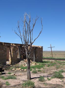
The road crossed the tracks at a place called Willaha. Formerly a train station, the site has the ruins of a building, foundations of at least one other building, and a huge cattle holding pen overgrown with grass and weeds. I could imagine ranchers moving their cattle to this spot, putting them into the pens until the train with cattle cars stopped at the station. Then the cattle would be moved up onto the train and brought to market. Nowadays, the only train that uses the tracks is the Grand Canyon Railway, which runs one or two trains a day on scenic rides between Williams and Grand Canyon. I don’t think any cattle have passed through the corral in years, if not decades.

We crossed the tracks and headed west. I had a crazy idea that we’d go out to Hilltop and see what was going on out there. I checked my GPS to see how far it was — it was beyond the range of my map. It was more than 20 miles. I’d gone less than five miles when I decided to go back and stick with my original plan.

Cowboy Drag Gate
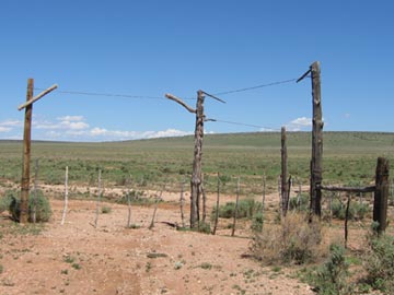
Back at the tracks, I took a left, heading northbound on a two-track road on the west side of the tracks. This road was not on my map, but it was on my GPS. It was easy enough to follow, although it did have quite a few gates to pass through. Most of them were drag gates, like the three-way gate shown here. You may have heard this type of gate referred to as a “cowboy gate” because they’re relatively common out on the range where only the cowboys go.

A drag gate is basically a continuation of a barbed-wire fence, but with a moveable fence post. Each time I approached one, I’d pull right up to the gate and get out of the Jeep. I’d approach the side of the gate with the moveable post, lift a loop of smooth wire off the top of the post, life the post out of a similar loop out the bottom, and drag the gate to the opposite side, opening it wide enough to get my Jeep through. I’d drop the post there, walk back to the Jeep, drive through the gap, and then get back out of the Jeep. Then I’d pull the post back to close the opening, stick the bottom of the post into the fixed loop, and pull the top of the post to make the gate wires taut. I’d pull the top loop of wire over the top of the post, thus locking it in place.

This particular gate was the most difficult I’d ever had to close. I put all my weight against it — you’d think that would be enough — to pull it taut, and still couldn’t get the top loop over it. I had to fiddle around with the position of the loop at the bottom. Still, I barely got the top loop over.

Two Track Road
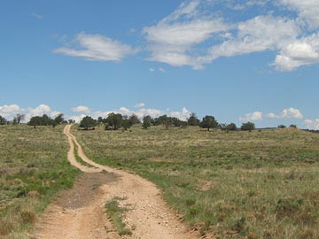
The road followed the tracks north. In most places, it was both smooth and dry. But in some places, water had gathered in the wheel ruts and that water was muddy. I drove through the first spot like that and managed to get mud all over the Jeep as I slid around in the muck. The next muddy spot I reached showed evidence that someone else had driven around it, so I did the same. In other places, the road climbed up a rocky outcropping and got rough with broken rocks, forcing me to slow down. I certainly didn’t want to break a tie rod or something out there.

During the entire ride, Jack the Dog stood in the back seat, sticking his head out one window or the other. When we went through mud and it started flinging up, he’d pull back into the Jeep until the mud stopped flying. He was a having a great time. For him, it was almost as good as riding in the back of the pickup truck!

Anita Station
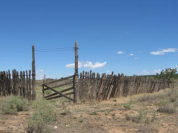
We reached Anita Station, where several roads intersected at the remnants of another cattle pen. Jack and I got out and walked around a bit. I saw the remains of several other buildings, reduced to mere concrete slabs. It was already close to 11 AM and I expected the train soon. But I couldn’t hear it coming, nor see its black smoke on the horizon. I decided to continue up the two-track road.

I gave Jack some water and we climbed back into the Jeep, continuing on our way. The road forked and I chose the fork closer to the tracks. It got very rough, with lots of broken rock on the road. The terrain was changing, with more rocky outcroppings and hills. We were less than 15 miles from the South Rim of the Grand Canyon, due south of Dripping Springs. The terrain would climb with hills and valleys all the way to the Rim.

By around 11:30, I had enough of the road. I pulled to the left side, as far from the tracks as I could. We were less than 20 feet from the tracks here, on a rise of land. I thought it would be a good place to take a photo of the train. I gave Jack some more water and told him to stay in the Jeep. I got out, scouted what I thought would be a good place for the photo, and waited.

The minutes ticked away slowly. No sign of the train. I remembered, from my days as a pilot at the canyon, that the train would go past the airport at about 11:30. It hadn’t passed us yet. Where was it?

I spent some time examining the map on my GPS. I discovered that the two-track we were on wasn’t on either the GPS or the map. No wonder it was in such bad shape. It was probably a maintenance road for the tracks.

Steam Engine
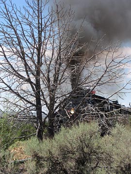
I heard the train coming and returned to my photo spot. As the train came puffing into view, I realized I’d picked a terrible spot for photos. I was too close to the tracks and there were too many trees in the way. For some reason, I’d imagined the train being bigger. It wasn’t. I offer this photo as an example of a good plan gone bad. I laughed at myself as the train passed and I walked back to the Jeep.

But I’m not giving up! I’ll try again, perhaps one day next week.

We backtracked to Anita Station, then turned left and crossed the tracks. We were on FR 347 now, heading east. If we followed that road for about seven miles, we’d end up at Route 64. So I turned left again, at FR 306, heading northeast. This road, like FR 347, was maintained — the grader had been parked near Anita Station — so it was easy going. But the mile markers indicated that I’d soon be back at Route 64, this time near Grand Canyon Airport. I made another left on FR 2615A and followed that to the intersection with FR 2615, which was on my map. At that point, to continue north on FR 2615, I’d have to go through a gate at an enormous mud puddle. I was tired from the bumpy road and didn’t feel like dealing with puddles or drag gates. So I stayed right and followed FR 2615 back to FR 306.

A few miles down the road, I found another forest road that headed north. Although it was not on my map, I think it was numbered 634. I turned left and followed it. A few moments later, we passed through an open drag gate with what looked like coyote pelts draped over the fence posts at each side. Creepy.

I steered us down a narrow road that wound through the forest, then dropped into a small canyon. I could imagine the water gushing though this place in a heavy rainfall and was glad it was only partly cloudy. Sometimes the road was so scrubbed by flooding that it didn’t even look like a road. It looked like I was driving down a rocky canyon.

Rain Tank WashThe canyon and road ended at an intersection: FR 2615 again. I wanted to go north, to the other side of the tracks. So I turned left. I realized about two miles down the road that left was wrong — it would just bring me back to the mud puddle — and backtracked yet again. I headed northeast on FR 2615, following it up Rain Tank Wash. The open meadow-like area closed up to another canyon and I followed the road through it. Although my map showed that the road ended not far after I’d gotten on it, I had become accustomed to roads continuing beyond their map ends. This one continued for a good two miles up the wash while steep walls and pine trees closed around us.

After a while, I realized that the road was getting fainter and tougher to follow. Then, suddenly, it ended, with huge blocks of stone in the way. I got out of the Jeep and went to investigate. The rocks looked natural, but I couldn’t imagine where they’d come from. They must have been placed there. But by what? Heavy equipment could not have traveled down the road I’d been on — it was just too narrow in some places. It must have been a natural end.

I checked my GPS. We were less than a half mile from Rain Tank, which was at the southwest edge of the Grand Canyon Airport property.

This was not good news for me. It meant I had to backtrack to the intersection and go back up the washed out canyon road. It was about five or six rough miles to FR 306. And I wouldn’t be any closer to where I wanted to be — at the railroad tracks northwest of the airport.

It was nearly 1 PM by this time and I was hungry. So I turned the Jeep around and started back down the road. I parked in the shade of a big pine tree, let Jack out, and set up a picnic lunch. I had a folding chair in the back of the Jeep and I used the cooler for a table. I poured out a generous helping of water for Jack. I settled down for lunch while he chased some kind of critter around the underbrush nearby.

While I ate, I consulted the map. According to the map, I wasn’t anywhere near a road. I checked the GPS. It told me I was on a road that went passed the rocks to Rain Tank. There were no other roads.

I finished up lunch and packed up. Jack and I got back in the Jeep. And I started back to Coyote Pelt Gate.

I was nearly all the way back to the gate when I saw an unmarked road heading northeast. It wasn’t on my map, but it was on my GPS. I made a left and followed it.

The road was lightly used and, in some places, extremely difficult to follow. But it wasn’t too rough. I was energized after my lunch and ready for adventure again.

The road followed a fence line for some time. There were bright pink surveyors’ ribbons tied to branches on some trees on the other side of the fence. The ribbons were relatively new — certainly not older than a month or so. There was no road on the other side, though, and I wondered whether people had come through on foot to place the ribbons. The barbed wire fence was in good shape and the ribbons were sometimes placed too far from the fence to be done by someone simply reaching over.

Grand Canyon Airport
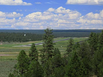
The road reached a clearing where the earth dropped away in front of us. There, in the near distance, was the approach end of Runway 3 at Grand Canyon Airport.

I continued along the road I was on, winding up outside the airport fence at the end of the runway. I reached an intersection. A right turn would have brought me back to FR 306 and, not long afterward, pavement. A left turn would take me back into the forest at the other side of the airport. I turned left.

The road wound near Rain Tank and forked. The left fork seemed to descend down into a small canyon. Could it be? I took the left fork. A few minutes later, I reached a point where the road was blocked off by big rocks. A sign said the road was closed to vehicles but open to hikers. I left the Jeep behind and took a short walk down the hiking trail. It looked familiar. I confirmed what I suspected with my GPS: I was 1/10 mile from the point I’d been stopped when I drove up FR 2615. The blocks had indeed been placed, most likely from this end of the canyon — just to place a 1/10 mile long hiking trail in Rain Tank Wash.

I backtracked up to the fork, then followed a series of roads through the forest on the northwest side of the airport. By this time, it was after 2:30 PM and I was tired enough to end my off-pavement explorations. I was still about five miles from pavement when I passed the only other vehicle I’d seen on my trip: a Forest Service pickup truck parked on the side of the road. Its driver was nowhere in sight.

The road I was on eventually dumped me on a back road in Tusayan. I turned right on Route 64 and headed south. I was tired and dusty. But I had one more bit of exploration to do.

More on that in another entry.

[composed on top of a mesa in the middle of nowhere with ecto]

train, off-road, explore, Grand Canyon, Jeep

The Roads of Howard Mesa

Yet another expensive auto repair.

Our place at Howard Mesa Ranch is on top of the mesa, five miles from pavement.

When we bought our place from the original sales organization, the roads, although unpaved, were in pristine condition. I never saw a grader at work there, but the roads were always smooth and wide. Our sales guy, Larry, took us around in his old Buick sedan. That was six years ago.

Although Mike and I never expected the roads to be kept in that same great condition, we expected them to be kept in passable condition. Certainly by a Jeep or 4WD pickup truck — even while towing horses or a camping trailer. Hopefully by a sedan if driven carefully in dry conditions.

Flash forward several years. Road maintenance dollars, divvied out by the Property Owners’ Association, goes to the people who complain the most — who also happen to be the people who live closest to pavement. One of them whines that his road needs to be maintained so construction vehicles can reach his lot. One of those vehicles gets stuck and the POA pays to have it towed out. Dollars that should be spread around evenly on the roads that service all owners are laid on thick on the south end near Highway 64.

July 2004. I was living in a trailer on our Howard Mesa lot, working at Papillon at the Grand Canyon. I drove my Jeep down from the top of the mesa early in the morning to get to work by 7 AM. I hit a pothole in the road hard and instantly hear the sound of air hissing from the tire. I was still two miles from pavement and managed to get a mile closer before the tire was completely flat. Another property owner helped change the tire. The damaged tire could not be repaired. Replacement cost: $152.

August 2004. I’d flown to work that day in my old R22 helicopter, but storms in the area convinced me to leave the helicopter at the airport and drive home. My 1987 Toyota MR-2 was at the airport. I’d driven it on many occasions to and from our lot. But that day would be different. On that day, I’d get stuck in the mud two miles from my gate. I walked to my trailer in the drizzling rain, still in my uniform, as the sky darkened around me. A shortcut through a field got scary when I heard coyotes howling nearby and realized that I had nothing to protect myself from them. No damage to the car; just inconvenience. I came back two days later when the ground was dry and managed to make it the rest of the way to my lot.

October 2004. I take my Toyota to get an oil change. The quick lube place refuses to do the job. The oil pan is smashed in and they’re afraid they won’t get the plug back in after they remove it. The oil pan, which was obviously damaged while driving at Howard Mesa, has to be replaced — I don’t take the car off pavement anywhere else. Total cost $312.

May 2005. Mike and I bring our horse trailer with living quarters back up to our lot for the summer season. Erosion has narrowed the road in places. The 35-foot long trailer slips into a ditch on the driver’s side, smashing the valve for the black water holding tank. We get it back on the road. It then slips into a ditch on the passenger side, smashing the step to the trailer door. Total cost: $268.

May 2005. The next day. Mike and I take his truck on the other road that climbs up to our side of the mesa to see if it’s any better. It isn’t. It’s worse. The 4WD truck slides into a deep, mud-filled ditch. Another property owner tries to pull us out with his Jeep when our truck’s 4WD low setting doesn’t do the trick. The truck is stuck fast in the muck. AAA refuses to send someone to tow us out. We pay a local tow company to do the job. Total cost $250.

We make a lot of noise at the POA annual meeting. It wakes up the POA decision makers. They finally start spending some money on road maintenance on our part of the “ranch.” They grade the state road and spread cinders in the most slippery spots. They put in culverts. But the money runs out before the job can be finished. The road is much better, but has a few very tough spots to negotiate, spots where tire placement can mean the difference between clearing the ground and bottoming out. Yet last week the cinder truck spread cinders on a perfectly smooth road that is never even used. Could it be because there are two lots are for sale on it and the owners wanted the road to look “maintained”? That road is only about a mile from pavement.

July 2006. Today. MIke has driven up for the weekend in his Honda Accord. He’s driven very slowly, very carefully. But he still bottoms out once on his way down this morning. The oil trail starts about a mile short of pavement. His car’s oil light went on three miles south of the Howard Mesa turnoff on Route 64. The oil pan is so torn up that Mike can stick his finger in it. Total cost: unknown so far. But the tow to Williams was $89, the rental trailer to bring the car from Williams to a Honda dealer in Flagstaff was $64, the rental car so he could get to work tomorrow was $86. He missed work today. The cost of the oil pan and replacement labor will probably exceed $300.

[August 1 Update: The Honda’s engine damage was severe and the engine needed to be replaced. Thank heaven it was covered by insurance. It would have cost thousands of dollars.]

It struck me today that we spend more on repairs to our vehicles due to road conditions than we do on property taxes, POA dues, and even hauled water combined. What’s wrong with this picture?

There are a lot of lots for sale at Howard Mesa Ranch. If you’re thinking of buying one, be sure you talk to the POA about maintenance on the road to your lot first.

Then, if you do buy, go out and get a high clearance 4WD vehicle. You’ll need it.

[composed on top of a mesa in the middle of nowhere with ecto]