A Hike in the Mountains

What a great trail!

On Wednesday, I went hiking with my new midweek hiking friends, Sue and Jerry. They’re both retired and they know a lot of local trails — including more than a few just a short distance from our homes.

Penny in 2012
I found this photo of Penny shot that day in August 2012. She was probably about 5 months old here.

Wednesday’s hike was actually on two different trails: Devils Spur and Beehive. We drove up toward Mission Ridge on Mission Ridge Road and parked at the last switchback, which is the trailhead for the Devils Spur Trail. There’s a viewpoint there where you can look down into Squilchuck Valley — I’d been there a few times in the past — and a closed road that led off into the forest. I’d hiked a bit on that road with Penny the Tiny Dog back in 2012, but hadn’t gone far, mostly because I was worried about Penny and the potential for encountering predatory animals on a trail I knew nothing about.

But Sue and Jerry knew the trail well. It wound into the forest, a former road blocked off for hiking and biking only. I was surprised to see felled trees and cleared forest a little way in — it certainly hadn’t been like that two years ago — but realized it likely had to do with the 2012 fires that occurred after my hike with Penny. Then the forest returned to its natural dense growth.

Forest Trail
Can you see Penny sniffing at something up ahead on the trail?

It was cool and moist in the shade — so unlike the desert around my home less than 10 miles away. I was glad I’d worn a fleece sweatshirt. But just when it got uncomfortably cool, the trail would open up to a dry, exposed patch, full of warm sunlight. The sweatshirt came off. And just when I was starting to get really hot, the trail dove back into cool, shady forest. It made the switch over and over for the entire length of the hike.

Jerry accompanied us about a mile up Devils Spur trail. Just before the trail narrowed, he turned back. He has a bit of acrophobia and a while later, I realized why he didn’t want to continue with us — the trail wound along a narrow ledge on a cliff face of volcanic talus. Instead, he went back to get the car and drive it around to the Beehive Trailhead where we’d emerge some time later.

Sue and I (with Penny) continued along the trail. Sue is very knowledgeable about the mushrooms we saw along the way and even pointed out some clearly visible fossils on a rocky outcropping the trail passed. Penny ran ahead as she always does, occasionally running back to hurry us along. The trail climbed about 600 feet over about 2 miles — a gentle grade that didn’t require many rest stops. It was a perfect day for hiking, with calm winds, cool air, and clear skies.

Fossilized Leaf
I would have walked right past this rock full of fossils if Sue hadn’t pointed it out. This leaf was especially clear and easy to see.

The trail approached the old Pipeline trail, which runs alongside Forest Road 9712. I’d driven quite a distance on that gravel road in 2013 several times, including with my friend Janet, who was visiting from Colorado. Recently, I’d taken the Jeep up there with my friend Bob and noted that they were doing some sort of work on the pipeline. That Wednesday, they were hard at it and as we got close, we heard the steady beep-beep-beep trucks backing up. We never did see them, though. The trail reached 9712 where it turned back downhill as the Beehive Trail and we started our descent to Beehive Reservoir.

Vista from Trail
There were sweeping vistas down toward Wenatchee from various points along the trail. My home is at the base of the cliffs nearly dead center in this photo.

We were about a mile down the trail when we saw another hiker approaching from the other direction. It was Jerry. He’d parked the car and walked up to meet us. I assumed we were close, but there was still another mile or so to go. I think he got the same length hike we got, but did two out-and-backs rather than a long one-way hike.

Hike Track
Here’s our track as recorded by Gaia GPS. The blue pins indicate places I took photos; the photos are uploaded with the track on Gaia Cloud.

The hike was just the right length for me: just over 4 miles. I tracked it with Gaia GPS on my iPhone, which I highly recommend to anyone who hikes with a smartphone. (The main benefit: being able to load detailed topo maps before starting the hike so a cell phone signal is not necessary to view live location-on-map data.) I took photos along the way and later uploaded the track and photos to the Gaia Cloud.

It was a great hike — one I hope to do again, perhaps with my Meetup group. This is certainly the right time of year for it. Many thanks to Sue and Jerry for introducing it to me!

My Lopez Island Vacation

A quick recap, with photos.

It’s hard to believe it’s already been a full month since Penny and I got back from our week-long vacation to a friend’s home on Lopez Island. Time seems to zoom by these days.

I thought I’d take a moment to document the trip, mostly to help me remember it in the years to come. It was a great vacation — laid back but with enough activities to not only keep me entertained but to prevent me from gaining a pound despite all the wine and cheese I consumed with my friend.
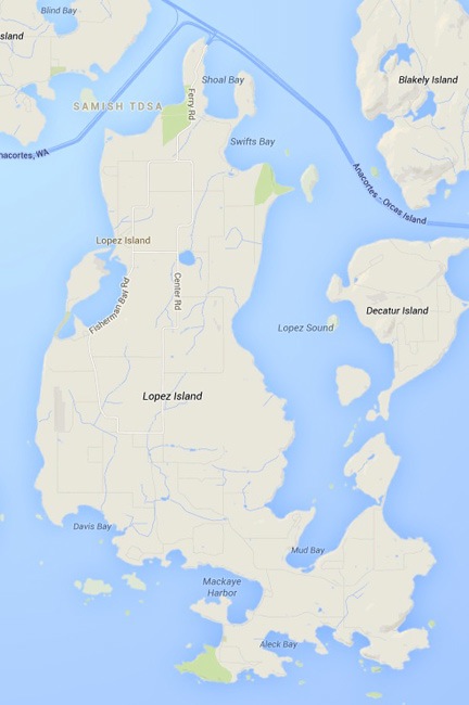
Lopez Island

Lopez Island
Lopez Island is one of the San Juan Islands in the northwest corner of Washington state.

Steve and I had gone wine tasting in Napa Valley, CA in March and Woodinville, WA in May. It was at dinner after four Woodinville wineries that he’d invited me to stay at his Lopez Island place in August. That’s when my responsibilities for cherry season were finished and he would be taking his vacation. It was too good an offer to pass up.

Lopez Island is one of the San Juan Islands in the northwest corner of Washington State. It’s less than 30 square miles in size with a population of fewer than 3000 people.

Lopez Island can only be reached two ways: by boat or air — there’s no bridge. Ferry service is available from the mainland at Anacortes with stops at other San Juan Island ports such as Friday Harbor and Shaw Island. According to Google Maps, the 200-mile trip from my home would take just over five hours — assuming I reached the ferry terminal in time to drive right onto the ferry. Six hours is probably more accurate.

Needless to say, I wasn’t very excited about the prospect of driving there. So I treated myself to a helicopter flight. That was only about 90 minutes.

The Trip Out

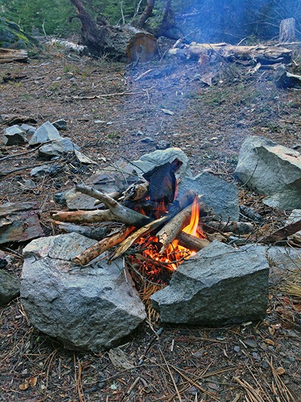
Of course, before Penny and I departed that Saturday we had things to do. I put two racks of baby back ribs on the smoker at 9 AM and spent much of the day packing and running errands. I wanted to bring some goodies from Wenatchee, including Quincy corn, two kinds of fresh-baked bread, and buckboard bacon from Pybus Market’s Saturday Farmer’s Market, as well as fresh blueberries that still needed picking at a friend’s house. The ribs would pair perfectly with some “Singed Cat” Cab Franc wine from Malaga Springs Winery just down the street from my home. The wine was sort of smoke infused due to the smoke from wildfires in the area back in September 2012 when the grapes were picked. I packed two bottles of that, along with another four bottles of local wine for sharing with my host. I also had five different cheeses that I’d picked up from Beecher’s in Seattle on my way home from Phoenix earlier in the week. I never go to anyone’s home empty handed, but I think I took things to extremes on this trip.

By 1 PM, I’d loaded my big cooler with veggies from my garden and all the other perishables that I’d bought or picked. The wine had its own cooler. Both of these went into the back of the helicopter. My luggage went on the other back seat with my camera bag on the floor. I laid the ribs, wrapped in thick foil, on the floor beneath the coolers. I put Penny’s bed on the front passenger seat, but after a moment sitting there in the sun while I ran up the engine, she wanted to sit in back. The only place to put her bed was on top of the cooler, which was about level with my head. She seemed comfortable enough there. I lifted off around 1:15 PM. After a quick stop at Pangborn Airport to top off both fuel tanks, I pointed the helicopter northwest.

Leaving Wenatchee
It was a beautiful day in Wenatchee, warm with scattered clouds that seemed to thicken to the west.

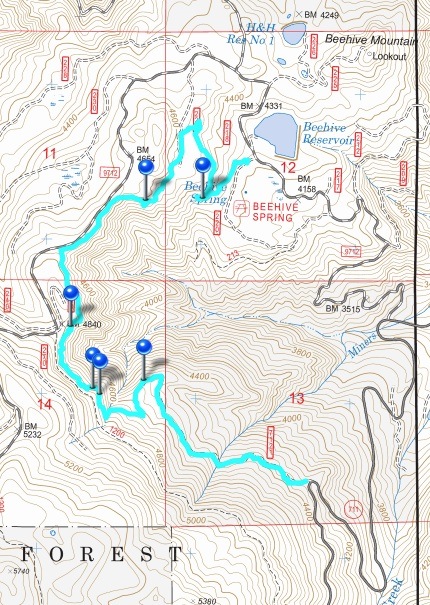
The flight was mostly uneventful. I tried to keep my route as straight as possible, but there were TFRs (temporary flight restrictions) in the area due to the wildfires we’d been having. One of them was in my path just west of Leavenworth. I kept south of it, flying up Icicle Creek and hugging the base of Cashmere Mountain so as not to stray into it. It was an extremely pleasant flight, cradled at the base of the mountains over the creek, to the end of the paved and then dirt road and beyond.

Icicle Creek
A flight up Icicle Creek.

The farther up the creek I got, the thicker the clouds ahead of me got. The higher I climbed up the drainage, the closer I got to all those thick clouds. I dropped down closer and closer to the trees to stay under the clouds. I slowed down as the path ahead began to look more and more iffy.

A quick look at my location on a sectional chart in Foreflight told me I was just south of Stevens Pass, the highest point on my trip west. If I could just get over the pass, I would probably be okay. Probably.

I started getting hopeful at 35 seconds into this GoPro nosecam clip from my flight. If you listen closely to the audio, you’ll hear the blade flap when I slowed way down before crossing over the ridge.

Finally, I was within about 50 feet of the Ponderosa pine trees, moving ahead cautiously at about 60 knots. Wisps of clouds were tangled in the treetops on either side of me. I looked ahead anxiously at the gap I’d have to pass through. All I saw were clouds — at first. Then an opening with trees beyond it. Could I get through?

I could, but barely. I squeezed through the pass under the low clouds and wound my way between clouds at my elevation, descending over Route 2 just west of Stevens Pass.

Whew.

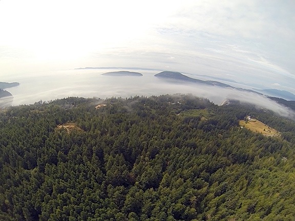
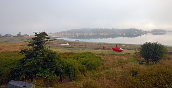
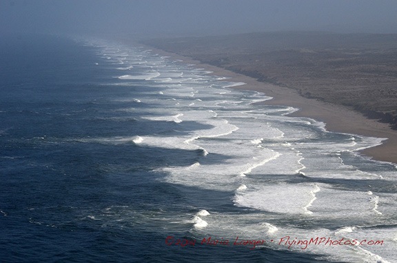
The rest of the trip was under overcast skies. I beelined it for the coast, flying over Arlington Airport along the way. I detoured north around the surface airspace for Whidbey Island NAS, not really interested in talking to the tower there. That’s when I started noticing a light fog over the water up ahead. Dang!

Fog Over Puget
Fog drifted about 50 feet over the surface of the water west of Anacortes.

I called my host to see what conditions were like at his home. It went right to voicemail. I left a message and pointed the helicopter across the Rosario Strait. The fog below me was light — I could see an occasional boat down there — but I wasn’t sure what lay ahead.

I was over Decatur Island when Steve called back. It was clear, he reported. By that time, I’d gotten the feeling it would be. The fog seemed localized between Decatur Island and Anacortes. I told him I was five minutes out. Five minutes later, I flew over Fisherman’s Bay on Lopez Island. I scanned the shoreline and saw Steve and his sister waving. I circled around and came in for a landing, touching down lightly on the sea grass between the shore and his home.

Sure beats driving.

A Week of Fun and Relaxation

Seagull on Log
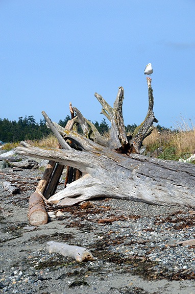
The rocky beach was full of driftwood logs that made perfect perches for seagulls.

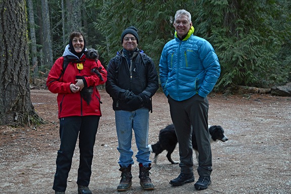
Steve greeted me with a hug and introduced me to his sister, Kathi. Then we offloaded the helicopter and brought everything up to the house. (The ribs were still warm.) I brought my luggage up to the guest room and then set up an area in the corner of the kitchen for Penny’s food and water. Then we unloaded my groceries and stowed everything in his already packed refrigerator.

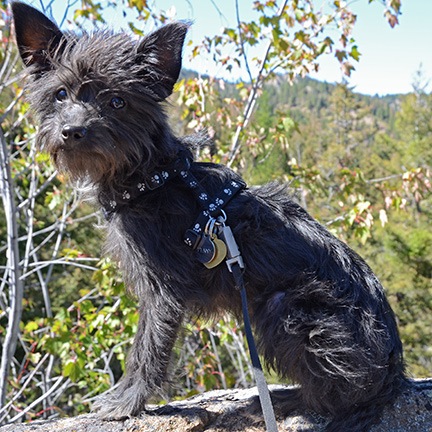
After we were settled in, Steve, Penny, and I went for a walk to the beach and walked the length of the causeway that separates Fisherman’s Bay from Griffin Bay and San Juan Island beyond it. Penny ran ahead of us, sniffing at the kelp washed up on shore and chasing seagulls and killdeer.

Helicopter at Lopez Island
I shot this photo of Steve’s back yard from the guest room balcony not long after arriving. I had to admit that my helicopter looked even better in Steve’s backyard than it does in my front yard.

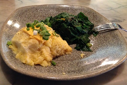
Later, we sat on an upstairs deck to munch on wine and cheese and watch the sun set. Then we came downstairs and fixed up a dinner of Quincy corn on the cob, sliced cucumbers from my garden, sea asparagus Steve had harvested from his yard, and smoked ribs from my Traeger, finished off with some homemade barbecue sauce on Steve’s grill. Steve and Kathi seemed to like the Singed Cat as much as I did — the three of us polished off both bottles. We talked until well after dark and turned in for the night.

More Fog
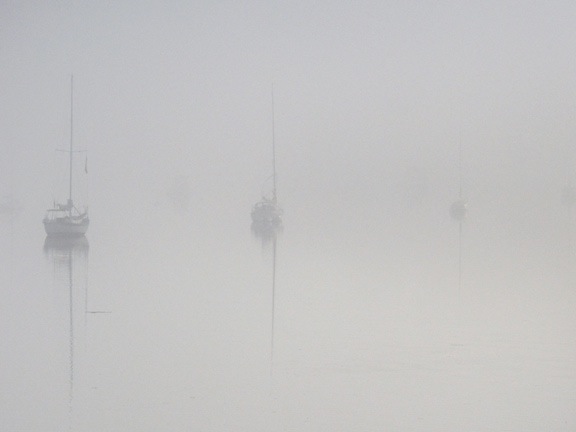
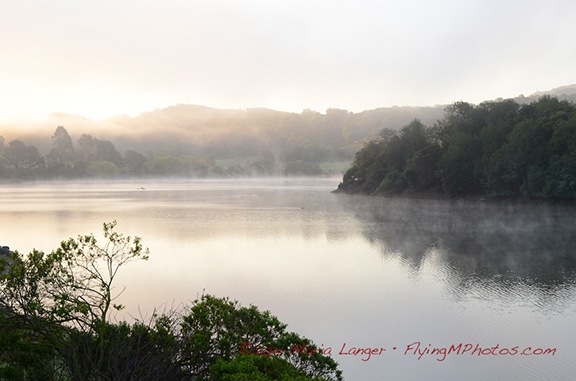
In the morning the bay was shrouded in a thick fog that took some time to lift.

After breakfast, Steve, Penny, and I headed out on Steve’s little boat to drop the crab traps. We both had fishing licenses that allowed us to catch dungeness crabs and wanted to get the traps in the water as quickly as possible because they needed to be pulled on Monday per fishing rules.

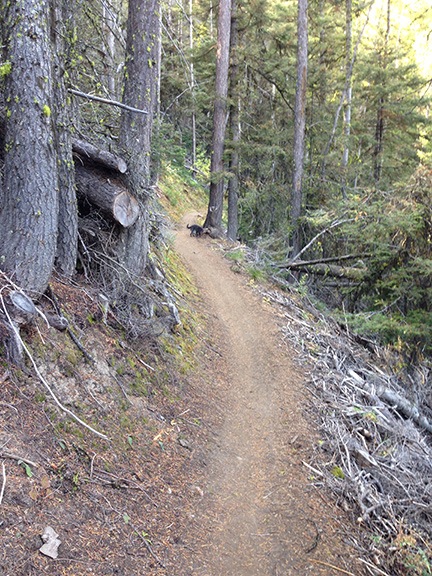
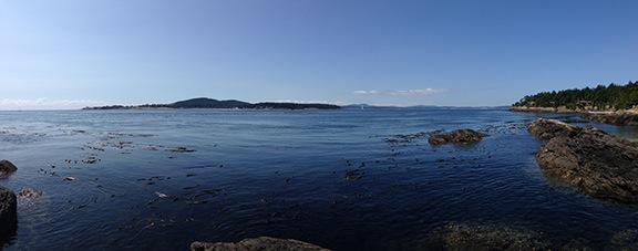
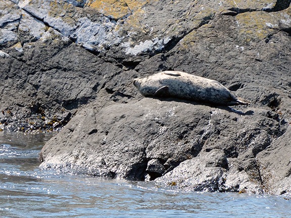
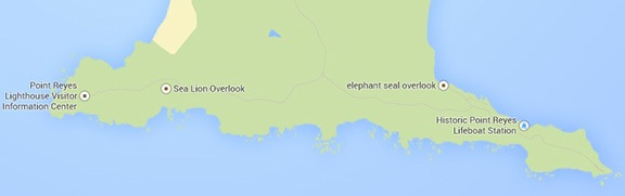
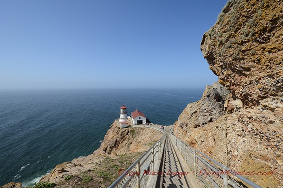
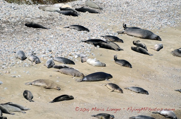
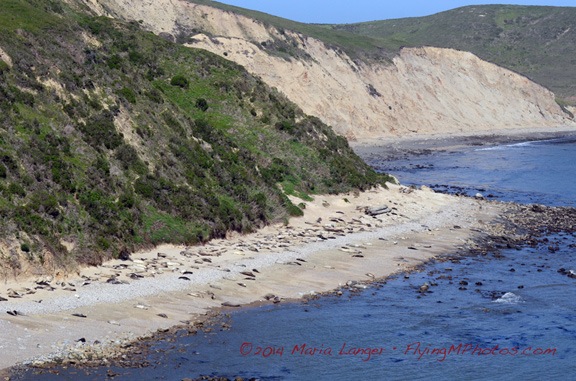
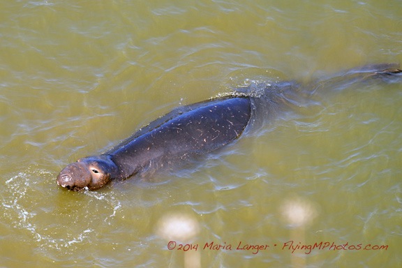
Later in the day, we headed out to Shark Reef, with a great hiking trail that wound through woods before emerging at the shore where giant elephant seals sunned themselves on the rocks and bull kelp floated on the water.

Shark Reef
Panoramic view of the poorly named Shark Reef, which has elephant seals instead of sharks.

Elephant Seal
Does this look like a shark to you?

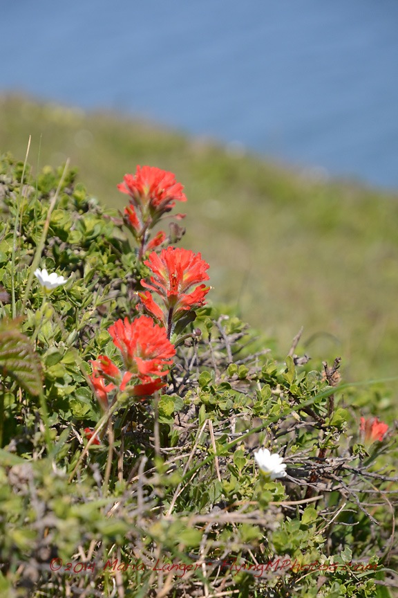
We spent a lot of time just talking and walking and taking photos. Steve is into photography even more than I am and I enjoyed seeing his 6’4″ frame folded up to get a closeup shot of a flower or interesting rock. It’s refreshing to go on a photo walk with someone who understands the importance of light in photography; we did almost all of our photo walks late in the afternoon when the sun was low in the horizon, casting a golden light.

For dinner back at the house, we had salmon that Steve marinated and then grilled. More wine, this time some Chardonay from Steve’s collection.

Sunrise
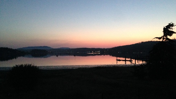
Sunrise varied from one day to the next; this one, shot from my window on Monday morning, was especially colorful.

Monday morning’s activity included a drive out to Fisherman Bay Spit Preserve at the entrance to Fisherman Bay. That’s where I got my introduction to sea glass — broken glass pieces that have been ground down by the sand and motion of the water. I eagerly joined in the hunt, although I only seemed able to find very small pieces of the stuff while Steve managed to find lots of large ones.

We also visited the local transfer station and a spot the locals call Neil’s Mall — a place where people leave possessions they no longer want and take possessions others have left behind. Steve was looking for a new coffee maker or a carafe for the one he’d broken on the coffee maker he had. Neil’s had both. We wound up taking a gently used Braun drip coffee maker that seemed to have all the parts. Later, we cleaned it up, set the clock, and even programmed it for the next morning’s coffee.

Kathi left around midday and Steve, Penny, and I went out in the boat again to try some salmon fishing. Steve piloted the boat up the bay and out the mouth of it, then back down the shoreline to a point not far (as the crow flies, anyway) from his house. We tried various places, spending a total of about 2 hours without any luck at all.

Crabs for Dinner
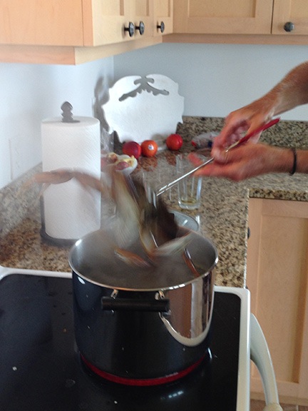
We caught three good-sized dungeness crabs on Monday and enjoyed them for dinner that night.

On the way back, however, we stopped to pull in the crab traps we’d set the day before and were rewarded with three keepers. Guess what we had for dinner that evening with the champagne I’d brought along to go with a shellfish dinner?

Kathi’s husband John arrived that evening, too. He’d be with us for the rest of the week, attending a golf tournament on the island and doing work with his computer when he wasn’t out golfing.

I think it was Monday night that Steve and I ventured out onto the back lawn after nightfall for some star photography. I’d come without a tripod, but Steve had his. He said he didn’t have much experience doing star photography, but he certainly had a good helping of beginner’s luck — almost every one of his shots included an amazing star field.

After breakfast on Tuesday, we headed out in the helicopter for pie. A friend of mine had told me that the best airport pie could be found at Port Townsend Airport. Although Steve had been flying with me before — I’d taken him and his sister Kriss on an aerial tour of Napa Valley back in March — neither he nor I had been flying around the San Juan Islands. Airport pie seemed like a pretty good excuse to get airborne.

I pulled both front doors off the helicopter for airflow and so Steve could use his camera without worrying about window reflections in his shots. I loaded Penny in the back seat on her bed. Then we took off from Steve’s backyard.

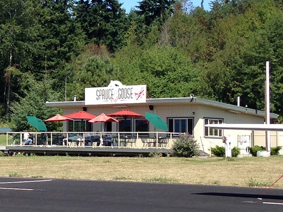
We flew east over Decatur Island and Anacortes, then followed the shoreline of the mainland south before crossing Skagit Bay to the east side of Whidbey Island. We flew just south of Oak Harbor and over San de Fuca, then crossed the bay to Port Townsend. The airport was south of town. We landed at the end of the parking area and walked to the Spruce Goose restaurant.

Spruce Goose Restaurant
The Spruce Goose does indeed have the best pie at any airport I’ve ever been to.

Although the restaurant had an outdoor eating area, Penny wasn’t allowed to sit with us there. So I tied her up nearby while Steve and I sat down for some pie. I had rhubarb (my favorite) with a glass of milk. I honestly can’t remember what Steve had. But I do remember that both were excellent.

After our pie, we fetched Penny and walked around the airport ramp area, looking at the planes. I told Steve what I knew about each model we saw — which wasn’t much. Steve isn’t a pilot but was interested in the planes. Actually, like me, he seems to be interested in most everything.

When we left, I decided on a more direct route back. Not the direct route — that would have had us flying over water for about 15 miles — but a route that took us up the west coast of Whidbey Island, past the navy airbase. That meant talking to the tower. I was pleasantly surprised when they cleared us to fly per my request. (I think Steve was impressed.) Later, as we neared the airbase, they amended our instructions to fly at 1500 feet over the field. As we did, we watched two F18s (in formation) and an air tanker take off below us. Very cool.

Whidbey Island
Overflying the airbase at Whidbey Island.

We crossed the Strait of Juan de Fuca for the southeast corner of Lopez Island. But rather than go in for landing, we continued west to the west coast of San Juan Island. That’s where the orcas travel and we were interested in seeing them from the air. We flew up the coast and saw plenty of boats on the water and tourists at Lime Kiln Point State Park, a primary orca viewing area. But no whales.

San Juan West
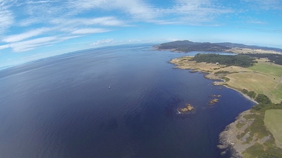
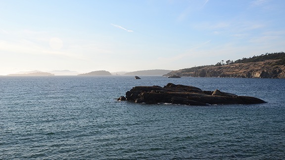
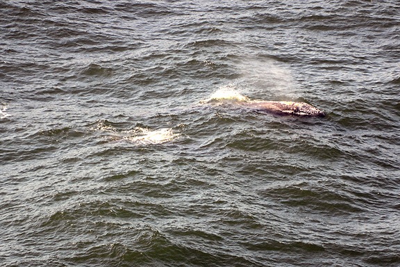
The west coast of San Juan Island. I was about 10 miles from Canada here.

Low on fuel, I headed over to Friday Harbor Airport. I landed near the pumps and topped off the main tank; I knew I’d get more fuel in Bellingham or Arlington on the way home later in the week. Again, we decided to take a quick flight along the coast to look for whales. This time, we scored. There was an orca pod of at least six whales traveling south along the coast. Steve took a few pictures, but I didn’t dare fly any lower than the 500 feet I was at — the area was full of boats and spectators. I didn’t want to be blamed for “scaring off” the whales. We went past and I cruised away from the scene to give Steve time to change his lens. But when we returned, the whales were gone and the spectator boats were breaking up and going their separate ways. The show was over. We headed back to Steve’s place on Fisherman’s Bay.

Fisherman's Bay
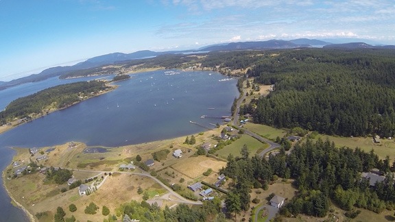
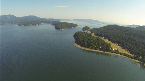
Fisherman’s Bay from the air.

Later that day we headed out for yet another seashore hike. This time, we went to Iceberg Point on the southern tip of the island. (No, there weren’t any icebergs, either.) After a pleasant mile or so walk through cool forest, we emerged on a rocky, grassy point overlooking the mouth of Puget Sound and Strait of Juan de Fuca. It was clear and I was able to point out the Whidbey Island air base, mostly because its tower made a good landmark. We spent some time walking on pathways that wound among the rocks. Steve showed me some cacti that grew there — yes, cacti do grow in the Pacific Northwest. At first, I thought they were some form of cholla, which we have in Arizona, but they’re apparently brittle prickly pear, which is likely the same variety my neighbor gave me last year to plant in my garden. I realize now that I didn’t even take a picture of them, although I do have a picture of Steve taking a picture of them. (Don’t worry, Steve, I won’t share it here!)

Thistle Ladybug
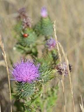
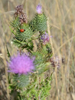
I played around a bit with depth of field and focus on my Nikon with this view of a thistle and ladybug.

We spent hours there, walking, talking, exploring, taking photos. After a while, we found a quiet spot sheltered from the wind and just stretched out on the grass among the late summer wildflowers, listening to the sound of the waves on the shore and the gulls that flew by. Penny stretched out nearby in the tiny shade cast by my camera bag. It was nice to be unplugged and to go back to the basics of a more simple time. I thought about the countless trips I’d made to the shore on the east coast, alone or with a companion, and how I’d just soak in the scenery and the world around me. What happened to those times? It was good to get a chance to remember them, especially with a companion who seemed to feel the way I did about the experience.

Iceberg Point View
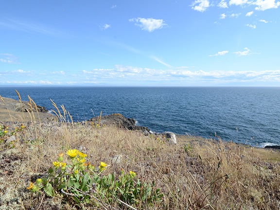
At one point, I sat up to take this photo of the view from where we lounged just listening to the sound of the waves and the birds.

The sun got ever closer to the horizon. When the temperature started to drop, we headed back out.

Near Iceberg Point
Here’s a look at Outer Bay on the walk back to where the car was parked t Agate Beach County Park.

Watmough Bay
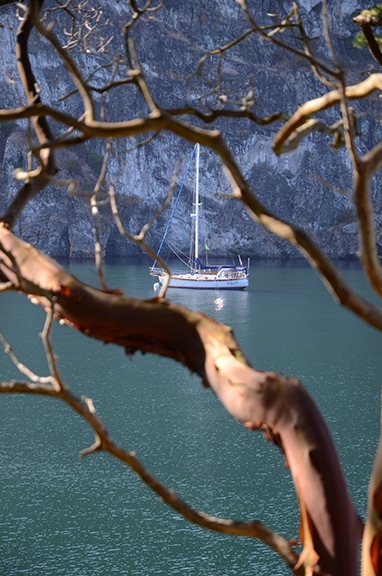
A sailboat spied through the trees along the trail at Watmough Bay.

On Wednesday morning, after a search and rescue for Steve’s boat — I hadn’t tied it quite securely enough on Monday afternoon and the wind and tide took it for a short cruise without us — we did some work around Steve’s house, helping John set up some badly needed storage shelves in the garage.

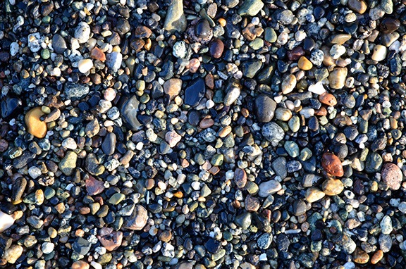
Afterwards, we took another hike, this time along the south side of Watmough Bay, a sheltered cove surrounded by tall cliffs that’s apparently popular with sailors — there were three sailboats anchored there. The trail wound through thick, lush forest that offered glimpses of the bay beneath us as we climbed. Soon, the trail dropped us down into a tiny gravel beach where we spent some time looking for sea glass. Penny wandered off and found something super stinky to roll in. We hiked back to the head of the cove and walked along the beach there for a while.

Pebbles
It’s not easy to find sea glass when the beach is full of pebbles like this.

Back at the car, I had to wrap Penny in a tablecloth that Steve happened to have to prevent her from stinking up his car. A bath for her outside with the hose was the first order of business when we got back to Steve’s house.

Cabernet Sauvignon
I brought along these two Cabs specifically for a taste test.

That evening, we did a side-by-side taste test with the two Malaga Springs cabernets I’d brought along. They both went very well with the steak Steve grilled up for us. I think we both preferred the 2009 over the 2011, although Steve’s blend of the two was probably best of all.

On Thursday, we spent some time setting up a satellite dish antenna in Steve’s side yard. That meant digging a hole and planting a post, then mixing up some concrete and using it to secure the post in place. (We’d put the antenna on the post the next day, once the cement had cured.)

Steve put the crab traps back out that afternoon. Afterwards, we went for a bike ride out to Fisherman’s Bay Spit Preserve again. That’s when I realized how completely out of shape I was. I hadn’t ridden my bike in about two years and it really showed. The ride was short — only about 2 miles each way — and on relatively flat terrain. Steve loaned me a 21-speed bike quite similar to mine while he handicapped himself (so to speak) with a one-speed. Clearly I’d need to get more time in the saddle if I expected to go riding with him again.

Out at the point we spent some time just overlooking the entrance to the bay while boats came and went. A couple on a road trip from Maryland (if I recall correctly) stopped and chatted with us for a while. The air was warm and comfortable on yet another beautiful day. There’s something to be said about the rain shadow east of the Olympic Mountains and Lopez Island is definitely in it.

Fisherman's Bay Entrance
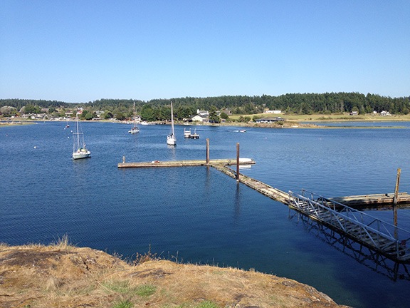
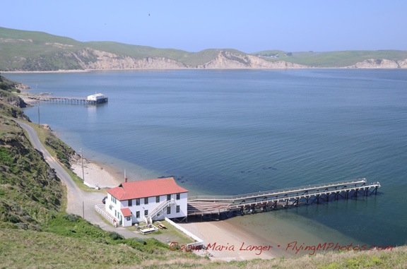
The bench we sat on at the point overlooked the mouth of the bay and this disused dock with the village of Lopez Island directly across from us.

We went out for dinner that night — my treat — at restaurant just up the road: The Galley. We had seafood (of course) and shared a bottle of wine. The food was excellent; the portions were huge. Outside the window, the sun set over the bay. I realized that my vacation was quickly coming to an end.

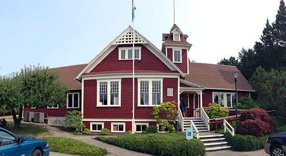
On Friday, after fiddling around a bit with the satellite dish, we each did our own thing. Steve went for a real bike ride and since we both knew that I’d just hold him back, he did it solo. Penny and I walked into town, a distance of about two miles. Along the way, I took photos of some of the flowers that were growing alongside the road and took a moment to check out the library, which is located in the original schoolhouse.

Flowers
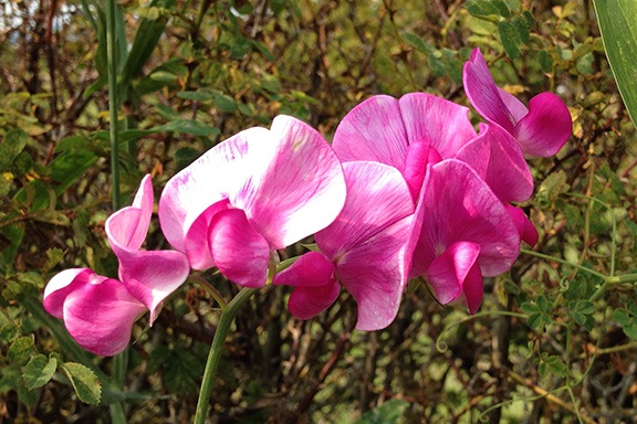
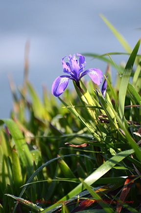
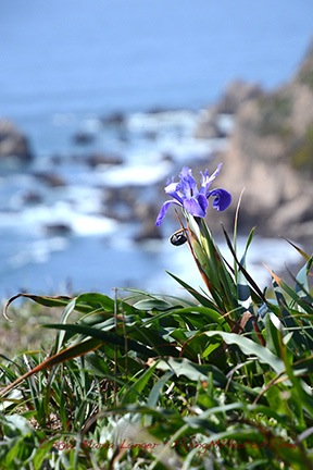
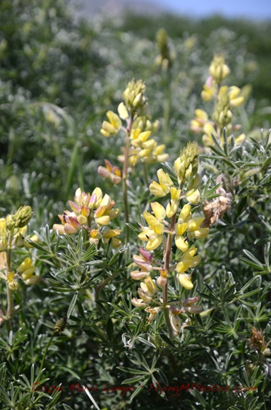
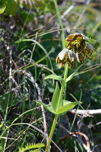
I don’t know what these are but they were all over the place alongside the road.

Lopez Island Library
A panoramic shot of the Lopez Island Library, which is in an historic schoolhouse. I highly recommend stopping in if you’re ever out that way. It’s a really wonderful place.

While we were in town, I picked up some gifts for my host and a few small pieces of jewelry for myself; chatted with a gallery owner about glass work, helicopters, and the recent flash floods in the Twisp area; tasted some wine; and bought a whole salmon for dinner. The walk home wasn’t exactly fun — the bags were heavy! I refreshed myself with a quick shower before Steve returned, then faced the challenge of filleting the salmon. (Let’s just say I need practice.) Steve grilled up the salmon for dinner and we all feasted on it with some white wine from Steve’s collection.

The next day was Saturday, the day I had a good weather window for my flight home. It certainly didn’t start that way, though: the morning fog was accompanied by the sound of fog horns off in the distance. It took a while to burn off and when it did, we had yet another beautiful day.

Fog at Fishermans Bay
Saturday started with fog, but soon cleared up again.

While I waited for the fog to clear, I packed and did some laundry, then restored the guest room to the way it had been before I arrived, all ready for the next guest. We finished up the last of the blueberries with some yogurt and cereal — we’d actually eaten most of the food I’d brought, although a few pesky cucumbers and zucchini remained. Steve and I lounged in the living room together one last time and Penny curled up to nap on Steve’s lap.

I’d made plans to meet some friends of mine from Wickenburg in Bellingham; when the fog cleared, I texted them to give them an ETA. Then we packed up the helicopter, I put Penny on her perch atop the big cooler, and I said goodbye to my host. A while later, I was lifting off as Steve and his neighbors waved goodbye.

Bellingham and Beyond

The flight to Bellingham was quick — only about 15 minutes — and took me between Blakely and Obstruction Islands, up the coast of Orcas Island, and over Lummi and Portage Islands. I had become accustomed to flying longer than usual distances over water, but still kept higher than I normally would fly, watching out for the seaplanes I kept hearing on the radio.

Blakely Island
Most of the islands have airports; this is the one on Blakely Island.

The tower cleared me to land near the FBO. I shut down, put Penny on a leash, and went inside. My friends Stan and Rosemarie were waiting for me. We shared hugs and went out to their car. A while later, we were sitting on the patio at Anthony’s on the harbor. I had fried oysters — my favorite and not easy to come by in Wenatchee. We talked about all kinds of things, from what was going on in Wickenburg to how we’d spent our summers to the progress I was making on my new home. I hadn’t seen them since I moved out of Arizona in May 2013, although we’d spoken and texted several times since then and it was really good to catch up.

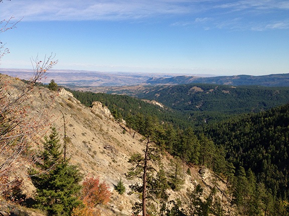
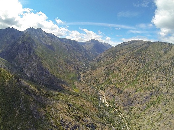
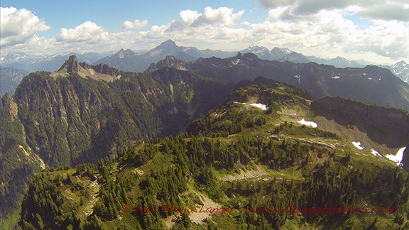
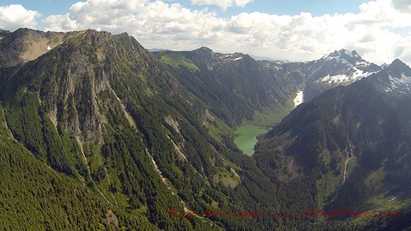
They had me back at the airport by 3 PM for my flight home. The flight was mostly direct, taking me right past or over more than a few very tall, rugged mountains. At least twice I found myself looking at the blue ice of small glaciers on north facing mountain tops. I spied hidden valleys and lakes and dozens of waterfalls. It was a really amazing flight, only slightly marred by the haziness caused by forest fires in the area.

Cascade Mountains
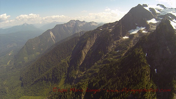
The North Cascades offer a rugged landscape with patches of snow in August.

Glacier View
I don’t know why I was so surprised to see glaciers, but there were at least two along my way.

Mountain Lake
Lakes like this one were hidden away up in high valleys, seldom seen by anyone other than pilots and adventurers on foot.

I did detour a bit to the north to avoid the TFR near Leavenworth. This time, I made a point of flying over Lake Wenatchee, which I’d never flown over. It looked smaller than I remembered it.

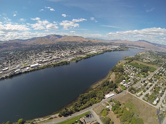
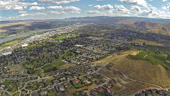
Then I was in familiar terrain, passing Cashmere, flying along the Wenatchee River, popping out at the confluence with the city of Wenatchee spread out before me.

Wenatchee from the Air
Wenatchee awaited me with yet another beautiful day.

I overflew my friend Bob’s house in East Wenatchee before turning toward home. As I touched down in my front yard, I thought about what a great vacation I’d had — including my trip there and back — and reminded myself how fortunate I am to have such great friends.

Whale Watching at Point Reyes

And so much more.

I went whale watching yesterday. At least that was the excuse I used to make the two-hour drive to Point Reyes National Seashore. The motivation to get out there by 9:30 AM was provided by the Sacramento Paddle Pushers, a Meetup.com group that had suggested the trip. (I’d gone on a 9-mile paddling trip with the SPP a few weeks before; they’re really active and do a lot more than paddling. Thought I’d blogged about it, but I guess not!)

I didn’t carpool with the group. Although I like the idea of carpooling — saving gas, companionship for a drive, etc. — I don’t like the idea of being tied to another person who I may or may not know very well. I like the freedom to make things up as I go along. And I absolutely detest waiting for other people to get organized or to give the green light for setting out on the next part of a drive. So I didn’t carpool. I drove out on my own, with Penny beside me and Google providing turn-by-turn driving instructions.

It was dark when I left at 6:30 AM. I not only wanted to get there on time, but I wanted the freedom to stop wherever I wanted to along the way. I headed westbound on I-80 as it got lighter and lighter and foggier and foggier. By the time I’d exited at Route 37, the fog was thick — so thick that I had to slow down going through the San Pablo Bay National Wildlife Refuge. Then it lifted just enough to make normal speed possible and I continued on my way.

The route Google chose took me through some residential areas before sending me toward the coast on Novado Boulevard. There were cows grazing on lush green hills along the way. The road wound up and down and around, past small lakes as wisps of fog got caught up in trees and floated on lake surfaces. The early morning sun shined brightly above the marine layer, trying so hard to break through. I stopped at Stafford Lake Park to let Penny take a walk while I shot a few photos.

Stafford Lake
The scene at Stafford Lake Park yesterday morning.

Interesting Breakfast
Not sure how I wound up with a veggie breakfast, but it was good. It’s always nice to try something different.

Eventually, we wound up at Point Reyes Station. It was early — only 8:30 AM. I had a whole hour to go the last 16 miles, which Google said would take me 33 minutes. I decided to stop for breakfast. I wound up at the Station House Cafe, which was pretty much empty. (Heck, the whole town was empty at 8:30; it would be very different later on.) I sat at the counter and although my brain really wanted an omelet as good as the one I’d had in Winters the morning before, I went with something completely different: cheese grits and sauteed Swiss chard. As I told a Facebook friend later in the day, it was good, but bacon would have made it better.

Please don’t lecture me about leaving my dog in the car. First of all, I only do this when I’m certain that the temperature in the car won’t exceed a balmy 70° or 80°F or get below 40°F. On warm days, I always park in the shade if possible. And if I’m parked in town, I always leave the doors unlocked so anyone could simply open them up if there was a concern.

Penny has spent a lot of time in the car — whether it’s my Honda, Jeep, truck, or a rental car — and is quite accustomed to it. She usually just settles down and goes to sleep.

On that particular day, the high in the area was forecasted as 50°F and although there was no shade, I did leave both front windows down a good 4 inches. I locked the doors, but anyone with a long, skinny arm could have unlocked them.

I was back in the truck, finishing up my drive by 9:00 AM. The road wound through the tiny town of Inverness on Tomales Bay before cutting west across the peninsula into the park. I followed the signs and wound up in the nearly empty Drakes Beach parking lot. I took Penny out for another quick walk and moved the truck to a spot closer to the ranger station. Then I gathered my camera equipment together, made sure Penny was set with food and water, locked up the car, and went to find the others.

I brought all my good camera equipment with me that day: my Nikon D7000 and 3 lenses, including my 300 mm lens, which I thought might be good to capture images of the whales. I also had my Manfrotto monopod. Yes, I know a tripod would be better, but I detest using one in situations involving moving subject matter. My monopod gives me enough steadying on full-sun shoots.

And there was plenty of sun that day. The fog was mostly burned off, although there was a definite white haze in the air. I went to the building just as the ranger was unlocking it. There were a handful of people milling about, but no one I recognized. I didn’t think it worth querying people to see if they were with the group. Again, I was leery of tying myself to one or more people until I knew how the day would unfold.

Like most other people there, I paid $5 for a shuttle bus ticket. Then I went outside and followed the group to a nice charter coach that was being used to shuttle park visitors to two points of interest: the Point Reyes Lighthouse and a spot called Chimney Rock. The bus pulled away from the curb and the driver, a big man who obviously had a lot of passion about the park and his job, told us a little about the wildlife we were already seeing: black-tailed deer and Tule elk. He then put in a short CD that explained a little of the park’s history and told us about the dairy farms we were passing along the way.

We were making the final climb up the road toward the lighthouse, when the man in front of me and I saw the same thing out on the ocean to our left: a whale! We’d already made our first spotting.

At the bus stop, we all got out and headed up the hill toward the lighthouse. There were about 20 of us in this first trip of the day. I took my time, taking in the view of the surf on the beach stretching out to the north. This was my third trip to Point Reyes and this particular view has become iconic for me. No matter when I come — late afternoon, midday, or morning — the pounding surf seems to disappear into the far distance, perfectly illustrating one of the themes I like to capture in my photography: infinity.

Infinity Waves
It looks like this pattern of waves against the shore could go on forever, no?

I caught sight of movement over a small hill and moved farther up the trail to investigate. On the other side of a clump of trees, on the hillside sloping down to the cliffs, were two black-tailed deer, grazing. I moved in among the trees for some photos while other bus passengers hurried by behind me, talking at full volume about anything other than their surroundings, oblivious to nature around them. Finally, someone spotted me with my camera and took a closer look. By the time I was finished, a small crowd had gathered with people snapping photos of the deer less than 100 feet away. To their credit, no one tried to approach them more closely.

Black-Tailed Deer
Shot with a 300 mm focal length lens, cropping this photo was not necessary; this deer was close.

I reached the top of the steps leading down to the lighthouse and stopped for a moment to take in the view. We were on a point of land facing due west with sweeping views to the south and northwest. There wasn’t a cloud in the sky. The blue of the sky and the blue of the ocean met in a somewhat blurred line out in the distance. The sound of the waves and calling birds laid a background soundtrack to the chatter of the people around me. There was almost no wind at all. An absolutely perfect day to be at Point Reyes.

Map View of Point Reyes
Google’s Map view of Point Reyes. The lighthouse is on the left (west) point; Chimney Rock is on the right (east) point.

There were 300 steps down to the lighthouse. A sign at the top of the steps warned that the climb back up was the equivalent of climbing a 30-story building. (I seriously doubt that. The stairs were shallow and easy. Maybe 20 stories.)

Lighthouse at 70 mm

This is an interesting illustration of the way various lens focal lengths affect the appearance of distances. The top image was shot from the top of the stairs at 70mm. The bottom image was shot about halfway down the stairs (on my way back up) at 10mm. Neither image was cropped; both are shown here at the same size. Doesn’t the stairway look longer in the second image?

Lighthouse at 10mm

Once at the lighthouse, I joined a few other people there who were actively looking for whales. We were rewarded many times. A pair of young whales, maybe 20-25 feet long, were making their way around the point. They’d surface together every 5 or 10 minutes quite close to us, send up two sprays of misty air, give us a good look at their backs, and then disappear under the waves. They did this at least a half-dozen times while I watched with the others. Good photos weren’t possible — there just wasn’t any exciting activity. These whales were motoring, not auditioning for SeaWorld. This is the best I could do.

Whales
Yes, there are two gray whales in this photo. No NatGeo photo op yesterday.

Lighthouse Tower
An example of symmetry — or as much as possible, considering the light and rust patterns.

Since I wasn’t getting any satisfying whale photos, I started looking at other things that were interesting. The lighthouse, flowers along the stairway, equipment in the lighthouse building. Other themes and techniques I like to explore in my photography include symmetry, patterns, filling the frame with an image, and putting foreground items against out-of-focus backgrounds.

Detail from Lighthouse
I don’t know why I like this photo so much, but I do. It seems to me that anyone can take a picture. But when a picture evokes an emotion — as this one does for me — it’s something worth looking at.

Iris Iris
Two examples of an interesting foreground — irises in bloom — against an out-of-focus background. Which do you think works better?

Red Maid
I’m not sure, but I think this one is called red maid.

Voilet
And I’m pretty sure this is a violet.

Indian Paintbrush
I’m pretty sure this is Indian Paintbrush.

Yellow Bush Lupine
Yellow bush lupine grows in huge clumps out on the peninsula.

One of the huge benefits of traveling alone is that you can spend your day the way you want to do it. No one to compromise with. No one to get bored and hurry you along. No one to drag you places you couldn’t care less about.

That was me yesterday. Spending as much time as I liked, seeing what I wanted to see. I know a companion would have lost patience with the amount of time I spent kneeling or even lying in the dirt to frame up some of these photos. I’ve had traveling companions like that in the past and I can’t begin to imagine the things I missed because of them.

(You could also argue that traveling companions can reveal a whole new world for you. I think that’s possible — with someone who is imaginative, open to seeing new things, and not opposed to changing plans as opportunities arise. But I haven’t had a companion like that for many, many years. Instead, I spent a lot of time stuck with someone who was tied to a schedule. Any suggested change resulted in, “But I thought we were going to….” I’d rather travel alone than deal with that ever again.)

Once I’d finished up at the lighthouse and made the climb up the 300 steps, I walked back to the bus stop. Along the way I peeked through the row of trees to see if the deer were still there. They were. And that’s when I noticed a third deer lying in the shade of a bush.

Two Deer
Can you see the deer in the background?

While I was enjoying my day, taking lots of photos, and really having a great time being outdoors in such a beautiful place, I was also chatting with the folks around me. One by one I met up with about a dozen of the SPP members, including Lynn, who’d organized the meetup. The group had broken into smaller subgroups of twos and fours, each wandering around the park at their own pace. Nice. No pressure.

I rode the bus to the Chimney Rock stop. There were three points of interest there: the elephant seal beach, the historic life boat station, and Chimney Rock point. The elephant seals were closest, so I took that path, getting into a conversation along the way with a woman from Las Vegas who was also traveling alone — and enjoying every minute of it. She and I would cross paths a few more times before the end of the day.

At the end of the path was a lookout point where we could clearly see hundreds of young elephant seals and their mothers stretched out on the sand, sunning themselves. Every once in a while, one of them would start barking or screeching or making some other weird noise. Seals would swim out of the water and shimmy up onto the beach. A harbor seal splashed around in the weeds just offshore. There were no breakers in the sheltered cove, making it ideal for the young animals to rest and learn how to swim.

Elephant Seals
Elephant seal weanlings sun themselves on the beach with their mothers.

Seal Beach
There were hundreds of seals along the stretch of sheltered beach.

I chatted with a volunteer naturalist about the seals and the flowers I’d been seeing throughout the day. She was extremely informative and had some visual aids to show how the features of the elephant seals change throughout their lifetimes. While we chatted, a male seal swam up to the base of the cliff right below us. Meanwhile, a ranger worked with some kids to teach them about the seals. (Really, parents, why aren’t you taking your kids to places like this?)

My Ex Brother In Law
You can kind of get an idea why they call them elephant seals — the males get an elongated nose as they age.

Chocolate Lily
Chocolate lily. This plant also grows in the mountains near where I live.

Afterwards, the naturalist walked back along the trail with me and another member of the group to show us a relatively rare chocolate lily in bloom. I’d only seen one before — on a wildflower hike in Washington State near where I live — and it was nice to see one again out in the wild.

Although the historic boathouse was open that day for tours, I decided to skip it. Instead. I walked out along the 1.6 mile trail to Chimney Rock. I got a nice photo of the boathouse and Drakes Bay from along the trail. I also snapped some photographs of some of the flowers I’ve already shown above.

Historic Boathouse
The historic life boat station with the old pier and seal beach in the distance.

The trail to Chimney Rock was interesting mostly because it ran along a relatively narrow spit of land with open ocean on one side and Drakes Bay on the other. The ocean side had dramatic rock cliffs with more seals sunning themselves on small beaches. At the end was a rocky point, a fence to discourage wandering along the cliff, and some benches. Off the point, a buoy bounced it the waves, making a mournful sound. Some members of SPP were having lunch.

From Chimney Rock
View from along the trail to Chimney Rock. The beach was full of sunning seals.

I’d chosen to carry camera equipment instead of food and was quite hungry by that point. It was after 2 PM. I was starting to get a little worried about Penny being stuck in the car for 4-1/2 hours. It was time to head back.

I met up with Lynn again at the bus stop. Most of the group was going to stop in Point Reyes Station — coincidentally, at the restaurant I’d had breakfast — for a meal. Others were going to the Cowgirl Creamery nearby. Neither plan sounded that good to me; I wanted to try something different and preferred to avoid the temptations of cheese. And I knew I couldn’t wait around for the group to gather. So I decided to stick to my solo plan for the day.

Back at the main parking lot, Penny was fine but glad to see me. I put her leash on and walked her out along one edge of the parking lot where there was a picnic area with grass. Despite the No Dogs sign, there were four other dogs on leashes nearby. Penny got a lot of pee and barking out of her system before we climbed back into the truck and headed out.

My stomach did the driving, retracing our route past the cows and various park turns toward Point Reyes. When I got to Inverness, I spotted Vladimir’s Czech Restaurant, which had outdoor seating. Soon Penny and I were sitting beneath the shade of an umbrella, eating stuffed cabbage with a hearty grain bread. The sound of live musicians playing Irish music (for some reason) drifted out the restaurant’s open doors, flooding the patio with a cheerful sound.

I made a few more stops on the way home — Point Reyes Station, which was packed with people, and Muir Woods, which was just emptying out — before heading home. I’ll cover Muir Woods in another blog post; it deserves one.

It had been another great day out. Yes, I’d seen some whales, but I’d also enjoyed experimenting with photography again, doing some good walking, and being out in great weather. Although I’d debated spending the night in the area and doing more the next day, I soon realized that an overnight trip would be better during the week when it wasn’t so crowded. I have a month left here in California; I need to plan a nice two or three day trip with Penny before I head back home.

Maybe next week? Got nothing else planned and the only schedule I need to check is my own.

Snowshoeing. Finally.

More like iceshoeing, if you ask me.

When I decided to spend the winter at my new home in Malaga, WA, I decided to embrace the winter. After all, it was the first real winter I would experience since leaving New Jersey for Arizona in 1997. And, from what I could see, the winter was likely to be about the same as the winters I’d experienced back east — perhaps a little milder but with a little more snow. Perfect for winter sports.

Embracing Winter Sports

Back in my New York and New Jersey days, I did some cross-country skiing — although not enough to ever get good at it. I discovered just how rusty and inexperienced I was when I went cross-country skiing up in the Methow Valley for Christmas. I had a great time, but also learned that I certainly need more practice.

Back in my east coast days, I also did some sledding, tobogganing, and ice skating — but very little of all three in my adult years. (I do vividly remember dislocating my shoulder on a Girl Scout skate outing — the troop leaders were convinced I’d broken my collarbone and the X-rays showed nothing because my shoulder had popped itself back into place before they could get me to the hospital.)

But snowshoeing? That was something that people back east just never did. In fact, whenever I conjured up an image of snowshoes, I saw wooden frames similar to the business end of a tennis racket strapped onto someone’s feet. Was that from cartoons or old movies?

When I moved out here, however, everyone was talking about snowshoeing and I soon realized that it was the winter version of hiking. I love to hike — it’s great exercise and a wonderful way to spend time outdoors with friends and my dog. Surely I’d love to go snowshoeing. I put snowshoes on my Christmas wish list and my brother sent them to me — thanks, Norb! I’d already outfitted myself with all the warm winter clothes I’d need to stay cozy while out in the snow.

But what snow? That was the problem.

Where’s the Snow?

This is my first winter in north central Washington state. I was here for a week last January, just to see what it was like. There was about 4-8 inches of snow on the ground, depending on where I was. No fresh snow fell during that time, but it stayed cold enough to keep the snow from melting.

Everyone told me that it usually starts snowing in December here and that it snows periodically through January and into February. They even said that April snowstorms aren’t unusual. Surely snow must be common — after all, there’s a ski resort right outside of town!

Weatherspark Snow
Here’s what Weatherspark has to say about snowfall averages in Wenatchee.

And things did start off promising. It snowed right around the time I moved into the house I’m caring for this winter — December 1 or thereabouts. There was about 2-3 inches on the ground — not quite enough to get the driveway plowed, but enough to see my truck’s tracks in the snow. I even bought a snow shovel, which I used to push the snow off the pathway so I wouldn’t track it in the house.

But that was it. It got warm enough over time to melt all that snow away. Then very cold and warm and cold and not so cold. It was always cold enough for it to snow out — daytime temperatures hovered around 30°F — there simply wasn’t any moisture in the air.

Or, actually, there was. But it came in the form of Wenatchee’s famous winter fog.

Understand that although I do live in Washington, I don’t live anywhere near Seattle or the ocean. This fog is a completely different from what you might expect in a coastal region. It apparently forms when there’s stagnant air — indeed, we’ve been under an air stagnation advisory for nearly two weeks now. That means no wind. None at all. Air quality isn’t affected — the air is crisp and clean. But a layer of clouds forms over the valley and sometimes dips quite low. More than once, the house I’m living in now (elevation 1200 feet) was in those clouds. Another time, it was above them.

Above the Clouds
The view out my window about a month ago. Have I already shared this? I really love this shot!

For some reason, this year we’re getting lots of that fog but none of the usual snow. And it’s not just Wenatchee, which sits at about 600 feet elevation. It’s also Leavenworth, which is the closest cross-country ski and snowshoeing area. There just isn’t any snow.

Showshoeing at the Fish Hatchery

I set up a snowshoeing outing for my favorite local Meetup group, the Wenatchee Social & Outdoor Adventure Group. It was a free outing at the Leavenworth Fish Hatchery, sponsored by Friends of Northwest Hatcheries. It included a 2-hour walk along hatchery trails, guided by naturalists. Snowshoes would be provided.

Of course, I brought my own. I went with my friend Tim — who seems to know everyone everywhere we go. We got there early and Tim wasted no time chatting with one of the guides while I went to check out the salmon fry in huge tanks in their indoor facility. (I could go into a lot of detail about what they do at this hatchery, but I’ll save it for another blog post — probably one after a springtime visit to the trails.) After a while, another four people joined us. Then a second guide arrived and we were ready to go.

Although there was no snow, our guides insisted that we bring and later put on snowshoes. The trouble was the ice — everywhere the snow had melted into pools had turned into patches of ice. Some of them were quite large. All of them were pretty slippery. One of the guides, Janet, said she didn’t want to be calling any ambulances today. Apparently she’d been calling them periodically over the past few weeks.

The three of the four later arrivals — all of whom traveled from Oregon for the weekend, I might add — came without snowshoes. We stopped at a shed along the way and Janet handed them out. Then we got on the trail along Icicle Creek. When the ice began covering too much of the trail to stay off it, we put on our snowshoes and continued on our way.

Maria on Snowshoes
Tim took this picture of me in the snowiest spot we could find.

This was my first time wearing snowshoes. I didn’t have much trouble putting them on over my big Sorrel snow boots once I figured out how the straps worked. Soon I was crunch-crunch-crunching over the ice with my companions. The sound was deafening as the metal spikes at the bottom of the shoes stabbed through the ice, pushed down mercilessly by the weight of person above them. Whenever the guides wanted to tell us about something along the trail, we all had to stop and stand still just to hear them.

But what I liked most about them was that with them on my feet, I wasn’t going to slip one single inch.

We walked for about two hours stopping here and there along the trail. We learned about the various types of fir and other evergreen trees, including the incorrectly named Douglas Fir, which isn’t a fir at all. We saw tiny birds flittering about the trees over head, bear scratches on tree bark, beaver dams, and water-carved ice floes. We learned about various unusual local plants (like horsetail) and how they were originally used by the native people who once inhabited this area. I soon realized that we were on a very large and complex trail system that would be great to explore on foot in the spring, summer, or fall.

I would have taken pictures along the way, but I managed to leave my phone behind in the Jeep. That just gives me an excuse to come back with my Nikon, long lens, and monopod. Apparently the area is a prime site for bird watching, with plenty of viewing blinds along Icicle Creek. A springtime hike with Penny and my camera should be lots of fun, with plenty of photos to share.

We were back at the Visitor Center by 3 PM and heading back to Wenatchee a while later. I was glad to have had the chance to finally give my snowshoes a try. Tim tells me they’re a lot more fun when there’s a nice deep base of snow. Somehow, however, I suspect I’ll have to wait until next year to experience that.

The Hidden Lake Adventure

A short hike with a twist at the end.

I belong to several Meetup groups in the Wenatchee area, including the Weekly Hikes group — which doesn’t actually do hikes weekly. (As a matter of fact most of the Meetup groups I belong to in the Wenatchee area don’t do anything regularly, but I’m working on that in one group.) Len, a member of the Weekly Hikes group who lives up in the Leavenworth area, suggested a hike up to Hidden Lake, near Lake Wenatchee. I suggested it to my friend, Tim, who joined the group. The three of us did the hike on Saturday.

Tim and I drove up to the Park and Ride at “The Y” (where Route 97 breaks away from Route 2) with our two dogs in my Jeep. When Len arrived to meet us, he suggested going in his truck. I had no problem with that. Not only was it new and comfortable, but it would be a lot quieter than my Jeep. It also gave us the added benefit of getting to know each other before the hike. It would be at least a 30 minute drive to the trailhead. So we loaded our stuff and dogs into the truck and headed to Lake Wenatchee.

It was a nice drive with good conversation, mostly about Meetup groups and activities in the area. We all have one thing in common: we’re divorced and interested in meeting people to do things with — and form new, more intimate relationships. Our ages are pretty close, too, so we’re all on pretty much the same page. It was a pleasure to just chat with interesting people about things that matter to all of us.

One thing we talked about a lot was the snow — or lack of it. This is my first full winter in the Wenatchee area, so I really don’t know what to expect. But most folks have been telling me that there’s usually a lot more snow by this time of year, especially up near Leavenworth and Lake Wenatchee. Although we did pass the Tumwater Campground, which was closed for camping but open for cross-country skiing and we did see some people there on skis, conditions looked pretty bad and very icy.

The Wenatchee River, which we drove along for quite some time, looked great. Lots of water rushing through and around icy patches. It was still pretty cold that day — I don’t think it got above freezing in the shade — but I’m sure there was ice and snow melting in the sunlight somewhere upriver. As Len pointed out, we’re going to be in big trouble if we don’t get more snow on the mountains before spring. Yes, there’s a lot more water in Central Washington than there was in Arizona, but it still mostly comes from snowmelt. We don’t get the kind of rain they get on the coast.

We made the turn off Route 2 toward Lake Wenatchee. We passed by several campgrounds that were closed and full of ice but had very little snow. We followed Cedar Brae Road, which wound up along the south shore of Lake Wenatchee. It was quiet and the glimpses I caught of the lake between the tall pine trees and vacation homes showed smooth, glassy water. The pavement ended and the gravel road that continued into the forest had icy patches. The road got narrower and narrower. Then Len made a left turn down a short drive and parked at the Hidden Lake Trailhead.

Hidden Lake Trailhead
Here’s where the trailhead is in relation to Lake Wenatchee. This Google Maps terrain image even shows the trail that winds up to the lake.

We got out and organized our gear. I was warmly dressed in my new Under Armor ColdGear shirt and leggings with a sweatshirt and water proof shell on top and a pair of Under Armor outer layer pants on bottom. I was also wearing thick wool socks and my new Sorel boots, which I’d only worn briefly once so far. And I had a pair of YakTrax Pros in my daypack, just in case I needed more traction. My Buff, which I’d worn as a neck cover, could be pulled up to make a balaclava — which is exactly what I wound up doing. I had some more clothes in my daypack, along with some snacks and my Nikon camera.

While the guys used the pit toilet, I put Penny’s parka on her. I had her boots in my daypack, but because there was no snow, I didn’t think she’d need them. My daypack had enough free space to put her in there if she got so cold that she needed to be carried.

There was no snow. None at all. It was weird. We were at about 2100 feet elevation and it was winter in the mountains but there was no snow.

There were lots of fallen trees, though. As we began the hike up the trail, Len told us about a hike he’d done earlier in the season on the other side of Lake Wenatchee, on Dirty Face Mountain. There had been some heavy wind and he heard a loud crack sound. A tree about 30 feet away broke in two halfway up and came crashing down near him. He said that it happened almost in slow motion so he didn’t really feel any danger, but it was still scary. The situation was serious enough to warrant an article in the Wenatchee World about the danger, especially after two people were killed when a falling tree fell on their vehicle near Stevens Pass.

Dirty Face Peak
This is the best shot I could get of Dirty Face — there were just too many trees in the way!

The forest was full of huge pines that stretched straight up to the sky. The trail was clear — someone with a chainsaw had been busy cutting away any tree trucks that had blocked it. Although we were totally in the shade, the sun shone brightly on the granite rocks of Dirty Face, across the lake. It dominated the landscape on that side, with just enough snow to make it picture postcard perfect — if I could get a shot of it through the trees.

The trail was icy in places, but not icy enough to put on my YakTrax. Penny and Tim’s dog, Banjo, ran ahead of us on the trail, making occasional forays into the forest on either side of the trail. At one point, Banjo stood stubbornly at the base of a tree, looking up. There was a squirrel up there. I don’t think I’ve ever seen a squirrel out in the winter time.

Hidden Lake was completely covered with thick ice. A big family with kids was standing near the shore. Banjo wasted no time bringing a stick for the kids to throw and they wasted no time throwing it. Banjo didn’t seem the least bit concerned about running on the ice, but Penny stayed clear — at least in the beginning.

Hidden Lake
Hidden Lake was frozen. Although it was a bright, sunny day, it was gray over the lake in the shadows of the mountains to the south. I doubt if the lake ever sees the sun this time of year.

Our group of three gathered at a huge fallen log, where Len set up a camp stove and boiled water for hot cocoa. We talked about camping and laughed about eating things while camping — like instant hot cocoa out of semi-clean cups — that we’d never dream of eating at home. The only thing I had to drink cocoa from was the collapsable water bowl I’d brought along for Penny. I gave it a quick rinse and mixed cocoa in it without a second thought. Later, I rinsed it again and filled it with cold water from my pack for Banjo and Penny.

We spent about an hour there at the lake. The family hiked around, then left back down the trail. A couple carrying a baby came up, walked around briefly, and left.

Gaia GPS Hidden Lake
Here’s what Hidden Lake looked like on Gaia GPS with our track shown. This may have been the first time in my life that I walked across a frozen lake.

All the time we were there, we heard rushing water across the lake but had no idea where the sound was coming from. I had the Gaia GPS app on my phone and had loaded it in advance with topo maps of the area. It showed two streams across the lake, but we couldn’t see either one. There was no trail on the other side; the steep hill came right down to the water’s edge. With lots of footprints already on the lake’s icy surface, we decided to explore. Cautiously, at first, we ventured out onto the ice. It looked to be at least four to six inches thick. Slowly, we made our way across the ice, looking at the huge cracks that ran here and there across its surface. Finally, nearly on the other side, we saw the stream that was making all the noise. It wasn’t very big; it must have been the shape of the land around us that magnified the sound.

We packed up and headed back down the trail a little while later. The hike was pretty much uneventful.

At the truck, however, there was a problem: Len’s keyless entry fob would not work.

At first, we thought it might just have a cold battery. He warmed it up in his pocket and in his hand. No joy. It soon became clear that we’d need to summon help. Len has AAA and hiked down the road a bit to get a better cell phone signal so he could call.

Campfire
Len finally got this fire going. We would have made a better fire pit, but the rocks were frozen to the ground.

Although we weren’t cold — yet — Tim and I tried to start a fire for warmth. There was plenty of wood — why isn’t there this much wood when I go camping? Trouble was, it was all frosty wet. We couldn’t even get pine needles to catch. We tried a few times and pretty much gave up. I discovered along the way that my business cards are apparently fireproof. (Note to self: add waterproof matches and fire starter to emergency kit.)

Len to the rescue! When he got back from making his call, he gave it a try, using some toilet paper he had in a plastic bag in his pack as a starter. The dry paper did the trick. Although the fire got off to a slow start, by the time help arrived 90 minutes later, the fire was burning well enough for Penny and I to sit beside it for warmth.

The tow company guy used an inflatable pouch to open a crack in the window. He then inserted a wire device to grab the door lock and pull it up. (Seriously: when you see how easy it is to break into a vehicle with the right tools, you wonder why you bother to lock it at all.) The alarm sounded immediately, but Len shut it down quickly. A short while later, we were on the road, heading back toward Leavenworth and the Y.

The Three Hikers
We posed for a picture before heading out. Left to right: me, Tim, Len. I’m holding Penny and Banjo is on the ground.

Len dropped us off, thanking us for our patience. It wasn’t a big deal to me. The bad key fob had turned a short hike into a little adventure. My gear kept me warm enough and I had plenty to snack on.

Tim and I got back into my Jeep with the dogs and our gear. We made one stop on the way back to Wenatchee: Country Boys BBQ in Cashmere. Great food!

It had been a nice day out with friends. Funny how I’d been afraid of winter when I first decided to spend the winter here. I’m not afraid anymore. With the right gear and friends to spend time with, it’s all good.