We take a mule ride to the bottom of the Grand Canyon, spend two nights, and return to civilization.
There are two ways to get to the bottom of the Grand Canyon: hike or ride a mule. Although I’m quite sure I could hike down into the Grand Canyon, I am equally sure that I could not hike up. So that left the mule ride.
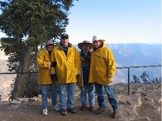 We’d done it before, perhaps ten years ago. It had been a Christmas present for Mike. A two-night mule trip to Phantom Ranch at the bottom of the Grand Canyon. This time, we did it with John and Lorna, two friends of ours from Maine. The Grand Canyon’s mule operators have, during the high season, 160 mules on hand to take riders or supplies into and out of the canyon. In late February, there are several dozen. We turned up at the “round corral” at 8 AM as instructed, wearing our outfitter-supplied yellow rain slickers. The temperature was in the 20s (F, of course) and we were shivering as we waited. There were about 12 of us going down that day, but eight were doing the day trip to Plateau Point, which looks out over the Inner Gorge not far from Indian Gardens. That’s about a 3-hour ride (each way). Our ride would be 4-1/2 hours, taking the Bright Angel Trail all the way down to the river.
We mounted up right after the first group left. Our wrangler’s name was Jeff and he didn’t seem to be too happy to be making the trip to Phantom Ranch with us. Maybe he’d woken up on the wrong side of the bed that morning. But when we headed out, I started working on him and I softened him up a bit. We told him what we all did and he told us about some of the places he’d worked. I think he soon realized that we were among the most experienced riders he’d have on a mule ride and I think that helped him to relax.
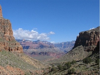 All the time, we were heading down into the canyon, on a trail that was about six feet wide in most places. Near the top — perhaps the first 30 minutes of the ride — there was ice on the trail and you had to just hope your mule was surefooted enough to cross it safely. It turns out that the mules wear special winter shoes that help grip that ice. Further down into the canyon, the ice was melting and running off from the top, making tiny streams and waterfalls. Everything was wet and alive. And the view was great. Mules are not afraid of heights and they seem to like to prove this. They often walk on the outside edge of the trail, sometimes only inches from a sheer cliff. This did not bother me much on the way down, but, for some reason, freaked me out a bit on the way back up. (Go figure.) My mule’s name was Bumpy because he was. But his name could also have been Muddy, Dirty, or Filthy. He obviously liked rolling in the mud of the mule enclosure and the wranglers didn’t think it was worth brushing all that mud off his neck, legs, and lower body. His saddle was quite uncomfortable and seemed to have seams running right under my butt. Of course, those could have been the seams of my underwear against a rock-hard seat as I bumped down the trail.
We were in the shadows for most of the first two hours of the ride and it was quite cool. But at least we were sheltered from the wind that had been blowing up top. We saw three big horn sheep and a small herd of mule deer along the way. By the time we got to Indian Gardens, I was ready to shed the yellow slicker. We dismounted and I took a few moments to stretch the kinks out of my legs before sitting down to the box lunch Jeff had brought us. The other riders were already there, finishing up their lunches. While we ate, they mounted up again and headed down the trail to Plateau Point. We spent about 30 minutes out of the saddle, made an all-important visit to the pit toilets — among the nicest I’ve ever seen — then mounted back up and continued down our trail.
The ride slipped into a narrow canyon that rode alongside Pipe Creek for a while. The creek was rushing with water from the runoff up above and we had to cross it several times. There were a few places where the trail seemed to narrow as it wound along the edge of various cliffs. Every time we passed hikers, Jeff would instruct them to stand on the inside of the trail, leaving us to go around them on the outside. We got to a point in the trail where a small creek far below came into view and Jeff told us the stupidest question a rider had ever asked: “If the dam wasn’t built, would there be more water there?” The rider was obviously mistaking a tiny runoff creek for the Colorado. Jeff had merely replied, “Yes.” He figured that she probably felt pretty stupid when she saw the Colorado a while later.
We came out of the bottom of Pipe Creek Canyon — so named because the trans-canyon pipeline runs up it to Indian Gardens — and the Colorado was suddenly before us: rushing wildly with silty runoff. Colorado means reddish in Spanish (or so I’ve read) and what we were seeing was the natural color of the river. Nowadays, the river’s normal color is a deep blue-green. (I know because I flew over it multiple times over the past summer.) The Glen Canyon Dam 80 miles or so upstream doesn’t just hold back the water. It holds back the silt. So the water coming out of the dam is always clear and cold. But with all the rain we’d been having in Arizona, there was lots of water draining into river tributaries, including the Little Colorado River to the east and multiple side canyons. So the canyon was getting its share of silt and the water color was a bright, muddy brown.
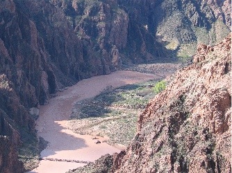 We rode for another hour or so after that, finally reaching the pair of bridges that cross the Colorado to Bright Angel Canyon. The first bridge, a silver-colored suspension bridge, was for foot traffic only, so we added an extra 20 minutes to our ride getting to the black bridge of the Kaibab Trail, about a half-mile upriver. We had to ride through a low tunnel in the rock wall to get to the bridge. From there, it was only 20 minutes more to Phantom Ranch. By the time we reached the ranch, I was in serious pain. My stirrups were too short and my knees were aching. It felt good to get out of the saddle. Although I didn’t think I’d ever recover, I was feeling much better just a half hour later.
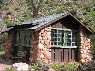 Dave, the ranch manager, met us at the corral and took us to our cabins. There were only two cabins with queen sized beds at Phantom Ranch and we’d reserved them both — eight months ago. The cabins, which were designed by Mary Colter and built in the 1920s, were one-room buildings built primarily of stone. Very quaint. Each one had a closet with a toilet in it and a sink that ran cold water. Hot water and showers were available in a building a few hundred yards away. The main lodge building was where you could buy supplies and have your meals. We stopped in for a lemonade not long after we arrived.
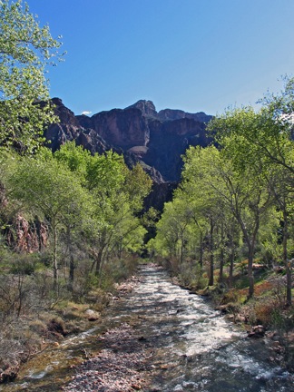 We went for a short hike back down to the river before dinner, checking out the confluence of the river with the clear waters of Bright Angel Creek. Then a good, hot shower. Then back to the lodge. Dinner was served family style with two seatings. We were in the first seating, at 5 PM, the first night. The meal featured steak, which was surprisingly tender (although not cooked quite enough for my taste), baked potatoes, corn, peas, salad, and cornbread. It was all you could eat and I ate a ton. I think I expected all the exercise I’d get during our stay to burn off calories. Sadly, it didn’t.
After the second seating, the lodge opened back up for drinks (beer, terrible wine, and soft drinks), talking, and game playing. We hung around for a short while, then headed back to our cabins. I slept great that night — much better than I had in our cabin on the rim — and woke the next morning feeling really refreshed.
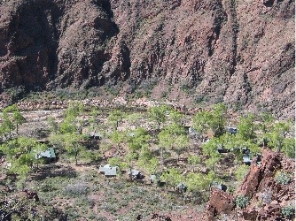 After a hearty (too hearty!) breakfast in the lodge, we headed out for a hike on the Clear Creek Trail. This trail climbs about 1,000 feet in its first mile, passes a lookout point where you can see all of Phantom Ranch below you, then offers stunning views of the Colorado River, Inner Gorge, and canyon walls. The first mile was a killer for me — I don’t do up very well. But it was worth it. The views were great and the trail leveled out for a pleasant walk.
Oddly enough, while we were hiking, we came out to a viewpoint that looked down at the mouth of the Bright Angel Creek. A helicopter was spinning on a helipad far below us. We hadn’t even heard him come in. It was the park helicopter and, as we watched, it took off with a long line below it and headed up Bright Angel Canyon. A few moments later, it returned, dangling a generator or welder beneath it as it headed to the South Rim. (There had been a water line break in the canyon and this was probably some of the equipment needed to fix it. He returned for another load a short while later, then returned once again to have the long line removed. It amazed me how little noise the helicopter made. I’d begun to believe what I heard from the tree-huggers: that helicopters were a noisy intrusion on the grandeur of the canyon. In reality, the sound of the river and the bends in the canyon walls swallowed the sound of the helicopter.
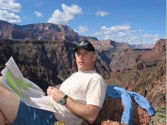 We did about two miles, stopping for lunch on a point that looked down the river. The trail kept going, lined with yellow flowers as it climbed a bit more to the top of the inner gorge. But we’d had enough. We turned around and went back. Mike and John headed up Bright Angel Creek while Lorna and I went back to the ranch to relax. We got there just before 3 PM.
Dinner that second night was beef stew and it was good. I ate a ton of food and fully regretted it the next day, when I had to cram my body into a clean pair of jeans. We spent some time playing dominoes after dinner, then hit the sack.
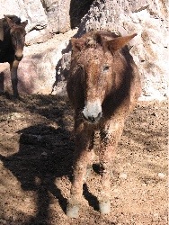 The next day, after yet another hearty breakfast, we headed over to the mule corral where Bumpy, Charlie, BB, and Darth Vader were waiting. Frank, a different wrangler, had come down the day before to take us out. There was a female wrangler there, too. She was in charge of the eight or so riders that had come down the previous day for a one-night trip. They left before us and we mounted up and followed Frank out. Fortunately, I’d had the foresight to have my stirrups lengthened, so I wasn’t in as much pain on the way out as I’d been in on the way down. Now if only I’d brought a cushion for the seat!The ride out of the canyon was considerably longer, primarily because we had to stop often to rest the mules. I figure it took about five hours. We stopped at Indian Gardens for a snack and a bathroom break on the way out. We saw some more bighorn sheep and a condor. And lots of photo opportunities along the way. Finally, we were back on the rim and the trip was over.
Did I have a great time? You bet! Would I recommend this trip to others? Of course! A mule ride to the bottom of the canyon is an experience that I’ll remember forever. I’m just fortunate enough to have done it twice.


