Wickenburg, AZ to Placerville, CA – Day 1

Foiled by wind.

I planned the trip for hours. That’s the truth. I knew I was going to go on a helicopter trip, but I didn’t know where I was going. It wasn’t until Friday, when I met Rod’s friend Nick, that I decided. I’d go to Placerville, to visit Liz and Rod. But it wasn’t until Sunday that I started planning a route.

The trouble with getting to Placerville from Wickenburg is the Sierra Nevada mountain range. There aren’t many places to cross it without climbing to altitudes that would cause Three-Niner-Lima to vibrate to pieces. (Three-Niner-Lima starts vibrating at 8500 feet.) I finally decided on the Tehachapi Pass, northwest of Palmdale. I then listed all the airports along the way, noting which ones had fuel (all of them) and restaurants (few of them). I marked up a WAC. And then I packed.

I got off to a late start on Monday morning. I’d hoped to leave by 8 AM; I took off at 9. I’d filed a flight plan to Apple Valley via Twentynine Palms. It was an ambitious flight plan. I’d have to fly direct at an average about 90 knots ground speed.

Flying direct was new for me. I have a tendency to follow roads when I fly and to look for mountain passes when I have to cross mountain ranges. Things worked out well for me at the start of this trip. I headed almost due west, over Forepaugh, and north of Eagle Roost. Then through Cunningham Pass, and over the Cactus Plains to the Colorado River, south of Parker. The terrain was boring, water-scarred desert, broken by mountains thrust out of the desert floor. To someone from the east or north or midwest, the terrain would be fascinating. But when you’ve flown over it as many times as I have, it loses its charm.

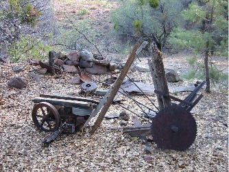
The Colorado River wound through the desert, a dark blue ribbon cutting across the dust and rock. Beyond it, the desert floor was flat, sloping gently back toward the river, scarred with thousands of tiny washes. I imagined the scene before me during a rainstorm, when water flowed in every single channel. I crossed over a VOR and followed a road and a line of train tracks. The track ballast consisted of light and dark colored stones. I caught sight of a name written alongside the tracks in carefully arranged stones. Then another and another. I soon realized that there were hundreds of names, all neatly written in stone in the middle of nowhere. I circled to take a picture. At least this was something interesting.

Photo
This photo doesn’t do the site justice; the names in stone went on for at least a mile.

Monitoring my progress on the Los Angeles Sectional chart now, I crossed over what had once been the town of Rice. It was a railroad junction where a few train cars waited on a siding. There were building ruins, including a stone building that still had one full wall standing. Lots of debris and trash. I continued on my course, almost due west, and passed south of Iron Mountain, with it single north/south runway. Nothing going on there.

Rocky hills and mountains rose from the desert floor. My path took me beside several of them. I joined up again with the road I’d left at Rice. It formed the northern border of Joshua Tree National Park. I stayed north of the road, flying about 300 feet AGL, admiring the stark rocks of the Coxcomb Mountains to the south. I climbed with the terrain, reaching an altitude of almost 3000 feet.

Joshua Tree
The landscape just northeast of the northern edge of Joshua Tree National Park.

Throughout the flight, I’d managed to maintain an airspeed that varied from 85 knots to 95 knots, with a similar ground speed. Still, flying at nearly full power with carb heat on, I was burning fuel at a higher rate than I’d expected. As Dale Lake (mostly dry) and the Twentynine Palms VOR came into view, I realized that I would not make it to Apple Valley. I made my first call to Twentynine Palms while I was ten miles out. No response. An airplane called in when I was about five miles out. He didn’t get any response either. He said he was heading toward Hi Desert, the next airport on my path, about 15 miles further along. I asked if there was fuel at Hi Desert — the chart said there was, but you never know — and he told me there was. I decided to go there instead. At least I knew there would be someone there.

Dale Lake
Dale Lake did have some water in it. But not much.

I passed Twentynine Palms airport just to the north of its runways. The field looked to be in good condition and I could see a big Chevron sign by the fuel pumps. About a half dozen planes were parked on the ramp. But there was no sign of life. I kept flying.

I overflew the rather large town of Twentynine Palms. Between Hi Desert and me was a mesa; I decided to fly around it, to the south. Meanwhile, the plane, a Cherokee, was getting closer to Hi Desert. Although I expected him to beat me in, he was still 5 miles out when I had the airport in sight. It wasn’t much to look at. I overflew it to check the wind, reported my findings to the Cherokee, and made a spiral landing down to the fuel pumps. It was about 11 AM.

Hi Desert is an airpark, something that isn’t obvious when you consult a sectional chart for information. It had one runway, which was in pretty good shape, and a handful of Mexican style adobe buildings on the southeast end of the runway. It looked as if it had once been a very nice place, but had since been neglected, probably because no one was around to admire it. I was shutting down when the Cherokee landed. The pilot appeared from behind some buildings when I was looking for a bathroom. Although the sign on the FBO door said it was open from 8 AM to 5 PM, everything was locked up tight.

The Cherokee pilot pointed out a bathroom that appeared to have been added as an afterthought to a shed. It was bright, but reminded me of the kind of rest room you’d find at a very old gas station. Not exactly dirty, but certainly not clean. There was toilet paper, but no paper towel. The Cherokee pilot helped me with the fuel hose, then spent some time looking at my helicopter while I fueled it. We chatted about the place. I told him that my husband and I were looking for a place like that. He told me it was for sale. I told him we weren’t interested in living in California. He told me he couldn’t blame us. Then a friend of his walked up and they started talking about other things. I finished up and put away the hose and static line, which was hopelessly tangled. I checked the oil, warned them to stand back, then climbed aboard and started up. It was about 11:20 AM. It wasn’t until the blades were spinning that I realized I’d forgotten to take a picture. It would have made an interesting shot.

I waved goodbye and climbed out, continuing toward Apple Valley. My course was now slightly northwest. Twentynine Palms and Hi Desert are just south of a bunch of restricted areas, which is why I had to remain so far south. Now I was flying across the high desert, with terrain roughly 2500 to 3500 feet. And the wind had kicked up. As I flew on the north side of the San Bernadino Mountains, I realized I was hitting headwinds of 20 to 30 knots. In the somewhat gusty conditions, it was tough to maintain an airspeed of 95 without getting dangerously close to my never exceed speed of 102 when the wind gusted, so I let it slip to 90. That gave me ground speeds in the 60s. As I flew along the road at Lucerne Valley, I realized that some of the cars were passing me. I dropped altitude in an attempt to stay out of the worst of the wind, but that didn’t seem to help at all. I was very glad I’d fueled at Hi Desert; I never would have made it to Apple Valley.

Meanwhile, the terrain wasn’t being as cooperative along my course. A mountain separated me from Apple Valley. Again, I skirted along the southern end of it, slipping through a pass about 5 miles southeast of the airport. There was a Decathalon in the pattern there; a Citation had landed when I was still 15 miles out. The airport was large and looked brand new, although there didn’t seem to be many planes on the ramp. I announced that I was transitioning but would remain east and then north of the runways. Someone with the Decathalon pilot — an instructor, perhaps? — thanked me. I continued on, heading into the wind, toward Victorville.

Victorville, or Southern California Logistics, is a controlled airport used primarily by the military. The AWOS was on a frequency that my radio couldn’t get. So I tuned into the tower while I was about 8 miles out and told them I wanted to transition westbound. “Transition approved,” was the reply I got. Simple as that. As I approached the airport, I realized that it was huge and full of parked airliners. Most of them wore United paint jobs, but I did notice one for Tower Air. An army helicopter was making excruciatingly slow approaches to the end of the runway. All around the airport were buildings and the ruins of buildings. I assume this had once been a big air force base that was no longer needed. The radio was quiet. When I was a mile out, I reminded the tower that I’d be flying over. He acknowledged my call with a simple, “Roger.” I punched L00 for Rosamond into my GPS. According to my research, Rosamond had fuel and a restaurant. It would make a good next stop, someplace where I could reassess my route over the mountains. I headed northwest, crossing more high desert. Below me were scattered ruins of stone walls and foundations. As I approached the southern edge of the restricted area around Edwards Air Force Base, I could clearly see Rogers Lake and the buildings of Edwards. I followed a paved road due west for a while, flying over a few homes, most of which were manufactured. My route took me far to the north of Palmdale and far enough to the north of General Fox, so I didn’t need to talk to either of these controlled airports.

Meanwhile, I realized that I was getting kind of sick. Like airsick. The problem was, the wind was gusty and the helicopter was doing a lot of bobbing around. Every time I consulted the chart to see exactly where I was — a GPS is nice, but situational awareness is important — I’d look up to find myself facing another direction. I’d correct my course, bounce up and down a few times, then check the map again. It was uncomfortable flying. And up ahead, I could see where the high valley I was in ended, with the windmills of Tehachapi pass. I’d been warned about the wind in the pass and had a feeling it would be worse than where I was now.

I crossed Rosamond Lake (mostly dry) and saw ripples on the water. Then I saw something that took me a while to figure out. It was a dark object, moving across the surface of the water, leaving dusty water behind it. At first, I thought it was a swimming animal. But the shape was all wrong. I realized then that it was a tumbleweed, being blown across the lake surface. We’re talking serious wind.

Rosamond Airport was beyond the town and it took a while to find it. I made a few calls in and didn’t hear any response. I overflew the field and saw windsocks flying straight out with a cross wind. I made right traffic to Runaway 25. As I was landing, I saw two people watching me. That’s when I realized that Rosamond was an airpark, too.

I set down by the pumps and shut down. There was nothing going on. The FBO office looked closed. The wind was howling.

A man stood by the FBO office. He told me he’d been listening on the radio and was very surprised to hear a helicopter coming in. He confirmed what I’d already suspected: that the restaurant was closed. He told me I could use his phone to call flight service about the weather. Feeling a bit dazed after almost two hours of bouncing around in the air, I followed him. He took me to his home, where his wife was waiting. They gave me the phone and waited while I called Flight Service. I was on hold a long time. When I got a briefer, he gave me the bad news. Winds of 30 gusting to 41 up in the mountain passes. Clouds building. The wind would calm by 7 PM, but there would be clouds in the valley in the morning.

One thing was clear: I wouldn’t be flying over the mountains that day.

I went back to the helicopter, filled it with fuel, and moved it into a parking spot. Moving it wasn’t easy; although I’d brought the ground handling wheels with me, they were underinflated. I tied down the blades and was removing my luggage when my new friend reappeared. He brought me back to his house, where his wife offered to let me stay there. That was weird, but what was weirder was that they were leaving, going back to their primary home in Los Angeles. They were offering to let me stay alone in their house. I thanked them, but said no.

So they brought me into town, where I starting to think I’d made a bad decision about staying at all. There was nothing going on in town — in fact, there wasn’t even much of a town. They drove me around for a while, then stopped at the Devonshire Motel, which one of their neighbors had recommended. I thanked them again, then climbed out with my luggage to get a room.

Inside the motel office, the desk clerk was struggling to get a fax machine working. She said the machine showed an empty paper message and kept trying to close the top of the machine without properly loading the paper. A man, who was waiting to receive a fax, was talking to someone on his cell phone. When it became obvious that it wasn’t going to work, he thanked her and left.

I got a room and the phone number for the local cab company, Dial-a-Ride. My room was on the second floor of the two-story building, just at the top of the stairs. It was clean, but otherwise unremarkable. I used my cell phone to call Mike and report where I was and why I’d stopped for the day. Then I called Liz and Rod and left a message with them.

I tried calling the cab company, but the phone was busy.

I walked to a Mexican place I’d seen nearby and had some lunch. It wasn’t bad, but it wasn’t anything to write home about. I walked back to my room. By this time, it was about 2 PM. I had an entire day to kill, but there wasn’t anything within walking distance of my motel to do. The town seemed to consist of a handful of schools, fast food joints, and a strip mall with a supermarket, pharmacy, and other necessities of life. There was no quaint town to walk through, no museum, no points of interest.

I spent the afternoon watching TV and starting this blog. And I called the cab company over and over. The phone was always busy.

Liz called to see where I was. She’d misheard me on the phone and thought I was near Santa Rosa, which she knew was pretty much impossible. I filled her in. Later, Mike called. I filled him in. Even later, Rod called. I filled him in, too.

At about 7 PM, I walked next door to the Fosters Freeze, an ice cream/burger chain in California. I bought a hot fudge sundae (so much for the diet). I tried to buy a souvenir tee shirt for Mike, but they didn’t have his size. I went back to the room, listened to the busy signal when I called the cab company, and watched Stargate reruns. By 9 PM, I was asleep.

Flashback: September 1, 2002

The hidden cabins of the Weaver Mountains.

Richard’s story emerged over lunch at a local restaurant. I don’t even know how it came up in the conversation.

Years ago, he and his stepfather had gone on a four-day hike in the desert, looking for lost treasure. They’d followed old mining roads and pack trails high up into the Weaver Mountains, following vague directions given to them by an old miner who had recently gone to that great mother lode in the sky. As days wore on, they found one landmark after another. On the third morning, they were searching for their last landmark, some cabins deep in a thickly treed canyon. Although they couldn’t see any sign of the cabins from a ridge overlooking miles of high desert terrain, later that day they stumbled upon them while following a spring-fed creek. By then, they were out of time and had to start on their way back home. They never went back.

Richard’s tale of a four-day hike in the desert, living off the land and finding old buildings hidden away in canyons, fascinated me. I’d done my share of exploring when I was in my teens and had some interesting tales to tell. But none could come close to his. I wanted to know more, to see the cabins with my own eyes. Perhaps I thought it was a way to recapture part of my youth, when the simple pleasure of discovery was all the reward I needed after a long hike on a hot day.

But although Richard wanted very much to find the site again, a work-related injury made a long hike or horseback ride impossible. And Richard was certain that there were no roads anywhere near the canyon, so a Jeep wouldn’t get us there. Besides, with thousands of acres of mountainous terrain and numerous canyons with spring-fed creeks, locating the site would be like finding a cactus spine in a patch of tumbleweed. After all, Richard’s initial visit had been long before the era of GPS and he wasn’t sure where the site was.

I can’t recall if it were Richard or me who suggested the helicopter as a means to find his hidden cabins. If Richard suggested it, I’d probably been thinking about it quietly already, so his suggestion seemed perfectly natural. If I suggested it, I don’t recall him being surprised, so he must have been thinking about it, too.

Three-Niner-Lima, as I call my helicopter, is a 1999 Robinson R22 Beta II. I’ve owned it since October 2000 and have done most of my flying at its controls. I learned to fly late in life, earning my private pilot helicopter rating shortly before my 39th birthday and my commercial rating a year and a half later. Three-Niner-Lima seats two, including the pilot. Although it doesn’t have much power — a fact that becomes apparent at higher elevations, especially on warm days — it’s fun and relatively inexpensive to fly.

Richard, his wife Christal, and I met again over breakfast the next day. I brought along some topographic maps. Richard pointed out where he and his stepfather had parked the car for their hike and where he thought they’d hiked. He pointed out a few canyons with springs that could be the canyon they’d visited. I saw a number of 4WD roads and pack trails on the map and pointed them out. Richard repeated with certainty that there were no roads leading into the canyon.

There was a lot of mountainous terrain to cover. When flying helicopters, mountains mean three things: high elevation, which limits available power; unusual winds, which can make landing difficult or hazardous; and uneven terrain, which makes it hard to find an emergency landing area in the unlikely event of an engine failure. With all this in mind, I suggested that we begin our search early in the morning, before the temperature rises and the winds kick up. We agreed to meet at 6:00 AM.

One thing led to another and I was unable to keep our appointment. So we put it off a few days. Thus, it was by chance that we made our flight thirty years to the day of Richard’s original hike — a fact Richard didn’t realize until much later.

The morning of our flight was clear, cool, and calm. We took off from Wickenburg, heading north, just after sunrise. Although Three-Niner-Lima was equipped with a panel-mounted GPS, I brought along my hand-held Garmin, which has mapping capabilities, and set it up to log our route. Later, I was able to overlay the route on some topographic maps, which gave us an interesting view of our flight.

We climbed over the Weaver Mountains in the early morning light. It was slightly hazy that September morning, as if the desert were trying to send its moisture up to the sky to start monsoonal rains as early as possible. But because the summer had been so dry, the desert was a parched beige color, with dusty green patches of vegetation. Up in the Weavers, however, it was obvious where springs flowed. Dozens of canyons were green with tall cottonwoods and other water-loving trees of the desert. It was under one of those canopies of trees that we’d find the hidden cabins.

We flew a relatively standard search-and-rescue pattern, weaving back and forth over one canyon after another. For safety’s sake, I needed to remain at least 500 feet up. Since we were operating in an area of rapidly changing elevations, I kept my eyes outside the cockpit, concentrating on keeping us clear of terrain. I did my best to place the best view on the left side of the cockpit, where Richard sat, scanning the ground.

After about 40 minutes of searching, we were getting discouraged. I felt bad for Richard, who had come prepared with hiking shoes, water pack, and camera, ready to relive a thirty-year-old experience. He clearly expected us to land somewhere and it had gotten to the point where he didn’t really care where. We talked about finding a landing zone near one of the more densely vegetated canyons and I saw a spot that might work. After doing a high reconnaissance, I told him I’d try an approach, but warned that if the site didn’t look smooth or level, I’d have to break it off.

I went in cautiously, my eyes on the proposed landing zone, an arm of the mountain that seemed flat and clear. I was about 100 feet from the ground when Richard called out suddenly, “There it is!” I tore my eyes from the landing zone for a quick look and saw the weathered roof of a cabin among the trees. A moment later, I touched down on level ground on a high point near the canyon, surrounded by prickly pear cacti, agaves, and scrubby creosote bushes.

Richard and I were both excited as I cooled off the engine and shut down. I marked my helicopter’s location as a waypoint on my handheld GPS and followed Richard toward the canyon. There were some cattle trails that wound back and forth along the slope and headed into the trees. One thing I’d learned about free range cattle is that they always know where the water is. Following their trail would lead us to the creek.

N7139L
Three-Niner-Lima in the landing zone, only 1/10 mile from the cabins.

We began to see signs of long-gone occupation as soon as we got into the shade of the tall trees that filled the canyon. First a thick pipe, broken here and there, which must have carried water from the spring-fed creek. Then an almost intact wagon wheel lying among the broken remains of a cart, some old tools, and saw blades. We continued down toward the creek, our feet crunching over years of fallen leaves. We walked around a thick bed of what looked like irises and then came face to face with the first cabin.

Photo
Photo
A wagon wheel and some tools were the first signs of civilization we encountered under the canopy of trees.

I don’t know who built the cabin or how long it had been standing beneath those trees, but I know it’s old — perhaps a hundred years or more. Its sides were made of crudely shaped wooden planks, which had colored with age to warm browns and dark grays. The roof was corrugated tin sheets, laid almost haphazardly to provide the best coverage. A stove pipe came though a hole in the roof and another pipe led from the ground into the wall. Two windows faced out over the stream, which gurgled softly nearby.

Photo
Richard approaches the main cabin.

A small porch and open doorway faced us and we wasted no time stepping up for a peek inside. There were two rooms, a kitchen and a bedroom. Inside the kitchen, we found the remains of a wood-burning stove and a sink with a countertop. A firewood bin had been built into the wall between them. In the bedroom, a bed frame stood neatly against the window. Although the floor looked to be in remarkably good condition, especially in the bedroom, Richard and I thought it best to stay outside, where we were less likely to damage the fragile remains.

Beyond the main cabin stood a second, smaller cabin, which had probably been used for storage. That cabin was surrounded with a dense growth of vines. Had I been properly dressed in heavy jeans and hiking shoes, I would have made my way through the growth for a closer look. But my lightweight slacks had already been torn on the 1/10 mile hike from the helicopter to the cabins and my Keds did little to protect my otherwise bare feet.

Photo
The other cabin.

Despite our find, Richard was still disappointed. He told me that the cabins he and his stepfather had found had apple trees growing in front of them. There was no sign of the trees that day — just the thick vines that covered the ground with a narrow cattle trail running through them. Although I pointed out that the trees could have died and rotted away during the past thirty years, he wasn’t convinced. He was sure we had the wrong cabins, although he thought we might be close. So we set off on a short hike down and then up the creek. Other than the cabins and some old fencing, there was no other sign of occupation.

After an hour exploring the area, it was warming up. Three-Niner-Lima sat at 5,000 feet — an elevation that would have an impact on its performance, especially on a hot day. Thermal updrafts and winds would be starting up soon, too. I was anxious to head out before performance and turbulence became an issue. As Richard and I climbed up out of the canyon and made our way back to Three-Niner-Lima, we talked about returning another day, with a better camera and the proper footwear for me. I marked the landing zone with a row of white rocks and walked around my ship to make sure stray cattle hadn’t damaged it while we were out of sight. Moments later, we were airborne, heading out over the canyon to start a spiraling climb over the mountain peaks between us and Wickenburg.

Richard, who is retired, spent the next few weeks trying to dig up some information about the cabins. He found an old man who knew about them and told him that there had indeed been apple trees. But some city slickers out camping in the wilderness had decided to cut them down for firewood. That had been years ago and no trace of the trees remained.

No trace of the people who lived there remain either. Or of visitors like us, who come to look but take pictures instead of souvenirs. Although the coordinates of the hidden cabins are safely stored in my GPS, they’ll remain hidden, too. Too many places have been destroyed by heartless vandals, who take pleasure in rubbing out the traces of our state’s history. I’d rather let nature reclaim the site at its own pace than share the secret location of the hidden cabins of the Weaver Mountains.

A Trip to Chandler, AZ for a New Attitude (Indicator)

I take a seasoned aerobatic pilot on a helicopter trip to Chandler and back.

My helicopter’s instrument panel includes an attitude indicator. That’s the gadget that tells you whether you’re flying straight and level or doing turns and climbs (or descents). My attitude indicator never worked right (how fitting!) in that it sometimes told me I was doing things I wasn’t doing. When it started telling me I was doing loops and rolls, I decided to get it fixed.

Ed Taylor pulled it out of my ship for me. He did some research and found a company that would fix it for a mere $1,195. Ouch. I made a few phone calls. A place in Mesa said they could fix it for me for about $900, but when I told them it was for a helicopter, they backed off. They said they didn’t have much luck with helicopter instruments and recommended that I buy a new one for about $1,400. I called the Chandler-based company they recommended and was told that the new one would be $1,700. Ouch ouch! But for $965, I could get an overhauled unit with the same one-year warranty as a new one. They had them in stock. I chatted with the woman for a while and she decided she liked me. She talked her boss down to $900. I gave her my credit card number before they could change their minds.

The day dragged on. A 2:30 meeting I had was finished in 10 minutes rather than an hour. At 3:00 PM, I was at the fuel pumps in Wickenburg with Three-Niner-Lima, doing a preflight for my trip to Chandler.

Nancy, one of our local pilots, stopped by. She’d just gone flying for the first time in several weeks and had put her plane away for the day. I didn’t know it, but she’d had a bicycle accident and that had kept her at home, nursing a nasty cut and bump on her head. Nancy flies a Decathalon, an aerobatic plane. In her words, the plane is “just as happy flying upside down as it is right side up.” So she flies it upside down a lot. And does loops and rolls. And hammerheads. The kinds of maneuvers that make some people sick. She does them a few times a week for about 20 to 30 minutes each outing, several miles north of the airport.

Nancy, who is also one of my favorite people, used to do aerobatics professionally. Now she just does it for fun. She’s 73 years old.

I asked Nancy what she was doing, and she told me she had nothing planned. I invited her to come with me on my trip to Chandler. She made a quick phone call, then hopped in. A while later, we were airborne, heading southeast. As we left, Gary, on duty at the airport, told me to remind Nancy that we couldn’t fly upside down.

I took my usual route to Chandler: southeast to Camelback mountain, east along the north side of Camelback, then south to Chandler. It avoids all other airspace, so the only airport you have to talk to is Chandler.

Nancy thoroughly enjoyed the flight. Years ago, her husband Bill owned a Hughes 269 helicopter. I’m not quite sure what that was, but Nancy tells me it sat three people. Probably a lot like a Schweitzer 300. They used to land it at their home in Scottsdale — we’re talking years ago — and later, at their home in Wickenburg. Oddly enough, their old home in Wickenburg now belongs to one of my neighbors, and I can clearly see the nice, flat area where Bill used to set down. She told me a story about how a friend of theirs once landed his helicopter at their home after they’d moved. “He realized pretty quick that we weren’t there anymore and took off,” she told me.

I got the impression that it had been a while since Nancy was in a helicopter. She said, “This is great,” about a dozen times. She remarked that in an airplane, you don’t see as much. That’s because in a plane, you’re not sitting in front of a window that’s bigger than you are.

We talked about the airport and the airport commission. Boring stuff that would put you to sleep if I detailed it here. Heck, it would put ME to sleep if I detailed it here.

I pointed out interesting landmarks along the way. Highways, malls, roads, mountains, airports. We could see right down the runway for Luke, just before we reached Arrowhead Mall. I remarked about the new construction. We listened to Scottsdale tower scold a pilot for flying the wrong direction. We searched for the Chandler High School, which was my landmark for approaching Chandler.

We came into Chandler and landed at the helipad near Quantum, then hover-taxied to the transient pad. I shut down. We walked to Varga, two buildings away from Quantum. Along the way, I saw Tristan’s helicopter, shoved up alongside the hangar, and ran into Paul Mansfield, my old mechanic. Paul greeted me warmly as ever. We talked about Tristan and how we wished we could slap him on the side of the head. Then we headed to Varga.

At Varga, we didn’t seem too welcome. But we eventually got the attention of the fat man behind the desk, who went into a back room to retrieve the attitude indicator. And here’s a funny thing. When I first talked to Ed about all this, I told him that I was thinking of replacing the attitude indicator with one that had a ball. The ball tells you if you’re in trim. My helicopter has trim strings that also do this, but they’re completely useless if its raining or dark. I thought it might be good to have a ball in the ship. Well guess what? The attitude indicator the fat man gave me had a ball.

We walked back to Quantum, stopping to chat with Paul again along the way. If it were up to Paul, we’d still be chatting with him. But we were anxious to get back before dark. It was already 5 PM and sunset was less than an hour away. The flight would take an hour. We pulled ourselves away and I took one last look at 45PG.

Meanwhile, Quantum’s R22s were flying in, like homing pigeons. One after another, they landed at the helipad and hover-taxied to parking spots. We started up as the last one glided past. I remembered all my radio calls, hover-taxied to the helipad when cleared, and took off to the west.

We went back along the south side of South Mountain, over the Gila River, over the northernmost part of the Estrella mountains, south of Goodyear, over Buckeye, and north along the Hassayampa. I wanted to show Nancy something different. She had a great time and I enjoyed her company. We set down at Wickenburg just before 6 PM.

Today, Ed installed my attitude indicator. I can’t wait to try out the ball.

Helo Day at Falcon Field

A trip to Mesa to put Three-Niner-Lima on display.

A few months ago, I got a phone call from Jeff Fulinari (whose name I have probably just mangled). He’d gotten my name and number from someone — I can’t remember who — who said that I might be interested in putting my helicopter on display at a special “Helo Day” at Falcon Field’s Veteran’s Day Fly In. Of course I was interested. Any excuse to fly!

And then I proceeded to tell him about all my other helicopter friends who had ships that were far more interesting than mine. At the top of my list were Brian and Keith with their Bell 47s and Jim with his Hughes 500c. I promised to contact these people to see if they were also interested in putting their ships on display.

Time went by. Jim agreed to come and made arrangements with Jeff early on. Brian seemed to hop on board about a week before. Meanwhile, Jeff had been busy. He told us via e-mail that he’d lined up a total of 19 helicopters for the show. Very impressive.

Jim and his wife Judith agreed to fly down to Mesa with Mike and I. The trouble was, Jim’s 500c usually cruises at 105 knots. My never exceed speed is 102 knots. Alone, on a cool (less than 80° or so) day, I can push my ship to cruise at 95 knots. But with Mike on board, I’d be lucky to get 85 knots. Jim might slow down by 10 knots, but he certainly wouldn’t slow by 20. The solution was simple: let Mike fly down to Mesa with Jim. That would lighten me up so we could fly together. It seemed like a good enough idea to Mike — he’d been wanting a ride in Jim’s ship and this was his big chance. We settled on this as the plan.

Early this morning, Mike drove to Jim’s house, where he hangars his helicopter. I drove to the airport and loaded my ship with folding chairs, Big Wheels (a long story), and miscellaneous marketing material for Big Wheels and the airport. I took off and circled Jim’s place, which is about 3 miles north of the Wickenburg airport. Jim’s helicopter was sitting on the helipad. A few moments later, the strobe light started blinking and the blades started turning. I was on my second pass when he took off.

He slowed to let me pass him just south of town. Then we flew in a loose formation toward Phoenix. My GPS had the old “Camelback Route” set into it. The route goes from Wickenburg to a point just west of the north side of Camelback mountain, passing over Arrowhead Mall and Metro Park along the way. It then slips between Camelback and Squaw Peak, east past the 101. From there, it goes due south to Chandler, but I’d change the last waypoint when we were clear of Phoenix’s class B airspace. The benefit of this route, of course, is that it is the most direct way that avoids all Class B, Class C, and Class D airspace in the Phoenix area.

It was a beautiful day in Wickenburg — clear and cold (8�C on the ramp) — with excellent visibility. Not so in Phoenix. A beige smog cloud blanketed the valley, hiding the skyscrapers and mountains beyond from view. Even Camelback looked far away and, at first, I thought it was a different mountain much further to the southeast. I thought about people with breathing problems who may have come to Arizona for better air. So many people, so many cars, and a daily thermal inversion conspired to make the air worse to breath than where they’d come from.

As we flew, we tuned in, at first, to 122.75, which is the “official” air-to-air airplane frequency in the area. That frequency was full of students announcing positions in the Northwest and Northeast practice areas north of Phoenix. So we switched to 122.85. That frequency was used by students in the Southeast and Southwest practice areas, and there were far fewer of them. But the frequency was also being used by a bunch of airplane pilots.

“Six-five-bravo is 152 miles out.”

“Niner-three-juliet is 110 miles out.”

“Four-Alpha-Papa is 140 miles out.”

There were six or seven calls like this. Then some chatter about who was faster, how high airplanes close to each other were flying, and whether the plane off one guy’s left wing was one of the group. Then silence.

A while later, new position reports trickled in, followed by more chatter. I couldn’t contain my curiosity. “Where are you guys going?” I asked.

“Chiriaco Summit, for breakfast,” one of the pilots replied.

Chiriaco Summit is a truck stop along I-10 in California, about halfway between Blythe and Palm Springs. It had a decent runway, a Patton Museum, a gas station (for cars), and a restaurant that featured photos of the airport when it was actually used.

“Sounds like fun,” I said.

“They’re filming a movie out there,” another guy said, “and we want to check out the actresses.”

I laughed to myself. Any excuse to fly. “Where are you flying from?” I asked.

“Deer Valley,” two of the pilots answered, stepping on each other.

The conversation was over — no need to clutter up the airwaves any more than they needed to be. I thought about flying out to Chiriaco Summit instead of Falcon Field, wondering if I’d have a better time there. But by the time I made it there — after two hours and a fuel stop — all the activity would probably be winding down. And I didn’t think Jim would want to fly that far.

I tried to get Jim to switch to the helicopter air-to-air frequency (123.025) as we got closer to Phoenix. He tried, then met me back on 122.85 to report that his radio couldn’t get that frequency. Mike later reported that he heard me laughing when I replied. Old radio equipment.

We flew north of Camelback to the canal, then headed straight southeast to Falcon. We agreed to switch to Falcon’s frequency and make separate radio calls. I called in first. The controller, a woman who sounded very cheerful, replied with instructions to report one mile north of the tower. A plane reported in before Jim, then Jim got a chance to call. “Helicopter Two-Zero-Three-Zero-Foxtrot, flying with the other helicopter that just called in wants to do the same thing.” (Jim’s a riot.) The controller was just as friendly to him.

A mile north, Jim called in before me. I think he was afraid that I’d forgotten. We were cleared across and told to switch to 122.8 for guidance. I crossed first and made the switch. I was told to follow the signals of the man in the orange jumpsuit. After figuring out which man in the orange jumpsuit, I touched down on the ramp. Jim parked nearby.

A few other helicopters were already assembled, including an APS Huey, a huge Sikorsky, and a Hiller that looked strangely familiar. It was 8:30 and the show was scheduled to start at 9 AM. Jim led us all to one of Falcon’s two restaurants for breakfast. Mike and I had the Atkins Special omelet, which appeared to be meat scrapings from the griddle, loaded into a thin, folded layer of egg. It couldn’t have been too bad, because we both ate the whole thing.

Back outside, we spent some time walking around, checking out the helicopters. A pair of JetRangers and an AStar had arrived. The JetRangers were doing rides for $25 a pop and were in constant movement by 11 AM. Paul Alukonis, my first flight instructor, was flying the AStar and he spent some time showing off it’s avionics and ENG (electronic news gathering) equipment. Extremely cool. I introduced Paul to a number of people as “the man who taught me to fly.” I think it made him feel good. Brian arrived in his Bell 47 at about 10 AM, embarrassed to be late. No one complained.

I met the Sikorsky owner and, later in the day, got to climb into the ship’s cockpit. He’d been letting kids climb all over the ship all day and I thought he was nuts. But when I sat in the cockpit, I realized why he wasn’t worried. The instrument panel looked like something in a museum. Only in museums, none of the stuff works. In his ship, it was all the same industrial strength stuff, dusty and dirty and looking ancient — but it worked. Very strange. But not as strange as sitting in a cockpit ten to fifteen feet off the ground.

I also met the Hiller owner. He’d been trained in Chandler, where he also got the ship maintained. He told me that if he was lucky, an annual would cost him only about $5,000. He figured his hourly cost to operate was around $300. Not bad for an antique. It’s a weird-looking ship, with a 1-3 seating arrangement. The pilot sits up front, in the middle, by himself. Three passengers can sit on a bench seat behind him. Unlike his Sikorsky buddy, he’d plastered his ship with “Do Not Touch” signs and left his daughter to sit on guard with it.

I was pleasantly surprised to see quite a few people checking out my ship. In my opinion, it was the least interesting of the bunch. But people appeared to be amazed at how small it was. I heard comments when Mike and I finally decided to use the chairs I’d brought along. Some people had assumed it could only seat one person. Many assumed it was a kit helicopter. I set quite a few people straight and spent some time explaining how the drive system worked. I also opened the door and let a few kids sit in it.

Mike and I checked out the rest of the show, including the fixed wing area and museum. We used coupons provided by Jeff to “buy” hot dogs and water. We watched a never-ending stream of planes and helicopters fly by. The fly-in impressed me not only for how big it was, but how well-organized. That point was really driven home when it was time to go. Jim left first. His helicopter was surrounded by three or four ground guys who kept all pedestrians away until he was airborne. Then they surrounded me and did the same thing. It took a while for me to get clearance from the tower to leave — the friendly woman was gone and the man who’d taken her place was extremely busy. Finally, we were cleared to the west and told to fly three miles before turning to the north.

Mike flew with me on the way home. We sent the Big Wheels and chairs home with Jim and Judith. We took a northern route, over Scottsdale Airport. The controller was irate — I think that’s a job requirement there — but we were cleared into the airspace and over the airport. I showed Mike the big, white tire (see my previous entry), then headed home on a leisurely route. I was monitoring 122.75 just south of Carefree Highway when Jim’s voice came on. He was about 10 miles closer to Wickenburg, over Lake Pleasant. I told him where I was and that I’d be landing at his house to drop off Mike.

Back in Wickenburg, an Enstrom was in the area, giving rides to a bunch of young people there. I never got a chance to see the ship. I emptied my ship, hopped into the Jeep, and went home, tired from a good day out.

The House Surrounded by Wood

About the simple photo shoot that took two tries (so far) to get right.

The client left a voicemail message, explaining that she wanted us to take an aerial photo of her house as a surprise Christmas present for her husband. She left a phone number, but I was afraid to call her back. I didn’t want to spoil the surprise.

She caught me in my office two days later. We met at the airport so I could take her deposit and learn more about the job.

She explained where the house was — less than a mile south of the airport — and described it as being surrounded by chopped wood. “You have to take the photo soon,” she urged. “Before all the wood is gone.”

She’d done her homework on the Flying M Air Web site, and knew all about the Pentax 67 camera with the big negatives. The one I’d just decided to sell because it was so difficult to use. She wanted us to use that camera because she wanted the photo blown up to a large print.

I took a $50 deposit and told her I’d call her when I had a contact sheet for her to look at, probably within a week. She told me to e-mail her, since her husband never looked at the computer.

Mike and I went up a few days later. We’d loaded the camera with 10 shots, but had decided to use half of them photographing Rancho de los Caballeros, in hopes of selling them a postcard. I flew for about 20 minutes. Mike took pictures. I had to climb to 5000+ feet for the photos of the ranch.

I dropped off the film at Safeway, requesting Kodak processing. The only kind of processing I could get for that kind of film. I noted that I wanted a contact sheet only. No sense in spending $20 on processing.

The contact sheet was a major disappointment. If the client wanted a great shot of her neighborhood, we could deliver. But a photo of just her house and all that wood? By the time we had it cropped enough, we would have been better off with the 35mm negatives.

I broke the news to Mike. He complained that the camera didn’t show the right thing through the viewfinder. I didn’t point out that the ranch photos came out okay. There didn’t seem to be a need to start an argument.

I e-mailed the client and explained the situation. I asked her to come to the airport and tell me which angle she liked best and to draw her property line on the best shot. She came in and looked at the contact sheet. “My house is one of those?” she asked. I assure her it was. Then I pointed it out. She picked an angle and I used a Sharpie to mark up the image. I told her we were switching to a 35mm camera, one my photographer was more accustomed to using. I told her he’d do a better job and she could still get her enlargement. I told her it was a “man thing.” She understood completely.

We went up today to try again. Mike loaded his Nikon with zoom lens with 24 exposures of 100 ASA Kodak print film. He shot about 10 of the house, 10 of the ranch, and 4 of the town. I dropped off the film at Osco, so I could pick up the prints tomorrow.

Let’s hope I don’t have to continue this tale in another blog entry.