How I Spent My Autumn Vacation, Part 6: In Vermont

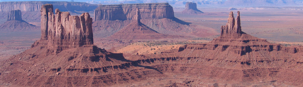
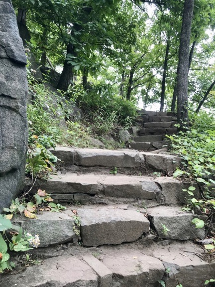
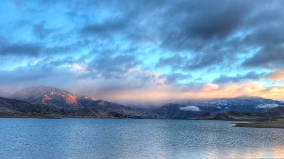
Not the peak color I was hoping for, but still a great time.

(Continued from Part 5: On the Road to Vermont)

My friends Tom and Tammy are among my oldest friends and that’s who I stayed with in Vermont.

But first, as you might expect, some back story.

The BBS Days and Beyond

I met Tom back in my BBS days — yes, I ran a multi-line networked bulletin board system (think prehistoric Internet) out of my home starting in 1989 when I bought the computer that changed my life. (I thought I’d blogged about the computer changing my life and hoped to link to that post, but a quick search yielded no results. I’ll have to blog about it in the future.)

At the time, Tom was working in a family owned business selling tombstones in a greenhouse just a few miles away. He ran a multiline BBS out of his office there. I honestly don’t remember how we met, but when I left my full-time job to become a freelance writer and computer trainer/consultant, I’d often spend free time visiting with him and talking about computers. Back then, I had an Apple Macintosh IIcx and I think he had a IIci. (I’d later run my BBS on a Mac SE/30, which was perfect for the task.

Through Tom, I became part of a computer “super user” network that included him and other BBS SysOps: Mike, Ralph, and Zeke. Mike was especially well connected. He worked for a design firm that did a lot of cutting edge things with computers and, thus, had access to all the latest and greatest hardware and software. We’d occasionally drive down to his office to gawk at his new toys and play with the latest offerings from Adobe and other companies, many of which no longer exist. (Aldus comes to mind.)

I was self-taught on computers and had managed to get a per diem gig teaching computer applications: Mac OS, Microsoft Word, Microsoft Excel, and Lotus 1-2-3. I think being so well connected with other computer superusers helped make that possible.

Anyway, time went on. Tom married Tammy. My future wasband and I went to the wedding. They sat us at the same table as Mike, who was so white he could be albino and another guy I didn’t know who happened to be the blackest black guy I’ve ever seen. Of course, he and Mike sat side by side. I wish I had a picture. (Isn’t it funny the things you remember?)

Tom and Tammy moved to Vermont not long after that. Tom was into winter sports and I think he was as fed up as I was becoming with the traffic, congestion, and expense of living in the New York City Metro area. He telecommuted to a new job with a big company. He’d gone beyond mere “superuser” status and was a networking expert. He could work from home with a fast Internet connection and he did, making occasional trips down to New Jersey when he needed to.

I didn’t see him at all after his move, but we kept in touch via email and a little Twitter and later text messaging.

Meanwhile, they had kids. Three boys, all named with the initial T.

I moved to Arizona and invited them to visit. But I could understand why they didn’t. Airfare isn’t cheap when you have to buy five tickets. And then there’s that school thing. They like winter sports so they couldn’t come in the winter. And who wants to go to Arizona on summer vacation?

We continued to keep in touch throughout my crazy divorce. He was extremely supportive, providing me with a lot of useful computer information when I needed it.

It was around then that Tom kept suggesting that I come stay with them for a while in Vermont. The boys were away at college (already!) and he had plenty of room in his big, old farmhouse. It was definitely an inviting idea. I hadn’t been to Vermont in years and I remembered how amazing the fall colors had been on my last trip. I envisioned another trip with my camera. We have a nice autumn here, but no autumn compares to Vermont’s.

Still, I couldn’t get a trip together. There was always something else I had to do in the autumn. But this year, I decided to go for it. After playing around with a calendar and his schedule, we decided I’d come during the first week in October.

At the T’s

I rolled up to Tom and Tammy’s house in the Maserati in late afternoon on October 1. It was overcast and wet. Tom came right out to greet me and Penny. It was really good to see him — for the first time in at least 20 years.

After chatting a bit and unwinding from my drive, he gave me the tour of the three-story wood frame house that dates back to the 1800s. They’d put me in Penny in one of two dedicated guest rooms on the second floor with the shared bathroom right outside my door. How nice!

Tammy was busy with something that evening, so Tom and I went out to get some dinner. Along the way, he showed me a few local highlights, including Singleton’s General Store, which features “guns and liquor.” (I had to buy a tee shirt.) We ate dinner at Mr. Darcy’s Bar and Grill. It was good.

Afterwards, back at the house, we just relaxed in the living room with his two big chocolate labs stretched out on the sofa with us. I was pooped and went to bed early.

SpeedTest
Not all rural areas have crappy Internet. The Ts access is three times faster than mine — and mine is nothing to be ashamed of.

The weather was kind of crappy the next day — overcast and rainy — and I had no problem amusing myself indoors while Tammy, a lawyer, and Tom worked in their offices. I’d brought a handful of stones and some jewelry-making supplies and tools. I sat at the kitchen table and made two pendants while Tom and Tammy occasionally stopped by to see what I was up to. I used Periscope to broadcast me creating a piece of jewelry and, although it didn’t have many viewers, I kept it running until the end. The Ts have excellent high speed internet, so I know I wasn’t straining anything.

Lego Candy
I took a photo of the Lego candies to share it on Twitter for my friend Andy, who is a real Lego fan.

Sometime during the day, we went to The Vermont Country Store, which exists to showcase Vermont products and sell tourists stuff they really don’t need. Yeah, I know I sound critical/cynical, but when you’ve spent enough time in tourist destinations, you really get a feel for that kind of shop. There was a lot of merchandise, including more candy and old-fashioned toys — like the ones we played with when I was a kid! — than I’d every seen under one roof. There was also clothes and linens, and kitchen stuff. And maple syrup, of course. One of the nice things was being able to taste three different colors of maple syrup, side by side — there really is a noticeable difference! It was a neat place to browse.

Tammy made dinner and we had a relaxing evening sitting around with the dogs and chatting. I didn’t feel guilty for doing almost nothing all day because I knew the weather would be better later in the week. Besides, it was nice to just take it easy in a comfortable place. I’d been on the move almost non stop since arriving in the New York area the previous Saturday.

Exploring the Forest on ATVs

Penny in the ATV
Penny wrapped in a blanket in a milk crate attached to the front of the ATV I rode. She wasn’t happy about it, but it was the only solution to bring her with us on the very bumpy roads.

Tom took Wednesday off. He pulled two ATVs out of his shed and fired them up. We mounted up, with Penny wrapped in blankets in a basket in front of mine, and headed out on back roads and trails into the adjacent national forest. The trails were very rough in parts, forcing me to slow down and remember my ATV training from about 20 years ago. I was able to follow Tom, but a few times he got way in front of me. It was a lot of fun to be challenged (for a change); my ATV riding in Washington is limited and local.

He showed me the foundations of an old farmhouse long gone and nearly forgotten in the forest and a lake his boys like to camp at, and an old irrigation setup with a dam. Everything was accessible only via narrow forest trails surrounded by relatively new growth trees showing their early autumn colors.

Forest Dam
One trail ended at this old cement dam that holds back a small pond for feeding an irrigation pipe.

It wasn’t raining but the forest was pretty wet and the trail was muddy in spots. I kept a sharp lookout for mushrooms — I was hoping to find some chanterelles — and I actually found some that could be edible. But “could be” isn’t the same as “are definitely” so I left them behind, not wanting to potentially poison my hosts or myself.

After asking me if I was up for a ride on a really rugged road, Tom led me back the way we’d come and then up a different road and trail. It started out the same as the others and then got very rough, with lots of big rocks, tree roots, and fallen branches across the trail. I followed as closely as I could without slipping out of my comfort zone. Suddenly, the trail ended at the edge of someone’s grassy yard and I admit I was a little surprised when Tom continued across it, hugging the edge of the grass. Then more trail and finally a turn with a climb up a short hill.

There was a log cabin there and we walked up the steps to sit on the porch. Tom and his family had been there many times; he knew the three men who had built it by hand. We looked out over the hillside, into a bank of clouds, and Tom assured me that there was usually an excellent view down into the valley and mountains beyond.

We were still sitting there when a small SUV drove up from the other direction and an older couple got out. One of the builder/owners. It felt awkward for only a few minutes; they quickly realized who Tom was. We were soon chatting with them about the place and when they unlocked it, they invited me in for a tour. It was a really basic place with two big rooms and a sleeping loft. Completely off the grid, it didn’t have any electric appliances.

As we chatted, the clouds lifted a bit to give us glimpses of the valley beyond. But they never lifted enough to give us a good view of the valley.

Valley from Cabin
The clouds lifted just enough to give us an idea of how amazing the view from the cabin’s porch might be on a clear day.

We headed back not long after that, taking it easy at the house. Tammy, who’d gone out for a meeting, returned with barbecue takeout from their favorite place. It was good.

Day Trip to Manchester

I was on my own the next day and that was fine. I decided to drive down to Manchester, with a stop for breakfast along the way. I also wanted to check out the Dorset Quarry, which I’d read a little about online.

So I headed out, dropping down off the mountain into Wallingford, where I picked up Route 140. A Google search before departing had me aiming for a little restaurant called Dorset Rising, but I soon reached a section of road work where the detours put me on progressively more rugged roads. Worried about the Maserati, I made my way back to the main roads and somehow wound up on Route 7. So I took that all the way down to Manchester and then came back up Route 30 to Dorset. I passed the quarry along the way, but my primary goal was breakfast so I kept going.

Although Dorset Rising had a nice outdoor dining area where I could have eaten with Penny, it was kind of nasty out — too cool to enjoy a meal outdoors. So I left her in the car and went inside alone. A while later, I was seated at a comfy table with a latte and a breakfast burrito in front of me. They had a nice selection of baked goods but I resisted the urge to take some with me. (We — well, mostly I — had been picking away at those Italian pastries since my arrival. They weren’t nearly as good after two days in a cooler as they had been fresh. Lesson learned.) Instead, I got an iced tea to go and got back on the road.

Dorset Quarry was right down the road and I pulled into the parking lot. The quarry has an impressive place in history: when it first opened in 1785, it was America’s first marble quarry. It supplied marble to there New York Public Library and other buildings in New York City and Washington DC.

I grabbed Penny’s leash and she and I left the car for a walk around what had become a popular local swimming hole. Of course, it was nearly deserted that day — certainly no swimmers — but I could imagine it being a fun spot on a hot day if it wasn’t too crowded.

Dorset Quarry
Dorset Quarry is a popular swimming hole — but not in early October.

Penny at Dorset Quarry
The south side of Dorset Quarry’s big pond. Can you see Penny running towards me?

We tried to walk around the north side of the quarry but the trail soon wandered off into the woods in a direction I didn’t want to go. So we backtracked to the road and walked over to the south side, past huge marble blocks left behind from operations long ago.

As I walked, I looked down at the ground along the path. I was looking for stones — small pieces of marble that I might be able to polish into cabochons. I wound up with about a dozen of them, all smaller than my two thumbs held side-to-side. I filled my jacket pocket.

We reached the place where a creek fed the pond. There was a bridge over the creek and a ladder coming out of the water. I don’t know how deep the water was; I couldn’t see the bottom.

I wandered around and took pictures. Then we wandered back to the car.

We continued on to Manchester, with a quick stop at the Kitchen Store at JK Adams. I was looking for a gift for my house sitter, who really likes to cook. Nothing struck me so I kept going.

A short while later, I was pulling back into Manchester Center and parking in the lot behind Northshire Bookstore, which Tom had recommended. That was, of course, my first stop and I, of course, left with books in hand. Penny and I walked up one side of Main Street and down the other. I wound up buying a maple syrup sampler for my house sitter. (I later kicked myself for not buying myself syrup; I erroneously thought I still had some at home.)

We walked back to the car and stowed my rather heavy purchases in the trunk, then headed down Depot Street, where there were a handful of outlet stores. I was looking for the “wood shop” Tom had told me about. Before I found it, I stopped in at Eddie Bauer, where they had a storewide sale, and bought myself a few shirts and a scarf. I also bought a scarf with pictures of a pug dog on it for my friend Janet, who travels with her aging pug, Lulu. Then Manchester Woodcraft, where they had a huge selection of reasonably priced items made of wood. Try as I might, however, I didn’t find anything I couldn’t go home without.

Then it was back to the car again, stopping only a moment to read the Thomas Jefferson quotes under a Jefferson monument. One of them really stuck with me and I took a photo to share it on Twitter:

Men by their nature are divided into two parties: those who fear and distrust the people, and those who identify themselves with the people, have confidence in them, cherish and consider them as the most honest and safe depository of the public interest.

You might be able to guess which party I’m in.

We continued south on route 7A, past the Orvis company headquarters and the American Museum of Fly Fishing. That got me thinking of Janet again — she’s really into fishing — but I didn’t stop.

Tom had suggested going to the top of Equinox Mountain to take in the views from up there, but when I arrived at the turn, I discovered that it was a toll road. Not willing to spend $20 for the privilege of driving up a mountain road to take in the view on a cloudy day, I skipped it.

I did stop, however, at the Arlington Dairy Bar where I took a photo and tweeted “Will brake for ice cream.” I had a shake and Penny had a small dish of vanilla ice cream. Then we were on our way again.

Arlington Dairy Bar
Will brake for ice cream.

We kept going, eventually reaching Bennington. By then, the weather had turned bad and I wasn’t interested in dealing with traffic to maybe find a place to get out and walk around. So I followed the signs for Route 9, which cut across the national forest on a scenic road that climbed up one side of the mountain and down the other. There wasn’t much to see in Wilmington, which was on the other side of the mountain, so I hopped on Route 100 and headed north. More pleasant driving, although the weather was either gray or drizzling rain the whole time.

By that time, it was late afternoon and I felt done exploring. I think the weather had a lot to do with it. But I did make one more stop: the Crowley Cheese Company, which was a few miles off the main road west of Okemo Mountain Resort. I tasted a bunch of cheeses and wound up buying two for my brother.

From there, it was back to the T’s.

Another guest joined us late that evening and, true to form, I’ve forgotten his name. He came up from New Jersey to do a photography job on Saturday. The four of us spent the evening watching a few episodes of a weird show on Netflix, sitting on the sofas with the dogs lying all over us. The newcomer wound up in the guest room next to mine.

Rutland, Okemo Mountain, and an Old Cemetery

The next day, I went with Tammy into Rutland, VT. She had a yoga class there and I had to visit the post office.

My big piece of luggage was already pretty heavy and I knew that if I added the books and rocks, it would likely weigh more than the 50 pounds allowed by the airline. The solution was to cram all that stuff into a flat rate box and send it home via Priority Mail. So after dropping Tammy off at yoga, I went in search of the post office and took care of that. I also sent Janet her scarf.

With a little time before I had to pick up Tammy, I found a car wash. I had a moment of fright when I saw brushes in the wash tunnel in front of me, but the guys working the controls flipped a few switching and nothing other than water touched the car. I could have made it look a lot better if I had a rag to dry it off afterwards, but I didn’t. Still, it was better than before I’d had it washed. I figured I’d wash it again in New Jersey before handing it off to my brother.

When I picked up Tammy, we weren’t in a rush to get back so we drove into town for some breakfast at one of the coffee shops there. I left Penny parked outside near the car. I had a great breakfast sandwich and managed to muster enough willpower to skip the pastry I wanted for dessert.

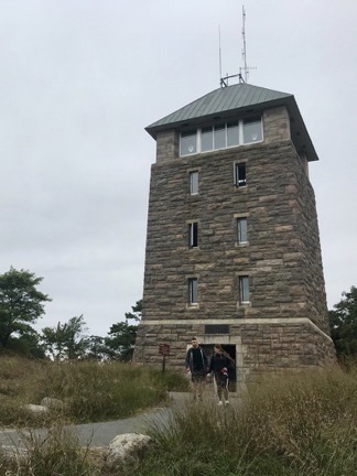
We drove back and Tammy got back to work. Tom was already working up in his office. The day had turned nice and I was ready for another day trip. This time, my destination was the Okemo Mountain Resort. Tom had told me that I could drive almost all the way up to the top of the mountain, hike a little more, and visit a fire tower at the summit. The weather looked good enough for a hike so I headed out around noon with Penny.

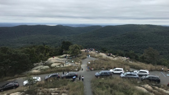
The drive up the mountain was mostly smooth with just one big pothole I almost didn’t avoid. At the top was a gravel parking lot with about ten other cars and space to back in the Maserati. I grabbed Penny’s leash and got out with her. Together, we walked through an open car gate and up a gravel road. Up is the appropriate word. The road climbed, sometimes steeply.

Tom had told me that the fire tower wasn’t visible from the road, but if I walked to the ski lift I’d be able to see it in the forest from there. But when I got closer, I found a small marked trail. I followed the sign onto a narrow trail into the woods.

Fire Tower
The fire tower atop Okemo Mountain.

Penny ran ahead, as she does. Some hikers coming back thought she was a stray and tried unsuccessfully to catch her. Then they saw me and told me what they’d thought and done. We all laughed. It was that kind of mellow, pleasant day.

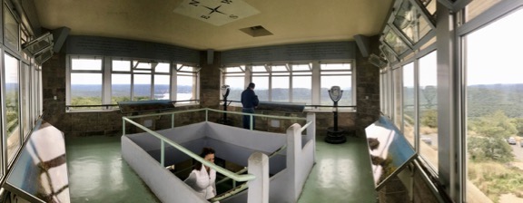
We reached the fire tower and, because the stairs looked so iffy, I picked Penny up and carried up with me. It was only five flights and each flight was narrower than the one before it. I came up through the trap door and found myself in a small area with a wooden floor and glassless windows all around. I put Penny down and took in the views in all directions. It really was a gorgeous day.

View of Ludlow
Here’s the view to the east, toward Ludlow. As you can see, it wasn’t quite peak color yet, although I think the cold rain that had been coming through Vermont may have spoiled the autumn leaf season.

I took photos in most directions, including down toward the ski lifts. Then, hearing some people coming through the woods toward the tower, I picked up Penny and headed back down.

In the forest, a couple was stopped on the trail. The husband pointed out a cool looking little snake escaping into the underbrush while his wife absolutely freaked out. I tried not to laugh as I passed them and headed back to the road.

We walked around for a while by the ski lifts. I took some more photos.

Ski Lift
View from the top of one ski lift.

I went into the woods looking for mushrooms and found a bunch — but not the ones I hoped to find. I played with the portrait mode on my iPhone and found myself disappointed again at how limited it was for subjects other than people’s faces.

Mushroom1 More Mushrooms
The obligatory mushroom photos. I took more than a dozen but I’ll only bore you with two.

After poking around in the woods for a while, we went back the car and headed down the mountain. I stopped along the way at a view point where a couple were having some wine and cheese at a picnic table. We chatted for a while (of course) and I discovered that they were from New Jersey. They tried to talk me into have lunch at the restaurant near the bottom of the road, but when I drove past a few minutes later, I knew it wasn’t for me. Instead, I drove into Ludlow, parked, and had lunch with a hard cider outside Mojo Cafe, which I highly recommend.

After a quick walk in town, we got back into the car and headed back to the T’s.

I did make one other short trip before day’s end: to that old cemetery down the road. It was full of wonderful old tombstones, many of them very ornate. The oldest one I saw dated back to 1809, making the cemetery over 200 years old. I walked among the stones, taking photos and thinking about the people who had lived and died — sometimes quite young — in the area. There was one row of stones with the same last name repeated over and over. You could follow the history of the family as you walked in one direction or the other.

Tombstone Tombstone
Two of the dozens of interesting old tombstones in this 200+ year old cemetery.

Later that evening, we were back in Ludlow for dinner. The plan had been to have dinner at Homestyle Hostel, but the place was mobbed and we couldn’t get a table. After a few craft cocktails across the street at Main and Mountain Bar, we wound up at another restaurant a bit farther down the road. I honestly can’t remember what it was called — maybe I had too many cocktails? We had a good dinner and I picked up the tab, mostly because I really appreciated having such a great week with my friends in Vermont.

Last Day

The whole time I was in Vermont, I was pretty vague about when I would leave. Originally, I was going to leave on Thursday; I had some friends in New York State I was hoping to visit for a day or two on my way back to New Jersey. But I was enjoying myself so much that when Tom and Tammy told me to stay through the weekend and my brother reported that he had to work on Saturday and go to a match on Sunday, I agreed to stay until Saturday. I figured I’d spend Saturday evening and Sunday with my friends in New York.

Saturday was the day of the farmer’s market in Rutland. Tom, Tammy, and I headed out together in the morning to see what they had that we wanted. It was a nice farmers market, even that late in the season, with plenty of produce and baked goods and other items. I wound up buying a package of frozen spaetzle, a German pasta that my grandfather and dad used to make when I was a kid. (And no, it wasn’t nearly as good as theirs was.) We wound up walking into town and having breakfast at the same place Tammy and I had eaten the day before. I had the same breakfast sandwich since it had been so good.

We headed back to the T’s after that. I’d already repacked my bags, setting aside enough clothes in a smaller bag for my overnight stay in New York. I packed everything into the car’s trunk, loaded Penny on board, and said goodbye to my hosts.

It had been a great six-day stay in Vermont, despite the less than perfect weather and the disappointing foliage. There’s nothing like reconnecting with old friends in person. I just hope I have the opportunity one day to return the favor and host them on a trip out west.

It was a little after noon when I finally left. I had a long drive ahead of me, but it felt good to be heading toward my next destination.

(Continued)

How I Spent My Autumn Vacation, Part 5: On the Road to Vermont

I revisit my past (again) and reveal a bit more about me than most people know.

(Continued from Part 4: Killing Time in New Jersey)

Overnight, trains rumbled by the historic Port Jervis Erie Hotel where I may have been the only guest. It only woke me once or twice and each time I was able to get right back to sleep. So when I pulled myself to a vertical position around 6 AM, I felt refreshed and ready for the long drive ahead of me.

I showered, dressed, and pulled together the few things I’d taken out. Then Penny and I made our exit, heading out to stow my bags in the Maserati before taking her for a walk to do her business.

Breakfast First

Town was pretty much dead at that hour of a Monday morning. The restaurant on the lower level of the hotel was closed. All restaurants that might have provided breakfast and coffee were closed on Mondays. No problem. I used Google Maps to find a place to eat and get a dose of caffeine. It directed me to Stewie’s Restaurant in nearby Matamoras, PA. We headed out.

(It wasn’t until much later in the day that I realized I left Penny’s brown fleece blanket behind in the hotel. It was a shame because the $5 blanket perfectly matched the brown of the leather sofa in my bedroom. I usually kept it draped over the back of the sofa to protect the leather from the afternoon sun and give Penny a place to sit and look out the window.)

Stewie’s turned out to be a diner-type place, which was fine with me. There were a few locals there when I came in. I ordered a breakfast special and a glass of iced tea. I don’t drink diner coffee. It’s not because I’m a coffee snob as much as the fact that I simply can’t drink the swill that comes out of commercial coffee makers and sits on a burner for hours. (Okay, so maybe I am a coffee snob.)

While I sat there, I used my iPad and Google Maps to plan my drive. I’d go northeast on Route 209, which would take me near several places that loomed large in my childhood. A few side trips might be nice. I wasn’t in a hurry to get to my destination; I just needed to arrive before dark. I had the whole day ahead of me.

Revisiting My Past

When I was a kid in the early 1970s, before my parents split, we owned a 22-foot Prowler pull trailer. Bought originally for vacationing after my dad caught a very bad cold on a tent camping trip, my parents decided that it might make a good summer home when based at a full hookup campground in the Catskills. (My family lived in northeastern New Jersey at the time.) It wound up at a place called Rondout Valley Campground in Accord, NY.

Those were great times — some of the last great times of a mostly good childhood. We lived up there all summer and made friends with other families who also lived up there every summer. The Murrays were a good Catholic family from Brooklyn with four kids in an even smaller Prowler trailer and the Smalls were a Jewish (I think) family from somewhere in Westchester county (I think) with two kids packed into a tiny Shasta trailer. We’d spend our days fishing in the creek, exploring the woods, and riding on the running boards of the pickup that doubled as a garbage truck as it made its rounds around the campground. We made and said goodbye to new friends that came for a weekend or a week. At night, we’d either play flashlight tag in the huge field studded with a handful of tiny pine trees or we’d retreat to the Rec Hall where there was a jukebox, pool tables, and pinball machines. I can’t tell you how many times we listened and danced to The Hollies’ Long Cool Woman (in a Black Dress) and Sly and the Family Stone’s Dance to the Music. One night a week, they’d play a movie in the open sided “Pavilion” — that’s where I saw The Graduate and I clearly remember Mrs. Murray pulling her kids out after the strip club scene. (Oops.)

Two things brought those days to an end. First, after two summers at Rondout Valley my parents found another campground slightly closer to home. It was brand new and cheaper and I think that’s what convinced us all — including the Murrays and Smalls — to make the move. I was excited because our new campsite would be in the woods, rather than on the edge of a big field. I have a clear memory of walking through the deserted campground on an autumn day, past what would be our new site with our big German shepherd.

But the thing that really shut down my childhood was my parents divorce. You see, while we were away and my dad was working, he was also playing. I remember the fights, I remember the screaming and cursing, and I remember the evening my dad came up to the attic room I shared with my sister to tell us he was leaving. I was sitting on the floor next to a low table he’d made for us, carefully pencilling in the irregularly shaped pavers around the courtyard swimming pool of a dream home I’d designed. (I was really into drawing floor plans back then and still like to do it.) I remember my tears hitting the pencil drawing, soaking into the paper, and creating tiny bumps.

Things got bad and then got worse and then got much better when my mom remarried and we moved to Long Island. All that took about three years, which is an eternity when you’re in your very early teens. The trailer got sold to my mother’s cousin (who married a Nazi — really, but that’s another story) and there were no more vacations for quite a while. My dad moved into an apartment with his girlfriend, who he’d later marry, and adopted her daughter from another relationship so I gained a half sister. For a while, I worked two kid jobs: a paper route and a summer job I qualified for because we were so poor. (I was one of a team of four poverty-stricken teens scraping rust off a chain link fence along a railroad track. You don’t know blisters until you’ve done this kind of work.) I got free lunch in junior high school; I’d pick up 65¢ in a small manila envelope in the school office every day and spend only what I had to on lunch in the cafeteria so I could save the change. I also became responsible for watching my brother, who was about five, and my sister, who is 16 months younger than me, while my mother went to work to put food on the table. She’d made the nearly fatal error of dropping out of high school in her senior year to get married and [six and a half months] later give birth to me. Her struggle to get a job without a high school diploma wasn’t lost on 14-year-old me. Actually, none of our struggle was lost on me and it helped make me the strong, independent, financially stable, cynical, and happily childless person I am today.

I don’t mean to play on your heart strings, dear reader. I’m just laying down the facts. Rondout Valley Campground is a sort of touchstone in my life — something I didn’t realize until today as I put down this summary as yet another lengthy backstory for a blog post.

Anyway, part of my drive that overcast Monday morning was along Route 209 that eventually brought me to Wurtsboro, which we’d pass on our way from home to the trailer. Wurtsboro was where we exited Route 17 after coming over some mountains and descending into a valley. It was memorable mostly because the airport there had gliders and we’d often see them flying overhead as we came down the hill. There were no gliders that morning; the ceilings were much too low for anything to fly and thermals that gliders rely on for flight were not possible.

Now I was tracing roads that I’d been on many, many times — more than 40 years before. I remembered numerous signs for a place called Ice Caves Mountain that I think we finally did visit once way back then and looked for them as I drove but came up empty. The place might be part of a state park now. I did pass Custer’s Last Stand, which is a soft-serve ice cream place that still exists (!), although I remember its name being Custard’s Last Stand.

Of course, there wasn’t much else familiar to me. Places change in 40 years. New York State is one of those weird old places that is constantly mixing old and new. There are homes there dating back to before the Revolutionary War near a brand new Starbuck’s or Dollar General. There are ratty old farm buildings tucked away in dense overgrown thickets, seemingly forgotten, near new condos or subdivisions.

I continued along 209 to Ellenville, which was “the big town” near the trailer. I turned right and drove through. It looked depressed and there seemed to be a lot of homeless-looking people around. But I also saw a bakery and, since real bakeries are a treat after so many years out west, I stopped and went in. Cohen’s Bakery, “Home of the Famous Raisin Pumpernickel,” had quite a selection of fresh baked goods. I bought a danish, despite the fact that I had Italian pastries in a cooler in the trunk, and hit the road again.

Google Maps had Rondout Valley RV Campground listed and I used it to home in on Accord and the campground. I admit that I didn’t find much along the way very familiar. I did remember the left hand turn just before the town of Accord. I passed the entrance to the campground, looking for familiar sights beyond: the Rec Hall and the waterfall where the creek that runs through the campground continues its journey east, merging with numerous small creeks along the way. The Rec Hall was gone and apparently had been for some time — there was nothing more than a grassy field in its place. But Mother Nature takes better care of what she builds and the waterfall was still there.

Waterfall
It might not look like much, but when you’re 12 years old, a “waterfall” like this is a big thing.

I circled back and pulled into the driveway for the campground. There was a gate with a little guard house, but the gate opened before I even had time to stop. (I guess I must have looked trustworthy in the Maserati.) There was a big building with an office and shop on the right — the old office had been on the left and was now a lounge. I pulled into a parking spot, put Penny on a leash, and walked up to the entrance. I left Penny out on the porch and went inside.

Soon I was chatting with a woman only a little younger than me about the campground. It had gone through a bunch of changes in the past 40+ years. For while, it was called Jellystone Campground — think Yogi Bear — and I dimly recall driving past with my wasband years and years ago on one of our trips in the Catskills. Now the place was part of a chain and associated with one those “RV resort” time share places. The gimmick is that you pay a fee to join and get “free” camping at member resorts. But I think this campground was also available to non-members. I didn’t ask. I didn’t have any plans to camp there with my camper nearly 3000 away.

After a trip down memory lane with her, she gave me a map and told me to drive through. I told her I’d rather walk since we’d been in the car for a few hours already. Then I went back outside to fetch Penny. Together, we crossed the one-lane bridge and walked into the campground.

Rondout Valley Bridge
The rickety bridge over the creek is the only way in and out of the campground. Once, during a summer flood, the campground had to be evacuated in the middle of the night because they thought they might lose the bridge.

As I walked along the road, I found myself walking the same way as a man about my age. Of course, we got into a conversation. He was traveling with his wife in their fifth wheel from someplace in the south — I can’t remember where. We went our different ways at the intersection where my family’s trailer had been parked that first year. Behind us had been a big, empty field. Now that field had trees and roads and campsites that hadn’t existed. The place had really grown.

Old Campsite
This is the corner where we’d camped all those years ago. (At least I think it was on the corner; it may have been one site to the right.) The trees were newly planted back then, the site was in full sun, and there was nothing but an old cow pasture behind the trailer.

I don’t need to revisit all my memories of this place. What you got above was enough. Let’s just say that a lot of the place was the same but a lot was different. There was a playground I didn’t remember. The Pavilion is now enclosed and has a snack bar. There was a new pool in the big field where we used to play flashlight tag. All the trees that had been around our campsites where huge, giving campers the shade I wished we’d had 40+ years before.

The Pavilion
The Pavilion, which had been built when we were there, is now enclosed.

As I stood on the corner in front of what had been my summer home back in 1972, I suddenly got tired of my trip down memory lane. Although I’d originally wanted to walk through the wooded area of the campground that had been limited to tent campers back then, I found myself just wanting to get back in the car and continue my drive. This had been one stop on what I’d begun thinking of as my farewell tour of the New York area. I think I suddenly realized that I’d said goodbye a long time ago. I didn’t belong there. I didn’t want to see the place as it was today. I wanted to keep my memories pure.

So I turned around and walked back to the car.

Woodstock

It was still early in the day and I had plenty of time to get to my destination in Vermont, so I took a detour up to Woodstock, NY. I had a vague idea of trying to get a local shop to take a few pieces of the jewelry I make on consignment, but I’ll be the first to admit that I’m rather shy about trying to work deals like that. In any case, Woodstock was one of the places I used to come with my wasband and friends back in the day and it was definitely appropriate for my farewell tour.

I took back roads, following the guidance of Google Maps. I wound through farmland, most of which looked neglected. There were more decrepit old farm buildings and some silos, which I rarely see out west, and lots of weeds and brambles covering stuff up. There were also lots of creeks and plenty of trees just starting to turn into their autumn colors. It was a pleasant drive with few other cars on the road.

Eventually, I reached the bridge over the huge Ashokan reservoir, crossed it, and turned east on Route 28. Another turn onto 375 took me into the outskirts of Woodstock.

There was road construction in town. They’d torn up one of the lanes of the road and were using pilot cars to shuttle traffic through a stretch of about a half mile. They had us drive on the compressed gravel side, past pavers working on the other side. I drove carefully, mindful of raised manhole covers and the like. The Maserati rides very low and I had already been warned about potholes.

Town wasn’t anything like I remembered. It had more shops and, try as I might, I could not identify the house a friend’s sister had bought and used as a photo gallery years before. (She’s long gone from the area now, supposedly living near Tucson, AZ.) I drove through town, turned around, and drove back. I parked, put Penny on a leash, and got out for a walk.

A young guy immediately tried to hit me up for a dollar. I said I was sorry but I didn’t have anything for him and I kept walking. Panhandlers in Woodstock? Really?

I went into a few shops, always asking permission to take Penny in. I got into a good conversation with a woman in one shop that I really thought would be a good match for my jewelry, but never got up the nerve to talk to her about it. That was probably a good thing, since she turned to talk about retirement and not being able to afford health care and having to keep the business open just to get by. Maybe not such a good match after all.

I left Penny outside when I went into a bookstore. I spent some time browsing and, as I always do when I go into a local bookstore, I bought a book.

We continued down almost to where the construction began, crossed the street, and walked back. I realized that my trip to Woodstock wasn’t doing anything for me. I found myself eager to continue on my way. So we went back to the car, climbed in, and headed back out of town.

The only other place I was hoping to visit was Smoke House of the Catskills, which still exists. I remember stopping there with my wasband a few times on our way home from visiting friends in Elka Park. But just my luck: it was closed.

The Long Drive

I hopped on the New York Thruway and headed north. I really prefer staying off highways on a road trip, but I had a lot of miles to cover before dark and there wasn’t much else I needed to revisit.

So I took the Thruway north, through Albany. It brought to mind the day 1985 or 1986 when my future wasband and I were part of a convoy of brand new cars heading to Montreal for a Mets game. We were in a Nissan Maxima and our companions drove a Nissan 300ZX, a Mazda RX7, and some other sporty Japanese thing. We were flying at 95 miles per hour most of the way and made it from New York City to Albany in less than 2 hours.

I never thought of the Thruway as Memory Lane, but I guess it can be.

I got off at Troy, dealt with traffic, and finally escaped onto Route 7. Although the day had gotten brighter for a while and even a little sunny, it was overcast again and would stay that way for the rest of the drive. It made things kind of dreary and unremarkable, so even though I was off the highway, I didn’t really enjoy the drive as much as I should have.

Before I hit the Vermont border, I stopped for lunch at a place called Man of Kent Tavern. I’d been passing a bunch of what seemed like British themed restaurants and figured I’d give one a try. The place was absolutely packed, but I got a table near the bar and had the most amazing hearty beef stew — perfect for a damp, overcast day of driving.

Once in Vermont, I continued north on Route 7 into the Green Mountain National Forest. My destination was a friend’s house in East Wallingford, at the northeast corner of the forest. I let Google Maps guide me. Things were fine until I reached the last turn to my friend’s house and Google put me on an unpaved road.

Google had done this once before to me, putting me on an extremely rugged road in Colorado when I was driving south with my camper and boat in tow last autumn. Not knowing how bad the road was up ahead, I’d turned around and found another route, adding about an hour to the total time of my drive that day. Although I didn’t have a boat in tow this time, I also wasn’t in a high clearance 4WD pickup. I’d promised my brother I’d be careful in his car and driving three miles on gravel wasn’t something I wanted to do.

But the road was smooth enough, with a fine, nicely graded gravel surface. I continued up the hill, driving very slowly. The road wound into a thick forest with few homes along the way. There was an old cemetery about a mile and half in that I would have stopped to explore if I wasn’t so road weary. (I’d get to it later in the week.) Then there were more houses and lots of clearings and finally my friend’s 160-year-old farm house, sitting at an intersection.

I pulled into the driveway, parked beside some other cars there, and got out, feeling good to be done driving for the day.

(Continued in Part 6: In Vermont.)

How I Spent My Autumn Vacation, Part 2: The Farewell Tour

I visit my old stomping grounds in northeastern New Jersey and southeastern New York State.

(Continued from Part 1: The Plan and Getting There)

When I got up the next morning, my brother was gone. I’m a light sleeper after midnight but I hadn’t heard him leave. Neither had Penny, which is saying a lot.

Coffee and Pastry

Bluetooth Pairing
I introduced my brother’s car to my phone so I could listen to my own music and enjoy hands-free phone communication while driving.

I washed up, got dressed, and headed out with Penny in search of coffee. My brother doesn’t drink coffee and his bachelor apartment is lacking in a few of the things I consider necessary, including a way to make coffee. I used Google Maps to track down a coffee shop in nearby Westfield and we headed out in the Maserati to find it.

There was a lot of police activity in Westfield at 7:30 AM and I couldn’t get to the place I was trying to find. I soon realized that there was some sort of street fair that day and the streets were blocked off for that. I parked in a lot, walked right past a Starbucks, and headed off with Penny to find the local coffee shop. I found something better: an Italian pastry shop.

Understand that when you’re born and raised in the New York City metro area — especially by a family with some Italian heritage — Italian pastries are a part of your life. I have a favorite — pasticiotti — which is a sort flakey, covered pie crust filled with custard. It’s extremely hard to find — in fact, the only place I’ve ever found them is in a real Italian pastry shop. Needless to say, there are no Italian bakeries in Wenatchee — hell, there are few real bakeries at all in Wenatchee — and I haven’t found one in Seattle yet, either. So I was pretty starved for Italian pastries and felt thrilled to stumble upon this one.

So at 8 AM, I sat at one of just two tables outside the bakery with Penny, munching a pasticiotti and sipping a rather disappointing coffee while watching various vendors drive up and begin setting up their spots for the street fair. Bovella’s pasticiotti was passable, but not nearly as good as they make them at Ferrara in Manhattan’s Little Italy. But their rainbow layer cookies, which bought to snack on throughout the day, were perfect.

Although I would have liked to attend the fair, it didn’t start until 10 AM and I certainly wasn’t willing to sit around for two hours. So we walked back to the car, climbed aboard, and headed out.

Return to the Palisades

Where were we going? I had some loose ideas. I wanted to hike along the New Jersey Palisades. There’s a wonderful trail there called the Long Path and I knew that if I parked at the State Line Lookout, I could easily access the trail. So that’s where we headed first.

But we didn’t take a direct route. Instead, we went up the New Jersey Turnpike to the Paramus Park Mall exit. I had this weird idea about driving past my old house. For years, when I worked in Red Bank and, later, Roseland, NJ, I’d come home this way and I figured that I’d just follow the road as I had back in the 1990s. But although I remembered a lot of landmarks, I didn’t remember all the turns. I couldn’t find my way from memory. Ouch. I wound up following road signs instead.

Eventually, I drove past my old house — the first house my future wasband and I had bought way back in the mid 1980s. The house looked remarkably the same, although someone in the past 20+ years had replaced the jalousie windows with modern ones that were likely a lot more energy efficient. The neighborhood looked a bit run down, but still suburban New Jersey. In town, the butcher/market where we’d bought food for dinner most nights was closed with a For Rent sign in the window. The town looked sad. Even the gas station on the corner was boarded up. I continued on my way, taking only one photo, noting the deer grazing on someone’s lawn as I drove out of town.

Harrington Park Market
One of my fondest memories of my first house was walking one block into town to this German butcher shop/market to buy fresh, hand cut meat for dinner.

There was construction so I couldn’t drive the usual way — which I did remember — to neighboring Closter, NJ. I followed detour signs and eventually made it into town. Although the town’s Main Street looked pretty much the same, the strip mall that used to have a Grand Union supermarket was different. Now there was a Whole Foods. I stopped and picked some soup, bread, and dog food. Then we continued on, up the steep hill into Alpine and eventually onto the Palisades Interstate Parkway.

It was a gray day and fall had not yet arrived. I remembered the last time I’d been at the lookout — with my future ex-sister-in-law in 2013. It had been closer to Halloween and the leaves were just peaking. We’d gone for a hike down to the ruins at the bottom of Peanut Leap Falls and, afterward, hiked to the State Line Lookout. State Line Lookout was also a big part of my past — in the 1990s, before moving to Arizona, my future wasband and I had belonged to a motorcycle club that met there for rides most Sundays in the spring, summer, and autumn.

View from State Line Lookout
The view from State Line Lookout, looking southeast. That’s the mighty Hudson River down there. The cliffs on the New Jersey side stretch all the way down to the George Washington Bridge, which is just beyond the range of this photo.

The place looked just the way I remembered it: the big parking lot filled with visitor cars and motorcycles, the old CCC-built refreshment/gift shop, the lookout points where you can see up and down the Hudson River and out over Westchester County. We got out and went to one of the overlooks where a bunch of photographers with long-lensed cameras were scanning the skies. Birdwatchers. I asked what the’d been seeing. Mostly hawks, but they had seen a bald eagle earlier in the day. I didn’t tell them that a bald eagle often roosts in one of my neighbor’s ponderosa pine trees at home.

Palisades Steps
Looking back up the steps that take you down toward the Hudson River from the top of the Palisades at State Line.

We set off on a hike along the Long Path. My destination was the Women’s Federation Monument, a stone structure built and dedicated in 1929 that looks like a little castle. To get there, you follow a well-marked trail into the woods, down a flight of rugged CCC-built steps, across a little wooden bridge, and up a trail on the other side of the ravine. It’s not a long walk, but portions are steep. I remember taking my grandmother on this walk years ago, not realizing how steep it was. Along the way, she saw a snake on the trail and attacked it with her walking stick. (She was a gutsy old lady.)

We passed a few hikers walking in the opposite direction when we reached the bridge. That’s where the trail forked off and descended all the way down to the river. We continued to the little castle. When we arrived, we had the whole place to ourselves.

Womens Federation Monument
The Women’s Federation Monument is a tiny castle overlooking the Hudson River on top of the New Jersey Palisades.

I took pictures from various angles, went up to the parapeted rooftop, and came down for a look over the river. Although it was quiet there, I could hear the sound of cars zooming by on the Palisades Interstate Parkway only a quarter mile away through the dense forest. After a while, another woman hiking with her (larger) dog arrived. We chatted briefly before I continued on the trail. I hadn’t gone far when something an odd shade of blue-green caught my eye. I made my way through the undergrowth and found myself at the edge of an abandoned swimming pool.

Abandoned Swimming Pool
This long abandoned swimming pool is the only trace I saw of the cliff-top estates that once lined the Palisades. The woman in the upper right corner of the photo is the other hiker, who I called over when I found the pool. She said she hikes there all the time and had never seen it.

(By the way, you can see a weird little documentary about the history of the Palisades Interstate Park here. It includes a photo of the dedication of the Women’s Federation Monument in 1929 and some footage of construction at State Line Lookout.)

Penny and I followed a narrow side trail that kept us close to the edge of the cliffs. It was quiet and gave the illusion of being remote. I met up with the other hiker a few times and a jogger passed by once. Other than that, it was surprisingly deserted for midday on a Sunday.

After a while, we made our way back past the monument, down the hill, across the ravine, and up the stairs to the State Line Lookout. I got my soup and bread and the dog food out of the car and sat at a picnic table with Penny for a quick lunch. A motorcyclist stopped by to chat about the Maserati for a while — he knew more about it than I did. I put Penny in the car and walked back to the Lookout’s snack bar/gift shop building for another look inside. It looked the same, but better. I was glad that the hot dog cooker (and its smell) was gone. I bought a bag of potato chips and headed back to the car.

There was a Ferrari and a few other exotic cars parked in a fire zone along the edge of the parking lot as I left. I wondered if I could have made a few new friends if I joined them with the Maserati, but didn’t bother to try.

Piermont and Beyond

My brother had recommended taking the car up route 9W (no, not 9 west, Google) to open it up a little. So that’s what I did. I don’t know what he was thinking — there were lots of lights and just enough traffic to take the thrill out of driving. Maybe he expected me to go all the way up to West Point? In any case, I didn’t make it that far.

I stopped for a while in Piermont, an old town just downriver from the Tappan Zee Bridge. When I was a kid, it barely existed. But in the past 40 years, it had become gentrified, with lots of upscale housing, shopping, and dining on and near the pier. We walked through a disappointing Farmer’s Market and then strolled through town, where I visited a few shops. I also stopped in the park for a look at the bridge that replaced the old Tappan Zee, which I hear they want to name after Mario Cuomo, a former New York Governor. To me, it’ll aways be the Tappan Zee, named after the Dutch name for the wide area of the Hudson River it crosses.

Tappan Zee Bridge
In the distance, I could see the old Tappan Zee Bridge, which is now being dismantled, along with its replacement.

Then we continued up 9W along the river. I stopped for just a moment at the site of the old Hudson River National Defense Reserve Fleet, which is now marked with a placard and pair of ship anchors. When I was a kid, my family had a small motor boat that we’d launch under the George Washington Bridge. Common day trips back then included a cruise around Manhattan Island, a trip down to the Statue of Liberty, or a trip up the Hudson River, sometimes as far as West Point. Back in those days, the Navy had a fleet of ships anchored at a point along the river, waiting in storage in case they were needed. I clearly remember my father steering our little motorboat up and down the rows of huge ships parked there. They were removed back in 1971 — gives you an idea of how old I am (!) — and sold for scrap, but the memory is strong.

Ghost Fleet Monument
This is all that remains of the dozens of Navy ships once anchored here.

At this point, I was just driving, trying to enjoy the fast car but getting stymied by traffic lights and slower traffic. But I kept driving. Part of me wanted to see the old Bear Mountain Bridge, which was the next Hudson crossing. Another part wanted to check out the rib joint my brother likes near West Point. I eventually reached the bridge but, by that time, I decided to skip West Point. Instead, I headed toward Bear Mountain State Park. I would have stopped in for a quick visit to the Bear Mountain Inn — I remembered its cafeteria-style dining from my last visit 25+ years ago — but it looked crowded with day trippers from New York and the parking lots were full. And had there aways been a fee for parking? So instead, I hopped on Seven Lakes Drive, a place I knew I’d get a good driving experience. It was there that we’d often come with our motorcycles on a Sunday morning, whipping, one after another, around the curvy roads that wound through the forest between the lakes.

Perkins Tower
Perkins Tower, from the ground.

But first another stop: Perkins Tower. I couldn’t remember ever being there, but I know I had been at least once, probably on a motorcycle outing with the group. I followed the road up to the top and squeezed into a parking spot near the tower.

Leaving Penny behind, I made the short walk to the tower and the climb to the top. There were a handful of people inside — I guess most of the folks whose cars filled the parking lot were out hiking or admiring the view from ground level. At the top is a room with views in every direction — and annotated photographs for each direction that point out landmarks.

Perkins Panorama
Here’s a panoramic view of the inside of Perkins Tower, shot from one corner.

I popped a quarter into one of those binocular do-dads for a look at the skyscrapers of Manhattan through the haze, then made sure anyone standing nearby got a look, too. Autumn had barely touched the area; I knew the view would be spectacular in just a few weeks.

Perkins View
The view south from Perkins Tower on that overcast day. You can see the Hudson River above the trees on the left. Manhattan’s skyscrapers are nearly dead center over the trees, but you can’t see them in this shot. My brother’s car is just left of the path; I’m not really sure if that was a parking spot, but it worked.

I came down the tower, climbed back into the car where Penny waited, and then drove back down the mountain. I followed signs for Seven Lakes Drive. Soon I was on vaguely familiar winding roads, ignoring the posted speed limit signs just as we had on our motorcycle flights through the area years ago. It was pleasant, but it wasn’t the same.

More Reminiscing — and a Good Meal

At the south end of the drive, it was time to return to my brother’s place. That’s when I was reintroduced to the unpleasantness of Sunday afternoon traffic.

I quickly got off the highway and started taking back roads, using Google Maps to help me find one county road after another. I wove my way southeast through Rockland County. In one area I drove through, there were all kinds of makeshift huts erected near people’s homes and in their driveways. They triggered a memory from my college days when the on-campus Jewish student club, Hillel (thanks, Google!) built similar structures in September. Doing my homework now, I realize that it was September 23 and the structures were sukkah structures for the Sukkot festival. I was passing through an Orthodox Jewish community. I hadn’t seen sukkah structures since I left the New York metro area back in the late 1990s.

I eventually made my way back to the Palisades Interstate Parkway and got off at Exit 2. From there, I drove to Hillside Avenue and turned west toward the town I’d been raised in, Cresskill, NJ. I came down the hill past the huge estates, recalling the days when my father would take the family on a Sunday drive up “the rich people’s hill” where the big houses were. He had no idea what was to come.

I drove through town, past the building my grandparents had owned with their bakery on the ground floor — it’s still the upholstery shop that went in when they sold in the 1970s. Then up Grant Avenue, past my third grade best friend’s house — she moved to Old Bridge after third grade — and right on Brookside Avenue. I turned left onto Merrifield Drive — renamed for my neighbor after he won the Nobel Prize for Chemistry in 1984 — and drove slowly past the site of my old house. Built in 1901 on 3/4 of an acre of land, it had been torn down about ten years ago and replaced with a pair of ugly McMansions. This was the first time I’d seen them and I wasn’t impressed. It was nice to see that the rest of the neighborhood was mostly intact and that the Heberts still lived in their house on the corner and had a big garden every summer.

And no, I didn’t take a picture. I’d rather remember it as it was.

Why “The Farewell Tour”?

You might be wondering why I titled this part of my trip account “The Farewell Tour.” Well, it’s mostly because I spent so much time revisiting the places that had been a part of my life from birth through 1997, when I moved with my future wasband to Arizona. I don’t get back east as often as I used to, mostly because my only relative there is my brother. Throughout this trip, I worked with the premise that I might never be back at all. So every time I revisited one of the places I used to go, I looked at it through the eyes of someone who might never see it again. I know it sounds odd or even sad, but I’m realistic about these things. Why revisit old places again and again when you can visit new ones? That’s what I need to focus on from now on.

I drove south on Jefferson Avenue, past the place I used to pick up newspapers for my paper route in the late 1970s, eventually getting to Tenafly. From there, followed the road along the tracks to Englewood. I’d already decided where I was having dinner: Baumgart’s. That’s where my wasband and I used to eat once in a while. It’s a Chinese restaurant with an Art Deco look and a Jewish name. My grandmother used to eat there sixty or seventy years ago when it was a regular old lunch counter cafe.

I ordered the cold noodles with sesame sauce — they used to make the best — and an eggplant with chicken dish. Then I texted my brother to see what he wanted and made another order to go for him. I took my time eating, remembering other meals there. The noodles weren’t as good as I remembered them and they no longer put pickled broccoli stems — don’t knock them until you’ve tried them — on the table to munch on while you wait for your food. But my meal was good and I was glad I’d come.

Inside Baumgart's
The inside of Baumgart’s in Englewood. There’s still a lunch counter up front. There weren’t many people there, probably because it was pretty early for dinner.

I let Google guide me back to my brother’s place. By that time, traffic had subsided and I was traveling away from New York, anyway. I had a little trouble finding my brother’s home — he lives in a huge garden apartment complex — but eventually homed in on it. I parked the car, locked it, and went inside with Penny for the night.

Tomorrow would be the start of my first big trip on this vacation and I wanted to get some rest.

(Continued in Part 3.)

The Long Road Home

I make my way home from my winter travels, slowly but surely.

I’m writing this in my RV at a campsite in Maryhill State Park in Washington State. As I so often do when traveling through the area, I arrived late enough in the afternoon to stop for the night. Yes, home is only a 3-hour drive from here, but I don’t like driving at night. I have come to use Maryhill as a sort of post-trip celebration spot, a place I wind down from a long trip and start getting myself mentally prepared for my return to home.

As usual, the campground is nearly empty and I got a nice pull-through spot along the river. There’s electricity and a sewer dump at my site, but the water is still turned off for the winter. That’s okay; I filled up my fresh water tank in Las Vegas before I left and have plenty of water left.

Away from the Camper

Las Vegas is where I went after my helicopter mishap on February 24. My truck, camper, and boat were waiting there for me in a “storage” site at the Sam’s Town KOA. Although I generally avoid KOA camping, I really do like the one in Vegas for what it is: city camping. With my small rig, I can take one of the double-width sites along the edge of the campground property and not be right on top of my neighbor. I’d parked the boat beside the truck and camper before coming home in mid February to fetch the helicopter and take it down to California for a frost contract. I was able to plug in to power, which saved a ton of propane for the fridge, and the KOA folks charged only $15/day while I was gone. It was good to leave my stuff in a place I knew it would be safe.

The original idea was to go right back to Vegas after tucking the helicopter into a hangar at Yolo County Airport, but the weather in the Sacramento area turned cold and I wound up in a Woodland motel for a week in case I had to fly for frost control.

I spent my days goofing off, going as far as Calistoga for a mud bath and facial one day. (I am a sucker a good facial.) I managed to visit two wineries for tastings before heading back.

When I finally got to fly, the flight was very short with a bad end.

After being discharged from the hospital’s emergency room, my friend Sean took me to see the wreckage and we pulled out the last few personal possessions I had in there. (Sean had already collected quite a few things.) We stowed them in the hangar. Then I drove my rental car to Sacramento Airport, dropped it off, and waited in the terminal for a Southwest flight back to Vegas. With no helicopter or frost contract, there was no reason to stay in Woodland.

In Las Vegas

I was back in my RV by 6 PM. As you might imagine, I had a little trouble getting to sleep. Every time I closed my eyes, I’d see those damn trees in front of me. But putting the TV on seemed to help. And I eventually got a decent night sleep.

I took a full inventory of my bruises the next morning in the shower. That day — Sunday — is when the soreness really kicked in. I later learned that the helicopter impacted the ground at least twice before coming to rest against a small berm in the field where I crashed. I must have been like a rag doll in there with my muscles all tensed up from the adrenaline rush. (I don’t remember any of it, but without a head injury, I don’t think I passed out. It’s just blank.) Once my muscles relaxed a little, every single one of them got sore. The ibuprofen I was taking took the edge off.

I started the active part of my day by repositioning my truck, camper, and boat to a site on the south side of the RV park. It was a nice site with grass behind it — which is good since the camper’s door is in back. I hooked everything up — electricity, water, and sewer — since I’d be staying for the week.

I went to the convention center to meet up with my friend Zac from HAI (Helicopter Association International). The show wasn’t open yet, but he was in charge of guiding the helicopters in to land in the Convention Center parking lot. From there, they were wheeled into the building to be put on display. He got me an exhibitor pass so I could come in for a behind the scenes look at the show getting set up. Later, I joined him outside to watch (and broadcast on Periscope) a few of the helicopters that came in. It was fascinating and a lot of fun, but the walking really took a toll on me. By 5 PM, I was spent.

Show Girl
Eve didn’t like the location of the booth so she hired a model to attract attention to it during the show.

On Monday, I helped my friend’s Jim and Eve, who own Rotorcraft Enterprises, set up their booth at the show. Jim invented Start Pac, a battery device for helping to start turbine engines. He has since branched off into a bunch of other related products, including an APU for jets, a Start Pac for locomotive engines, and small battery devices to provide power when testing avionics on an aircraft. Jim’s a great guy — a former airline pilot who started flying helicopters in retirement. Like me, he lived in Wickenburg and left. I’m sure I’ve written about him elsewhere in this blog.

By the time we’d finished setting up, I was spent (again), but I went with them to lunch at a German restaurant near their office. Eating a good meal really picked me up. But I still went right back to the RV to relax. I slept a lot better that night.

Tuesday, Wednesday, and Thursday were spent at Heli Expo. I chatted with Pat Cox and Tim Tucker at Robinson to tell them about the crash and show pictures. They were very interested and even dragged Kurt Robinson over to see them. They were certain that the helicopter’s bladder tanks, which I’d whined about installing, had saved my life. I talked to the folks at Hillsboro Aviation, which had sold me my R44 back in 2004, about a new helicopter; I’m still waiting for a price quote but seriously doubt I’ll replace it with a new one. (They’re a lot more expensive now!) I walked the entire show floor and found a neat video solution for tours and YouTube videos; I might take the plunge and get a setup this summer. I met up with numerous friends, including one of the few people who had flown my helicopter without me on board and my first flight instructor, who now works for the FAA. I also walked the show floor early one morning, before it was open to the public, to get some really great photos of some of the helicopters there without people hanging all over them. I posted them all to Twitter.

The MD Booth
There’s nothing quite like walking a trade show floor before the public is let in. This is a panorama of the MD Helicopter’s booth on Thursday morning.

I treated myself to dinner at the MGM grand on Wednesday evening before heading back to my camper. And I took a break from the show at midday on Thursday to treat myself to a cocktail and lunch at the Wynn resort. So much of my traveling this winter has been low budget, so it was nice to get a few doses of luxury.

A Parisol Down
I sat along the pond at the Wynn’s Parasol Down cocktail lounge. It was a nice, peaceful escape from the Heli Expo show.

On Thursday afternoon, the show closed promptly at 4 PM. By 4:15, they were wheeling helicopters out the door. I joined my friend Zac again with Jim and another Start Pac employee tagging along to watch the departures. I broadcast on Persicope and they featured the video so I soon had hundreds of viewers. I think a total of 10 helicopters left. The rest would leave the following day. Zac invited me back but I’d had enough.

Leaving Las Vegas

The next morning I had breakfast at nearby Sam’s Town Casino, then packed up leisurely and was on the road by 10 AM. It was wicked windy out as I headed down I-15 toward Los Angeles.

Camping at Lake Isabella
My campsite on the shore of Lake Isabella.

Although I usually drive through Death Valley on my way to Sacramento with my rig, I decided to take a more southern route this time, hoping to avoid snow in the mountain passes near Lake Tahoe. I was aiming for Lake Isabella, in the foothills of the Sierra Nevada. I arrived about a hour before sunset and got a nice campsite right on the lake.

Lake Isabella at Dawn
I shot this from my camper’s back door at dawn at Lake Isabella. It was an amazingly beautiful morning.

The following morning, I was back on the road. I think it was then that I realized how much I just wanted to be done traveling. So I made my way out of the mountains and joined route 99 north. I took that all the way to Sacramento, then hopped on I-80 to Davis.

In California Again

I stopped at the same hospital I’d been in the week before and checked myself into the ER. A number of friends had suggested that blood clots could be an issue. The bruises on my lower legs were horrendous with a few painful spots. Although I no longer needed ibuprofen for pain, I was starting to wonder whether I had a bigger problem than just bruises.

I stayed for about two hours. They did blood work and used ultrasound to scan my legs for clots. I got a clean bill of health but the doctor suggested that I get it checked again in a week.

I spent the night camped out at the hangar at Yolo County Airport. I parked right next to it. Around 2 AM, Sean arrived and sat in his car, waiting for a call to fly. I didn’t realize he was there until I woke at 4 AM. It was foggy out and the ASOS (Automated Surface Observation System) was reporting freezing fog. Even if he got a call, he couldn’t fly.

The fog was still thick when the sun rose. I got dressed for the day and went into the hangar to organize my personal possessions from the helicopter. I packed them in my truck for the ride home and said goodbye to Sean. I would not be back next year for a frost contract, but there’s a chance he’ll join me in Washington for cherry season this year.

The fog was localized; there was none north of Woodland.

I tried to retrieve my cockpit cover from the salvage guy, but it was Sunday and his place was closed.

I drove up to Williams to have lunch with another pilot fired of mine who was on a frost contract up there. I tolerated his mansplaining about how he finds his orchards in the dark. I deserved the lecture. But, at the same time, it didn’t really matter. I changed the subject.

I thought I might need to meet with the insurance adjuster and Sacramento FAA guy, but they didn’t need to meet with me. That meant I had no reason to stay in the area. So I left. I hopped on I-5, set the cruise control for 62, and headed north.

In Oregon

I tried hard to get to the Seven Feathers Casino in Oregon. Casinos make excellent overnight spots for RVers. They have big parking lots and good security. And being able to go in for dinner or breakfast the next morning is a real plus. But as the sun was getting close to setting, Seven Feathers was still about a hundred miles away and, like I said, I don’t like driving at night. (Besides, I suspect the boat trailer’s running lights aren’t working, although I know the turn signals and brake lights are.) So I wound up in a Walmart parking lot in Medford with about a dozen other RVers.

I walked over to the Outback Steakhouse and treated myself to a blooming onion, which I used to really like. They’re a lot greasier than I remember; I only ate about 1/3 of it.

The next morning, I was back on the road as soon as the sun was up and the overnight frost started to melt. Someone on Twitter had mentioned that the I-5 corridor was IFR (Instrument Flight Rules) and he wasn’t kidding. I drove for two hours through big patches of fog.

My first destination was McMinville Airport where a 2005 R44 was for sale. I had an appointment to meet with the owner at 11 AM. It was a 4-hour drive from Medford and I was a little late because I had to stop for fuel. I saw the helicopter, which is only a few months newer than mine was and it looked fine — but not like mine inside. I still haven’t decided if I’ll put an offer in on it.

From there, I drove another hour north to an Apple Store in Tigard. I had a heck of a time finding parking — the store was in one of those modern outdoor malls designed to look like a downtown area. Nice place and I would have loved to spend the day shopping there, but I had a mission. I needed to buy a new iMac. The one I have at home, which is now 7-1/2 years old, refuses to start. It had been on the fritz for about a year, but it’s now dead. I think it’s a logic board or possible a video card problem. It doesn’t matter. I’m replacing it.

I wound up with a 27-inch iMac. I had to wait while they expanded the RAM from 8 GB to 16 GB. I had lunch at PF Changs while I waited. I ate too much. There was a bit of a challenge getting the computer out to my truck, but the Apple Store folks were helpful. Then I was on my way again.

I hit some early rush hour traffic in Portland — by this time, it was about 3:45 — before getting on I-84 eastbound. This is a really pretty drive along the Columbia River in Oregon, past numerous waterfalls in the Gorge area. I tried two state park campgrounds along the way but both were “closed for winter.” I knew Maryhill would be open. I stopped for fuel one last time in Biggs, OR, then crossed the river and pulled into the site I am in now.

I fed Penny but skipped dinner; I was still full from lunch.

Today’s Drive

The sun is now up, illuminating the basalt cliffs west of the park. The wind turbines up there are glowing bright white but are motionless in the still air. The frost on the ground is just starting to melt. My camper is warm; the small electric heater I brought along has been running all night. My next door neighbors pulled out a few minutes ago; we’ll leave in less than an hour.

Campground View
The view out my back door this morning. Note the frost on my boat cover and grass.

It’s an easy drive up route 97 to I-90 near Ellensburg. From there, I’ll head east to Vantage, cross the river, and come up back roads from George through Quincy to Wenatchee. I might stop at Fred Meyer for groceries to save myself a trip later on.

My house sitter left last night so I’ll have my home to myself. The cats will come out to greet us. I’ll collect this morning’s eggs.

And then I’ll go inside and run the water for a nice, hot bath.

There’s no place like home.

The Eclipse Trip Days 5-7: The Palouse, Spokane, and Lake Roosevelt

I finish up the trip in an uneventful way.

Although I tried hard to blog about each day of this trip shortly after it happened, I ran out of steam after my trip to Walla Walla. I think there are two reasons for this:

  • The rest of the trip wasn’t very interesting.
  • I spent a lot of time driving.

So I’ll just sum up here.

Day 5: Walla Walla to Palouse Falls

In the morning, I went down to the motel breakfast room for coffee, eggs, and sausage. They were all horrible. Honestly: I’d rather have a cold and stale Egg McMuffin than just about anything served up at a motel’s “free” breakfast. The eggs and sausage were so bad that even Penny wouldn’t eat them.

Later, after packing up and stowing my things back in the camper, we went for a walk on Main Street. I stopped at an outside cafe for a good cup of coffee. They sold fresh figs by the pound inside so I bought a pound to munch on later in my trip. I love figs so, as you might imagine, they didn’t last long.

I wanted to get some wine tasting in before I left town and to do that I had to wait until 11 AM. That’s when I hit Trust Cellars on 2nd Street. The hostess from the restaurant where I’d had dinner the night before had recommended it. I chatted with her father, the wine maker. I soon began to realize that very few Walla Walla area wineries grew their own grapes. The wine was pretty good, so I bought three bottles.

From there I went to lunch at a “southern comfort food” restaurant on Main Street called Whoopemup Hollow Cafe. I had a gumbo that was good but took half of it to go. I also had a peach cobbler for dessert that was excellent.

Then on to Walla Walla Airport. Yes, the airport. Believe it or not, quite a few of Walla Walla’s wineries have tasting rooms at the airport. It used to be an air force facility and there are lots of barracks and other buildings there dating back to the World War II era. Wineries have set up shop in these buildings. Although most are simply tasting rooms, a few also do production and/or bottling. I visited two tasting rooms next to each other, Buty Winery and Adamant Cellars. Buty had been recommended by the winemaker at Trust. Neither impressed me, but I bought a bottle from each because I always buy wine when I go tasting unless it’s simply undrinkable.

I’d wanted to hit a third winery at the airport but since I was so unimpressed with the first two and had drunk enough before 2 PM, I headed out instead.

My destination was Palouse Falls, where I hoped to spend the night. The drive would take me through much of the Palouse, a sort of mecca for photographers.

The Palouse is an area of Washington State with rolling hills covered with wheat. At a certain time of the year — July and early August, I expect — it’s an amazing place to photograph — well, rolling hills covered with green (July) or golden (August) wheat. Google Palouse Image and see what I mean.

I’ve always wanted to get out there in just the right season, but that season happens to be my cherry drying season when I’m pretty much stuck in the Wenatchee area. So I can’t see it until the wheat has already been harvested and it isn’t nearly as attractive.

The drive was a lot longer than I expected but was pleasant and scenic without the least bit of traffic. Honestly, I think that my road trips have spoiled me because of often travel to places on routes that no one else seems to use. The only time I experience traffic these days is when I’m driving through Wenatchee and have to deal with traffic lights.

Palouse Falls is a 200-foot waterfall on a place along the Palouse River where it cuts through a canyon and drops into a crack in the terrain. The visitor parking area is on a hillside overlooking the falls so most of the photos you see of the place look like aerial shots.

Palouse Falls from the Overlook
I shot this photo of Palouse Falls from the parking area not long after our arrival. The light was flat and never did get interesting during my stay.

Permit me to vent a little about No Fly zones for drones.

First of all, the No Drone rule at Palouse Falls is a Washington State law. It prevents people from launching a drone from within any State Park. Palouse Falls is a State Park.

What it doesn’t prevent is launching a drone from outside a State Park and flying it into that park. You see, the state doesn’t control the airspace. That’s the FAA’s jurisdiction. As I pilot, I know a lot about airspace and where it’s legal to fly. I also wrote a whole book about FAA Part 107, which lays out regulations for commercial drone flight that include regulations for non-commercial drone flight.

So there would be nothing stopping me from launching the drone from outside the park and flying it into the park as long as I didn’t fly over any people, kept it below 400 feet above ground level, and somehow — this is the tricky part — managed to keep it within sight at all times.

But do you want to know what’s really crazy? I could fly my helicopter into the park, which I guarantee would get a lot more notice than a half-pound drone, and maneuver it down into the canyon to get the shot I wanted. Legally. Again, the state does not control airspace and as long as my skids didn’t touch the ground inside the park I wouldn’t be breaking any laws.

Would I do that? What do you think?

It’s just an example of how absurd the rules can be — prohibiting one activity that could be a minor annoyance to a few people while allowing another activity that would definitely be a major annoyance to everyone within the park.

In reality, a better view of the falls would be from a drone hovering below the operator inside the canyon. In fact, it would be a perfect shot. But although I had my Mavic Pro with me, there were enough No Drone signs and other visitors to prevent a launch.

It was a gray day. Beyond the smoke-induced haze were clouds spreading rain in the area. I had a cell signal and could track a few rainstorms on radar. It rained a little on us, but not enough to get wet.

Tired from driving and still hoping to do some nighttime photography there, I paid for a campsite and parked next to it. This was apparently a no-no, as I learned from a ranger in the morning. He didn’t cite me but he did lecture me until I pretended to understand and agree with the absurd rule. Yes, tent campers are allowed to park in the lot and then pitch a tent on the grass and sleep in that. But no, people without tents can’t just park a car or truck in the lot and sleep in their car or truck. The rule had nothing to do with parking but everything to do with where you actually slept. If I had pitched a tent and slept in that, there would have been no problem. Next time, that’s what I’ll do.

Palouse Canyon
I think the view down the river from the falls is far more interesting than the falls themselves. Look at those layers of basalt!

In the meantime, the girl who’d parked near me and slept in her car, slipped away while I was being lectured. I didn’t turn her in. Heck, not everyone can afford camping gear. Why shouldn’t she be allowed to spend the night in a safe place, sheltered by her own vehicle? The rule was absurd and I certainly had no intention of helping them enforce it.

Of course, the sky never did clear up that night so I didn’t get the opportunity to do any night photography.

All in all, I consider my trip to Palouse Falls a disappointing bust.

Day 6: Palouse Falls to Lake Roosevelt via Spokane

My Palouse Falls experience left a bad taste in my mouth that I was eager to wash away. I figured that a trip to Trader Joe’s in Spokane to stock up on a few pantry goods followed up with lunch in my favorite Ethiopian restaurant — okay, so the only Ethiopian restaurant I know — would fix me right up.

But I did make one interesting stop along the way: Steptoe Butte.

Steptoe Butte is a granite outcropping that juts up out of those rolling hills. It’s tall so, as you might expect, they put antennas on it. There’s a road that spirals up to the top and offers unobstructed views in every direction.

View from Steptoe
The view from Steptoe Butte. I think this was north, but it could have been any direction. The view is pretty much the same no matter where you look: lots of rolling wheat fields.

Road to Steptoe Butte
When I say the road spirals, I’m not kidding. Here’s how it looked on Google Maps on the way down.

On the day of my visit, it was still hazy with smoke. It was mid afternoon and the light was flat. In other words, not the best conditions for landscape photography. Of course, camping isn’t allowed up there so anyone with the thought of spending the night after a golden hour evening shoot or before a golden hour morning shoot (or both) would be disappointed. No camping anywhere near there at all. Still, photographers make the long drive out there pretty regularly before dawn or back after sunset to be there at the right time. That wasn’t going to be me, at least not that day.

I came back down and continued on to Spokane. A little over an hour later, I was battling local traffic to maneuver my rig into a Trader Joe’s parking lot (which, fortunately, was part of a strip mall parking lot), shopping for things I can only get at TJ’s (if you like sardines, their sardines in olive oil are the best), and then making my way to Queen of Sheeba Ethiopian Cuisine on the Spokane River (great food).

Then I faced the option of ending my trip by making the 3-1/2 hour drive home or staying on the road one more day and finding an interesting campsite to spend the night. Not really fully decided either way, I found a few potential overnight destinations on the map that were also on the way home. If I found a spot I liked, I’d stop. Otherwise, I’d drive home.

I wound up along Lake Roosevelt, a very large lake on the Columbia River created by the Grand Coulee Dam. I’ve flown over it a few times and it’s the kind of place I’d really like to spend more time exploring, preferably with a boat or even a houseboat.

It was late Thursday afternoon, and the first campground I stopped at, Keller Ferry Campground, was crowded with loud RVers and their loud families. I almost backed into a campsite that was not much more than a glorified parking space in an asphalt lot with a picnic table on the grass nearby. But I knew I’d hate it and I hate paying for things I hate. So I pulled out and continued on my way.

The second campground, Spring Canyon, which was nearly all the way to Grand Coulee, was much more pleasant. Lake Roosevelt is a National Recreation Area and this campground was managed by the park service. The other was managed by a concessionaire and you can really tell the difference. The sites were on a hill with views of the lake. The spots were spread out a bit with lots of shade but little underbrush. I drove around and finally found an open spot that just happened to be designated as handicapped. A sign said that if it was still available after 6 PM, anyone could have it for one night. (Apparently, handicapped campers need to get where they’re going by 6.) It was 6:30. I only needed it for one night. I backed in, checked the level, was satisfied, and shut the engine.

It wasn’t until after I paid the $12 fee in the self-pay station that I regretted my choice. That’s when the white trash family in the site next to me went off the rails. They had three young sons aged 12 and below and one of them — I never could figure out which one — was misbehaving. That got dad yelling and threatening. Then mom joined in. Soon they were both yelling and cursing at each other and the kids. I have never heard a couple throw the F-bomb so loudly in public in front of their own kids and other kids as much as these two did. Fuck this fucking fucked up thing. Well, okay, not exactly that, but close. It reminded me too much of time spent with my ex-brother-in-law, a low-life loser who couldn’t complete a sentence without some form of the word fuck in it. But these people were doing it loudly in a campground full of families.

I wanted it to stop. I looked around for a ranger but didn’t see anyone. I was just starting to wonder if it was worth complaining to the campground host when they finally settled down. I think someone got sent into the tent. Mom settled into a chair to study her phone. Dad disappeared.

You don’t get scenes like this when you camp out in the middle of nowhere. You get the sound of nature — wind, birds, falling water, coyotes, squirrels high in trees chattering at small dogs on the ground — or no sound at all.

Anyway, things were fine after that. I ate reheated leftover Ethiopian food on the back steps of my camper, looking out over a campground that was settling down for the night. Someone nearby — maybe in the camper van? — started playing a flute and it sounded very nice. I took Penny for a walk around the campground and then we climbed up into the sleeping area for bed.

Day 7: Lake Roosevelt to Home

I woke up before dawn, as usual. I had coffee while Penny slept in. I caught up on Twitter and did the word puzzle I try to start each morning with. Each morning I have an Internet connection, anyway. It’s a daily puzzle and I’ve done it faithfully every day for the past 70+ days.

When it got light, I took Penny for a walk down on the beach. I let her loose to run on the sand. She loves the beach.

Dawn at Lake Roosevelt
Dawn at Lake Roosevelt.

It was quiet and very pleasant. I watched the sun rise and saw the first light hit hillsides beyond the dam. I wished I had my boat with me. I thought about boat camping. I had recently bought a new tent that would give me, Penny, and even a companion plenty of space to camp in and was eager to use it along a lake or river.

Back at camp, I made breakfast and ate it on the back steps. Other campers were waking. There was no sign of life from the tents at the loud family’s camp. I wondered if the husband or wife had killed the family during the night.

I did the dishes and went through my morning routine. By that time, the loud family was awake and breaking camp. They sure didn’t look like happy people. I wonder sometimes why people bother going on vacation when they spend so much time fighting with each other and staring at their phones.

Penny and I went out for another walk. Although I’d only planned to walk around the campground, I found a “nature trail” and started up that. It was a dirt path that climbed up a hillside with numbered markers along the way that had likely, at one time, corresponded to points on a self-guided tour. There were a few benches along the way that looked like good places to stop and look out at the lake and contemplate life. I stopped at the one at the top of the hill. There were nice views from up there of the lake and campground. The trail continued and we followed it, not sure where it would lead us. It wound up bringing us back down to the campground, no far from our site.

Lake Roosevelt
A view of Lake Roosevelt from the highest point on the trail.

The loud family was gone. There was an inflated beach ball under my truck. I fished it out and gave it to a family with small kids that was camped nearby. The one that spoke English thanked me and handed it off to two young girls who immediately started playing with it. The rest seemed to speak Russian.

I was already ready to go. So I hopped into the truck, started up, and asked Google to show me the quickest way home.

I did stop at the dump station on the way out to dump the holding tanks. I have a very convenient place to dump at home, right near the door to the garage where the camper lives. But I’d rather dump before going home. Then I can add a gallon of clean water and chemicals to the tank and let it slosh around in a sort of cleaning cycle on the way home. It’s a losing battle to keep the tank sensors clean but I haven’t given up. This is just one strategy in my fight.

Our route home took us down the east side of Banks Lake, over the dam at Coulee City, and then up onto the Waterville Plateau. I made a quick stop to look at a vintage pull trailer in Waterville where I chatted at length with a man who’d stopped to do the same thing. Then we descended down to Orondo. I stopped at Katy Bee’s farmstand-turned-cafe for lunch and an ice cream. From there, it was less than 30 minute to get home.

My first vacation for the season was over.