Snowbirding 2017: A Trip to the Racetrack

And its fallout.

After a night spent at the Mesquite Springs Campground near the north end of Death Valley, I got an early start on my trip to what’s known as The Racetrack. It’s basically a dry lake bed in a valley on the west side of the park where large rocks “mysteriously” move by themselves across the flats. I put mysteriously in quotes because it’s pretty obvious that the rocks are moved by strong winds when the silty playa is slick from a heavy rainfall. But heck, it gets people out there, right?

The visitor center had warned me that the road was only appropriate for vehicles with good tires. Apparently more than a few tourists have been getting flat tires on some of the more rugged roads, which really aren’t intended for their Priuses or even their city-slicker Jeeps with junky car tires. I assured the ranger that I had all terrain tires on my truck and that they were only a year old. Still, she got me worried about my tires all day and I knew I’d never get AAA out to change a flat, even if I did have a cell signal to call them. I wondered if I could get the spare down from where it was hung under the truck if I needed to.

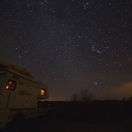
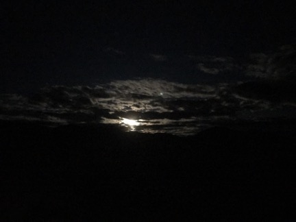
I left at just after 6 AM, eager to get to the Racetrack in the best light, but not interested in making the estimated 2-1/2 hou drive in the dark. It was still dark in the campground as I pulled out of my spot, leaving the Turtleback behind, but dawn was more than a hint to the east. The bright waning gibbous moon made it possible to pull out with only my parking lights on so I wouldn’t disturb other campers.

Ubehebe Crater
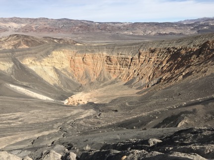
Here’s a tourist photo I shot of Ubehebe Crater the day before.

It was chilly so I turned on the heat for my seat and Penny’s and cranked the heat up a bit. I headed out to the main road, then turned left and followed the pavement all the way to Ubehebe Crater, which I’d visited the day before. Then I made the right turn off pavement, onto the gravel road I’d be following for 24 miles.

Whiplash — For a Reason

The road was completely washboarded and I bounced along it, trying but never quite succeeding to pick a speed that smoothed the ride. I tried 10, 15, and even 20 miles per hour. No joy. I drove with one hand, holding my coffee, in a travel mug up with the other so it wouldn’t spill out of the drinking hole in the cap. That bumpy. Penny alternately stood and sat on the console between the two seats, somehow not falling off.

The road climbed as the sky lightened. It was pretty straight and very narrow — maybe 1-1/2 cars wide? There were few turnouts. I’d considered, the previous day, making camp somewhere along the road instead of back in the campground, but I was glad I had decided not to — there was nowhere to pull off to camp. The grader, which likely worked the road at least once a decade, had left tall dirt curbs on either side of the roadway. There were very few places even wide enough for two cars to pass, let alone for someone to camp.

That didn’t stop someone in an SUV. They were parked nearly half in the road and had likely camped out there overnight. No one stirred in the vehicle as I slowed to inch my way around it.

As the road climbed, the vegetation changed and the outside temperature got colder and colder. Cacti and greasewood bushes gave way to Joshua trees. My outside air temperature gauge got as low as 33°F. I saw frost.

Time passed. It got lighter and lighter. Soon first light touched the tops of the mountains around me. I continued bumping up the road, never quite getting comfortable. Not another soul was in sight.

Sign at Teakettle Junction
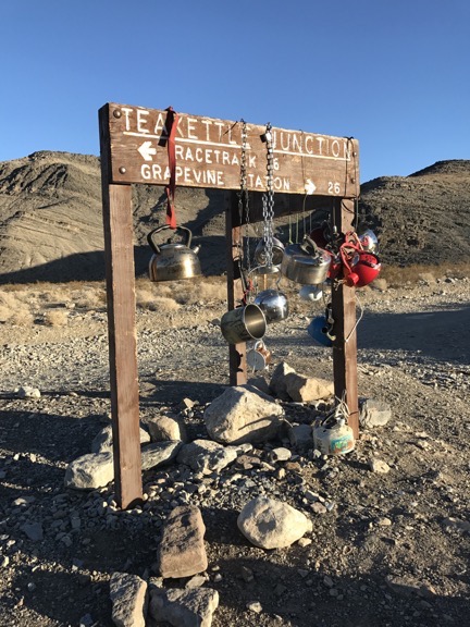
The sign at Teakettle Junction.

After nearly two hours, I’d gone 18 miles and arrived at Teakettle Junction, which is actually a named place on my map. But that’s about all it is. It’s a crossroads with a turn off for someplace called Hidden Valley. A sign decorated with a variety of hanging tea kettles stands at a triangle in the road and points the way. A couple with a big dog in an SUV were camped there, which surprised me because I thought camping wasn’t allowed at the Junction. But, at the same time, it wasn’t as if there was anywhere else to camp.

When I got out to take the photo of the sign, I smelled something I don’t usually smell around my truck. Some kind of hot oil or maybe transmission fluid. I took a quick walk around and looked underneath to see if anything was dripping. Nothing looked wrong and the truck sounded fine. So I got back in and continued on my way.

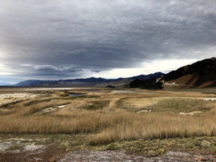
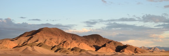
I saw Racetrack Valley minutes later. The main feature, besides the very large dry lake bed, was an island of rocks near the north end. This is what was referred to as The Grandstand. Oddly, I’d never seen any photos of it and it was a heck of a lot more interesting to me than a few moving rocks. It was obviously volcanic in nature — the whole north end of the park shows a lot of evidence of volcanic activity — and wasn’t very large. It reminded me a little of Wizard Island at Crater Lake.

The Grandstand
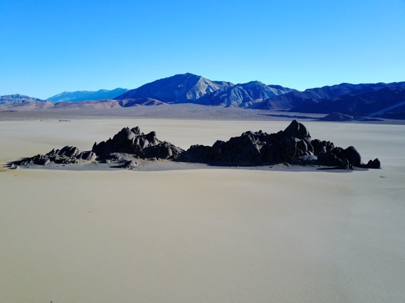
The Grandstand looks like an island in the middle of the dry lake bed.

Melted Shock
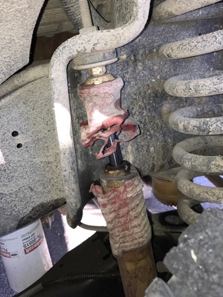
When I break something, I break it for keeps.

We reached a very small parking area with an interpretive sign just abeam the Grandstand. I parked the truck. Again that smell. What was leaking? I walked around the truck, now looking into the wheel wells. That’s when I saw that one of my front shocks was stripped bare of its protective cover and the other was leaking like a sieve.

Great. Well, I guess that would explain why I felt like I had whiplash.

There was nothing I could do about it, so I got a few things together and walked out onto the dry lake bed with my camera. But before I tell you more about my visit, I need to take a break and get something off my chest.

A Word about National Parks and Vandalism

National Parks are among America’s greatest treasures. They set aside special land to showcase some of the most amazing things that can be found in our country: geology, topography, history, wildlife, etc. They are managed by Federal employees who work hard to protect not only the parks and the wonders inside them, but the people who visit those parks. Anyone who tells you otherwise is, quite simply, an uninformed/misinformed idiot.

Every park has rules. Unfortunately, they’re necessary. For some reason, people think it’s okay to litter, or let their dogs shit on trails, or carve their initials into the rock beside petroglyphs 1000 years old. Most of the rules in a park protect the park, although a few also protect the people who visit.

One rule in Death Valley is that off-road travel is prohibited. This is pretty simple stuff: if it isn’t a road, you shouldn’t drive on it. If you’re not sure whether something is a road, it probably isn’t so you shouldn’t drive on it. If something was a road once and isn’t a road anymore, the Park Service has very considerately placed signs letting you know that it is not a road and you shouldn’t drive on it.

This rule protects the fragile desert, its plants, and even its rocks from the affects of a 2000-pound (or more) vehicle’s four tires as they make contact on the ground.

The Racetrack is one of the places where the staff at Death Valley National Park has placed signs making it pretty clear that you shouldn’t be driving anywhere off the road. A dry lake bed is not a road. It doesn’t even look like a road. If you think it’s a road, you probably should not be driving anywhere, let alone in a remote area of a National Park.

I had been warned by a friend who truly loves Death Valley that the Racetrack had been vandalized by some — pardon my language — fucking inconsiderate moron driving a vehicle on it, likely when it was either wet or damp from a rain. Tire tracks now criss-cross the dry lake bed, in some places deeply embedded into the surface. It rains very seldom in Death Valley, but it had rained earlier in the week. Still, the tire tracks remained in the otherwise pristine surface. It could take decades for them to disappear.

That means that the Racetrack’s otherwise pristine desert playa environment has been destroyed, possibly for generations of visitors.

Vandalism at the Racetrack
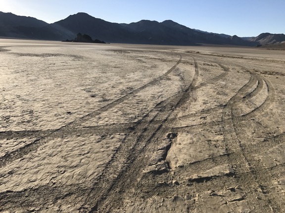
I took photos to document the tire tracks. I want everyone to see how this area was ruined by a vandal who thought it was fun to drive around where signs clearly told him not to.

Thank you, selfish asshole fuck-head.

A sign where I parked also asked visitors not to walk on the surface of the playa when it was wet. Well, some asshole had done that, too. Fortunately, he was either a lazy son of a bitch who didn’t walk very far or his brain belatedly connected with his feet and he realized he was leaving somewhat permanent footprints. The surface was dry when I visited, but the footprints remained.

Is it that difficult to obey the rules? Will it truly ruin your visit to not vandalize the terrain while you’re there? Are you so important that you don’t have to worry about whether your fun will ruin a National Park’s natural wonder for the thousands of other people who might not want to see it ruined?

If you answered yes to any of those questions, go fuck yourself and stay the hell out of our national parks.

You want to drive around on dry lake beds? Go to Nevada. There are a shit-ton of them there that no one cares about.

Glad I got that off my chest.

My Visit to the Racetrack

Textured Mud
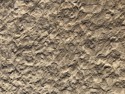
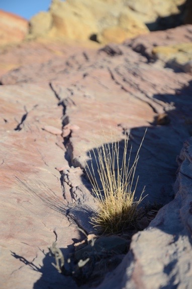
I love closeup views of surfaces textured by nature. This was near the edge of the dry lake bed.

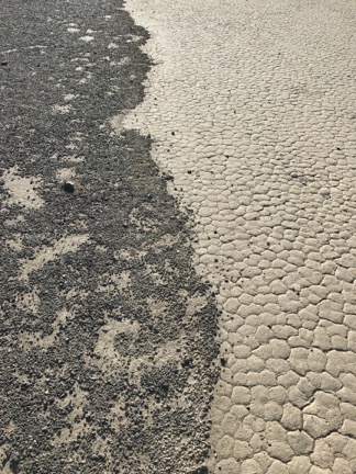
I walked onto the lakebed carefully, making sure I wasn’t leaving any footprints. (I didn’t.) The surface was bone dry with a flat textured or cracked surface that was actually quite interesting — if you’re interested in textured or cracked mud, which I apparently am.

There were a few rocks on the north end where I was walking; the interpretive sign had mentioned that the moving rocks were mostly at the south end but, after 24 miles, I didn’t feel like driving another 3 miles (each way) in my mobile bouncy house to see them. I don’t think the rocks I saw were moving rocks, but who knows?

A Not Moving Rock
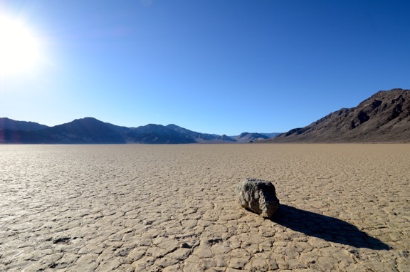
I don’t know if this was one of the moving rocks. It certainly wasn’t moving when I saw it.

Beach
Where the Grandstand’s “island” met the playa reminds me of a beach.

I walked three quarters of the way around the Grandstand, then climbed up one side of it and crossed the rocks in an area where crossing was easy. I liked the way the gravel rock of the Grandstand’s “island” formed a sort of “beach” where it met the dry lake bed around it.

Rocks on Grandstand
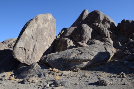
A close-up of the rocks on the Grandstand.

I used my binoculars to look down the lake bed where something shiny was just beyond the surface. Three vehicles, one of which had a very small camper on it. They probably didn’t have broken shocks and were looking at the moving stones.

I headed back to the truck. In need of a bathroom break, I was very disappointed by the lack of cover in the surrounding desert. Still, with the closest people at least two miles away, I crossed the road and walked a bit away from it before taking care of business. I suspect I wasn’t the only one who’d used that particular area for that particular purpose. But why hadn’t the others taken their paper with them? Inconsiderate.

I climbed back into the truck with Penny, started it up, and turned around. We began our long bouncy ride back to camp.

The Aftermath

Two of the vehicles that had been at the south end passed me before I left. I got in behind them. There was some position juggling and I became the middle one. I was glad; if my truck decided it wasn’t going to go any farther, at least I could hitch a ride out with the guy behind me.

We passed about a dozen inbound vehicles on our way out. About half were rental Jeeps. In most cases, I pulled up off the side of the road with my left wheels, leaving enough space for people coming from the other direction to get through. Just once someone moved over for me.

One of the cars was a compact. Maybe a Toyota? It was near the beginning of the road. As they passed, I asked them if they were sure they wanted to make the drive. “Does it get any worse?” the older man at the wheel asked me. “A little,” I said. “It certainly doesn’t get any better.” They kept going.

I was almost surprised I made it without a wheel falling off or something. It took nearly three hours. I don’t think the shocks got any worse.

I was pretty glad to hit pavement. But not when I hit 65 miles per hour. That’s when a front end wobble kicked in. Shit. Had I broken something else?

Up at the Grapevine Ranger Station — which didn’t have any rangers in it — my cell phone worked. I parked and did some research. Within 20 minutes, I’d made an appointment to get the shocks replaced in Pahrump, NV, a two hour drive back towards Las Vegas. It was the biggest town around. The repair shop said the parts would be in at 8 AM and I said I’d be there waiting for them.

Back at the campground, I found a man who had some experience with heavy equipment and had him look at it. My question: could I put my camper back on and take it as far as Stovepipe Wells or Furnace Creek? At first, he said no. But later he came to my campsite and said that if I took it slow I might be able to make it to Furnace Creek. That was only an hour from Pahrump and it would save me a lot of driving the next day. So I loaded it up and made the move. I was fortunate to get one of the last three campsites at Furnace Creek.

I treated myself to a fine meal at the Furnace Creek Inn. I really need to stay there one day.

In the morning, sore as hell from the previous day’s ride, I bounced the 51 miles to Pahrump, using cruise control set at 64 mph. I had a nice breakfast at Mom’s Diner while the folks at Pete’s Auto Clinic replaced all four shocks. The 65 mile per hour wobble was gone when I headed back to pick up my camper and exit out the other side of the park.

Hours later, my truck left Death Valley westbound under its own power for the first time. My camper was on top. My 7-month vacation was officially over.

Snowbirding 2017: Astrophotography

Practice makes perfect. I’m practicing.

I have more than the average amount of free time in my life and I like to put it to good use doing and learning things. Last September, I took an astrophotography class at the North Cascades Environmental Learning Center. You can read about the class and see some of the photos I took during our field trip in this blog post.

What I learned about shooting the night sky is that it’s very easy to do if you have the right equipment. Fortunately, I do: a DSLR with full manual mode, a very wide angle (10mm) lens, and a sturdy tripod. The hardest thing to do is to find skies dark enough to see enough stars to make the effort worthwhile.

We had dark enough skies in the North Cascades, despite ambient light from the nearby dam and occasional passing car. I don’t have dark enough skies at home, though — the glow from Wenatchee is surprisingly (and disappointingly) bright. And although I camped at more than a few places that should have been dark enough for night sky photography, most weren’t.

Or if I found a place that should have dark enough skies, the sky was overcast while I was there. Or the moon was in the sky, illuminating it so only the brightest stars showed.

Cibola
I like this shot of my RV parked on the levee along the Colorado River. I had to crop it square to get rid of the light from the town of Cibola, which is still in the shot.

I did have some success back in January when I camped out along the Colorado River near the Cibola National Wildlife Refuge in southwestern Arizona. I shared one of those photos in a blog post about the campsites I’ve been finding.

The one I didn’t share was a bit more challenging and I’m not sure if I successfully pulled it off. (Maybe you can tell me?) The bright point of light in the sky is Venus. I wanted to catch its reflection in the Colorado River, which I did. Unfortunately, although it was long past sunset, there was still a bit of a glow to the west. I think it’s from towns and homes off in the distance, but who knows?

Venus Reflected
It’s nearly impossible to include the horizon in a night photography shot without some sort of glow from terrestrial lighting.

I got a chance to practice again in Death Valley National Park, on my third night in the park. The first two nights were too cloudy and the moon was nearly full anyway. But the third night offered a window of opportunity between the end of twilight and before the waning gibbous moon came up. I was parked in Greenwater Valley with some mountains behind the camper. It was very dark outside and the sky was full of stars. I took eight shots. I think these two are the best.

Death Valley Night Sky
This was my first shot of the evening with the camera pointed pretty much straight up. It features the Milky Way with the Pleiades near the center and Orion’s Belt almost cropped off the top.

Death Valley Night Sky
In this shot, I pointed the camera up above the mountains behind the camper. You can see the big dipper just above the horizon. Once again, there’s the glow from something out there; it’s not the sun because I was pointed east.

I think photos are more interesting with something in the foreground. The one with my camper works for me. So does the one with Venus and its reflection. I guess the challenge is going someplace with something interesting to frame in the foreground and possibly “light paint” it with a lantern or something. It wouldn’t take much. The only light in my camper in the above shot was from a single tea light candle burning on the dining table inside. It looks as if I have multiple lights on!

I enjoy doing this, although I admit I’d likely enjoy it more with companions on the same sort of mission. Because my remote shutter release doesn’t work — I think it needs a new battery (again) — I have to use the camera’s self-timer as a shutter release. That adds 10 seconds to a 30 second exposure with about 30 seconds of processing time before an image finally appears. A lot of time standing around by myself in the dark. The field trip I took at the North Cascades class was a bit more of a crowd than I like, but at least it kept things interesting.

I hope to get at least one more chance to experiment with this kind of photography on my trip, but I’m not sure when. Most of my remaining destinations are not well known for their dark skies. I’ll see how I do.

Snowbirding 2017: Two Days at the Dunes

With a note about why loneliness doesn’t exist for people who don’t need the company of others.

On Friday afternoon, I took a right turn off a two-lane road in San Bernardino County, California. A historical marker indicated that I’d found the “Harry Wade Exit Route,” a route a man and his family had taken to escape a particularly deadly desert valley in 1849.

Thus I began a long trek down a series of washboarded single-lane roads into the Mohave Desert. I was on a quest to visit some sand dunes in the farthest reaches of a National Park that gets nearly a million visitors a year but there wasn’t a single vehicle on the road with me. After bumping along on one road and then making a right turn onto another, the only indication I had that I’d entered the park was a weathered sign with the park name followed by a similarly weathered sign warning that off-road travel was prohibited.

Map
My map of the area was very detailed.

I crossed a few dry washes, recalling quite clearly that my detailed map warned “River crossing dangerous in flood.” I had seen water flowing earlier in the day and suspected the meandering river might enter the valley, but it certainly didn’t seem as if the water had made it this far. Until a healthy stream trickled across the road a few hundred yards ahead. Surely my big pickup with its beefy tires could cross this sandy stream? Even with my big camper on back? I knew that a slow crossing was not advised, so I gave it a bit more gas and surged forward. The tires started to bog down on the far side of the stream, but by then momentum had carried us through. On the way back, I’d use 4WD.

Saratoga Springs
This was supposed to be a photo of the ponds by the springs but it’s a better picture of the dreary weather. Apparently, it was pouring in the main park area.

I followed signs to a spring where another sign that I suspected might be there said “No Camping.” There were no people in the parking area, although there was a weather station that I later found on Weather Underground. I never saw the source of the spring, but I did see the huge reed-fringed ponds that had formed in a desert well-known for its lack of water. I heard water fowl and frogs and, after retrieving my binoculars from the camper, saw a few dark colored birds floating on one of the ponds. I also saw what I think was burro (AKA donkey) dung along the trail.

I was tempted to park there for the night despite the sign, but didn’t want to get in trouble in the unlikely event of a park ranger stopping by this remote spot during the night. My camper is pretty much zero-impact; it’s fully equipped to haul what I need — fresh water, fuel for cooking, food — in and what I don’t need — waste water and garbage — out. A campfire isn’t necessary for cooking. All I need is a relatively level place to park, preferably with a view. But rules are not meant to be broken and if this spot wasn’t protected by the “No Camping” rule, it would likely be overrun with motorhomes and people bathing in the springs as soon as word got out about what a great spot it was.

We are our own worst enemies.

The goal, I reminded myself, was the dunes. It would be better if I could find a place closer to them to park for the night. Although the weather was degrading and rain was in the forecast, a hike to the dunes from my campsite was a possibility, either that evening or in the morning. So I came away from the spring and turned left on the washboard road, continuing north and mindful of the sign that warned about deep sand 4 miles up the road. I didn’t plan on going that far.

I found what I think was a parking area for the dunes about a mile up the road and turned in. There was a sign about it being a wilderness area that allowed foot and horse traffic only. There was space between the sign and the road for my rig, so I pulled out, turned around, and backed in with my camper’s back door facing the dunes. I killed the engine, fetched a few things from the truck, and opened up the camper. After spending about 10 minutes putting out the slide and picking up the things that had fallen during the bumpy ride, I was settled in.

The dunes, over a mile away without a clear trail to them, taunted me under a darkening sky.

Parking for the Dunes
Parking for the dunes — the view out my camper’s back door.

I fed Penny.

I checked my cell phone, fully expecting to see No Service in the area where there are usually dots representing signal strength. I was shocked to see three dots and LTE. That had to be wrong. I ran SpeedTest and was even more shocked to see that not only did I have Internet service, but it was the fastest service I’d had since leaving home.

I checked in on social media. I admit that part of me wished I didn’t have an Internet connection so that I could fully disconnect. But, at the same time, I’m a realist and know that if anything goes wrong, it’s nice to be able to call for help — even if help would likely take hours to find me. (My dead starter was still fresh in my mind, which also explains why I always back into a campsite now.)

I found a classic rock station on the radio that actually played good music. I listened for about 15 minutes before realizing I preferred silence.

And it was silent. No sound of cars or trucks or planes. I could hear the wind coming through the greasewood (AKA creosote) bushes before it reached me. I occasionally heard a bird.

From my parking spot, I could see for miles in almost every direction; nothing moved.

I looked again with my binoculars. Nothing.

I sat at the table, writing a blog post on my laptop (that I might never publish), finishing the last of the ice tea from my late breakfast in Boulder City. Occasionally, I’d glance outside to see if Mother Nature would surprise me with a ray of sunshine highlighting the dunes or mountains behind them. I heard a few raindrops on the roof. It got dark out without the pleasure of a nice sunset.

Despite the full moon that had risen behind the clouds at around sunset, it got very dark.

I made some dinner and sat up in bed eating it while I did a crossword puzzle. I debated watching a movie but decided against it.

I realized I was exhausted. I’d started the day with a 4-1/2 mile hike on the Historic Railroad Trail near Hoover Dam, which would have been nothing if I was still in shape. But I’d been letting exercise opportunities pass me by and it was starting to really make a difference. Which is why I’d done the hike.

So I went to bed early.

As I slept, I was very aware of the persistent rain on the roof. I thought about that little stream I’d crossed and wondered whether it would be a bigger stream.

Later, I was also aware of the wind loudly snapping the ratchet tie-down strap holding my old rotor blades in place on the roof. There was no way to stop the sound without going outside and climbing a ladder, so I tried to ignore it. Eventually, the wind — and the noise — stopped.

I slept well after that, waking enough just a few times to notice that it wasn’t dark anymore. The clouds had thinned enough to bathe the desert around me in faint moonlight.

I’d slept until after 5:30 AM, which was actually quite late for me.

No surprise that it was dead quiet when I woke up. It was still cloudy. The sky was brightening from the coming sunrise. The dunes taunted me.

I had some coffee and breakfast, fed Penny again, and caught up on social media. The world is going nuts, but you don’t really feel it when you’re disconnected. Sadly, I was not disconnected and can feel it. It makes me sad.

I looked out at the dunes. It wasn’t worth the mile plus walk to get out there with bad light and I definitely didn’t want to spend the day out there waiting for the light to get good.

But I didn’t mind waiting in my camper for the light to get good. There was no place else I had to be. Heck, I had enough food, water, and fuel to last me at least a week and didn’t need to be at my next destination, which was only 536 miles away for six days.

And I really liked the solitude of this roadside campsite in the middle of nowhere.

So I pulled out my portable solar panels and set them up on the south side of the camper. There was enough blue sky that I knew they’d eventually generate some power. I certainly didn’t want to run my generator and break the silence.

And that’s how I spent the day: writing, relaxing, reading, and shooting the occasional photo.

A park ranger stopped by around 10 AM. We chatted for a while and he gave me some advice about road closures and campsites over the next few days of my stay in the park. A while later, two guys in a pickup stopped, wanting to know what the road was like up ahead. I told them I didn’t know, but mentioned the deep sand sign, which they’d also seen. I told them not to get stuck because I didn’t want to pull them out. We laughed.

Much later in the day, two SUVs parked near me and two men and a woman got out. By then the wind was really howling and visibility had dropped due to blowing dust. It was also cloudy and threatened rain. They told me they’d been much farther north in the park and it had poured on them all day. I asked them if they were going to hike to the dunes and they said that they’d come this far so they had to go all the way. I watched them bundle up against the wind — the temperature had dropped to the 60s — and head northeast. It rained while they were gone, but not enough to make anything wet. Around sunset, when they still hadn’t returned, I took out my binoculars and saw them at the base of one of the dunes. I guess they were doing some photography; it was too far away to really tell. I wondered if they’d taken camping gear with them; I hadn’t really paid attention to their departure.

A few other pickups and SUVs drove by but didn’t stop. It was actually a lot more activity than I expected.

The sun finally made an afternoon appearance about a half hour before sunset, illuminating the dunes and the mountains behind them and making deep shadows. It was too late to walk out there — and besides, the wind was still blowing pretty good — so I satisfied my urge to document the moment using my 70-300mm lens from the roof of the camper. The light was constantly changing and I took quite a few photos. The one below, which I obviously cropped, is one of my favorites.

Sunset at the Dunes
Sunset at the dunes.

When the sunset show was over, I started making dinner: chicken cordon bleu with fresh creamed spinach and chanterelle mushrooms (from the freezer). It got dark quickly. I kept checking out the back windows for the moonrise, which was expected just north of due west at about 6:30. There were clouds out there on the horizon and I wondered it they’d clear out enough for me the see the moon coming over the mountains. Overhead, stars started appearing one-by-one with Venus leading the way.

My dinner was almost ready and it was dark when the sand dune hikers returned. I turned on one of my outside lights for them. Soon their engines were running and I saw taillights down the road. I didn’t envy their drive back to pavement in the dark.

Moon Rise
Moon rise through the clouds.

My friend Bob called and we chatted for a while. It had snowed quite a bit at home and he’d spent the weekend in his shop, working on a Moto Guzzi motorcycle he’d owned for more than 20 years, getting it back into pristine condition. Unfortunately, the work he needed to do on the engine required him to keep the door open to the cold so he wouldn’t be overcome with fumes. While we talked, the moon rose just where I expected it to, making the clouds around it glow. Overhead, the stars faded away, unable to compete with the moon’s brightness.

I went to bed with a book I’d downloaded from the library, Time and Again by Jack Finney. I originally read it not long after it was first published in 1970 and it seemed brand new to me. I recommend it.

I slept great until about midnight, then woke for a while, then slept again until after 6:30. The sound of rain that was nearly forecasted nor on radar got me out of bed. It was overcast (again).

Outside, the dunes taunted me.

The hourly forecast said it would clear up around 10 AM. It would be my last chance to hike to the dunes; I really did need to get on my way if I wanted to see other remote parts of the park. So, after coffee and breakfast, I did the dishes and dressed, getting the camper prepped as much as I could for departure. The sun finally made an appearance as the clouds fled west, faster than the sun could climb into the sky.

Two pickups drove by. I started wondering why vehicles nearly always came by in pairs.

It was just after 9 AM when I started my hike to the dunes. Although satellite images had shown the remnants of a road that went that way, I couldn’t find it. So I just cut as straight as I could through the desert. Halfway there, I stripped off my flannel shirt and faced the sun in a tank top. The shade temperature was below 60°F, but I was not in the shade. The sun felt amazing on my skin and the light breeze kept me cool.

I looked back every once in a while. Although I thought the route was pretty flat, we apparently descended into a dip; I couldn’t see the camper when we were about halfway to the dunes. I later saw it again and made a note of the knob on the mountaintop behind it so I could easily navigate back in the unlikely event that my phone’s GPS tracker failed and I couldn’t see my rig.

Desert Mushroom
I saw three of these within a half mile radius of each other. They were about an inch and a half tall.

The walk took about a half hour, with stops along the way to look at interesting plants, including mushrooms (!), and rocks.

The dunes are large and I felt small beside them. Penny went nuts running up and down the sand. She loves the beach and I suspect that to her, there was nothing better than a beach without water.

Ibex Dunes
A closeup shot of part of the dunes.

Dune Ridge
I didn’t get very far trying to climb up this ridge.

I took a bunch of photos. Unfortunately, although I might have been in the right place, I was definitely not there at the right time. The dunes were in full sun and the golden hour was long gone. Shadows were relatively small. The light was bright and harsh. A more serious photographer would have arrived at dawn — and gotten rained on along the way.

I tried to climb one of the ridges, but when I got to the point where every step forward slid me a half step back, I quit.

It was windy there — windy enough for my footprints to disappear within seconds of me laying them down.

We stayed about a half hour, then turned around and headed back. By this time, it was almost cloudless. The sun still felt good on my skin and I never really worked up a heavy sweat. Halfway back, my path intersected with the old road and I saw the footprints of the previous day’s visitors. I almost lost the trail when a wide wash ran through it, but I picked it up on the other side and was almost surprised to see that it delivered me almost right back to the door of my camper.

Behind me, the dunes smiled and winked.

After a bathroom break and something cold to drink, I finished up this blog post. I want to get back on the road before noon and I suspect I won’t have as good an Internet connection as I have here for a few days.

I know a lot of people will read this and be amazed that I spent two days alone in such a remote place. Wasn’t I scared? Wasn’t I lonely? How could I stand to be so completely alone for so long?

First of all, no, I wasn’t scared. I come to places like this very prepared. Why would I be scared when help is a phone call away, phone service is excellent, and I have everything I need on hand to survive for at least a week without skipping a meal?

Second, no, I wasn’t lonely. I don’t get lonely. Loneliness is a feeling suffered by people who need to be around other people to be happy. While I wouldn’t call myself anti-social, I’m also not dependent on other people to keep me — well, what? What is it that people need other people for? Conversation? Sex? Companionship while watching television? Am I that unusual in that I can go for more than two days without any of that?

I love my friends, but I don’t need to be with them all of the time.

And third, not only can I stand to be alone, but I rather like it. I’ve always needed a certain amount of alone time. Time to think and reflect without having to keep someone else entertained. Time to read and write and do photography without someone interrupting me, demanding my attention. Time to do whatever I want to do without someone else making judgements about how I spend that time.

When I was in a relationship, every year my future wasband used to ask me what I wanted for my birthday. In the later years, I told him that all I wanted was to have the day to do what I wanted to do. I wanted alone time.

I finally have as much of it as I want.

Snowbirding 2017 Postcards: A Crazy Day

This one is actually worthy of a full blog post, but I’m too lazy to go out in the rain to fetch my laptop right now, so I’ll use the WordPress app on my iPad and let the photos do some of the talking.

Camped out at the Anzio-Borrego Desert State Park’s Palm Mountain Spring primitive Campground last night. Great, quiet site among cholla cacti and ocotillo. Expecting rain that never came.

After a beautiful sunrise


I made a plan to visit a scenic overlook farther down the road and then head back to Borrego Springs with a few hikes along the way.

I had breakfast, packed up, put on my new hiking pants and hiking shoes, and put Penny, my camera bag, and my rain jacket into the truck. Put the key in the ignition, waited for the seat to move and the chimes to stop, turned the key to get the glow plug thingie working, and then turned the key to start the engine.

Click.

No hearty vroom of a starting Diesel engine.

I did some troubleshooting for a while. No success. I was pretty sure it wasn’t the batteries, both of which are less than a year old.

I had no Internet connection. This was actually my first campsite all month that had absolutely no Internet.

Barely a cell signal at all. 

I texted my friend Jim and asked him to look up the phone number for the Ford dealer in El Centro, CA, which was the closest big city to where I was. I was actually able to talk to him by placing my phone in a specific spot on my windowsill and not touching it. I had to use the speaker. He sent the phone number and I called. I chatted with a service guy. He confirmed what I suspected: it sounded like an electrical issue. He told me to have it towed in.

I managed to call AAA. I also managed to describe my exact location for a tow truck to come get me. I explained that I had a camper on the back and if the tow truck was a flatbed, the rig would likely be too tall to fit under overpasses and traffic lights. I knew that in a pinch, I could take the camper off the truck and leave it behind.

And then I waited.

A volunteer ranger came by and I flagged him down to tell him that I might need to leave the camper overnight. He had a beard like Santa Claus. He asked me if I knew what Ford  stood for. We said in unison “found on road dead.”

I saw the tow truck pass by on the paved road. I figured he’d realize he gone too far and would turn around so I decided to walk down to the road with Penny. We were about halfway there when he saw me waving and pulled in.

Fortunately, he didn’t come with a flatbed. He hooked up my truck, lifted it, and then disconnected the driveshaft — it’s a four-wheel-drive and apparently that’s necessary. He moved it far enough forward for me to retrieve the plastic Lego like blocks that I used to level it overnight. Then we both took pictures, 


climbed aboard, and headed out.

Along the way, we discussed how fortunate it was that I’d backed into the spot.

He took us to the Ford dealer, which was about 50 miles away. I was prepared for this tow — I had AAA membership that entitled me to up to 100 miles of towing per incident for free. And because I also paid for the RV coverage, I wouldn’t have to pay anything extra for having the camper on board. The driver told me that the tow would probably have cost around $900 – $1,000. So once again, my AAA membership has paid for itself. All it cost me today was the $20 tip I gave the tow truck driver.

The service center was short handed, but they promised to look at it today. They made me sign off on a $120 diagnostic fee. I signed. Did I have a choice?

Meanwhile, I knew I had the extended warranty I’d bought with the truck. I didn’t have the information about it that I needed, however. So I looked up the phone number for the dealer in Oregon where I bought the truck, called them, and left a message for the finance guy. He called back a little while later with the information. I passed it on to the service guy who was helping me. By that time, they had the verdict: I needed a new starter. It would cost $770.

The service guy called the warranty people. The starter was covered. They could pay the same day. The part was in stock. The service guy told me they’d be done by 4:30.

I waited with Penny.


They were done before 3 PM. I signed some papers. The total cost was $750.18 but I didn’t have to pay any of it. 

So yes, today I got a brand-new starter for my Ford pickup truck for a total out-of-pocket cost of $20.

Of course, I had lost most of the day. My plans were pretty much shot to hell and I had to come up with a new plan. I decided to spend the night at a primitive campsite on the east shore of the Salton Sea, a large inland body of salt water that’s about 275 feet below sea level. (I can’t make this stuff up.) I programmed the location into Google maps and headed north.

When I reach the campground an hour later, it was raining and the campground was closed.

Undaunted and knowing that there were more campgrounds farther up the shore, I kept going. I found one less than 5 miles away that was open. By this time, it was raining pretty hard. I backed into a spot along the shore so that I could see the lake through my back and dining area windows and parked.

The sun, which was now quite low in the western sky, poked through the clouds. A magnificent double rainbow appeared to the east. I took a picture, of course. It was so big that I had to use the panorama feature on my iPhone.


Outside my back door, the wooden picnic table gleamed in the sun. Waves were breaking on the shore of the lake as seagulls flew by. I took a picture, of course.


And that’s with Penny and I are right now. I had dinner, the sun has set, and now I’ve managed to write a very lengthy blog post about my very unusual day. Rain is pattering on the roof of the Turtleback but Penny and I are warm inside. 

Let’s just hope tomorrow’s adventure is a little more predictable.

Snowbirding 2016: Valley of Fire

A short overnight visit to a geologically interesting place.

Posts in the Snowbirding 2016 Series:
Introduction
The Colorado River Backwaters
Quartzsite
Wickenburg
Phoenix
Home
Back to the Backwaters
Return to Wickenburg
Valley of Fire
Death Valley
– Back to Work

When I left Wickenburg that Sunday morning, I was technically on my way to my late winter job in the Sacramento area of California. Indeed, I had to be in Sacramento to catch a 6:40 AM flight home on Friday to fetch my helicopter. But I’d planned the drive with enough time to make two stops along the way. The first was Valley of Fire State Park near Overton, NV.

Valley of Fire gets its name from the vibrant red rocks that jut out of the desert floor in this area of Nevada. It’s full of scenic overlooks, easy to difficult hiking trails, and plenty of interesting sandstone formations. In the right light, it’s quite photogenic. It’s also easy to visit. Only 50 miles from Las Vegas, it gets quite a few visitors on weekends — as I soon found out.

Camping with the Mobile Mansion

When I planned the trip, I didn’t realize it was a holiday weekend — since when is President’s Day right after Valentine’s Day? — and had half expected to be able to slide into a campsite inside the park that Sunday afternoon when weekenders left. I’d also been assured by a friend who’d been there weeks before that if all the campsites were taken, I could park my rig in “overflow parking.”

Wrong on both counts.

When I arrived in early afternoon after a long but pleasant drive up Route 93 from Wickenburg, the weekenders weren’t quite through with their weekends and the first come, first served campgrounds were marked “Full.” I managed to park my rig along the curb in a completely full Visitor Center parking lot and went in to talk to a ranger. She confirmed what I’d already learned on the Self-Pay Station signs: camping in designated sites only. But she was extremely helpful, offering suggestions for camping on Bureau of Land Management (BLM) land west of the park or Bureau of Reclamation land east of the park.

Since the Reclamation land was closer, I soon found myself backtracking out the park entrance I’d come in and then turning north along the main road there. In a few miles, I found the gravel road I thought she’d referred to and made a right onto it. I could see a few other campers out there, quite far from the road. Since I wasn’t interested in exploring with the mobile mansion behind me — it’s seriously difficult to turn that sucker around in a narrow space — I opted for the first “pull through” spot I could find: a narrow road that climbed up a hill with a relatively level spot on top. I approached it from the east after turning around in a wide area and parked with the Mobile Mansion’s big back window facing out toward the lake. When I got it level enough that I didn’t have to worry about it rolling back down the hill, I dropped the landing gear and disconnected it from my truck. Then I put out the slides, gave Penny some food and water, locked it back up with Penny inside, and headed back into the park.

Another free campsite, courtesy of our government.

I later discovered that the location the ranger had referred to was about a half mile farther down the road where there were literally dozens of RVs, some of which were even bigger than mine, parked. I was glad that I wasn’t among them, though — I know half of them would be running generators past dark; likely watching satellite TV instead of the stars. There was no one within a quarter mile of my site and the closest campers were in tents. I had no intention of ruining their quiet evening with my generator so it was all good.

Afternoon Photo Shoot

Closer Look at Valley of Fire
Want to learn more about what’s photogenic in the park? Start with this €4 ebook.

It was nearly 4 PM and the sun was low in the west when I got back into the park. I took the road north from the Visitor Center. I was very interested in hiking out to a formation called the Fire Wave, which was best viewed in the afternoon. My photographer friend Rebecca, who had been to the park recently, had recommended an ebook about the park: A Closer Look at Valley of Fire by Isabel & Steffen Synnatschke. That’s where I learned about the Fire Wave, which is pictured on the cover, and it was exactly the kind of scenery I like to shoot.

Of course, what had been described in the book as something off the beaten path had since gotten its own marked path. The parking lot there was completely full and there were people all over the place. Even if I could have parked, I doubted I could get the kind of scenery-only photos I wanted. On top of that was the authors’ note that the scene was best shot just after sunset and numerous signs that warned that anyone out on the trails after sunset was trespassing. So it seemed to me that a walk down to the Fire Wave that afternoon would be a frustrating waste of time.

I continued out to the end of the road, finding every single parking area completely full with day trippers who were out of their cars and climbing all over the rocks. While it’s nice to see families enjoying the outdoors together, I really wish I’d come on a weekday when it would likely be a lot less crowded. I turned around at the end of the road and headed back.

Red Rocks
I spent an hour shooting various rock outcroppings with various lenses from various positions. It was nice working alone, unrushed with plenty of time to experiment.

I wound up parking at an almost empty parking lot beyond the Fire Wave’s lot on the way back. From there, I struck out into the desert to the northeast with the thought of maybe coming up on the Fire Wave or an area like it from the other side. That didn’t pan out, but I did find some interesting rock outcroppings to photograph. I walked about a mile with Gaia GPS turned on in my phone to record my track. In addition to my phone, which I used to take a few photos for my Gaia track, I had my Nikon with me, along with three lenses. I got a chance to use my 10-24mm lens, which I rarely use, to take some really wide angle shots. As the sun got lower and lower, the shadows grew, giving the rocks a three-dimensionality they wouldn’t have when the sun was higher in the sky. The tricky part was keeping my shadow out of some of the shots. And I tried to tread carefully among the sometimes delicate rock formations to keep from crushing thin rock ridges beneath my feet.

Cactus with Red Rocks
Another wide angle shot, this one featuring a type of prickly pear cactus that would likely be in full bloom with large pink flowers within two months.

Selfie
I seldom share selfies — I usually don’t like the way they turn out — but was very pleased with this one.

On the way back to the truck, I stopped for a selfie with the park behind me. The battery in my camera’s remote was apparently dead — no real surprise there — so I did it the old fashioned way, with the camera’s self-timer. I was very pleased to get a good shot on the first try.

Sunset
Another beautiful desert sunset, reflected on the side of the Mobile Mansion.

I explored a bit more of the park before the sun set, trying to find a good place for a morning shoot the next day. Then I headed back to the Mobile Mansion. Penny, as usual, was glad to see me. We went for a walk and I watched the sun set. Later, while I was having dinner, I watched the flickering dots of nearby campfires through my big back window, marveling at how bright the moonlight was.

Morning Photo Shoot

I was up, as usual, before sunrise. My closest neighbors had started a campfire, likely to keep warm. I could see it flickering off in the distance. It reminded me of my days at the backwaters in January and early February.

I made a cup of coffee to go and grabbed a snack bar for breakfast. Then, as the sky brightened to the east, Penny and I were in the truck, headed into the park.

Stone Walls
I love the textures of the wood window frames and stone walls at the Cabins.

Although I’d read through the Valley of Fire book looking for ideas of where to go for that morning shoot, I decided, in the end, to keep it simple: I’d go to the Cabins, a trio of stone cabins built by the Civilian Conservation Corps (CCC) to house workers years ago. The book panned the Cabins as a photographic destination, claiming it wasn’t interesting unless they were lit from inside. I disagree. I was there before sunrise — trespassing? — and began shooting almost immediately. The first light on the cabins was extraordinary and I got more than a few interesting shots. I was the only one around and, again, it was a real pleasure to shoot on my own without having to deal with other photographers or tourists. (Honestly, I don’t understand why people go on photo excursions where they have to jockey with other photographers for a good spot to take a shot.) My only challenge was keeping an eye on Penny — and keeping her out of my shots.

Cabins in First Light
The Cabins at Valley of Fire, shot with a 10mm lens at first light. No, I didn’t retouch this (or any other image) here. It really was that red.

Grass and Rock
Yet another wide-angle close up. The light had already become too harsh by the time I shot this.

Afterwards, I drove farther into the park, retracing my route from the afternoon before. It was around 7 AM, the Visitor Center was still closed, and there wasn’t another soul in sight. I parked alongside the road in one of the numbered dips where the road crosses a wash, got out alone, and began hiking down a slot canyon. The sun hadn’t climbed high enough to illuminate the canyon walls and there were deep shadows. According to the book, the canyon would eventually end up by the Fire Wave. I didn’t get that far, however — the canyon was full of water about a quarter mile in.

I turned around and went back to the truck, then crossed the road and headed off to the west. By that time, however, the light had become bright and harsh — not good for photographing desert landscapes. It was time to go.

Hooking Up and Heading Out

After taking a drive through the west side of the park, Penny and I headed back to the Mobile Mansion. It was around 9 AM. People were just starting to come into the park.

After a quick drive farther down the road where I’d parked — mostly to scout it out for better sites for a future stay — I returned to my rig and began the relatively quick task of hooking it up to the truck and getting ready to move on. Although it’s big, I’ve learned over the years that if I don’t take a lot of stuff out of storage while I’m parked, it’s pretty quick to close up for travel.

By 10 AM, we were rolling back down the gravel hill and onto the pavement. We’d have to drive through the park again — it was the shortest route to I-15. I had to show my pay stub at the ranger station on the west side to exit. Then we were on our way to our next destination: Death Valley.